Introduction to today's journey
There is no such thing as bad weather, only inappropriate clothing.
- Sir Rannulph Fiennes.
THE FIRST European explorer to discover the park was Abel Tasman in 1642 several days after first discovering New Zealand around Punakaiki area. The coast along the western side of the South Island was very rough, so he was unable to land there. Heading north, he swung around the top of the island into what is now Golden Bay, and landed at what is believed to be Whariwharangi Bay. A cultural misunderstanding resulted in a battle breaking out between the Maori and the visitors, resulting in several fatalities on either side. He named what is now Golden Bay "Murderer's Bay" as he sailed out towards Cook Strait.
Today's trek heads further north from Waiharakeke past the sweeping Totaranui Beach before crossing the rugged Anapai Headlands to where I set up camp at Anapai Bay. From there I continue northward to Separation Point before turning westward to Whariwharangi Bay. From there I return to Anapai Bay before the rain sets in.
Today's Journey
Distance trekked today: 23.3 kilometres.
Total distance trekked to date: 44.7 kilometres.
 |
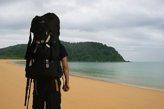
07:06 - It feels too cold for summer on this overcast morning. I see a few spots on the tent fly where light rain fell during the night. Keen to head northward, I get up and after a quick breakfast pack up and leave the campsite. The other four tents full of people are quiet with all occupants still asleep. By leaving early as I had done yesterday, I will be able to avoid most of the crowds. My aim for the day is to get to Anapai as early as possible to set up camp there before exploring further up the coast to the rugged northern beaches.
|
 |
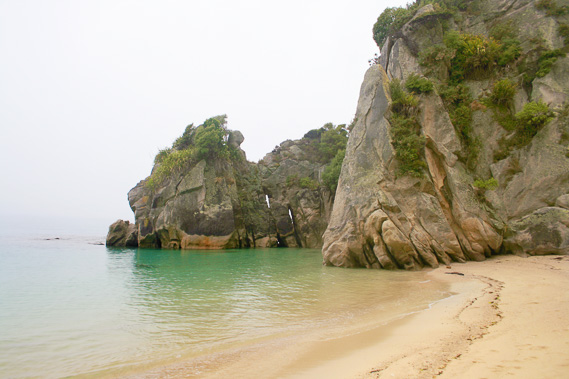
07:13 - After a short walk along the track I return to the beach. The water is flat apart from a slight ruffling by the gentle cold breeze. A thick misty blue grey cloud cover takes most of the colour out of the dark headlands on either side. I walk along the coarse beach to the left heading towards the dark headland. The tide is out leaving gravely lines along the beach. Towards the end of the beach I see a large orange marker indicating the start of the track. From here I follow the narrow track steeply climbing around the front of the bluff. The terrain is extremely rugged here with precipitous gullies plunging into the transparent turquoise water.
|
 |
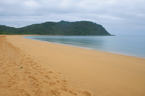
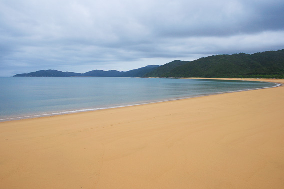
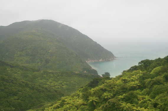
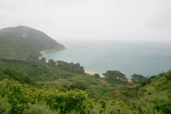
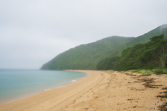
07:31 - Within a couple of minutes the bluff turns and I see the long granite beach of Goat Bay spread out to the next low headland. Beyond the headland appears the far end of Totaranui Beach with the almost black Anapai Headlands beyond filling in part of the gap where the grey clouds meet the grey sea. I can still clearly see the horizon, so it doesn’t look like rain is going to fall here any time soon.
|
 |
07:37 - Upon reaching the soft sandy beach of Goat Bay, I walk along it leaving the long reefs of the previous headland behind me. The Awaroa heads jut out further behind. A few exposed rocky areas extend from the point below the high tide line. Otherwise the bay doesn’t have much character. There is no significant stream or lagoon behind the beach as there has been in previous bays. |
 |
07:48 - About a hundred metres from the end of the beach, I see a man walking towards me. He doesn’t have a pack on, so he must just be doing a short morning walk from the Totaranui campsite. |
 |
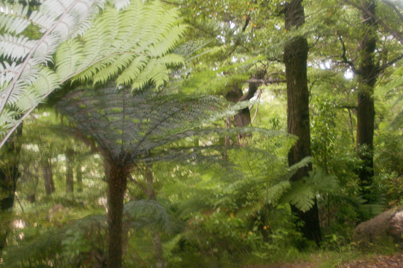
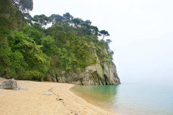
07:57 - I reach the rocky headland, where the rocks seem to come out of the forest flowing like giant buttress roots. Once more the track steeply ascends across the bluff. Although the area is covered mostly in forest, there are some good gaps through the bush where I can see back along the length of Goat Bay and beyond across Awaroa Beach. Some very tall tree ferns grow here. |
 |
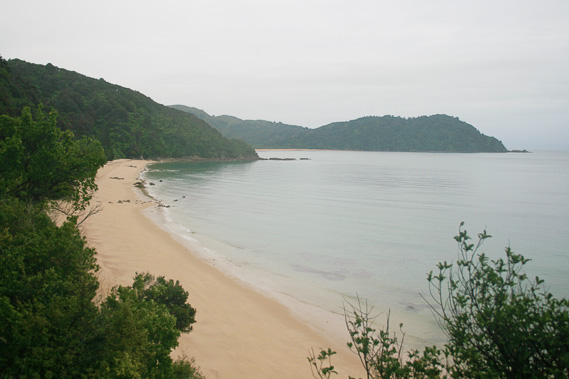
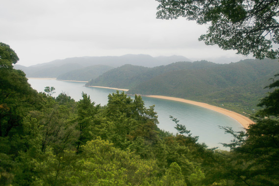
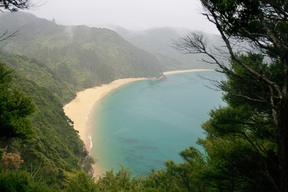
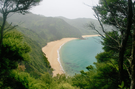
08:00 - Upon reaching the end of the bluff, I am rewarded with a viewpoint revealing a spectacular view across to Totaranui. Looking over the pinkish granite where the waves break translucently across the reef, I see the orange beach sweeping across in front of a forested plain to the Anapai Headlands on the far side. Despite the grey sky, it is very serene here. |
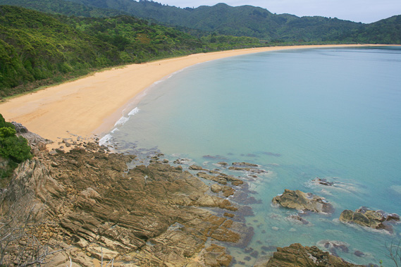 |
08:02 - The reef below me has sweeping patterns showing the flow of the granite batholith when it was formed deep underground around a hundred and fifty million years ago, when the dinosaurs were dwelling on the surface far overhead of these rocks. |
 |
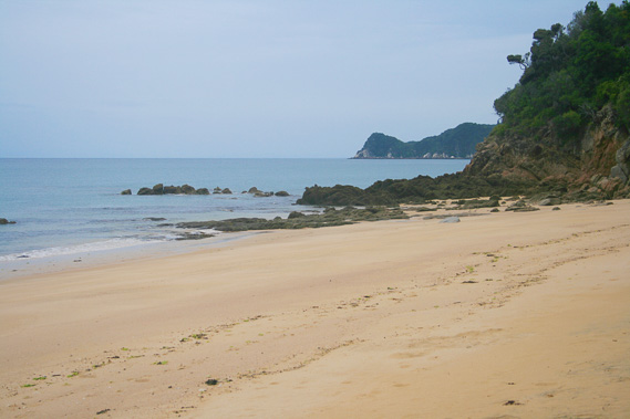
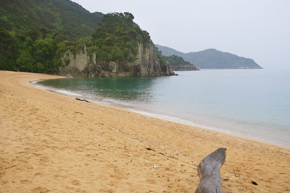
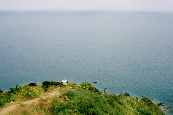
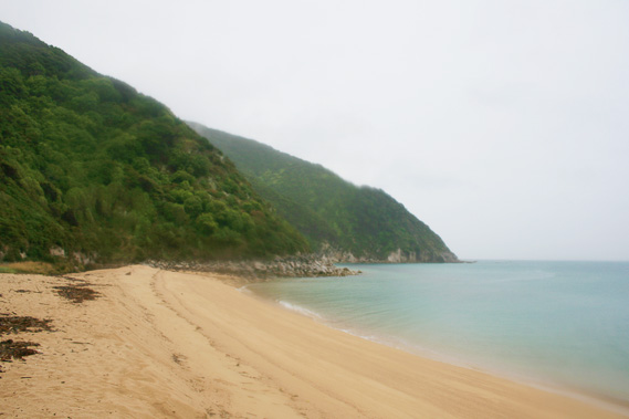
08:09 - I walk down the gentle sloping track off the bluff into an area of regenerating forest. Here tree ferns grow abundantly in under the thick canopy of manuka. It is very peaceful in here. Finally I reach a side track breaking off onto the beach. I head out onto the beach following its long sweeping curve towards the blackened Anapai Headlands. |
 |
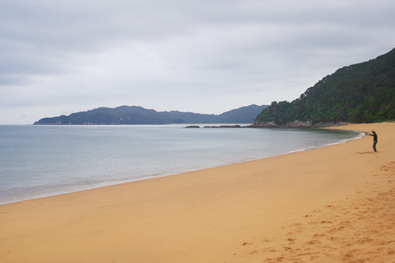
08:17 - It it obvious where the tide rose overnight. Above the tide line the beach is covered in the indentations of footprints covering yesterday's big tide. Below the line is the sand covered by the overnight tide with the waves sweeping the sand perfectly smooth. No one has walked here this morning. Looking along the length of the beach I am on the only person here. The laminar waves break on the beach with a surprisingly loud rush, almost a deep metallic sound. Once more I smell the distinct kelpy salt aroma only found on the sea shore.
|
 |
08:18 - As I walk along the beach, a couple of people wearing black appear. Two of them are walking along the beach. The other one is doing a Tai Chi routine. The walkers pass me and quickly disappear out of view, leaving only the man doing Tai Chi on this remote beach. This is the perfect place to do Tai Chi. |
 |
08:22 - As I walk further along the beach, the breaking waves grow larger. There is a point about two thirds of the way along the beach where the waves start breaking. |
 |
08:32 - Looking back I can see right across the Awaroa headlands with Stony Hill behind. In front I can see the beaches of Goat Bay, Waiharakeke Bay, and Awaroa Bay. I can from here see around the Awaroa heads all the way to reef rock, which is partially obscuring Foul Point behind it.
|
 |
08:36 - I reach the end of the beach. A small tannin stained stream meanders in a braided path from the edge of the headland behind. This is the only flowing stream crossing this beach.
|
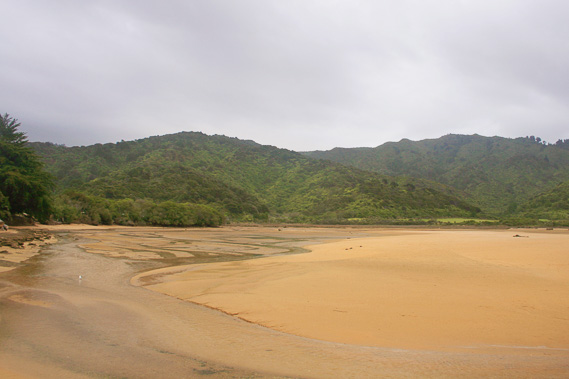 |
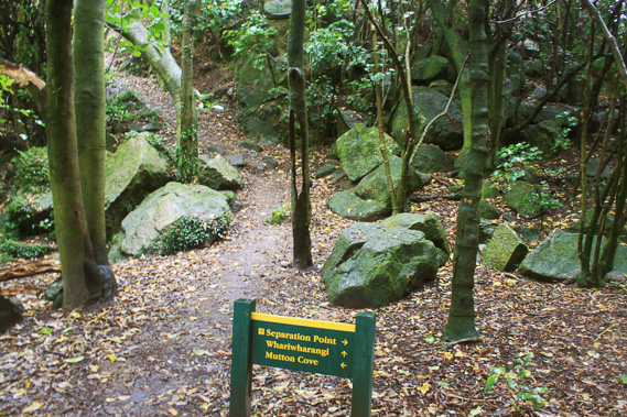
08:38 - The stream comes from a small estuary behind which is mostly dried out from the low tide. I stop on a drift log to rest but rain starts falling within a couple of minutes. I decide not to linger here, so I move on and start crossing the estuary in the hope of finding a way across to the main track. There are numerous footprints here, so I follow them to where they met a track entrance. This is a part of the Anapai Headlands walk. Here I have the option of either turning left and going to the main track which goes over a low saddle heading towards Anapai Bay, or turning right to do the Anapai Headlands track which I have never done before. I decide to do the headlands track. |
 |
08:46 - The track moderately rises through the thick undergrowth of silver tree ferns and manuka. The vegetation is striking here on the shady southern side of the bluffs. Interspersed in amongst the bright green fern foliage are the distinctive jet black trunks of the black beech tree with their sickly honeydew smell. The leaf litter is largely undisturbed on the ground and the track itself is soft indicating it wasn’t used very often. The main coastal track is as hard as concrete compacted by the countless people hiking it. |
 |
09:25 - I finally get a reasonably clear view of the coast after quite some time. From here I see the sweeping beaches of Totaranui, Goat Bay, Waiharakeke, and finally Awaroa in a small break in the trees. The track continues uphill for a little way, before undulating with no views. I am starting to tire and wonder if I should have taken the other track to the saddle and hidden my pack there before doing this circuit. It is difficult going walking along this relatively rough track carrying a pack. Fortunately the track turns to follow another ridge downhill gradually approaching the main track. The descent briefly steepens but continues moderating. As the track goes further away from Totaranui, the black beech and tree ferns give way to kanuka scrub and scraggly ground ferns. |
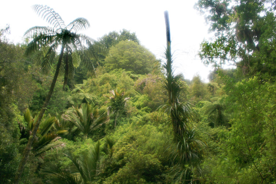 |
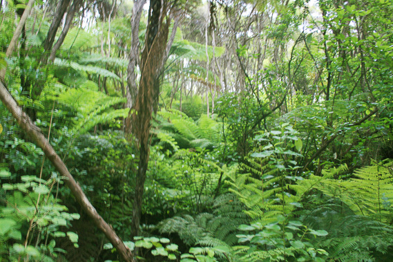
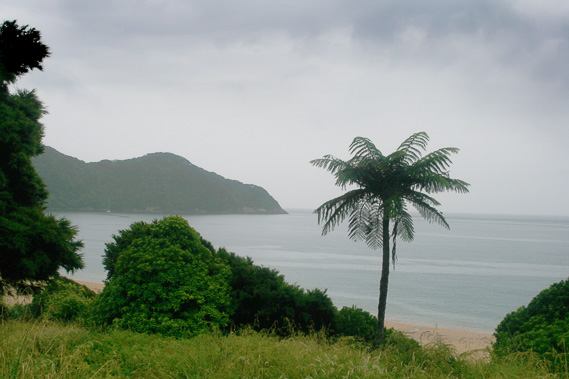
09:54 - Finally after quite some time heading inland off the Anapai headlands, the main track suddenly appears in front of me. I am at the saddle. I continue along the main track now narrower than any of the sections of track I have hiked to date from Bark Bay. Most hikers hike from Totaranui southwards. The track up here is considered an extra day or two for the really keen trekkers. I am obviously one of those. The track descends into a long valley running almost parallel to the long track I have just come off. Down here the vegetation is different. For the first time I see Nikau palms, the locally growing palm tree. This is their southern limit in Tasman Bay, although they do grow down the West Coast, particularly along the Heaphy Coast giving a most interesting juxtaposition of a tropical looking jungle right next to the violent Antarctic ocean.
|
 |
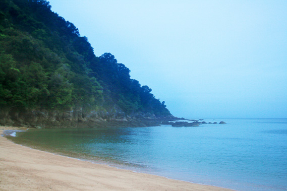
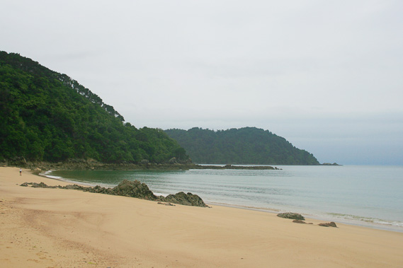
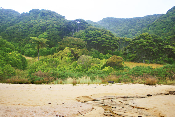
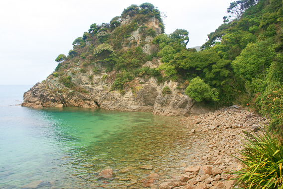
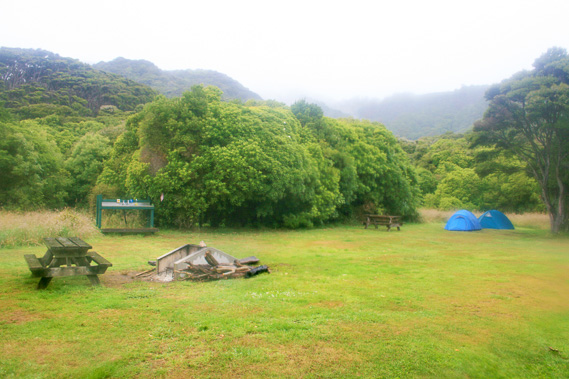
10:02 - Finally I hear gentle waves breaking ahead, and sure enough within a minute I am standing on the coarse golden sand of Anapai Bay. The steep rocky headland to the right is indistinct compared to the long headland at Totaranui. Looking the other way the beach abruptly ends about two hundred metres away by an almost vertical grey granite rocky headland. Beyond the headland are two more headlands, the larger more distant one being Separation Point, where I have only ever been to once before in 1988. In the middle of the bay is a flat area in the forest where the campsite is located. The campsite is small, given not many people stay here. The ground here is damp, but I find a good place to pitch my tent. No sooner is my tent up, rain begins to fall. It quickly intensifies, so I crawl inside, putting my gear in the fly to keep it dry. The rain seems to have set in for the day. I am very tired, from not having had enough sleep last night, and from all the walking I did yesterday and this morning. With the rain falling heavily, I crawl into my sleeping bag and quickly fall asleep.
|
 |
13:24 - I sleep solidly for over three hours. When I do wake up rain is falling heavily on my tent from the trees above and the damp air feels a lot colder. Now I need to make a decision. I am only booked to stay here for one night before heading back down the coast to Bark Bay tomorrow night, and Anchorage the following night. The goal of this trip is to walk the entire trek and I plan to get to Separation Point and to Whariwharangi this afternoon. With all the heavy rain falling this goal is now getting out of reach. With this thought, the rain suddenly stops falling. I put on my heavy raincoat and put the waterproof bag over my camera as I pack it. It is going to be a very wet afternoon, but this is my only opportunity to explore the northern end of the park. I get up and walk out onto the beach. As expected it is very quiet, but the swell is gentle with only small waves breaking on the beach. It seems fairly clear up to Separation Point with reasonably good visibility.
|
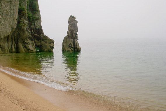 |
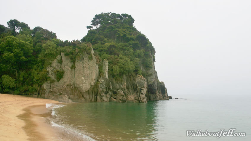
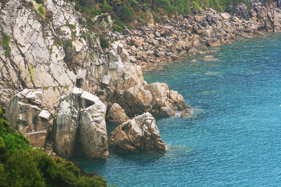
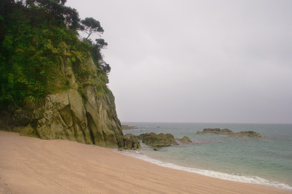
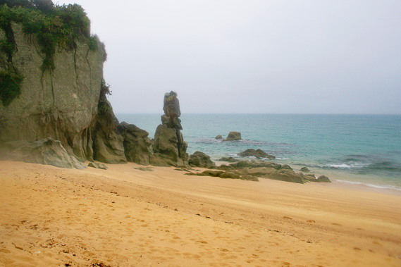
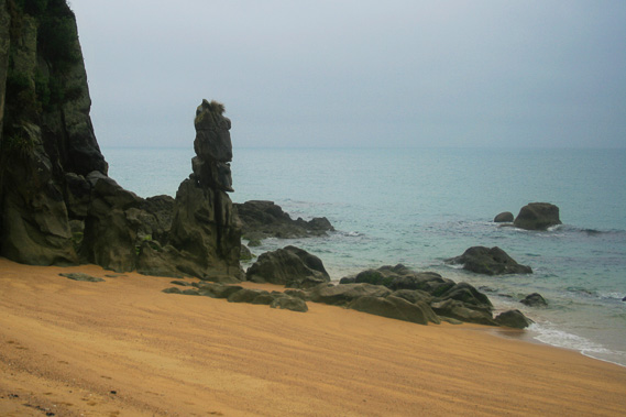
13:28 - I walk along the beach watching the vertical headland at the other end transform in shape. This is the most interesting headland in the entire park. Nowhere else do the rocks rise vertically out of the water. One striking rock about five metres off the main cliff now sits in the water of high tide. The rock looks like a person with a pointy beard wearing a tall royal hat. |
 |
13:31 - A steep track leads into the forest over the rugged headland. Minutes later I am on the other side. From the beach I can see through two long holes in the rock perhaps thirty centimetres wide and three metres long. |
 |
13:32 - The headland at the other end of this very short beach (less than a hundred metres long) has an almost vertical rise to its forested top. A small saddle appears about ten metres up in the bluff, but the steep track through the forest rises much higher. This bluff is just part of a large headland separating Anapai Bay from Mutton Cove, the next bay. Heavy rain starts falling again as I walk along the narrow track negotiating its way across the precipitous bluff. Several landslides have come down here in years past. If one were to come down now then it will be very difficult to negotiate a new trail through the precipitous terrain.
|
 |
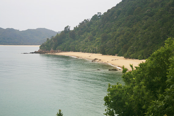
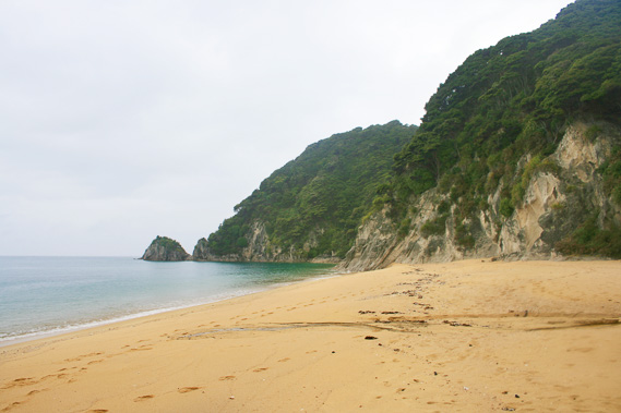
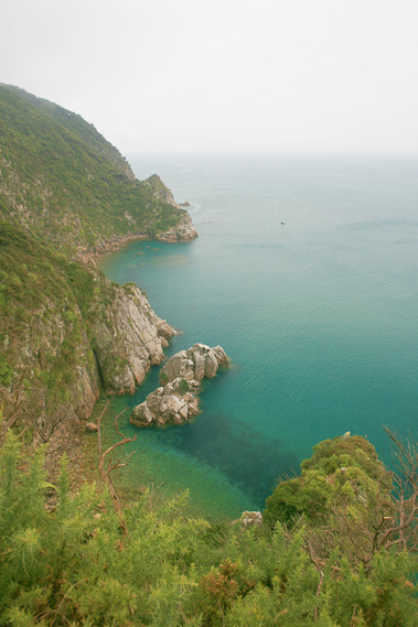
13:51 - Finally the track levels off and I have a clear view in a small patch to Mutton Cove. The beach is a long way down, perhaps sixty metres. The beach is split in two by a headland which you could probably walk across dry sand during low tide. The tide is well in by now, blocking access to the northern part of the beach. The transparent water is a strong turquoise blue colour refracting the golden sand green in the shallows beside the golden beach. Small white waves break on the beach. Mist shrouds the hills above Mutton Cove, with tufts of cloud moving down the gullies. It appears very exposed up there.
|
 |
14:00 - The track quickly drops along the steep narrow path towards Mutton Cove. Here I see one man wearing a bright purple rain coat. He is quite old and says he is going slow as well. I continue heading downhill until reaching the beach through the dark forest and one large very old tree fern. |
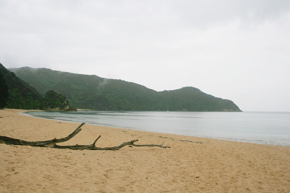 |
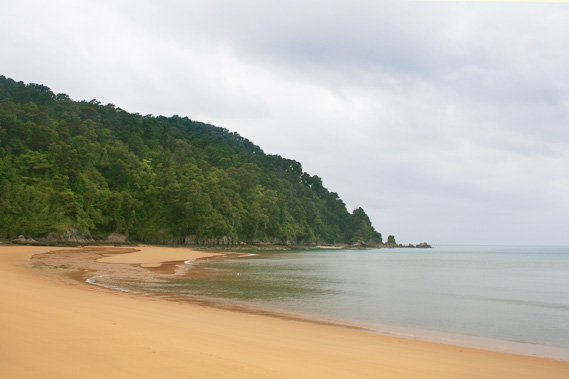
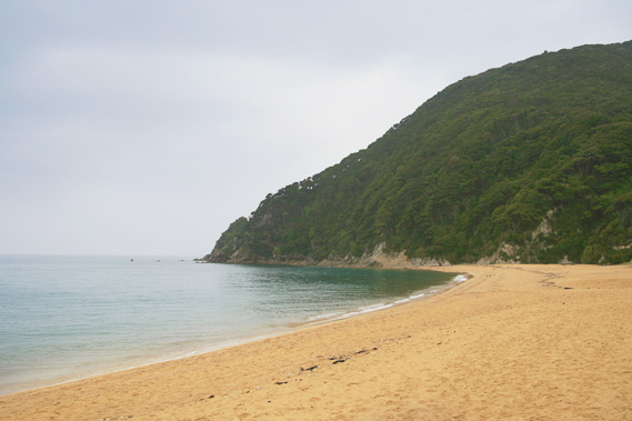
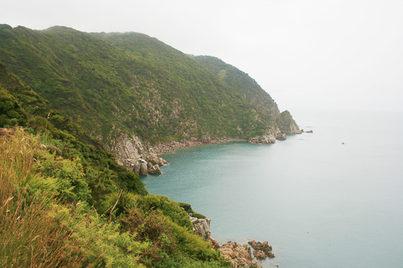
14:03 - By now the rain has stopped falling. A fallen tree trunk with most of its large branches sits washed up on the beach. The sea is fairly calm here and the cloud has cleared from most of the ridges. The short range ending at Separation Point appears almost black under the overcast sky. |
 |
14:04 - Looking back the other way over where the small stream is attempting to reach the sea not quite successfully, the rocky headlands show why it was such a long walk between the top of Anapai Bay and here.
|
 |
14:06 - This beach is a lot more golden than most others apart from Totaranui despite not having any obvious inlet behind it. The sand is coarse with obvious stones at where the waves from previous tides have brought them up. Just before the headland splitting the bay in half is a small stream coming out of the forest. |
 |
14:11 - The headland looks small with a low gap where the track could go over. Separation Point is still visible in the distance. Just past the stream is the entrance to the campsite under some huge pine trees well over a hundred years old. |
 |
14:12 - Inside the campground are a couple of tents whose occupants are probably inside sheltering from the drizzle now falling. A couple of large weathered picnic tables and a concrete fireplace are in the middle of the grassy clearing with a plastic toilet cubicle at the edge of the hill. From the campsite there are two tracks. Once heads over the bluff continuing towards Separation Point. The other track heads directly inland to cross the hill to Whariwharangi.
|
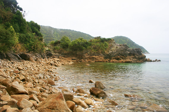 |
14:16 - Now I am so close, I decide to head to Separation Point. I have only ever been here once before, and now determined to make it again today, even in this unfavourable weather. The track crosses over the little bluff and comes out on a very rocky beach. Instead of sand, it has large boulders to climb over. At the other end of the short boulder beach of pink granite is a very low headland heading out about thirty metres into the sea.
|
 |
14:20 - At the end of the headland is a good view of the northern half of Mutton Cove with Separation Point directly behind it. Behind me the water is very transparent, now that I am right at the end of Tasman Bay where the water is not affected at all by the murkiness of the main rivers crossing farmland at the back of the bay now some fifty kilometres away. |
 |
14:23 - I walk along the length of the beach heading towards Separation Point rolling out into the relatively calm sea. |
 |
14:26 - From the end of the beach looking back, I see the other part of Mutton Cove, and Anapai Bay, along with the Anapai Heads. Here the sand was golden with streaks of ironsand. At the end of the beach the rough track rises steeply along the face of the bluffs towards Separation Point. It is not long before it meets the other track coming from Whariwharangi. |
 |
14:38 - From the junction the track follows the top of the ridge occasionally revealing dramatic views down the precipitous cliffs. The terrain of Separation Point seemed easy from Mutton Cove, but on the northern side it is a wall of rock exposed to the open ocean. |
 |
14:49 - In between the exposed cliff top the track runs along moderate terrain with very different scrubby trees I have not seen in the rest of the park. These are more resistant to the exposed weather up here. In amongst the leaf litter are large granite boulders set as if they had been landscaped into it. |
 |
14:50 - Separation Point itself is a large bare granite rock covering several acres. Upon it is a light for navigating boats at night. Several seals and birds bask on the rocks. I climb down most of the way to the rock, to as far as the signage allows. This is a protected seal colony so getting out onto the rock isn’t an option. Here it is very exposed with a strong wind blowing as one would expect at any extremity of land. |
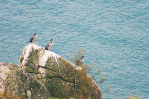 |
14:51 - Gannets and large sea gulls perch on the rocks no doubt waiting for a fish to swim by. On the rocky beaches of huge boulders lay seals looking like giant brownish grey slugs. |
 |
14:54 - Upon leaving Separation Point I walk the rough track back to the junction before following the main track towards Whariwharangi. |
 |
15:01 - The track ascends as it continues over the precipitous bluffs with almost no views. The strange scrub and boulders amongst the leaf litter continues all the way to the saddle. |
 |
15:24 - The saddle is a good one hundred metres above sea level. From there I can see over the forest to Whariwharangi Bay. I can’t see the beach though. The bluffs are hiding it. I do see a row of large pine trees there though, the same arrangement I had seen at Mutton Cove. From here I follow the track down the hill. The track is an old bulldozed track heading down the hill having come over from Mutton Cove. There would have been farms at Whariwharangi and Mutton Cove, but the terrain beyond Mutton Cove would have been impossible for farming. The track steeply descends, eventually rounding a ridge providing a good view of the beach below. On a fine day I would have been able to see Farewell Spit, and maybe even Mount Taranaki from here, but both are obscured by the misty rain with the horizon now indistinguishable. Heavy rain will start falling here soon. |
 |
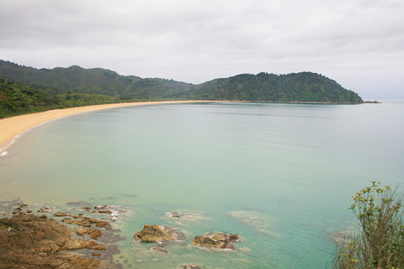
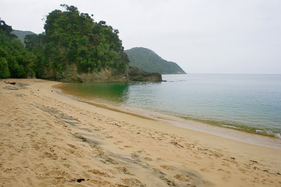
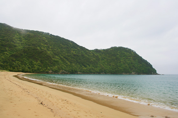
15:31 - Finally the long downhill ends at the pine trees, where I walk out onto the beach. The waves are gently breaking. Although this beach is directly exposed to the north, it is sheltered by the long sweeping Farewell Spit containing sand deposited from the rapid current from the Antarctic sweeping up the west coast of the South Island. Any sand caught up in the strong current gets deposited around the spit which in turn creates a natural barrier to the prevailing swells. From Separation Point around to the end of the spit is known as Golden Bay. This was is first of several golden beaches in Golden Bay, but beyond the beaches at this end most of Golden Bay is sand flats. It is here where Abel Tasman landed in 1642 on his first landing in New Zealand. Here a tribe of Maori were here to greet him, but not with the greeting he expected. The tribe here were cannibals and they proceeded to execute several of the party.
|
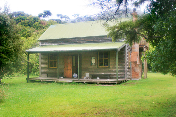 |
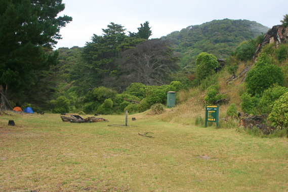
15:53 - Fortunately most of them escaped and Abel Tasman named this place Massacre Bay. It was not until Durmont D’Urville came through here that he renamed it Golden Bay. Later the original name of Whariwharangi was officially given to this beach. I walk along the track under the huge gnarly pine trees parallel to the beach for nearly five hundred metres. I am now only a hundred metres from the end of the beach. The track turns inland and after following it for about a hundred and fifty metres I arrive at a clearing about an acre in size with an old homestead in the middle of it. The hut is a traditional timber cottage with a verandah out the front and a brick chimney stack out the right hand side. It has a painted green roof no doubt to help it blend in with the surroundings. Around the hut are a few tents, picnic tables and open concrete fireplaces. The clearing is surrounded by large bushy scrub providing views of the surrounding hills, including the saddle where I have just descended from.
|
 |
15:56 - The hut is unpainted and still set up with its original rooms which have by now been converted into bunkrooms. This used to be a farm where the lower valley was cleared and pine trees grown along the beach. The soil around here is very poor, so the farm was eventually sold to become part of the park.
|
 |
16:18 - I return to the beach. To the left at the far end a small stream flows into the placid sea water. Beyond that is a steep scrub covered point, and further beyond is Taupo Point. The very large Wainui Bay is on the other side of the point. Looking the other direction a similar point blocking off Separation Point appears. This point is also covered in scrub. This area (apart from the farm) was covered in forest until a large bush fire in 1975 wiped it all out. Bush fires here are severe and forests take hundreds of years to regenerate. |
 |
16:19 - Rain is falling again, so I decide to take the long walk back to Anapai before it gets too cold. I need to get back soon before it gets dark. I follow the long bulldozed road track back up to the saddle. It is a long slog climbing the one hundred and twenty metres vertical. My camera is safely stored in the camera bag but with this much rain I start to wonder if it is going to get damaged from water. This has been the first trip I had taken this camera and it will be a big shame to have it destroyed.
|
 |
17:25 - I finally reach the saddle. The track to Separation Point goes to the left, but the main track continue to the right heading directly towards Mutton Cove. I take the main track remembering I had least followed it 21 years ago. Back then the scrub had been a lot clearer with views of Mutton Cove and Separation Point. Now the scrub has grown nearly two metres taller blocking the view. Two metres growth in twenty years is testament of the very poor soil here. The track gradually descends without any views until finally arriving at the campsite at Mutton Cove. Rain is still steadily falling, so I don't stop to rest here but continue following the track. The wind has by now picked up and become a lot colder. This is the southerly which usually comes after the north west rains, so this is a sign the weather is going to clear. Sometimes it clears immediately by the southerly, but sometimes it continues to rain for several days afterwards.
|
 |
17:46 - Walking along Mutton Cove I see the swell has picked up with definite white waves breaking on the beach. The tide is well out as well. With one more bluff to go to Anapai the rain stops falling, but only briefly. |
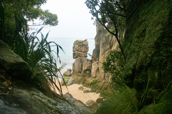 |
17:48 - I reach the start of Anapai Bay and notice the tide is almost right out, so the rock formations appear a lot different. The rock looking like a bearded man with the large hat is now completely above the water line. There are several small dark reefs nearby which had been completely submerged and hidden a few hours ago. |
 |
17:50 - I finally reach the campsite. Fortunately it isn’t dark yet, but I unpack and crawled into the tent ready for a long night of heavy rain. Fortunately being summer the days are quite long here, so the night won’t be too long. I managed to get some food into me but don't have the motivation or space to prepare a full meal. |
 |
19:28 - In amongst the sound of the heavy rain falling, I hear an elusive weka outside. The rain stops falling so I head out onto the beach for one last look as the sky is darkening. I quickly return to the shelter of the tent. In the last remaining light I carefully position the cameras inside the tent to dry out. Not that they will be able to dry properly with the cold humidity being so high tonight. |
|