Introduction to today's journey
To find new things, take the path you took yesterday.
- John Burroughs.
WHEN the New Zealand Company was established, much of the land around the park was taken from the Maori people and subdivided and sold to European settlers in the 1850s and 1860s. Farming the land proved very challenging with the extremely rough terrain, poor soil and poor access - only by sea. The settlers cleared some of the bush in an attempt to farm the land, and introduced over a hundred species of exotic plant, many of these now pests. One industry that had reasonable success was milling, particularly around Awaroa. Timothy Huffam migrated to New Zealand with his four sons following the death of his wife and gaining a new sense of adventure. He leased 50 hectares south of Awaroa. They settled behind a beautiful estuary and became very enterprising once their house was built. They cut timber for firewood, harvested bark for the tannin to be extracted, cut the thin kanuka poles for hop farmers, and milled timber for shipbuilding. The sailors picking up the timber named the location Bark Bay. The industry continued on the property for two decades until the sons moved away to Nelson and other areas along the coast to start their own ventures and Timothy's health started to decline. One of his sons eventually sold the property in to the Tonga Quarry company in 1904.
Today's trek begins at Anapai, and heads southward through Totaranui, across the Awaroa inlet at low tide, then across Tonga Saddle and over to Bark Bay where I settle and explore the lagoon once more before the rain comes in again.
Today's Journey
Distance trekked today: 28.2 kilometres.
Total distance trekked to date: 72.9 kilometres.
 |
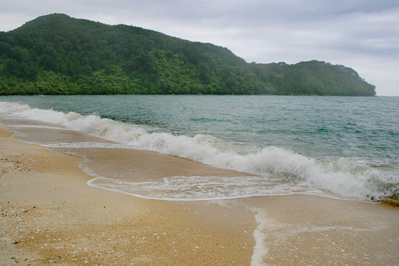
06:03 - Following a night of the occasional rain shower, I am finally relieved to see the light of the early morning filtering through the sodden forest vegetation into my tent which is still mostly dry inside apart from the foot of my sleeping bag which is saturated. The cameras are damp, but still functional to my amazement. The SLR camera in particular is reasonably new but the persistent rain is exposing it to far more moisture than the manufacturer has intended. It is still working perfectly well. I walk out onto the beach where the dark grey sky is letting in very little sunlight. The horizon is visible across the bay and the angry fast moving clouds have some definition. Is this a break in the storm, or is this storm system clearing? Cold and damp, there is little else to do but quickly pack up and head southwards back to Bark Bay where I am booked to stay tonight.
|
 |
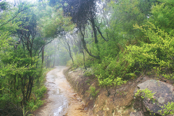
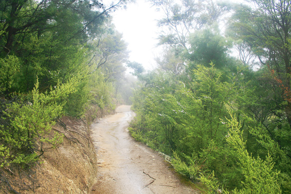
06:05 - Once packed, I walk along the sodden beach covered in the pock marks of yesterday's heavy rain. Coming from Brisbane I find it hard to believe this is the height of summer in early February. It is more like a winter tempest and even these are rare where I live. There is no time to linger in these miserable conditions, so decide to hike the return to Bark Bay as quickly as possible. I won't be taking many photos this morning. Following the short walk along the beach, I reach the track along the long gully to Anapai Hill. Gusts of wind blow bringing the occasional squall of rain. Sheltered only by the sodden scrub I continue walking quickly against the wind until finally reaching the saddle. Here I see the long track across the Anapai Headlands I had taken just yesterday morning. The main track drops steeply from the top of the saddle. I take this track down towards the head of the inlet behind Totaranui.
|
 |
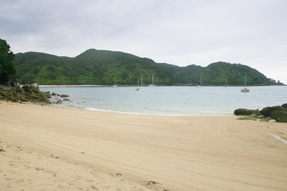
06:59 - After the short steep descent, I reach the long flat plain behind Totaranui Beach. Here the scrubby forest clears to farmland and the track becomes a tractor trail before becoming a gravel road heading towards the small village of Totaranui. The gravel road turns towards the beach, having met the main road coming over the hill from Wainui. This gravel road is the only road into Totaranui. Heavy rain often creates slips that completely isolate this village from the outside world. Massive exotic trees tower along either side of the road. These trees were planted well over a hundred years ago when this area was first settled. An hour has already passed since leaving Anapai.
|
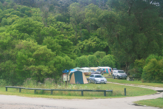 |
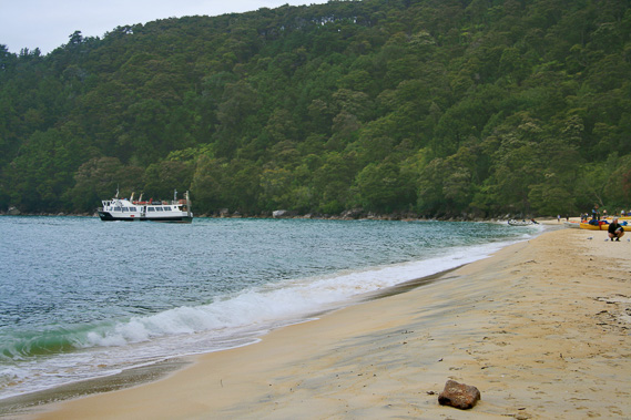
07:00 - Once at the end of the avenue of giant trees, I turn right to walk along another gravel road through the large camping ground running just behind the beach. It is usually packed during the summer peak, but for most of the year lies almost deserted. The summer peak has passed and only a few tents linger here. Most people here this morning are no doubt still asleep or at least staying inside their tents waiting for the rain to go away. Rain starts falling again, but it isn’t heavy. My main concern now is getting across Awaroa. The tide is out, but the heavy rain over the past twenty four hours would have swollen the rivers. These rivers are sometimes too flooded to cross. If this is the case, I won't be able to cross and will have to return here to camp. I cross my fingers hoping Awaroa river is low enough to cross. |
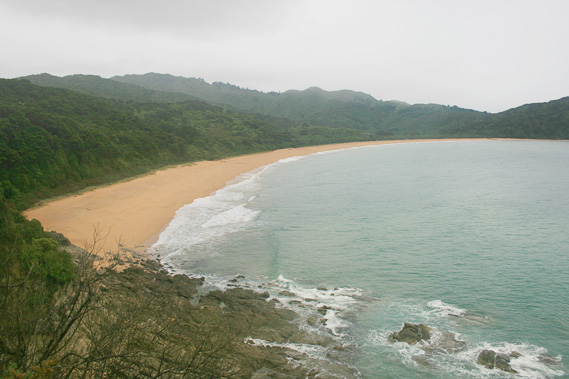 |
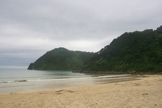
07:22 - I quickly follow the track behind the beach reaching the headland looking back across the bright orange sands of the beach back to Anapai Headlands. The clouds are still a solid grey colour but the view is clear. The rain has stopped falling. There is still no indication the weather is going to clear at any time soon. Looking the other way I can clearly see the Awaroa Heads, where I will be crossing back over Tonga Saddle should the Awaroa Estuary not be too flooded. There is still a long way to go though. I climb down off the headland onto the coarse beach of Goat Bay. Squalls of misty rain start falling again. I persisted along the beach crossing over the next headland onto Waiharakeke Bay, then up the stream towards the portage.
|
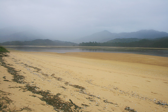 |
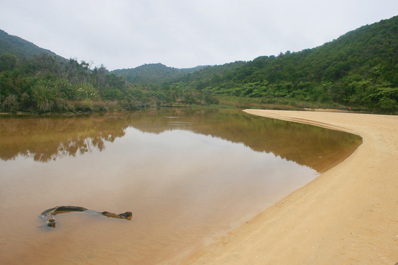
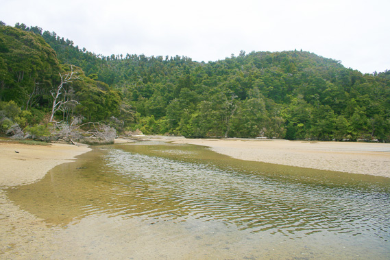
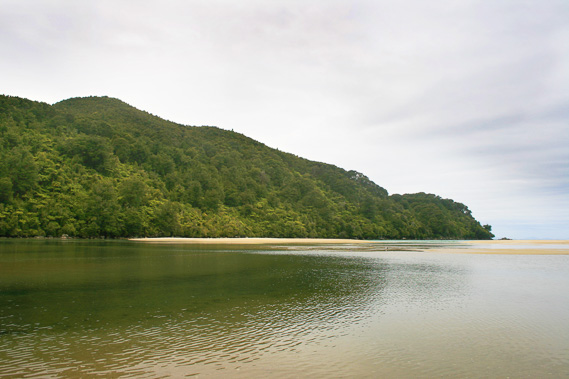
08:58 - Finally I reach the estuary where just the other day it had been fine and clear. I walk across with ease. To my relief the river isn’t at all flooded. The water is nearly thigh deep, but still reasonably clear. Once across the main river, I change course to head downstream directly towards Venture Creek. Misty rain continues shrouding the dark headlands as I continue walking across the barren sand of the estuary soon to flood with the incoming tide. I reach Venture Creek, which is little more than a trickle of ochre water flowing down the wide basin already starting to fill downstream with the incoming tide.
|
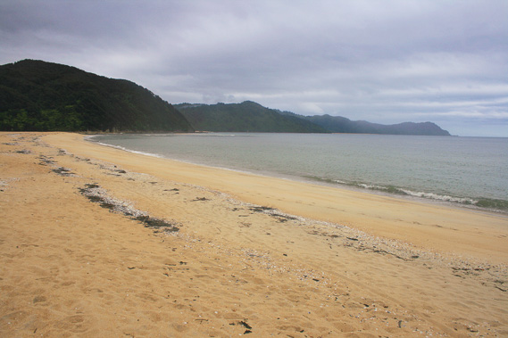 |
09:22 - Once across the creek I walk over the low sand bank towards the beach. I look back up the huge estuary but a large squall blocks the hills completely from view. Small waves break on the beach out of the disturbed grey water. From here I can see across to the large bluff surprisingly close now to Waiharakeke Beach, and around the headlands to Goat Bay and Totaranui, though both beaches are unseen from here. The view extends to the Anapai Headlands hiding the northern bays and headlands.
|
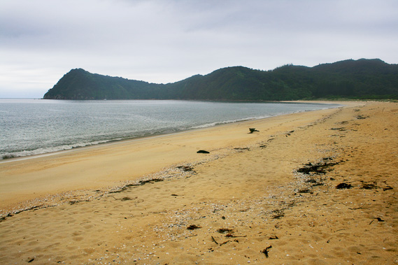 |
09:23 - Looking to the right, the beach sweeps along the coastline to the almost black headlands of the Awaroa Heads. Lines of white cockle shells and black driftwood detritus litters the beach in the contours of recent high tides. |
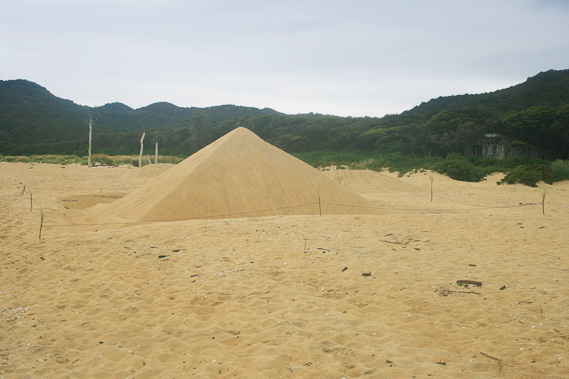 |
09:24 - I walk along the beach towards the Awaroa Heads. I see several driftwood and sand sculptures people have gone to a lot of effort to create. There is a large perfectly formed square pyramid about two metres high and three metres wide along each side. Fortunately the rain hasn’t eroded it. |
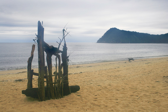 |
09:26 - Further along the beach are a couple of sculptures created from cockle shells held in wire cages. This is followed by a large driftwood scupture. Here I find a large log upon which I sit and rest for a while. |
 |
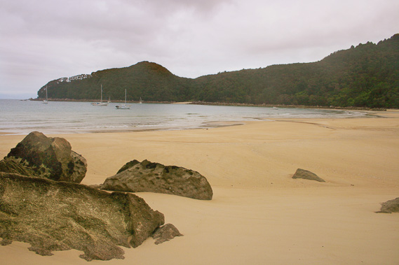
09:37 - After five minutes I get up and continue along the beach, reaching a small break in the trees covering the sandspit giving one final view of the grey estuary soon to flood. I continue walking along the beach until reaching the end at the start of the Awaroa Heads. By now I am very hungry not having breakfast back at Anapai. Fortunately the Awaroa Lodge is nearby.
|
 |
09:48 - Most of the accommodation in the park is very basic, to cater for the hikers and kayakers. There are a few small guest houses for people on guided tours. Then there is Awaroa Lodge providing prestige accommodation for those happy to spend huge amounts of money on luxury. It was constructed just a few years ago on the sandspit. Behind the lodge is a nice café where hikers are welcome to stop for a meal. I take up the offer staggering off the beach through a small track leading to the lodge, reaching the café. What a relief to be able to sit down on good seating.
|
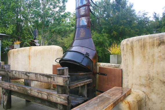 |
10:05 - The furniture of the café is rustic rough sawn timber, probably all driftwood. There is a fire oven and other old artefacts around in the bush setting. A waiter arrives and gives me a menu. I order what is perhaps the nicest meal I had ever eaten, perhaps because I am so hungry at the time. The meal includes a very nice steak and a salad with lots of purple onion. It is very colourful. I also order a nice cool refreshing lime juice. It is very quiet here at the lodge. I was expecting it to be busy as it is still summer. I will later find out that actor Tom Cruise and his family has just arrived here to stay, booking out the entire lodge (except the café). Finally being recharged from having breakfast, I set off to take the track across Tonga Saddle towards Onetahuti.
|
 |
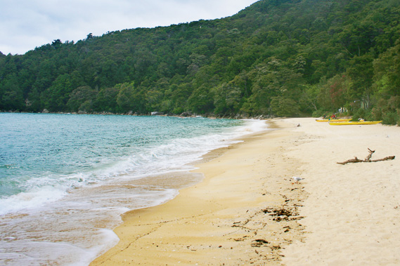
12:00 - The old track from Tonga Saddle passes right by the Awaroa Lodge. The original track isn’t very well maintained. Some sections are fairly steep and muddy, not helped by the rain of the past few days. Again I decide to hurry and don't take photo stops. Scrubby bush stands on either side of the track denying me of any view of the estuary below. It doesn’t take long at all for the track to reach the top of the saddle, where it meets the main track. I turn left and start descending towards Onetahuti beach above Richardson swamp. I reach Onetahuti estuary just before midday and cross the shallow stream before following the estuary upstream.
|
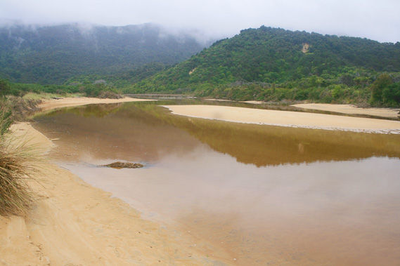 |
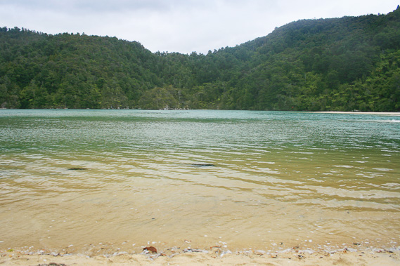
12:01 - The water is a little cloudy with a murky grey colour. Yesterday's rain must have flushed out some of the Richardson Creek Swamp and the main estuary running the length of the beach. Thick grey cloud covers the top of Stony Hill behind the far end of the beach. I follow the estuary upstream. Beyond the exit channel, shallow water is permanently held back by the deposited sand creating a permanent ecosystem for the plants and animals adapted to brackish water. Dirty sand frames the still water on either side. An ochre stream passes in between the flax and red tussock into the tidal water at the back of a wide channel running into the main estuary. Beyond the initial row of flax there is no obvious stream. It just filters out of the huge swamp beyond.
|
 |
12:03 - Further upstream a long line of reeds grow in the water creating a definite edge. I walk along the side of the swampy bank towards the campground at the far end of the beach. The estuary runs parallel to the beach with a very narrow sand bar covered in low scrub. Despite it being so thin there are no cuts across the sand bar to walk across, but I follow a crude trail along the side of the water of the stagnant estuary.
|
 |
12:09 - At one point there is a clearing across the sand bar where I walk across to the beach, which I follow to the camping ground. |
 |
12:35 - I quickly explore the camping ground. One tent is pitched at one end of the camping ground but there is no activity. I have camped here a couple of times in the past. The first time I camped here was with my family in 1988 at the start of a big rain storm much bigger than this one. The second time was at the beginning of 1997 and it was here that I made the decision to move from New Zealand to Australia a few weeks later.
|
 |
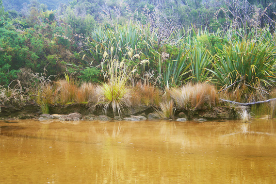
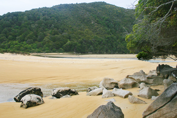
12:38 - In the years since I last stayed here, a new shelter has been built just above the camping area. Otherwise everything is exactly the same. I walk to the other end of the campsite and into the forest along a short five minute track through the dark tree cover to a small waterfall and pool near where the stream comes out into the back of the estuary. The stream is stained a soft ochre colour. It runs between large granite boulders covered in small ferns and mosses. I reach the small bubbling waterfall plunging a metre or so over a moss covered cascade of rocks into a shallow pool. Tree ferns create an umbrella over the waterfall.
|
 |
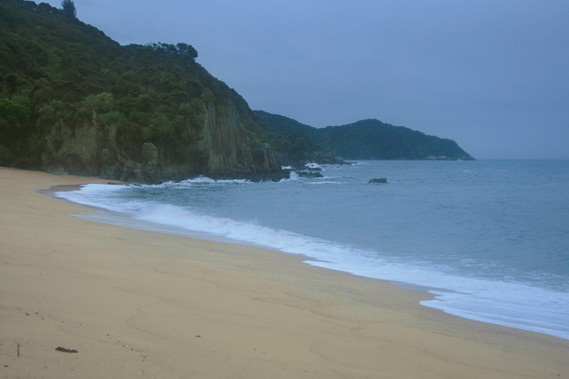
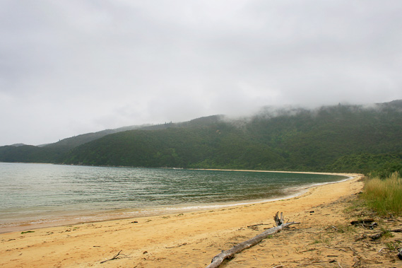
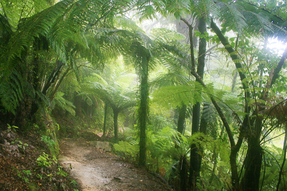
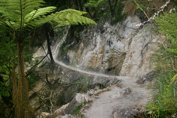
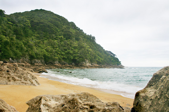
13:31 - From Onetahuti I follow the initial steep climb over the Tonga Quarry bluff. Rain is beginning to fall now, but it is impossible to tell how long it will last. After all this is New Zealand, and rain here can fall for weeks on end. Within ten minutes I reach Tonga Beach. It is not the idyllic setting I had experienced the other day. A strong swell is breaking on the beach now exposed to the north. I don’t stop here, but start heading up the switchback climb to Long Valley Swamp which drains into Mosquito Bay. I continue heading up the hill towards the Stony Hill Pass. Soon the track is enveloped in thick cloud, though fortunately the rain has reduced to a strong drizzle. It is not windy but the air is still cold. I cross my fingers hoping it will clear, but the norwesterly hasn't changed to a southerly yet, and even then often the weather doesn’t clear for several days.
|
 |
14:03 - I cross the Stony Hill pass, briefly resting on the park bench at the top. I don't linger though as the rain starts falling heavily. |
 |
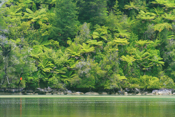
14:15 - The cloud remains thick all the way down to the junction between the high and low tide tracks across Bark Bay. I briefly hesitate here to decide whether to get a little wet crossing the estuary, or stay dry and take the long way around. The tide is well on its way in now but fortunately the rain has stopped falling, so I decide to take the low tide route. The mist hangs thick around the tree ferns but quickly clears as I continue descending.
|
 |
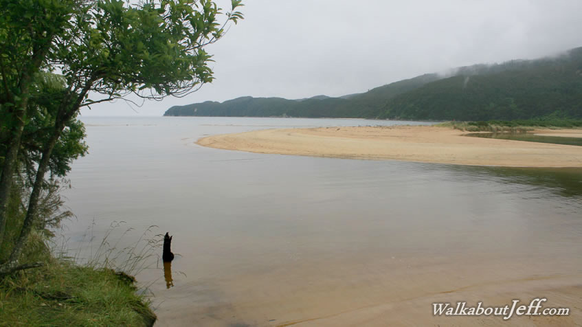
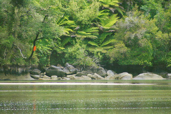
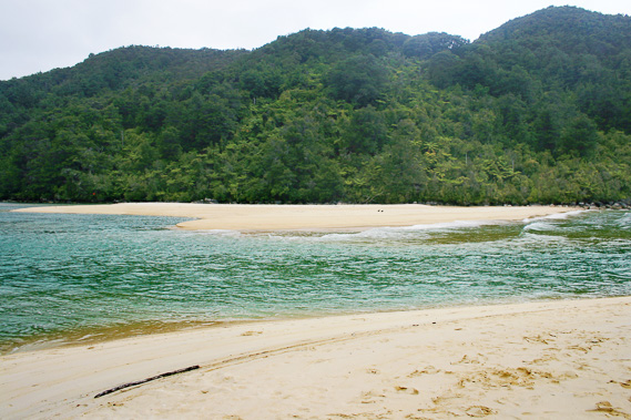
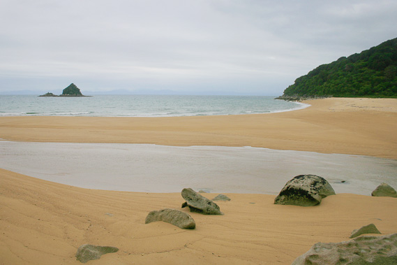
14:28 - I reach the entrance of the estuary scrambling down a few rocks. As expected the estuary is quickly flooding. The far headland is almost black. Cloud clings to the forested slopes at the back of the estuary behind the island. I can clearly hear the waterfall at the back. As I start crossing the estuary wading ankle deep through the cold water, I spot the waterfall though it doesn't seem any bigger than it had done the other day. Across the estuary I see the small solar panels and the orange dot marking the entrance to the hut.
|
 |
14:30 - The main river cuts deep in between the sand banks. The water is thigh deep, and running swiftly upstream. It isn’t discoloured at all though, so this rain is normal for here. |
 |
14:37 - Once across the main channel I continue following it upstream along the sand bank heading towards the camping ground. |
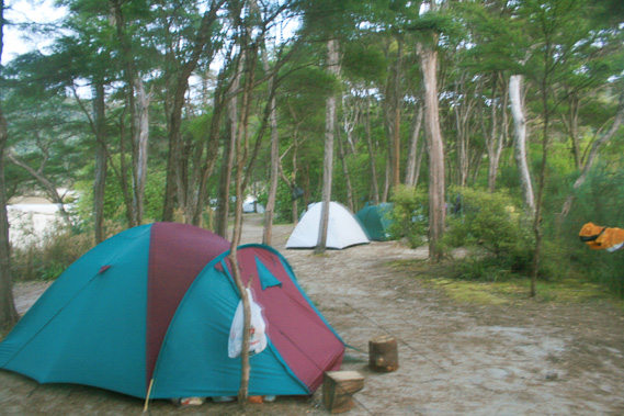 |
15:11 - Tents are scattered throughout the camping ground, so I pitch my tent in a sizable gap at the far end from the estuary. There are less trees at this end, and looking at the clouds above I figure there is will be a lot more rain tonight. Better to be out in the open than to be under trees where the rain drops accumulate into much larger drops. I quickly set up the tent.
|
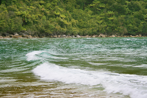 |
15:57 - After resting in the tent for about half an hour I walk out to the beach where a moderate swell is breaking. The fifty centimetre white waves are is quite high for here.
|
 |
15:59 - I walk along the beach back to the mouth of the estuary. It has quickly filled in the hour since crossing, now reaching the rocky island. The two boats I had earlier seen that had been sitting on the sand are now surrounded by water and the people on board are making preparations to sail them out once they are afloat. |
 |
16:02 - With the tide quickly coming in, I wade across the shallow part of the lagoon towards the hut before heading to the place where I crossed the stream yesterday to head towards the waterfall. I cross the knee deep water over the main river, the current running very gently upstream. Once on the other side I walk up onto the remaining slither of dry land behind the island. The two boats are still sitting on the sand, but are well away from where I was heading.
|
 |
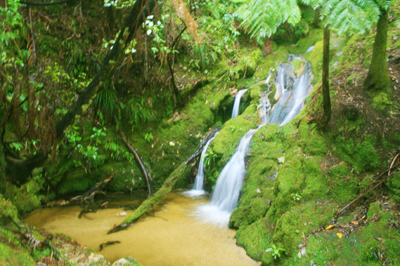
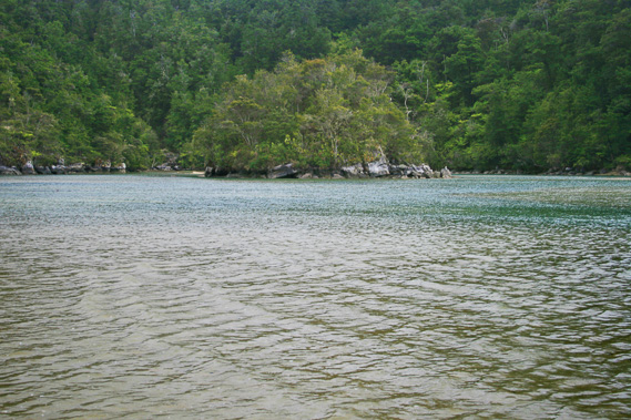
16:03 - The shallow water is a little cold as I wade up the northern channel towards the waterfall. It is still overcast, so the lighting is a lot better today, showing the area in its true beauty with the numerous tree ferns and small trees almost touching the water, just separated by white granite rocks reflecting in the almost mirror smooth water. I find a location on a small area of the small spongy weed still above the surface of the water. |
 |
16:16 - The waterfall appears almost out of nowhere running from two separate locations about a metre apart, one running down a natural channel in the rock, and the other falling freely towards a common meeting point hidden behind the large boulders behind the bridge which crossed over very fittingly. It is not flowing much more than it had done a few days ago despite the rain. I don't think much rain has fallen in this part of the park, most of it fell over the northern beaches. |
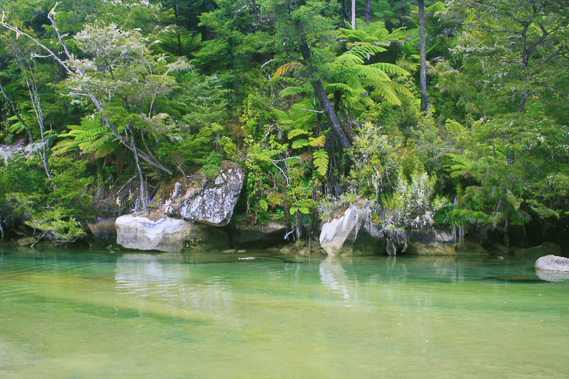 |
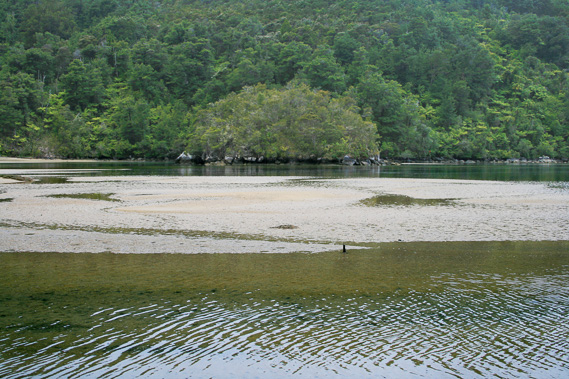
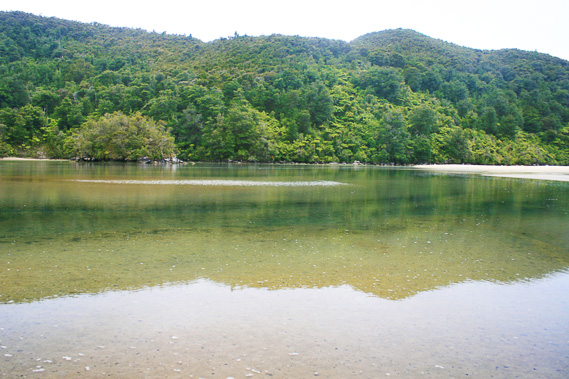
16:21 - I look the other way from the waterfall. The water has covered the flat between the island and the point separating the two arms of the lagoon and it is starting to flow in my direction. The north lagoon is absolutely idyllic, with its shades of forest green, turquoise grey water and sandstone to white granite.
|
 |
16:22 - A gentle breeze begins to blow. I look back towards the island. Much of the water is ruffled by now. Looking back at the waterfall the water is ruffling in the pool under the bridge as well, so any good shots I have of the area have now been taken. It is time for me to return to the sand bar. |
 |
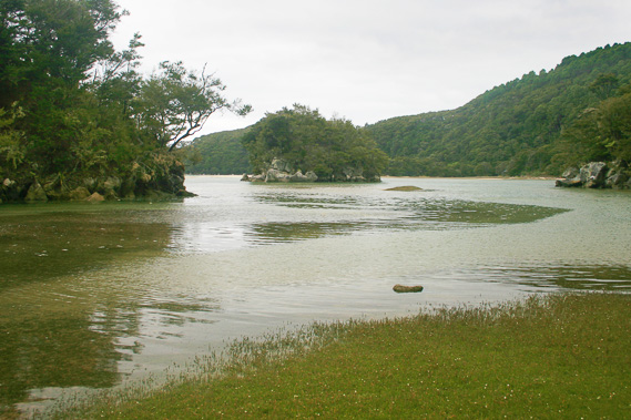
16:40 - I wade back across the back of the island, and across the main river which is now waist deep and quickly deepening with a moderate current now heading upstream. Once across the main channel, I see it is now mostly flooded almost to the bridge. The lagoon is full of water. A small orange dot marks the end of the high tide route where I had come out of the bush earlier. It is nailed to a black beech tree sitting on a rock leaning out slightly over the water. Next to the dot is a small hollow through which hikers can access the track from a few steps up the granite.
|
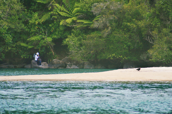 |
16:53 - A couple of kayakers enter the lagoon, kayaking through the peaceful waters after what would have been a rough ride through the open water today. I look back to the tidal entrance of the lagoon. A young Asian couple are sitting on the rocks on the other side, having hiked over from Awaroa today. The water would go up to their necks if they were to cross now, but they don’t. They sit on the rock hoping the tide will start going out shortly. |
 |
17:11 - I head back towards the camping ground. A pair of oystercatchers forage the beach on the sandbar. This is their territory as it has been for many generations in the fifteen years I have been coming here. |
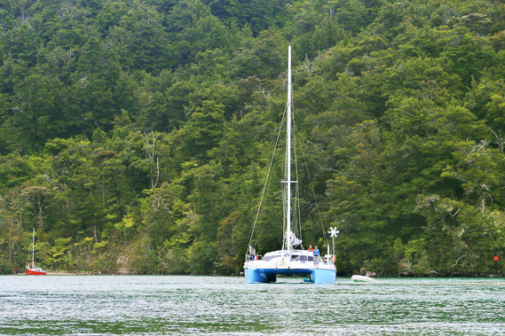 |
17:17 - I look through a clearing across the sandbar into the estuary. The small boats moored near the camping ground are afloat now. One has already departed, but the others are obviously staying another day or two. The two boats that had sat in the northern arm of the estuary are now making their way out of the channel now the tide is full. The small red boat passes the catamaran and goes through the channel first. The catamaran has quite a narrow entrance to negotiate and the sailor has his two children, one at each bow, navigating him out. The boats bob up and down with the waves running in as they head out. The boats are followed by a kayak negotiating its way through the big waves. The incoming wind is causing the tide to rise higher than normally expected at this stage of the lunar cycle.
|
 |
17:20 - The beach is almost deserted. Most people are hiding in their tents or the hut. The beach is very small now anyhow. The waves are breaking loudly on the small beach, though they are not high enough to threaten the campsite. The waves expose the fragments of sea shells and coarse sand on the beach. |
 |
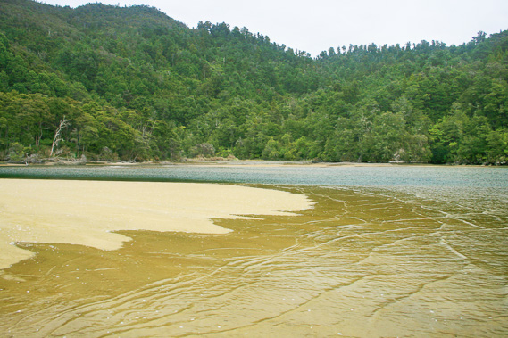
17:21 - Water is now leaving the lagoon with the tide dropping. The main channel is a deep turquoise colour translucent with all the fine debris picked up along the bottom of the channel. Seagulls wait along the side of the channel for small fish to swim through.
|
 |
17:37 - The evening boats arrives, dropping off a few people who are staying here the night before trekking their way out. |
 |
18:06 - The tide continues to ebb, exposing some of the higher sand flats. Tiny hillocks dry out first leaving small pools of what had once been footprints of countless travellers around them still wet and unable to quickly drain away with the rest of the water. These pools gradually soak into the sand.
|
 |
18:11 - The Asian couple has long gone, no doubt having gone back up the track to take the high tide route especially with having seen the tide continue to rise. Small white bubbles of salt form orderly patterns showing the speed at which the tide is going out.
|
 |
18:20 - The estuary is silent as it continues to drain. The wind has stopped blowing and it has not rained since I arrived here. The cloud is still thick though. Although I have walked a long way today, I decide to make the most of the evening and head towards Falls River.
|
 |
19:07 - The track leading from the beach clings to the side of the very steep forested bluff as it heads towards the headland about six metres above the water. Below me the waves swirl around the rubble of huge boulders. Although the growing terrain is almost impossibly steep, thick forest of black beach, with its distinctive strong sweet honeydew smell fills the salty air. Although it is dark under the thick cover of trees, the track stands out very well over the white granite in between the black fungus that has fallen onto the surrounding leaf litter.
|
 |
19:11 - As I continue following the track, the far headland starts peeling back exposing the larger Tasman Bay. A few hundred metres offshore lie the dark rocks of the reef protecting the bay. About ten minutes after leaving the beach, the track suddenly turns right to head up a gully. Here it splits into two. The main track heads uphill into the start of a steep ascent towards a small saddle unseen towards the southern bays of the park. The lower much narrower track steeply descends to a small beach below.
|
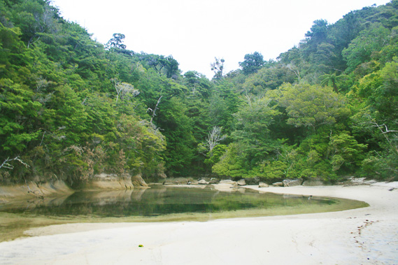 |
19:18 - I follow the lower track down to Meddy’s Beach, where waves are breaking on the cream coloured sand sweeping between the small rocky headlands on either side. The beach occupies the end of a small gully where a small stream cascades from the thick forest above into a placid lagoon covering about half of the beach to the slope on the far side. A small stream dribbles out of the end of the lagoon but is absorbed into the sand before reaching the level the waves are breaking to.
|
 |
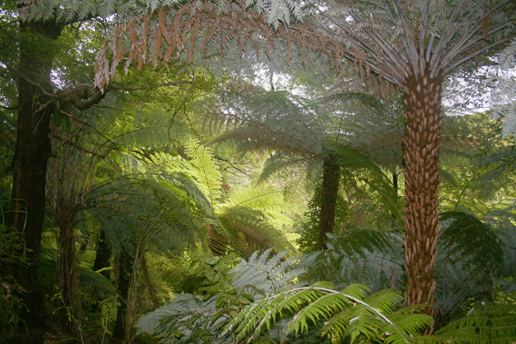
19:26 - The side of the lagoon is carved straight into the rock, with a sharp level boundary to the vegetation marking the extent of the high tide. Looking out from the beach I can see the far half of the main beach, nearly a kilometre distant now. The headland appears longer here, but it isn’t enough to stop the swell from coming in. Upon leaving Meddy’s beach I follow the short steep track back to the main trail. Upon reaching the junction I continue following it heading up the dark mossy forest with trees covered in epiphytes. The track is steep and narrow, with the intention of gaining altitude as quickly as possible. It is a slow trek for about five minutes before reaching a small bridge crossing a plunging funnel of moss covered rocks. The sound of the small stream protrudes through the cracks between the rocks. Only during very heavy rain does the water become visible.
|
 |
19:53 - The track continues steeply for another ten metres or so before the forest suddenly gives way to manuka scrub and the track almost completely levells. It continued a gentle ascent for another five minutes before reaching a small junction at a low saddle. At this junction a side track lead to a view point at the headland. I hiked there a couple of years ago and it had long overgrown. It goes up a small hill in front of the saddle. The main track descends straight from the saddle down a gentle slope over a maze of manuka roots that had once been underground, but with hundreds of thousands of people walking over them over several decades, they are a good five centimetres above ground now. I negotiate my way through the roots until reaching another junction. The main trail turns right to follow the contour of the next bay. The rough side track goes almost straight down the bluff towards a small beach I see through the thick vegetation. The signpost says this is the entrance to Sandfly Bay. I slowly climb down the steep track through the thick scrub. It is interesting here the beach being called Sandfly Bay. The beach on the other side of Bark Bay that unfortunately cannot be reached by track is called Mosquito Bay. Fortunately with the overcast skies and moderate wind, I won’t going to be getting either this evening. I am wearing insect repellent anyway just in case. Upon reaching the bottom of the trail, I scramble down a couple of huge boulders onto the beach. Just a few metres ahead of me is the mouth of the Falls River, running across the coarse sand. Beyond the end of the lagoon the beach sweeps for about half a kilometre to the next headland.
|
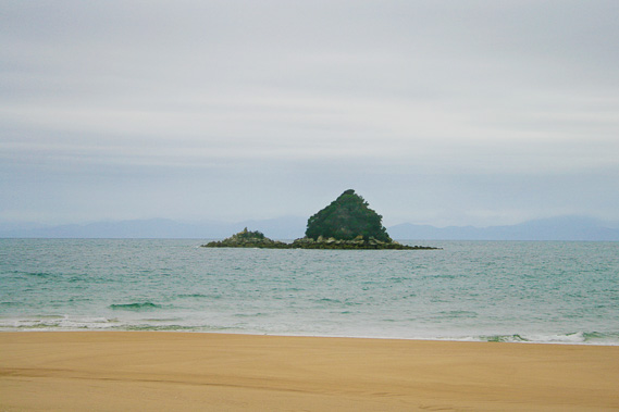 |
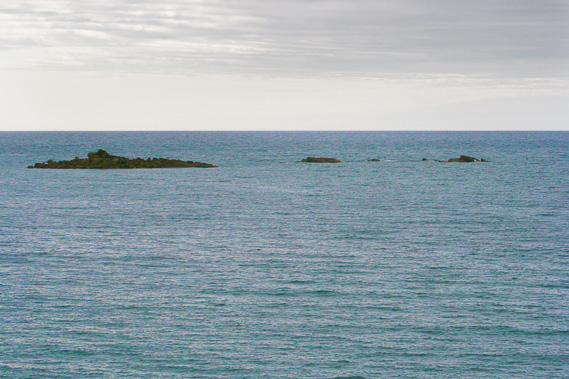
19:54 - The grey sea is breaking reasonable sized waves onto the beach. Offshore is Pinnacle Island, a small upward arrow shaped island jutting out of a small reef. The grey cloud almost completely obscures the dull outline of the Richmond Ranges and lower Marlborough Sounds. |
 |
19:55 - Looking up the lagoon the water sweeps behind the sand bar to the headland on the other side before continuing up the long gully from where the river is flowing from unheard. |
 |
19:58 - I decide to head left around a small headland safely above the river, where I reach a small beach from where I see the headland between here and Meddy’s Beach. The waves are breaking quite heavily on this beach and large areas of bedrock make it a little unwelcoming. It is a quiet little paradise often missed. |
 |
20:01 - I walk along the foreshore back to the river, before following it upstream looking up the now placid estuary behind it. From here I return to the main track scrambling up the steep trail. The forest is dark and thick following the north side of the gully above the long estuary mostly unseen. The sun shines to the north, so this side of the gully in any bay gets little sunshine, so it has a different microclimate to the south side of each gully. The forest is much thicker and covered with a sub canopy of tree ferns and supple jack – an endless spider web of impenetrable vines.
|
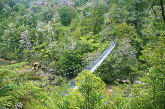 |
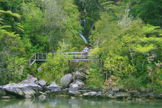
20:37 - The track through here isn’t easy either. It is rough going over the roots of the larger trees following the very steep sided bank going up from the river. Finally I see the swingbridge up ahead. It is the largest bridge in the entire park, going from one precipitous bluff across the river to another precipitous bluff on the other. The swingbridge marks the boundary between two very different zones of the river.
|
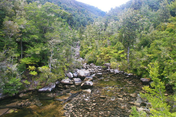 |
20:49 - Downstream the river runs very placid through the tidal estuary. The water has been blocked off somewhere downstream, most likely at the mouth where I was earlier. The golden sand is interspersed with numerous trunks of trees washed down from floods past and deposited here. They are all black as death slowly rotting away in the corrosive brackish water. Trees tower on either side of the river. Upstream it is totally different. The river cascades down giant boulders at quite a steep slope. There isn’t much water in the river though, so the grey boulders run down the steep valley like an old landslide. The surrounding forest on either side is well established rising into the steep hills. The Falls River is well named. It runs its entire length down cascades, with frequent waterfalls coming off Moa Park plateau over a thousand metres above me, and ten to fifteen kilometres away. It is a very difficult river to traverse. There is one track heading up from Torrent Bay about two hours away from here, where you can reach a part of the river further upstream, but otherwise it is almost impossible. The river has only ever been scaled down its length once before, and in that journey the explorers often had to divert wildly away from the river.
|
 |
21:07 - The swingbridge makes light work of crossing this difficult river. There is a track I discovered a few years ago that leads down to a crossing over the small boulders. The crossing would be relatively easy now, but after any heavy rain it would be impossible to cross the torrent cascading down the valley. After a couple of minutes at the swingbridge, I decide to return to Bark Bay before it gets dark. I follows the track back along the heavily forested gorge above the Sandfly Bay lagoon.
|
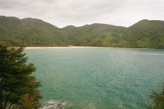 |
21:20 - Once back on the top of the saddle between the mouth of the Falls River and Meddy’s Beach, I quickly return to Bark Bay. The turquoise grey water gently churned in the bay as the deep green forested hills provided an excellent backdrop.
|
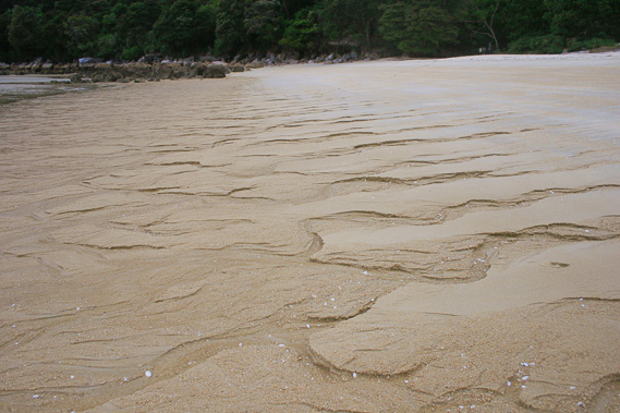 |
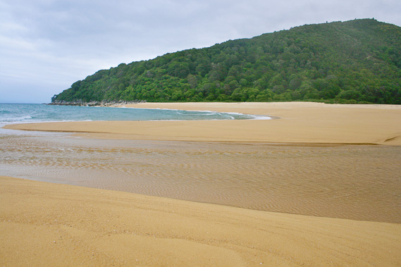
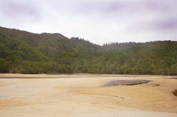
21:21 - I return to the beach where the tide is almost completely out leaving interesting drainage patterns in the sand. |
 |
21:39 - I walk to the far end of the beach as the sky changes colour with the coming of the dusk. |
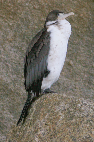 |
21:42 - Gannets stand perched on the low trees and rocks waiting for any last supper fish to swim by before they return to their nests for the night.
|
 |
21:45 - The tide has mostly emptied out of the lagoon when exhausted I return to the tent. I fall into a solid sleep for a couple of hours before heavy rain starts falling through the rest of the night.
|
|