Introduction to today's journey
Water is the driving force of all nature.
- Leonardo da Vinci.
ALTHOUGH Torrent Bay had been marked for good industry potential, this was never realised apart from a small sawmill in the village a small quarry at the western end of Anchorage Beach, and a farm behind Anchorage. There is quite a settlement mostly of small holiday homes in Torrent Bay, and as the name suggests, Anchorage is a very sheltered haven for recreational boats. Completely surrounded by national park and ocean, the only access to this area is either by sea or by walking track.
Today's trek starts at Bark Bay, heading around South Head into Sandfly Bay going upstream to cross high above the dramatic Falls River. From there the track steeply ascends following the ridges above Frenchman Cove before descending into Torrent Bay. The tide is coming in, so I head around the high tide track to the Torrent River following it upstream to Cleopatra's Pool. From there I cross the inlet and head along the beach to Anchorage Hut.
Today's Journey
Distance trekked today: 14.7 kilometres.
Total distance trekked to date: 87.6 kilometres.
 |
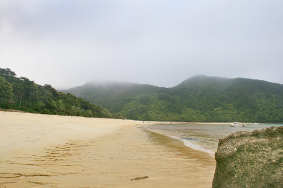
08:16 - It is still raining when I awake so I remain in the tent having breakfast until it stops falling. Today's hike is relatively short heading across to Anchorage, where I have booked a campsite for tonight. The rain briefly stops falling so I head outside to have a look. |
 |
08:18 - I reach the entrance of the estuary at the end of the sand bar. The cloud covers the hills but seems to be lifting. Little sunlight filters through the thick cloud and almost all the colour I saw on my first afternoon here has been washed out. |
 |
08:23 - Drizzle starts falling. The estuary is empty aside from the main stream which gently flows past me. The far headland is almost black though a little obscured by the falling drizzle. Several hikers have left the hut and are now crossing the estuary heading north towards Awaroa. |
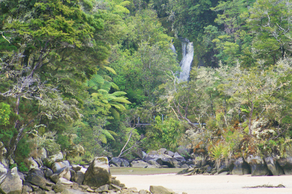 |
08:25 - I hear the waterfall at the back of the estuary. It is clearly visible from the sand bar today. It roars with increased capacity from the overnight rain. |
 |
08:26 - The main river cuts deep in between the sand banks. The water is not much more than ankle deep, but it flows swift. It isn’t discoloured at all though, so the overnight rain was not significant. |
 |
08:27 - Remnants of the rising cloud clings to the forested slopes at the back of the estuary behind the island as some of the hilltops emerge. Cold misty rain falls. |
 |
08:28 - I look out towards the northern head, seeing the sky is a lot lighter to the north. Does this indicate the weather is starting to clear? This is supposed to be a southerly. I see an area to the south east past the headland clearing as well. The weather seems to be clearing over the Richmond Ranges over the other side of Tasman Bay. The rain gets heavier so I quickly return to the shelter of the tent. |
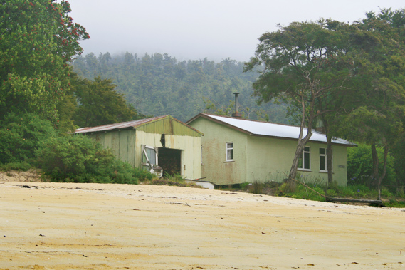 |
09:43 - An hour passes before the rain clears. I quickly pack up and start heading along the beach back towards Falls River. A small boat shed and shack sits on the sand bar past the end of the camping ground. This is one of three such shacks in the park. There is an agreement between the New Zealand government and the owner as part of the leasehold agreement that when the owner dies, the shack will be demolished and the land returned to the public.
|
 |
09:52 - I briefly stop at the far end of the bay on the main beach. A pattern of small channels in the sand shows where the water pours out of the porous sand. An enormous volume of water absorbed into the sand during the last high tide, so it is draining out fast enough to form the channels. |
 |
09:53 - It is obvious this side of Tasman Bay isn’t going to clear any time soon. The rain bearing cloud still hangs low over the hills. There is little swell this morning as I follow the trail above the water towards Meddy’s Beach. Obviously the worst of the storm has passed, but the cloud will linger. Upon reaching Meddy’s Beach, the track steeply ascends towards the low pass in front of the southern headland. The forest here is thick and the track therefore very dark. Drizzle falls so I don't do any photography along this section of the trail.
|
 |
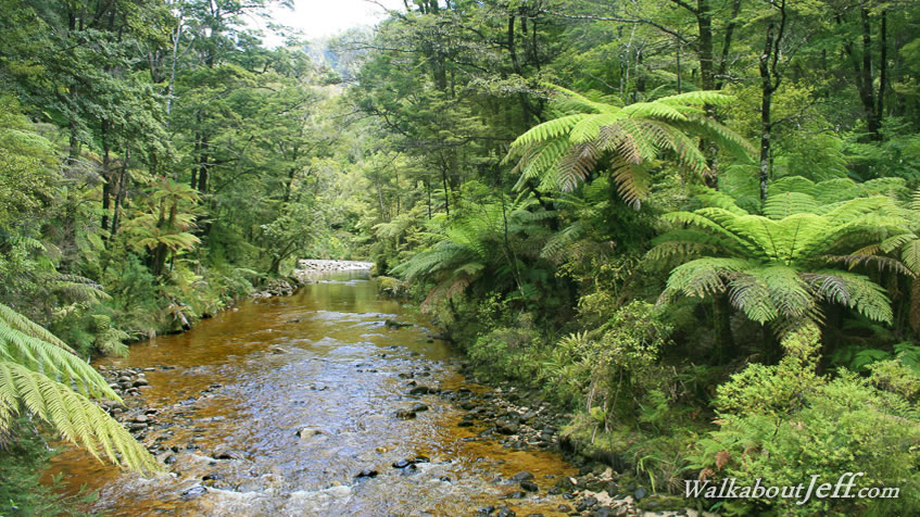
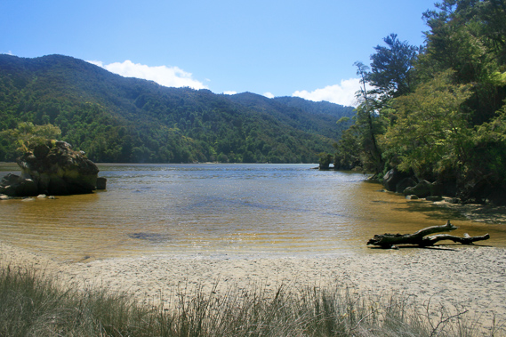
10:49 - Eventually I reach the top of the saddle and start heading down the other side before the trail starts negotiating its way up the steep gorge of the inlet behind Sandfly Bay. The water in the estuary flows a dark ochre colour indicating the Falls River must have a large volume of water coming down from the unseen range above. The walk through the gorge is dark with the trail covered with a canopy of silver tree ferns blocking out most of the little light filtering through the clouds. Eventually I do reach the swingbridge across Falls River as several guided walkers hike across heading north from Torrent Bay.
|
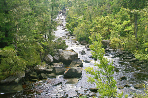 |
10:57 - The view from the swing bridge is spectacular. A lot more water plunges down the gorge today than it had done yesterday evening. It roars over the giant boulders to the swingbridge crossing where it eases off into the estuary with its huge black tree trunks washed down by past storms. Although the river is swollen, it is not high enough to cover most of the boulders. I have been here before when the river was much higher with a huge torrent running down the valley covering from side to side. |
 |
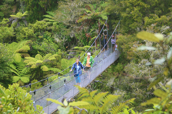
10:59 - Today the water is too swift to ford, so I am very thankful for the swingbridge. Several people cross the swing bridge on their way northwards towards Bark Bay. They are all coming from The Anchorage or perhaps Torrent Bay.
|
 |
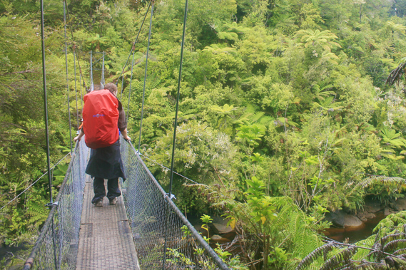
11:00 - Finally when there is no one crossing the bridge I walk to the middle where I can get some good shots of the river. The swingbridge has the capacity to hold up to five people. It is very narrow though, and if anyone is coming from either direction then I will have to move out of the way. I take a couple of shots before my camera tells me the memory card is full. I have taken 552 shots since Kaiteriteri. Fortunately I have another card, and still plenty of battery power. I see someone approaching from the Bark Bay end, so I complete the crossing of the swingbridge before fumbling to replace the memory card in the light rain. Quite a few people cross the bridge before is is clear enough for me to go back into the middle to take some more photos. I get a few more before another group approaches from behind, so I return to the far bank and wait for them to pass. From here I start the ascent towards the next saddle.
|
 |
11:01 - This is the steepest section of the main track. The trail switchbacks through thin kanuka scrub a good hundred metres rise climbing a moderate ridge. It is slow going along the steep trail carrying my heavy wet pack. I have done this steep section many times before and I’m sure I will be back again. |
 |
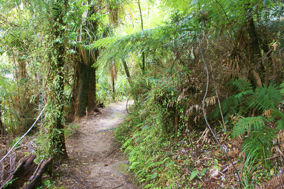
11:24 - Finally the trail reaches the top of the steep spur before turning to the left following a very gentle rise towards a low saddle. Once over the saddle the trail switchbacks a few times down a gentle slope before heading around the hill again. I see the track had largely improved since I was last here. This section of track used to be a bit of an obstacle course with what I used to call the roots, the three rocks, and the white rock face. This has in recent years all been bulldozed into a flat track a quad bike could travel through with ease. Despite the improvements I do see where the three obstacles had all been. Kilby Stream faintly bubbles unseen at the bottom of the gully. The noise gets closer and closer until I reach the back of the valley and cross over a low bridge across the large pools in amongst the boulders. Once across Kilby Stream the track continues a gradual ascent. Too bad the rain is falling too much for me to pull out the camera. Now I am on the south side of the valley, the trees are thinner and the ground not so wet. Eventually I reach the end of the spur where I have a spectacular view over Frenchman’s Cove. From the boat heading up to Bark Bay the cove was a very small beach, but from this angle in the hills it has a sweeping estuary behind it perhaps half the size of Bark Bay. The bay is surrounded by little jagged granite peaks making it a very idyllic retreat. Much of the land around the cove is private, hence the track passing so high above it.
|
 |
11:30 - Rain still fall making it difficult to get a good shot from up here. On a fine day the view would be spectacular. Looking to the south east I see Pitt Head for the first time. This is the point separating Torrent Bay from Astrolabe Roadstead. I continue walking through the scrub. The tiny white flowers of the kanuka are in full bloom. The trail goes into the next gully, though this one doesn’t have its own stream. Once through the gully it heads towards a small saddle. For many years this saddle was covered in pine forest planted perhaps a hundred years ago. This forest is being cut down now to make way for native forest to revegetate.
|
 |
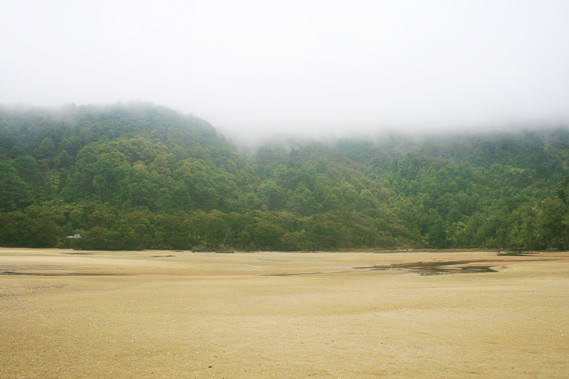
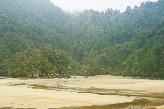
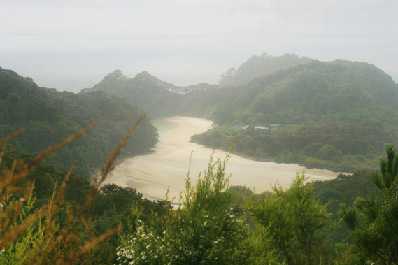
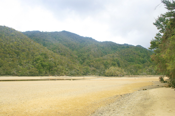
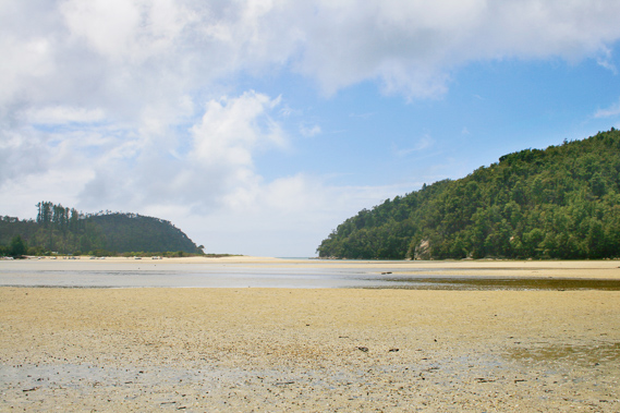
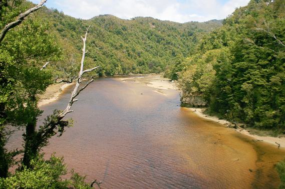
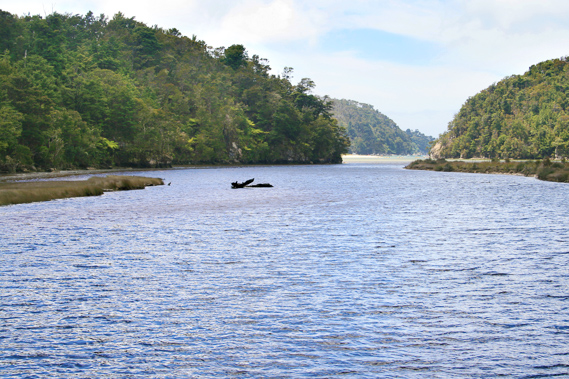
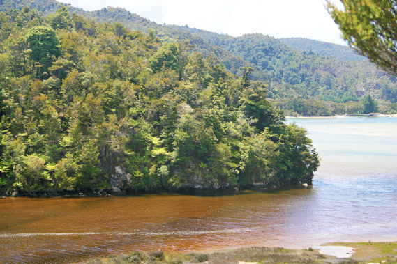
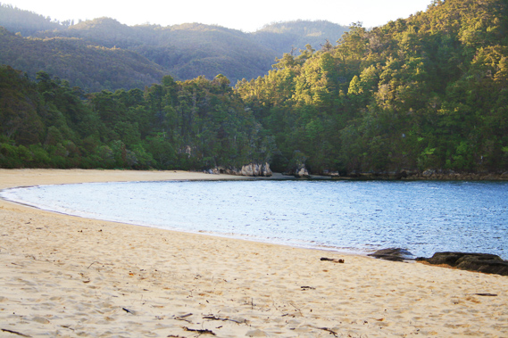
12:30 - With much of the forest cleared, I have a clear view of Torrent Bay from the top. Looking out I see a patch of blue sky for the first time in several days. The weather is starting to look hopeful now. Below me the beach of Torrent Bay points towards a large estuary, twice the size of the one at Bark Bay. The beach sweeps across a scrubby sand bar containing the small village of Torrent Bay, mostly holiday homes. Beyond the village is the estuary, with the outlet running between the far end of the beach and a large forested hill providing much of the shelter from the open sea. Behind the estuary is an ascending ridge along which one of the routes of the inland trail follows towards the top of the Pikikiruna Range. Upon reaching the range, the track follows it all the way to Whariwharangi. |
 |
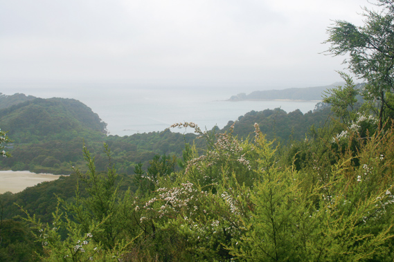
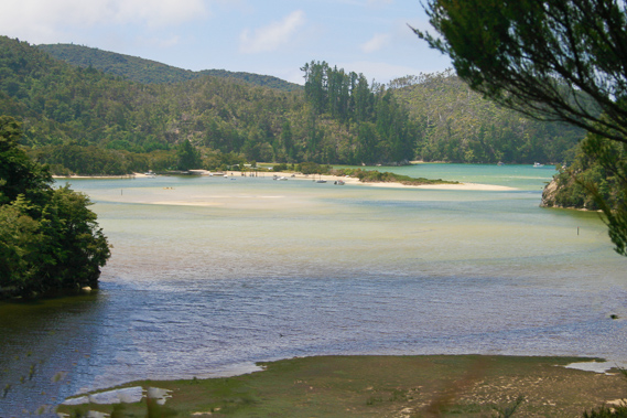
12:31 - Looking from the other side of the bluff I see the long sweeping beach of Anchorage. I will be staying at the far end of the beach overnight, but there is still a long hike ahead. Although the distance as the crow flies would only take half an hour to walk from here, it will take at least an hour to get there at low tide, but as it is coming in, it will take probably two hours to get there. From the lookout the trail switchbacks down the steep terrain towards a gully behind the village. As I descend, patches of sunlight appear on the hills on the other side of the estuary. The clouds are definitely moving from the south, so hopefully this means the weather is finally clearing. A small dark stream flows down the back of the gully, the source of the village's water supply. When I do reach the stream, I am just a few metres above sea level. The track turns to follow the stream along even terrain through the dark forest.
|
 |
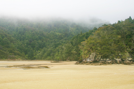
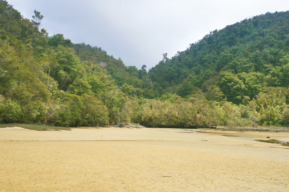
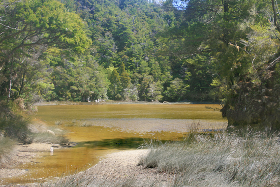
12:59 - The gully comes out into a very small tidal estuary. Before reaching the beach the track follows a grassy main street down the middle of the village. It is only a very small village with a few holiday homes and a couple of guest lodges all sitting on the grassy sand bar with kanuka scrub keeping each building reasonably private. Even at this busy time of year it is pretty quiet here. At the end of the street is an old wooden wharf going out into the main estuary, which is flooding now. The water is not deep enough to prevent me from crossing yet. However I want to explore the area behind the estuary. A high tide track follows it all the way around to Anchorage beach. To the right is the start of the large Torrent Bay campsite. Here I stop for half an hour for lunch.
|
 |
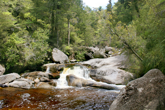
13:33 - From Torrent Bay campsite I follow the high tide trail around the estuary. Initially it went deep into a gully where the Cascade Creek came out. About half an hour up the track is Cascade Falls, then another twenty minutes is a low saddle to the Falls River. The saddle is perhaps only fifteen metres below the level of Falls River and I have a theory the river had once flowed down this gully into Torrent Bay. Another theory is Cascade Creek is gradually eroding the relatively soft rock to eventually divert the river from Sandfly Bay to here. |
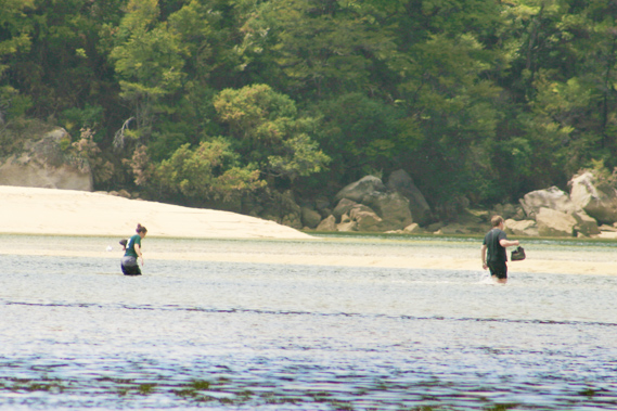 |
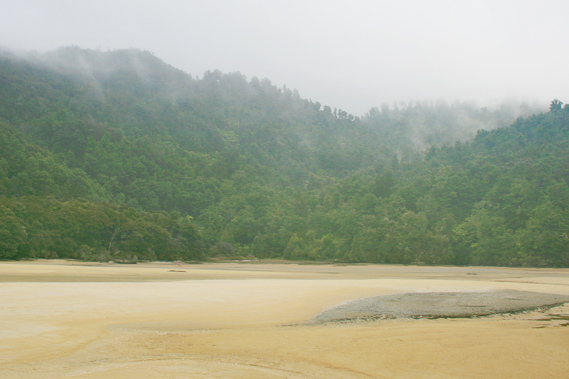
13:34 - The high tide trail is of a much lower standard than the main track, but this is because most people take the route across the sand flats of the estuary during low tide. As the trail approaches the next point I can see out into the estuary. There are a few people crossing over whilst it isn’t too flooded. At low tide the river flowing through the middle of the estuary would be ankle deep. Though after the recent rain it could be nearly knee deep. The estuary is flooding now from the rising tide almost reaching the hips of the straggling people crossing it. |
 |
13:47 - I reach the small Torrent Bay Hut. It is a dark khaki green hut set on a small bank nestled in behind the estuary. There are still a couple of people crossing over with the water in the deepest channel now hip deep. Soon it will be too deep to cross. Water is now flooding onto the sand banks sweeping across and bubbling as the air in the soft sand escapes. |
 |
13:54 - I don’t stay at the hut for long, but continue along the narrow trail to round a point where the estuary follows a deep valley through which the Torrent River flows out into the main inlet. Water is flowing upstream from the incoming tide now. I follow the track upstream through the thick forest. |
 |
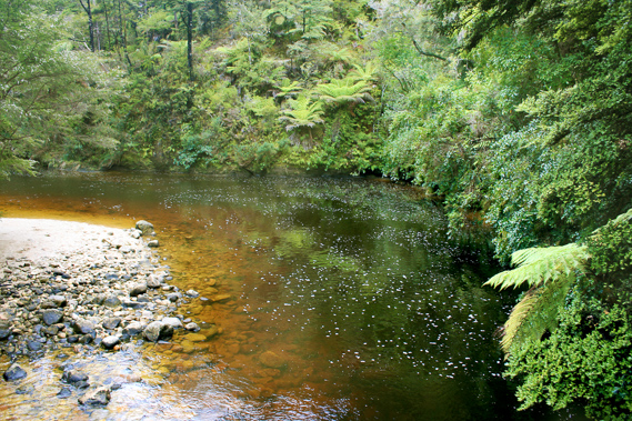
13:58 - Although the view is usually obscurred by the scrubby forest, I get the occasional spectacular view of the lagoon. Here the water is tannin stained from all the forest vegetation upstream. Under the surface there were braided channels from erosion by past floods. The inlet quickly become concealed with hills all around, so it was very sheltered in here. It is not long before the estuary gives way to the main river, which flows downstream over a wide gully of small boulders. Beech trees and tree ferns line either bank and covers the hills. I reach a bridge marking the start of a new track heading across to Anchorage and the southern bays.
|
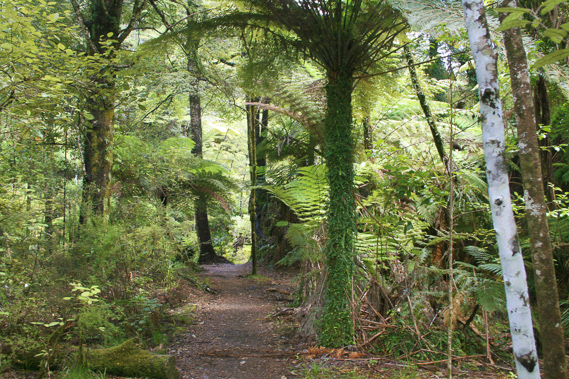 |
14:13 - I continue following the track straight ahead upstream. It is very quiet and peaceful up here. Moss and ferns line the blank above the trail around the bluffs. They are still dripping with the rain that has fallen here over the past few days. Where the track crosses a flat area, I am surrounded by groves of silver tree ferns. |
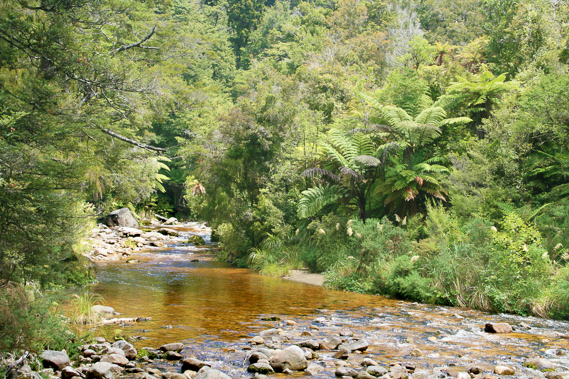 |
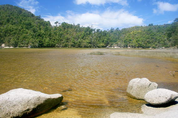
14:15 - The river narrows and follows a rocky gorge through large boulders. Although the river flows higher than usual, the ochre water is clear. |
 |
14:22 - After about ten minutes hiking upstream, I reach a point where the river splits into two. I cross dry boulders over over the smaller stream. From here I have a short scramble over some rocks before reaching Cleopatra’s Pool. |
 |
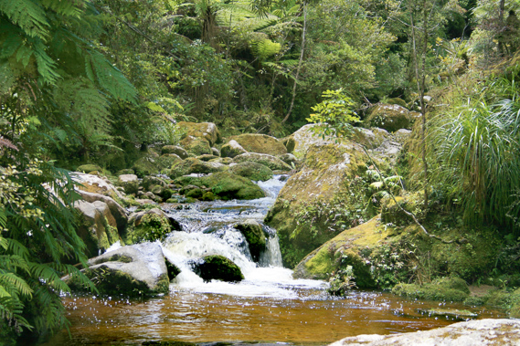
14:33 - Cleopatra's pool is a swimming hole on the main river under a one metre high waterfall. The waterfall splits into two by a large boulder about half way down. The water to the left continues going straight down whilst the water to the right follows a natural channel in the rock diverting to the side. Above the waterfall the boulders are a lot larger indicating the river follows a steep gorge similar to Falls River.
|
 |
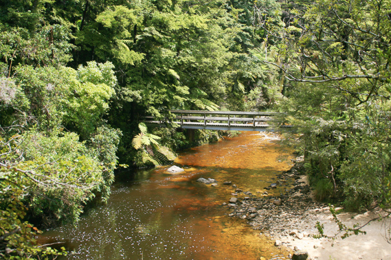
15:06 - I only stay there for a few minutes as it is too cold for swimming. I photograph both streams before returning along the trail following the river downstream until reaching the wooden bridge from where I can continue heading around the estuary. |
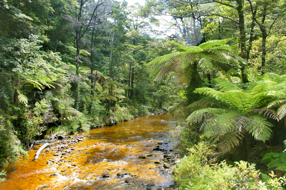 |
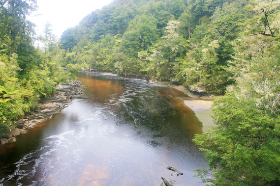
15:25 - Looking from the bridge upstream the river follows a straight line gently flowing over small boulders. The water is an ochre colour but not dirty. On either side stands tall black beech trees with their distinctive honeydew smell. Magnificent silver tree ferns create a lower canopy, some specimens are right at the waters’ edge. |
 |
15:26 - Looking downstream the river deepens into a black pool as it rounds a bend just past the bridge. From here it flows a little further downstream before reaching the widening estuary. |
 |
15:28 - I cross the bridge and follow the trail against the steep bank. I have a spectacular view back to the bridge in a gap between the bush as it heads around a small spur. |
 |
15:32 - A few minutes pass before I am able to see out into the estuary. By now much of it has flooded with the rapidly rising tide. It still has a fair way to rise though. |
 |
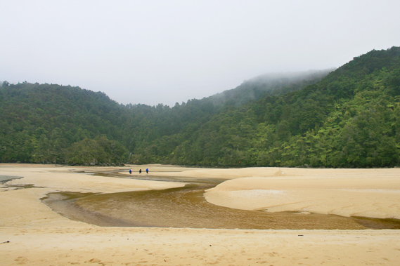
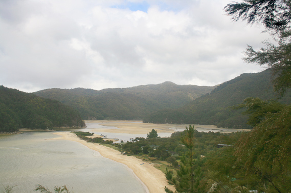
15:37 - Another five minutes pass before I can see across to Torrent Bay Village. The estuary has almost completely flooded by now in very clear water. The sand bar is still sticking above the water and several small boats have moored themselves around the back of it to be sheltered from the swell of the exposed bay. A few kayakers are now exploring the estuary. It is definitely too deep for hikers to cross now.
|
 |
15:38 - The track commences a moderately steep ascent towards the Anchorage Hill, leaving the coast not to return until Yellow Point a good hour away. I rise about fifty metres before finding a rough side track descending back to the estuary. |
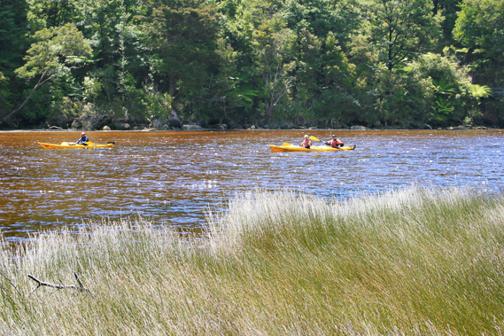 |
15:45 - Upon reaching the estuary I follow a path through the reeds. At this point I am across the river, so I know wading across the remaining inlet to the low pass across to Anchorage will be very easy. A couple of kayakers are heading upstream to explore the river and perhaps to walk up to Cleopatra’s Pool.
|
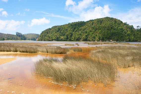 |
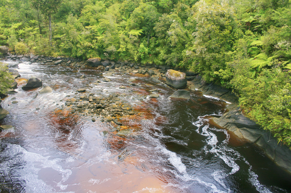
15:47 - The trail follows the lower part of the river before it fans out into the main estuary. The water around the large clumps of reed is stained an orange ochre colour from the swollen Torrent river. It is clean though.
|
 |
15:52 - The water is no more than knee deep heading directly across to the point where the large bluff cutting off the estuary reduces from a maximum of one hundred metres to about ten metres. Over this low pass is the track to the Anchorage. |
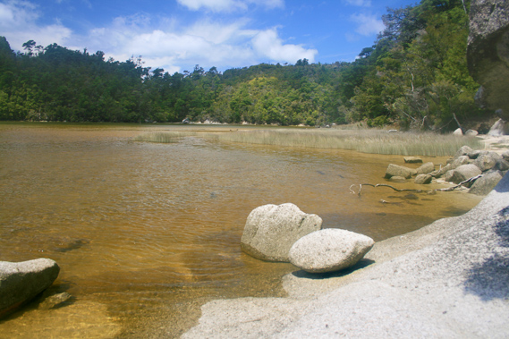 |
15:54 - The sand is softer towards the little cove that the gully held itself in. I know the other side of the cove is quite muddy. Otherwise the rock formations here are very interesting and full of character. |
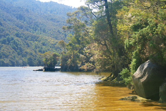 |
16:16 - Trees grow right to the water’s edge leaning out over the estuary. About ten metres out from the track entrance is a large rock with a couple of small gnarled trees growing on it. |
 |
16:20 - A young couple sit on the rock no doubt waiting for the tide to go out. They will have to wait a long time though. Shortly after I arrive they decide to return to the track heading over to the Anchorage. At the top of the low saddle is the start of a steep track along the ridge which eventually joins the track I started climbing up before diverting back to the estuary. Following the track will get them across to the village, but it will be a long way from here. They should have perhaps taken the shortcut I had followed along this side of the estuary. |
 |
16:21 - I head up the track across the pass. The track is steep but well-constructed. I stand briefly at the top of the saddle before commencing up the rough and steep track towards the other track. I only walk about a hundred metres though, hoping to get some good views of the Anchorage and of the Torrent Bay estuary. I only get one obscurred view of the estuary through the thick scrub covering the trail. |
 |
16:22 - Upon returning to the saddle I decide to head down the other way to the end of Anchorage Beach. I will be camping at the other end of the beach tonight, nearly two kilometres away across the sweeping beach.
|
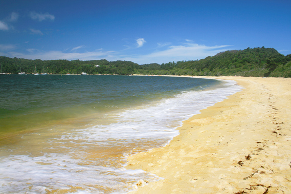 |
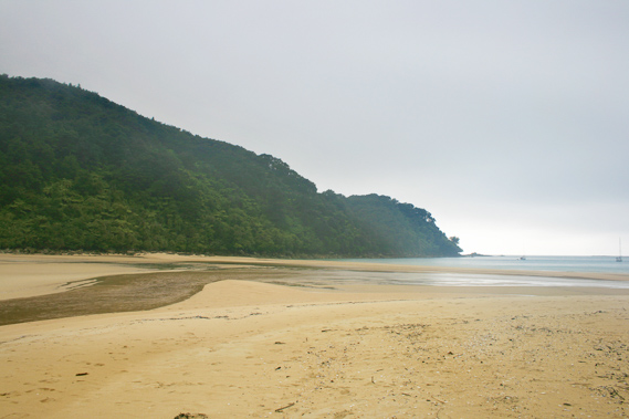
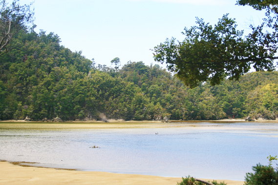
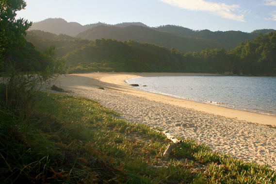
16:35 - A substantial swell breaks on Anchorage Beach. It is not living up to its name today. By now nearly all the cloud has cleared from the sky and the rain of the past few days is forgotten. There is still a cold nip in the breeze. With the tide in so I won't be able to explore the nearby caves. This will have to wait until tomorrow. The water along the beach is discoloured with ochre from the Torrent River outlet on the other side of the long bluff.
|
 |
16:37 - Pitt Head extends out from the other side of the bay, giving increasing shelter as I follow the beach. The swell gradually decreases as I head around the bay, towards the camping ground where I will stay tonight. |
 |
19:21 - Beyond the hut is a small wooden bridge over a small swampy creek. On the other side of the creek is the grassy camping ground. There are quite a lot of tents pitched here, but being one of the last to arrive for the day, I am fortunate in finding a nice quiet spot in the short grass to pitch my tent. Relaxing at the campsite I prepare dinner. I eventually return to the hut and back out on the beach. The sun is still shining, but it won’t be long before it sets behind the hills.
|
 |
19:24 - A patchwork of mid-level alto-stratus cloud sweeps across the sky to the north east. It is moving from the south east indicating the Antarctic southerly hadn’t blown itself out yet. The sky is still clear to the west, and the sun lowering itself in the sky has a warmth to it which I haven’t experienced in several days. |
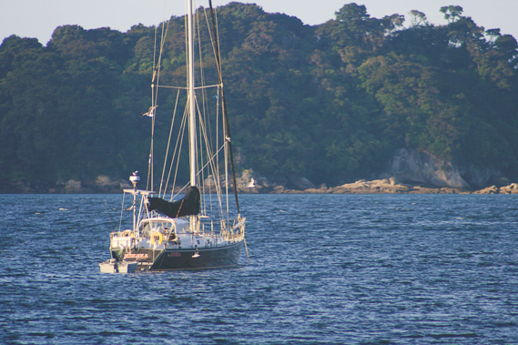 |
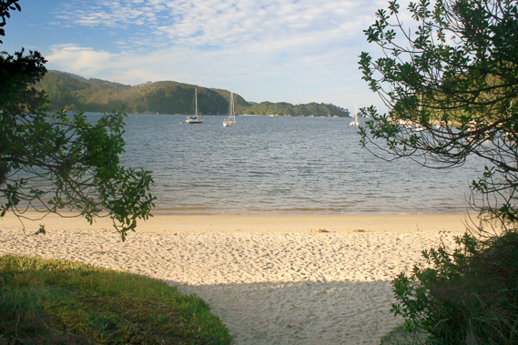
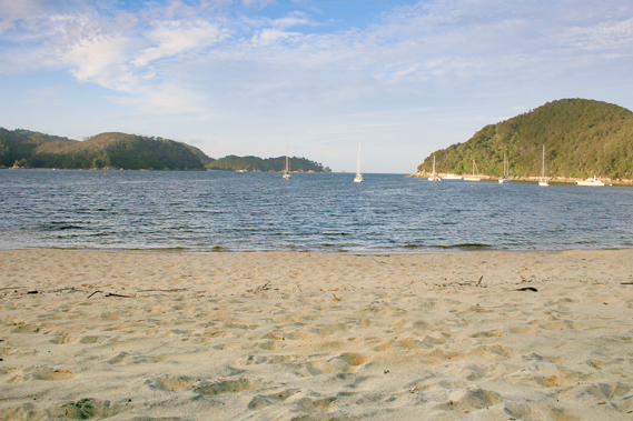
19:49 - Offshore at this end of the bay are a number of yachts anchored in the moderately deep waters. Although the other end of the beach is exposed to the daily sea breezes, this end of the beach is nearly always calm, hence the name of the beach. |
 |
20:05 - The swell has eased off and the rain of the past few days is already forgotten. The air cools as the shadows across the hills lengthen. The tide as already dropped a lot, but I won't explore the other end of the beach until tomorrow. |
 |
20:06 - I relax on the beach before the air gets too cold. The beach was originally named Brown’s Bay but was renamed The Anchorage after farming in the area ceased. The bush on the hills here is very scrubby, in the early stages of regeneration in the poor soil of these exposed granite headlands. |
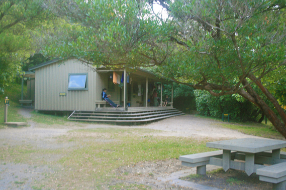 |
20:19 - As I return to the tent, I pass the hut. Anchorage Hut is older than the other huts in the park (except obviously Whariwharangi). It was about two thirds of the size of the Bark Bay Hut and has a verandah out the front and some washing had been hung out to dry. The hut has since been replaced with a much larger one. With the air getting colder I return to the tent. It had been another long day coming here all the way from Bark Bay. Exhausted I quickly fell asleep.
|
|