Introduction to today's journey
It is good to have an end to journey toward, but it is the journey that matters in the end.
- Ursula K. Le Guin.
THE FIRST European settlers built a track along the coast in the 1890s along the proposed route of a road. In 1908 a road was surveyed from Marahau to Torrent Bay, and beyond over the Falls River and Stony Hill to Awaroa. Construction of the road began at Marahau during World War I, but was abandoned when it reached arount Tinline Bay, never to be considered again with industries now in decline. The track along the coast remained rough, and as the timber and farming industries continued to slow down, it fell into disrepair. By the 1930s it had become largely overgrown and landslide damage made the track impossible to navigate apart from the section between Marahau and some point before Torrent Bay. Navigation from there involved following the ridges, with the trip from Marahau to Awaroa taking a fit person 4 days to a week. After the area was declared a national park in 1942, a new track was cut roughly following today's track. The new track from Marahau to Torrent Bay was completed in 1955, and extended northward from 1965. The track was completed in the 1970s and has continued to be upgraded over the years since to take on the increasingly larger numbers of people on this now New Zealand's most popular trek.
Today's trek begins at Anchorage, exploring the length of the beach and over Pitt Head to Te Pukatea Bay. Returning to the hut, I follow the track southwards over the hills stopping at Watering Cove before continuing over reaching the sea again at Yellow Point, then rounding Guilbert Point into the enormous Sandy Bay. A line of bridges crosses the inlet to the end of the track at Marahau.
Today's Journey
Distance trekked today: 13.6 kilometres.
Total distance trekked to date: 101.2 kilometres.
 |
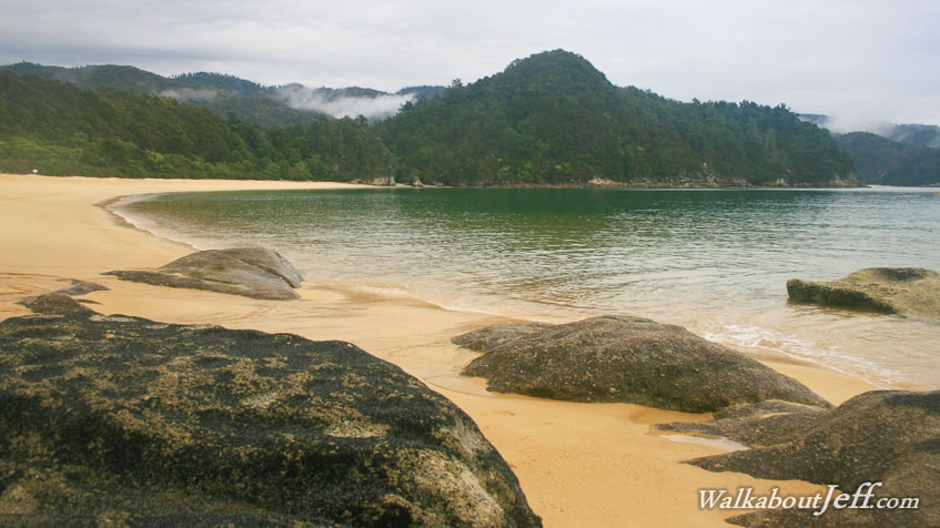
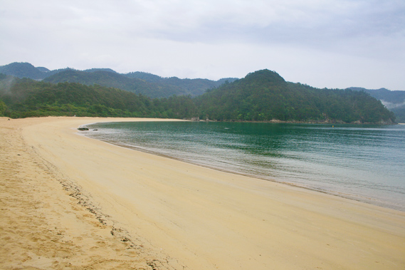
07:04 - A thick untextured layer of cloud covers the sky when I awake. About an hour of rain has fallen before sunrise, but that has all cleared. No one else in the camping ground has woken up yet, so I proceed across the headland along a well constructed trail towards Te Pukatea Bay. At the end of the camping ground is a bridge over a small tidal stream draining the small gully occupying the campsite. The tide is out and the stream meanders across the otherwise straight channel some four metres wide. From the stream the trail passes through kanuka scrub, the first stages of revegetation from the old farmland back to bush. The kanuka forms a solid cover overhead making the track dark. The trail ambles its way up a gully towards a short saddle. From the top of the saddle another track heads to the left towards Pitt Head. I had some years ago on a past trek here followed the very rough trail through loose scrub. You do eventually reach the end of Pitt Head but there is little to see so I don't take this side track today. I continue down the main trail following another gully through the scrub until it eventually comes out at Te Pukatea Bay.
|
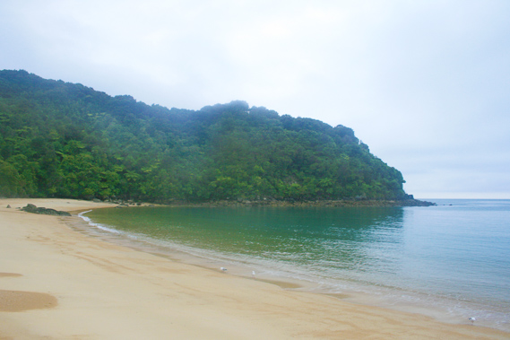 |
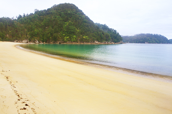
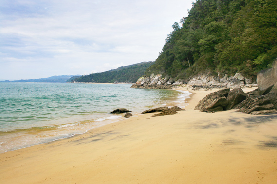
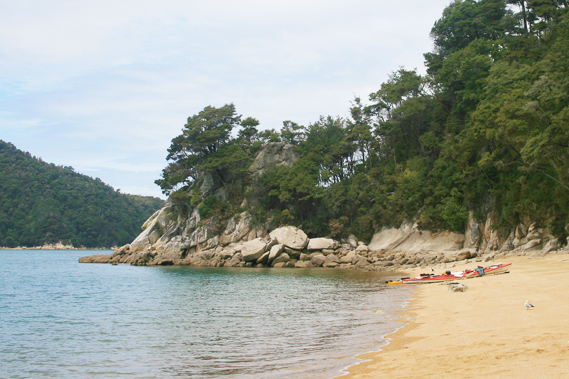
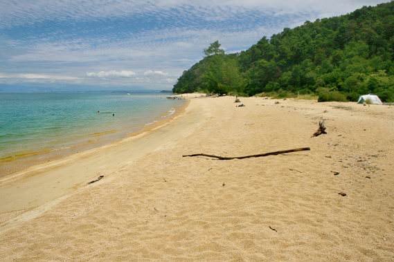
07:06 - The dark turquoise water is almost mirror flat with long tiny waves breaking on the hard golden sand with an almost metallic sound. The beach extends in either direction to headlands sweeping across to an entrance a bit narrower than expected. The thick cloud comes down to the horizon on the other side of Tasman Bay, with no clear sign of the mountain range. The headlands themselves are relatively featureless. A small camping ground sits above the beach. One person staying here is walking down the far end of the beach, perhaps to collect water. The only water supply here is in a cave to the left at the northern end of the beach. The entrance to the cave is flooded during high tide, but when the tide is low, you can collect fresh water from a small stream trickling down at the back of the cave. The campsite is small, similar to the one at Anapai with broadleaf scrubby trees providing shelter during fine weather.
|
 |
07:19 - I don’t stay here long as light drizzle begins falling, so I decide to quickly return to my tent at Anchorage for breakfast. Here I reach the stream just before the camping ground. |
 |
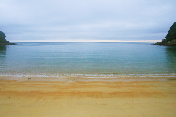
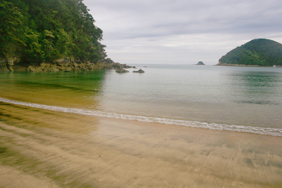
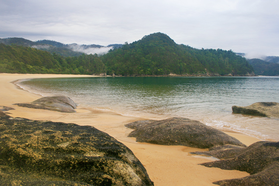
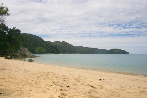
07:41 - Following breakfast I return to the beach. The brief spell of drizzle had stopped. The water here is surprisingly calm. The golden beach sweeps across the bay to the headland blocking off the Torrent Bay estuary which will no doubt be dry now. The headland creates a dark backdrop with lighter coloured forested hills visible on the other side of the hidden estuary. The dark turquoise blue water is calm apart from some slight ruffling from the damp breeze. Small pockets of low cloud drape across some of the ridges and gullies of the hills across the other side of Torrent Bay and the estuary.
|
 |
07:44 - The beach sweeps unbroken apart from some weathered rounded granite about a hundred metres from the hut entrance. This marks the point where a small stream drains from a swampy valley behind the beach. |
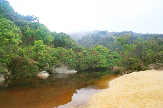 |
07:47 - Most of the time the stream is blocked by the sand washed up by big northerly swells. The dark ochre water sits deep in a channel behind the sand along the front of the scrubby hill towards the small lake it drains from. A wooden bridge without handrails crosses the stream a little upstream from the outlet. The water under the bridge is so deep the water is black. This bridge is the start of the main track I will later follow south to the end of the track at Marahau. |
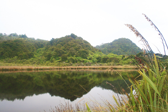 |
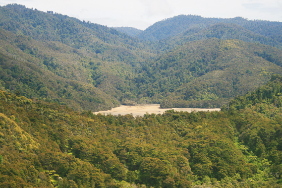
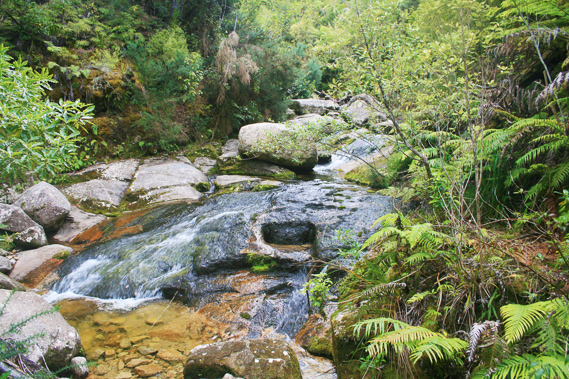
07:53 - Once across the stream, the track briefly follows it upstream to the start of a substantial lake before the track steeply ascends to cross over the hills towards Marahau. I stop just before the start of the ascent to look out over the lake. The lake is full, held back by the sand bar across the beach. Following very heavy rain the channel across the sand bar unblocks draining the small lake into a large bed of soft sand. Today it is full of deep black water stained with rotting vegetation leached out from the surrounding swamp of reeds and flax. Reeds and flax frame the edge of the lake covering the rest of the flat to the edge of the scrub covered hills. |
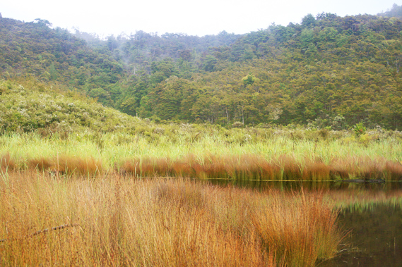 |
07:54 - It is very peaceful up here away from the sound of the tiny waves breaking on the beach. It is still too early in the morning for anyone to be hiking yet. There are no wading birds here - there are almost no birds at all. I recall in the late 1980s and early 1990s when I first explored this area, the park was full of native birds to the extent it was almost deafening in the mornings. These days it is deathly silent thanks to the large population of stoats eating all the eggs decimating the population.
|
 |
08:01 - From the swamp I return to the beach. Instead of returning to the hut I continue to walk down the beach back towards the low saddle across to the Torrent Bay estuary. The tide is still going out, but being a neap tide the range isn’t very much at all, perhaps two and a half metres today. |
 |
08:07 - I approach the huge hundred metre high bluff. It is covered in forest with tree ferns almost touching the turquoise water. Towards the end of the beach the sand darkens to show patterns of ironsand washed in amongst the granite. There is a high concentration of iron in the granite in this area. The much heavier ironsand leaves patterns left by the retreating wavelets. |
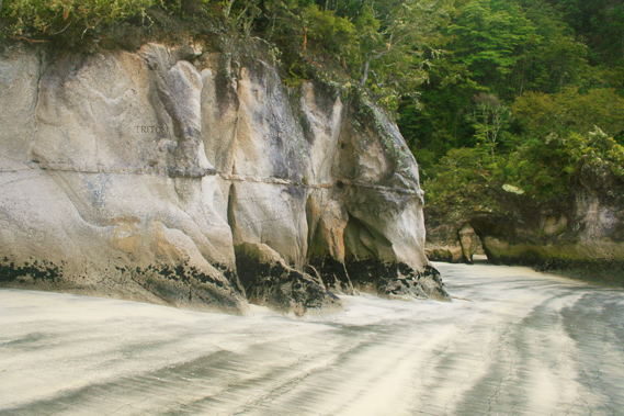 |
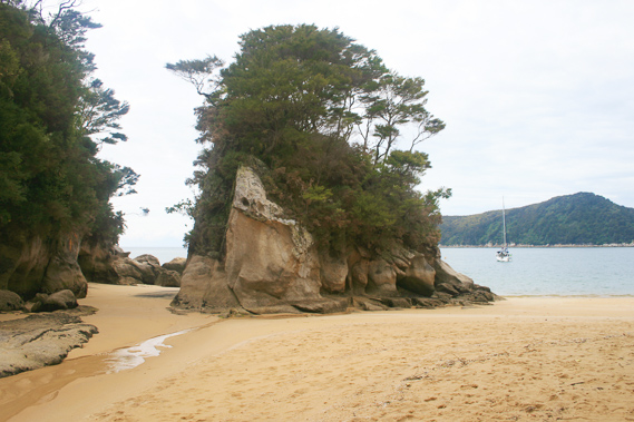
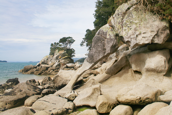
08:08 - I am now close to the bluff. The lower three metres is bare granite rock, and the lowest twenty centimetres is coloured black with the tiny shells of mussels established here. Deep markings appear in the rock where people in the past have carved their initials, names and dates. Beyond the first small bluff is a tiny gorge with sand running up its length. The gorge is only a couple of metres wide. On the other side is a low bluff covered with small bonsai style trees restricted by the lack of soil space. A hole goes through the rock and next to it is a rock in the shape of a baby elephant.
|
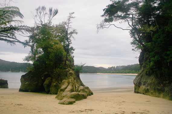 |
08:09 - The island splits the gully into two. Once past the island the gully narrows over about fifteen metres before ending at a cave surrounded by different types of vegetation almost looking like a maintained garden. A rata brightly flowers nearby. Apart from the tiny flowering white kanukas this is the first flowering tree I have seen on the entire trek. |
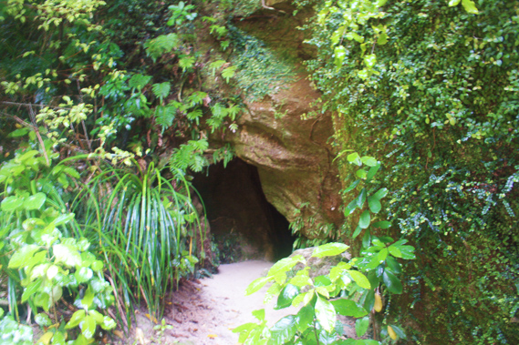 |
08:16 - I enter the dark cave. A few glow worms shine their lights to attract insects. There used to be a lot of glow worms here, but they are not as numerous or bright as they have been in past years when I had explored here. After briefly exploring the cave I start the long walk back along the beach. The cloud appears to be thinning on the other side of the campground, so perhaps it is going to clear up as it had done yesterday.
|
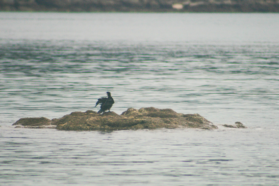 |
08:43 - About two thirds of the way back to the camping ground, I pass a large granite outcrop sticking out of the water. A grey gannet is preening itself on the rock. |
 |
09:26 - I staggered back to my campsite, have a little second breakfast before packing up ready for the return to Marahau. Suddenly I am going back to civilisation. Until now I have kept time based on the sun and moon. Travelling between sunrise and sunset, and crossing lagoons during low tide. Now I have a real time to contend with – the bus I need to catch at Marahau later this afternoon. |
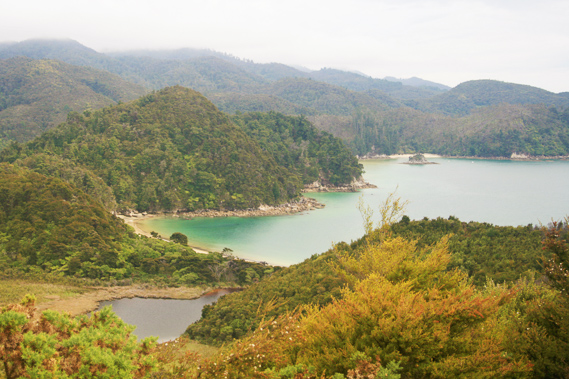 |
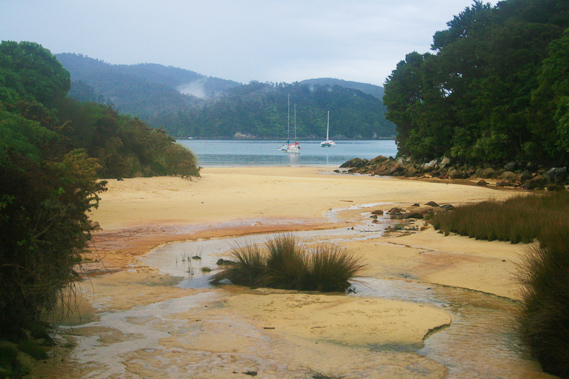
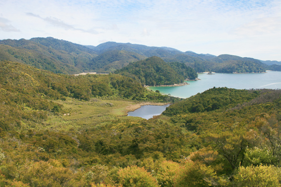
10:04 - Once my tent is packed up I leave the Anchorage campsite to start heading towards Marahau, the final leg of the trek. It is a bit of a slow start walking up the one hundred metres of beach to where the wooden bridge crosses the mouth of the lake. From the start of the lake the track track begins a steep ascent up the hill standing behind the hut. This is perhaps the steepest part of the entire track, even steeper than the climb from the Falls River. Fortunately this climb is only half the height. The track reaches the top of the ridge at about sixty metres above sea level. The scrub up here is very thin. This area was once farmland but the very poor soil and steep terrain made for very tough and unprofitable farming. This land was eventually sold to the New Zealand government to form part of the national park. The very poor soil makes regeneration extremely slow. Some fifty years has passed and the scrub is still scattered and standing only two to three metres tall. It will be hundreds, perhaps thousands of years before the forest will eventually return. Looking back there is an amazing view across the dark swampy lake to the far end of Anchorage Beach, the big bluff still completely hides the Torrent Bay estuary and all the headlands all the way up to Tonga Island. For the first time I see the overall terrain sloping gradually downhill into the sea at a ten degree angle. There is still some cloud cover down to about six hundred metres, so the high slopes are still hidden in the cloud. It is obvious though the terrain continues rising in the ten degree slope with the forested gullies cut deep in to the solid granite.
|
 |
10:07 - I have a brief view back to the eastern side of Anchorage before reaching a small junction at the top of the hill. A faded photographic sign shows the beach I am heading towards. A gentle breeze now ruffles the dark purple lake behind the beach. In stark contrast the water in the sea near the beach is a brilliant turquoise colour. I put my pack beside the track and start heading down the steep track towards Watering Cove. The track descend a dark scrubby gully.
|
 |
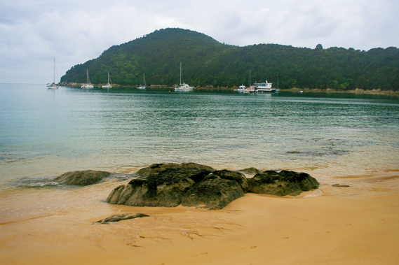
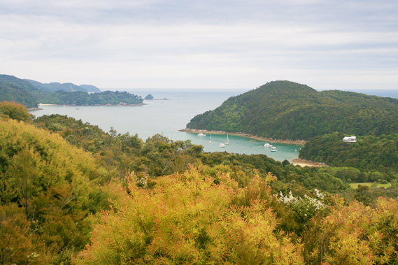
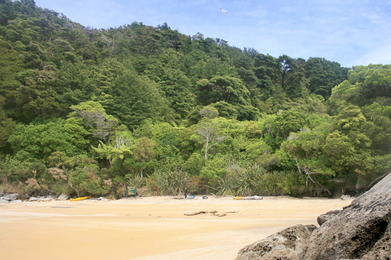
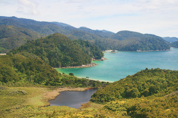
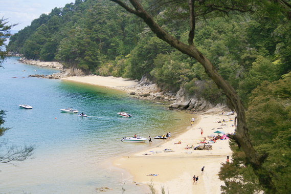
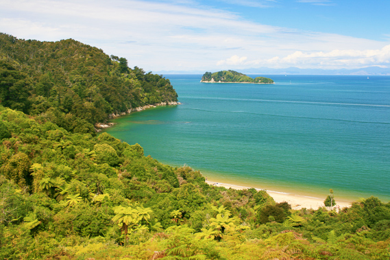
10:21 - Ten minutes pass before I arrive at the campsite. There is a tent pitched but no is visible. Perhaps they are still asleep. This campsite is similar to the Te Pukatea Bay camp, very dark being covered with a canopy of broadleaf vegetation. I walk out onto the beach and followed it to where the stream flows out of a deep gully. It passes a small island with sand running down either side. During high tide the island is completely cut off from the rest of the land. The tide is out though, so I can now walk all the way around it. The stream flows to the left hand side of the island as the sand is very slightly lower than on the other side. A yacht is moored about fifty metres offshore and about a kilometre away is the twin peaked forested Adele Island. Watering Cove marks the start of the Astrolabe Roadstead, the sheltered section of water I had come through on the boat. This is named after Durmont D’Urville’s ship the Astrolabe. He named Adele Island after his wife. The island itself has bare rock over most of its vertical sides towering about five metres high. Scrub covers the top and a higher canopy of kanuka towers another four metres above the top. The bluffs on either side of the island are also covered in kanuka scrub, although a lot taller due to the lesser restrictions in the soil base.
|
 |
10:24 - The stream silently meander through the golden sand towards the rock, negotiating its way around the odd rounded granite boulder washed down the gully or perhaps fallen off the edge of the bluff. I walk as far up the stream as possible, but once it rises above the sand, the vegetation and rubble is too thick to negotiate. Watering Cove was named as it was the location where the Astrolabe obtained water supplies.
|
 |
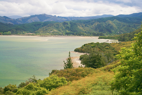
10:29 - The launch passes the bay about two hundred metres offshore having commenced the journey from Kaiteriteri about an hour earlier. Layers of thick ironsand surrounds the small island. On the upstream side the bank is nearly vertical, but on the other side it tapers off towards the water. From the beach I can see along the coast to Observation Beach, one of the few beaches the track does not reach as the land around it is private land there, so the track has to go into the hills behind it to pass. Beyond Observation Beach is Cyathea Cove, named after the coin spotted tree ferns filling its gullies. Beyond Cyathea Cove is Ackersten Bay with Yellow Point cutting Astrolabe Roadstead into two. Past Yellow Point I can just make out the rounded Guilbert Point.
|
 |
10:37 - I walk across to the other side of the coarse beach, where low granite headlands cut the bay off from the next one. It may have been possible to walk around the coast towards Ackersten Bay, where I would meet the beach again, but with a bus to catch I don’t have much room for error. It is almost time to head back up the hill, collect my pack and continue towards Marahau. |
 |
10:43 - At the southern end of the beach is a rock creating an arch. The rock itself is almost completely eroded at the base being only about ten centimetres thick near the base. It reminds me of a large chicken leg. |
 |
11:14 - I start walking back up the steep hill. Just as I enter the campsite a small dinghy from the yacht anchored offshore begins to approach the beach. I climb up the scrubby gully until reaching the main track. I pick my pack up from behind the sign, showing a faded painting done in January 1827 by Durmont D’Urville’s artist. The scene was painted from the back of the stream. Despite the perspective being a little forced (the people are about half the size they should have been indicating they were added into the painting at a later stage when he had forgotten the scale of the place) it is remarkably similar to the scence I saw one hundred and eighty years later. |
 |
11:16 - With my heavy backpack weighing me down I start walking along the trail following the top of the ridge. It rises up and down, but more up than down as the ridge gradually ascends towards the Pikikiruna Range. The cloud by now is starting to clear with most of the low cloud now dissipated. Alto stratus cloud now cover much of the sky, but there are plenty of blue patches overhead in between the quilted pattern. The sun will be coming out soon.
|
 |
11:17 - From further up the hill I get the occasional break in the scrub with views across Anchorage and Torrent Bay. As I gain altitude I can see into the brown inlet of the dried out Torrent Bay estuary, particularly around Cascade Creek where I can see the valley it occupies rising up the hill to where it almost reachs the Falls River. This is a magnificent view with the sea now a dark vibrant blue. |
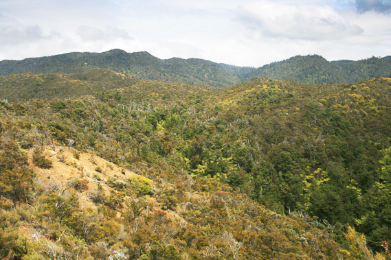 |
11:19 - Looking ahead the scrubby terrain seems deceptively easy. It rises to a good seven hundred metres above sea level though. The scrub all the way up the hill seems barren, having once been cleared for farmland. The ground beside the track is covered in lichen in its feeble attempt to break the granite rock up into soil. About quarter of an hour passes after leaving the junction to Watering Cove when I reached the next junction. This is where the trails heading directly to Torrent Bay meet the trail I have followed coming from Anchorage. The trail heading back to Torrent Bay appears in far better condition than the rough track I have just followed, but having followed the Torrent Bay track a few times I remember it quickly becomes rough and a little overgrown. I turn to the left to continue following the main track towards Marahau. |
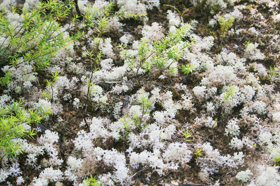 |
12:14 - The track is very wide, almost wide enough to drive a car. About five minutes pass before reaching another junction at the back of a loosely scrubbed valley where a rough trail commences up the hill towards Holyoake Clearing Hut on the inland trail. The main trail heading up there starts from Tinline Bay towards the end of my walk today, but this is a more direct route from the inland track to the beaches of the coast track. From here the main track continues winding around at the same altitude around the spurs and gullies. Two of the gullies have bridges, one crossing above a flowing stream. This gully is full of tree ferns and a few large trees. Otherwise this area was barren full of mainly kanuka scrub and the ground covered in white lichen. Finally around one of the many ridges the trail begins a gradual descent. For people coming the other way this is the first significant hill of the trek. For me this is the last. The track gradually winds its way down the hill through the thick scrub from about a hundred and ten metres above sea level. The scrub thickens into manuka before suddenly arriving at Yellow Point.
|
 |
12:47 - The main trail winds its way around Yellow Point, named after the lichen that grows on it. From the main trail two tracks headg out towards the point. A rough track goes towards the end of Yellow Point and a steep track heads down to the left towards Ackersten Bay, which was directly below. I took the track down to Ackersten Bay. The track descends steeply, but not precipitous like it used to be. It eventually arrives at a campsite perched on a ledge two metres above the beach.
|
 |
12:48 - I rest on the beach for about half an hour. From here I see across back to Watering Cove, with Observation Beach and Cyathea Cove nearby under the blackened headlands of Mad Mile. If there had been a track from Watering Cove, the hike would have taken me perhaps fifteen to twenty minutes. Instead it had been about an hour over the hills. |
 |
13:01 - Looking to the right the distinctive headland of Yellow Point is just seventy metres away from where I sit. The point was named due to the yellow lichen that used to grow on it. There is still some lichen growing on it, but it is hard to find. Beyond Yellow Point is the forested Adele Island. I can see the long sand bar protruding a couple of hundred metres out from the middle of the island. A fairly steep peak rises about a hundred metres at either end with a long gradual saddle linking them.
|
 |
13:20 - I stay at the beach for about half an hour before following the steep path to the junction and taking the short route to the end of Yellow Point. The rough track negotiates its way over huge protruding boulders. It only takes a few minutes to reach the end of the point, but it is too scrubby to get any descent view. I return to the main track and continue following towards Marahau. The track here quickly narrows to negotiate its way around perhaps some of the steepest terrain of the entire coast. The banks rise very steeply out of the bays and the forest is full of supplejack, a climbing vine. Supplejack is common throughout the park, but here it is a very thick maze. Fortunately I have the track to walk on. Any attempt to go cross country here would be almost impossible though the thick matted maze of supplejack.
|
 |
13:43 - Below the steep bank is Stilwell Bay, probably one of the most beautiful of the entire park. Shame though as it is now a designated water ski area, and several boats roar across the pristine water. The tide is quickly rising but several small beaches hug the forested hills. At low tide these tiny beaches join into one large beach. The water now covers a large shallow area. The track crosses a couple of small streams dripping down over the foliage of the steep mossy bank above me.
|
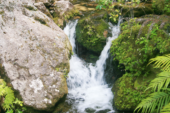 |
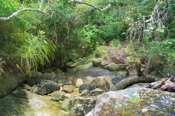
13:46 - After passing the steep bluffs I finally reach the back of the small valley where Lesson Creek tumbles out of the steep gorge above. The stream cascades over moss and epiphyte covered boulders. On the other side of the stream is a side trail heading steeply down the dark forested gully towards the beach. |
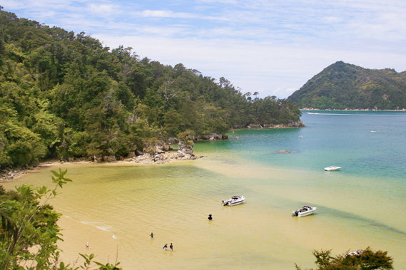 |
13:49 - The main track quickly ascends providing good views across the beach to Yellow Point. A couple of tiny islands each housing a couple of small trees on top jutted out just offshore on the other side. A long sandbar submerged just beneath the surface extends from these islets to cross the entire bay. Despite the boats, this is a stunning view.
|
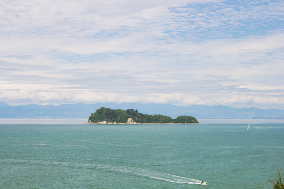 |
13:51 - Looking out over the sea I now clearly see Fisherman Island, the southernmost of the islands in the national park. From here the trail mostly passes through thick forest clinging to the impossibly steep bluffs. I am a good forty metres above the water, but the cliffs below the track plunge directly to the rocks or sand below. Moss and lichen cover the sides of the bluff and at one stage I cross a a tiny gully where a nice little stream plunges.
|
 |
14:28 - About ten minutes after leaving Lesson Creek the terrain eases as I reached the junction of another side track heading down to Appletree Bay. The track descends steeply through the manuka scrub forest before suddenly arriving at the northern end of the beach. Despite its name, there are no apple trees here. The beach has a row of very old pine trees running along the top of the sandbar to shelter the camping ground underneath. Below the sandbar the beach spreads out to about two thirds of the way to Guilbert Point, now only a couple of kilometres away.
|
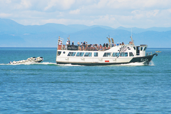 |
14:32 - The launch suddenly passes being full of people on cruises or hikers who have been picked up from Totaranui.
|
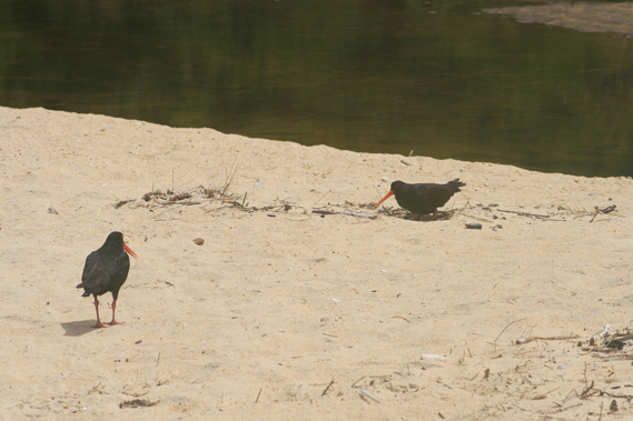 |
14:34 - A pair of oystercatchers are foraging the beach nearby. I cross the sand bar to where the small tidal estuary of Simonet Creek flows across the back of the beach to where it flows out near the other end. The water is blocked up to perhaps knee deep with reeds growing on either side. From the beach Adele and Fisherman Islands are very close offshore. Beyond them I see a low bank of cloud over the Richmond Ranges obscuring the summits. |
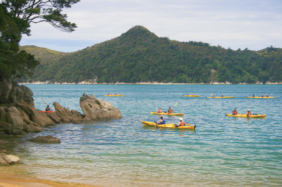 |
14:40 - A large group of kayakers paddle offshore along the length of the beach on their journey towards Anchorage for the night. It is time for me to be continuing. With over an hour go to Marahau and the bus arriving in less than two hours, there isn’t much time to spare.
|
 |
15:00 - I return up the steep narrow trail to the main track and continue walking until crossing the twin bridges over Simonet Creek tumbling over huge boulders. Looking downstream I can see over the silent estuary to the sandbar covered in huge pine trees overlooking the sea. From here the track gains a little more altitude before going backwards and forwards into deep gullies and out onto near vertical spurs. A couple of the gullies have small streams, including one where I used to always get a drink from until the mid-1990s when the park became infected with giardia bacteria. Until then it used to be perfectly safe to drink the water from any of the streams without filtering or boiling. The track going in and out of the gullies made for a far longer walk than if I had just walked along the beach and taken a steep side track. Eventually though the beach does end and I am walking along the tops of steep cliffs plunging straight into the water. Another five minutes pass before I reach Guilbert Point.
|
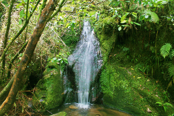 |
15:43 - Once around the point I can see out into the sweeping sand banks around Marahau. This is where I was heading. Once around the point the black beech forest quickly disappears to be replaced with scrub regenerating from where a pine forest had been planted but removed a few years ago to allow the native forest to eventually return. The track follows high above Coquille Bay, named after one of D’Urville’s ships. It is a very peaceful little bay, just visible through the scrub. The track weaves in and out of deep gullies as it had done over Appletree Bay. At the back of one of the gullies flows a small waterfall. Shortly afterwards I pass the entrance to Coquille Bay but continue onwards as there isn’t much time left.
|
 |
15:58 - Here the beaches suddenly change. Coquille Bay is the last of the beaches in the park with soft golden sand. Ahead the beaches are either rocky or have huge sand banks. It is essentially a large tidal estuary with no sand bar out the front. |
 |
16:00 - A few minutes pass before the track rounds the end of a spur. This point marks the start of the inland track which follows the ridge up to the Pikikiruna Range. Four days hiking along this track reaches the top of the park at a junction with the coast track on top of the saddle between Whariwharangi and Wainui Bays. This is a narrow track in comparison to the coast track, and a lot less well known or frequented. |
 |
16:09 - From here the main track quickly descends to a large grassy camping area at the edge of Tinline Bay. The beach here is very rocky unlike most other beaches I have seen here. The scrub surrounding the beach makes this area very dull compared to the spectacular beaches of the past few days. I have been so used to seeing beautiful golden sandy beaches with forested hill backdrops up till now. Obviously I am approaching civilisation. |
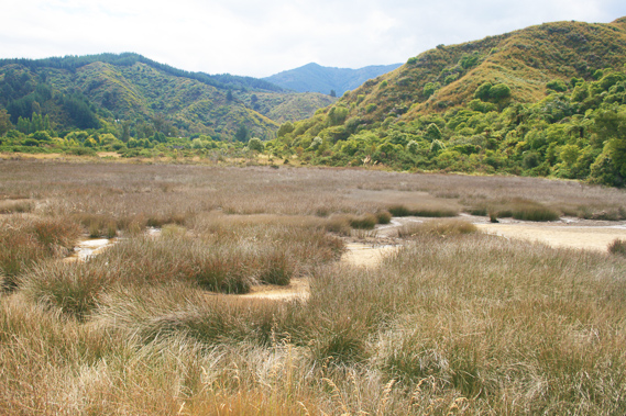 |
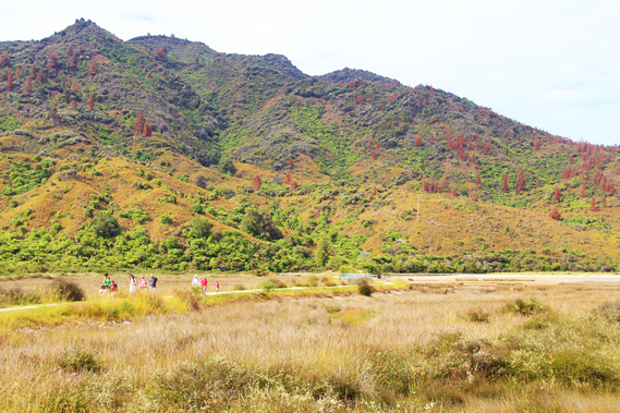
16:40 - The track continues for another twenty minutes going over low bluffs alongside the large sandflats going across Marahau until finally the sand flats gives way to reeds. At this point an elevated boardwalk juts out perpendicular to the edge of the bay and crosses the swamp towards the small buildings marking the start of the track. The Marahau Valley extends a long way back to the base of the Pikikiruna Range. The line is very straight indicating it was a fault line. |
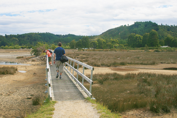 |
16:41 - I follow the boardwalk across the estuary, crossing several small channels as the end of the track quickly comes into view. |
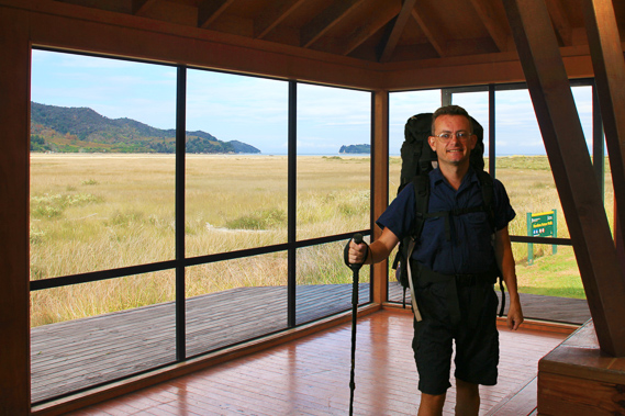 |
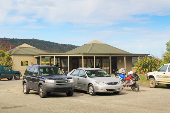
17:06 - Eventually reach the end of the track, passing through a tidy information building. The building has some good displays and weather reports for those starting the track from this end. |
 |
17:10 - I have arrived at the end of the track about half an hour before the bus was due, but I am too exhausted to do any more exploring. This had been quite a challenging trip not in the walk itself, but the length of hiking each day, having done one and a half lengths of the track. |
 |
17:18 - The bus arrives early, so I leave the little shelter going through the car park where day walkers can park. It is nice to no longer be wearing a pack and be travelling no longer under my own steam. |
|