Introduction to today's journey
The three great elemental sounds in nature are the sound of rain, the sound of wind in a primeval wood and the sound of outer ocean on a beach.
- Henry Beston.
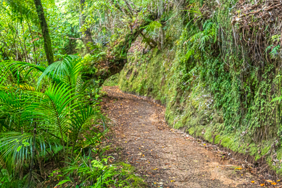
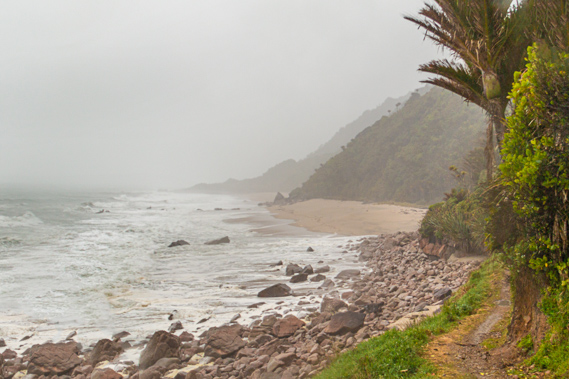
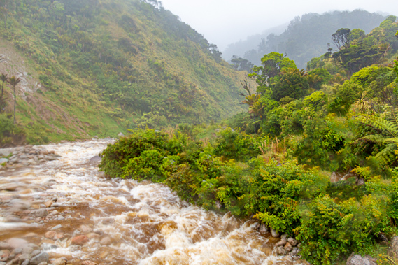
THE FIRST and toughest section of track follows the rugged northern end of South Island's west coast, First navigated by Charles Heaphy and Brunner as they were exploring routes between Westland and Golden Bay. They followed the rugged coast the entire way. The thundering seas crash onto the steeply rising headlands and small bays. The path the Heaphy Track now follows was supposed to be a road linking the West Coast with Golden Bay, but it was never completed. The very rugged coastline has made the difference between this area being a pristine wilderness and yet another mountain highway. The coastal section of the track was the last section to be completed, with the track crossing the Kowhaiwhai Bluff being the last to be completed in 1931. To this day the track along the coast is narrow and frequently prone to coastal erosion, making the construction of any road through here almost impossible.
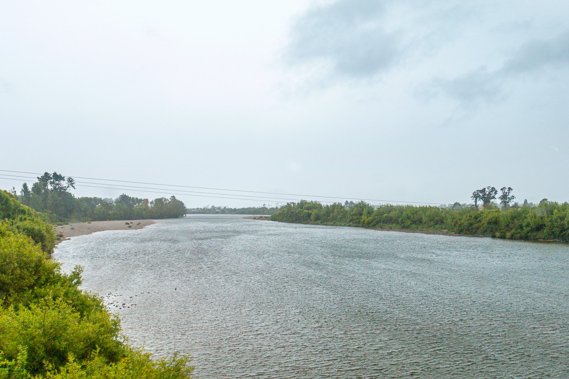
Today's trek starts from the southern end of the track at Kowhaiwhai. After crossing the Kowhaiwhai River and negotiating across the Kowhaiwhai Bluff, the track continues northward along the rugged coastline of jagged bluffs and tiny bays filled with palm trees, crossing several swollen streams before heading a little inland to the Heaphy Hut at the mouth of the Heaphy River.
Today's Journey
Distance trekked today: 16.2 kilometres.
Total distance trekked to date: 16.2 kilometres.
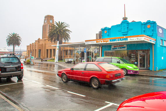 |
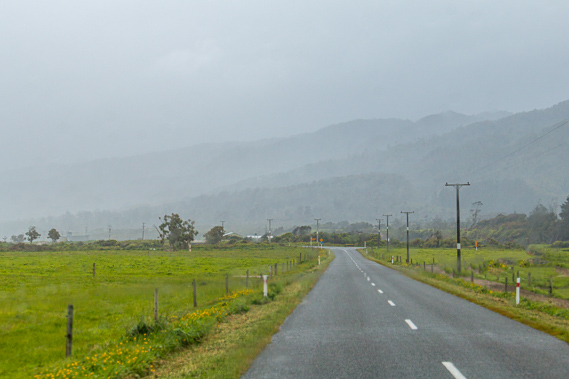
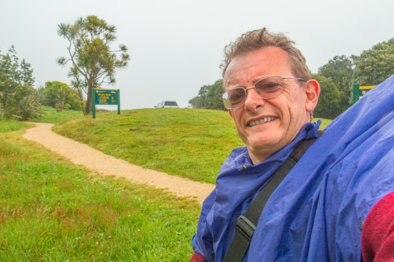
11:54 - A cold rain falls in Westport, as it nearly always does here on the South Island west coast. The wind blows strong from the sea befitting of the nearby Cape Foulwind. There are a surprising number of locals out doing their shopping seemingly oblivious to the bitterly cold rain. A digital clock tower reads twelve degrees, hardly a temperature you would expect in the middle of the day. It is going to be a cold hike along the coast this afternoon. I set off from here just before lunch in a van delivering passengers to the track (I am the only passenger today being the start of the season). The start of the Heaphy Track is 111 kilometres away along the rugged road through the remote northern westland. I am relieved to be in the warmth of the van as we set off northward along the road with the driving rain battering us from the side.
|
 |
12:36 - This part of the coast must be a most miserable place to live, often raining like this for weeks on end. Rickety weathered houses stand perched on the hillsides with spectacular views over the ocean on the rare occasion when the weather does clear up. The area looked very depressed. The main industry around here over the past hundred years has been coal mining. |
 |
12:42 - It is too remote here for tourism to really take off. Even the main road down the Buller Gorge and southward to Greymouth is not frequented, with most travellers crossing the alps at Arthurs Pass and hurrying directly to the glaciers a few hundred kilometres south of here. This is one of the most remote parts of New Zealand cut off from the rest of the South Island by the Kahurangi National Park, and serviced only by the road we were travelling on. The Heaphy Track follows the route along what was once a proposed highway that would have linked north Westland to Golden Bay. |
 |
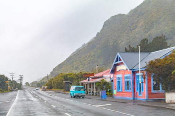
12:53 - We eventually reach Mohikinui, a small village servicing a large area with a population of around 150 people. A large bluff slams into the sea behind the scant houses making up this remote village. The road is forced to turn crossing a narrow single lane bridge over the Mohikinui River to begin an ascent along a winding road over the legendary Karamea Bluff. |
 |
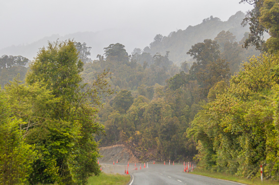
13:10 - The farmland quickly gives way to dense misty rainforest. As a testament to the persistant rainfall, huge tree ferns grow out on the open completely unaffected by the harsh sunlight occasioning the area when the rain stops. The road winds its way up the hills, entering thick banks of mist. I notice some of the ridge lines have been almost completely stripped of trees. My guide mentions Cyclone Ita which had come through here about a year ago ripping up a lot of the trees and bringing down landslides closing the road for a long time. The ridges were particularly hard hit with many of the trees flattened. There are still witch’s cones on the sides of the road where road works clearing the debris from the cyclone is still in progress. |
 |
13:11 - Eventually we reach the top of the bluff enclosed in misty cloud before promptly descending the other side towards Little Wanganui and Karamea. The forest and landscape is even more dramatic on this side of the bluff. |
 |
13:14 - At the bottom of the hill is a swampy valley which my guide says floods quite often, cutting the upcoming villages off completely from the rest of the world. We reach the coast at Little Wanganui, a tiny run-down village of just a few houses and a shop. Looking southward I can see the precipitous bluff that forced the long diversion over the mountains. |
 |
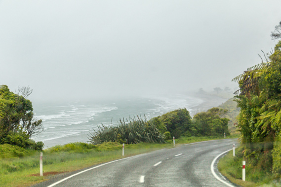
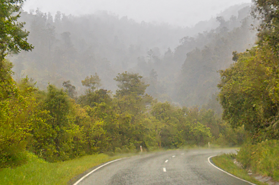
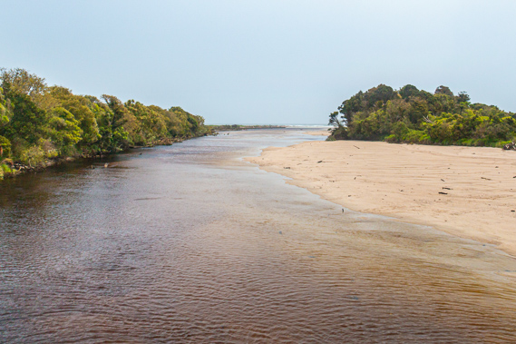
13:35 - The land from here on is surprisingly flat. The sky is still dark and overcast with moderate rain falling. The locals say this area is like a subtropical microclimate. Obviously whoever said that hasn’t been to Brisbane. The road follows the an extensive mud flat to the left. Most of the grassy land to the right is used for dairy. It is too wet here to grow anything else. Following a brief winding section around the bottom of a forested bluff we reach the mouth of the Karamea River. A narrow bridge spans its grey waters leading into the tiny town of Karamea, with a population of about 400. Karamea was initially settled in 1874 with a group of thirty pioneers brave enough to move to this completely isolated location. We pass the aptly named “The Last Resort” motel with its cabins with grass growing on its roof. This was where my guide was going to stay overnight and hopefully do some fishing this afternoon before picking up another group tomorrow morning from this end of the track. The weather is starting to clear, but it looks very doubtful for him fishing this afternoon.
|
 |
13:41 - The village quickly passes before the road turns a corner to head north along the final fifteen kilometre stretch to Kohaihai. It is not long before we cross the black waters of the mouth of the Oparara River, flowing from a spectacular limestone cave system. The clouds are beginning to clear, but I am thinking that is only because we were going ahead of the storm now. It has been moving northwards up the country coming in from the north west, and I am hoping a southerly change will come in to clear it, but that won’t happen until at least tonight.
|
 |
13:45 - From the Oparara River, we pass through a few dairy farms as the flat land between the rough sea and the towering hills becomes narrower. The paddocks are covered in bright green grass with the occasional solitary cabbage tree, tree fern or nikau palm. |
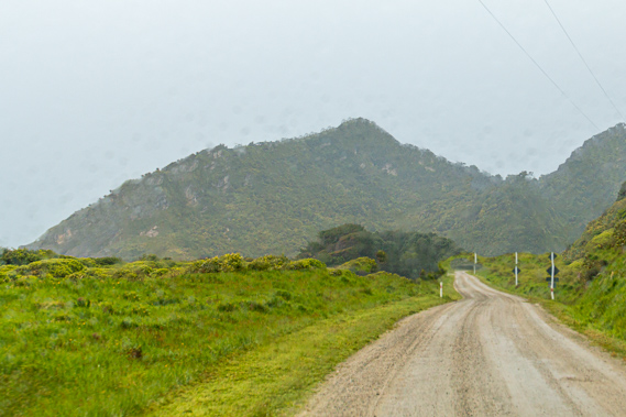 |
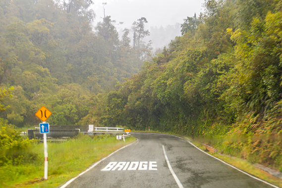
13:51 - The sealed road becomes rougher with increasing potholes before suddenly turning to gravel for the final two kilometres passing around a steep hillside. A large towering bluff stands ahead of us. This is the Kohaihai Bluff, marking the end of the road and the start of the Heaphy Track. |
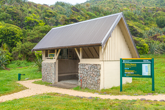 |
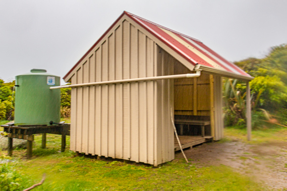
14:02 - After dropping me off, the van takes off back towards Karamea. The sound of tyres running over gravel quickly fades leaving only the faint roar of the ocean breaking on the nearby beach at the mouth of the Kohaihai River. The road ends here in a sweeping loop around a campsite clearing. From here it is all walking the 78.4 kilometre track along the coast and over the mountains towards Golden Bay. At the start of the track stands the recently repainted Kohaihai Shelter, built to shelter hikers coming the other way as they await their afternoon connections back to Karamea. The shelter is open to the view towards the mouth of the Kohaihai River, though much of the view is obscured by cabbage trees. The other three sides of the shelter are walled with a bench around the inside for sleeping three or four people. It is a very basic setup without mattresses, but perfectly comfortable to sleep in overnight.
|
 |
14:03 - Next to the shelter stands a low plaque commemorating the centenary of the track when it was initially opened in 1993. The track has quite a history behind it which I will cover as I go. In 1893 most of the track had been completed – from Golden Bay over the mountains down to the Heaphy River about fifteen kilometres along the coast from here. The coastal section from the Heaphy Hut back to here at the time was just a route along the beach with a little known rough Maori track heading over the Kohaihai Bluff. The track over the bluff was not built until 1931, finally completing the connection between Golden Bay and the West Coast.
|
 |
14:06 - Rain is starting to fall again, so I put on my large rain cape draping it over my pack. The northern West Coast receives around 1900 millimetres of rain per year. This is less than half of the coastal rainfall of the mountainous areas down south, but still very significant. The South Island West Coast has the reputation of being one of the wettest places in the world. It rains here more often than not. Air is heated up over the deserts of Australia before moving across the Tasman Sea where it picks up enormous quantities of moisture. The air reaches New Zealand where it is forced over the high mountains. This produces the endless rain the West Coast is famous for. |
 |
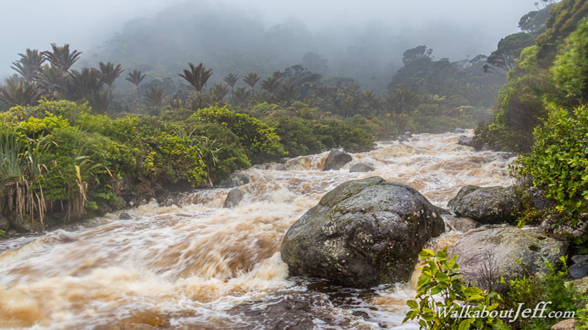
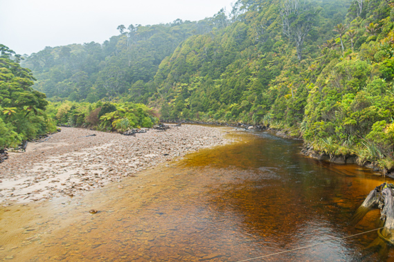
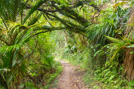
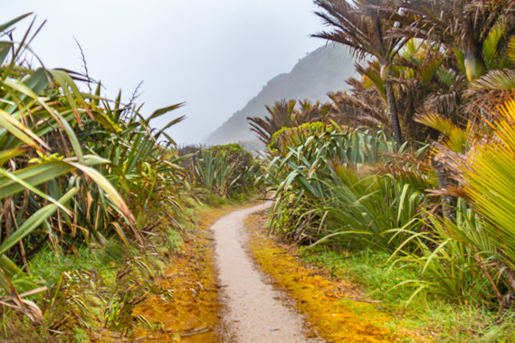
14:11 - The track starts by ascending around the back of the shelter into the scrub to follow the Kohaihai River upstream. The river was initially called the Haihai by the local Maori, but in 1860 the name had changed to Kohaihai. The meaning of both names has been lost to time. The 17 kilometre long Kohaihai River drains from the mountains unseen in the thick cloud to meander through the narrow valley between the steep limestone bluffs on either side towards the rolling hills obscured by misty rain. The water is coloured a deep ochre colour from tannin leached from the forest vegetation. It is the same tannin that gives tea its colour. All but the largest rivers along the West Coast have this peculiar tea stain colour. The water is otherwise very clean as much of the West Coast is in its original pristine environment.
|
 |
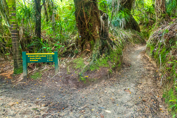
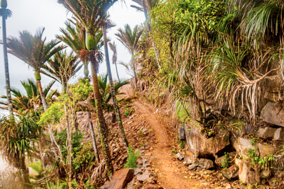
14:12 - The track is in surprisingly good condition with fine granite gravel covering the surface, saving for an otherwise mushy start of the hike. It is a big improvement on the standard of this track when I first hiked it back in the mid 1990s. It was upgraded significantly in recent years when it was made one of the nine great walks of New Zealand. Since 2011, mountain bikes have been allowed on the track between May and September each year. Fortunately they aren’t allowed on the track during the busy summer season. I have chosen early November to do the track as it is just the start of the summer season yet there won't be the crowds of the December and January school holidays. About five minutes after leaving the shelter I reach the Kohaihai swing bridge, a large wooden structure spanning the ochre stained black depths of the river. The swing bridge was built in 1966 to prevent hikers from becoming stranded when the river was running high. This is the second biggest river crossing along the entire track.
|
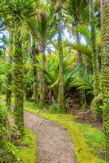 |
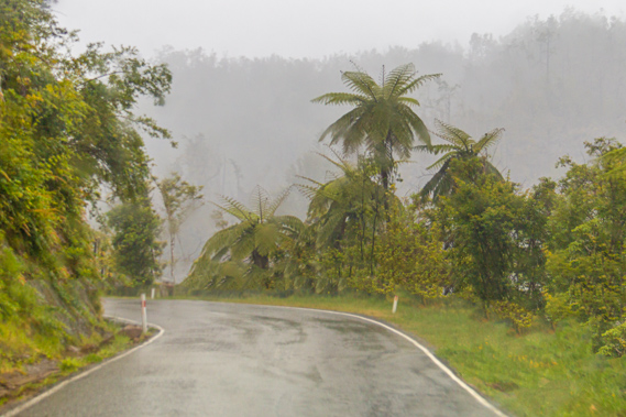
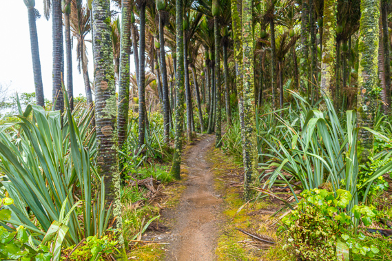
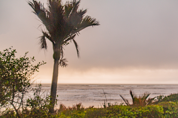
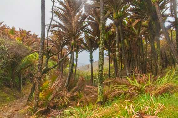
14:14 - The vegetation dramatically changes once I reach the other side of the river. The elevated swampy river flat grows thick with nikau palms giving a significantly tropical feel to this side of the river. The twelve degree temperature and rain certainly didn't make it feel tropical. A thick carpet of sphagnum moss is growing under the palm trees. The nikau palm (Rhopalsostylis sapida) is the southernmost palm species in the world. Nikau is the Maori word for “no nuts” indicating the first settlers here around 800 years ago saw these looked very similar to the coconut palm, but they didn’t have coconuts which they would have eaten. The Nikau palm is a very slow growing species. They say the palm only produces one frond per year. It takes about fifty years for the trunk to appear, then it grows only a few centimetres per year eventually reaching around fifteen metres tall. The palm foliage grows straight out of the top of the trunk, giving this a very primordial feel – as if I have stepped back over a hundred million years in the past.
|
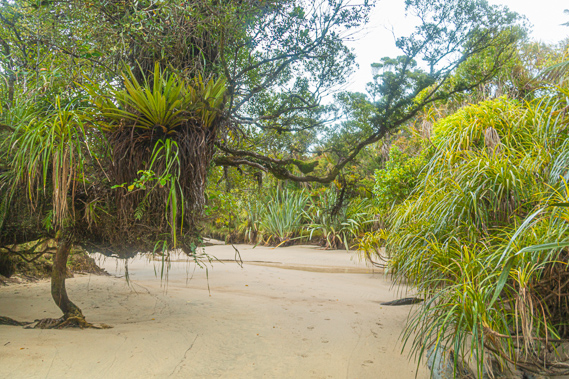 |
14:16 - The rain has by now reduced to a light mist. The looming bluff ahead of me provides good shelter for the palm forest. A side track leads off into a loop around the palm forest, but I remain on the main track which dips to a tidal sand patch. This part of the track now floods when the river is high and the tide is in. A temporary track has been cut through the forest around the patch for when it does flood. Several large northern ratas covered in epiphytes form a partial cover over the white sand patch. It is a very idyllic setting. The northern rata (Metrosideros robusta) is a parasitic tree, germinating high up in the branches of a mature tree. Like the strangler fig it sends roots down the trunk of the tree and slowly establishes itself over several centuries. Eventually the tree produces enough stems to create its own trunk and as the host tree dies, it becomes a free standing tree in its own right growing up to twenty five metres in height.
|
 |
14:23 - Shortly after passing the sand patch the track meets the end of the side track loop and starts ascending towards a saddle behind Kohaihai Bluff. This is going to be the most substantial climb for today. This was the last section of track to be constructed in 1931 when the original rough Maori track was replaced with the current four foot wide track. With the completion of this section of track travellers could walk all the way from the West Coast to Golden Bay. This is my intention over the following days. There is one gap in the thick foliage where I have a clear view back to the start of the track at the end of the road.
|
 |
14:27 - The palm forest thickens as I follow the moderate slope over the sand covered track otherwise making for a rather slippery ascent. Contorted rata trees hang over the trail with their assortments of epiphytes. Ferns and mosses grow on the steep banks on the right hand side of the track.
|
 |
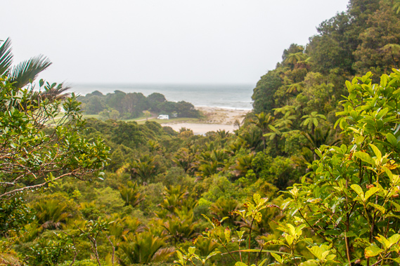
14:39 - Eventually I reach the top of the saddle around a hundred metres above sea level. The boundary between Buller and Collingwood to the north once ran along this ridgeline at the time the coast was surveyed in the early 1900s. From here on the track was once under the jurisdiction of Collingwood in Golden Bay before the boundary was moved north to the edge of Gouland Downs. No wonder this part of the track was the last to have been established. At the top a side track clambering over roots heads up to the left. I step over the roots for about ten metres to a small lookout over the coast I was about to explore.
|
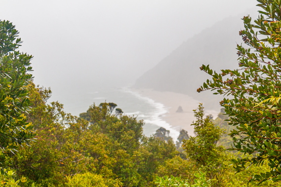 |
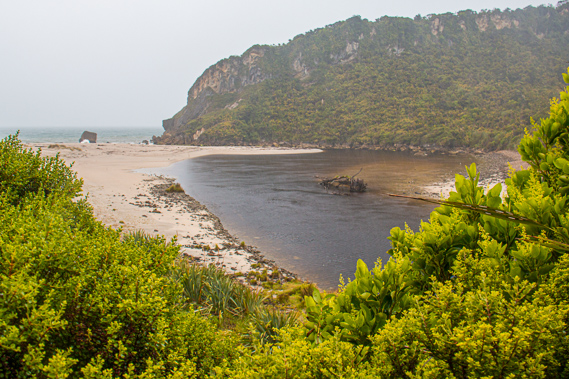
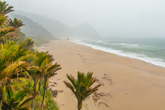
14:43 - I have been up here at this lookout a couple of times before, each time having a spectacular view over the rugged ocean breaking on golden beaches under the steep hills rising straight out of the sea. I don't have that luxury today. I recall the first time I discovered this amazing coastline in May 1992. The weather had been similar with a large storm having just cleared. I only had a couple of days before needing to return to Christchurch, so I remained on the coastal section of the track, exploring its mysteriousness. Having ascended to above the shelter of the bluff, the wind drives right into me and the cloud is thick with the rain it carries. The water isn’t all rain though, it has a distinctive salty taste to it, picked up from the foaming waves generated by the strong offshore wind. Immediately below me are the golden sands of Scott’s Beach, with its distinctive rock outcrop towering out of the sandy beach. Behind the rock I clearly see the dark rounded shape of the next bluff, followed by the very faint outline of the following bluff at Koura Point. I don’t linger at this lookout. Ahead of me is a long trek along the rugged coastline past many mist-enveloped headlands to the warmth of the Heaphy Hut which I need to reach before nightfall.
|
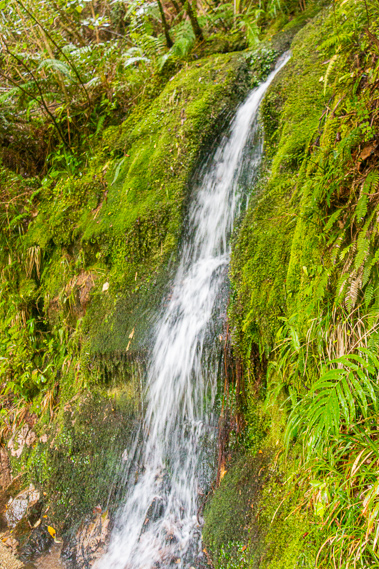 |
14:48 - From Kohaihai Saddle a gradual descent through thick forest leads me towards Scott’s Beach. All signs of civilisation are now hidden away, concealed behind the bluff. Thankfully the track is in excellent condition. I pass a small waterfall tumbling down the side of the moss covered bank running through a culvert under the track and into the densely forested gully below. |
 |
15:08 - Shortly after passing the waterfall I see the first people I have seen on the track. A lady heavily rugged up in a rather expensive looking parka hurrying out towards civilisation to stay as dry as possible before the rain sets in. Intently watching her boots completely unaware of the surroundings, she almost collides with me. Perhaps after five or six days of hiking her mind is so firmly fixed on reaching civilisation, she wants only to pay attention to the track immediately in front of her and not take in the wider surroundings. Perhaps she has seen enough for one trip. This is why I am doing the track in this direction - the coast offers some of the most spectacular scenery of the entire trek. |
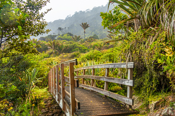 |
15:12 - A few minutes later another two hikers pass me also heading out to Kohaihai. This older couple seem a bit more alert to their surroundings as they plod their way up the last hill of their hike. They are just a saddle and a swing bridge away from the creature comforts of modern living. The forest suddenly opens up to a short section of scrub where a simple wooden bridge spans over a cascading stream.
|
 |
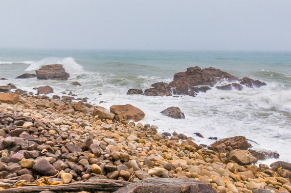
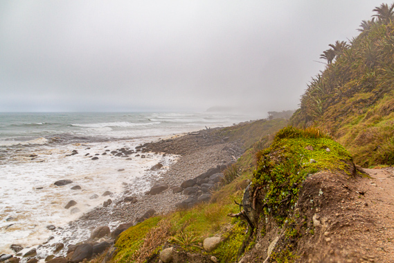
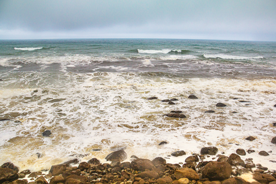
15:13 - The stream is running very low indicating the rain has only just started falling around here as I had expected. The rain we had passed through heading up from Westport has not reached this area yet. The stream drains from the cloud enshrouded hills overhead down to the golden beach about two hundred metres downstream. From the stream the track continues its gradual descent through the scrubby forest to just above the beach. Harakeke flax separates the sand from the scrub. The scrub clings precariously to the steep hillside. The large waves erratically break on the sandy beach with the deafening noise of a jet engine. Such is the power of the waves. The sea is still a good two hundred metres away separated from the track by a massive bank of sand deeply scarred by the action of enormous waves from past storms. Huge piles of driftwood lies scattered in patterns over the beach distinctly showing the force of the huge waves that had dumped them there.
|
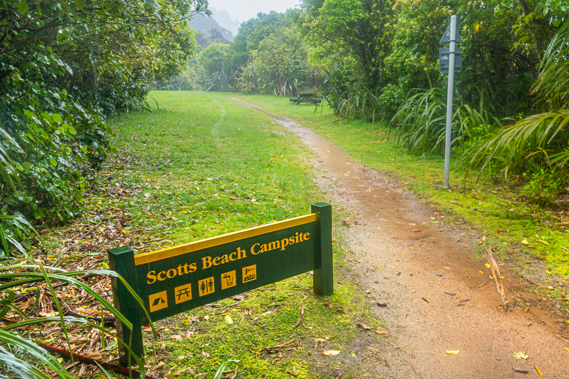 |
15:20 - The horizon has completely disappeared now and I can only see out to as far as the headland at the end of Scott’s Beach about a kilometre away. This can only mean one thing. Sure enough heavy rain begins falling just as I reach the large grassy flat marking Scott’s Beach Campsite. There are a few picnic tables here but no shelter. With the heavy rain falling it is pointless me resting here. Scott’s Beach is named after William Tasman Scott who rented the 10,000 acres of rugged land between the Kohaihai Saddle and just before the Heaphy River and two miles inland for 20 pounds a year from December 1915. The forty year old farmer from Canterbury set up camp at the present location of this campsite.
|
 |
15:28 - The following year William Scott married Kate Catwallander and they had two sons Tasman and George. Little is known about whether he ever lived here, in what he called his paradise. Upon discovering how rugged this coastline is with the dangerous seas and unforgiving weather eating away at what little usable land lines this coast, he did little to establish it. He abandoned his paradise in 1920 when he purchased a block at Port Hills behind Christchurch.
|
 |
15:31 - Upon reaching the end of the campsite I see two signs. One indicates the beach is dangerous to walk on during high tide during stormy conditions. High tide is due in about an hour’s time and a strong wind is blowing straight off the sea. I can taste the salt water in the sideways falling rain. The other sign indicates the high tide track is unstable with falling rocks and hikers should not linger on this section of track. Here I have the unenviable choice between risking getting swept away by a huge wave, or being swept away by a landslide crashing down the mountainside. I choose the latter deciding this is the lesser of the two evils. |
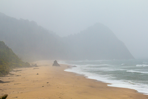 |
15:32 - The track is smooth being covered with a mixture of compacted earth and sand. It runs over the rubble of broken boulders brought down in a recent landslide. The boulders rolling down the hill didn't do too much damage as the palm forest is still intact. Within a few minutes the track narrows and rises moderately to negotiate its way across a bluff. A break in the forest on the bluff gives a good view back along Scott’s Beach. Although Kohaihai Bluff is little more than a kilometre behind me, it is heavily obscured in the thick misty rain. The big rock towering out of the beach is quite some distance back now. Civilisation is completely out of view. I may as well be a thousand miles away from anywhere. From the saddle the Kohaihai Bluff rises steeply to a sharp point before dropping nearly vertically into the turbulent sea.
|
 |
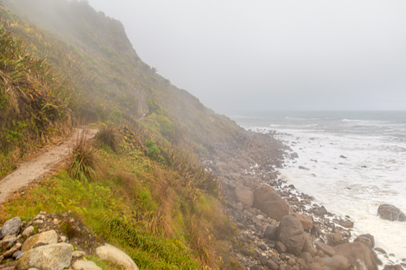
15:36 - From here the track negotiates its way around the very steep bluff. I have hiked this section four times before this trip, but don’t recognise it at all. I recall one time I had hiked through here at high tide when there was grass growing over the old landslide brought down in Cyclone Bola of 1988. At the time the tide was high but the waves were even bigger than they were today. They were slamming onto the beach below causing the ground to vibrate. One particularly large wave had smashed onto the beach causing a large boulder of half a metre in diameter to dislodge from the bank and roll onto the track less than a metre ahead of me. That was quite a scare. Fortunately today the waves are not violent enough to shake the ground. In the twenty years since I have last ventured here, several landslides have come down making this bluff totally unrecognisable. A lot of the damage would have occurred during last year’s Cyclone Ita wiping much of the track off the side of the hill. This would have forced trekkers to take the coastal route when the tide is low enough. There is still a lot of debris strewn down the side of the bluff. With all the rain falling there is a significant risk of some of this debris falling down. This definitely is no place to linger.
|
 |
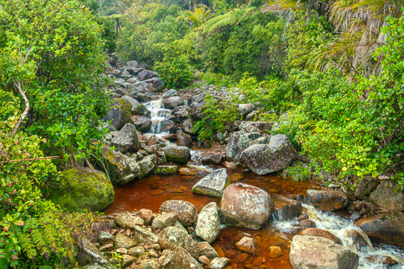
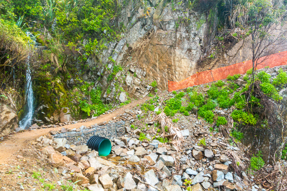
15:43 - I briefly descend into a tiny gully where a waterfall drops to beside the track and a plastic culvert diverts the water down the scree of boulders to the turbulent sea. Waved patterns are exposed in the pink Karamea Granite. The rock formed here during a batholith in the late Devonian 350 million years ago at a time when the continents of Australia and New Zealand were joined together as part of Pangaea. The granite mountains that I will be crossing were formed as part of the same mountain range as the granite mountains of Australia between Sydney and Melbourne, including the Snowy Mountains where I had hiked earlier this year. The chain of mountains had remained intact until Gondwanaland broke up during the early Mesozoic. The granite formation still extends to Southern Fiordland and out into the now submerged Campbell Plateau and Lord Howe Rise.
|
 |
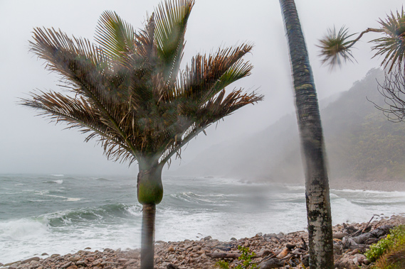
15:45 - The track rises over the other side of the bluff and steeply descends to a narrow strip of nikau palm forest beside the rocky beach. A couple of huge exposed reefs tower out of the water, but are smashed by the large grey waves rolling in. The rocks become covered in sea foam for a few moments before it all began to drain away in large cascades. This beach of giant boulders is called “Big Rock Beach”, big rock in the plural no doubt – as opposed to the singular big rock in the middle of Scott’s beach. Hiking along the boulders in these conditions would be treacherous with the huge waves breaking on even larger boulders below and the heavy rain making it rather slippery. Fortunately the rain has cleared just enough for me to have a view to the mouth of Swan Burn and over a couple more ridges to what would be Mid Point – a headland half way between the Kohaihai Saddle and the Heaphy River. The rabble of boulders reaches the level of the track as it negotiates its way into the bay over the steep headland. Eventually the bluff does end and the beach of boulders turns to bright orange granite sand with a palm forest growing on the thin strip of land between it and the steep hill.
|
 |
16:05 - The forest is thick with nikau palms. The black and white ringed ancient trunks have large pieces of lichen growing on them. Underneath the palms are the bluish grey New Zealand flax plants. Under the flax grows a thick carpet of sphagnum moss. The track is still in good condition, but it is just hardened soil with large puddles that have formed in the heavy rain. Fortunately the rain is light now, so perhaps the worst of the storm has passed. |
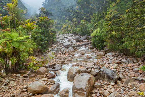 |
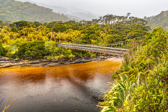
16:13 - Ahead a long wooden suspension bridge crosses Swan Burn. Water thunders down the cascades out of a narrow gorge lined with palm trees on either side. Just downstream from the bridge a huge rata tree stands leaning over the stream. The bridge, like almost all bridges along the coastal part of the track, are fairly new. In 1986 Cyclone Bola brutally hit the coast tearing out all the bridges along with many trees and large sections of the track. The aftermath was devastating requiring much of the track and all the bridges to be rebuilt.
|
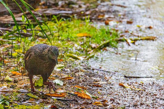 |
16:32 - Once on the other side of the stream the trail continues around the fan spread out by debris carried by the stream up to another bluff where a small stream cascades down to a culvert under the track. The rain is falling heavily again indicating there is quite a bit more puff left in today’s storm. I see some movement ahead of me. It is a weka. Its brown hairy feathers are saturated in the heavy rain but it seems happy enough. This is a very common relative of the kiwi, being a flightless bird that dwells the forest floor eating grubs and small insects. It is also known as the New Zealand wood hen, not to confuse with the brightly coloured pukeko (swamp hen). Unlike the kiwi wekas have flourished despite the almost complete wipe-out of other bird species in New Zealand in recent decades.
|
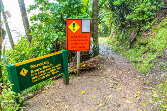 |
16:35 - Just before the end of the bluff I reach a big warning sign indicating the following 300 metres around Koura Beach and Crayfish Point is very dangerous to negotiate at high tide. Despite the warning sign there is a lot of sand on the beach, well above the top of the breaking waves. Enormous quantities of driftwood have been deposited on the beach, having been carried up by the strong northward flowing Antarctic current from the debris that had washed down the swift rivers further south.
|
 |
17:00 - I walk along the very coarse sand of Koura Beach, named after the Koura or crayfish which thrive on the rocks under the surface of the sea. I am amazed with how a small crustacean can survive in such turbulent open seas. Upon reaching the end of the beach a track leads over the top of Crayfish Point. Until a few years ago this part of the track was completely overgrown. It had been clear last time I passed through here about twenty years ago, but has since completely overgrown but been cleared again in recent years with more people using the track.
|
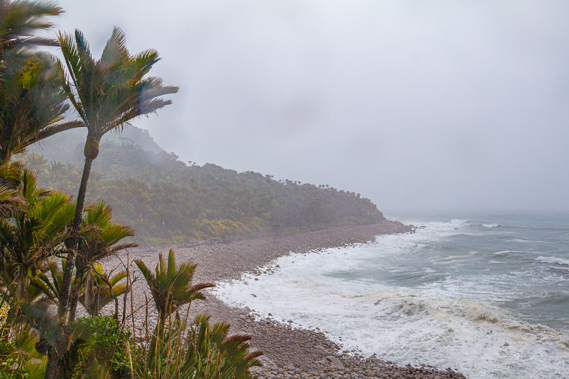 |
17:06 - At the top of the low bluff stands a large sign indicating the start of the Kahurangi Marine Reserve. The reserve starts here heading northward past the Heaphy River up to Wekakura Point some twenty kilometres up the coast. The reserve extends to about six kilometres offshore. Despite the wildness of the sea seeming impossible for any life to survive in its turbulence, it does thrive with life. There are many protected places in rock crevices and driftwood and within the seaweed supporting a host of life. Huge surf clams live on the muddy sea floor below the turbulence of the waves. Here they compete with sharks and flounder lurking beneath the fierce weather systems on the surface.
|
 |
17:21 - Just past the sign I reach another wooden bridge crossing Crayfish Creek. Despite the heavy rain over the past hour (which is fortunately clearing now) the water is still clear as it cascades down the huge granite boulders. The forested hills behind the burn are misty, but reasonably visible now. Looking ahead I can see around several steep headlands to as far as Mid Point, another burn sticking out into the ocean. Between the two points is Twin Beach. Looking back the large waves are breaking over Crayfish Point, making for treacherous conditions if it were not for the reopened track. The track passes over over giant boulders with huge waves slamming into them for a few minutes before I reach the first of the two sandy beaches of Twin Beach. |
 |
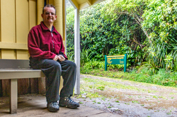
17:47 - Heavy rain begins to set in again as I walk through the bush of the first beach. This is followed by the short headland separating the two halves of the beach. At the end of the second beach is a normally dry small stream, but with the heavy rain it is flowing quite fast. Fortunately I easily cross it but my boots fill with water. Finally I reach the flat mostly clear burn of Mid Point I have been aiming for. Ahead of me is Katipo Creek Shelter. This marks the half way point to the Heaphy River, and the first shelter since Kohaihai and the last before Heaphy Hut, so I rest here before pressing on in the heavy rain.
|
 |
17:59 - The area around Katipo Creek Campsite is very different now to how I remembered it during my first trip on the Heaphy in May 1992. Back then the shelter had been a small A frame structure constructed from the trunks of a number of palm trees. The shelter had stood in a dark grotto nestled deep in the boggy palm forest. The old A frame shelter has been removed and replaced with a larger shelter sometime in my twenty years of absence. This shelter looks like it has been here for quite a while but has recently been repainted. The steep corrugated iron roof drains the heavy rain into a green water tank which is now overflowing. The rain is falling very heavily now and I am quite tempted to stay here for the night, as my boots are full of water and the pack is getting wet with the rain cape having shifted during the hike from Kohaihai. I don’t have a cooker though. The huts on this track have a gas supply, so there is no need to carry a cooker unless stuck here in one of these shelters.
|
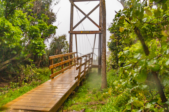 |
18:03 - The large wooden swing bridge crossing Katipo Creek is just a few short metres from the shelter. The creek is named after the Katipo, New Zealand’s only venomous spider. It is a close relative to the Australian redback spider and the American black widow, but with milder venom. Katipo is the Maori word for night stinger, implying it bites at night. That being said these spiders are rare, and bites are almost unheard of now. The last reported bite was to a Canadian tourist in 2010. There has only ever been one reported fatality, recorded in Auckland way back in 1901. The spider would have made its way from Australia on some large raft of vegetation brought down by a flood and drifted intact two and a half thousand kilometres across the Tasman Sea onto New Zealand and evolved into the current species now distinctly different to the redback.
|
 |
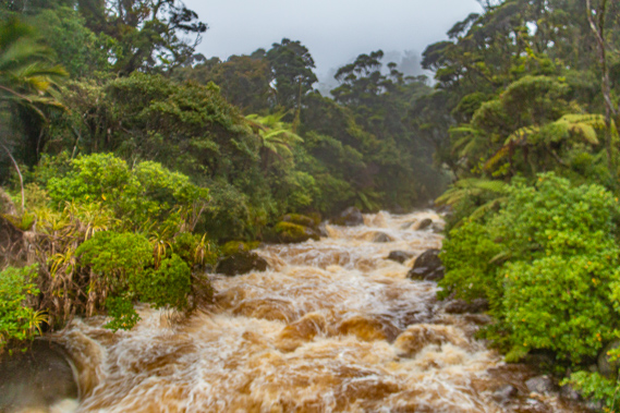
18:04 - The heavy rain is now having an impact. Previous large streams I have crossed had a channel of water flowing between the boulders only taking up about a quarter of the width of the stream. Here at Katipo Creek it is different. A torrent of dirty brown water thunders down the creek from bank to bank with only a few of the largest boulders showing above the foaming torrent. If it were not for the bridge crossing this stream, I would definitely have to stay in the shelter overnight. |
 |
18:26 - Once across Katipo Creek I continue following the track to a smaller normally dry stream without a bridge. It is a straight forward crossing but unfortunately fills my boots again. So much for me draining my boots a few minutes ago. |
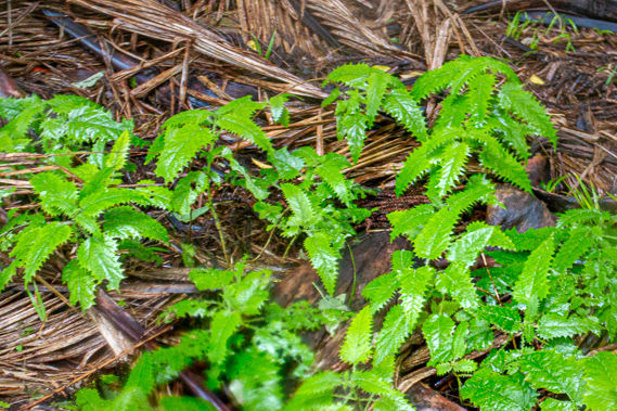 |
17:34 - I descend into Nettle Bay, well named for the bright green stinging nettle shrub (Utrica ferox) which grows here. There are a number of varieties of stinging nettle in the world, but this is the only species that develops into a sizeable shrub. It grows to about three metres high and has a trunk of up to twelve centimetres in diameter. The leaves of the shrub were large and slender. There were sharp serrations around the edges of the leaves but these were soft to the touch. The sting comes from the venomous hairy spine running up the length of the leaf. I keep clear of it, having been stung in the past. It leaves a sting lasting for several days. Usually alkaline leaf neutralises the venom. These plants can kill. There is one case where a lightly clad hunter died five hours after walking through a dense patch. Interestingly this plant is the main food source for the New Zealand Red Admiral caterpillar. Somehow it isn’t at all affected by the toxic venom, allowing it to take advantage of the safe environment lethal to most of its predators. |
 |
18:45 - The bush in this bay has a lot of these plants, so it was well named. There had been some further back along the track, but here it is a lot more prevalent. The bay only goes for a short distance before crossing another small normally dry creek without a bridge. The water runs down the rocks to the beach where much of the sand has been deeply stripped exposing boulders before running in a single channel across sand into the turbulent grey sea missing its horizon. From here the track follows above the sand of Twenty Minute Beach. The rain continues falling heavily with visibility very much reduced and the rain blowing in from the sea continuing to taste like salt. I’m not sure whether it does take twenty minutes to hike the track above the beach, but the distance seems right.
|
 |
18:47 - Another creek crossing fills my boots again. Once over the creek there is a brief elevated piece of land covered in tall flax. The track then rises over a steep headland going through scrub over huge boulders smashed by the breaking waves. The rain briefly clears revealing the horizon. Looking ahead the cloud has lifted just enough to reveal the bottom of Heaphy Bluff about seven kilometres ahead. The bluff is effectively my destination for tonight, so it it encouraging to finally see it. |
 |
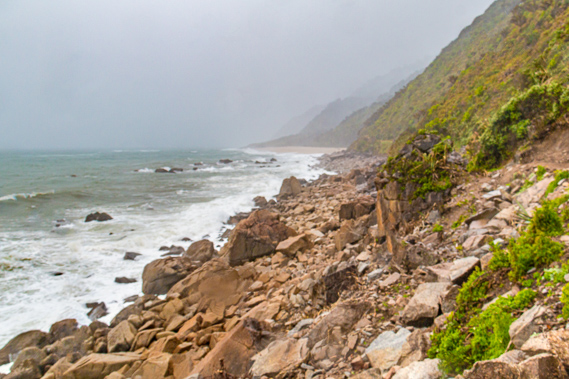
19:04 - The Heaphy Bluff marks the start of a coastline that is even more rugged than that I have been following today with vertical bluffs towering straight out of the sea. In 1846 the guide Kehu of the Ngati Taumata Kokiri and his slave Etau led Charles Heaphy and Thomas Brunner southward along the coast from Golden Bay through here in their search for pastures of farmland. They took a terrier dog with them to help hunt small game like the weka to provide food on their ambitious journey around the rugged coastline. Heaphy was born in London and had moved to New Zealand just a few years before embarking on this epic expedition along the coast to work as a farmer. Upon discovering farming wasn’t going to work out for him, he took up exploring for the New Zealand Company in search for more lands for settlers to farm. It is said that Kehu had pointed out a Maori track following the Heaphy River and over the mountains following a similar path to where this track will lead. Taking the inland route would have been a lot easier for Heaphy’s party. Under Kehu’s direction, Heaphy and Brunner had to slowly scramble their way up and down rock faces, and sidle along ledges above the brutal ocean pounding the bluffs they so precariously clung to. Thankfully the Maori had used the coastal route frequently enough to cut out permanent footholds in the rock assisting the explorers. |
 |
19:05 - By now the clouds have lifted enough for me to see offshore to as far as the horizon. There is no dry land anywhere between here and Australia some 2300 kilometres away. Not far below the surface though is the start of the Lord Howe Rise, a continuation of the Karamea Granite forming this part of New Zealand over to the mountains of eastern Australia when the two continents had been joined together. As the two continents split apart, Australia remained intact. The Zealandia continent on the other hand was stretched by all the surrounding continents and plates. The stretching made the crust around Zealandia become thin with the top of it sinking beneath the surface. Much of what remains of the Zealandia continent is now over a kilometre beneath the surface.
|
 |
19:06 - What is now dry land here (and throughout the rest of what is currently New Zealand) was at one point completely submerged leaving only a small landmass offshore from here. At some point the fault line in the middle of the Tasman Sea that had been pulling Australia and New Zealand apart fused together permanently. The continents continued to move against each other building up enormous pressure. Finally the pressure was so great that a new fault line tore open diagonally across the middle of Zealandia a couple of hundred kilometres to the east of the small island. As the new alpine fault opened up, the land began to rise causing the island to gradually expand into the South Island, transferring its biota of unique plants and animals to the land near the fault line before the original island became submerged with the rest of the Zealandia continent, leaving only the mountainous scabs along either side of the new fault line.
|
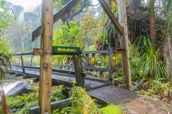 |
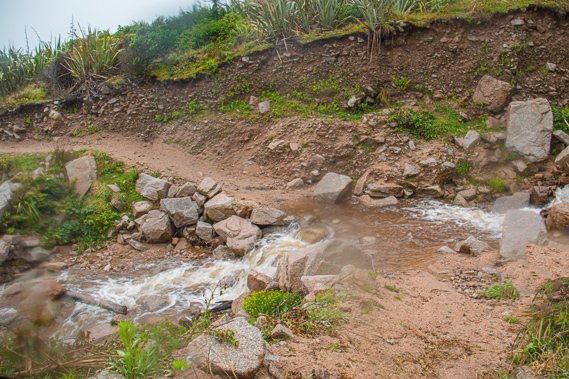
19:14 - The rain has by now eased to a misty drizzle. Ahead of me I can now hear a roaring sound, not as deep as the jet engine sound of the sea. I suddenly reach the edge of the palm forest where a massive torrent of angry brown water greets me. I have reached Wekakura Creek. Normally there isn’t much water and one can easily ford across it at this point. The heavy rain has swollen it from bank to bank with the dirty brown water barrelling dangerously towards the sea. Only a few enormous boulders the size of cars along the banks, and one mammoth boulder the size of a house near the middle of the stream now stand above the turbulent water. The cloud is lifting and I could clearly see the palm forest on the other side and up into the steep hills perhaps a hundred metres before they merge into the misty cloud. I guessed it was still raining heavily on the hill feeding this raging torrent.
|
 |
19:16 - I can't see a bridge anywhere, and for a few moments it looks like I have to head back to Katipo Creek Shelter for the night. Attempting to ford such a raging torrent as this would meet with certain death. I see a track heading upstream, so I follow it and fortunately find the wooden swing bridge standing firm with a sign saying there was a limit of one person crossing it. I cross the bridge above the menacing stream below. Once on the other side the track heads back downstream to the ford and continues around the burn until reaching the start of Heaphy Beach. The Maori named Wekakura Creek from the red feathers of the weka. The Maori hunted the weka for their food. They also used their red feathers for clothing, providing some decoration and warmth to couple with the structure and strength of their woven flax clothing. Now I am across Wekakura Creek there are only a few small bridged streams to cross, so at this point I know I am able to get to Heaphy Hut tonight, but need to progress quickly before the darkness of night sets in.
|
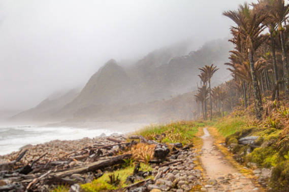 |
19:26 - Large boulders and huge pieces of driftwood from the southern end of Heaphy Beach are strewn over the track into the palm forest above it as if a large tsunami has recently come ashore. The waves generated by Cyclone Ita must have been enormous to have washed the boulders right into the forest. The waves of today’s storm are big, but they don't reach anywhere near the track. Fortunately the track has been mostly cleared of the debris, but it would have taken a lot of work to reopen it. I remembered Cyclone Ita in mid-April last year. It had started as a low pressure system in the Solomon Islands on the 18th quickly intensifying to a category 5 cyclone barrelling towards northern Queensland. Fortunately it had reduced to a category 3 before reaching the coast. It never did quite make landfall though, instead heading south eastward away from the coast. It passed Brisbane so far offshore that apart from a large swell breaking on the beach, I wasn’t affected at all. It continued heading south eastward as a low pressure system until suddenly re-intensifying when it collided with another low pressure system. From there it slammed into this part of New Zealand's west coast. Westport reported winds of 130 kilometres per hour. The damage from this cyclone is still apparent along this part of the coast a year and a half later leaving the boulders awash into the forest, and the scarring landslides further back along the track, not to mention all the fallen trees I had earlier seen on the ridges.
|
 |
19:38 - The cloud is sweeping back over the steep bluffs ahead. Heaphy Bluff is appearing quite close now at the far end of the beach rising moderately out of the edge of the ocean. The hills between here and the Heaphy Bluff towered almost vertically above the very thin strip of palm forest through which the track passes. The thick mist is now peeling away from these vertical slopes but still lingering in the scarred gullies in between them. These bluffs rise up to Bellbird Ridge hidden in amongst the thick swirling cloud. The coast here is spectacularly rugged just as the 26 year old Charles Heaphy had reported it when he followed this coast sothward on 18 April 1846. This was the last of his expeditions before moving back to Nelson. Not long afterwards he was transferred to Auckland where he would take on a few government and military positions before poor health would move him to the warmer climes of Brisbane where he died a couple of months after his arrival.
|
 |
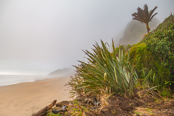
19:50 - The rocky beach eventually gives way to granite sand as the track continues through the sodden forest. The sand of Heaphy Beach gradually widens to quite a substantial beach sweeping all the way to the misty headland. A small wooden bridge crosses over Cold Creek as the sky in the western horizon turns a soft orange colour with the sunset. There is still thick cloud overhead but the cloud towards the horizon has lightened, so hopefully it will clear overnight.
|
 |
20:09 - The track leaves the beach and heads behind a tall sand dune covered in flax and palm forest. This very quickly mutes the jet engine roar of the waves that has constantly filled my left ear in my trek along the coast. A short rise over the sand at the back of the dune crosses a very low saddle in the palm trees. Then it drops into a large swamp. The track follows the edge of the swamp which fortunately hasn’t flooded. I passed a small green sign indicating just one kilometre to go to the hut. I quicken the pace as the sky has started to gradually darken. By now the roar of the sea is almost non-existent, leaving a quiet swamp where the diurnal creatures are going to rest and the nocturnal ones are coming out.
|
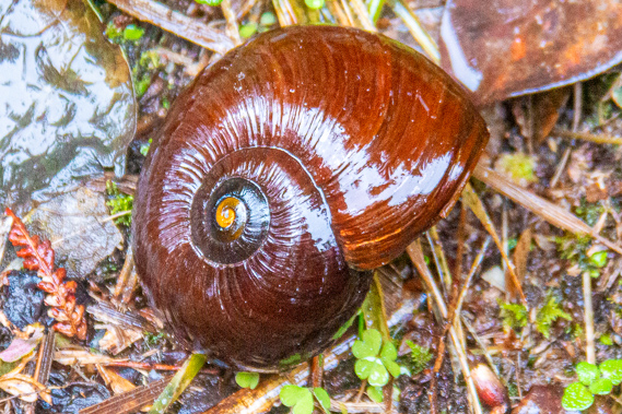 |
20:11 - One of these nocturnal creatures is the mysterious Powelliphanta, the giant carnivorous snail. Having been split off from the rest of the world since the age of dinosaurs, New Zealand has evolved its own entire ecosystems totally unlike anything else found in the world. Many of its birds have become flightless, and for millions of years there was an almost complete absence of mammals. The vast sphagnum moss swamps became inhabited by many varieties of snail completely unlike other species found anywhere else in the world. There are some 2000 different species of these snails, 500 of these have been named. The native snails grow up to nine centimetres wide and eat worms, sucking them out of the ground like spaghetti. They were rare and protected. I found one beside the track that hadn’t quite woken up yet. With all the rainfall this afternoon these were ideal conditions for it.
|
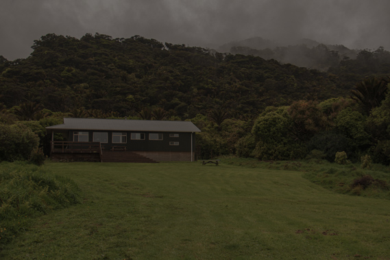 |
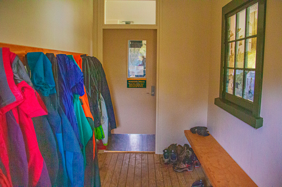
20:29 - The sky continues to darken but fortunately I can see a grassy clearing up ahead through the trees. Sure enough this is the clearing beside the Heaphy River, where the hut stands. Upon reaching the clearing I head up the grassy bank to the hut. A staired verandah leads up to the entrance to the hut. It has only been built two years ago replacing the one I had stayed in twenty years earlier. The first room is a mud room full of wet boots, a rainbow of raincoats and a few walking poles (though most of the walking poles were outside. I removed my saturated boots before entering the main cabin. The first hut was built here in 1907 at the time the area was being surveyed for settlement. In particular one of the surveyors Dr James Mackintosh Bell was preparing to carry out a major geological survey of the area between Karamea and the Aorere River in Golden Bay. The hut in the tiny clearing in amongst the nikaus became the headquarters for the survey party, being called the Whakapouai Hut after the Maori name for the river. It was a long hut with a big fireplace, three rooms and opening windows. In the near darkness I had just made out a stream in the bush to the left of the hut. This was called Pitt Stream named after the survey party’s cook who was known to always be at the creek either washing up or collecting water to boil. The hut quickly deteriorated in the harsh humid weather. Some of the roof had collapsed by 1920. Money had been allocated to repair it, but no work was ever done. It remained standing in an unused dilapidated state until accidentally burning down in 1926. The hut was finally rebuilt in 1929. Some of the windows were used from the original hut, but otherwise all the materials were new. The timber used to build the hut was pit sawn at Murray Creek a couple of kilometres along the swampy track up the Heaphy River. The new hut was a lot smaller than the original one. It only had one room and two windows but had galvanised iron roof and sides packed in from Karamea.
|
 |
20:31 - This hut was the main hikers’ hut for 39 years until a new one was built nearby in 1968. It was a much larger 20 bunk hut sitting on the site of the current hut. The old hut was closed to the public but used for the forestry rangers. Although it has had extensive modifications and additions over the years, it still stands today as the rangers hut separated by a few trees now hidden in the evening darkness. The new hut had a shower and bathroom added in the 1970s. In 1980 a new kitchen and glass doors going onto a large verandah were added. In 1986 a new flush toilet was added when the old long drop building was flattened by a huge rata tree that fell down on top of it during Cyclone Bola. Another staff hut was erected behind the main hut in 1981 but was later moved to become the staff hut at Saxon (where I’ll be passing in 3 days time). The new hut I have entered was built in 2012 and sleeps 32 people. The old hut that I had previously stayed in was pulled down as part of the new construction project. I'm surprised to see quite a lot of people in the communal room. This is a bit of a shock having not seen anyone since passing the hikers coming the other way before Scott’s Beach. A fire is going in the wood burner heating the room almost into a sauna. I have acclimatised somewhat to the cold rainy conditions over the afternoon and in comparison it was pretty hot in here.
|
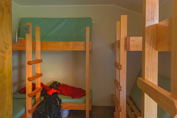 |
20:39 - Off the main kitchen and dining room are three bunk rooms. Two of them seem crowded but the third one has several bunks free, including the last available lower bunk which I take. Everything is a bit damp but the sleeping bag is still dry. Back in the main cabin there are wet clothes hanging over every conceivable place, so there isn’t space for me to hang out wet stuff to dry. I head to the kitchen with some food – a can of dog food and a packet of noodles. A large bench in the middle of the kitchen had several gas cookers on it. All I need are matches and fortunately I had some. I light one of the cookers, take a small pot of water and started cooking dinner. The canned food and noodles don’t taste too bad following the long afternoon hike in the rain. As someone who normally avoids any processed food, I consider anything out of a can to be dog food not fit for human consumption. Once dinner is finished, I headed off to bed. Nearly everyone else in the hut is turning in as well, so there won't be much noise tonight thank goodness. I quickly fall asleep as light rain falls steadily on the roof of the hut.
|
|