Introduction to today's journey
It is one thing to hear about the forest and the river, but an entirely other experience to go there, to see the environment and to appreciate the natural riches there first hand.
- Chris Kilham
THE MOUTH of the Heaphy River posed no archaeological interest until November 1960 when two bone collectors from the Canterbury Museum were exploring the local caves for moa bones. It was on their second expedition a year later when they surprisingly discovered a stone adze on the beach near a large deposit of charcoal. This quickly diverted them from the caves, beginning an archaeological excavation over the following week. Here they discovered the foundations of a long abandoned village and large stone ovens. This was a moa hunter settlement, one of the earliest settled Maori villages in New Zealand. It contained relics from throughout early New Zealand showing the people who had settled here around 1250AD were very good traders. This prosperous village was abandoned, particularly due to the local extinction of the moa they hunted. In the centuries since, the forest has concealed this most important archaeological site.
Today's trek begins at the Heaphy Hut, following the river upstream and exploring some of the large caves hidden in the dense rainforest. Returning to the hut, I collect my pack and follow the track upstream along the peaceful meanders of the Heaphy River, until a large swingbridge crosses it to the mouth of the Lewis River. Here I stop at the Lewis Hut for the night before heading up into the mountains.
Today's Journey
Distance trekked today: 10.5 kilometres.
Total distance trekked to date: 26.7 kilometres.
 |
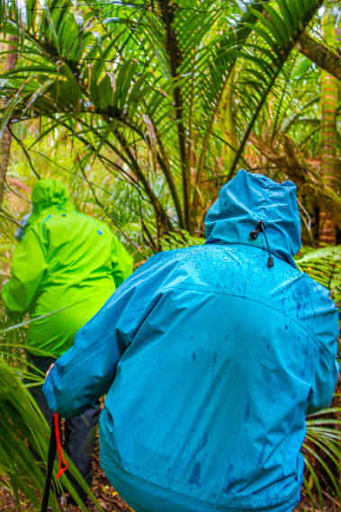
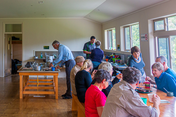
08:28 - I wake up at first light as a few others in my bunkroom are already hurrying to pack up and leave to hike the coast to meet their transport at Kohaihai. Otherwise the activity in the hut is low as I have breakfast and return to the mud room to put on my soggy boots sitting within the clutter of other wet boots and rain coats. There is little wind this morning, and the air is not as chill as I am expecting. A cold southerly should be moving up the length of the South Island to hopefully clear away the drizzle still falling intermittently from the overcast sky. Hopefully the southerly will come soon.
|
 |
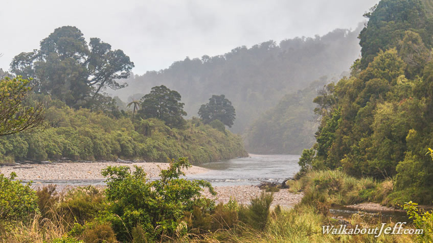
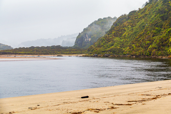
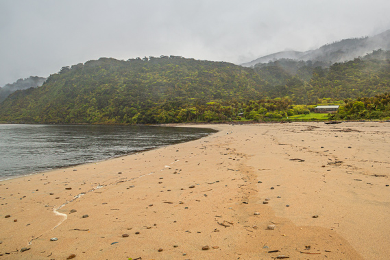
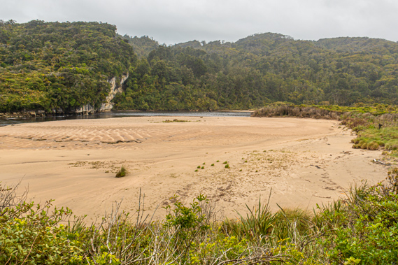
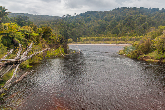
08:31 - Looking out from the hut verandah, the grassy field drops between the nikau palms and tree ferns to a low bank at the edge of the river. Beyond the bank a large sandy beach covered in huge amounts of driftwood carried down by recent floods extends out to the river flowing out through a narrow gap into the sea. The other side of the river leans right up against the scrub covered headland to an overhang at the mouth of the river. Large waves are breaking over the shallow sand bar surging in and out of the estuary at the end of the river. Despite the misty overcast conditions, the view has a very tropical feel about it with palm trees visible against the sea. For a moment I am cast away far from the South Island to some tropical location, but the morning chill reminds me I am definitely in New Zealand. |
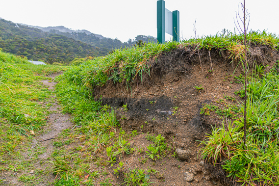 |
08:32 - I walk down the wet grass towards a ramp cut into the soil down the two metre high vertical bank to the sand. A pair of weka are foraging around in the grass no doubt looking for morsels dropped by hikers. There is a clean cut through the soil. The top twenty centimetres is dark topsoil where the grass grows. Below the topsoil is a thirty centimetre layer of gravel. Below the gravel is a twenty centimetre layer of black charcoal sitting on more layers of gravely dirt. These layers in the bank were of no interest to the people who surveyed the area in the early 1900s. The mouth of the Heaphy River was considered of no historical significance at all until November 1960 when Owen Wilkes and Ron Scarlett from the Canterbury Museum visited the area upon hearing claims of limestone caves in this area filled with bird bones. They collected some bones from one of the caves and brought them back to Christchurch. They had not looked for or found any evidence of anything of archaeological significance.
|
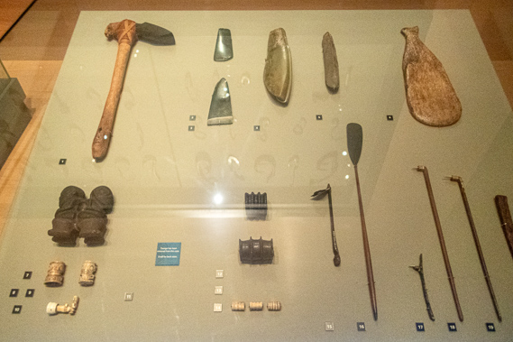 |
08:33 - They revisited the area a year later to collect more bones. Upon their arrival they found a large adze, a kind of stone axe, on the beach outside the hut. This was a big surprise to them. It was then that they noticed the black charcoal layer in the exposed river bank. This discovery quickly diverted them from the caves. Instead they spent a week with two assistant archaeologists excavating three pits. Noticing the dark layer they suspected it was charcoal. They carefully dug in the area to uncover the remains of birds, large shell dumps, and then stone tools, the post holes that would have formed the foundations of a village and large oven stones. The archaeologists studied the tools they had unearthed. These include greenstone distinctive to that found around Milford Sound, some four hundred kilometres south by sea. The blades of some tools were made from obsidian from Mayor Island, a dormant volcano near Tauranga. This island was well over a thousand kilometres away from here by sea. They also discovered tools made from stones only found in Northland, East Cape, Kaikoura, D’Urville Island, Central North Island and Central Otago. It was obvious that whoever these people were, they traded extensively with other Maori from far and wide, and that the early arrivals had thoroughly explored the country for the best resources to build their tools from.
|
 |
08:35 - They had made a huge discovery – a moa hunter settlement, perhaps one of the earliest settled Maori villages in New Zealand. Many of the bones had belonged to the lesser bush moa Anomalopteryx didiformis. This is an extinct flightless bird that dwelled the forests. It stood around 1.3 metres tall weighing around 30 kilogrammes. This species was found throughout the North Island and parts of Northern South Island. They also found the remains of a much larger species where the males grew to just over two metres high and the females over three metres weighing over two hundred kilogrammes.
|
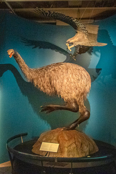 |
08:36 - The giant moa were hunted by the giant eagle as this dramatic display at the Te Papa Museum shows, but the smaller bush moa were relatively predator free living in the rainforests until the Maori arrived and completely wiped them out before 1500AD. They wiped out the giant moa as well. With no moa to hunt, the giant eagle quickly became extinct. The presence of charred moa bones indicated this was a very old Maori settlement. Given the low population density, the moa in this area would have been completely wiped out within about thirty years of the village being established. |
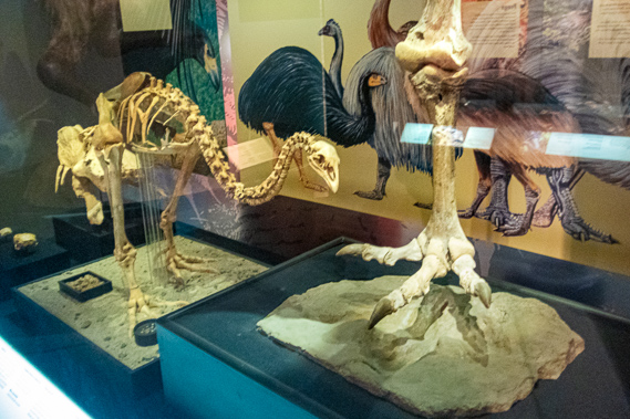 |
08:37 - The moa was a flightless bird covered in hairy feathers similar to the kiwi. It is commonly believed the moa and kiwi were closely related, but this isn’t the case. The kiwi is closely related to the much larger Australian emu and the moa was more closely related to the tinamou, a flying bird found throughout central and southern America (apart from Chile). Both birds date back to Miocene, at about the time when the Zealandia continent split off from Australia, South America and other parts of Gondwanaland. The fossil record shows New Zealand got its kiwi from Australia and the moa from South America.
|
 |
08:38 - The buried village had pavers set into the ground, perhaps because this had been a swampy area. Stone paving between buildings was very rare in Maori settlements, but had been used throughout Polynesia. They discovered fireplaces, flaking floors where tools were made, cooking shelters and the small huts where they lived. There were large midden of sea shells collected over the years. The settlement was dated back to around 1250 AD, a time before time when the earliest Maori arrived in New Zealand. This seemingly innocuous black layer in the riverbank had become the most significant archaeological site on the West Coast. Only five percent of archaeological sites date back to this very early part of Maori settlement. There were a couple of smaller sites discovered on other parts of the mouth of the Heaphy River. Most of the archaeological evidence has been lost forever from the forest reclaiming what hand once been the gardens the Maori grew. The clearing around the hut had remained mostly clear for hundreds of years preserving some of the site. This village seemed to last longer than other early Maori settlements in New Zealand due to its isolation and due to ideal location. About eight families would have lived here. Heaphy Bluff sheltered it from the brutal winds blowing in from the sea. The mountains behind the village sheltered it from the bitterly cold southerlies from the Antarctic buffeting their way through the South Island.
|
 |
08:39 - The microclimate here created ideal hunting conditions, with an abundance of fresh water, native fish, seals and birds including penguins. Even when the moa did die out from this area there was still plenty of food to be hunted from the sea. There is a large seal colony on the other side of the Heaphy Bluff where they would have hunted from. The wide mouth of the river provided access for their waka (canoes), but skill was needed to get the boats over the treacherous submerged sand banks. The palm trees were similar to those the people had used in Polynesia where they had come from. They built rounded thatch huts from the palm fronds. These tiny huts were very similar to those used by the African pygmies. The forest provided good timber for building and making boats. A similar site was discovered 135km south of here at the mouth of the Buller River. The findings in both sites were very similar indicating the tribes were closely associated with each other.
|
 |
08:40 - Over the centuries that followed the Maori established tribal boundaries and travelled less. This has resulted in less variety of artefacts at more recent archaeological sites. The quality of the artefacts decreased as ideas were no longer shared between tribes. This evidence shows the earliest settlers the most skilled of all the Maori. These people travelled by sea, but they also created the initial track over the mountains to the Mackay and Gouland Downs hunting grounds and into Golden Bay. This was the first incarnation of what would become the Heaphy Track, nearly 600 years before Heaphy’s expedition and 640 years before the track was rebuilt by European explorers. The Maori of the West Coast and Golden Bay would have reopened the track and kept it intact over the hundreds of years before European settlement. In particular the trail was used in 1826 when the Te Rauparaha war parties under the Chiefs Te Niho and Takerei from the north invaded the West Coat. Interestingly these people were a hunter-gatherer tribe, something not thought possible here in a temperate climate and because the sea was so rough it could only be fished for about twenty days per year. There was no real evidence of agriculture here. After several decades of settlement, the village was suddenly abandoned due to a huge landslide that had come down the nearby Pitt Creek burying the village. This may have been due to a spectacular flash flood, or perhaps from an earthquake moving the saturated soil. Either way the sudden landslide perfectly preserved the remains of the village until its discovery in the 1960s. Earthquakes were common here. The large terrace that the village had been built on had been uplifted in a big earthquake just a few thousand years ago, as were the surrounding limestone hills and the mountains behind them. The clearing had risen out of the sea with little time for the forest to establish itself there, creating an obvious place for the early Maori to create their settlement.
|
 |
08:41 - Looking up the Heaphy Valley I should be able to see to the Gouland Downs, but the higher hills are enshrouded in cloud. Whoever will be walking across the downs today is hiking through thick mist and rain. This point marks the start of the two old Maori trails. The first settlers had probably remained in this area, travelling by waka. Later Maori groups had travelled across land over much of the South Island between established settlements in Golden Bay and down the West Coast towards the precious greenstone fields near Milford Sound. The village was never re-inhabited following the great landslide. Maori historians now believe that the Ngati Tumatarariki tribe that had occupied the Nelson and Golden Bay areas had extended their tribal boundaries down into Northern Buller and would have likely set up small camps along the coast for hunting as they travelled over the following century. Over half a millennium would pass following the evacuation of the village before Heaphy and Brunner would camp here for a night on their epic expedition down the coast. They would most likely have not noticed the black layer in the riverbank, but Heaphy did report finding a potato plant growing wild over what had been the village. This peculiar find was a remnant of the gardens of the original village. Perhaps there wasn’t any erosion at the time. They would have camped directly on top of the ancient village without even realising it was there. The earthquake had displaced the river to the other side of the valley, but the river was now eating away at the bank reclaiming the land back.
|
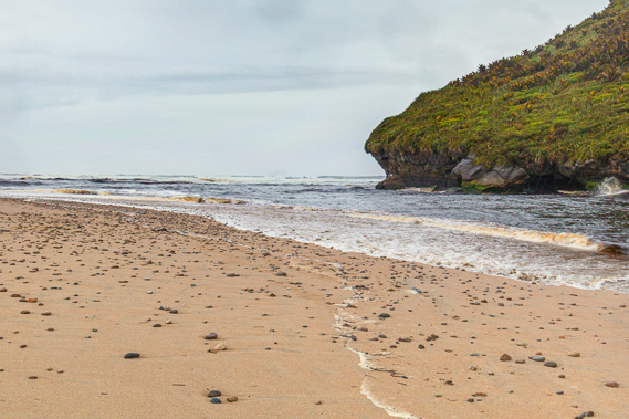 |
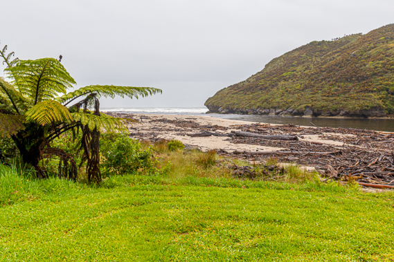
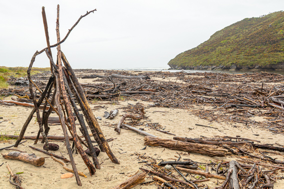
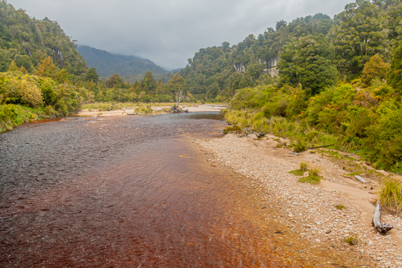
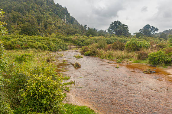
08:45 - The river is flowing swiftly out carrying the waters of yesterday’s rain and also draining the estuary with the outgoing tide. A couple of seagulls forage around the stones scattered on the sand. A thin erratic line of salt foam marks where the overnight tide reached. I head towards the mouth of the river. The sand bank makes easy access to the mouth and onto Heaphy Beach. The other side is a completely different story with the deep river running against the low cliff at the base of the headland marking the start of the Iwituaroa Range. The cliff becomes a dramatic overhang at the end of the river. Here the sand is a lot coarser covered with a more concentrated scattering of stones, indicating the breaking waves can be quite rough here. The roar of the waves is pretty intense out here, but barely audible at the hut. It’s amazing what a couple of hundred metres does. The unseen sandbar just offshore takes the brunt of the waves, leaving irregular surges to make the estuary breathe. The water rushes up along the length of Heaphy Bluff making coastal access impossible.
|
 |
08:46 - Once out on Heaphy Beach, I can see along the coast to where the high mountains of Bellbird Ridge cascades sharply into the sea. The pointed headlands are heavily obscured by the salt spray given off by the pounding waves. Some say you can get mobile phone coverage from here. I am not even tempted. I am now far away from civilisation and want to keep it that way.
|
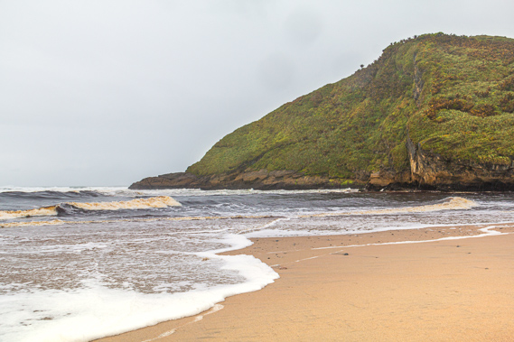 |
08:51 - Early explorers here had proposed a lighthouse be built on top of the Heaphy Bluff. The constantly roaring waves are breaking on the beach in a mad boil creating copious amounts of salt froth. The sea looked menacing highlighting the advice that swimming is unsafe here. Anyone brave enough to go for a swim here should go further upstream into the cold black waters of the lagoon. Mist is descending the hills preceding a rain squall. I quickly return to the hut to get shelter from the rain which is already barrelling down the valley. I notice at the base of the hut are a number of huge spinal bones of a whale beached here many years ago.
|
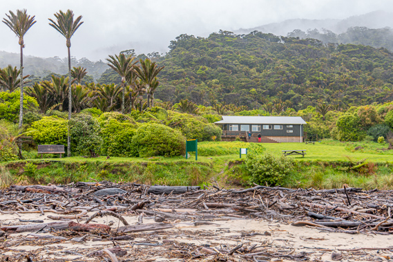 |
08:54 - The old Maori village around the hut was abandoned many centuries ago, and what little remains of the village is being quickly eaten away by the river. The bank has eroded back 33 metres in the past 105 years, including 18 metres since 1988. Archaeologists believe that all the remaining evidence of the village will be eroded away over the next ten years to be lost forever. |
 |
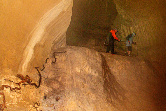
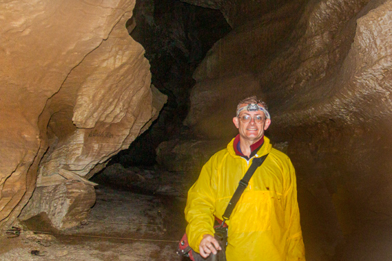
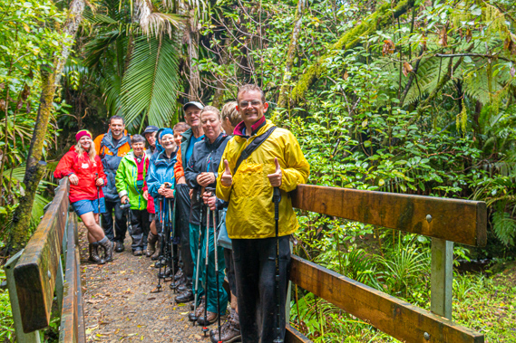
09:21 - Upon returning to the hut from the beach I meet Ken, one of the three guides in the largest group staying here overnight. He is starting to brief his group on a side trip they are about to do up to Field Cave and casually mentions I am more than welcome to join them when they leave in a few minutes. The Heaphy River flows through rugged limestone karst country. When the track was first constructed by European settlers in the 1890s rumours were spread about caves in the area containing human bones. These reports came long before the archaeological site was discovered. One of these caves was supposed to be near the Heaphy Hut and the other was near the Gunner River several kilometres upstream along the Heaphy. Despite these claims of discoveries being reported several times in the years between 1890 and 1909, subsequent expeditions to this day have never found human bones in caves, a number of caves have been rediscovered along the sides of the valley. I set off along the track with the group. There are two other guides, both female who live near Nelson. The group they were leading are from a bushwalking club based near Melbourne. Interestingly they are all over the age of seventy, but still very fit and young at heart - very much needed with what is coming.
|
 |
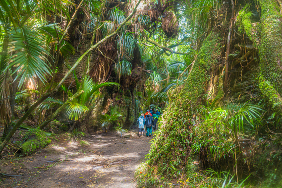
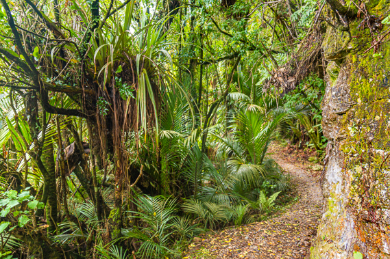
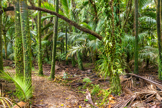
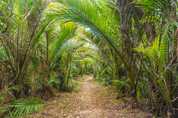
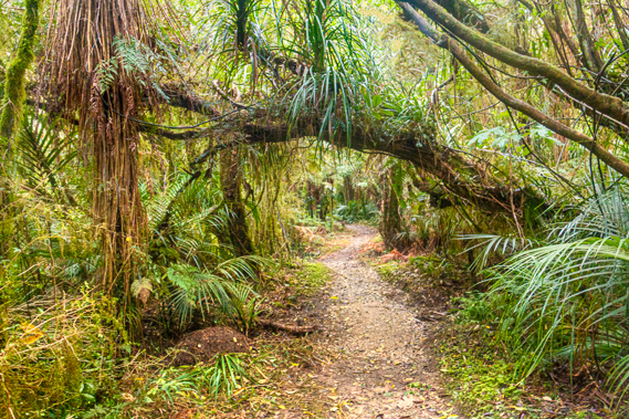
09:33 - From the hut we follow Ken along the main track upstream towards Lewis Hut. This is where I will be heading this afternoon. The group had yesterday come from the James Mackay hut which is the next one along up on the plateau. This is their fourth day on the track having booked two nights at the Heaphy Hut. Today is a day of relaxing and exploring before heading out tomorrow. Some of the older members of the group are resting in the hut. The track follows the river through increasingly thickening forest. Without the direct exposure to the sea the forest has better conditions to grow in. The palm trees and ratas are a lot larger here, growing on the small river terraces and around giant limestone boulders that have rolled down the mountain in past earthquakes.
|
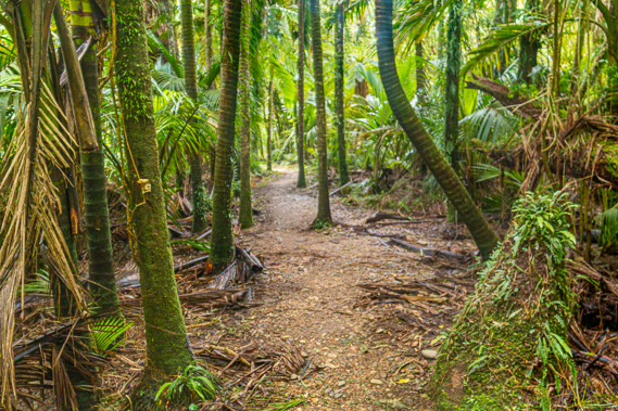 |
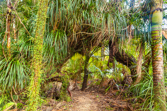
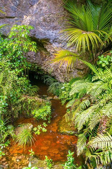
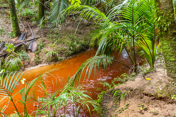
09:45 - Steady rain is falling, so everyone is in their waterproof raincoats and trousers. Thankfully there is no wind here in the shelter of the hills. The only sounds we hear is our own talking and the crunch-crunch of our wet boots on the granite gravel pathway. The birds are very quiet this morning. After hiking for about a kilometre we reach a bluff where a tannin stained stream flows out of the rock beside the small wooden bridge we cross. This is the first sign of caves in this area. The hills around the Heaphy River are apparently full of caves as would be expected in coastal limestone country. Apparently there is a sizeable cavern inside this entrance, but it would have involved a tight and very wet squeeze to get inside. We continue walking along the track a bit further until reaching the bridge crossing a fairly substantial stream. Its deep ochre colour is due to leaching of rainforest vegetation. Once over the bridge we stop. I note we are half way between the bridge and a palm tree growing in the middle of the track. This is the only palm tree along the entire track, so it is hard to miss.
|
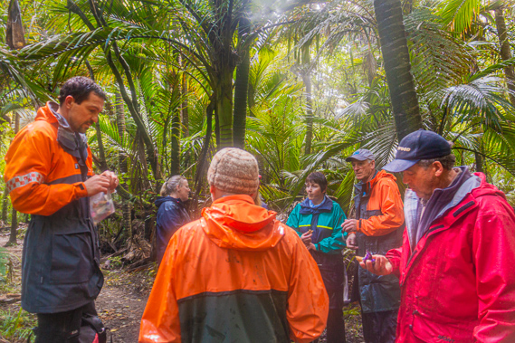 |
09:48 - I see a crudely trampled route through the forest to our left. The guides let us briefly rest here as they explain we will roughly be following the old main track inland over a swampy area towards the caves. We are about to venture into the bush when three guys from the Nelson Search and Rescue (wearing their uniform) join us having lumbered their way effortlessly along the track. We are in very good hands now. |
 |
09:51 - We leave the track following Ken walking in single file through the thick vegetation over soft boggy ground. The route is overgrown with the spring growth but still reasonably obvious as a trail. We are thankful to have three guides who we think know where they are going, and the three search and rescue guys. After a few minutes we do reach the remains of what used to be the original Heaphy Track. When first built in 1893 the track used to follow the base of the limestone formations to minimise any erosion by the river when it floods. The early explorers, track builders and surveyors had used some of the caves for shelter and storage. |
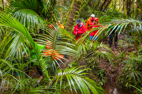 |
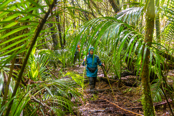
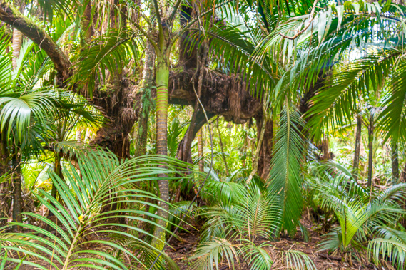
10:01 - Unfortunately the ground through here is very swampy with the forest litter hiding big puddles of water. My boots quickly fill with water again as we slosh our way through the boggy forest floor. The bush here is very thick causing one to easily lose their bearings. The going remains reasonably smooth until we suddenly reach a small stream cut deeply into the soft soil. The thick palm foliage makes it rather difficult to see but it is obvious the water is a little too deep to wade through. The knotted stems of a fallen Northern Rata has conveniently fallen across the stream, so we all decide to cross this natural bridge. It is a bit awkward getting everyone across, but fortunately we all made it without anyone getting wet. Our route now becomes particularly swampy, passing a large puddle in the forest almost big enough to be a lake. We quickly reach the edge of the steep hillside and follow it for a short distance before the guides decide we are close to the cave entrance. They lead us through thick bush up the slippery slope. Thankfully the foliage here is very sturdy and thankfully none of it is the stinging nettle I had seen yesterday. After some time the guides decide we are a bit lost and we o stay put on the edge of the steep slope for a while while they get their bearings and find a way up to the cave entrance.
|
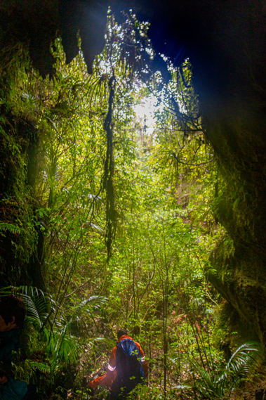 |
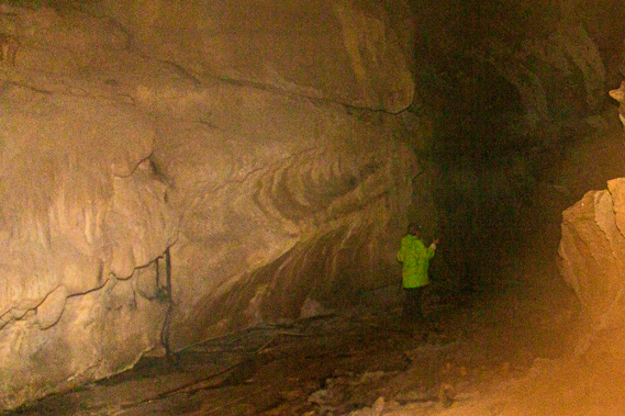
10:25 - After about quarter of an hour they work out the route and we traverse across the slope before finding a muddy route which we should have come up in the first place. We walked past it only by a few metres earlier. It is a bit of a scramble uphill under a large tree before we suddenly reach the huge gaping entrance of Field Cave. It is a double entrance with a huge twelve metre high hole running through the bluff for about fifteen metres. The cavern is about seven metres wide and had bright green foliage blocking the view on either side.
|
 |
10:26 - The route through the cavern steeply descends. I am already wearing my head torch and turn it on to look around the cavern. To the left of the cavern is a drop into an even larger cavern where we are heading. Field Cave is one of the largest known caves in the valley. It was named after the Field brothers who worked on the original track and scratched their names on the wall deep in the cave in September 1893 just before the track passing by was completed. Their initials were ACF and FWF. There was a third set of initials WMB, but the name of this person has been lost to time. The name was proposed by the late Trevor McNabb who used to be a well-known farmer and bushman who contacted the New Zealand Geographic Board to name the cave now long since grown over.
|
 |
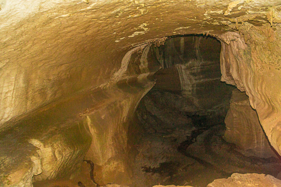
10:30 - There are two entrances to the main cavern. The main route requires a downhill scramble from where we currently stand. This doesn’t seem to be a good idea, so we head towards the other main opening into the cave to where a passage dropped moderately into the cavern. This is a much smaller entrance, but despite the muddy clay caking on our boots, it is easy to get into. Once down in the cavern I see markers with string running just off the ground. Clearly people have been here before and obviously they want people to walk along the established path.
|
 |
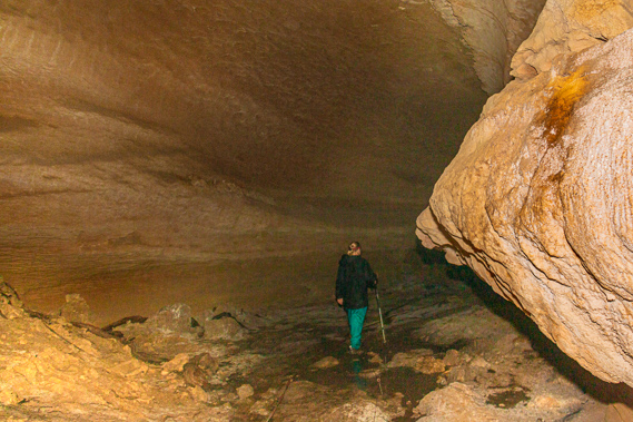
10:32 - A small stream runs along the bottom of the cave. This is most likely the same stream we had crossed earlier after leaving the main track. Fortunately the floor of the cave is very flat. At one stage a large stream, perhaps the Heaphy River itself had run through here, carving the cave out into a very easily accessible path. Other caves I have explored in the past have had huge boulders to clamber over that had fallen from the ceiling in past earthquakes. It is reassuring to see there were no obviously large boulders that have fallen off the ceiling in this cave. That being said I definitely don’t want an earthquake to happen now. |
 |
10:33 - A couple of people in our group brave the main entrance into the cavern. It is rather precarious for them still making their way down when I reach the bottom of the cavern. The cave is lifeless apart from a few long roots that snake their way down the main entrance searching like a braided river searching for the dampness of the stream running along the cave floor. Once we are all in the main cavern we follow the path upstream. The walls of the cave are surprisingly smooth indicating the river would have flowed swiftly through here at some stage before earthquakes lifted the valley higher causing the water to divert to the other side of the valley.
|
 |
10:47 - We find the shell of a dead giant snail in the cave. This is an ideal place for all sorts of critters to seek shelter from the elements outside. The other entrances are difficult to scale, so we end up returning the way we had come in.
|
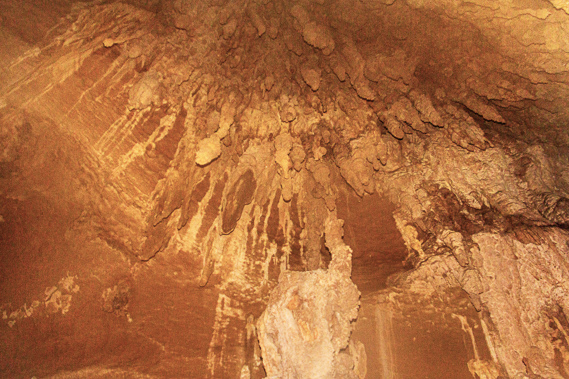 |
10:51 - On our way back we spot an area of small knobbly stalactites hanging from the ceiling. They seem to be very old from a time long past. The past rivers have wiped away any evidence of stalagmites on the cave floor. Finally we reach the main entrance and brave climbing the steep face up to the double entrance, neither entrance we can see from down here. Climbing up isn't anywhere near as precarious as the previous descent and soon we are all up going through the top entrance again. |
 |
11:18 - Once back above the ground we carefully descend the steep muddy route back to the old track. From there we make out way back sloshing through the swampy forest until reaching the creek, where one by one we cross over the slippery bridge of tangled roots. A couple of people in our group get impatient and decide to just wade through the cold thigh deep water. |
 |
11:23 - Once on the other side we continue through the thick swampy bush until eventually reaching the new track, where we stop and regroup at the bridge before heading back to the hut. For three years the track builders cleared the trail from Collingwood, having to endure tough wet conditions until they finally reached here at the bottom of the Heaphy Valley. Some of the toughest conditions they faced would have been through the final swampy forests along the Heaphy Valley, with the large menacing river to their right and the vertical limestone formations to their left. When surveying the route to cut the track around the limestone formations they discovered some of the caves, including Field Cave where three people – the Field Brothers and one mystery man, inscribed their initials in the darkness of the long cavern.
|
 |
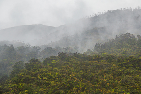
11:30 - When New Zealand was caught in the grip of the ice ages, most of the South Island became covered in ice sheets, some over a kilometre thick. The harsh perpetual winters wiped out much of the forest that filled the once sheltered valleys. Here in the almost subtropical microclimate of the western Kahurangi National Park, the deep valleys were almost completely untouched by the ice sheets. This created a refuge for plants and animals to comfortably survive during even the most severe ice ages. When the glaciers retreated, vegetation and wildlife from this area dispersed back into the rest of the South Island. Even though this is an interglacial period, these valleys provide the highest levels of biological diversity anywhere on the South Island. |
 |
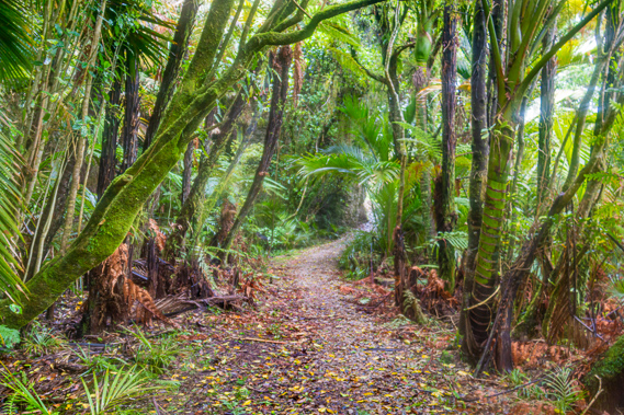
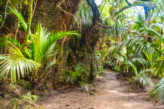
12:14 - Upon returning to the hut, I pack up to head up to Lewis Hut for the night. I say goodbye to my new friends on my way out and follow the main track upstream. Shortly after leaving the hut I cross the little creek as I enter the forest, then head through the rugged forest of giant rata trees and palms. It is hard to believe this area was once surveyed for settlement, but the remoteness of this valley resulted in a complete lack of interest in buying land.
|
 |
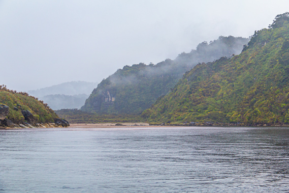
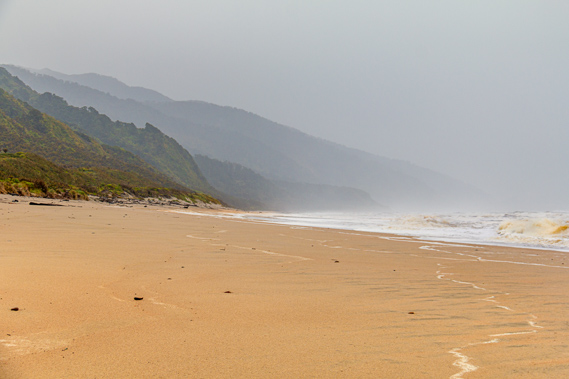
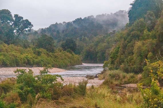
13:02 - The river meanders sluggishly across the wide valley. On the other side is the vertical cliff of a limestone rift towering up over the bluff at the harbour entrance. There is a route along the bottom of this cliff to the very steep terrain on the other side, from where you can explore the coast. The Heaphy Bluff marks the start of the Iwituaroa Range, a forested limestone range of hills separating the river from the sea. Although it doesn’t seem like much from here, the forest on this side of the hill is some of the thickest and most difficult to navigate in New Zealand. Local hunters say the bush is so thick and difficult that the deer are forced to go through it on their knees. The other side of the range poses even more challenges, with the near vertical drop straight into the turbulent ocean. Navigating this coastline would be almost impossible. Heaphy had taken many days of hardship to follow the coast. Even now few venture there, and some who go perish in the terrible conditions never to return.
|
 |
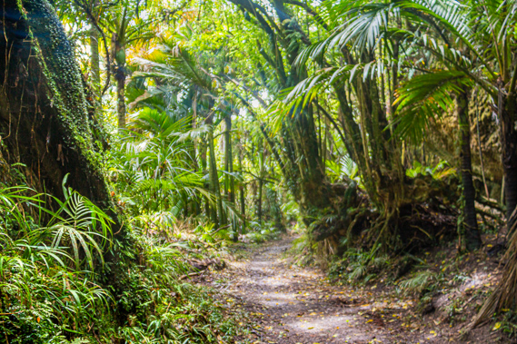
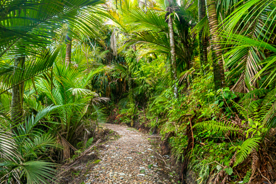
13:11 - Once around the first set of limestone bluffs the forest becomes very different to what it had been along the coast. The relatively calm conditions and shelter from the wind and salt result in a lot more epiphytes growing on the palm trees. The palm trees themselves have much larger foliage, the fronds often extending over three metres long. |
 |
13:12 - Upon passing the exit we had earlier taken to follow the old track to the cave, I continue following the new track elevated above the swampy forest floor through the darkness of the bush. |
 |
13:14 - Over the years following Heaphy’s exploration of the coast, the European influence has gradually taken over the earlier Maori control as has happened in much of the rest of New Zealand. This began in 1849 when the traditional name of the Whakapoai River changed to the Heaphy River. The original settlers in the thirteenth century most likely gave the river a completely different name which is now completely washed away with history just like much of the village.
|
 |
13:19 - Little happened in this area apart from the occasional explorer passing through between the West Coast and Golden Bay until in January 1887 when FE Gibbs and his brother Sidney, and A E Talbot carried out the first geological survey of the area. This was the beginning of what would become more extensive survey and exploration of the area. |
 |
13:20 - In October 1893 the track finally reached the mouth of the Heaphy River having been cut all the way from Collingwood. This would become the most remote outpost of Golden Bay – the official boundary between Golden Bay and the West Coast at the time had been at the Kohaihai Saddle. The new track allowed cattle to be moved from the Nelson area down into the northern Buller. They would follow the track down to the mouth of the Heaphy River, before being herded along the beach and over the rough route across Kohaihai Saddle before continuing down the coast. There were often up to 80 cattle on the track at any given time. |
 |
13:22 - Five years later “The Nautilus” became the first ship to cross the Heaphy River Bar. This marked the beginning of the potential settlement here. That same year a more detailed survey was done of the Heaphy River by J.H. Jennings. This time the intention of the survey was to prepare a major settlement plan for a village. It was not until 1905 though that the detailed survey was conducted by Mr D MacPherson along the Heaphy Valley. From this survey 13,030 acres of land was offered for lease. The plan was to create a town at the mouth of the river. The plan included roads, homestead sites, a school, and even a cemetery.
|
 |
13:27 - There was not much interest due to lack of access by either land or sea, but two years later the Buller County Council made the first proposal for a road to be built through the area essentially following the Heaphy Track. In 1907 James MacKintosh conducted a more detailed geological survey and J Donaldson grazed some cattle in the rugged Heaphy Valley at this clearing. A number of blocks had been surveyed for “landless natives”. It was a gesture in recognising their heritage here, but insignificant as the entire West Coast had been purchased for just three hundred pounds just a few years earlier.
|
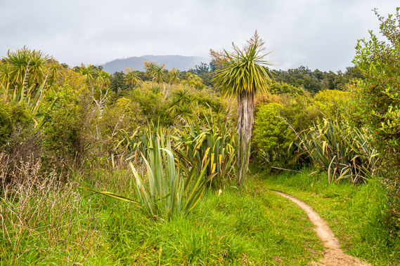 |
13:38 - There were big plans with the proposed road and now the Heaphy Hut being built. Despite all the enthusiasm, the settlement plans of the valley were withdrawn the following year in 1908 as there had only been three applicants interested in leasing the land. In 1909 10,000 acres of land from Kohaihai to Gunner River was put up for public auction. This time it was taken up by a M Milner. Little happened with the land and the area was largely forgotten until 1917 when there was renewed interest in the land from soldiers returning from the Great War. The forest I am hiking through suddenly clears into a scrubby clearing of regenerating flax, cabbage trees and tall shrubs. This could have been one of the blocks of land once cleared for habitation, but has since been abandoned.
|
 |
13:43 - The settlement continued to struggle with just a few cattle grazing the rugged country until 1926 when the last of the cattle were bought out from the coastal section leaving the forest to regenerate again. In 1929 the area suffered another setback with a storm creating huge slips at the Heaphy settlement and also on Kohaihai Hill. The area was repaired with a new hut built at Heaphy. The Heaphy public road was legalised in 1929 so plans began to have a permanent road built to the Heaphy River. By 1931 the track was in serious disrepair. A full survey for a road was done along the track at the time but it would never be built.
|
 |
13:51 - The final nail in the coffin for the settlement came in 1965 when the North West Nelson State Forest Park was created and the New Zealand Forest Service took over the track from the Buller and Collingwood County Councils. Grazing in the valley was no longer allowed. Once more the track was in serious disrepair, but the forest service repaired it and constructed new huts. The scrub quickly became palm forest again, but the palm trees all had very short trunks and huge fronds extending to a massive four metres in length. This area would have been cleared around a hundred years ago, but the palm trees had regenerated here. A little further on and I was back in the virgin bush, occupying a block that was never settled.
|
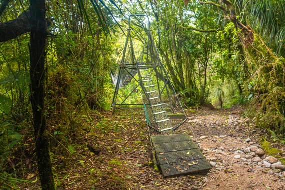 |
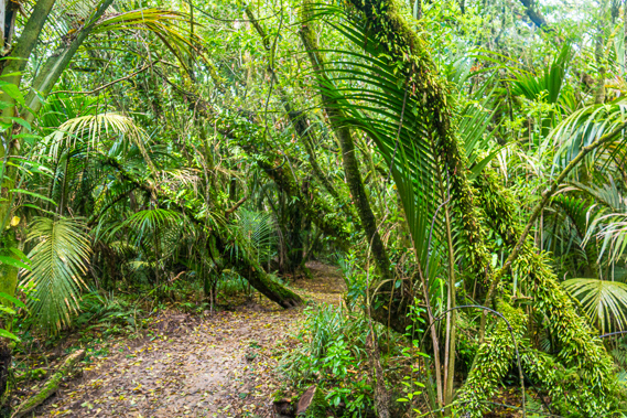
13:57 - Gnarly trees and supplejack make the forest impenetrable if it were not for the gravelled track. Ahead through the dense forest I can see a steel swing bridge. The main track passes the bridge dropping to a ford, but given the rivers are high I decide to take the swing bridge today.
|
 |
13:59 - The bridge leads over the Murray Stream, somewhere near where an airstrip was once built. It has long gone with the forest having reclaimed the land now. The Murray Stream was named after Mr Murray, the government surveyor who completed the survey of the track to the Heaphy River in 1887, six years before the original track opened. The steps up to the swing bridge are very steep and awkward in my wet boots, but it is a fairly easy crossing above the deeply ochre coloured stream before a steep descent on the other side into the dark forest. The stream is full of large granite boulders, having washed down from the mountains above the limestone. |
 |
14:23 - I pass a bank where delicate filmy ferns are growing. The dense forest is becoming even more gnarly and dense. There is only the occasional glimpse of the river now flowing quite swiftly towards the sea. On this bluff I meet a cheery older man and his family in tow having come from James Mackay Hut today. They are only about an hour away from the Heaphy Hut now.
|
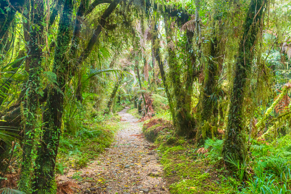 |
14:29 - Thick carpets of sphagnum moss cover the forest floor making the granite gravel covered track very easy to follow. Apparently kiwis can still be heard here in the bush at night, but sightings are rare. They are more common further along the track.
|
 |
14:33 - Following a long straight section of track, a small sign at the end points to the left saying bridge. When I turn the corner I see the large wooden swing bridge crossing the Gunner River. |
 |
14:34 - The Gunner River is quite significant, carrying perhaps a third of the Heaphy River’s water. The deep channel of ochre coloured water flows between banks of sand and stones brought down from past floods. It is equal in volume to the Kohaihai River yesterday, but only from being swollen from yesterday afternoon's rain. The river comes down a fairly straight valley from the distant cloud covered Gunner Downs, a large plateau behind the coastal section completed yesterday. The valley is long and straight, with tall bluffs of forested limestone towering on either side.
|
 |
14:35 - A hundred metres downstream from the bridge the Gunner flows into the Heaphy. I imagine there would be a lot of caves in the huge bluffs as there had been downstream. Beyond the bridge the track crosses the forested flat for a while following the moderately flowing Heaphy River upstream. The Iwituaroa Range is significantly higher now with the coast on the other side being a lot further away.
|
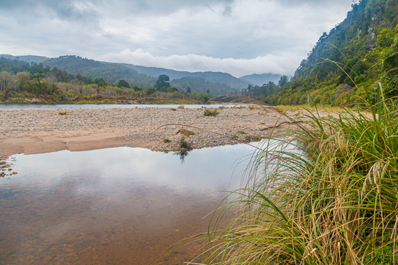 |
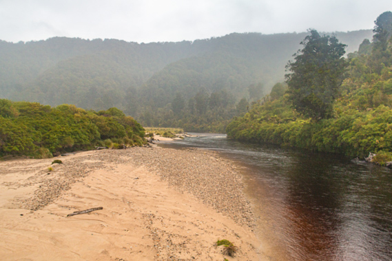
14:57 - The sun has briefly come out further downstream, but now the cloud completely covers the sky. Although the clouds are above all the hills I can see, they are beginning to thicken up again. Perhaps the rain is going to return. The track reaches the sand bar at the edge of the Heaphy River. This is the site of the original ford over the Heaphy River. Once across the river the track followed the base of the Iwituaroa Range upstream to the Lewis River where I will be reaching later. The modern track continues up this side of the river thankfully as the ford looks quite deep from here.
|
 |
15:36 - The track continues across the flat at the mouth of the river passing very gnarly trees covered in dense ecosystems of epiphytes. When I reach the end of the flat area of the Gunner River, the track rises across a large bluff though the vegetation is too thick for any views of the river below.
|
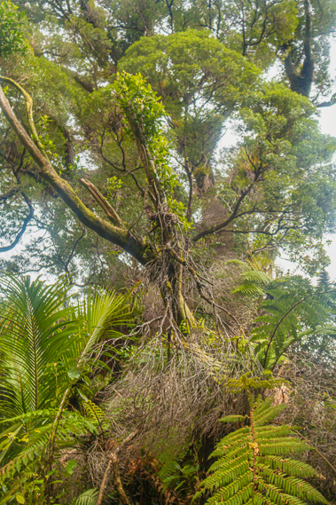 |
15:42 - The track zig-zags down the other side of the bluff to a large flat area of old forest. Ahead is an enormous Northern Rata tree standing a good thirty, perhaps forty metres high. The tree has its own forest ecosystem of epiphytes growing on its high branches. |
 |
15:44 - The trunk of the tree has multiple stems, like the braids of a rope. They drop down into the ground beside a small creek running over the surface. The trunk of this enormous tree is over two metres diameter.
|
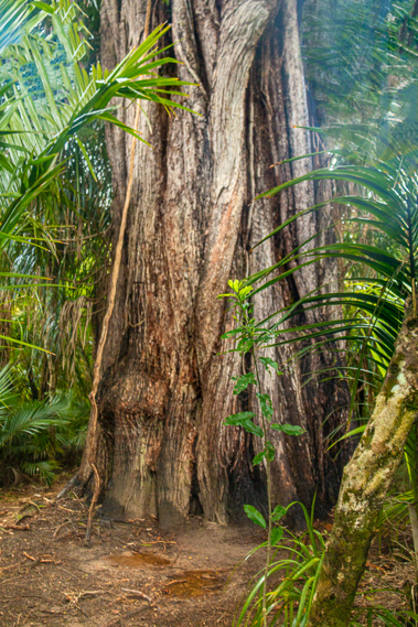 |
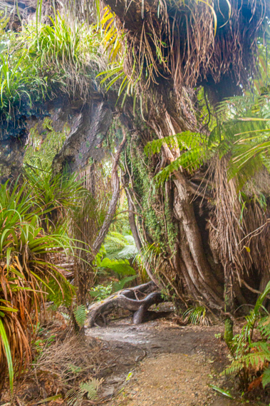
15:47 - I continue following the track for a few minutes before passing an equally enormous rata tree, towering high above the rest of the forest. Its multiple trunks wrap around each other very tightly until branching off into the branches holding up the canopy. |
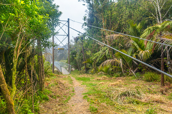 |
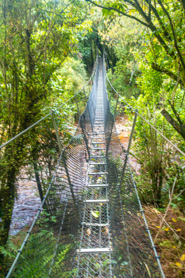
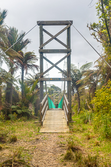
15:50 - A few minutes later the track turns into the entrance of a huge wooden swing bridge crossing the Heaphy River. A sign half way up the enormous columns holding up the suspension wires say the bridge was built in 2012 and there is a limit of ten people. |
 |
15:51 - I start crossing the 149 metre long bridge. The three previous times I have crossed the river to Lewis Hut were long before this bridge had been erected. This bridge crosses over a very deep pool with submerged sand banks brought down in recent floods. The river heads straight towards a large bluff. To the right of the bluff the Lewis River flows swiftly into the main river. The Lewis River is a shallow river of perhaps a tenth the capacity of the Heaphy. The rivers join and flowed down a rapid to the left hand side of the bluff. |
 |
15:53 - The previous time I had crossed the river twenty years ago had been over two narrow metal swing bridges with the capacity of only one person each. The first swing bridge had crossed the Heaphy River over the rapid I could see downstream. Then the track would traverse the bluff and cross the Lewis River over a second swing bridge. These have been replaced with the new bridge. The old track would have completely missed the two giant rata trees. Drizzle starts falling when I am about half way across the bridge. The surrounding hills have become shrouded in a very fine mist. I hurry across the rest of the bridge and follow the track for another two hundred metres before reaching Lewis Hut, where I will be spending the night.
|
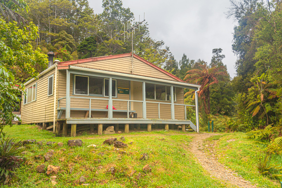 |
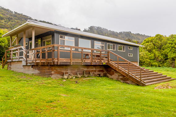
15:59 - The Lewis Hut is about half the size and much older than the Heaphy Hut, but it is still perfectly solid and functional. It was conveniently located just above the junction of the Heaphy and Lewis Rivers at the start of the long climb to the plateaus of the Mackay and Gouland Downs. For people hiking the other way, it marks the end of the long descent from Mackay Downs. A small porch with a bench along the outside wall gives a nice vantage point to watch the bubbling waters of the Lewis River flow past. At the start of the porch is a wooden door with a dodgy handle on it. The mechanism is on its way out but still functional with a bit of fiddling.
|
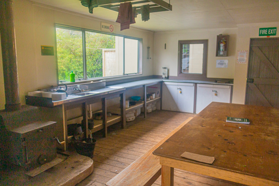 |
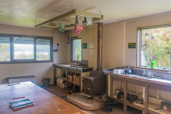
16:00 - The door leads into the main room occupying about half of the hut. Along the western wall are the benches with a couple of sinks, the gas cooker and a fire stove. A huge wooden table occupies the other side of the room. It has a much more homely feel of character than the Heaphy Hut. Two bunk rooms occupy the right hand side of the hut. Being the first to arrive here I have first choice, so I take a bottom bunk in the front room. It has dirty windows covered in cobwebs and sandflies looking out over the river with the two giant rata trees clearly visible on the other side. Most people walking the track in four days would stay at the Perry Saddle, James Mackay and Heaphy Huts. Those taking three days (usually the cyclists during the winter season) would generally stay in the Gouland Downs and Lewis Huts. The cycling season finished about a month ago, so I wonder if anyone else will be staying here tonight. I have stayed here once before. The first time I walked the track from end to end I took three days. The first day took me from Kohaihai to here, where I arrived late one sunny afternoon and camped in my old tent. It was fairly uneventful though battling the sand flies but the hut had been full as it was the middle of the peak season. I needed a good night’s sleep to hike the distance of three huts to Gouland Downs Hut, before heading out the following day and hitching across Golden Bay to start the two Abel Tasman tracks over the following week.
|
 |
16:01 - The Lewis Hut is named after Charles Lewis, an English born surveyor who grew up in Nelson and was educated to be a surveyor like his father and two brothers. His father had surveyed the town of Collingwood and discovered Lewis Pass, what is now the main highway across the Southern Alps between Nelson and Christchurch. In 1882, aged 32 he prepared the sketch plans for a proposed stock route between Collingwood and the Heaphy River, The stock route became a reality eleven years later. In 1883 he and two friends followed the proposed route of the Heaphy Track having crossed over from Takaka down the Karamea River. The round trip was supposed to have taken three weeks, but after five he had arrived only in Collingwood very much the worse for wear and decidedly thin. The track was built over the following years, and continued to maintain a strong interest in the area. During the 1880s he planned a road to follow the line of the track. His vision never took off though, but over a century later still surfaces occasionally. In 1917 he at age 67 took up land in the Heaphy Valley to farm, and to maintain the Heaphy Hut. He took on the land with a view that his sons would develop it, but the County Council rejected the proposal and it fell through. Charles continued to work on the track until aged 70 in 1921. He had worked for many years in the extreme hardships of constant rainy weather. Six years later in 1927 he constructed the first Lewis Hut at the present location at the sandfly infested junction of the Heaphy and Lewis Rivers. He died in 1935 aged 85. The original hut burnt down in 1930. The site remained vacant until a new hut was built by George Ray and Athol Newman in 1938. This remained standing until the current 20 bunk hut was built in 1965 by the New Zealand Forest Service shortly after having taken over jurisdiction of the track and forming the North West Nelson Forest Park.
|
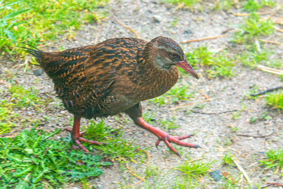 |
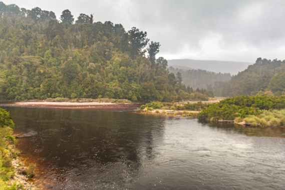
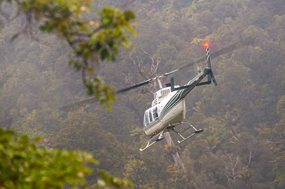
16:20 - A large fat weka is now hanging around the entrance of the hut. There had been one at the Heaphy Hut as well. I don’t have anything for it to eat though. It’s never a good idea feeding natural wildlife as they become too dependent on humans losing their natural hunter-gatherer instincts and end up getting rather fat like this weka. In the distance I hear a helicopter rumbling down the valley. The thumping sound gradually increases. It is heading this way. I had heard a helicopter go up the valley just before reaching Gunner River. Given the enormous distance between the two ends of the track, a lot of people go to one end, get a helicopter to the other end before walking back. That’s quite an expensive option out of my budget. Looking out the window I see across the nearby Lewis River, and over to the Heaphy River, both flowing quite swiftly. The rivers have been known to flood right up to the hut and even above floor level in the past. Fortunately they are both well contained despite yesterday’s rain. |
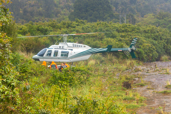 |
16:39 - I can now see the helicopter flying low above the river. It slows down and briefly hovers over a point about a hundred metres away before slowly descending. Several people in bright coloured clothing unload some gear, then huddle low near the helicopter before it takes off and heads back downstream. Once the helicopter leaves the people on the ground get up and start carrying the two large plastic bins towards the hut. The four young ladies are DOC workers based in Hokitika about 250 kilometres down the coast. After we all introduce ourselves they explain they were part of the possum and stoat baiting program. Their role is to leave out small wooden boards covered in peanut butter. They will return a week or two later to look for footprints on them, reporting their findings and where they had been discovered. The DOC office analyses the results determining the areas that need controlling before another team goes out and sets baits and traps to capture them.
|
 |
16:40 - New Zealand’s biota is very different to the rest of the world before humans arrived. Having been isolated from the rest of Gondwanaland since before the dinosaurs died out, and as the continent almost completely submerged around 20 million years ago, New Zealand evolved a biological ecosystem totally unlike that anywhere else on Earth. There were no mammals apart from a couple of tiny varieties of rare bat. The Maori brought some creatures with them and quickly wiped out the moa, but otherwise didn’t cause significant damage here. It was when the Europeans arrived bringing their mammals and releasing them to the wild to hunt that the real damage began. Now there are huge populations of Australian possum and stoat. There are no natural predators for them here, so their populations have exploded completely out of control. In recent years the forests have been silent as there are almost no birds left. The work that the DOC workers are doing is finally showing some fruition with the gradual increase in birdsong. Perhaps in another decade or two the chorus of birds that used to fill the forests will be fully restored.
|
 |
18:21 - The newest lady from DOC who had only started a couple of weeks ago begins to cook dinner from all the food they had brought in their plastic bins. The other three leave the hut to explore the river to find the best way to visit the lines they had previously set up. Shortly after they leave, a young fellow arrives. Chris is on a gap year from Byron Bay, Australia arrives with a vacuum cleaner tube strapped to his backpack which he uses as a digeridoo. He has hiked from Gouland Downs today having started the track after hitching across Golden Bay after completing the Abel Tasman Coast Track. He wanted an early start to hitch out from the end of the track down the West Coast to Queenstown to look for work in a bar as he was running out of money. After a half hour rest in the hut Chris leaves aiming for Heaphy Hut tonight. It will almost be dark when he arrives.
|
 |
18:24 - It is not long before the three ladies return. Yesterday's heavy rain has raised the river a lot higher than usual. It is normally knee deep but a lot deeper today. This was causing concern as they explained the new lady who has only started a few weeks ago is only allowed to cross rivers up to waist deep. The river is a lot deeper than that today. They had found an easy crossing to a small island, but the water in the next channel was over their heads. That wasn’t a problem for the other three apparently – they would just swim across. With their new member they will have to wait until the water levels drop and focus on the lines on this side of the river. Hopefully the river drop enough to access and work the affected lines before they fly out on Saturday. The work out here will be very exhausting, constantly crossing the cold rivers and traverse the extremely dense forest and limestone karst this area is legendary for. I return to my bunk room to start looking for something to cook for dinner. When I came back out the ladies tell me they have cooked far too much dinner and that I am more than welcome to help myself to it. Their plates are all piled high with the curry stew and rice they have cooked, but there is twice as much again still sitting in the pots. I am more than happy to oblige. As we eat the sky outside darkens. We all turn in shortly after dinner. I have the front bunkroom to myself tonight, although about an hour later I hear the heavy clunking sound of a man’s boots striding the porch outside, but it doesn’t last long at all. Whoever is was out there has obviously made the crazy decision to continue on his travels in the darkness of this drizzly night.
|
|