Introduction to today's journey
If you are looking down while you are walking it is better to walk up the hill - the ground is nearer.
- Gertrude Stein
JAMES Mackay was a farmer in Golden Bay. By 1856 his land was overstoked so with a travel companion, explored the upper Aorere River to find more pasture. Upon not finding any, they followed an old Maori trail into the mountains to reach the large open area known as Gouland Downs. He continued westward to what is now Mackay Downs. They are believed to have been the first Europeans to explore these 16,000 acres of highland plain. They reached a point near the current hut where they could see down the Wakapouai (Heaphy) River to its mouth where Charles Heaphy and Brunner had crossed ten years earlier. Mackay returned here in 1860 after become the magistrate of Collingwoood and been sent to purchase the 7,500,000 acre West Coast from Kahurangi Point to Milford Sound from the Maori people for
just 300 pounds. He built a track through here to assist travellers hiking up to Golden Bay during the gold rush.
Today's trek follows the ridge between the Heaphy and Lewis Rivers, moderately rising over seven hundred metres to the start of the Mackay Downs. The forest changes dramatically from dense rainforest to heathland scrub before the welcome arrival at the brand new James Mackay Hut.
Today's Journey
Distance trekked today: 12.5 kilometres.
Total distance trekked to date: 39.2 kilometres.
 |
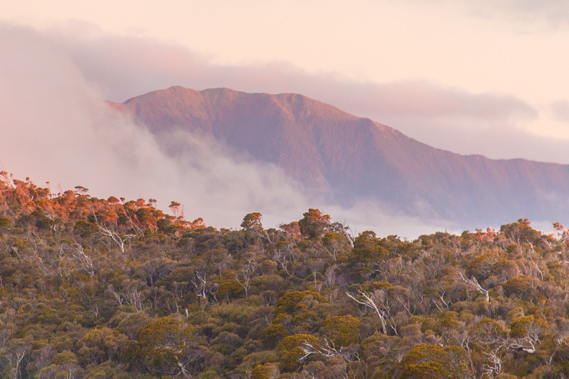
07:38 - The morning dawns drizzly. Thick mist hangs about fifty metres above the river draping the hills. The hut is silent as I quickly pack up and have breakfast. The young ladies in the room next door just begin to rise as I leave. Fortunately the mist is quickly rising and the drizzle has stopped falling. I quickly check outside my boots are still there, hoping the curious weka hasn’t taken them overnight. Fortunately they are where I had left them. Sadly they are still very wet following the past two days of hiking through wet and swampy conditions. I hope now I am heading up the ridge towards the downs the air up there will be a lot dryer allowing them to finally dry out. The dawn sun briefly attempts to come out, but to no avail. It will be a while before the sky clears – if at all today. I slip on my wet boots and heavy backpack, and head off. |
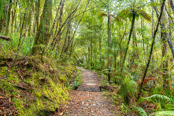 |
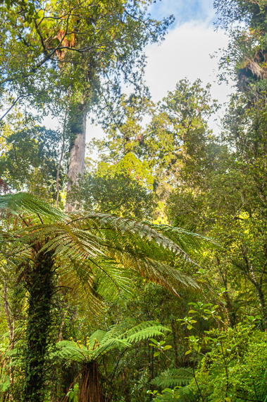
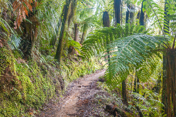
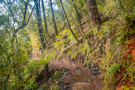
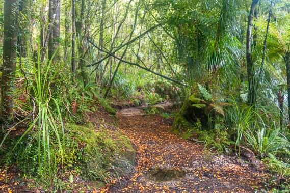
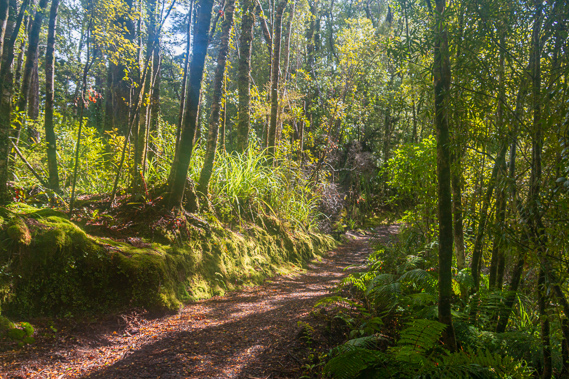
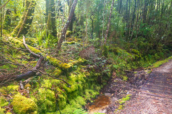
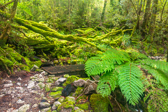
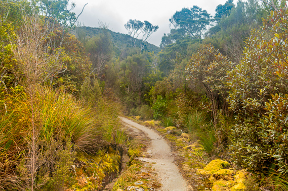
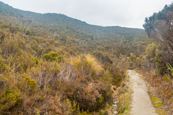
07:56 - The wide track begins a gradual ascent immediately outside the door. It is flat and covered in gravel. I recall the times I have previously hiked this section of the track where cut branches covered across the track the entire distance up to the James Mackay Hut. This had been to prevent the track from getting muddy, but it made for very difficult and uneven walking. This section of the track has since been levelled off and covered in gravel to make for easy walking. The forest is very different here to what it had been on the other side of the river. There are almost no nikau palms on this side of the river, and I don’t see any rata trees either. The forest here is a mixture of beech and rimu, with the occasional stand of tree ferns. Crown ferns cover the forest floor. Thick carpets of sphagnum moss cover the bank on the left hand side of the track. To the right the track drops off through the forest towards the river.
|
 |
07:57 - James Mackay Hut is twelve and a half kilometres away, with a steady rise of around seven hundred metres. The track closely follows one of the two Maori trails that once led from the Heaphy River over the mountains to Golden Bay. The first of these trails had departed what is now the main track at Gunner River, following it upstream, before gradually ascending around the back of the headwaters of the Heaphy River to meet the new track again somewhere near Perry Saddle. Although that had been the main Maori route, it has been lost with becoming overgrown with vegetation over the past two centuries since it was abandoned. |
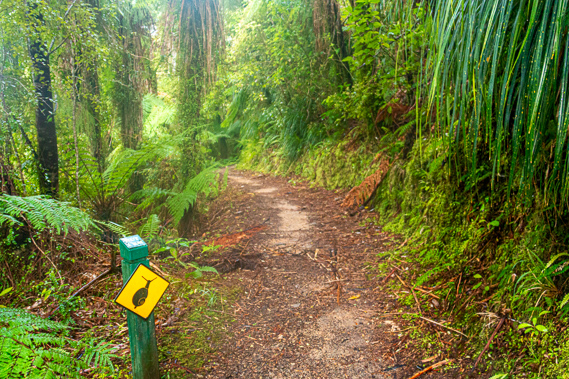 |
08:12 - The other old Maori track closely followed the route of the current track, and is believed to be the one the early explorers followed when travelling between the West Coast and Golden Bay. The Maoris preferred the other track as this route involved a deep crossing of the Heaphy River as opposed to the shallow crossing of the smaller Gunner River. The track rises in a gentle grade along the side of the ridge separating the Heaphy and Lewis Rivers. It is very quiet here with no sound from the river, and only the occasional birdcall. There doesn’t seem to be too many birds in this part of the forest. The ladies at the hut have their work cut out for them to bring the birdsong back. I recall a couple of decades ago the early morning chorus of birds here was almost deafening. I pass the sign marking one kilometre back to the track, with an alert of snails in the area. The moss along the side of the track is very healthy and lush, thriving in this humid valley.
|
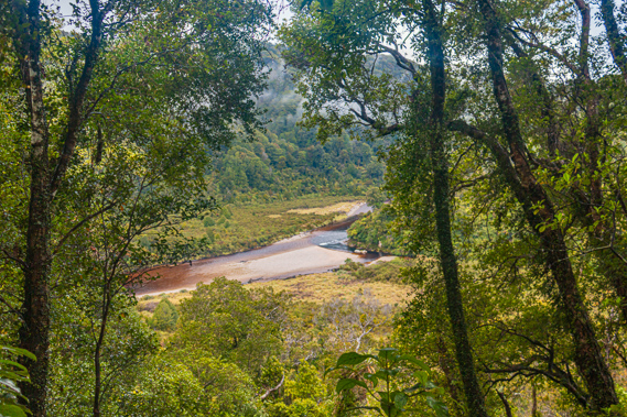 |
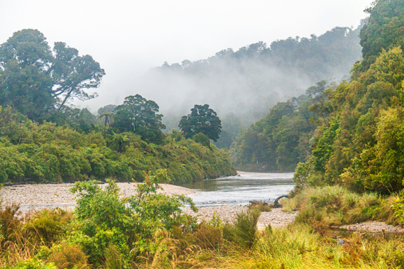
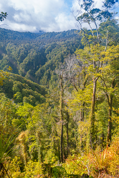
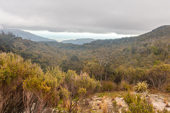
08:17 - It is not long after leaving the hut that the rimu trees growing on the ridge become enormously tall. Aside from the track itself this part of the forest is preserved in its original condition, with the huge rainforest rimu trees and their distinctive leaves of small pine needles growing out from branches from their enormous trunks. These trees are many hundreds of years old, predating the original Maori settlement at the mouth of the river. The rain has stopped falling and now the sun is coming out through gaps in the clouds. Through a small clearing in the canopy I see the other side of the valley with thick wisps of cloud still clinging to the sides of the hills as the overhead cloud starts clearing. Looking down I see the bottom of the valley already nearly a hundred metres below me. The Heaphy River flows in two channels around a large shingle bank in the middle of a scrubby flat before heading through a narrow gorge. Regular gorges such as this explain why the track follows the ridge from Lewis Hut.
|
 |
08:28 - Perhaps it is going to clear after all. Mottled light shows through the forest brightly shining through the drops hanging on the foliage brilliant as liquid diamonds. The sun filters through the canopy producing a faint haze rising from the forest humus. This gives the distinctive smell of healthy forest soil working its magic in sustaining the huge forest draping this vast wilderness.
|
 |
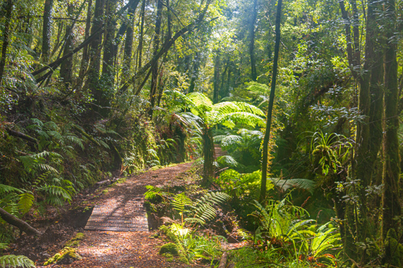
08:36 - Misty cloud covers the forest again. I pass through a thick grove of tree ferns. There will not be many tree ferns as I continue gaining altitude. They only grow in the relatively temperate climes of the lower altitudes.
|
 |
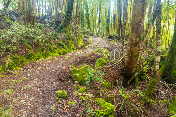
08:38 - The track becomes a little rougher as it negotiates its way around a steep part of the ridge. It is still covered in gravel though. There is no sign of the logs across the track that I had walked on during previous trips up and down this ridge. I reach a grove at the back of a gully where a couple of large nikau palm trees – the last ones I would see on this trip.
|
 |
08:42 - The track follows around another steep bluff before going into another gully where the sun came out again. Here an enormous tree has fallen snapped off about two metres above the ground. The entire trunk that remains had been splintered off. It would have been very dramatic watching this tree fall – most likely during Cyclone Ita last year. Fortunately the track has been cleared since the tree had come down. |
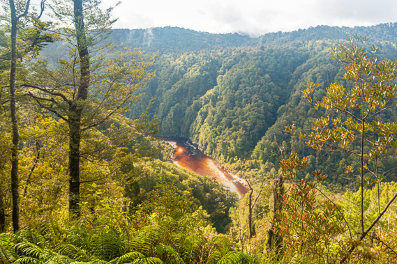 |
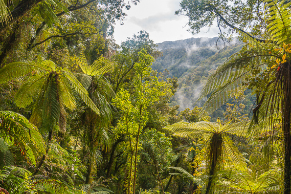
09:02 - The bright sunlight now shines through the translucent mountain beech tree leaves creating quite an ethereal effect in the forest. The mist has all but dissipated from both sides of the valley with the cloud cover now at a good five hundred to a thousand metres. Where the track passes over an old landslide there are spectacular views down to the river now quite a long way below. The ochre colour shows the variable depth of the river, black in the very deep gorge corners, and very pale in the shallows swiftly running over the wide gravel banks. |
 |
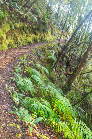
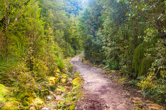
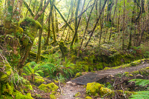
09:08 - The bank on the left hand side of the track becomes separated from the flat track surface by a deep channel and the occasional small bridge or culvert allowing for efficient drainage during rain. I remember the first time I walked this track a mechanical digger was digging out the channel. Before the channel was excavated and before the small logs had been placed on the track, this section would have been very muddy making for slow progress. With the addition of the channel twenty years ago and with adding the gravel about three years ago the trip is now relatively straight forward - if only my boots were a little drier. |
 |
09:10 - The morning has been very quiet so far, but suddenly ahead of me I see a middle aged man briskly heading down the track from James Mackay having had an equally early start as me. At this pace he will arrive at the Heaphy Hut in the late morning to early afternoon. Despite being in an obvious hurry he does briefly stop and introduce himself seeing my large camera. He mentioned he was with a party of ladies who had left James Mackay with him earlier and were going at their own pace behind him. After our chat he set off heading further down the hill towards Lewis Hut for morning tea.
|
 |
09:36 - At one point the track runs almost right on top of the ridge. It was carefully surveyed to go around the hills and stay just under the saddles to provide an even ascent. Most tracks climbing ridges just go over the hills creating a lot of ups and downs. This is a lot more even having been surveyed as a future highway. As the track goes out onto a spur, the rimu trees are largely replaced with moss covered beech trees, indicating what is to come at the higher altitudes. Back in the sheltered gullies the beech trees are replaced with rimu. Ahead of me are the ladies I am expecting. They are heading down at a steady pace admiring the scenery. I mention having met their other party member earlier and he will be about half an hour ahead of them.
|
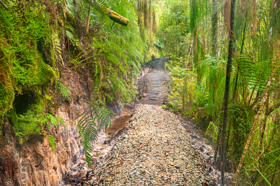 |
09:51 - Shortly afterwards I reach a point where the gravel on the track suddenly turns black. A thick layer of the bank beside the track is also black. I realise this is a seam of coal. Coal occurs naturally along much of the West Coast, indicating the location of past swamps, now uplifted with the rising of the Southern Alps. At some point over the last twenty million years when modern New Zealand was rising out of the sea, the large area between the fault line and the old island was an enormous swampland containing the vegetation of the Gondwana remnant. This is just one of many coal seams left from these past swamps as the Tasman Mountains were pushed upwards. |
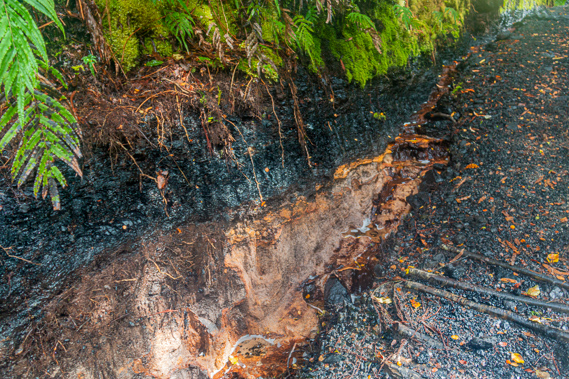 |
09:52 - There are a lot of coal mines along the South Island West Coast. Mining has been a huge industry here over the years, though in recent decades this has seen a significant decline. Fortunately this area is protected forever by national park. Some groups argue that these areas should be opened up for mining as the Kahurangi National Park in particular has enormous reserves of precious minerals. I was heading towards the Aorere River, the base of a gold rush in the 1800s. Over the past century there has been exploration done with a lot of valuable mineral resources being discovered. There are also a few old mines of tin and asbestos now protected within the confines of the park. There are a lot of valuable minerals here, but they have all been protected. Fortunately this coal seam will remain here forever untouched like the rest of the park. |
 |
10:32 - There is no clearly defined point on the track where the lowland rimu forest changes to the mountain beech forest typical of the higher altitudes throughout New Zealand. The transition happens gradually with the moss covered beech appearing around the end of each spur only to return to rimu forest when back in the shelter of the gullies. I do notice with the increase in altitude the ratio between beech on the ridges and rimu in the gullies increases, so there is no obvious location where the subtropical microclimate ends and the mountain heathland begins. In the occasional small viewpoint between gaps in the trees I see another ridge rising below me. This ridge forms part of a fault line that follows the northern side of the Heaphy River all the way downstream to Heaphy Bluff. I now realise Lewis Hut is perhaps just a hundred metres away from this fault line, and Heaphy Hut is a couple of hundred metres across the river from where it reaches the sea.
|
 |
10:42 - The river follows this fault line up to this point, eroding into the weakness caused by the fracture between the mountain blocks as they rose out of the ocean. From here the river bends inland towards its headwaters off the Gouland Range. The fault line follows Deception Creek, one of the tributaries of the Heaphy River. The forested ridge that gradually rises on the other side of Deception Creek now obscures the Heaphy River, so although I will continue to be hiking within the catchment of the river, I do not see the main river again this trip.
|
 |
10:43 - At this point Deception Creek is hundreds of metres below and hidden deep in the rimu forest. The track follows the top of the ridge above the creek at a lesser gradient until eventually the creek reaches the same altitude as the track, but that won’t happen until tomorrow morning when I cross the fault line. The terrain levels off again as the track is almost at the top of a saddle on the range. The sun now shines brightly through the increasing gaps in the clouds, emphasising the thick carpets of moss growing along the sides of the track.
|
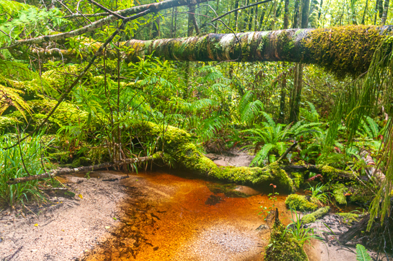 |
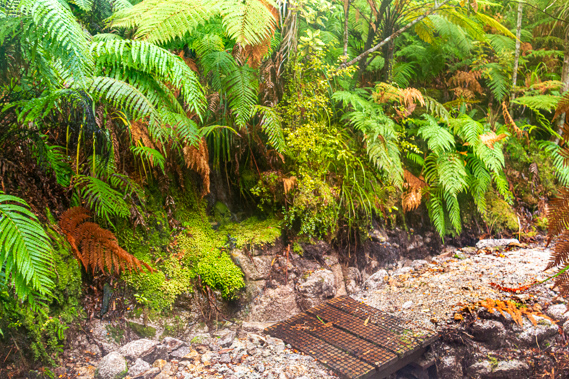
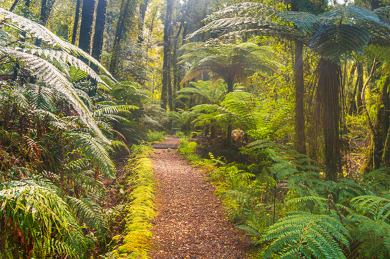
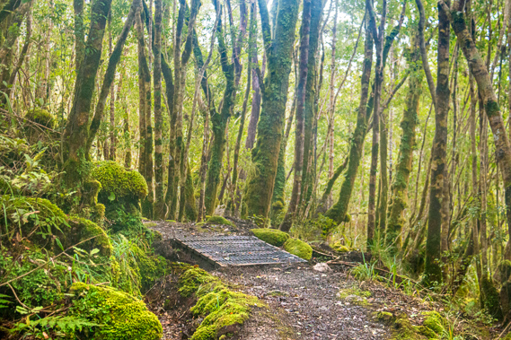
10:55 - Ferns now dominate the undergrowth and the middle canopy as the beech trees stand taller. The tree trunks are now covered in thick moss. The occasional small stream crosses the track, going under small well constructed bridges. The water channels expose the white granite rock in stark contrast to the almost black soil and bright green moss that covers everything else. The water is ochre coloured but otherwise looking very clean. Dead trees have fallen over each stream. These are covered in carpets of beautiful moss looking fresh and invigorated by the recent rain. |
 |
11:14 - In between the streams fallen logs and the broken trunks are all covered in thick moss. The remains of trunks still sitting in the ground appear mysterious with their rounded heads of moss growing on top of them. It is almost as if they are tiny sentinels watching over the forest floor. |
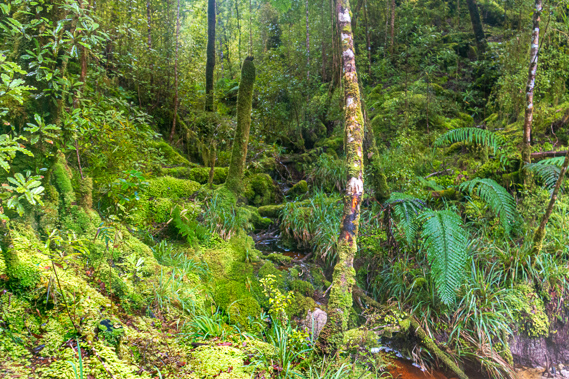 |
11:28 - Most of the moss is green, but upon closer inspection I see some patches of the moss are almost white, and other patches are a pale orange colour. There is a lot of variety in the colouring indicating there is a lot more going on here than just a static green carpet. It is a very dynamic ecosystem supporting a huge variety of tiny bugs and worms working the soil for the forest. The elusive giant native snails eat the worms asserting their place at the top of the food chain. |
 |
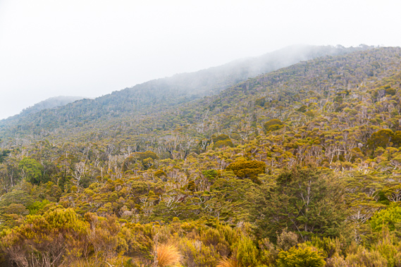
11:44 - The tall beech trees begin to stunt and become scrubby as I continue gaining altitude. I realise I have not seen any rimu for quite a while now. The forest undergrowth has become a lot thicker. Earlier I was able to see a long way through the forest with the canopy providing lots of shade to stunt the undergrowth. The overhead canopy has gone now and I can hardly see more than a metre on either side of the track.
|
 |
12:04 - The forest becomes taller again in a gully and the undergrowth subsequently thins enough for me to once more see through it. The mysterious moss covered forest continues for some time with the occasional echo of some mysterious birds calling unseen in the forest. |
 |
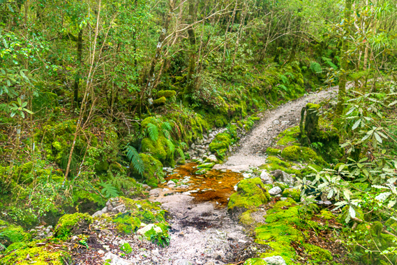
12:21 - More small streams flow under bridges across the track in each gully. The streams are all ochre coloured from tannin stains, but otherwise crystal clear. The occasional small tree fern grows in the shelter of these gullies. |
 |
12:33 - I found another small seam of coal indicating another part of the prehistoric swamp that had once been here before the fault line I was following has lifted this block up to its current altitude. |
 |
12:38 - The forest suddenly turns to thick scrub again. The air was definitely cooler up here having gained over half a kilometre of elevation since leaving the hut this morning. I see a couple of logs poking up either side of the gravel that had once been part of the endless row of logs crossing the track the entire way between the huts.
|
 |
13:18 - The track is otherwise very smooth and covered in granite sand, replacing the leaf litter. logs and mud of the previous hikes through here. The scrub is only three metres tall and consists of subalpine plants. The ridge continues rising to the left towards some rounded hills at the top of the ridge I have been following. A tiny square wooden sign hanging off a branch beside the track says the hut is two kilometres away. Thankfully I am near the top of the climb onto Mackay Downs.
|
 |
13:29 - The moss that was earlier bright green is now in various shades of greenish brown, most likely due to the exposed sun around this area. That being said the sky has completely clouded over again though the cloud is a little above the surrounding hills. The cloud is sitting at about a thousand metres above sea level. |
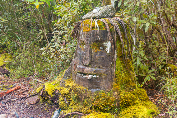 |
13:32 - I round a corner where another sign says there is one kilometre to go to the hut. The scrub is quite tall here, but there are two old tree stumps beside the track. These stumps are decorated to look like faces, having a very Pacific Island look with eyes, nose and mouth chainsawed into them, small stones inserted into the mouth as teeth and some strips of vegetation on top of the head held down by a rock for its hair. The sides, base and back of the stumps are covered in naturally growing moss looking like a flowing beard. |
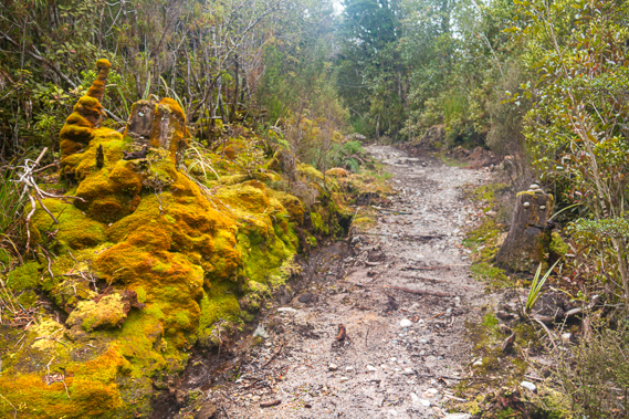 |
13:33 - The moss on the other side of the track is some of the most spectacular I have seen so far. Perhaps the combination of the altitude and high rainfall in the clearing of the track provides perfect conditions here. The scrub continues to thin out and as the terrain levels, much of the undergrowth turns to flax, not the harakeke I had seen along the coast, but a smaller alpine variety the Maori call wharariki, Although these plants are called flax, they are not related to the flax varieties of the northern hemisphere. New Zealand flax is a type of lilly. These are sometimes found along rugged coastlines – I had seen a few the other day, but they are almost non-existent along the lowlands where the Maori lived, so this variety wouldn’t have been utilised as much as the harakeke. |
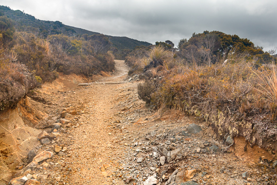 |
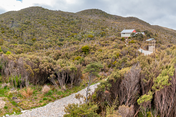
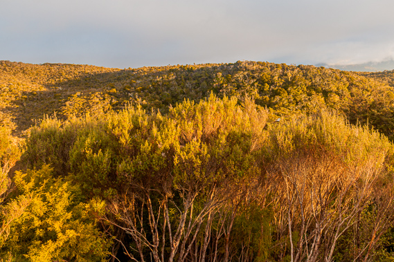
13:49 - The scrub is very fine leafed. There are almost no broadleaf plants up here. The scrub is various shades of brown and yellow, indicating the harsh climate. The scrub gradually lowers so most plants are only about a metre high. The track is wide creating a huge scar through the granite where past storms have eroded quite a channel into the granite soil. In clearer area tufts of red tussock grow. In just a few short hours the vegetation has changed enormously from subtropical forest to subalpine heath in the seven hundred metres I have ascended from the junction of the Lewis and Heaphy Rivers today. The trail levels off in a scrubby valley marking the start of the Mackay Downs. I see the James Mackay hut emerging from desolate scrub above me. The track reaches a cross junction. A short side track leads a little downhill to a helipad on the last patch of flat land before it drops into Deception Creek hidden in the scrubby bush just a few metres further below. The main track continues ahead across the downs having reached the top of a small saddle. To the right a broad track leads straight up the gradual spur towards the hut.
|
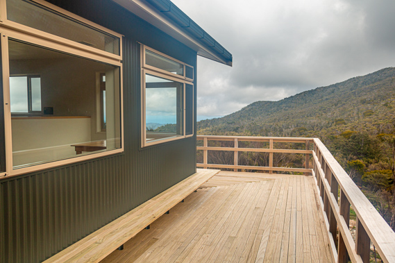 |
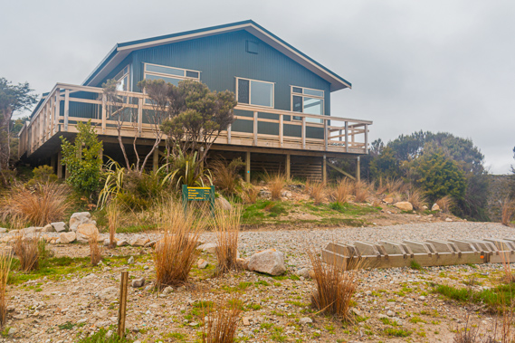
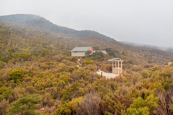
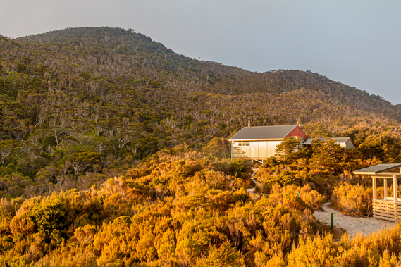
13:58 - The track goes around the front of the huge hut where a massive verandah extends out overhead. Below the verandah is a large wooden bike rack. There are no bikes on it today now that the cycling season is well past, but I imagine during winter it would fill pretty quickly. The track continues up the hill towards a campsite and to the ranger’s hut standing about two hundred metres further up the spur under the scrub covered Otepo Hill. The hill towers about a hundred metres above the valley. I walk around the back of the hut up to the main entrance. A sign indicates the hut is 700 metres above sea level – 680 higher than the Lewis Hut. It was built exactly one year ago in November 2014.
|
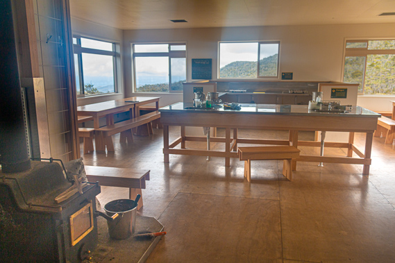 |
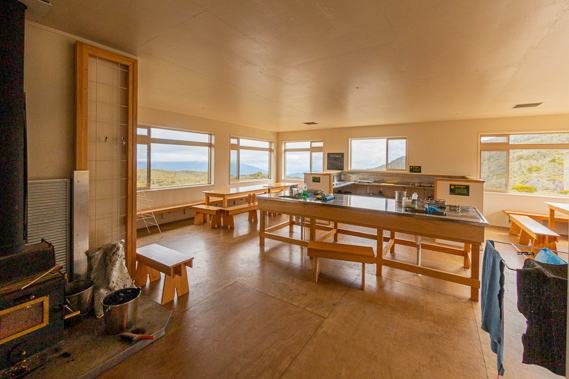
14:00 - I am the first to arrive at the enormous hut. It still smells of new timber and paint and is in immaculate condition. It feels more like a luxury resort than a tramping hut. The main entrance opens to a mud room just like the one at Heaphy Hut. I enter the extremely clean mud room and remove my boots, which are mostly dry. That’s a big relief. |
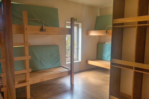 |
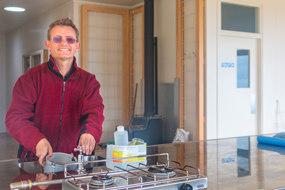
14:01 - A short hallway leads from the main room to four small bunkrooms. I enter the nearest bunk room and set up my bed. A small wood burner is just inside the main entrance followed by a large preparation area with several sinks and gas cookers. On either side of the preparation area is a large wooden table with benches with windows giving a spectacular view down the Heaphy River towards the coast. There is a set of two flush toilets attached to the main building so you can go outside without getting exposed too much to the elements. These are the newest and cleanest toilets I have ever seen on a hiking trail. Overall the hut is better accommodated than many hotels I have stayed in over the years.
|
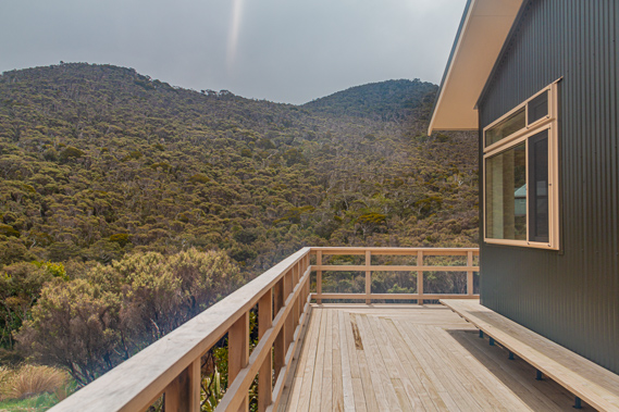 |
14:04 - I head out to the large wooden verandah. The views from here are stunning. The hut is high enough above the scrub to get clear views all around. To the right stands a range rising a hundred metres high, Otepo being the highest hill. The ranger’s hut stands on the ridge a little further up the hill. Looking from the front of the hut I see over the edge of the Mackay Downs down to the very end of the Heaphy River from where the last bluffs jut out over the river. Extending past the bluff is the long sand bank covered in driftwood that I had explored yesterday morning. I just see the flat near the end of the river where the Heaphy Hut stands, but the hut itself is too far back into the hill to be visible from here. |
 |
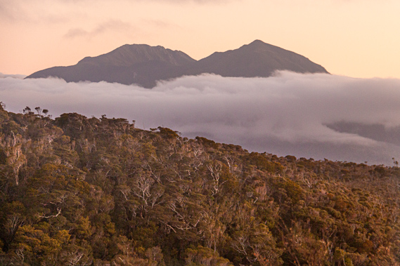
14:07 - A thick layer of cloud covers overhead down to about nine hundred metres above sea level. It is very close to me but still has enough clarity for me to see out to the bright blue sea. The end of the Iwituaroa Range and hills behind the Heaphy Hut are sunny, indicating the sky is clear out there with the cloud just lingering around the mountains. If this was the case it would be highly likely the cloud will clear when night sets in. Hungry from my hike up the hill I cook a late lunch.
|
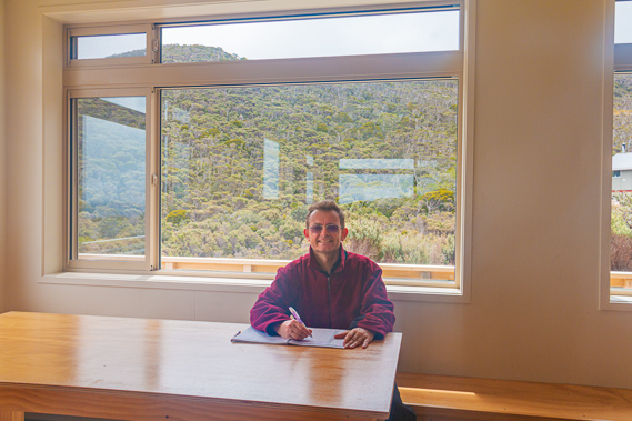 |
14:49 - Once cooked I settle at one of the big dining room tables and read a large folder of information on the history of the track. It provides an in-depth historical record of the track, along with survey maps of the Heaphy River and coast from the early 1900s. After reading it I fill in the intentions book. |
 |
15:03 - The remote Mackay Downs finally gained protection in 1966 when the North West Nelson Forest Park was established. The downs were just a small part of this park. At the time there were strong calls for the Heaphy Track to be improved and new huts built to encourage more people to use the track and explore the area. The following year in 1967 the original 16 bunk James Mackay Hut was built. I had camped near in the old hut in early 1996 when I last completed the track coming the other way. Construction of the new hut started about a year and a half ago on 7 April 2014. The builder’s logs recorded this day as “the day the rain started”. This was the beginning of Cyclone Ita which would have severely ravaged this exposed area. Somehow the builders managed to cope with the cyclone in this most exposed location. The bad weather didn’t completely clear with the cyclone. It marked the start of what would be the worst winter weather on record. Despite all the severe weather delaying the schedule, the hut was completed in October ready for the opening in November.
|
 |
15:20 - All the materials and the project team had to be airlifted in by helicopter from Brown Hut at the far end of the track. Once the new hut was built, the old one was dismantled and the parts were taken out by helicopter. The James Mackay was the last of the three main huts to be rebuilt. At this stage there are no plans to upgrade any of the other huts in the foreseeable future. They are all in excellent condition.
|
 |
15:36 - The hut was named after James Mackay. History records in 1860 that he travelled this route on his way back to Collingwood after having purchased the West Coast for a measly 300 pounds. 145 years later I was tracking his footsteps over a much higher graded track than the rough Maori trail he would have followed. A year later he returned blazing a better track for gold prospectors to follow between Golden Bay and the West Coast. Over the following four years he upgraded the track to pack-horse standard. The Collingwood gold rush didn’t last long though and quickly the track was forgotten and went into disrepair requiring it to be rebuilt in 1893.
|
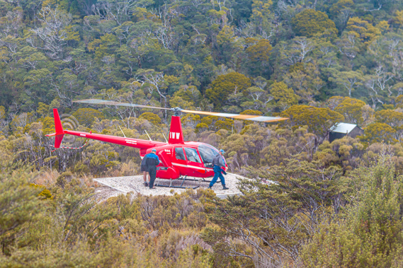 |
15:45 - A bright red helicopter thumps its way up the valley increasing altitude to maintain its height above the ascending slope. The helicopter hovers over the downs before gradually descending onto the helipad on the other side of the main track. Three men get out and head up to the hut to test the gas connections. They are only here for about fifteen minutes before heading back into their helicopter and flying on across the downs towards the next hut. |
 |
16:18 - About ten minutes pass before a middle aged couple from Canada arrived. They have hiked across the downs from Perry Saddle Hut today. Actually he was originally from Nelson but had moved to Canada where he met his wife. He has been away for many years now, so he decided to return with his wife on a long trip exploring New Zealand. As part of their travels they are doing a few hikes. This is the first of these. They have a quick look in all of the bunk rooms before they set up their beds in separate bunk rooms. Perhaps he is a snorer? Once they return to the dining area he lights a fire in the small wood burner. Perhaps this is an instinctive thing for him having come from Canada. I certainly dodn’t think it is cold enough to warrant a fire, and I’m from the subtropics. The temperature outside is getting quite cold, but this hut is very well insulated, something I have never seen in a hut before.
|
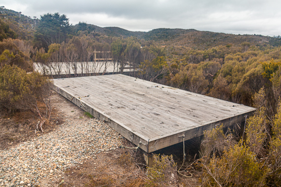 |
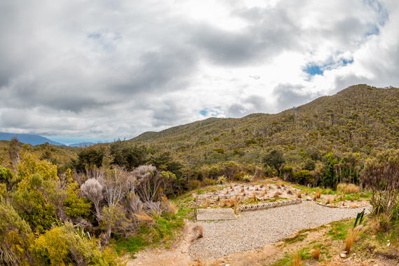
17:27 - With plenty of daylight left, I explore the outside of the hut at the campsite where several large wooden platforms have been set up to pitch tents. There are small ropes to tie tents to in order to save putting tent peg holes in the ground. Staying in the campsites is a little cheaper than the huts, but I think the extra expense of the luxurious huts is very well worth it.
|
 |
17:42 - Not long after I return to the hut a young Italian woman arrives. She has also come from Perry Saddle today and obviously knows the Canadian couple from meeting last night. She settles into the one remaining bunkroom and prepares her dinner. She is on a gap year in New Zealand having spent much of her time working in bars in the tourist areas like Queenstown. Now she is doing some of the hikes. |
 |
18:04 - The temperature outside begins to drop and the cloud lowers to cover the tops of the surrounding hills in mist. It probably won’t be too long before the hut is enveloped in thick cloud as it will have been in recent days. People hiking across the downs would have been in thick cloud for much of the time, missing out on the mountain scenery. The young guy with the vacuum cleaner digeridoo I had met at Lewis Hut last night had commented the downs were boring as they were covered in thick cloud. |
 |
18:08 - The fire is going now and just starting to give off heat. I had earlier read in the intentions book that even though it is only a very small wood burner, it is incredibly efficient and makes the hut quite hot. |
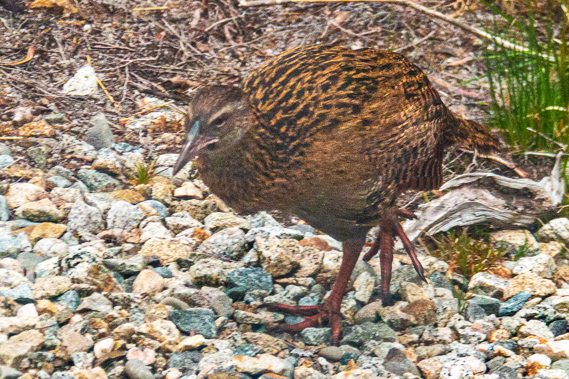 |
18:35 - I head back out onto the verandah with the Canadian couple to show them where they will be hiking to tomorrow. They are aiming for Heaphy Hut, so I show them the sand bar and where the hut would be whilst there was still enough light to clearly make out the mouth of the river. Looking down from the balcony I see a weka. It seems every hut here has its own fat weka that would no doubt vigorously defending this prime real estate where careless and clueless hikers drop morsels of food.
|
 |
18:48 - James Mackay was born in Scotland in 1831, he arrived in Nelson in 1845 the year before Heaphy and Brunner explored the coast. He worked the family farm in Golden Bay with his father before taking on his own block at Cape Farewell where the Wharariki walkway is now located. His land became overstocked and having heard stories of a big grassy plain in the mountains along the Maori trail to the West Coast, he decided to investigate. James left his farm in October 1856 with a travel companion John Clark to explore the rugged mountains at the headwaters of the Aorere River. There were no grassy plains there, but in following the Maori trail into the mountains discovered two large open areas. The first being what is now called Gouland Downs, where I will be passing through tomorrow. The second area further west was the Mackay Downs where I had just entered this afternoon, though they probably hadn’t ventured this far. James and John would have been the first Europeans to have seen these 16,000 acres of highland plains. During their expedition they had looked down the Wakapouai (Heaphy) Valley which Heaphy and Brunner had crossed the mouth of ten years earlier.
|
 |
19:35 - In 1857, the following year, James Mackay travelled south to Greymouth following the more difficult coastal route that Charles Heaphy and Thomas Brunner had taken. Over the following years James Mackay explored other areas of the Tasman Mountains with Major John Lockett, including the headwaters of the Takaka and Karamea Rivers. During these expeditions they named a number of mountains, lakes and other dominant landforms. James was appointed the role of resident magistrate of the Justice of the Peace in Collingwood in 1859. Upon settling into this role, the Nelson Provincial Council instructed him to go to Arahura down south in the middle of the West Coast to purchase 7,500,000 acres of land from the Maori. This land covered the coast between Kahurangi Point (north of the Heaphy River) and Milford Sound and inland to the Southern Alps. This was essentially the entire South Island West Coast.
|
 |
19:36 - After a year he had reached agreement with the 14 Maori tribal representatives to purchase the land for just 300 pounds. As part of the agreement 12,000 acres remained reserved for Maori use. James left Arahura on the West Coast on 22 May 1860 heading back home to Collingwood. Upon reaching Westport he met fifteen gold prospectors. They had moved there to find gold, but hadn’t found any at all, so desperate to return to civilisation, they hired James as a guide to take them back to Nelson. James took them up the coast to the Heaphy River before following the old Maori track along the path of what is now the Heaphy Track across the mountains to Golden Bay. From there they hiked over the Takaka Hill to Nelson. They arrived in Nelson on 20 June, 29 days after they had departed Westport. For a long time it was believed they were the first Europeans to successfully cross the track, but a year earlier a gold miner named Aldridge and his mate who’s name has been lost to history travelled south from Collingwood over the Maori track down to the Heaphy River. Upon reaching the river they followed the coast southwards towards Westport.
|
 |
20:11 - James Mackay returned to the area in 1862 with the Knyvett brothers to cut a proper track from the Aorere to the mouth of the Heaphy River. His vision was for the track to be a short cut for the gold prospectors when travelling from the West Coast to Nelson. It didn’t follow the old Maori track though, instead cutting down into the Heaphy River a lot further upstream than the modern track does at the Lewis River. The track he built became known as the Government track. This was his last time in the area as upon his return to Collingwood he became Resident Magistrate briefly before war broke out in Waikato. He was sent north to become the Assistant Native Secretary. From there he took on a number of government roles in the Auckland and Waikato areas for seventeen years before returning to the West Coast as Resident Magistrate of Nelson, Greymouth and Hokitika. A year later he returned to Waikato after a bad land deal left him bankrupt. He died there 22 years later in poverty aged 81.
|
 |
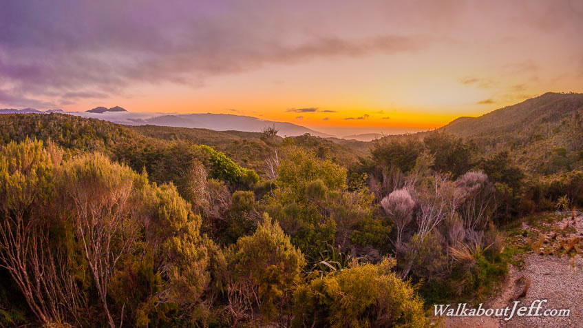
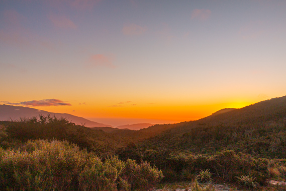
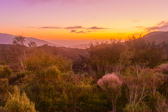
20:13 - The sun has been coming out over the past hour. Hopefully this means it is going to clear. The sun highlights the scrub and creates an orange hue over the Heaphy Valley. The cloud quickly clears off the surrounding hills.
|
 |
20:20 - The cloud completely peels back leaving the sky clear overhead and the distant mountains of the Gouland Range, where I will be following over the next few days, are clearing as well. Some cloud lingers around the mountains, but it is obvious we are in for some clear weather over the next couple of days. |
 |
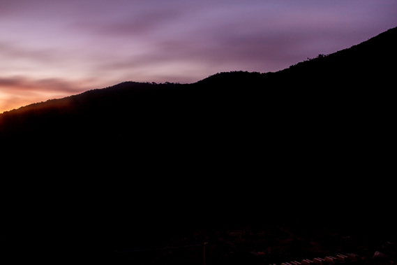
20:32 - Having largely missed the sunsets of the past two nights, I am finally rewarded with a spectacular orange sunset over the Tasman Sea. It illuminates the Heaphy Valley as the last lights of the day disappears over the Tasman Sea. |
 |
20:51 - It is now very cold outside, so upon returning into the hut the small fireplace has made the main dining area very hot. Fortunately the others are all ready for bed now, so the four of us go into our bunkrooms – one each. I am initially a bit surprised that the couple are not sleeping together, but I can just hear him snoring through the insulated walls. No wonder they have separate bunk rooms.
|
|