Introduction to today's journey
After climbing a great hill, one only finds that there are many more hills to climb.
- Nelson Mandela
THE GOULAND Downs was largely untouched apart from the occasional gold prospector hiking the rough track hewn by James Mackay for many years. In 1885 surveyor John Saxon was commissioned to survey a new track to become a road from the Aorere Valley in Golden Bay, all the way to a proposed new settlement at the mouth of the Heaphy River. At the time the boundary between Golden Bay and Westland was at the Kowhaiwhai Saddle at the start of the track, so it made sense for the road to the Heaphy Valley to come over Gouland Downs from Golden Bay. Saxon surveyed the road along almost exactly the route of the current Heaphy Track up to the present location of Saxon Hut. The following year, a Mr Murray (the Murray of Murray Creek in the Heaphy Valley) tool over and completed the survey
across Mackay Downs, down to the Lewis River and to the mouth of the Heaphy River. Once the survey was complete, the new bridle trail was constructed, bing completed to the downs in 1888 and reaching the Heaphy Valley in 1893.
Today's trek leaves the James Mackay Hut, crossing the mysterious bonsai forests of the Mackay Downs before crossing a low saddle high above the Heaphy River from Westland to Golden Bay. The track descends from there to Saxon Hut before continuing its descent into the Gouland Downs. Crossing several small rivers as I cross Gouland Downs, the track ascends passing through The Enchanted Forest to the rugged Gouland Downs Hut. Once settled at the hut, I explore The Enchanted Forest.
Today's Journey
Distance trekked today: 18.2 kilometres.
Total distance trekked to date: 57.4 kilometres.
 |
05:49 - I feel the morning chill outside penetrating through the insulated walls of the hut. The sky outside is just beginning to lighten, slowly erasing away the cold brilliance of the starry night sky. |
 |
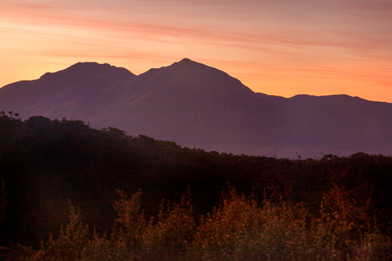
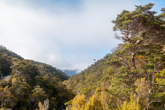
05:52 - I head outside onto the verandah to capture the sunrise as I eat breakfast. The coldness of the still air surprises me. It’s amazing how seven hundred metres gain in altitude makes the mornings so much colder. Fortunately I am rugged up with plenty of thermals. The sky to the east is almost perfectly clear with just a few wisps of high cloud. I see along the mountain range from Mount Gouland stretching back towards Mount Perry where I will be heading over the next two days. Mount Perry itself is hidden behind some of the lower hills at the edge of the downs, but the sky seems pretty clear over there.
|
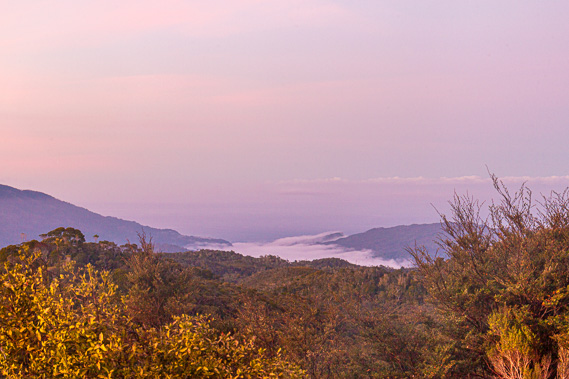 |
06:01 - The Heaphy Valley is still dark. A thick layer of fog fills the lowest hundred metres above the river. It will be quite a bit warmer there, but no doubt very humid. The cloud seems to end at the coast, so early risers at the Heaphy Hut will have a clear view over the sea to a bank of cloud a couple of kilometres offshore. A hazy mist hovers up to around four hundred metres above sea level, perhaps generated by the salt spray of the turbulent sea now so far away and unheard down the mountain. Anyone staying at the Lewis Hut on the other hand is encased under the greyness of the thick fog. |
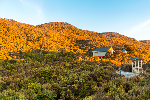 |
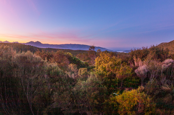
06:27 - The sun begins to catch on the high cloud hovering in the distance to the south. It lights up a brilliant blood red colour, peeling back the darkness of night to reveal a brilliant clear sky overhead. I have finished breakfast and packed up ready to go as the sun’s rays shine on the hills behind me. The warm sunlight reaches down to the unoccupied ranger’s hut as I leave the main hut. The scrub on the hills is illuminated a fiery orange colour.
|
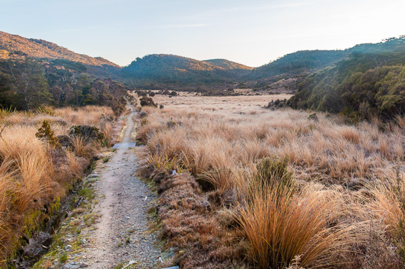 |
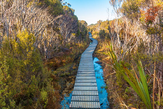
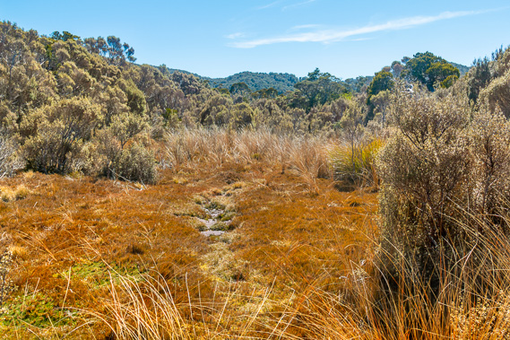
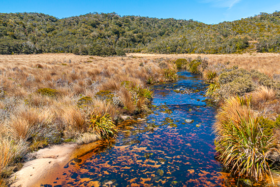
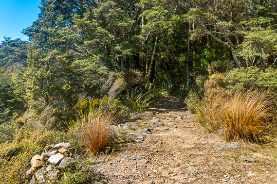
06:41 - As I leave the hut I have one more view back over the Heaphy River. The thick fog hasn’t moved. The peak of Heaphy Bluff, the final limestone hill of the Iwituaroa Range, pokes out above the fog. If a lighthouse had been built there at the head of the Heaphy River, it would have made a fascinating sight flashing away in the dying moments of the night. I follow the hut track to the junction, before turning to the left to begin the long walk towards Gouland Downs. There are two stages to today’s walk. The first is 11.5 kilometres across to Saxon Hut. The sign says three hours but given all the photography I will be doing it will take me quite a bit longer. From Saxon there will be another two hours across to Gouland Downs hut. The sun shines on the forested hilltops, but not on the tussock covered valley I walk along above Deception Creek. More scrub lines the creek but the bottom of the valley floor is too swampy for the scrubby bush to grow. The track is elevated with layers of shingle deposited over the years keeping it dry and above the swamp. I see drops of water at the tips of the leaves, but when I feel them the water is frozen solid in this morning's cold frost. Tiny drops of water are still frozen solid on the tussock. The ends of the tiny leaves of the shrubs have their little snowflake-like icicles hanging off them petrifying where they had been breathing overnight. It seems the inside of the forest has escaped the frost. The heat of the transpiring trees was enough to keep the temperature of the sheltered forests from freezing.
|
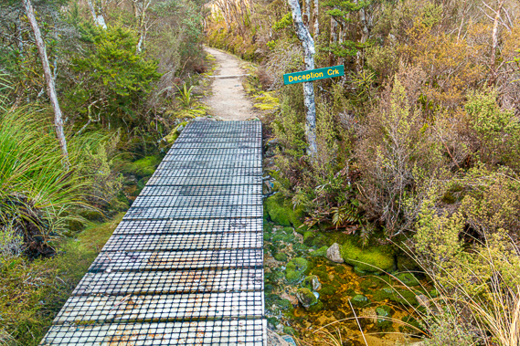 |
07:02 - After a few minutes of following the valley, the track enters the bush running beside Deception Creek. The bush is a mix of mountain beech and silver beech with their mottled white trunks partially covered in moss. The centuries old trees only stand four metres tall due to the swampy granite soil and high altitude, a perfect storm of poor growing conditions. The stony track gradually ascends to a small rise near the stream. Without the track, navigation would have been quite difficult through the dense forest. At the bottom of the short gully the track crosses Deception Creek and crosses the fault line I have been following since Heaphy Hut. The water is crystal clear. The strong tannin stain I had seen in every creek and river so far is noticeably absent in this stream. Here I am very close to the headwaters draining from the miniature valley to become a substantial tributary by the time it flows into the Heaphy River far below. |
 |
07:03 - From Deception Creek the track follows a narrow gorge between the low hills rising no more than eighty metres high on either side. This area of track does often flood during heavy rain, but the creeks are running at normal levels today. It is a totally different landscape up here walking through the bonsai forest under bonsai hills compared to the tall lush forests of the past two days. It is as if the Mackay Downs is an elevated lost world. I cross the crystal clear Deception Creek again over a wooden boardwalk before the track rises to a small open swampy area where a signpost marks the one kilometre distance from the hut. This signpost is a most welcome sight for hikers coming the other way having come all the way out from Perry Saddle or Gouland Downs. |
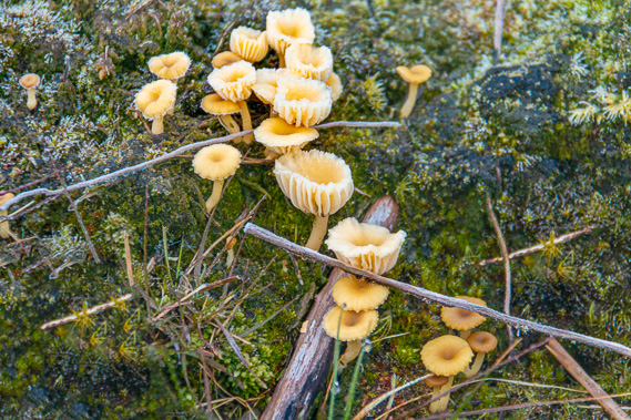 |
07:13 - The small clearing extends quite long containing the headwaters of Deception Creek. The occasional exposed rock or log that doesn’t have any scrub over it is covered in mosses and in one case, fungi. A little village of sandstone coloured tiny toadstools covers the log. |
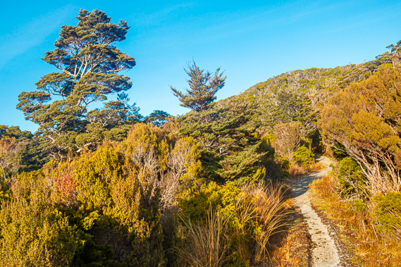 |
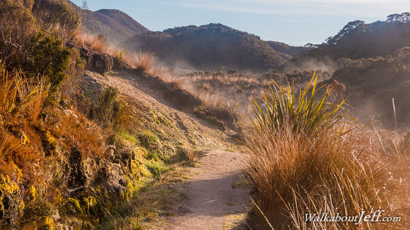
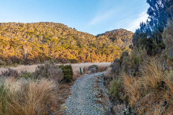
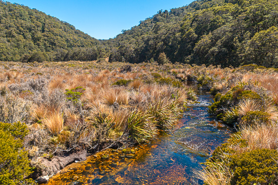
07:23 - From the swamp the track gradually ascends towards a very low saddle. For the first time I see the sun now covering the valley. A fine mist of steam rises silently from the bottom of the valley like a lost mist of smoke. The sun highlights the myriad of colours of the scrub – the reds, greens, browns and yellows. The track briefly returns into the shade again as it rises the final few metres to the top of the saddle before descending into blazing sunlight again. The sun is directly ahead of me now, low in the sky. Steam rises from the sunlit orange tussock swamp. The surrounding bonsai forest is scrubby now containing mostly small manuka bushes with the occasional windswept gnarly mountain beech tree rising through them.
|
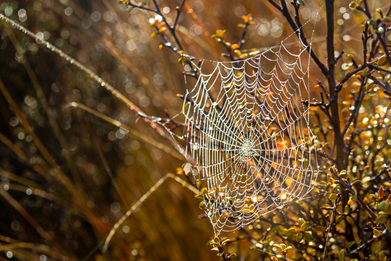 |
07:40 - The track crosses the swamp to another marker now indicating two kilometres from the hut. The valley is brightly illuminated now. I only see the steam rising when looking towards the sun. The steam is definitely rising behind me, but it is invisible. The drops of ice on the red tussock are just beginning to melt only to evaporate into a fine mist. A perfectly formed spider web has been cast in one of the shrubs. Tiny droplets of dew accentuate the fine weaving the spider had done overnight laboriously creating this delicate masterpiece waiting to be all but destroyed by its next meal when it unsuspectingly flies into it.
|
 |
07:41 - The track drops into a low valley heading downstream. Being right at the head of the valley there is no flowing water but it is obviously heading downhill towards a steam filled gorge about a kilometre ahead.
|
 |
07:46 - The track turns away from the valley and heads up through some low scrub. The gravel gives way to boardwalk hovering over a wet section of track filled with water before crossing Horrible Creek. This would have been a very damp crossing through the swamp if it were not for the boardwalk. Perhaps this is why this creek got its name. My boots completely dried out yesterday on the hike to James Mackay, so I am not too keen to get them wet again. |
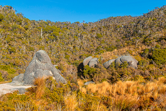 |
08:12 - At the end of the long boardwalk the track suddenly became quite rocky as it moderately ascends towards another saddle. The beech trees in this part of the bonsai forest are very stunted although their trunks are straight. They stand three or four metres high. Once over the saddle the track descends to cross the crystal clear Monument Creek draining off into a steep gorge below off the edge of the downs into the Heaphy Valley below. The track continues to follow Monument Creek through the tussock swamp valley. This valley is known to flood during heavy rain blocking passage along the track. I now see why it is so named. There are a few enormous rounded granite boulders towering above the scrub. They are surprisingly rounded and seem to have just been randomly placed there. You would expect these huge boulders to have been carried down by some great river, but there is no scope for large rivers up here. If the hills were much bigger, one could say they would have rolled down dislodged by past earthquakes, but these hills are not high enough. |
 |
08:15 - The size of the boulders are exaggerated by the bonsai trees and the tiny rolling hills on either side of the valley. It is a strange juxtaposition appearing completely in place. Further up Monument Creek the valley widens and the track heads above the swamp to an elevated lookout with several huge boulders standing out. I stop at the lookout for a while photographing the spectacular views. Small clouds appear over the hill having risen out of the Heaphy Valley. I remember the fog at the bottom of the valley at sunrise. It has quickly risen and is now rolling over the hills. Is it going to go overcast again?
|
 |
08:45 - The track ascends out of Monument Valley passing some ancient mountain beech trees covered in moss. This time the climb is relatively long, heading up to the top of a saddle covered in a three metre high forest of beech and dracophyllum. I rest at the top of the 780 metre high saddle, having reached the end of the bonsai forests of the Mackay Downs in the chill of the golden hour. |
 |
08:55 - The rugged forested hills of Teddy Range divide Mackay Downs from Gouland Downs. Somewhere along this range marks the half way point of the track between Kohaihai and Brown Hut. Somewhere along here also marks the boundary between the West Coast and Nelson. From the top of the unnamed saddle at the edge of Mackay Downs the gravelled track descends through thick forest standing four metres tall. The banks on either side of the track are covered in thick carpets of moss.
|
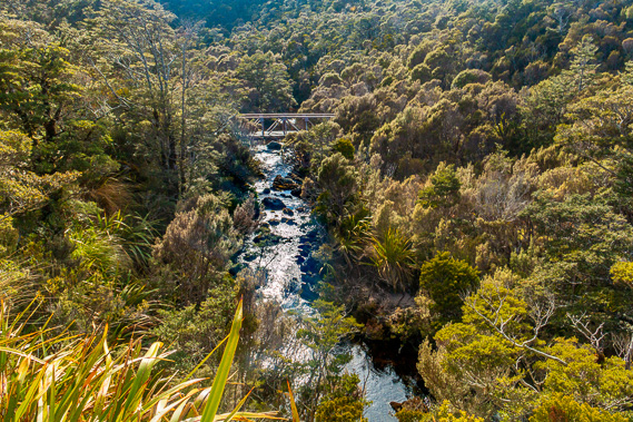 |
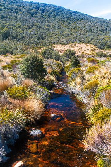
08:56 - A deep valley suddenly drops off below me. Looking down the valley the thickening cloud is obscuring the view towards the sea. Looking upstream I see the bright silver ribbon of Blue Shirt Creek running from pool to pool between large boulders. A wooden bridge with railing on either side provides passage upstream. The track gradually descends towards the bridge. Although the bridge looks sturdy, it has a load limit of one person crossing at a time. The crystal clear water is a little tannin stained. The pools are mirror flat but the water still runs across most of the width in the short rapids. There is little written about the history of Blue Shirt Creek. Perhaps it was named after a shirt that a gold prospector had left here, perhaps accidentally dropped from his backpack or maybe he had put a blue shirt on a tree as a navigation marker for a good crossing of the creek. Some years back a sole hiker travelled across the downs and never made it out the other end of the track. Search parties were sent out to find him. It was not until several weeks later that his body was found upstream of here, having for some reason strayed off the track.
|
 |
09:29 - From the creek the track gradually rises towards another clear tussock swamp then towards another low saddle. The cloud rising up onto the downs is quickly dissipating. The tussock valley lasts for about ten minutes before the track ascends again passing some very old gnarly trees towards another saddle. From the top of the low saddle the track follows around the base of the Saxon Range, and in particular Mount Teddy, a hill standing about a hundred metres above the track. The terrain suddenly changes as the track goes against the edge of the hillside, no longer navigating the tiny hills and swamps of the Mackay Downs. The moss covered trees of the forest stand about six metres high cutting off the view. Between the clearing and the range is a big drop in the forest into Bluffy Creek, a large tributary of the Heaphy River where James Mackay’s government track once followed. Beyond Bluffy Creek are two ridges into the Gouland Creek and upper Heaphy River respectively. For the most part though, this section of track follows through very brightly mottled forest. Being above the humidity of the valley below, the differences between light and shade are extreme, making it hard to see.
|
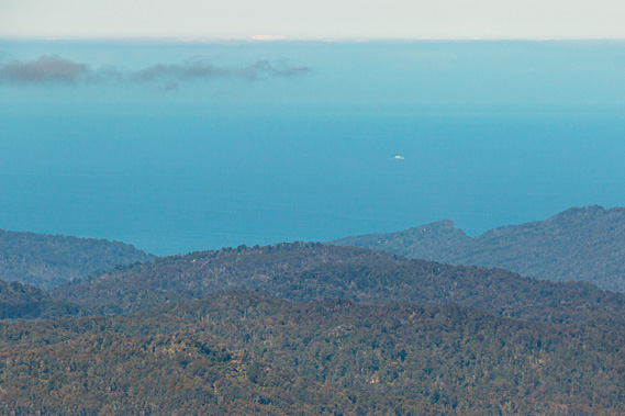 |
09:53 - After a long stint of hiking through the thick forest amongst the mottled light and shade under the full sun, I finally reach a small clearing above where perhaps a slip had dropped from the track in years past clearing the vegetation below it. From here I can no longer see the bottom of the Heaphy Valley, but I still easily make out the Iwituaroa Range and Heaphy Bluff. The cloud has parted and lifted to about my altitude. Now I see forest all the way out to the bright blue Tasman Sea, the first time I have seen it a blue colour. The weather has definitely cleared although there is a layer of high cloud a long way offshore. It is somewhere along here that James Mackay and John Clark had first seen the Heaphy Valley on 8 October 1856 having hiked across from the Aorere. They didn’t progress any further than here though, but returned to Collingwood. The first complete crossing of the Heaphy Track happened the following year when Aldridge and his mate hiked up the Aorere, crossed the downs and headed down into the Heaphy on their way to the West Coast. James Mackay returned to the area the following year and made the first crossing in the direction I am now following, on his way back from having successfully purchased the West Coast from the Maori tribes for just 300 pounds.
|
 |
10:28 - Looking eastward around the mountains I see along the Gouland Range to just make out the summit of Mount Perry. The unnamed mountain this side of the Perry Saddle is clearly visible. I will be going into the Perry Saddle tomorrow and all going well, will attempt to climb Mount Perry. I continue following the trail where thick carpets of moss fed small creeks of the headwaters of Bluffy Creek across the track from the gullies of Mount Teddy. I have one more glimpse of the Tasman Sea before the track heads over a low saddle into another small tussock clearing.
|
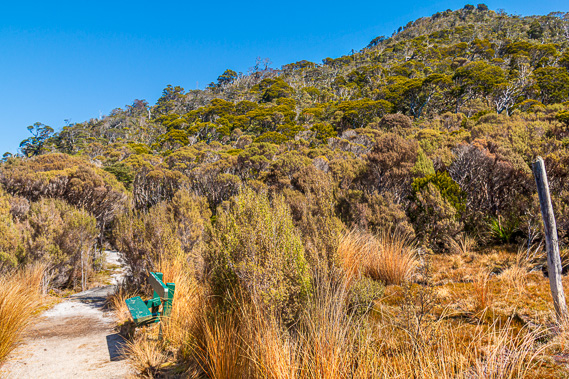 |
10:32 - I see an old wooden milestone marker post, heavily weathered having stood there exposed to the elements for around a century. Before the 1960s the track was often overgrown due to poor maintenance. The milestone posts aided the hikers navigating their way through the thick undergrowth. When the track was maintained, the milestone marker posts helped in communicating where the maintenance was being done. Nearly all of these posts have been lost to time, but this is one of a few still standing. This post is round and thick. Perhaps bigger than most of the other posts as it marks an important landmark along the border of two provinces. This 725 metre high saddle marks the current boundary between the Nelson and West Coast regions, or more specifically between the Tasman and Buller Districts. Crossing this boundary takes me out of the Heaphy River catchment and into the Big River catchment, where I will pass a lot of its headwaters between here and Perry Saddle as I cross Gouland Downs. I rest on a wooden seat painted dark green but it is a bit wobbly.
|
 |
10:57 - From here the border runs north west along the top of the Saxon Range at the top of Mackay Downs to Kahurangi Point. Going eastward the border runs along the top of the low ridge along the top of Gouland Downs where the downs is separated from the upper reaches of the Heaphy River. Then it goes south eastward through the Tasman Mountains around the back of the Aorere and Takaka Rivers. Big River is the northernmost of the West Coast rivers, draining into the sea just north of Kahurangi Point. There is a very remote road going down the coast from Golden Bay to about two kilometres short of the mouth of Big River. It is from there the impossible coastline begins down to Heaphy River Bluff. Aside from the Heaphy Track there are no routes in the Big River Catchment, so this is a very remote area.
|
 |
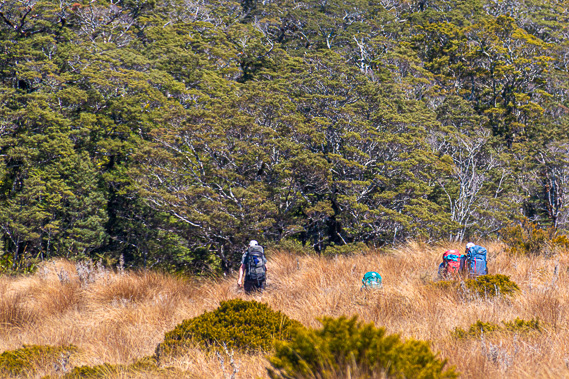
11:09 - From the saddle the track continues heading gradually uphill into the forest. The forest is very thick with twelve metre high silver and mountain beeches mostly covered in moss. As the track continues rising I suddenly see several people approaching from the other way. They left Gouland Downs Hut early this morning and have maintained quite a pace to get here this quickly. The track begins descending gradually into Saxon Valley. The forest floor begins to thicken with grassy undergrowth. Across the other side of the valley is the end of Slate Range. Saxon River flows along the bottom of the valley split between the Slate Range and Saxon Ridge eventually to meet the Big River. It is not long before I see the ochre coloured Saxon River. Moss covers the trunks and branches of the trees. The sun shines brightly through them illuminating their green foliage. Finally the track reaches the bottom of the valley coming out onto a large tussock plain, the small Saxon Downs.
|
 |
11:18 - Having come out of a forest of tall moss covered beech forest into Saxon Downs, the track crosses the swampy tussock heath. The tussock is fairly tall so the nearby Saxon River is now hidden from view. The tussock swamp is completely surrounded with low forested hills, although the hills of the Slate Ridge are higher than any of the others. Looking directly ahead I just see the tops of the Gouland Range above the nearer hilltops. The track has compacted granite dirt and gravel elevated above the surrounding swamp. I follow it in a straight line for a few minutes before reaching a boardwalk curving to a bridge crossing Blue Duck Creek, a tributary of the Saxon River. The water in the three metre wide creek is clear, although there is some sort of moss growing on the stones at the bottom of the slow moving water. Looking downstream the creek flows swifter and deeper into the Saxon River just visible about fifty metres downstream.
|
 |
11:19 - On the other side of the bridge is the one kilometre marker to the Saxon Hut. This is the first sign I have seen on the track since Deception Creek. This marker also has a snail sign on it, so the giant carnivorous snails live here too. I wonder if they are the same species of snail in the forests along the Heaphy River. The climate and conditions here are a lot different to those encountered in the valley lowlands. The track continues straight across the healthy tussock towards a bridge about two hundred metres away. The river has about twice the capacity of Blue Duck Creek, the darkly tannin stained water runs gentle. Once across the river the track enters the bush where I pass another person who had come from Perry Saddle heading across to James Mackay today. The track rises gently through the forest along the base of the Slate Range.
|
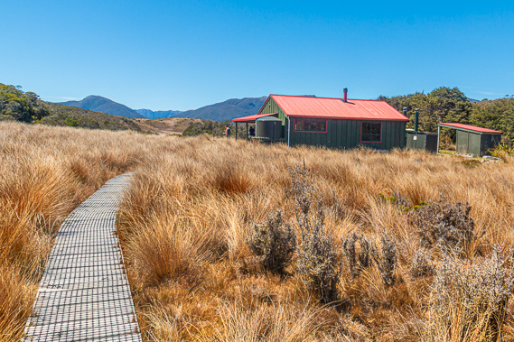 |
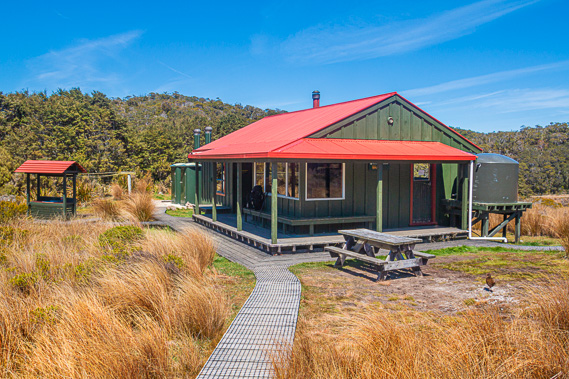
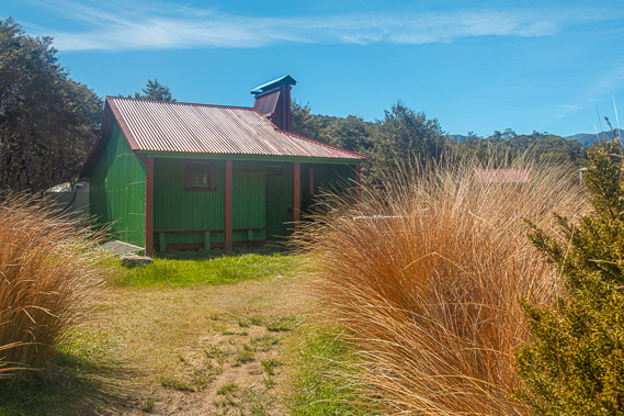
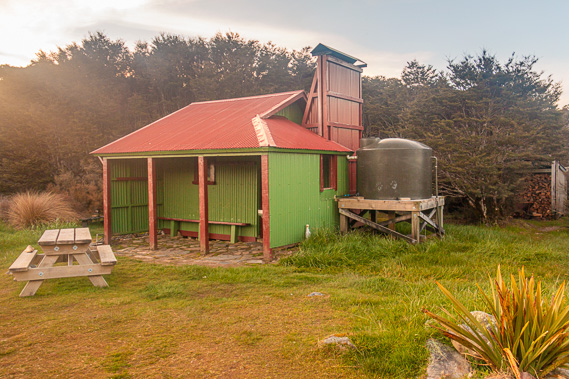
11:40 - Eventually the track rises out of the forest and the Saxon Hut is just a hundred metres ahead. A group of four people outside the hut are packing up ready to leave. The sky is now completely cloud free as I follow the boardwalk leading off the main track towards the recently painted hut. The roof is bright red (perhaps to make it clearly visible to helicopters servicing the area) and the walls are a deep pine green colour. This was the newest hut along the track before the three main huts were reconstructed in recent years. I greet the group of four as they leave and I take my heavy pack off in the verandah.
|
 |
12:01 - I booked a night on every hut on the track apart from this one. When I made the bookings this hut was marked as being closed for renovations. That being said there are no signs of renovations going on here - no workers, no tools, no materials, no unfinished work. The hut seems to be in top order. Perhaps the renovations were finished ahead of schedule. I stop here to rest for lunch, having hiked and photographed all morning from James Mackay Hut this morning. A sign says the hut is 710 metres above sea level. Despite all the saddles and valleys since James Mackay, there has been almost no change in elevation. This hut looks pretty old and rustic compared to the new huts, but is still in excellent condition having recently been repainted. I can’t smell the paint as would be expected when a fresh coat has recently been applied. Nearby hidden in the trees is the DOC staff hut. This had been an old staff hut built at the Heaphy River in 1981 but was relocated here a few years later. That hut has its own shower, wood stove, four beds and a storeroom.
|
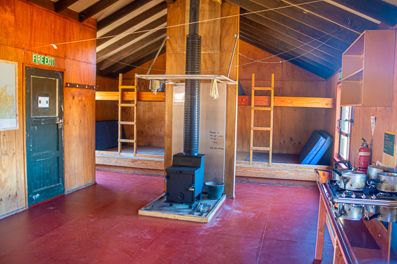 |
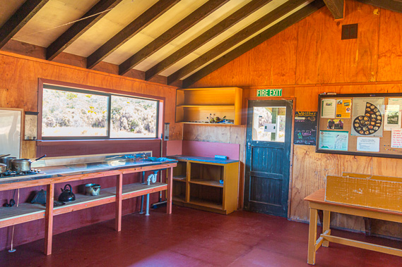
12:05 - I enter the main hut to prepare lunch. The inside of the hut is a large single room with a fireplace in the middle, and a partial partition to the bunk area with sixteen beds on a two level bench bunk. A long kitchen sink with gas and running water runs along the side of the walls. Like the Lewis Hut this is very basic, but very effective. The subalpine views out the windows are spectacular looking over the bright red tussock and green forested low hills around them. A large notice board has the instruction “Remember to fill some pots with water in the evening as the taps and water lines may freeze during the night between March and October”. The joys of being at altitude in New Zealand. I recall this morning’s frost, and this is November. I imagine the frosts during winter are pretty severe here. There is another notice warning of the flooding that can occur over the small flat where I had crossed Saxon River and Blue Duck Creek. The message indicates if you experience difficulty crossing that flat, then it would be impossible to get through Monument and Deception Creeks. Hikers unable to get through would be allowed an extra night at Saxon, I’m guessing assuming there aren’t too many people coming across from Gouland Downs if it were flooded.
|
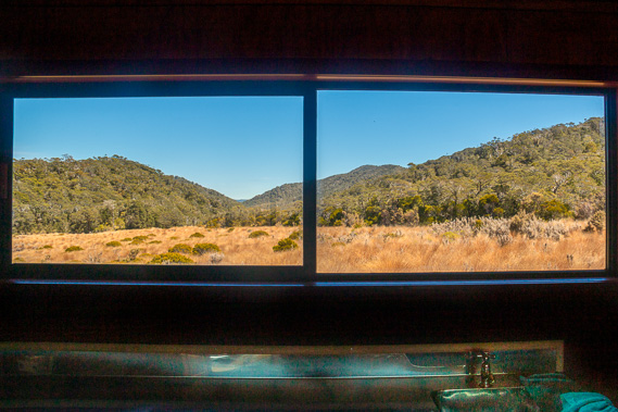 |
12:16 - Looking out the window I see across the clearing to the low hills separating Saxon Downs from Gouland Downs. I have never seen the sky so clear here. Last time I crossed here in 1996 the sky was overcast and the clouds covered the tops of the mountains. The previous time was sunny but hazy. I think the majority of people passing here come from Perry Saddle Hut with the intention of getting through to James Mackay in one day. If they get this far and find the Saxon River to be too flooded, then they stay here. Hopefully the streams would have gone down by the next morning and they would then be able to continue with a long walk to James Mackay, then down to Lewis or Heaphy Huts for the night.
|
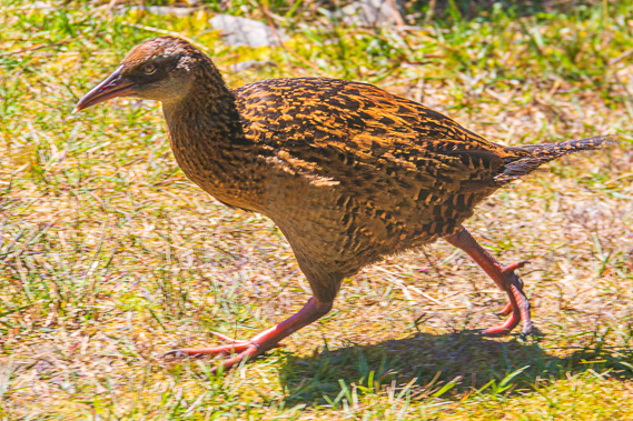 |
12:28 - With lunch prepared I return outside where I see a fat weka. Every hut and shelter so far has its own fat weka no doubt tightly defending its territory. A boardwalk leads from the verandah around passing a sheltered washing area to a camping area in amongst the trees. Another shorter boardwalk leads to two long drop toilets around the back. Saxon Hut was named after John Saxon, a surveyor who surveyed a new proposed track heading from the Aorere towards the Heaphy River. This followed almost the exact route of the current track. He started surveying in 1885 and at some stage during 1886 he had surveyed across the Gouland Downs to about this point where his survey ended. The following year Mr Murray (the Mr Murray of Murray Creek in the Heaphy Valley) took over and completed the survey down to the proposed settlement at the mouth of the Heaphy River. I recall the Collingwood County boundary was at that time at Kohaihai Saddle, so it made sense then for the track to go all the way from the Collingwood end.
|
 |
12:50 - Once the survey was complete Mr Murray supervised the construction of the bridle trail starting at the Aorere River. In 1888 the track had been completed to the downs. Construction continued through to 1893 when the track was completed at the mouth of the Heaphy River. Some of the trees growing on the hills are pretty massive. Their gnarly trunks and branches have large clusters of moss growing on them. With lunch finished I am packing up getting ready to leave when I see a group of three middle aged ladies arrive having hiked from Perry Saddle Hut. They have similar ideas to stop here for lunch before continuing onto James Mackay Hut.
|
 |
13:21 - I leave shortly after their arrival, following the boardwalk back to the main track. The Gouland Downs Hut is 5.5 kilometres away, the sign saying this would take about an hour and a half so I have plenty of time to get there, and therefore plenty of time to make the most of the clear conditions and get some good photography of the sweeping downs and mountains. |
 |
13:29 - The track becomes rocky with the occasional stream crossing it as I follow the fault line at the bottom of the Slate Range. The range slopes upwards towards the rocky summits of the Slate Range. As the name suggests these hills were made from slate whereas the hills below the range are made from granite. The Saxon Fault runs along the path of the track from where the Saxon River met Blue Duck Creek across the front of the range. Looking at the map it is obvious the fault line continues along the straight track over to Gouland Downs. The block containing Slate Range had been uplifted from the fault line. The soil over the slate is of a much higher quality than the granite soil. It is very difficult to grow anything in granite. This explains why the forest suddenly stops about a hundred metres short of the hut. The fault line continues down Bluffy Creek. |
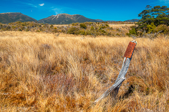 |
13:42 - One interesting slate boulder I pass had rolled down the hill dislodged by some past earthquake. It would have happened quite a long time ago as it is now covered with red lichen. I soon pass an old wooden fence post with a rusted piece of steel nailed to the top of it. This had once been another one of the milestone markers to help the gold prospectors and cattle herders navigate their way through the often poorly maintained track in the late 1800s to mid 1900s. A second supporting piece of wood attempts to hold up the milestone post but they are both leaning over significantly. The terrain begins to steepen as the gravel covering the track becames mostly small flat plates of slate. Slate is a metamorphic rock that was originally sedimentary shale and clay but has been compressed due to the enormous pressures of the mountain building processes. The compression has changed the rock into a fine-grained grey rock that easily breaks into large flat plates. In centuries past flat “slates” were used as blackboards for writing on.
|
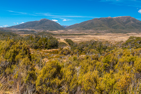 |
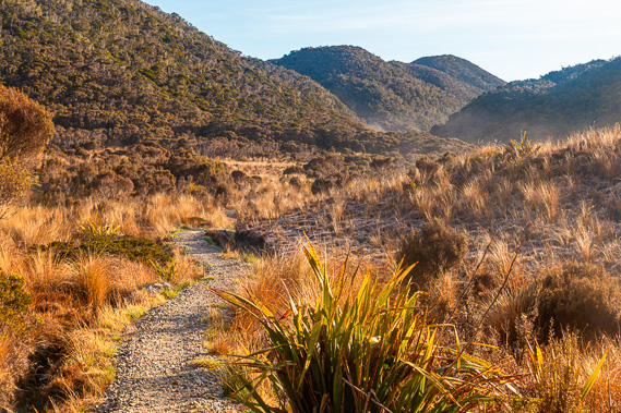
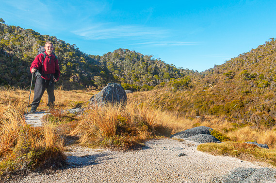
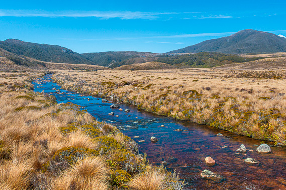
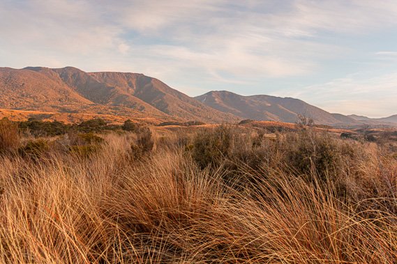
14:20 - The track gradually rises until it reaches the top of the ridge where a wooden seat just above the track gives a view over the scrub of the sweeping plains of the Gouland Downs, with a clear view across to the Perry Saddle and along the entire length of the Gouland Range. Looking from the viewpoint down into the Gouland Downs, the sweeping vista of brown tussock deceptively resembles fertile farmland. Gouland Downs was named after Henry Gouland who was appointed the position of resident magistrate in Collingwood in 1857. He planned to graze sheep over the sweeping grasslands of the downs, so he travelled up the Aorere River to inspect the land closely only to discover the grasslands were in fact tussock growing on very poor swampy soil. After an disastrous trial grazing a few sheep on the downs, he abandoned the idea. |
 |
14:35 - From the viewpoint the track descends towards the tussock plain. Mount Perry stands solitary at the end of the Gouland Range separated from the rest of the range by Perry Saddle. The track returns to slate forest for a while before coming out above a long tussock gully along the fault line. The track follows the right hand side of the gully moderately downhill over coarse slate coverage. I approach a small wooden bridge crossing over Weka Creek, a moderately cascading dark stream of water running down a narrow gully in between the fields of scrubby tussock. It would have been named from the wekas that live here. A geological expedition in 1910 reported Gouland Downs being full of wekas and kiwis. They are in far smaller numbers now, hidden away elusive in the thick tussock. They have in recent years (since this hike) been joined by a group of takahe released into the wild here for the first time in many decades.
|
 |
14:38 - A later expedition to the downs was led by James Drummond in 1915. He estimated there were about thirty thousand wekas on the downs. This is about five per acre. He took twenty five kiwis and moved them to the protective sanctuary of Little Barrier Island off the east coast of Auckland. Despite the abundance of native wildlife and Gouland’s earlier failure, sheep were kept on Gouland Downs. In 1912 a large mob of sheep was herded along the track all the way out to Karamea for shearing.
|
 |
14:43 - Farming here on the downs was very challenging. The high and frequent rainfall made the downs very boggy – explaining why no trees grow here. Thick mist often covers the downs making them very difficult to navigate due to the lack of landmarks. It became too tough for sheep, so eventually the farmers deserted the Downs. Two years later Gouland Downs was declared a wildlife refuge, named the Gouland Downs Scenic Reserve and Wildlife Sanctuary. This was the first protected area around what is now Kahurangi National Park. In 1965 when the New Zealand Forest Service took over the track from the Buller and Collingwood County Councils, the sanctuary became part of the North West Nelson Forest Park, which in turn became the Kahurangi National Park in 1996.
|
 |
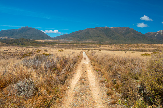
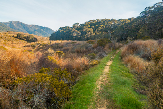
14:51 - From Weka Creek the track climbs to the other side of the gully and heads dead straight across the downs. Although the land appeared flat from the lookout it is quite bumpy with terraces. The track could be an easy ride on a quad bike, and a four wheel drive vehicle would manage this with moderate ease. The tussock across the downs is bent over towards the north east showing the direction of the prevailing wind, the last of the strong winds from the storm of recent days. Aside from the bent grass there is no longer any evidence of the storm the other day. The sky is crystal clear aside from some long bands of cirrus cloud. The air is perfectly still. The southerly that would have cleared the storm from two days ago has completely died. It would have been very windy coming through here the other day. Hikers heading the from Brown Hut towards Kohaihai would have walked almost directly into the wind.
|
 |
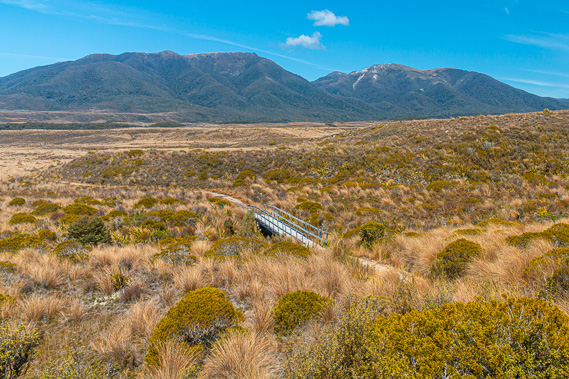
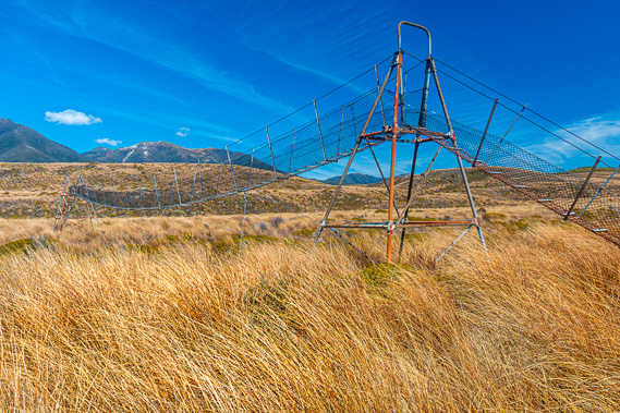
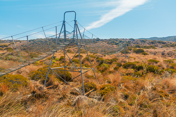
14:53 - I recall the other night Chris at Lewis Hut saying he hadn’t been overly impressed with the downs. That would have been because he was walking through thick fog against strong head winds all the way from Perry Saddle across to entering the bush below James Mackay. His impression would have no doubt been very different had he been walking through here today. Eventually the track drops into the ford of Big River. Despite its name it this river is quite small up here at its headwaters. When it meets up with Saxon River and all the other streams draining off Gouland Downs it will no doubt become quite a substantial river roaring its way down the gorge. The main track just goes through the river. There is a boardwalk heading off to the right to a swing bridge. I decide to take the boardwalk and swing bridge as I want to keep my boots dry and also want the higher photographic vantage view of the river. The idea seems good, but the swing bridge is rather rusted and has a steep climb up to it. The swing bridge is normally used when heavy rain has fallen and the river is too swollen to ford across. Despite the difficult climb onto the swing bridge, the views are very worthwhile. The river runs in a dead straight line between the banks of tussock. It seems very unnatural though. Any river meanders from side to side of the valley it travels along. I am not sure what makes this river run so straight. Additionally the small cascades run over of rocks almost in completely straight lines across the river. This seems a bit unnatural as well.
|
 |
15:10 - Once on the other side of the swing bridge there is a steep climb down the other side to the boardwalk. Relieved to be on the other side I quickly follow the boardwalk back to the main track. I’m not sure how many people take the swing bridges but all the people I have seen so far today had dry boots. I suspect most people take the swing bridge.
|
 |
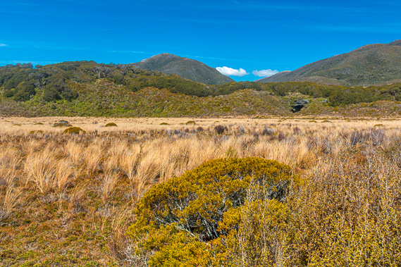
15:11 - Slate Range is getting quite distant behind me now. The track gradually ascends to a low ridge on the scrubby tussock. I now see some of the terraces in the downs, where erosion has taken place too slowly for proper valleys to form as these mountains have been thrust out of the ocean with the formation of the new fault line splitting Zealandia in recent geological history. Ahead in the distance is a dark cave entrance below a stand of beech forest. I recall the Gouland Downs hut is just on the other side of this small forest. There is not far to go now.
|
 |
15:23 - I cross another swingbridge over Shiner Brook before reaching the forest. This river also has a ford. The river is flowing into Big River is about half its capacity but I crossed the swing bridge anyway wanting to keep my boots dry. Once across the stream the track rises moderately to one of the terraces. Looking back I see across the downs with the two deep scars of the Big River and Shiner Brook leading towards a small hidden opening marking the start of what would be a spectacular gorge all the way down to the mouth of the river near Kahurangi Point. |
 |
15:30 - The track continues heading up the hill until suddenly entering the beech forest. The rocks suddenly change from granite to limestone, explaining why a forest would suddenly appear here in the middle of the downs. |
 |
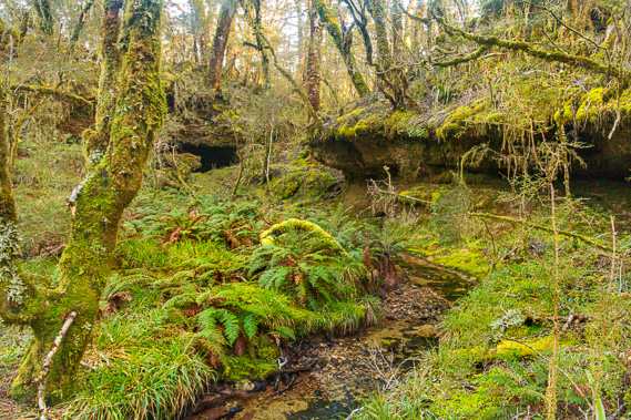
15:37 - The sun is still high overhead so it is hard to appreciate the amazing formations the track was negotiating its way through. I will be returning here later this afternoon after settling into the nearby hut. The track seems to be cut deep into the moss covered karst formations gently twisting its way uphill through the forest. |
 |
15:42 - After ten minutes I emerge from the forest. The track turns to the left to follow the edge of the forest where I see the Gouland Downs Hut, with a red roof and dark green walls freshly painted just like Saxon Hut. This is as far as I am hiking today. I have reached my destination. The Gouland Downs Hut is the oldest hut on the track that is still standing. It was built in 1936. Other huts along the track were built before this one, but they have all been replaced and upgraded over the years. This hut still has its original character with a large chimney, but it appears to be well maintained with a new roof and a large water tank out the back.
|
 |
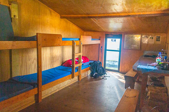
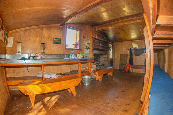
16:41 - The hut has a very small verandah with stone paving at ground level where I take my dry boots off and enter. A sign says the hut is at 640 metres above sea level. The downs at the fords would have been just under six hundred metres above sea level. The room itself is a little smaller than the main room of Lewis Hut. The room is long and narrow with 10 bunks along one side and a large table along the other. Next to the door is an enormous fireplace. |
 |
16:42 - There is a young German guy wearing glasses on one of the bunks. Hans is his name. He is a young guy who is on a gap year working and travelling in New Zealand. He is only a few weeks away from ending his gap year, so he is hiking some of the trails and hitchhiking around the country as many backpackers do here. He has come up from the start of the track at Brown Hut today, arriving about half an hour ago. Upon returning to Germany he is looking at studying at one of the schools of music and becoming a composer. We exchange notes so to speak of our journey so far along the track. He has a mirrorless camera with him but being very conservative with shots. On the other hand I have two batteries with me and still on my first – although the charge is starting to run a little low. I have taken 957 shots so far and have plenty of memory card and battery life left to keep me going to the end of the track. I have considered getting a mirrorless camera, but their main problem is the short battery charge life. Once the manufacturers realise the importance of a long battery life then I’ll definitely be getting one.
|
 |
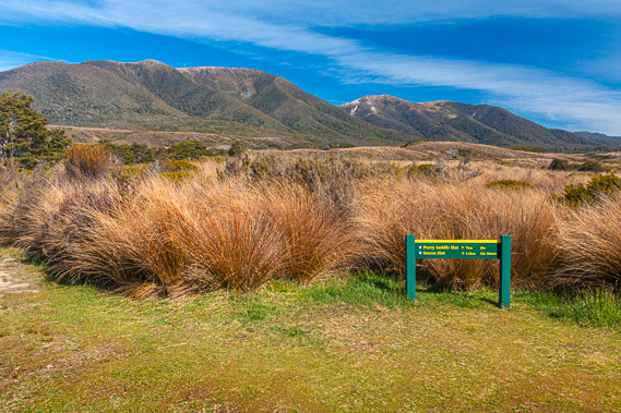
17:08 - I head outside. There is a sink in the verandah area outside, and another one a bit further out beside a single long drop toilet. Outside the hut is a sign pointing in either direction along the track. Saxon Hut is 5.4 kilometres, an hour and a half away. Perry Saddle Hut is just seven kilometres and two hours away. Tomorrow’s hike is going to be a lot shorter than today’s. If the weather is good I have a very good chance of making the Mount Perry summit tomorrow.
|
 |
18:09 - The sun is was dipping low towards the horizon. I have already settled into the Gouland Downs Hut and had dinner. With about an hour and a half of light left I decide to explore the Enchanted Forest – the mysterious forest over the limestone formations I had hurried across earlier just before reaching this hut. Being free of my backpack I only need to carry my camera bag – with the big SLR camera, lenses and flash unit. This equipment by itself is heavy enough. I leave the hut. The golden hour has already begun with brilliant colours coming off the tussock grass. The western sky is veiled in a thin layer of icy cirrus cloud sweeping across the sun filtering it quite nicely. Ideally I need overcast conditions here for the forest, but that isn’t going to happen today. I have limited time and will be leaving at sunrise tomorrow to head up to Perry Saddle so have to make the most of these conditions.
|
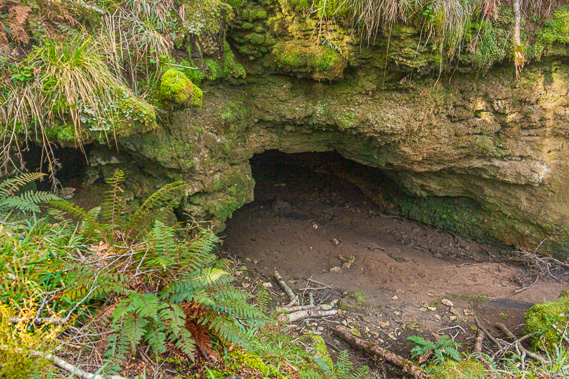 |
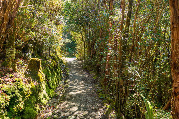
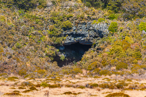
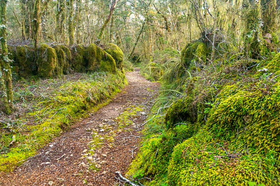
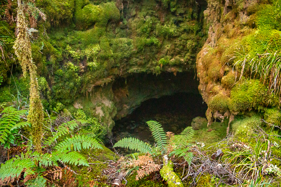
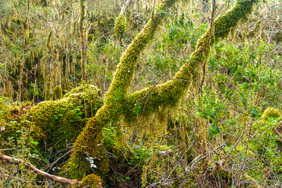
18:17 - I follow the track back towards Saxon Hut, entering the forest again after a couple of minutes. The filtered sunlight highlights the Spanish moss hanging off the branches. There is too much contrast at the moment for the enchantment to happen. The track sweeps broadly around over the top of the otherwise jagged karst limestone formations. When walking quickly you do not even notice the amazing formations. The terrain on either side of the track suddenly drops off into a five metre deep canyon, with a small stream flowing on either side. The track is a high obstruction but the stream seems to be flowing from one side to the other with ease, so that could mean only one thing – a cave tunnel under the track. A small worn path drops from the main track into the upstream gully. Sure enough part way down I see the entrance to the cave. The stream seems to stop just before the cave, but I figure it would have gone underground nearby and will re-emerge as a spring on the other side. After heavy rain I’m sure the excess water flows freely through the cave.
|
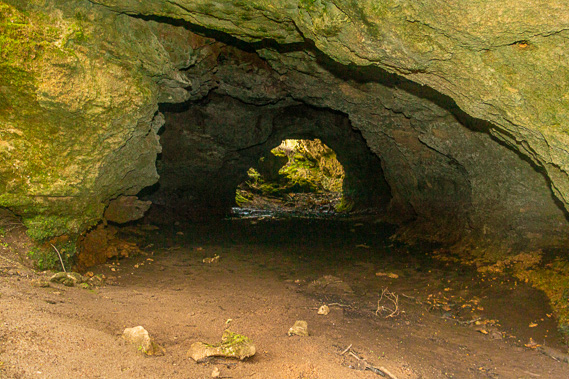 |
18:22 - Upon reaching the bottom of the gully I look into the cave. As expected I see right through it. I put on my head torch and put the flash unit onto my camera. Overhead the ravine stands over me like an ancient ruin the trees, ferns and mosses are taking over. Looking through the cave tunnel the ground is flat with wet sand and some mud. At the far end a section of the overhang has collapsed partially blocking the exit, but it still appears easy to climb out of. The blockage would cause the cave to flood during heavy rain but should clear pretty quickly. The wetness of the cave is from such storms – perhaps the storm the other day had flooded the cave.
|
 |
18:33 - The limestone here was deposited a little below sea level before these mountains were raise out of the sea. This accumulation of seashells has risen over six hundred metres to its current position above the Gouland Downs. This formation would have been formed a lot earlier than the limestone formations I had seen along the Heaphy River. Those were formed when this area had long risen above the sea. The Heaphy Valley's rise out of the sea was a lot more recent. Most of Gouland Downs would have once been covered in limestone, but most of this has eroded over history by Big River and its tributaries leaving only this small area of limestone. The rest of the downs has eroded down to its much harder granite base. This ancient sea bed is eroding away by the stream creating these caves, but these formations are still here, and very enchanting.
|
 |
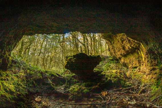
18:40 - I walk through the cave tunnel to the large grotto on the other side. I climb out through the partially collapsed end and enter the enchanted forest. The small cave entrance seems tiny behind me. The track going across the top of the side of the grotto has completely disappeared. It is as if I have been transported a million miles away in some strange parallel universe. The stream re-emerges from a small hole in the rock, flowing out onto a flat platform between the banks thick in soft moss. The trees in the grotto grow out of the moss.
|
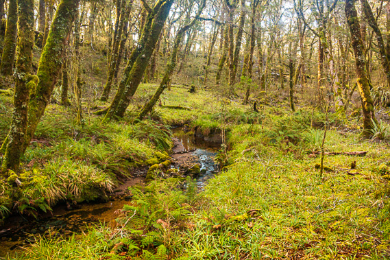 |
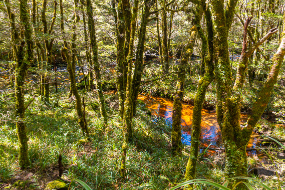
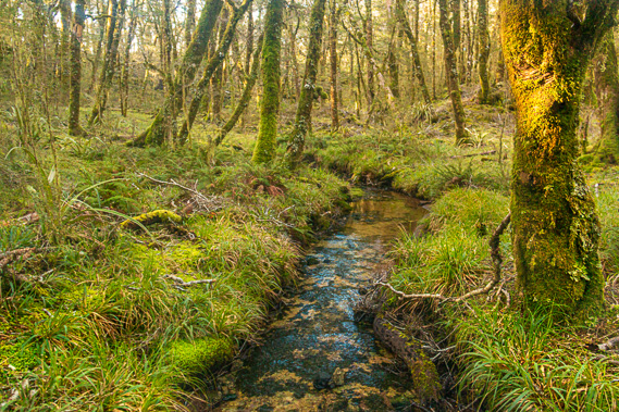
18:42 - I walk along the bottom of the stream. It is unlike anything I have ever seen before. Streams normally have stones in the bottom to walk on. There were a few stones in the water, but the bottom of this stream is flat limestone. The water is only about half a centimetre deep along the length of the channel yet it flows swift. Photographing the water makes it look deeper, but its shallowness allows for easy walking through it without getting my boots wet. Eventually though I need to get out and walk on the mossy ground. The forest floor is mostly thick luminescent sphagnum moss, but there is also a lot of ferns and some kind of native grass growing in clumps as well as if to break up the monotony of the forest. There are also a few alpine flax plants, appearing a bit out of place in the middle of this forest.
|
 |
18:44 - The moss is soft and spongy to walk on. I don’t know whether there is any chance of falling through the boggy moss, but I am more worried about tomos. In New Zealand there is a lot of karst limestone landscape. The Maori have a term called “tomo” which indicates a small hole in the ground where the roof of a cave has collapsed. Often these holes are only a few centimetres wide and don’t seem like much, but below them is a straight drop of over fifty metres to the cave floor below. Many caves in New Zealand have many bones of moa and other creatures that have fallen into a tomo into a cave below. Fortunately it wasn’t like that at Field Cave as all the openings were more or less horizontal. Vegetation including sphagnum moss can cover the entrance to a tomo. Whenever I sink in a few centimetres into the soft moss I hope there is bottom under it. I quickly work out the depressions where tomos were possible, so avoid these as I continue exploring the grotto. This is a thin deposit of limestone, so I don't think tomos are a problem here anyway.
|
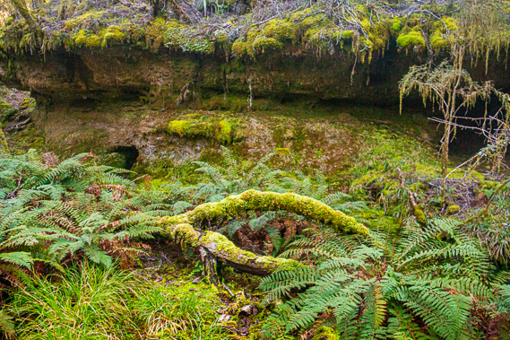 |
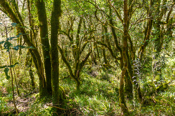
18:51 - Above the undergrowth the ancient mountain and silver beech trees towers overhead. There isn’t much foliage on them, but the branches spread out creating an eerie canopy of fingers concealing the enchanted forest from the rest of the world. Some of the branches have fallen off the trees. They are sitting on the mossy ground themselves covered in bright green moss quickly eating away at the timber to provide nutrients to the remaining trees.
|
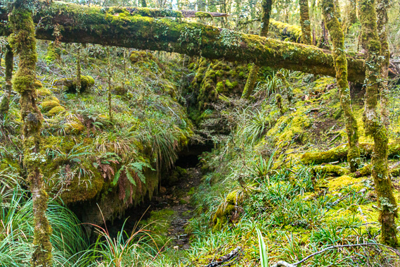 |
18:59 - Most trees are intact, but there was one in the middle of the grotto that had a trunk snapped in half about four metres off the ground. . The walls of the grotto had eerie overhangs of hard rock that hadn’t yet collapsed. Beech trees were growing on the rock that surrounded the grotto. Some of these trees were precariously clinging to the edges and starting to lean into the grotto. They were hanging on for dear life with their roots. These beech trees were the closest I have seen to Australia’s Antarctic beech. They don’t have the strange exposed root systems or suckers though, but one thing this area of forest has above the Antarctic Beech forests is the lack of undergrowth blocking the view. Here the altitude is too high for the middle level vegetation like tree ferns. The canopy was a bit too thick for shrubs to grow. There is just the upper canopy of beech trees, and the forest floor of ferns, grasses and moss. Around the edges of the grotto are several small caves and holes. I imagine there are creatures such as kiwis living in these caves.
|
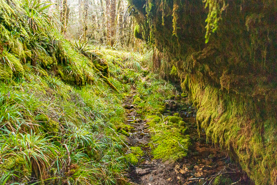 |
19:05 - Surrounding the small caves, the rock is covered in thick layers of moss looking like molten wax temporarily frozen in time ready to melt again when the temperature gets hot enough. The stream almost disappears entirely under a rock before emerging again for a short distance, then disappearing into a small dark cave on the other side of the grotto. Much of the cave has collapsed making entry impossible. The cave continues around the grotto with a slit around the edge of the rock before the stream emerges again in a large fracture in the rock. One side slopes downward at forty five degrees covered in moss and small plants. The other side is a dark overhang almost in parallel. I climb into the bottom of the fracture and follow the stream for a few metres before it disappears into a dark cave under the moss covered log of a fallen tree. |
 |
19:12 - By now the sun has sunken low enough in the sky to no longer be shining in the grotto. It is starting to look more magical now. I return down the creek under the cave tunnel and back onto the track. From the track the rock above the grotto takes on some weird shapes. The water erosion over many thousands of years has worn some interesting obelisk shapes. These are covered in thick carpets of moss making them look really weird. They almost look like giant eggs hidden away to one day hatch around the base of the trees.
|
 |
19:20 - The orange sun is still shining into the canopy, brightly highlighting the Spanish moss hanging off their branches. I follow the track back towards Saxon until I found a small grotto with a rough track through it. This grotto is a lot smaller and potentially more precarious with a tiny pool of water in the middle of it. The vegetation is very thick here and the rough track very short, so I return to the track. |
 |
19:56 - I return to the hut where Hans is eating dinner. Two young Canadian ladies arrived during my absence in the Enchanted forest. Like Hans they have come from the track entrance at Brown Hut this morning. They arrived at Perry Saddle, but decided to continue walking here for the night. Now there were four of us here. It is going to be very cosy tonight in this usually deserted hut. |
 |
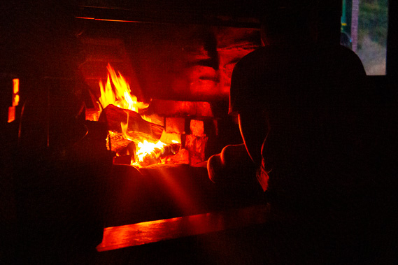
19:58 - Hans has lit a fire in the huge fireplace and it was giving off a lot of heat. I return outside to watch the sunset. The temperature is quickly dropping. Tonight is going to be cold. The sun sets behind the forest quickly darkening the mountains in front of me. The cirrus clouds hovering high overhead turn a nice orange colour.
|
 |
20:29 - I return into the warmth of the hut. My bunk is next to the back door. Looking through the door I see the hut’s weka, but don’t get to photograph it. This is was the only time I see the weka here. At least it is being consistent with my “weka at every hut” theory. The forest and terrain comes to life as darkness set in. I hear the screeching echoes of the kiwi as they forage the darkness of the distant tussock and forests for grubs to eat. I also hear the faint hooting of a morepork, the native owl, coming from the depths of the enchanted forest. Clearly Gouland Downs doesn’t sleep at night.
|
|