Introduction to today's journey
Our Te Anau sheep station was at the uttermost ends of the earth, so to speak the very back blocks and no place for women and children.
- Katherine Melland, 1885
IN 1888, Quintin McKinnon reached the Clinton Valley at the northern head of Lake Te Anau. He was commissioned to cut a track up this remote valley to find a route into the isolated Milford Sound accessible only by sea at the time. Upon reaching the head of the valley, he crossed the precarious pass that now bears his name and continued to Milford Sound. He became the first European to successfully negotiate an overland route to Milford Sound.
Following McKinnon's successful mission, he began taking guided groups up the valley trekking to Milford Sound. The trek soon gained the reputation of being the world's finest walk. The first big challenge for these trekker groups was to get to the start of the track, but a local man in the remote Te Anau settlement saw a business opportunity. Canadian immigrant Thomas Brodrick, known as Brod to the other locals, bought a run down steamer in Invercargill, cut it in two, and hauled the two halves up to Te Anau using bullock teams over several weeks. He successfully put the two halves back together again and started the first boat service until 1899 when the old boat was replaced. The boat trip from the remote Te Anau Downs farm was a precarious journey. The boat was officially named Te Uira, but everyone called it the "Cripple". The firewood powered boat was painfully slow and prone to breaking down. Brod the skipper was a crazy good natured man, but a bit lethargic as well. It was very common for the boat to run out of firewood mid passage and Brod would yell "I must run ashore - firewood's done!". The passengers heading up to the start of the track would then be given tomahawks and axes as they came onto shore into the rugged moss covered forest to cut down a good load of firewood for the boat to continue.
Today's trek starts at the Te Anau DOC office, with a transfer up to Te Anau Downs to where I catch a (thankfully) modern and reliable fast catamaran to the start of the track at the head of Lake Te Anau. From there it is a short walk upstream to Glade House, then across the river and another two kilometres passing a large swampy wetland to Clinton Hut.
Today's Journey
Distance trekked today: 5.0 kilometres.
Total distance trekked to date: 5.0 kilometres.
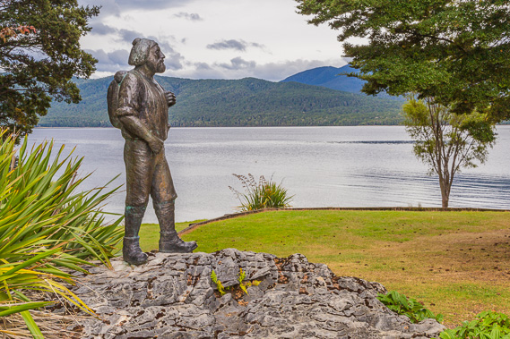 |
09:16 - The life sized bronze statue of Quinton McKinnon, the first European explorer to follow what is now the Milford Track, and later opened the track up to guided expeditions to evolve into the world famous track it is now. I will be following his path over the next three days. Cloud covers the sky but it is expected to clear soon. |
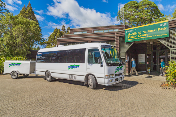 |
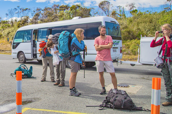
11:58 - The Te Anau DOC office where I picked up my Milford Track tickets yesterday, and where I'm now ready to be picked up by the bus to Te Anau Downs - being one of the lucky ones to have booked a place on the track. Bookings opened (and filled very quickly) eight months ago, and there would always be people pulling out. A small noticeboard in the office indicated there are two spaces today due to a last minute cancellation, so it is possible to turn up here on the day to chance a space on the track. Outside is the van which does three loads of independent trekkers to Te Anau Downs each day. A separate bus takes the guided hikers. |
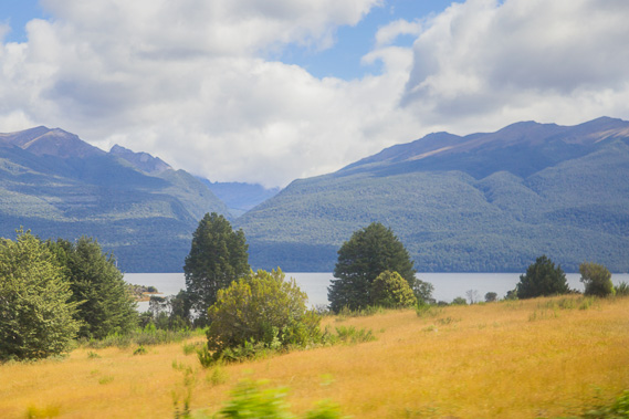 |
12:37 - Heading along the Milford Road following the lake northwards towards Te Anau Downs. The road follows grassy farmland on rolling hills of gravel in stark contrast to the mountains. The gravel along this side of the lake has been deposited here from several glaciers that carved out the mountains on the other side. The glaciers of past ice ages have long gone with almost no permanent ice left in Fiordland. |
 |
12:40 - A the dropoff point at Te Anau Downs where Edward and Katherine Melland's Sheep station was once established, and from where the owners used to take the early explorers and hikers to the start of the Milford Track. They accommodated the travellers on their very remote farm here, before taking them up to the start of the track by boat. Although it is well connected to the rest of the country by the Milford Road, in the early days of the track this station was reputed as being at the uttermost ends of the earth, and considered no place for women and children. The station was three days ride on horseback from Dunedin. Its remoteness attracted a few men and their tents wanting to get as far away from civilisation as possible, and here they were employed on the farm. |
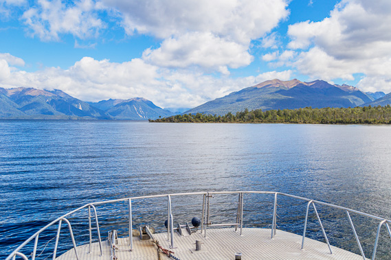 |
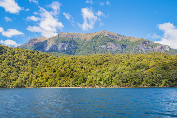
12:47 - View from the top of the boat across the bay and out into the lake. Fiordland starts on the other side of the lake, with the mountains quickly rising. In the centre beyond the point is Middle Sound, one of three major freshwater fiords draining into the main lake. |
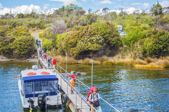 |
12:49 - Another busload of hikers come onto the narrow jetty towards the boat. Boats leaving from this little bay has serviced hikers on the trail since McKinnon started leading guided walks a year after his successful. These are a large group of guided hikers who will be staying in separate huts. |
 |
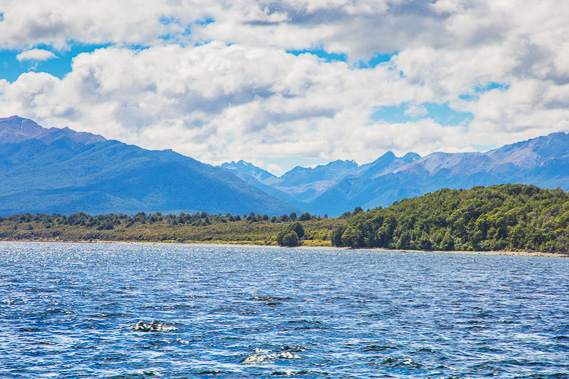
13:08 - Looking back along Lake Te Anau, New Zealand's second largest and most voluminous lake. The enormous quantities of gravel deposited on the eastern side carried out from the glaciers left this enormous depression now filled with water. |
 |
13:09 - The lowlands where the Eglinton River drains out from this valley into the lake. This is the route where the Milford Road continues following the river upstream to The Divide and up to Homer Tunnel. |
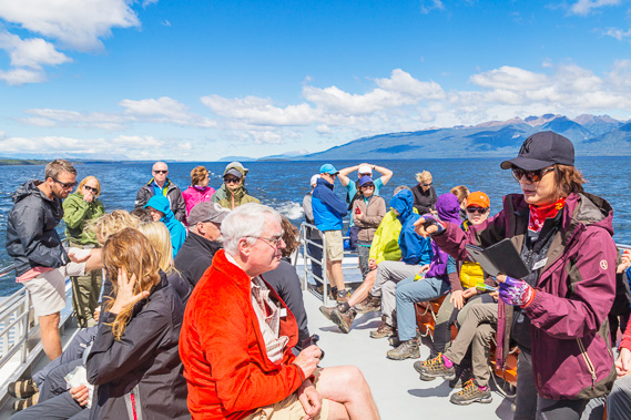 |
13:11 - Some of the other passengers on the top deck, some independent hikers and some guided. Everyone is very relaxed as the powerful boat speeds its way northward along the lake. This boat was brought into service only a few years ago, replacing a much slower single hulled boat which had serviced the track for many decades. |
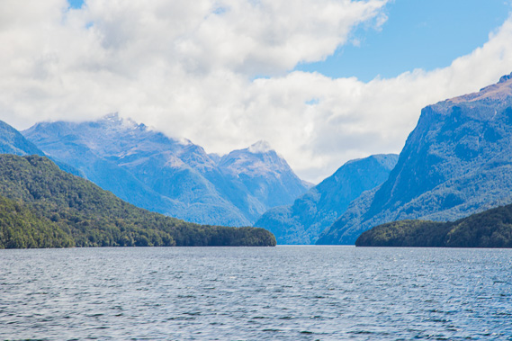 |
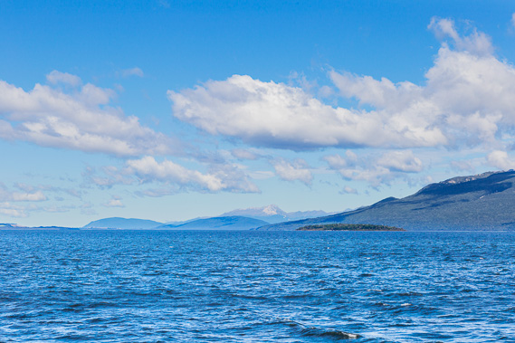
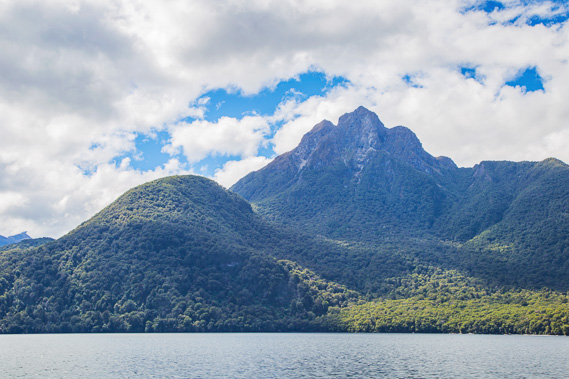
13:18 - Looking into the entrance of North Fiord as we pass it about ten minutes out from Te Anau Downs. The mountains here are a lot more dramatic than those in Central and South Fiords further south on the lake. |
 |
13:33 - The terrain on both sides of the fiord suddenly becomes dramatic as a mountain range starts to our right. The original boat to run this service was run by the crazy Canadian Thomas Brodrick - known as Brod. He was a well known pioneer in Te Anau and saw the opportunity for taking hikers to the trek, so he bought a steamer in Invercargill, had it cut in half and transported by two bullock teams over the muddy road, taking several weeks to arrive in Te Anau. Once the pieces arrived, Brod reassembled the steamer and put it into service on the lake. |
 |
13:40 - The mountains to our right are getting higher and steeper. The Milford Road runs along the other side of these mountains. The boat speeds reliably across the lake. Brod's boat officially known as the Te Uira or the Ripple, was nicknamed The Cripple as it would often break down. The boat was powered by firewood and often it would run out (usually due to his laziness in not restocking it). This required the passengers to go ashore in a remote bushland with axes and machetes to collect what firewood they could from the forest and bring it back to the boat so it could continue its journey towards The Glade. |
 |
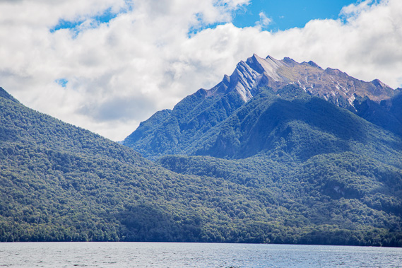
13:50 - A dramatic mountain rising directly ahead of us which we need to bypass to the left as the lake goes around it. |
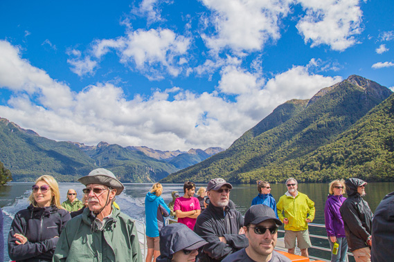 |
13:58 - Everyone in anticipation. It has been a quick hour and a half journey up the lake, compared to perhaps a full day (assuming no breakdowns or running out of firewood) as was the case with The Cripple. Fortunately that boat was replaced after seven years of service with the SS Tawera, a far more reliable steamship which ran this route from 1899 to 1997 when it was replaced with this faster twin hulled diesel boat we have boarded today. |
 |
14:00 - Glade Wharf at the start of the track comes into view. The mountains tower preciptiously steep behind the tiny landing, reminding us we will be hiking through some of New Zealand's most difficult country over the next few days. |
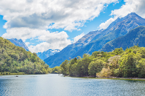 |
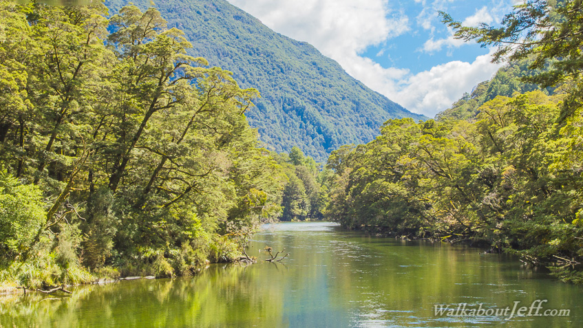
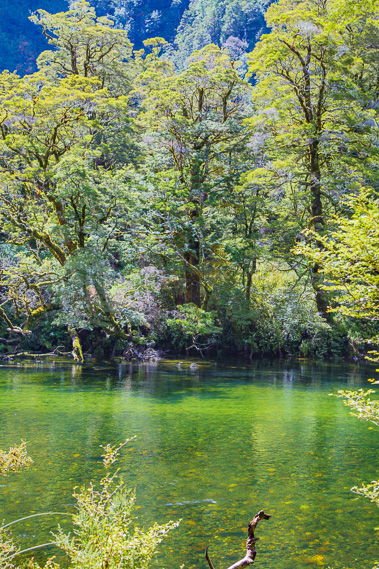
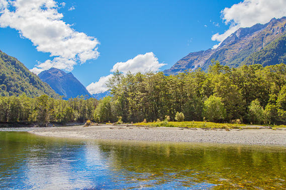
14:03 - First view up the Clinton Valley as we approach the wharf. The pristine beech forest touches the crystal clear lake water. |
 |
14:05 - Reaching the small wharf upon which we will make landfall at the start of the world famous Milford Track. |
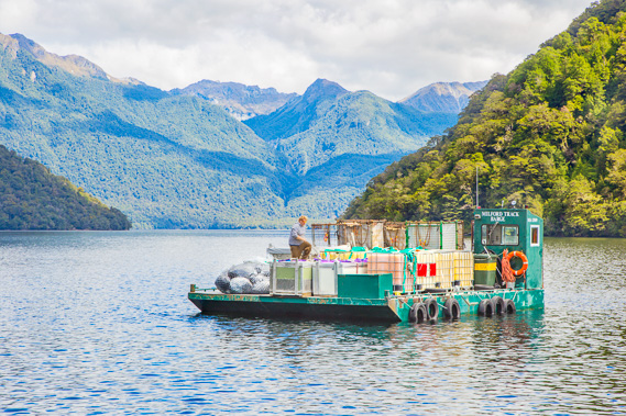 |
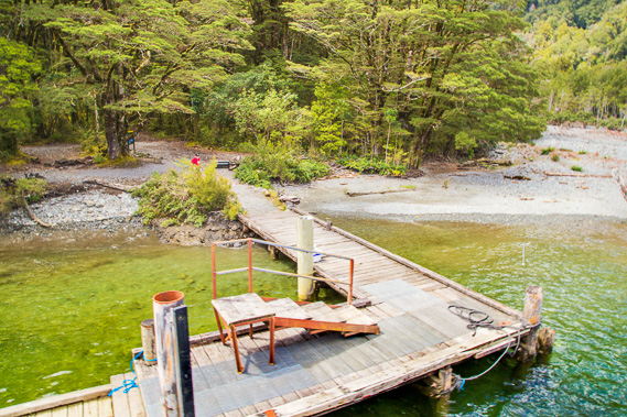
14:08 - The barge which services all the guided walker huts. A helicopter takes supplies to and from here to each of the huts once a week. The helicopter has finished its weekly runs and is on its way back to Te Anau. The barge operator is making sure everything is secure before starting the long and much slower journey back to Te Anau Downs. |
 |
14:09 - Disembarking the ship and washing out boots in a special disinfectant to prevent any didymo or other invasive species being introduced to the park. Boats are prohibited from going any further up the Clinton River in order to protect its pristine waters from the invasive species, and anglers and other river users have to use clean gear certificates. |
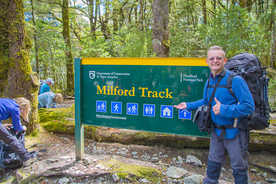 |
14:11 - At the start of the track just metres away from the end of the wharf. Here everyone finalises their packing and sets off along a short journey to the first hut. Behind this sign are a few warning signs about poisonous 1080 sodium fluoroacetate used for eradicating stoats, rats and possums. |
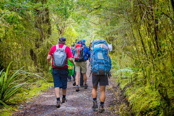 |
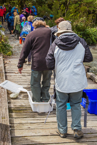
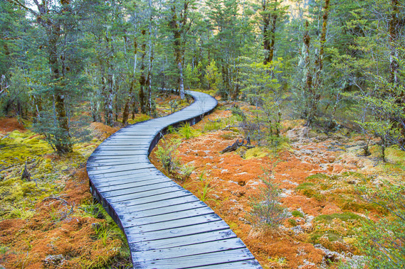
14:13 - Hiking towards the first hut along essentially a single lane dirt road for the first twenty minutes to Glade House. Clinton Hut where I was heading was an hour and a half away, still a relatively short walk. The main track is of exceptional quality, and it is the only track in this valley, apart from a few biodiversity management tracks marked with small blue, white, red or yellow triangles, but they are only used by conservation officers. |
 |
14:19 - View of the pristine lake through the trees. This is the mouth of the Clinton River, the channel into the lake carved out some time ago when the water level was a lot lower. |
 |
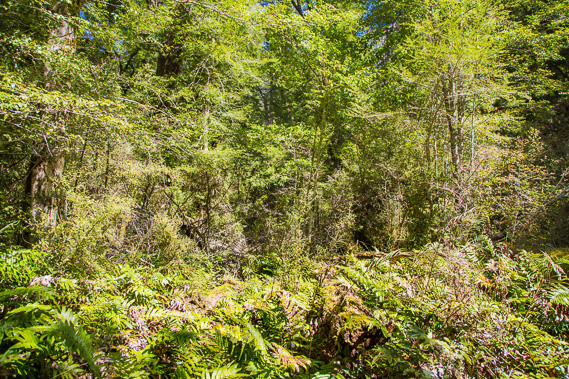
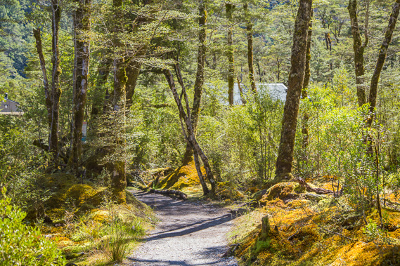
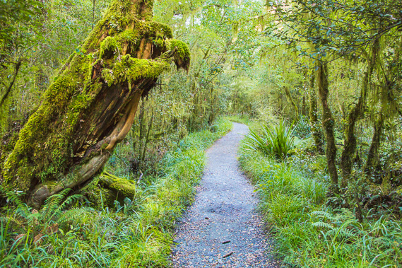
14:23 - Moss covered forest frames each side of the trail, with ferns appearing in the thick undergrowth. |
 |
14:33 - Reaching the very luxurious Glade House where the guided walkers will be staying. This looks very nice and surprisingly large with a lot of accommodation. I heard on the boat earlier they will be serving salmon tonight - a bit better than the packaged dehydrated dinner I will be eating tonight. The hut I will be staying in tonight is another kilometre or two up the valley. |
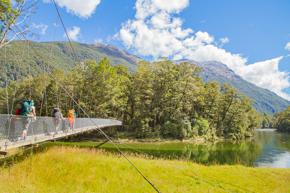 |
14:43 - Hikers crossing the swingbridge over the mouth of the Clinton River. The river leads the main track upstream to Clinton Hut which is about seventy minutes away. Nearby is another boot cleaning station, mainly for hikers who will be leaving from Glade House 100 metres behind tomorrow morning. Some of the guided walkers would not have worn their boots for today's very short walk, so they will need to be disinfected for the long hike up the valley tomorrow. |
 |
14:44 - Looking back to Glade House from the swingbridge. The bank is being eroded and will eventually erode away the land around the huts. |
 |
14:46 - Reaching the first mile marker. One of these posts sits every mile along the track (so there will be another 32 of these. The posts also mark the number of kilometres for those of us from the 186 countries which have updated to metric units. The Americans would feel really at home here being the only country on the planet still stuck in the old days of using imperial measurement. |
 |
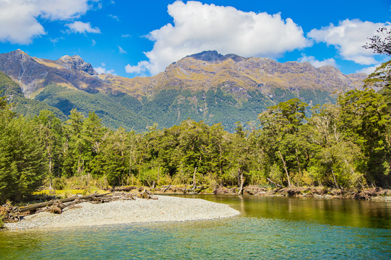
14:48 - Looking across the pristine Clinton River through a gap in the bush. |
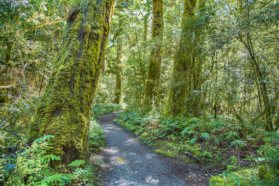 |
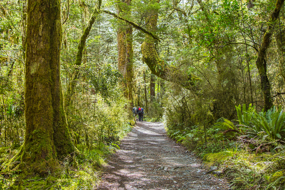
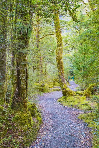
14:54 - The track is in excellent condition, and although it isn't as wide as the road we followed up to Glade House, it is still good enough for a quad bike to travel at a reasonable speed. |
 |
15:12 - This scrubby patch marks the location of the first hut built by McKinnon when he began leading groups along the trail - which would have been very rough. He started leading guided trips up to the saddle very soon after his initial discovery of the Mackinnon Saddle (the official spelling of the saddle is an incorrect spelling of his name). |
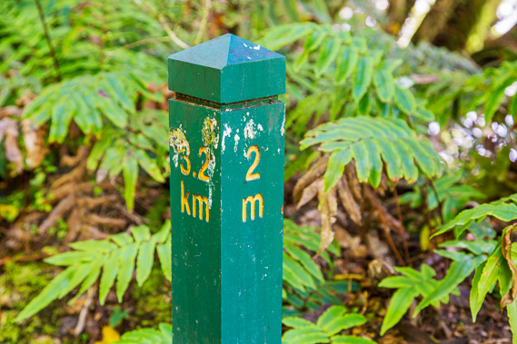 |
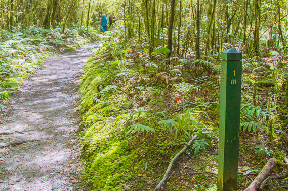
15:15 - The two mile marker, at 3.2 kilometres from Glade Wharf. These are very good with the map to help with planning. The mile distances are a bit disconcerting though being a lot longer than the kilometre which I'm a lot more used to. 1600 metres between each marker is actually quite a long way. |
 |
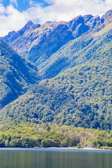
15:20 - View of the river as it goes around a bend coming very close to the track just past the two mile marker. The river is cutting into the bank in parts causing small diversions of the main track. Although the river is very placid today, it can turn into a major torrent following heavy rain. |
 |
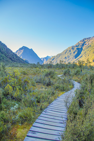
15:25 - Looking across to the large peninsula where the river is meandering its way around. From here I am looking back towards the start of the track. The forest hides the lake. Dores Pass is the low point in the range ahead. This is where a track goes over from the Milford Road when the boat is not operating in the winter season. A couple who has just passed me walked over the pass today along a very rough track. The summit of the pass is higher than Mackinnon Pass, so their most difficult hike is behind them. |
 |
15:29 - Once past the bend the terrain flattens as I continue through the forest. A few minutes later I reach the junction of the wetlands, where I will be exploring later. |
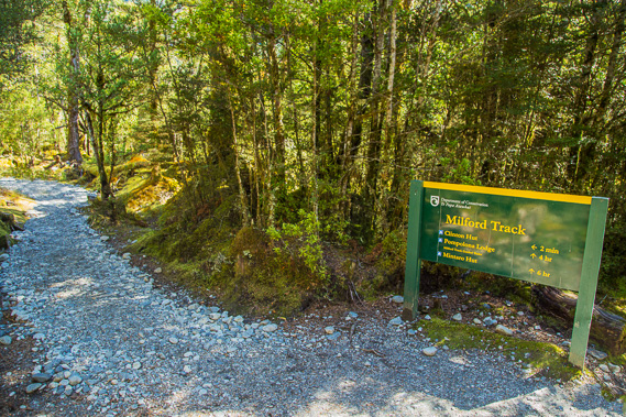 |
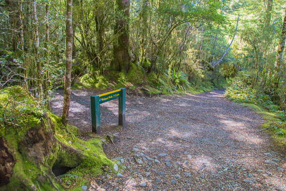
15:42 - Reaching the junction to Clinton Hut presumably just before the three mile marker. The hut is two minutes from this junction along a side track heading away from the river. The next guided hut is Pompolona Lodge which is four hours from here (and a little over 5 hours from Glade House). Mintaro Hut where I'll be heading tomorrow is 6 hours away. |
 |
15:45 - First view of the hut through the thinning swamp forest. Thick carpets of sphagnum moss covers the boggy ground on either side of the track. The moss absorbs the rainwater to keep the soil perpetually moist. |
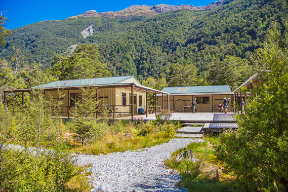 |
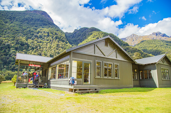
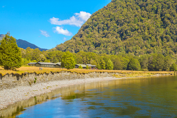
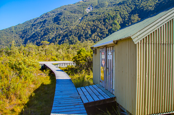
15:46 - Clinton Hut - actually three huts joined together by a large wooden courtyard. It was a short walk today, but I've now reached the first day's destination. To the right is the main dining hut. Clinton Hut was opened in 1997 as part of a big upgrade to the track, which included retiring the steamship Tawera for the new boat. This allowed the number of independent hikers on the track to increase from 15 to 50 per day. |
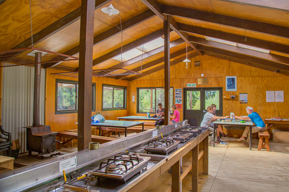 |
16:13 - Inside the main dining hut where gas cookers are provided. Whilst it is not busy here, I prepare my first meal of dehydrated food for dinner. |
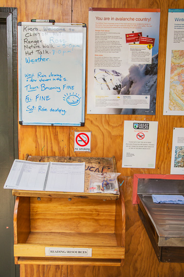 |
16:16 - The sign in book and noticeboard. Fifty people stay at the hut every night during the hiking season, so a system is needed of tickets and sign-ins to keep track f everyone. The weather is looking great for the following two days. Not so sure about the last day on the Milford though. |
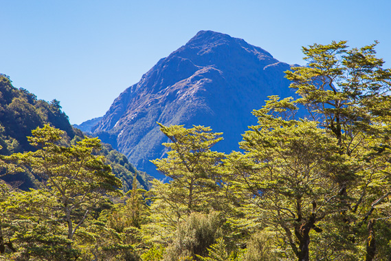 |
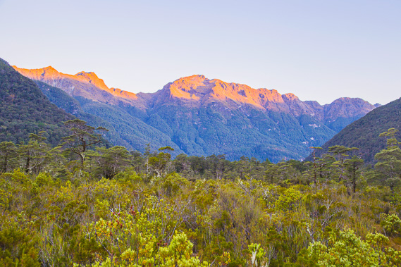
17:13 - Looking upstream from the hut to Mount Solitary. The river valley we have been looking up is to the right, but we will be following the other branch of the river going to the left. Although it appears to stand alone, this mountain is the start of a spectacular mountain range separating the two branches of the Clinton River. |
 |
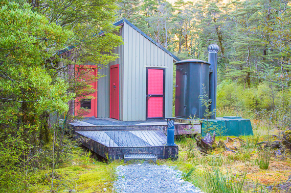
17:15 - View from the hut to the helipad and the service shed. Everything is on boardwalk as the ground here is so swampy. I wondered about the foundations of the hut here in this boggy soil. Maybe is is built on a low rocky outcrop just beneath the surface. |
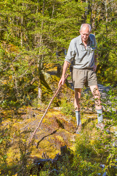 |
17:20 - Ranger Ross runs a fascinating nature tour of the area as he does every day. Standing just over two metres tall, he towers over the group - nearly everyone staying in the hut joins in. Ross is a veteran of 25 years on the track and very keen to impart his vast knowledge of this place he knows so well. |
 |
17:47 - Through a clearing in the forest we see the river. Ross tells us when this rock is covered in water, the track closes because the water on it is over a metre deep in parts and becomes impassible. No significant rain has fallen for a few days and no rain is forecast for another two days so the track will definitely be open all the way through to Milford Sound. |
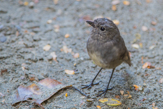 |
17:55 - A bush robin on the path very close to us waiting for the small insects we disturb. |
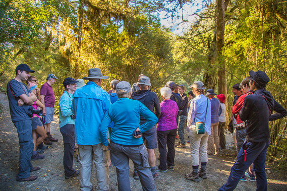 |
17:57 - The group on the little nature walk. These are my fellow hikers, many of them I'll be getting to know very well over the next couple of days on our trek towards Milford Sound. |
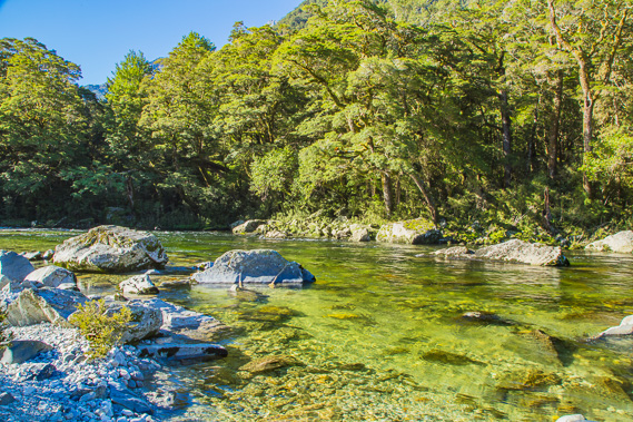 |
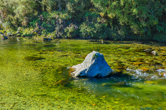
18:01 - We take a little side track down to the edge of the crystal clear Clinton River. The cold water flows quietly around the boulders. |
 |
18:15 - The nature walk tour ends near the junction to the wetlands. Instead of returning to the hut with everyone else, I follow the side track to the wetland boardwalk. |
 |
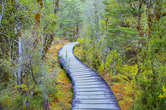
18:17 - Soon the forest floor becomes very swampy and the gravel track gives way to floating boardwalk through the spectacularly coloured sphagnum moss. |
 |
18:18 - Boardwalk leading out to the middle of the swamp, where Mount Solitary stands obvious. The hut is on the other side of the swamp hidden behind the trees. |
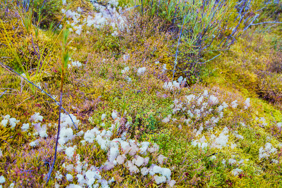 |
18:21 - Spectacular biodiversity in the moss. The entire bog covers what was once a lake. The vegetation growing around the edges of the lake gradually expanded across the middle of the lake until completely covering it. Over many centuries, the bog thickens with peat, now mostly filling the lake. Eventually the forest will also consume the lake as it gradually dries out. This bog is a very good sponge, absorbing the excess water coming down the valley after heavy rain, and gradually releasing it into the river during the drier spells. The bog is a very effective water filter. |
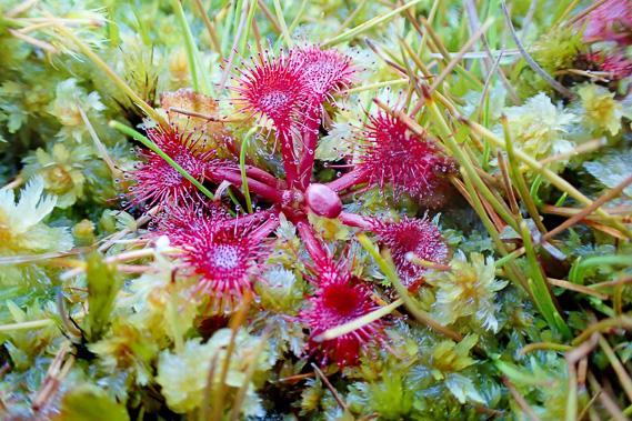 |
18:23 - A carnivorous sundew, about a centimetre across. These sundews are very common here, using the sticky residue on their leaves to catch and digest passing insects due to the extremely poor nutrient levels in the bog. There is also a bladderwort plant which traps insects in their bladder-like traps in their roots, but these are only visible above the surface in summer. The grassy plants growing out of the moss is wire scrub. Their long roots entangle amongst themselves holding the swamp together until the lower layers of dead moss break down into peat. |
 |
18:25 - Returning along the boardwalk through the swamp transition zone forest now encroaching towards the middle of the swamp. These trees and shrubs are more resistant to the boggy conditions than the larger beech and tawai trees growing in the main forest. Eventually when the transition zone forest completely covers the bog, the main forest will eventually return. |
 |
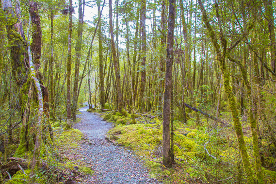
18:33 - Following the main track again in the peacefulness of the early evening. The spectacular forest has a mysteriously calm aura about it with the sun no longer shining. It is completely quiet here apart from the occasional distant birdsong. |
 |
18:46 - The junction is just up ahead. I'll be back at the hut in a couple of minutes. |
 |
18:52 - The ranger's hut just opposite the main one. |
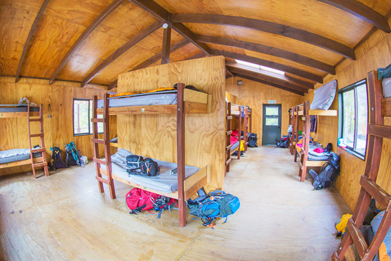 |
19:02 - Inside one of the bunk rooms. The Milford is by far the most popular track, so the bunkrooms can be guaranteed to be full every night of the hiking season. |
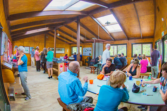 |
19:06 - Everyone else is having dinner. Lucky I got in earlier before the tour when it was a lot quieter. Ranger Ross comes in shortly afterwards to have a hut talk, discussing what we will be expecting tomorrow along the track up to Mintaro. Fortunately the weather looks good and there is little danger to worry about. |
 |
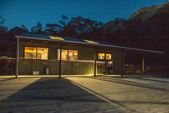
20:42 - After the hut talk, I head back out to the helipad to watch the sun on the mountaintops looking towards Dores Pass. It is nearly 9:00 in the evening and it is still light. This is very different to what I am used to living in the subtropics on the eastern side of the local timezone. Fiordland is the westernmost part of New Zealand and a fair way off the timezone meridian. They also have daylight saving over half of the year, making for late sunrises and very late sunsets over summer. |
 |
21:41 - The sky gradually darkens as a few of us wait for it to darken enough to go out and search for glowworms. |
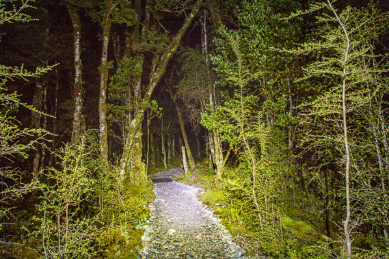 |
22:18 - My head light is very good for navigating through the silent swamp forest as I head back towards the hut. Unfortunately the vast constellations of glowworms I was expecting was only a few points of greenish light, so instead I decide to head to the helipad to photograph the night sky now all the clouds have cleared. |
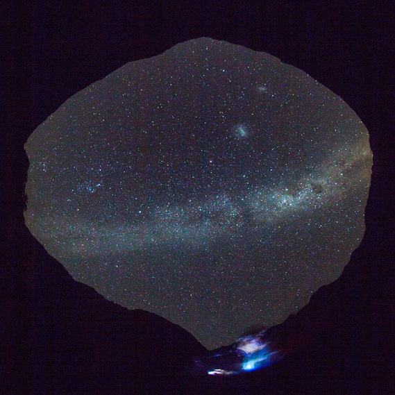 |
22:33 - Vertical view using the fisheye, with 180 degrees view around the mountains. The hut is in the direction of the lights at the bottom. Dore's Pass and the start of the track are to the right, and the valley towards Mount Solitary is to the left. The centre of the galaxy is to the right and the Magallenic Clouds are clearly visible near the top of the image directly above the lights of the hut. |
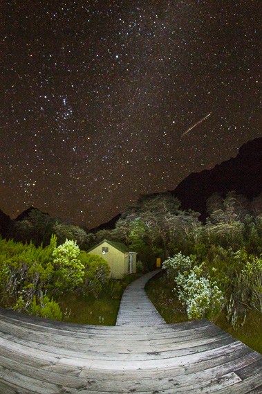 |
22:43 - Looking towards the hut from the helipad with the scene light painted with my head torch. I was fortunate in this shot to capture a meteorite which disintegrated in two points on its entry. Orion is on the left hand side of the shot. |
|