Introduction to today's journey
This is truly the "region of the perpendicular" - the mountains are split right straight down from their summits to within a few hundred feet of sea level. The other valley-side, perhaps half a mile from its fellow, is equally steep and just as precipitous; and presently, as the track ascends, as the trees lessen both in size and number, and the frowning white tipped walls begin to draw together above the canyon, you realise you are walking at the bottom of a gigantic furrow of the earth...
- Blanche Edith Bauhan, 1908
THE ROUTE following the Clinton River upstream has been used by the Maori people of Southland for many centuries as a summer access route towards the rich greenstone fields at the heads of Milford Sound. They would use the track in summer when it was clear of snow as a good alternative to canoeing the rough Southern Ocean seas around the other side of Fiordland. They called the river Wai Tawai and had named every feature along the river in far greater detail than today. The greenstone would be brought back along what is now the Milford Track, and taken down the lake and along the Waiau River to the Southland Coast by moki raft. The route was abruptly abandoned around 1830 when a moki disintegrated in stormy conditions resulting in the drowning deaths of several women and children riding it at the time. The track was henceforth abandoned and they returned to travelling around the western side of Fiordland by canoe to extract the greenstone.
Nearly six decades passed before McKinnon was commissioned to explore the Clinton Valley as a potential route into Milford Sound. By then the thick undergrowth of moss and scrub would have all but covered up any evidence of the track and the numerous campsites along the river. Much of the oral traditions of place names and legends along the river had been lost in the sands of time. Little would McKinnon have known the deep history of this long abandoned mysterious valley he was exploring.
Today's trek takes me further up the Clinton River, following its left hand branch to its source at Lake Mintaro. The valley moderately rises between the walls of rock towering on either side starting through dense cloud forest before reaching heathland with spectacular waterfalls and tranquil tarns as the river cascades down the valley. Eventually I reach the secluded Mintaro Hut at the bottom of a spur in ancient silver beech forest just above the lake.
Today's Journey
Distance trekked today: 16.5 kilometres.
Total distance trekked to date: 21.5 kilometres.
 |
06:55 - Cold mist hovers over the swamp at first light. This looks like it is going to be the perfect day for hiking. |
 |
06:58 - I return to the hut for breakfast before the dining area becomes crowded. Others are already rising, some have similar ideas of starting early. |
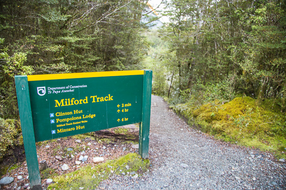 |
07:40 - At the junction with at least six hours to go to Mintaro. With all the photography I'm doing in this amazing valley, it's probably going to take me a lot longer. From here there's a short drop of a few metres to where the track will follow just above the river. |
 |
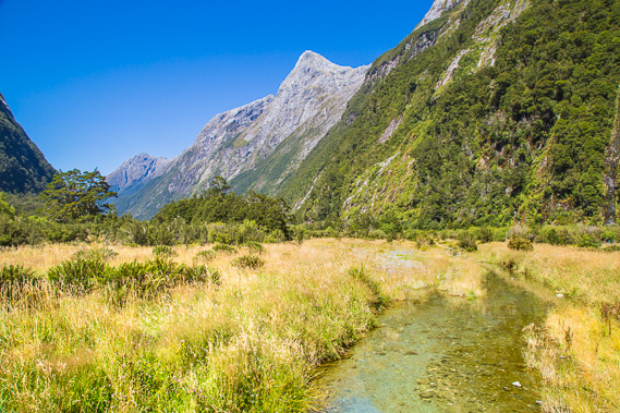
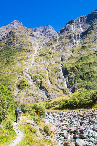
07:48 - The Clinton River just after the three mile marker, stretching wide as it passes through the pristine green forest. It is hard to believe as large as this river is, I will be reaching it's source this afternoon. |
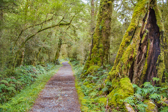 |
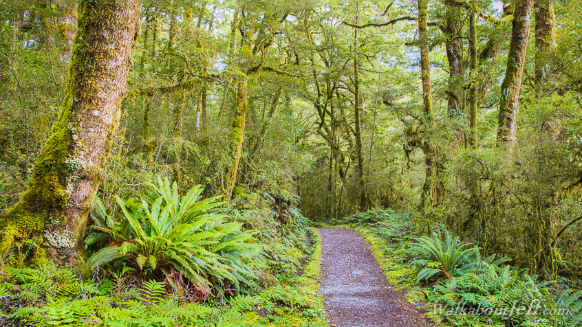
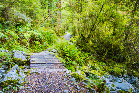
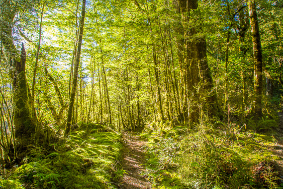
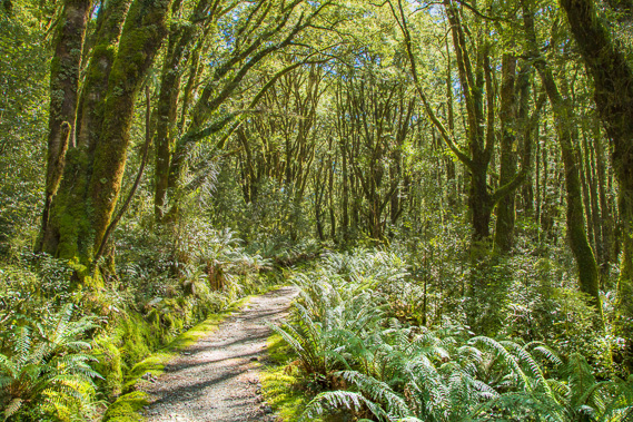
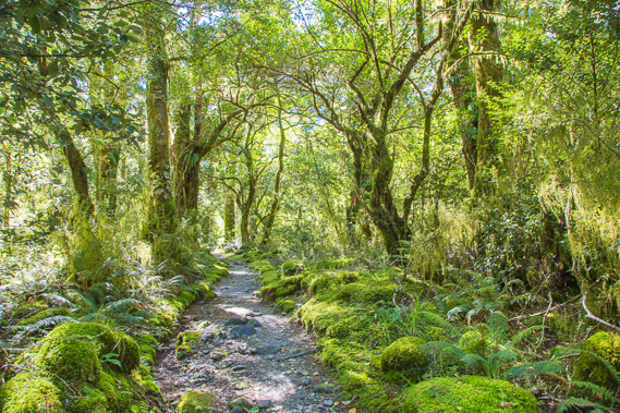
07:51 - The track remains in perfectly manicured condition as it gently slopes uphill along the valley floor in the ancient forest. The larger trees would have been alive when McKinnon did his first expedition exploring the swampy valley in 1888. This was his second attempt at finding a route from Te Anau to Milford Sound, having failed in another expedition the previous year. This year he was commissioned to continue finding a suitable route and was assisted this time by Ernest Mitchell. |
 |
08:00 - The track is so perfect going through the thick forest. There is some birdsong in the trees, but the birds are few and far between. |
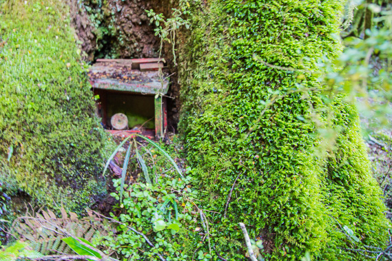 |
08:17 - I head off the track and find the remains of an old phone box mostly concealed in the trees. A telephone line once ran along the length of the track to provide the only communications access to Milford Sound. It was notoriously unreliable though, a single break in the cable anywhere along the track cut off all communication and the fault had to be manually found. Now we have satellite and microwave technology for communicating even in these remote areas. The rangers have satellite phones to allow easy communication with the outside world should it be necessary. Thankfully there is no mobile phone access here, so nobody would be using their phones apart from perhaps as alarm clocks. |
 |
08:26 - I return to the track and continue following it upstream crossing this bridge over a dry creek bed a short distance past the four mile marker. Fortunately I have a good sense of direction. Ranger Ross mentioned yesterday someone a few weeks ago went off the track at one point, and upon returning to it, hiked back to Clinton without even realising they had gone in the wrong direction. |
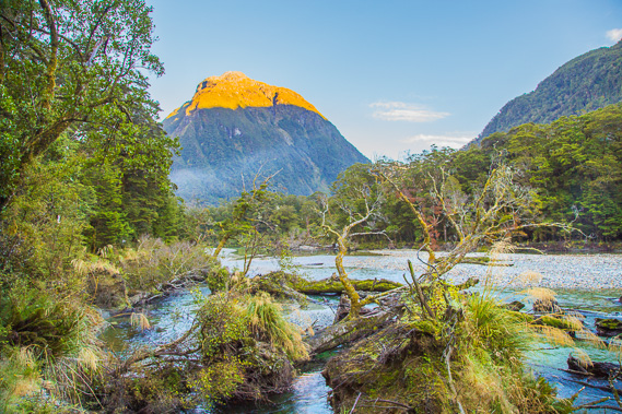 |
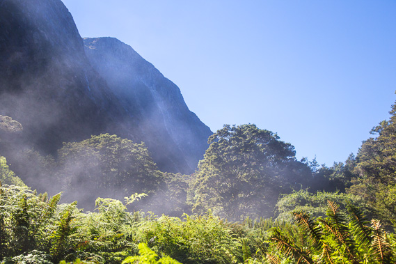
08:38 - I reach the river at a point where the bank has been cut falling some of the trees into the water as the river creeps its way over onto this side. Mist is rising from the valley floor and the sun shines brightly on the top of Mount Solitary boldly separating the two branches of the Clinton River. Mount Anau to the right blocks the sunlight from the valley floor. |
 |
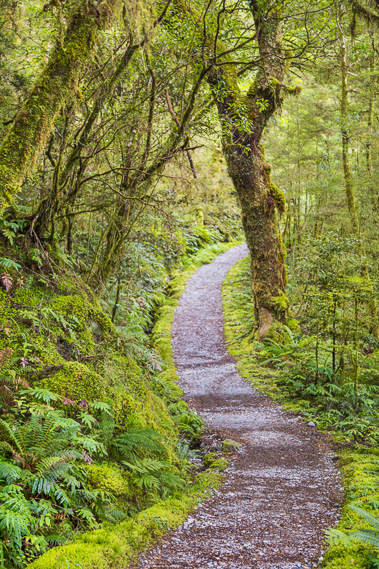
09:05 - Passing the five mile marker, the track nicely meanders its way through the thickening forest. The gravel path is raised above the swampy floor. The early expeditions led by McKinnon would have been a lot slower negotiating their way through the boggy carpets of saturated moss underfoot and bashing through the thick undergrowth. |
 |
09:07 - I reach a clearing past the division of the branches of the river. From here I follow the south branch of the Clinton River. In this view I have one final look up the north branch valley as the sun shines brightly on the mountaintops. There is a pass at the end of the north branch crossing into the Arthur Valley near Milford Sound, but this pass is higher and the terrain more difficult than Mackinnon Pass. The original Clinton Hut was built here in 1966, but the new hut in 1997 was built further downstream at its present location beside the wetlands high enough to be safe from any flooding. |
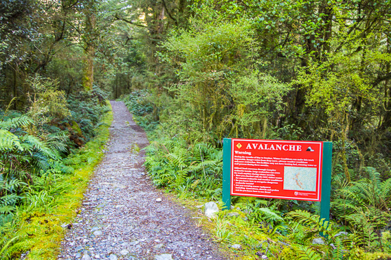 |
09:11 - Reaching the start of the avalanche danger area, which will continue until I'm well down the Arthur Valley on the other side of the pass. Fortunately this late in the season there is little snow on the mountaintops and the weather is calm, so there is almost no avalanche risk today. There are 20 known avalanche paths between here and Mintaro. The avalanche risk is particularly high in late winter and spring when the ice falls from up to 1700 metres altitude above the track generating winds of over 300 kilometres per hour flattening any forest in its path. |
 |
09:26 - The sun is now high enough to shine through the entrance of the river's north branch to the valley floor. The morning sunlight is amazing, but won't last long as I'm now close to Mount Solitary and the range that stretches behind it. |
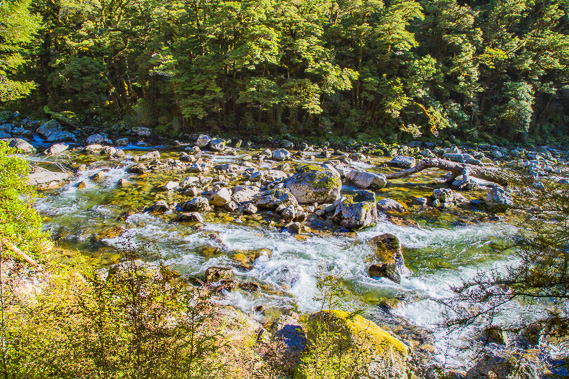 |
09:31 - View of the now roaring river below me. It is all rapids now and will continue to be all the remaining way up the valley, indicating the track will soon start rising significantly on its approach to the saddle. |
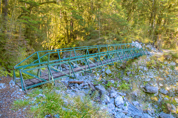 |
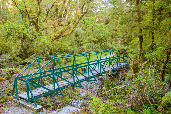
09:35 - A temporary bridge which is removed by helicopter in May for the winter avalache season. Ten bridges from this side of the pass before Mintaro Hut, and one bridge on the other side of the saddle above the bushline is removed. Hikers doing the track over winter have to ford these streams until the bridges are replaced in late October in time for the next year's hiking season to start. |
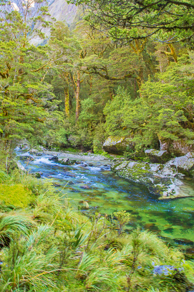 |
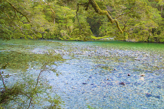
09:44 - The cold river is deliciously clear as Mount Solitary blocks off the sun from this view shortly after the 6 mile marker. |
 |
09:57 - Another temporary bridge in amongst the gnarly silver beech. The ground in this sunless valley is becoming increasingly swampy, but the track remains high and dry. |
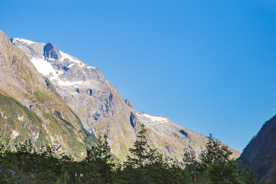 |
10:17 - Reaching a clearing where I see the first snow on the high mountains in the distance looking upstream. The saddle is not visible yet. |
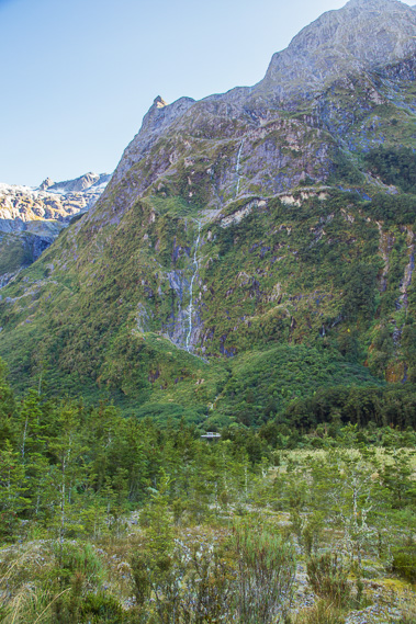 |
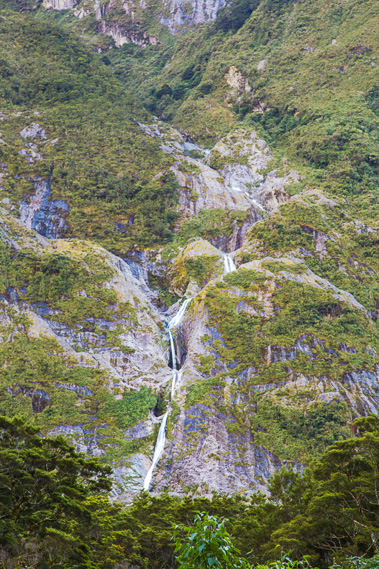
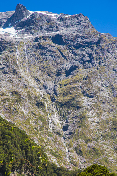
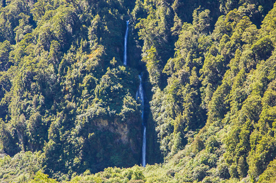
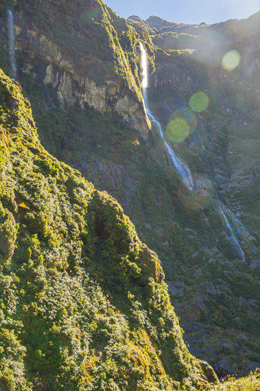
10:23 - First view of Hirere Falls tumbling nearly a kilometre down the mountainface as I approach the seven mile marker. |
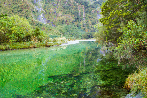 |
10:31 - Heading past the waterfall, I reach a perfectly clear pool of cold alpine water of the Clinton River. Flooding from heavy rain causes the gravel to shift, and this part of the river turns into a rapid gouging out the rocks depositing them further downstream. |
 |
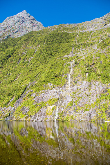
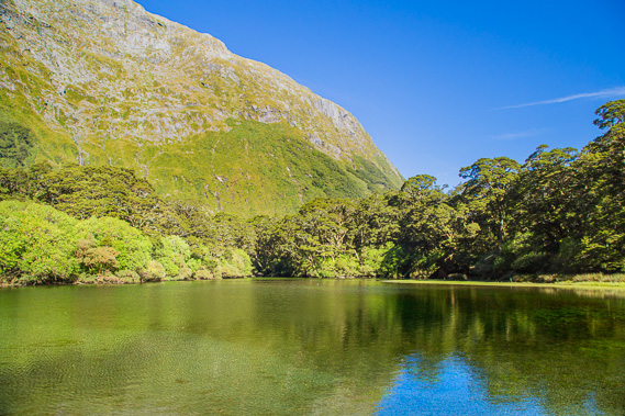
10:32 - Looking upstream from the same spot the mountains reflect perfectly in the mirror smooth river. This valley was very familiar to the Maori people of Southland who ventured over this route to collect and bring back the precious greenstone. Every mountain, every stream, and every feature had its own unique name, steeped in rich history and legend. Almost all that information was lost with the abandonment of the Maori track in the 1830s, with no trace left when Mackinnon explored the valley fifty years later. |
 |
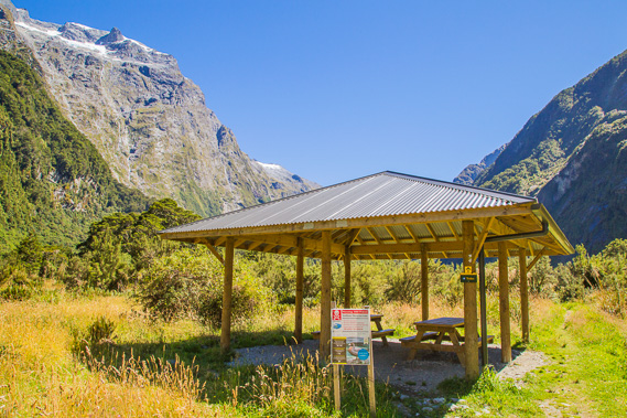
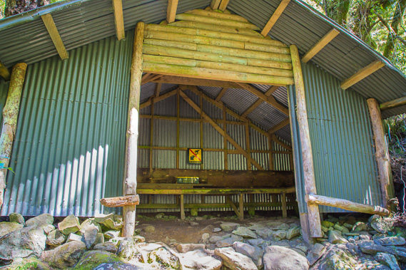
10:50 - Reaching Hirere Shelter. This is a small hut which the guided walkers stop for lunch on their way between Glade House and Pompolona. There are no facilities for independent walkers to stop here, but there is a toilet to use and plenty of good stops further up the track once we start getting above the bushline, the first being at Hidden Lake, about half an hour or so further along the track. |
 |
10:52 - View of Hirere Falls from near the shelter, as this permanent stream tumbles its way down the glacially eroded rock face. |
 |
11:08 - About ten minutes above the shelter, I leave the bush in a swampy area where steam rises from the plants. The sun has finally risen above the mountain range to evaporate the moisture from recent days' rain. |
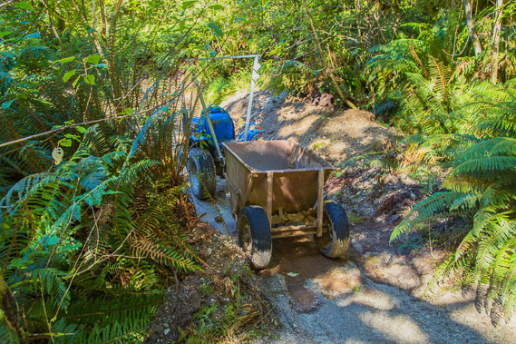 |
11:16 - Some track maintenance equipment a little past the eight mile marker. Today is a day off so there is no activity here. |
 |
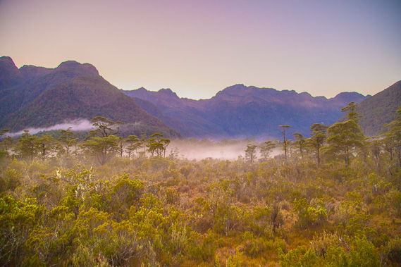
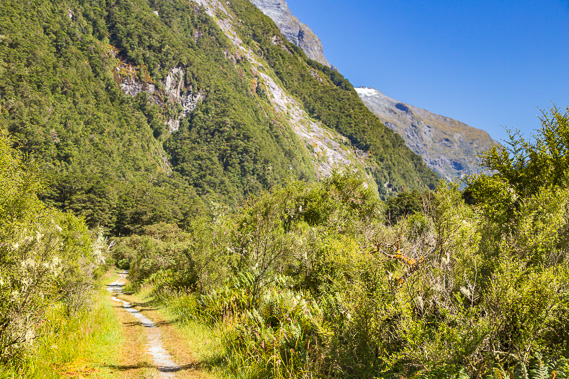
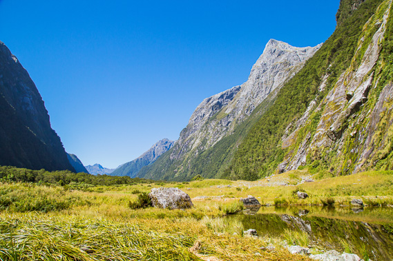
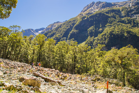
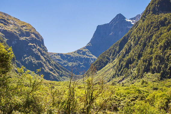
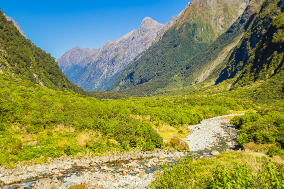
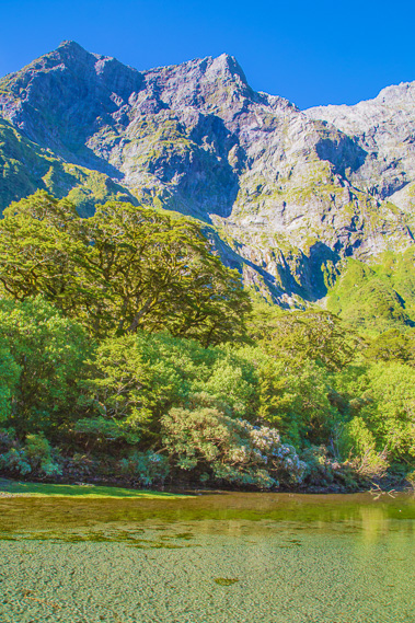
11:37 - My first view of Mackinnon Pass, quite distant up the valley, but looking ominously high even from here. Tomorrow's climb is going to be quite a challenge. Mintaro Hut is at the end of the last spur to the left in front of the pass. The forest has just ended being replaced with heathland scrub even though I am still several hundred metres below what should be the treeline. The frequent avalanches coming down the mountainsides prevents any permanent forest establishing itself around here. |
 |
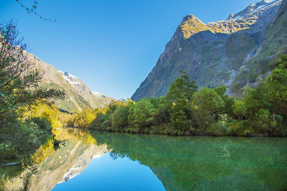
11:39 - Reaching Hidden Lake where I stop, having diverted ten minutes along a side track which is closed when there is avalanche danger. The main track runs a more direct route staying away from the mountainside. The moraine deposited from the last glacier to reach this far, or perhaps a landslide, prevents a view down to the end of the valley where I have come from. |
 |
11:40 - A weka foraging along the side of the lake, eating whatever the hikers would feed it or accidentally drop. This area was possibly one of numerous nohanga (camping grounds) the Maori used on this route. The trip up the valley was slow, taking them many days. They had to set up camp and hunt for food each day, deal with what the harsh climate would throw at them. On their return journey, they would also be burdened with the weight of the precious greenstone they were carrying. If this was a campsite, it is quite possibly Te Re-korari, the Flaxstick swamp where it is said man eating tuna (eels) lurk in the waters. They tell the story of an elderly couple staying here disappearing without a trace, believing the tuna had eaten them. |
 |
11:43 - A waterfall tumbling down into the mirror smooth lake from what appears to be a hanging valley next to a dramatic rock face peak. |
 |
11:55 - Back on the main track heading along the bright sunny heathland along the bottom of this massive valley. Looking ahead a large scar is visible where a past avalanche has wiped out the forest in its path. |
 |
12:05 - Reaching the river and more forest as the river quietly meanders through the valley just before the nine mile marker. |
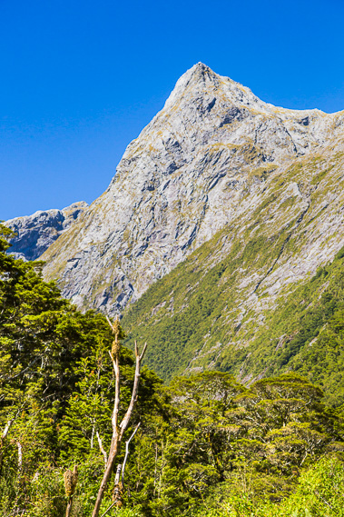 |
12:21 - The dramatic unnamed peak now towers over the forest. Its almost vertical rock wall is too steep to sustain vegetation. |
 |
12:32 - I reach another small waterfall which drains into another small lake carved out by substantial torrents and avalanches. |
 |
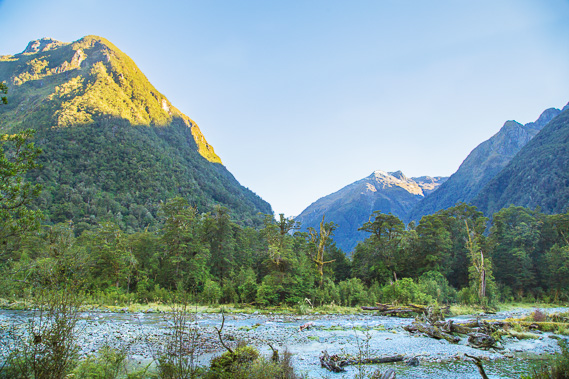
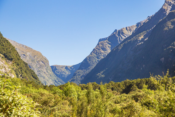
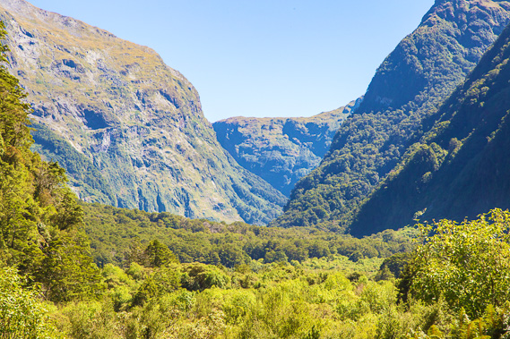
12:34 - I am now clear enough out of the scrub to see down the valley to the mountains at the end of the valley and Dore's Pass behind Lake Te Anau to the right. This is a very long and straight valley. Clinton Hut is behind the spur to the right at the end of the valley. I have already come a long distance today. This distance is somewhat exaggerated by the flat I'm standing on hiding all the forest I've hiked through hidden below its edge. |
 |
12:36 - Zoomed into Mackinnon Pass, it is now looking closer, with the shelter on top of the saddle just visible. There would be people up there on the saddle looking back down this valley. |
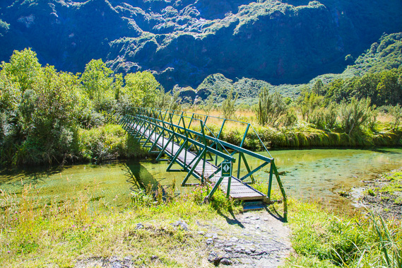 |
12:39 - Here the Clinton River diverts into two channels, with a bridge crossing this channel to the large island in between the now gentle streams. |
 |
12:56 - Reaching Prairie Shelter shortly after the ten mile marker, with a toilet about 50 metres behind it. The Prairie is named due to the grassy heathland which I've been following for the last quarter hour, and it looks to continue for another five or ten minutes. This is a good stopping point for independent hikers to have their lunch. Shortly after my arrival a three female runners jog past having started at the other end of the track and aiming to complete the entire 53 kilometres by the end of today, catching a boat back across Lake Te Anau. That's one way to see the track. |
 |
13:10 - More waterfalls tumbing down the mountain viewed from the shelter just before a couple of others arrive joining me for lunch. |
 |
13:25 - After leaving the shelter, I cross a bridge over the same branch of the Clinton River to leave the little island. The sky today is perfectly clear - quite a rare sight here in Fiordland where it is normally raining. |
 |
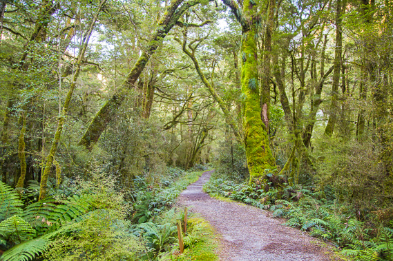
13:41 - After the bridge, the track leaves The Prairie starting a moderately steep ascent entering ancient forest. This marks the beginning of the moderate rise towards Mintaro. |
 |
13:51 - I reach Bus Stop Shelter, not because any buses stop here, but just looks like one. This is the emergency shelter to stop if the coming streams we will be crossing are flooded. I can imagine sodden hikers in rain capes huddling in this little shelter waiting for the rain to stop and the streams to go down. Fortunately there's no rain today so everything should be clear. |
 |
14:00 - About twenty metres past the shelter I reach this landslide with a small stream tumbling down it. The rocks are loose and the slope moderately steep, but a good temporary track is worn between the markers. The stream quietly bubbles under the boulders today, but in a storm it would be a dangerous torrent tearing down the side of the mountain. Fortunately these mountain streams fall very quickly when the rain stops falling. |
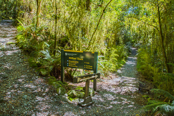 |
14:14 - Upon crossing the landslide, the track returns into the forest and after a short time I reach the junction of the Pompolona Huts, named after one of the recipes famously cooked here by one of the guided walk's first chefs. These huts are for the guided walkers only paying $2000 to $3500 for the three nights on the track (and one in Milford Sound after the trek). This will be their destination tonight. Some of the faster guided walkers have overtaken me, but from here I won't be seeing any more until well into tomorrow. I have about another two more hours to go to Mintaro, following the track climbing above the clearing where the huts are based. The track rises behind the huts, but there is no view of them apart from hints of the reflections of the metal roofing shining through the thick forest. |
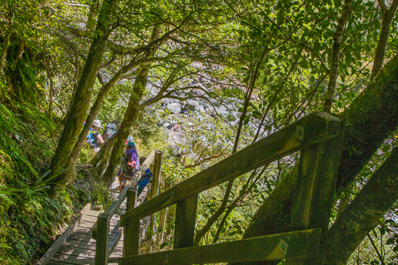 |
14:26 - Once past the huts, the track steeply descends this wooden staircase set into the trees under the dark canopy directing us towards a river roaring down the gully. |
 |
14:29 - The track follows the river upstream a short distance under the dramatic waterfalls tumbling down the mountain. Here I stop to fill my camelback with some of the purest water I have ever seen and tasted. This water is freshly melted glacial ice tumbled down the mountainside. |
 |
15:02 - Once I cross the bridge across the stream, the track rises to this viewpoint looking up towards the saddle where the Mckinnon Pass Shelter is now visible in this picture. Mintaro Hut is at the end of the spur during this trip, but at the time of writing a new hut is being built in the valley about two kilometres in front of it due to the earthquake risk. I am guessing the hut is being built at the top of the rise in the foreground. The land there is very open and at much less risk of rockfalls in an earthquake. |
 |
15:03 - The 115 metre high St Quintin Falls across the other side of the valley just before the 12 mile marker. |
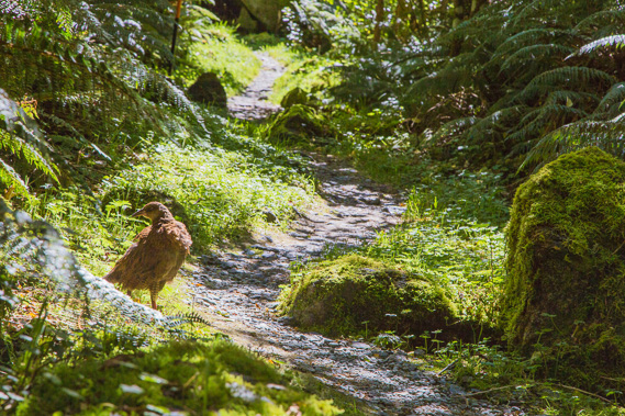 |
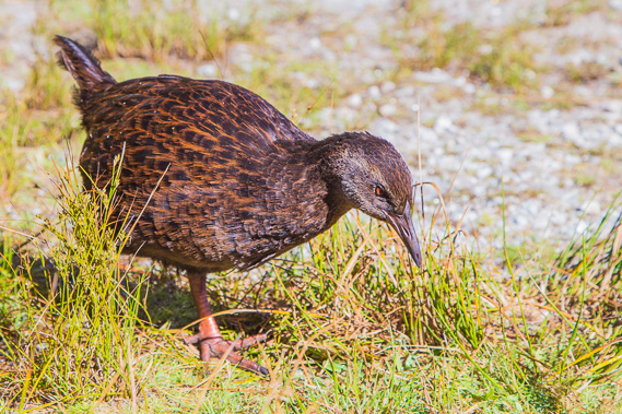
15:29 - A weka on the track. A few minutes later I meet tonight's ranger Laura. She is clearing some of the weeds from the track. When the rangers have cleaned up the huts following the departure of each group in the morning, they spend a bit of time each day maintaining their section of the track. I am guessing each ranger is allocated a section of the track to maintain, perhaps Ross maintaining up to The Prairie, and Laura maintaining the track from The Prairie to the shelter on the pass, and the other ranger we will meet tomorrow night perhaps looking after the pass down to Sandfly Point. |
 |
15:50 - Another waterfall gleaming in the sunlight as the water pounds its way down the glacier carved mountainside. The top of the waterfall catches the strong sunlight before plunging into the relative darkness of the deep valley. |
 |
16:05 - Looking back down the valley. The Clinton River is looking very small now compared to this morning. The wide bed of boulders it runs through gives some scale to the torrents that flow here during very heavy rain. The valley has turned with The Prairie hidden below what I can see of the valley floor. |
 |
16:31 - The forest just past the 13 mile mark is a lot more goblin-like with the increased altitude. It is shortly after this point when I reach the junction to the Clinton Hut. From the junction, a side track gently ascends two minutes to the hut. |
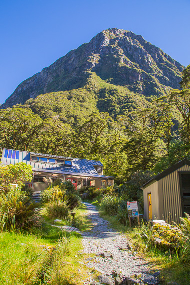 |
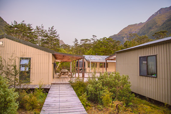
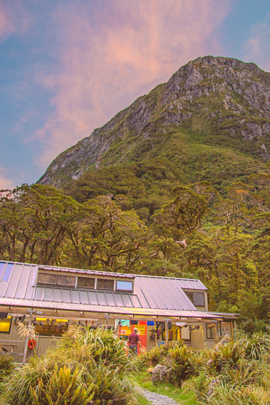
16:57 - First view of Mintaro Hut under the end of the spur at the base of an unnamed 1876 metre high mountain. This does look risky. A big earthquake would dislodge rocks from above rolling down towards the hut. This is why the hut is now being rebuilt in a safer location. |
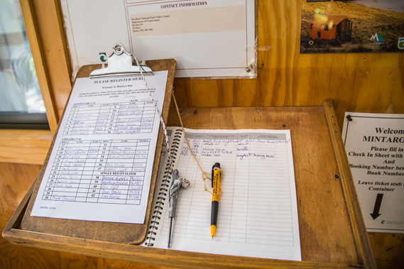 |
17:15 - The sign-in sheet at the hut. I'm one of the last to arrive thanks to all the amazing scenery to photograph during the day. The long late summer days doesn't make progress an issue, but unfortunately means I will have to sleep in a top bunk. |
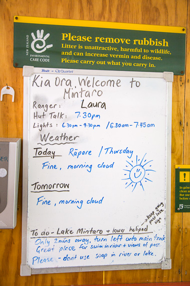 |
17:16 - I check the noticeboard. The weather forecast tomorrow is looking good for crossing the pass, so hopefully there will be some great views of the mountains on either side. |
 |
18:00 - Once unpacked and settled, I return to the main track and follow it upstream for a few minutes. |
 |
18:06 - I reach a helipad just above the top of Lake Mintaro, which has largely filled in by silt. The lake would have been a lot deeper when the glacier from the last ice age was retreating, leaving its terminal moraine to form the dam creating the lake. I follow the river channel with doesn't seem to be flowing at all. |
 |
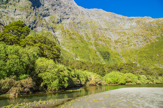
18:07 - The very shallow Lake Mintaro, the source of the Clinton River. I can't see far down the valley. The hut is in amongst the trees in the foreground. This was most likely the Maori nohoanga (camping ground) they called Te Hapua-whio, the lagoon of the blue duck. |
 |
18:13 - Mount Balloon towering over a vertical kilometre above the lake. I take this picture with a wide angle lens, but looking at it from the lake makes me dizzy. How can such a high mountain stand without toppling over? |
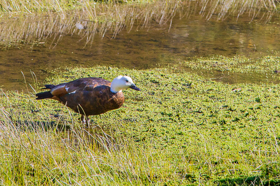 |
18:17 - A paradise duck. I have seen quite a few of these today, and even had a glimpse of a rare blue duck, but it was too far away to photograph (I do get to photograph one at Milford Sound, and again on the Waikaremoana track). |
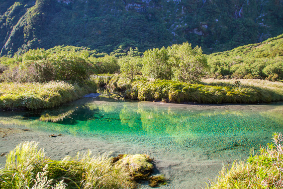 |
18:19 - Spectacular colours of the channel of water leading into the lake as I return to the track to the hut. The water is not flowing, but a torrent flows here during heavy rain, carving out the channels. |
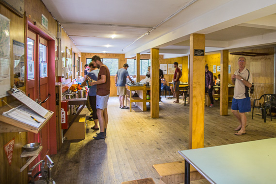 |
19:09 - The hut dining room which is quite busy now as I cook dinner. Laura comes and does her hut talk, explaining the route over the pass. Fortunately the track is in good condition so there's nothing to worry about, but she does warn of the huge downhill on the other side of the saddle. There is a drop of about a kilometre from the top of the saddle to Dumpling Hut. |
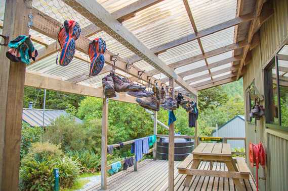 |
20:11 - Boots hanging outside as I head outside after the hut talk. The boots have to be tied together to prevent being stolen by kea. |
 |
20:12 - The shadow of the valley quickly rises up the wall of rock on the other side of the valley as the sun prepares to set. |
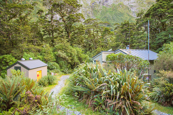 |
20:13 - View down the path from the front of the hut past the ranger's hut and utility shed. |
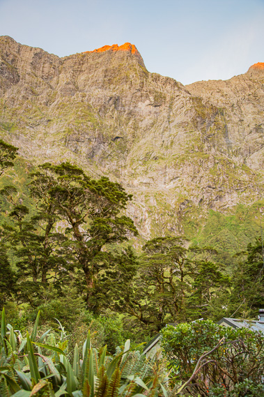 |
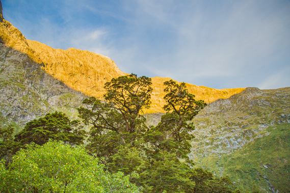
20:49 - Last light on the mountaintops. Although I have not seen the sun for a couple of hours, it has not set yet, and the twilight will be long. But I need an early night to prepare for the big day tomorrow. |
 |
20:57 - The sky darkens but the sun still reflects on the cirrus clouds which have suddenly appeared above. Cirrus clouds coming across the Tasman Sea are usually an indication of rain on the way. There is no rain forecast for tomorrow, but the following day is expected to be rainy. |
|