Introduction to today's journey
As we neared the top, the driving mist gave us entrancing glimpses of white crested peaks and crags and by the time we had completed the ascent, the sun had drunk up the mist and unfolded for us a gorgeous panorama of indescribable magnificence. On one side of the pass the deep-sunk verdant Clinton Canyon, on the other side the smiling Arthur Valley, and all around mighty peaks dressed in eternal snow dazzling in the brilliant sunshine.
- Otago Daily Times, 1912
MACKINNON Pass is a formidible arete separating the Clinton and Arthur Valleys. Long after the Maori people had abandoned the greenstone route, Quintin McKinnon successfully negotiated his way across this pass descending the 900 metre drop down the other side into the headwaters of the Arthur River. Upon reaching the bottom of his descent, he was greatly surprised to discover a freshly blazed trail, but recognised it as the newly constructed track between Milford Sound and the nearby Sutherland Falls. There he erected a stick and posted a hand written note with the message "To Mr Adams or Sutherland; arrived 17th October 1888, 4 o'clock sharp; all well; gone down river. Q McKinnon."
When Surveyor Charles Adams and Donald Sutherland were leading their next trekking expedition up to Sutherland Falls, they were equally surprised to find the note from McKinnon, having somehow successfully scaled the impenetrable rock walls surrounding the valley from Te Anau. The new route up the Clinton River and over the saddle combined with Sutherland's track would soon become the now famous Milford Track.
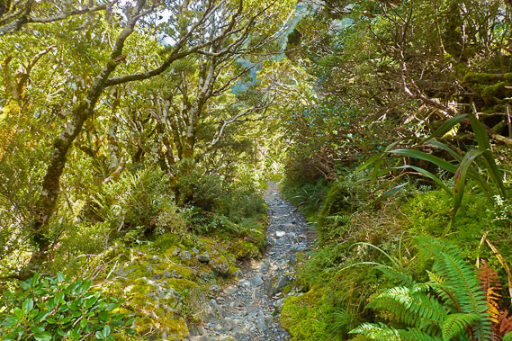
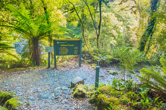
Today's trek starts at Mintaro Hut, crosses a dry stream above Lake Mintaro before steeply negotiating its way to the top of Mackinnon Saddle. From there the track follows the tussocklands and tarns along the top of the saddle until starting a long 900 metre descent under Mount Balloon following the Anderson Cascades to the Sutherland Falls junction at Quintin Hut before a final descent along the banks of the Arthur River to Dumpling Hut.
Today's Journey
Distance trekked today: 14.0 kilometres.
Total distance trekked to date: 35.5 kilometres.
 |
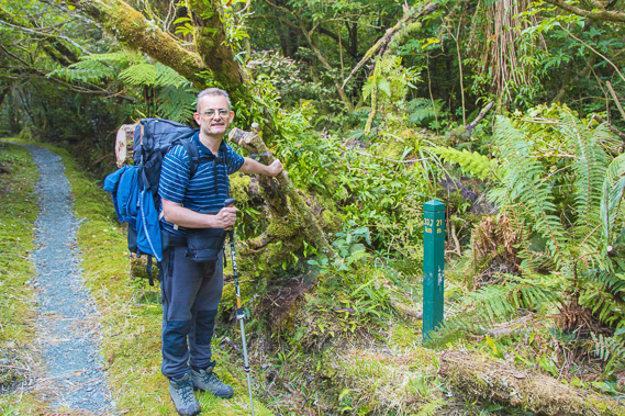
06:49 - Early start at the Mintaro Hut at first light. The solar lights have come on and quite a few of us are already up having breakfast ready for the longest and most challenging day of the trek. Despite having to climb down off the bunk this morning, it has been a good night. This is a very good group with everyone getting on well and no snorers that I could hear (the rangers suggest any snorers sleep in the communal rooms to not disturb others). |
 |
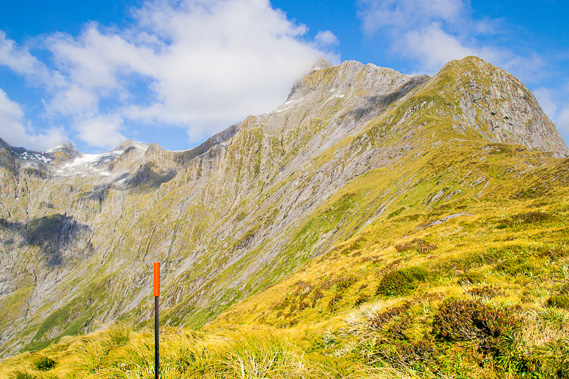
06:51 - A little cloud lingers around the top of Mount Balloon, but otherwise this looks like a clear day for crossing the mountains. That being said, the weather can rapidly change at any time of day. Mountains create their own weather, but having the clear sky and a good forecast is a very good sign of great scenery today. |
 |
06:58 - Breakfast in the hut. All the early birds are up now frantically getting breakfast out of the way for an early start to go over the pass. Others continue sleeping, opting for a later start to cross the pass. |
 |
07:02 - The helipad above the toilets. Each hut has a helipad for transporting supplies and for medical evacuations. |
 |
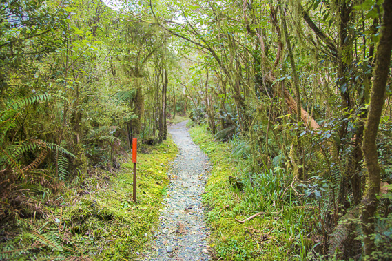
07:25 - I leave the hut at sunrise. A few minutes later after passing Lake Mintaro, the first rays of sunlight hit the mountaintops. I am now just short of the 14 mile (22.5km) marker. |
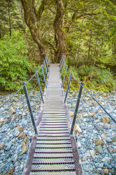 |
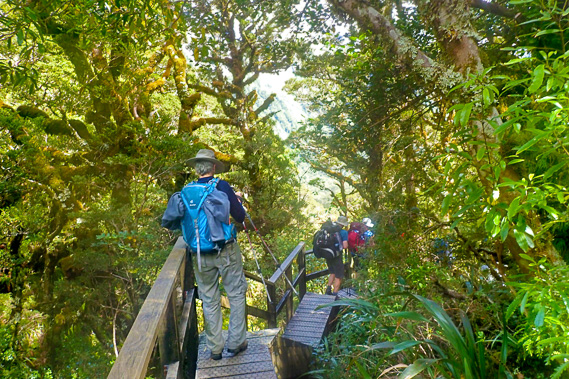
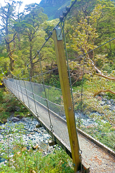
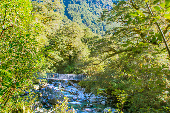
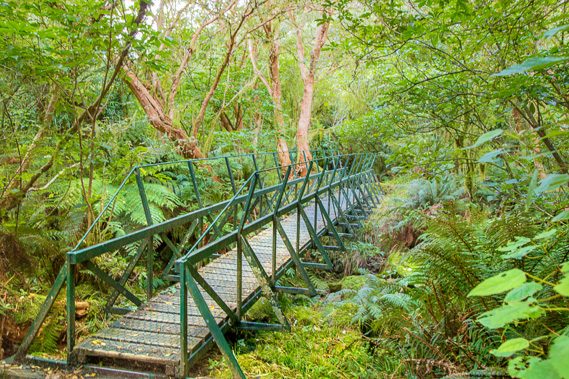
07:40 - The swingbridge over the upper reaches of the Clinton River is supported by trees at the far end. Steps lead up to the bridge on either side. Although there is no water under the bridge, a torrent often flows here in flooding, so the bridge needs to be high and held strong to prevent it being washed away. |
 |
07:41 - Looking down the dry creek bed towards Mount Balloon. This part of the valley drains very quickly. I'm guessing some permanent water flows underground through the coarse gravel. This will be the last bridge I cross until crossing the top of Roaring Burn down the other side of the pass. |
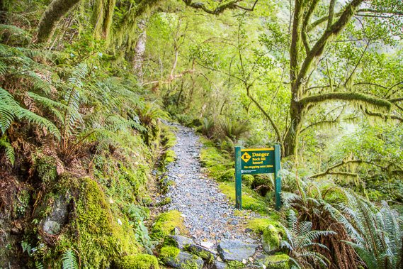 |
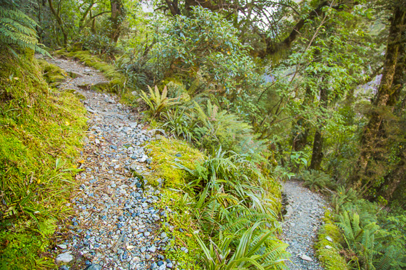
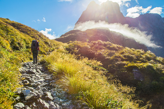
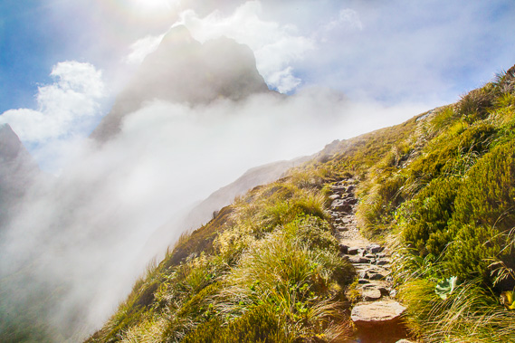
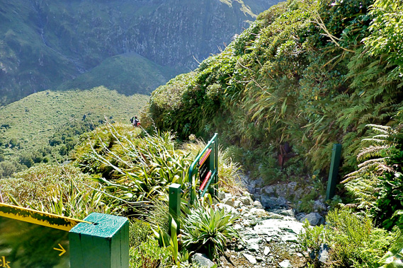
07:55 - The track narrows and becomes quite rocky in places as it moderately rises towards the pass. Here I reach an area of rockfall danger for about a hundred metres as the track passes under a cliff face. A couple of minutes pass before the track doubles back away from the face to where the rockfall danger passes. |
 |
08:30 - The track winds its way backwards and forwards around the second of fourteen bends to the top shortly. The bush here just before the 15 mile (24.1 kilometre) marker is thick and the air very cool. Two very fast hikers pass me, obviously in a mad rush to get to Dumpling Hut as quickly as possible. |
 |
08:40 - A gap through the now scrubby forest affords a view back to Lake Mintaro. Small waterfalls tumble down the side of Mount Balloon. The lake looks surpisingly small from here. Another dangerous rockfall area lies just ahead. |
 |
08:54 - The track steepens and becomes quite rocky as it continues heading up towards the pass. Climbing over this during winter when there is a layer of snow would be quite challenging. |
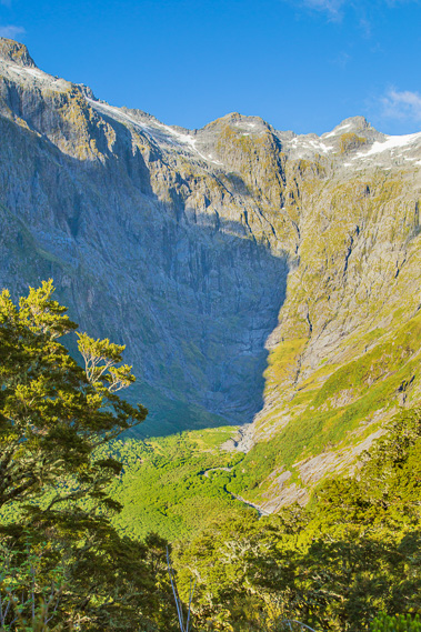 |
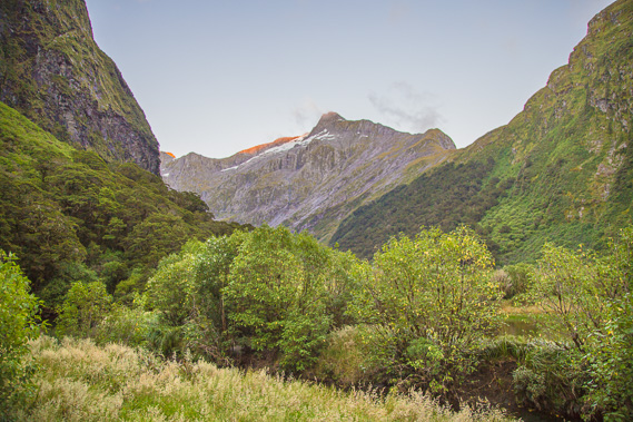
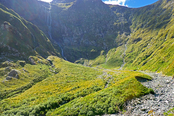
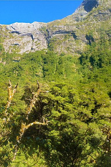
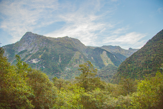
09:25 - View to the cirque at the source of the Clinton River. This basin was once the ice accumulation area from where it flowed down the glacial path carving out the valley all the way down to where we caught the boat at Te Anau Downs. |
 |
09:58 - Approaching the top of the saddle through exposed tussocklands with the bright sun having just risen above the top of Mount Balloon. |
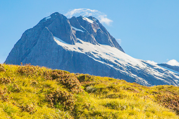 |
10:00 - First view of Mount Elliot with little clouds quickly passing over its very exposed summit. The near summit is 1928 metres high and the higher summit behind to its right is 1990 metres high. Jervois Glacier sits on the ledge above the spectacular cliff. Dumpling Hut is just on the other side of this peak. I feel a breeze for the first time since getting off the boat at The Glade. The air on the track has been dead still until now, but as I approach the top of the pass it blows stronger. |
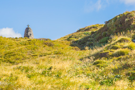 |
10:01 - First view of the Mackinnon Pass memorial. The cairn was built by the Otago Gaelic Society who raised funds over the 20 years following Quinton McKinnon's drowning death on Lake Te Anau in 1892. Dunedin stone mason James Robertson built it in the summer of 1914-15, hiking in from Pompolona with his small team every day to collect blocks of stone and build the cairn. They cemented the blocks together with lime. The tough work severely affected James' health and he died back in Dunedin a few months after completing the job. |
 |
10:02 - Looking along the ridge at the 16 mile (25.7 kilometre) marker towards the 1769 metre high Mount Hart. A string of poles with orange tops is used for navigation when snow covers the pass. |
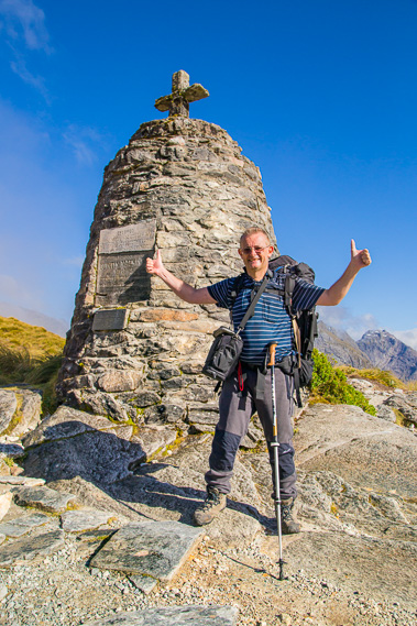 |
10:11 - I reach the MacKinnon memorial. At the time I thought was the top of the saddle - this is the lowest part of the pass at 1069 metres). The memorial commemorates the memory of Quinton McKinnon who reached the top of this pass with Ernest Mitchell on 16 October 1888, and later confirmed this was the best overland route to Milford Sound. |
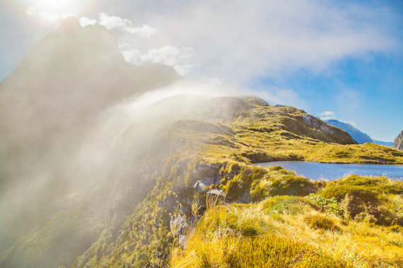 |
10:19 - Looking back from the edge to Mount Balloon. Cloud is streaming up the side of the cliff and over the pass. It is clear over this side of the pass but will it stay fine? At this altitude the mountains make their own weather. Fortunately the breeze is gentle only just ruffling the grass. More often than not the wind is very strong across here. Sometimes the wind is cyclonic in strength, forcing hikers to hold onto the grass and rocks to prevent them from being blown off the pass. |
 |
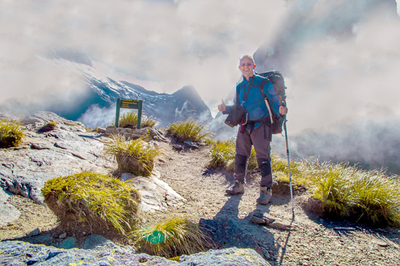
10:20 - Posing at the edge of the 900 metre high cliff above the valley floor. On the other side of the valley is the 1391 metre high Mount Pillans. Obviously this isn't the way down the other side with a 700 metre vertical face of rock dropping from just two metres in front of me. The main track has to cross along the top of the saddle towards the base of Mount Balloon. A nice young Asian guy with the same camera takes my picture. Three of us doing this track have a Canon 6D with 24-150mm lens, so where possible we take pictures of each other (particularly this one, and at the monument a few minutes ago) as we are completely familiar with the equipment. |
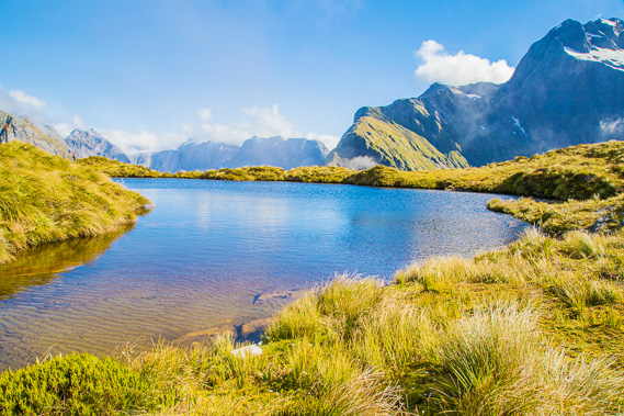 |
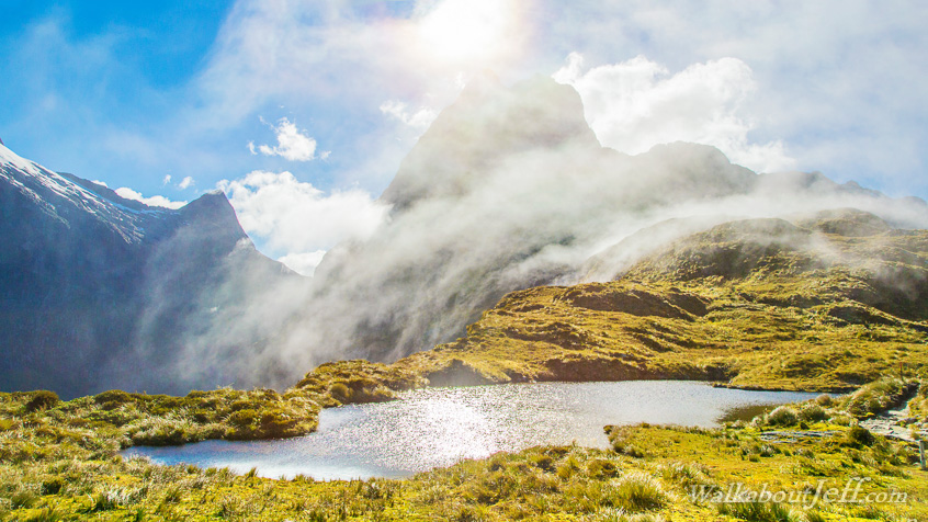
10:27 - One of many tarns along the top of the saddle just before the track starts ascending. These tiny lakes look pristine and inviting, but they are exposed to the extreme elements - severe wind, rain and snow all year round. This pass gets over ten metres of rain every year, making it one of the wettest places in the world. Today is sunny and the breeze is only just enough to ruffle the surface of the water. |
 |
10:31 - Zoomed into the headwaters feeding the Arthur River. Mount Daniel is to the left and Lady of the Snows is just visible through the cloud to the right. |
 |
10:33 - The track continues to ascend, and it is not long before I'm quite high above the memorial now looking very small in front of Mount Hart. |
 |
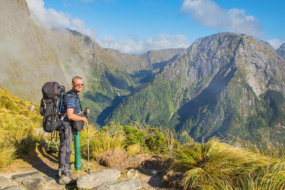
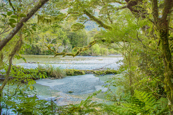
10:37 - Zoomed into the bottom of the Arthur Valley at the point from where I'll have a good view of the Sutherland Falls later today. The straight line leading from the river is an airstrip. This would be one precarious place to be flying a plane so close to the walls of the mountains. |
 |
10:41 - Ghostly cloud continues to blanket the side of the mountain drifting over the pass. The rocky track continues heading uphill towards its highest point. |
 |
10:49 - I reach the top of the track at 1143 metres above sea level as thick cloud now envelopes the mountains. Good thing I got some clear views back at the memorial as it looks like the weather is closing in despite the clear forecast, but here in the mountains, who knows? As they say, what goes up must come down, so this is the point where the very long 1033 metre downhill to Dumpling Hut (at 110 metres above sea level) begins. This is the longest single downhill on any of the great walks. |
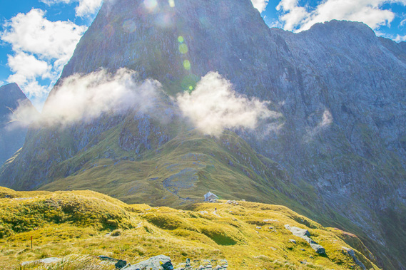 |
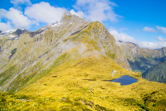
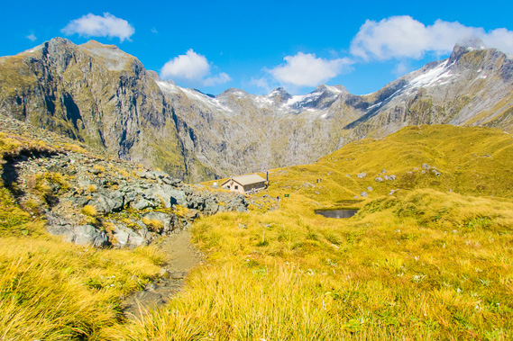
10:54 - I get my first view of the MacKinnon Shelter at the base of Mount Balloon. There is some wind blowing over the saddle now, but often it is very strong and very cold. Several previous versions of the hut have been blown right off the top of the saddle. The first hut was built in 1928 having been packed in parts on horseback all the way from Invercargill. It blew down three times in its forty years, each time requiring people to carry building supplies back up the mountain to rebuild it. |
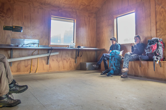 |
11:13 - Resting inside the hut. I reached the back of the hut about ten minutes ago from where a short side track heads around to its front. From here the left hand end of the hut is for the independent walkers and the right hand end of the hut is for the guided walkers. An A frame hut was built in 1958 but with the increasing numbers of hikers, needed to be further upgraded. A larger hut was built in 1967. For one year the three huts all stood here until they were all destroyed and blown off their foundations in a gale in 1968. A new A frame hut was built in the early 1970s and was replaced 10 years later by this hut which has stood and survived all the gales ever since. |
 |
11:22 - The toilet outside the hut bolted down to he ground with cables to prevent it blowing off the edge into Lake Mintaro nearly half a kilometre below. Apparently this toilet has the best view in the world. |
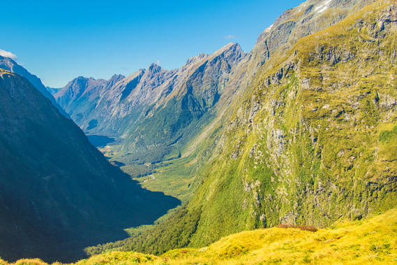 |
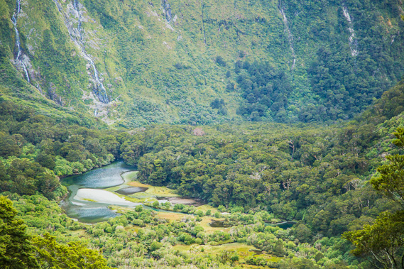
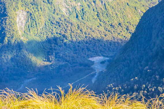
11:23 - View down the Clinton Valley from the toilet - no wonder it has this reputation. Just hoping there is nobody down there on the track with a supertelephoto lens pointing this way. Although it is approaching midday, much of the valley remains in shadow. Mintaro hut is at the bottom of the nearest ridge. Clinton Hut is behind the ridge in the last dip before the fathest mountains around Dore's Pass. |
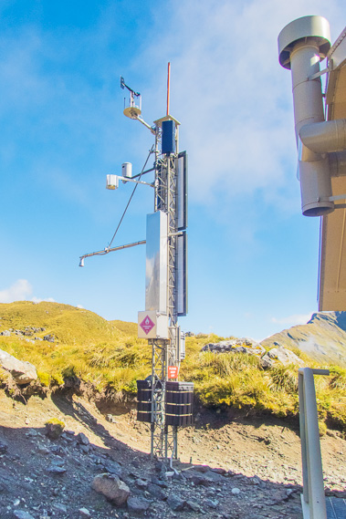 |
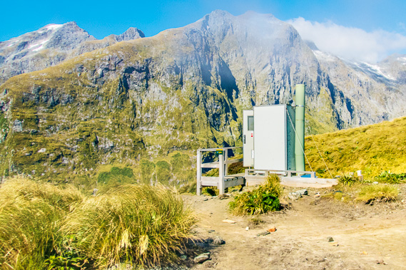
11:26 - The weather station next to the hut. Over ten metres of rain falls here every year, and the wind is nearly always strong. Today is relatively calm even though it is cold up here. There is even a web cam here taking pictures every few minutes allowing the pass to be remotely monitored. This is one tough weather station. |
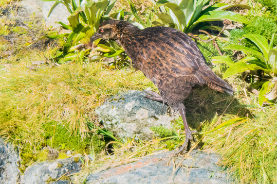 |
11:27 - A weka foraging around outside the shelter. No doubt it is very well fed at this time of year in this terribly exposed area. It probably nests under the hut. |
 |
11:31 - Leaving the shelter heading on a short moderate uphill to 1120 metres before the 1010 metre descent to Dumpling Hut begins. The highest point of the saddle I came over before reaching the shelter is the hill to the right. The cloud has completely cleared off the saddle now, but some cloud lingers over the mountain summits. To help save energy on the descent, I have put away my 6D and now using my Olympus TG-4 tough camera - not sure if that was a wise decision. |
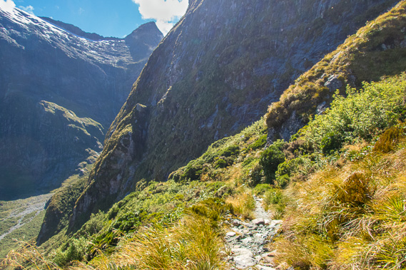 |
11:50 - First view of the valley with Anderson's Creek in the distance. Once I reach the bottom of this hanging valley, I will be following it downstream. The track steepens shortly after the 17 mile (27.3 kilometre) post. From here the track zig-zags down the side of the mountain to avoid the big bluff up ahead. The air is already perfectly still again. When it is very windy on the pass, it is a lot more sheltered from about here. |
 |
12:29 - I reach the junction of the emergency track at about 950 metres above sea level. The main track passes a dangerous avalanche zone, so when there is a lot of snow on Mount Balloon, the gate is closed and the track diverts dropping directly down the steep hillside to the river 220 metres below me. The avalanches here are different to those in the Clinton Valley. Over there, the avalanches drop down the near vertical mountainsides. Here the avalanches fall in large slabs over the slippery tussock, making it look like the entire mountain is sliding. These avalaches can be just as lethel as anyone caught in them quickly become buried in their quicksand-like consistency. All that being said, there is no snow on the mountain today, so the main track is still safe to use. |
 |
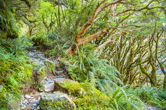
12:51 - The track becomes very rocky as it passes below the bottom of the steep spur on Mount Balloon. |
 |
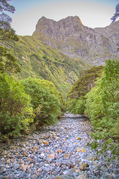
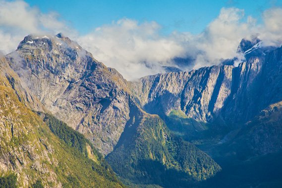
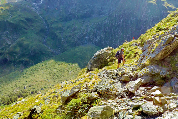
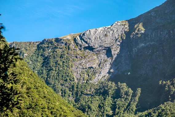
13:08 - Once I'm around the nose of the bluff, I pass a near vertical cliff stripped bare from avalanche falls then come out onto the next small spur where I now get a view of the upper reaches of Roaring Burn. Waterfalls tumble down the back of the cirque into the steep rocky valley floor. |
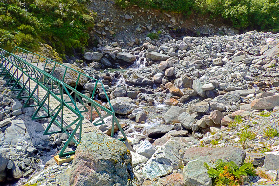 |
13:16 - The bridge crossing Roaring Burn sits on boulders high above the cascading stream about five minutes past the 18 mile (28.9 kilometre) marker following a zig-zagging descent. This is one of the bridges removed during the winter season, and the first bridge crossed since the one above Lake Mintaro early this morning. The bridge is about 730 metres above sea level, so there is still 620 metres to drop before I reach Dumpling. |
 |
13:18 - Looking back up the bluff once I'm across Roaring Burn. The bubbling stream is crystal clear. From here I'll be closely following the stream as it tumbles down the bottom of the valley. |
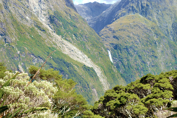 |
13:31 - Looking down the valley, there is still a long downhill to go. Zoomed in I can now see the top of the famous Sutherland Falls falling from the hanging valley on the other side of Mount Hart. Sutherland Falls was discovered by Donald Sutherland and James Mackay (the same Mackay famous on the Heaphy Track) on 10 November 1880, eight years before McKinnon's expedition to the pass. They discovered it on a journey heading up the Arthur Valley, so probably didn't see it from this angle. The falls drain from Lake Quill, named after William Quill who was the first to climb the falls in March 1890. |
 |
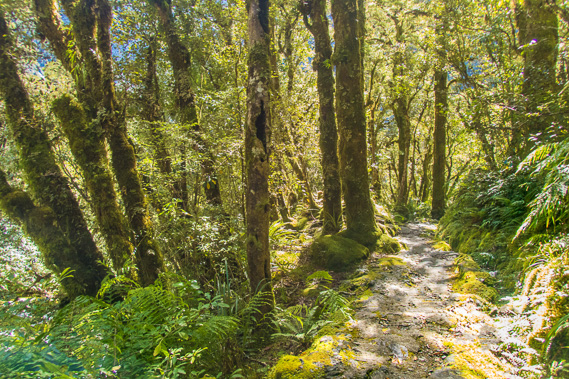
13:34 - At this point the track drops below the tree line into scrubby forest. This cuts off most of the view the rest of the way down the valley. |
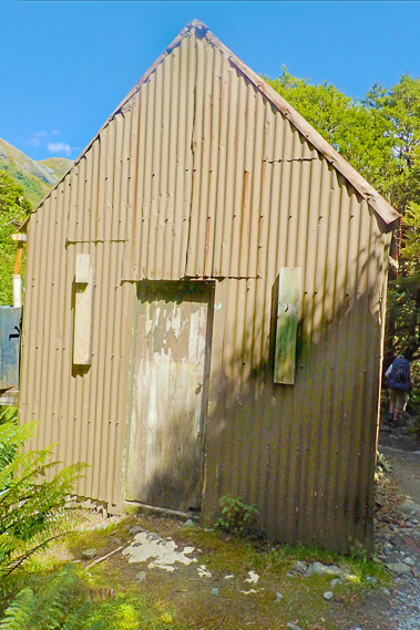 |
13:48 - I pass this small private hut right beside the track. It only has one small window in the back. There is a little long drop outhouse tucked away in the bush, but no other signs of civilisation or life. |
 |
13:57 - Reaching the gate at the other end of the steep emergency track now I'm out of the avalanche danger zone. As steep as the track I've just followed, this one would have been even steeper going straight down the mountain. |
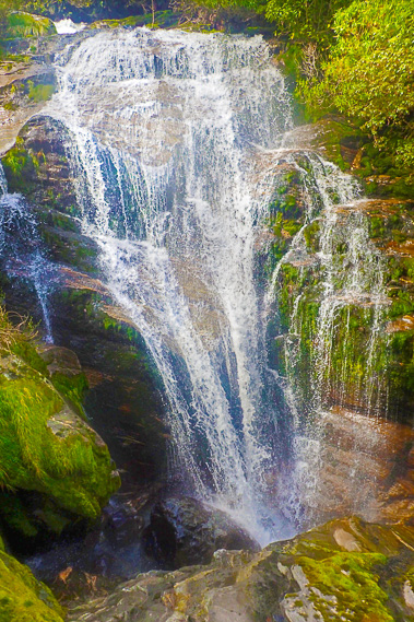 |
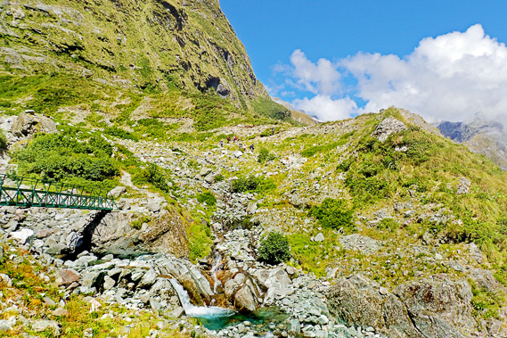
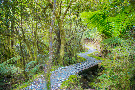
14:03 - The track suddenly starts descending boardwalk stairs along the side of a ravine. This is the start of Anderson's Cascade, the steep drop from the end of the hanging valley. Within minutes I reach this spectacular waterfall tumbling down the rock face. |
 |
14:05 - The boardwalk continues along the precarious terrain through the mossy forest. Anderson's Cascade is named after William and May Anderson who applied for a position in 1950 for a married couple to manage Quinton Hut further down the valley. They gave their southland farm to their sons and ended up settling at Quinton for 30 years, finishing in 1980 when William was aged 89. They were legends at Quinton, where the hospitality even included a piano lugged in from Milford Sound. William built many small tracks (including the emergency track I had passed earlier) and would run guided walks along the new tracks around the hut for the guests. |
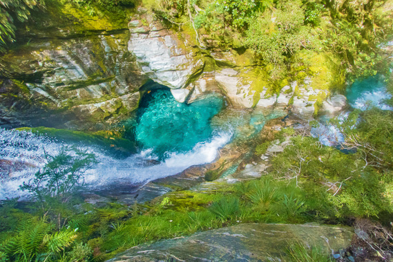 |
14:15 - The cascade of Roaring Burn rumbles a few tens of metres below. The water has carved out some spectacular and very cold pools in the rock. |
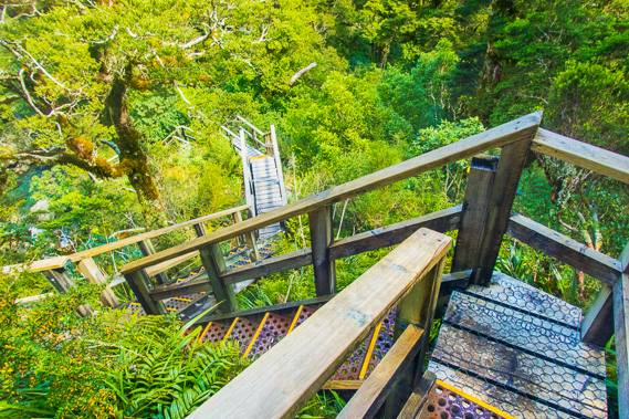 |
14:22 - The boardwalk goes on and on, descending steeply. At least the hand rails are good to hang onto. The original track before the boardwalk was built would have been very rough. |
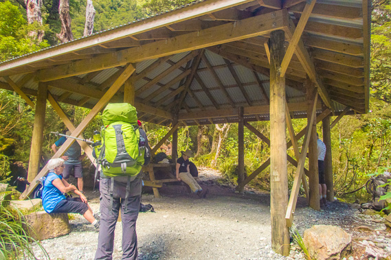 |
14:37 - I eventually reach Anderson's Cascade shelter for a well earned rest, joining some of the other independent hikers. The fastest guided hikers who have come from Pompolona have already passed us coming down this last section. The shelter is 630 metres above sea level, so there is still another 520 metres down to Dumpling. |
 |
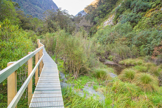
14:47 - Leaving the shelter, the track descends for a few minutes to this swingbridge about ten minutes before the 19 mile (30.5 kilometre) marker post. This stream is one of the main creeks draining from Mount Elliot. |
 |
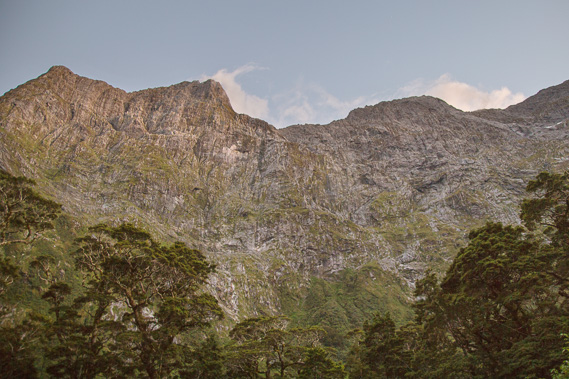
15:51 - The cloud forest quickly becomes denser but I do eventually reach a small clearing from where I can see up to the top of the cliff I stood at the edge of at the Mackinnon memorial. I have lost a huge amount of altitude since then. I am greatly relieved but there is still quite a long way to go to Dumpling Hut. |
 |
16:35 - The track widens after the 20 mile (32.1 kilometre marker post as it continues descending moderately through the dense forest. |
 |
16:43 - Another small waterfall beside the track. The sound of the river has been constant all the way down the valley and there is a lot more volume in the river now. |
 |
16:58 - A very welcome relief - I reach the junction where the Quinton Hut base is to the left and Dumpling Hut is still two hours to the right with a 130 metre drop in altitude. The main downhill is complete, so I switch back to the 6D SLR from the Olympus TG-4. Needing a rest, I head to the nearby Quinton Shelter. It was around here McKinnon discovered Donald Sutherland's track and left a note with his details and the date on it. This was his confirmation of the route between Lake Te Anau and Milford Sound. I'm not sure why he turned back from here though. If it were me assigned to this task, I would have followed the track down to Milford Sound to confirm this was the right valley. From here I cross a swingbridge over Anderson's Stream towards the shelter. |
 |
16:59 - View throught a gap in the trees to the swingbridge crossing Roaring Burn to Quinton Hut. |
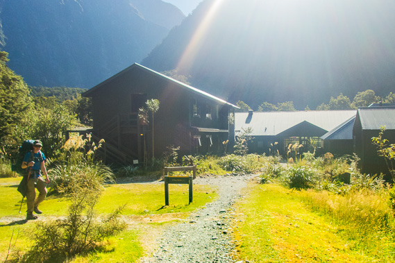 |
17:01 - I reach the Quinton guided walkers huts, with the shelter tucked away to the left. This is the third hut for the guided walkers. When McKinnon completed his expedition, he quickly arranged for the track to be blazed and began guided walks to Milford Sound, along "the finest walk in the world". Everyone hiking the track had to be on a guided walk until the National Parks board erected three new huts for independent walkers in 1966. This was following years (since 1947) of lobbying by hiking groups to allow people to hike it independently. |
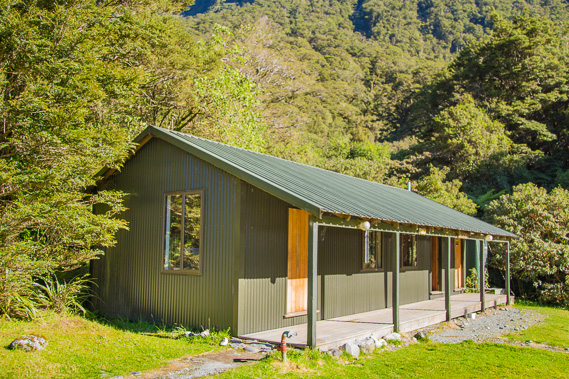 |
17:21 - The shelter for the independent hikers to the left of Quinton Hut. It is only a very small shelter, but good as a resting point before the final leg down to Dumpling. |
 |
17:13 - Inside the shelter. At the far end is an urn with hot water provided for tea drinkers. A few of the fitter people have taken a long side track up to the base of Sutherland Falls. The afternoon is drawing late though and I hear there is too much spray at the moment to get any good photos - but there is a good viewpoint further along. I decide at this point to press on towards Dumpling Hut. |
 |
17:41 - The track is in much better condition down here, about twenty minutes after leaving the shelter. The slope is fairly flat, making me forget there is still a bit of a drop to get down to Dumpling Hut. |
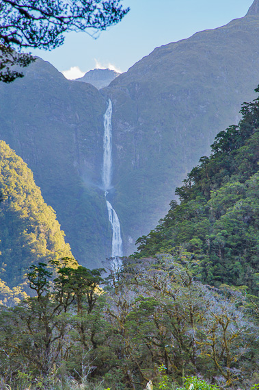 |
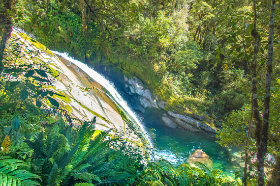
17:44 - Spectacular view of Sutherland Falls where the stream I've been following flows into the Arthur River. This is perhaps the best view as mentioned by Invercargill artist Samuel Moreton who sketched the falls in 1883, mentioning he had to go a full two miles away and climb a tree to get the full view of it. Donald Sutherland largely kept this a secret for about eight years when it finally hit the headlines about the same time as McKinnon's expedition when a track was built over 6 months. The tours were led up the Arthur River roughly following today's track up to the base of the falls. Sutherland reported the falls to be a massive 5000 to 6000 feet high, but it was measured at the much lesser 1904 feet, or 580 metres, making it the fifth highest falls in the world. |
 |
17:48 - Looking back up to Mackinnon Saddle. No wonder Sutherland didn't consider exploring it to see what lay on the other side. |
 |
17:53 - At the 21 mile (33.7 kilometre) marker. This is the only marker I have reached where one of my new friends was passing at the same time, so I don't need a selfie here. I have taken selfies at every mile marker, so will do a separate blog on that in time. The pack does look unusually big partly with my thermal top now hanging on the side (it is quite cool here, but not cold like it was on the tops), and there is a chopped log of a fallen tree behind the top of my pack making it appear a lot larger than it actually is. |
 |
19:05 - Crossing a bridge shortly before the 22 mile (35.4 kilometre) post now rounding the base of Mount Elliot. The track has once more narrowed and started descending moderately above a gorge as the rainforest continues to thicken. This descent is named the "Gentle Annie", as it is a lot gentler than the long descent from the pass. That being said, after such a long hike over the mountains today, even this section feels very tough. |
 |
19:14 - Clear view of the mountains on the other side of the valley as high cloud now starts covering the sky. This is the first sign of tomorrow's forecast rain. |
 |
19:16 - The track levels at the bottom of Gentle Annie (thankfully) and the river from here runs placid in most parts. Gravel banks are formed from recent flooding a few weeks ago. |
 |
19:17 - Orange markers follow the track for when it is flooded, which often occurs in this part of the river. |
 |
19:20 - Soon the track becomes elevated boardwalk as this area floods often. The grass below is still bent over from the recent floods. This is followed by more poles along the track to guide hikers when it is flooded. |
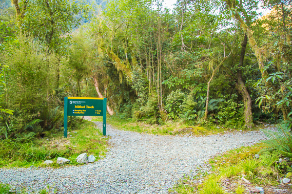 |
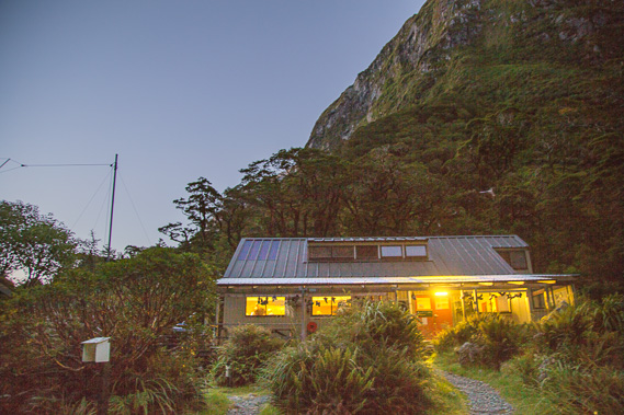
19:27 - I now reach the junction. The track in the middle heads towards Milford Sound, the track to the left leads towards the river and the track to the right goes up the hill a few metres to the hut. |
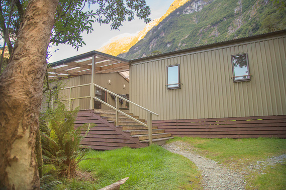 |
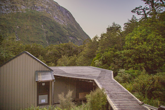
19:28 - The two bunkrooms a few metres above the track, safe from flooding. A couple of weeks ago this area received 700 millimetres of rain in a single day and the river rose to about the point where I am standing. The original independent hiker huts were built in 1966 and at the time it cost 4 pound 10 shillings ($9) to do the entire track. 16 independent hikers were allowed to start each day. The original huts were placed at Clinton Forks (where the two branches of the Clinton meet), Mintaro, and here at what was then known as Diamond Creek. |
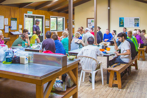 |
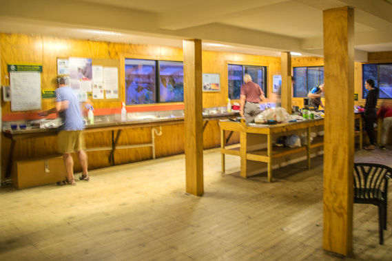
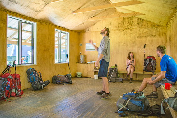
20:21 - About 20 metres past the bunk hunts is the main dining hut where we are listening to ranger Ian's hut talk as I prepare dinner. He mentioned the track tomorrow will be straight forward compared to today (thank goodness) but there were a couple of fallen trees to negotiate mainly due to the record rainfall a few weeks ago. There was some rain expected in the morning, but is expected to clear later in the day. He pointed to a chart showing times to Sandfly Point where we will be catching the boat tomorrow. For the first time in three days, we will need to keep to a schedule more specific than the sun rising and setting. It's been a huge day going over the mountain and there are about 18 kilometres of hiking to do tomorrow. |
|