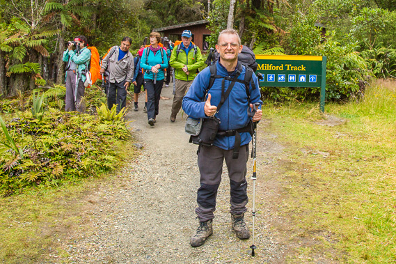
Introduction to today's journey
(Donald Sutherland) speaks a little conteptuously of city men, whom he calls "ashfelters" and of tourists who he says will take away anthing they are able to lift, while photographers... he speaks of as "shadow catchers".
- Otago Witness, 1888
DONALD Sutherland was well known as "The Hermit of Milford Sound". He first arrived in the uninhabited Milford Sound in the late 1860s in a whaling boat. In 1877 he moved there with his dog John O'Groats after a very rough voyage from Dunedin. He quickly established three one-room cottages which became known as the City of Milford. He established a small farm, but was mostly there to prospect for precious metals, of which were in very sparse supply. He joined forces with fellow prospector John Mackay and explored the Arthur Valley. They reached a magnificent waterfall and tossed a coin to see who it would be named after. Mackay won the toss and Mackay Falls was named. Just a few days later they discovered what is now the far more significant Sutherland Falls, so much so they decided to start leading private expeditions up to the falls to generate the income prospecting for minerals wasn't giving them.
Nearly a decade passed when when suddenly news of the Sutherland Falls made headlines around the world - "The Sutherland Waterfall, the highest in the world, new wonderland of the South". Sutherland was commissioned to built a track to the falls. He was provided with a gang of three men paid a shilling per week. It took them six months to cut the 16.5 mile track up to the falls, finishing not long before McKinnon's suprise discovery. This track would closely follow the final day and a bit of the modern Milford Track.
Today's trek starts at Dumpling Hut and heads downstream the gently flowing Arthur River to a large swingbridge just downstream from the Boatshed. From there I have a brief diversion to Mackay Falls before continuing downstream along this very long, straight and deep valley until eventually reaching the very well named Sandfly Point from where I catch a small boat across to Milford Sound, completing the trek.
Today's Journey
Distance trekked today: 18.0 kilometres.
Total distance trekked to date: 53.5 kilometres.
 |
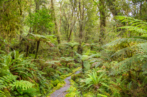
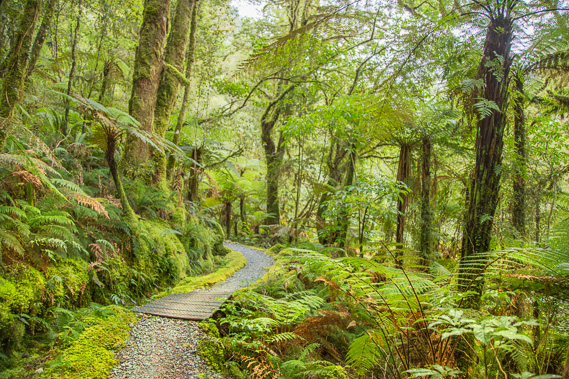
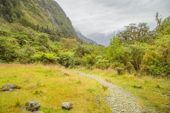
06:35 - A very early start at Dumpling Hut leaving at first light. I have already had breakfast and this is the last look at the main hut as I put on my backpack and start off along the track, in torchlight for the first half hour. The original hut around here built for the survey team in the late 1880s was called "Slip Hut" after the huge landslide visible here at the time having eroded down Mount Elliot. |
 |
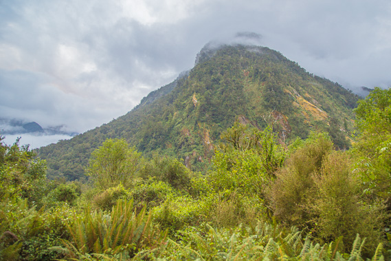
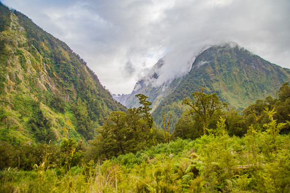
07:12 - The sky slowly lightens as I follow the track. I eventually reach a small clearing where I see the damp sky is thickly overcast with cloud draping the mountains. I will probably not see any mountains today, but the scenery is still amazing here. This valley was first explored in 1880 by Donald Sutherland with the help of fellow prospector James Mackay. By then Sutherland had long settled into living in Milford Sound and his initial intentions of finding minerals here was not working out. James joined him to explored the valley to look for minerals. They didn't find any minerals, but upon discovering Sutherland Falls, they immediately reaslised this area's potential for adventure tourism. |
 |
07:29 - Crossing a small stream that often becomes an amazing torrent here in the valley. This part of the track is quite straight and open, and has been known as "The Race Course", being the only part of the track where horses could pass each other when they were used on the track in the early days. |
 |
07:34 - Last view of Dumpling Hill a couple of minutes before passing the 24 mile marker. I think I missed the 23 mile marker in the darkness just after the hut - the only peg I missed on the entire trek. |
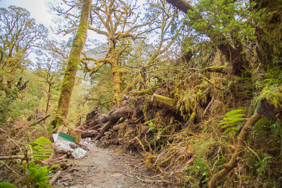 |
07:56 - A fallen tree over the track. There is a route below it to get past it. The tree came down in a small landslide in the recent rain a few weeks ago. |
 |
08:25 - Spectacular forest and mountain scenery a few minutes after the 25 mile marker. This is one of the wettest valleys in the world, this area averaging around 8 metres of rain every year. |
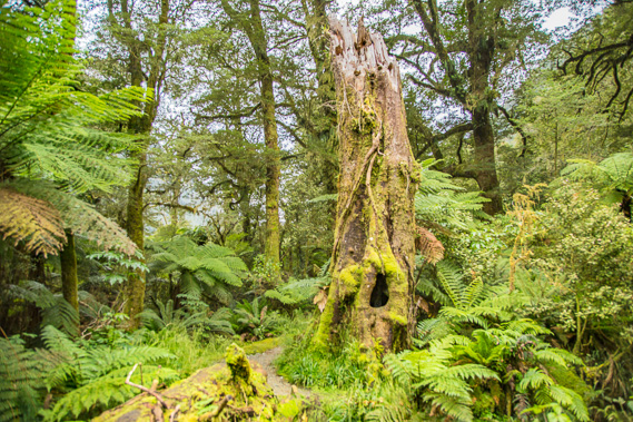 |
08:29 - Standing trunk of a dead tree. Fortunately there has never been any logging here, and all vegetation has been allowed to live a full life and die and recyle naturally. This tree would have seen all the hikers from when Sutherland and Mackay explored the valley. |
 |
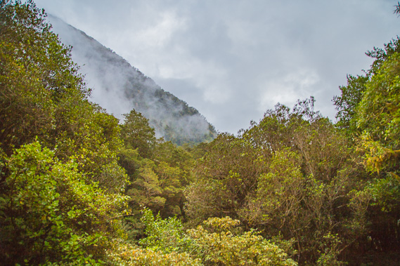
08:33 - Clouds passing the mountains. They seem to be thickening, indicating the rain that has held off until now is coming very soon. |
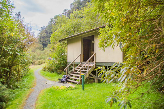 |
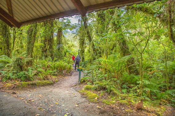
08:46 - Reaching Boatshed Shelter. This marks the start of the Arthur River's navigable section where small boats could travel from here down to Lake Ada. Sutherland reported that he and three men cut the track from May to September 1888 over the 16.5 miles to the falls. |
 |
08:47 - The Boatshed buildings viewed from the shelter. It is hard to tell whether it is going to rain or not. Two huts were put up along the track in the early days, one of which was located here and called Poseiden Hut. The track construction was funded partially by the government, by the same Mr Adams who commissioned McKinnon and Mitchell to explore the Clinton Valley in search for the overland route to Milford Sound. These huts were built around 1928. |
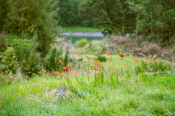 |
08:51 - Flowers growing in above the river in the clearing at Boatshed as I rest. |
 |
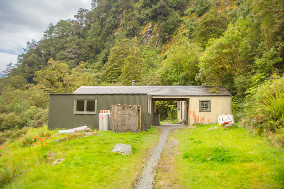
08:53 - Another building two minutes further down the track. This is a service shed just before the 26 mile (41.8 kilometre) marker. |
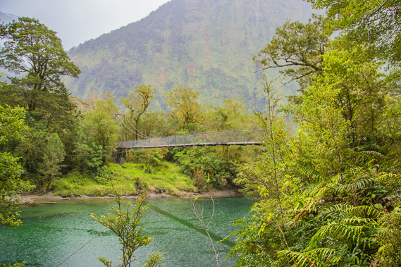 |
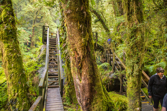
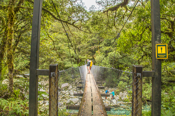
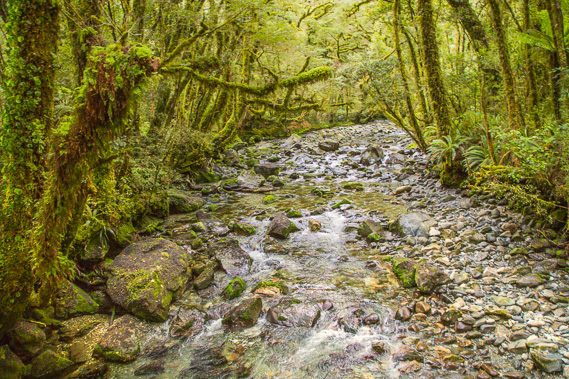
08:57 - First view of the swingbridge across the Arthur River. This is the first significant river we have crossed since Clinton River at Glade House. Rain is beginning to fall. We have been very fortunate with the weather so far. This end of the valley has an annual rainfall of 7.5 metres, and up to 10 metres on a wet year. This is the point where the current track diverts from the original track cut along this side of the valley by Sutherland and his crew. It was decided in October 1889 the track would be a lot easier on the western bank of the river, so from here downstream, the track is on the other side of the river. |
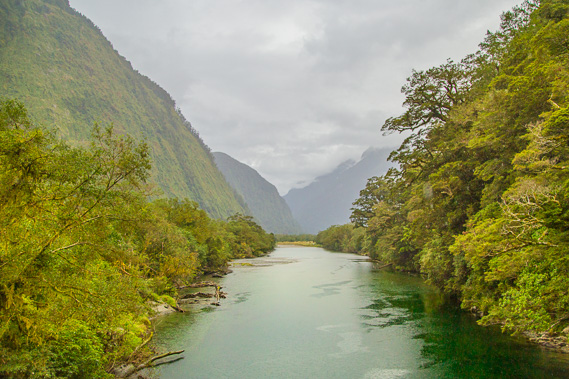 |
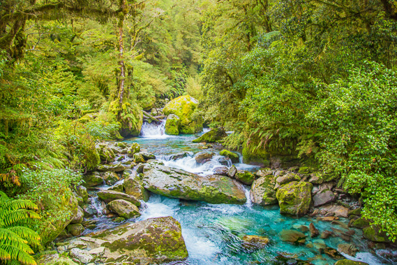
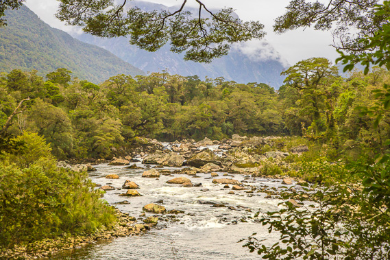
08:59 - View downstream from the swingbridge. The valley is very long and straight, with the mountain blocking if off at the end being at Milford Sound. This was a long glacial valley with at least a kilometre of ice in it. Now it has the gentle flowing Arthur River with pristine forest growing on either side. The swingbridge can be easily walked across now, but the original bridge was an open chair which went across on a suspended cable. The first swingbridge was built here in 1909 brought in by horseback from Milford Sound. Two years later a big flood washed it away, so a boat was brought in to transport hikers across the river untl it was replaced by the new bridge in 1969. That bridge lasted until another flood in 1978 carried it away. Then it was replaced with the higher current bridge which stands above even the highest of floods. |
 |
09:04 - The track continues to improve as I approach the junction to Mackay Falls. Rain is falling steadily now. |
 |
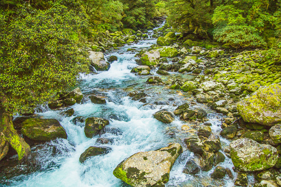
09:15 - The pristine Mackay River just before the junction to the short track to the waterfall. The rain has just stopped falling. Not enough fell for the water to be dripping from the foliage overhead. |
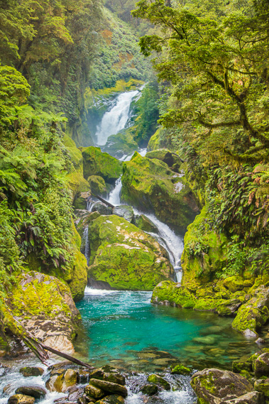 |
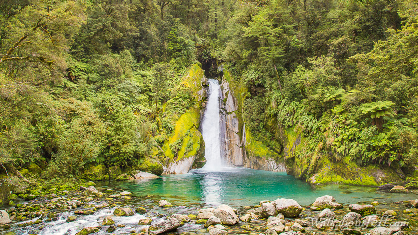
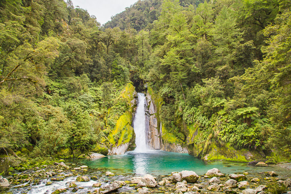
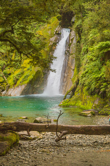
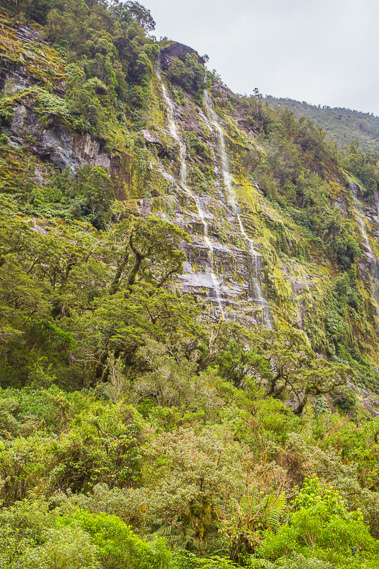
09:20 - Mackay Falls, named after James Mackay as he and Donald Sutherland explored the valley in November 1880. They discovered this waterfall and decided to toss a coin. The winner would name this fall, and the loser would name the next waterfall. James won this toss, but Sutherland got to name the next far more magnificent waterfall after himself. |
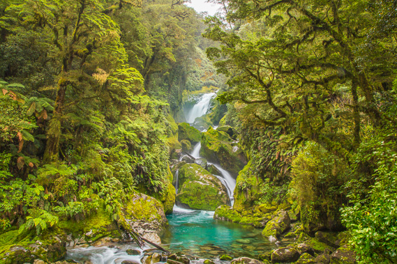 |
09:25 - The waterfall is in a very pristine patch of forest. The mist is formed from the water crashing onto the rocks. Although the mist feels very wet, there is no rain falling. |
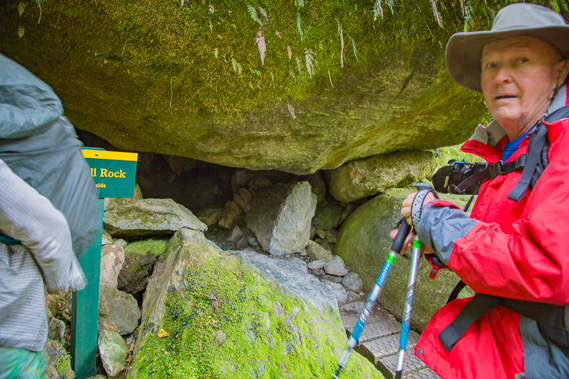 |
09:25 - Back down off the platform is Bell Rock, with a hole into a cavern under where it has fallen. Here you can crawl into it and stand up in the almost total darkness. |
 |
09:27 - Looking back up to the lookout from Bell Rock. A lot of us earlybirds have arrived here at the same time. Most of the others are catching the earlier 2:00 boat so will need to hurry along the rest of the trail to get there in time. I'm catching the 3:00 boat, so have a bit more time to explore and photograph the amazing scenery. |
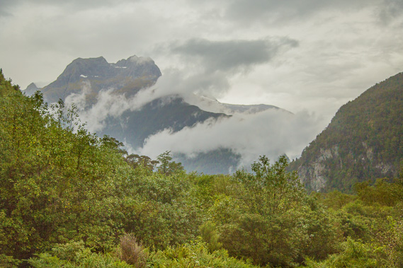 |
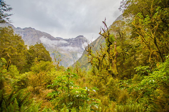
09:51 - View of the mountains downstream from shortly after the 27 mile (43.4km) marker. The low cloud is starting to clear from the mountains confirming the rain has finished. |
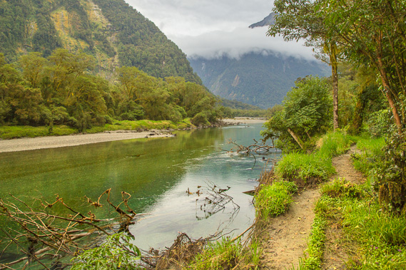 |
10:07 - The track closely follows the Arthur River. Parts of the bank have eroded from recent flooding, but today the water is very placid. The clouds conceal the mountaintops making it difficult for explorers to find routes over the passes. Thomas Mackenzie and W.S. Pillans joined Sutherland when they were exploring the valley and building the track. They aimed to find a route over the mountains towards Te Anau. This group was unsuccessful in finding a suitable route, but a few months later McKinnon discovered the pass at the end of the Clinton River and upon coming over this side, found the track. Sutherland asserted he could have easily found the pass with government backing, and insisted on calling it Balloon Pass for the remainder of his days here. |
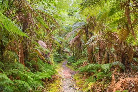 |
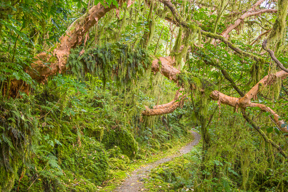
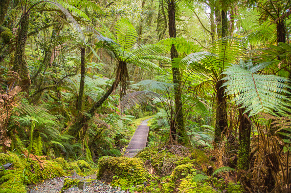
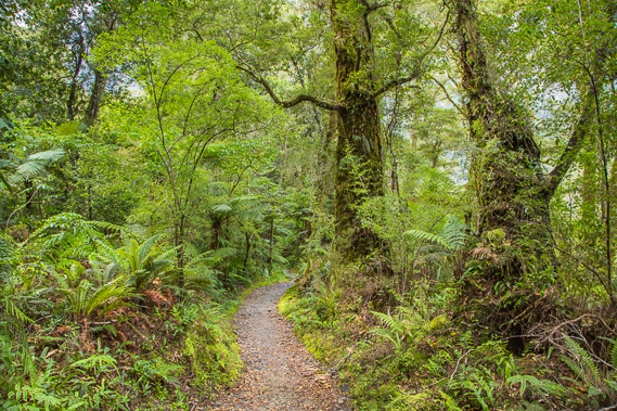
10:30 - Into a grove of pristine tree ferns ten minutes after the 28 mile (45km) marker. The lush rainforest has been thickening throughout the day. |
 |
10:33 - Poseiden Stream, apparently half way between Dumpling Hut and Sandfly Point. I am making good time for my 3:00 boat. |
 |
10:51 - A spectacular tree fuschia growing over the track shortly before the 29 mile (46.6km) marker. This is the largest species of fuschia, growing as gnarly trees with loose papery bark normally preventing ephiphytes from growing on them. This tree has somehow managed to get quite a few small epiphytes growing on it. |
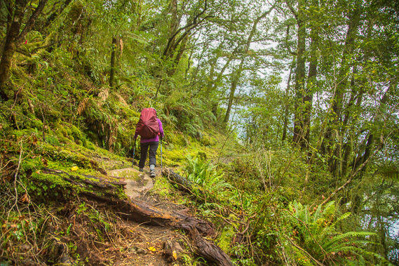 |
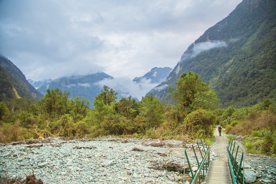
11:14 - The track today has been very easy going up till now, a big relief after the rough track yesterday crossing the mountains. This is the main exception today, where the river passes under a bluff. This section of track known as Rocky Cutting has been blasted out between 1893 and 1898 by Edwin Price supervising 13 men and a cook from the Kumara goldmines near Greymouth. They were commissioned to widen the entire track to 6 foot wide. This was by far the most difficult section of track requiring a lot of blasting. Some of the rock on this section of track is quite rough and slippery, not really the obstacles I'm wanting after being a bit sore from the long mountain trek yesterday. |
 |
11:21 - The view from the top of the bluff is spectacular though. The river is so calm and pristine. At this point I meet one of the guided walk guides who is racing ahead to get her group organised at Sandfly Point. We talked for a while before she started running on ahead. I commented her office here is very nice - she does the track about once a week throughout the hiking season. |
 |
11:43 - Fortunately the bluff does end and once more the track is meandering its way through the magnificent forest shortly before the 30 mile (48.2km) marker. |
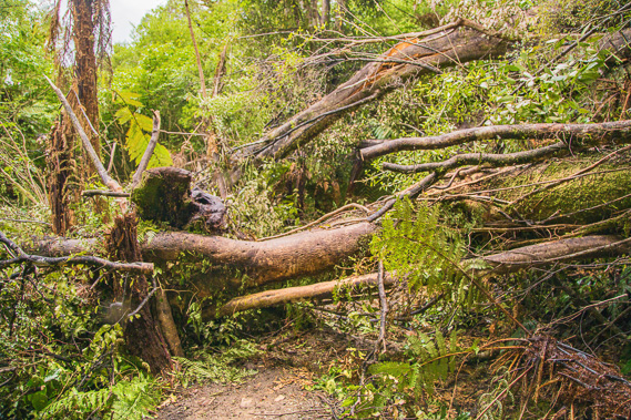 |
12:00 - Looking back after scrambling over the second fallen tree. This one we had to climb over as there was no way around it in the thick undergrowth. |
 |
12:21 - The forest scenery just keeps on getting better! The track was further improved in 1894 after the Lands and Survey Department took over its management. The improvements were needed to cope with the expected increase in hikers heading up to the falls from Milford Sound. One of the workers fell sick and died at Milford Sound. He is now buried at Cemetery Point near Bowen Falls. Once they completed the track to the falls, they continued building it following the current route up Roaring Burn and over Mackinnon Pass. |
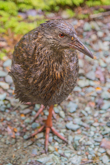 |
12:22 - A wet weka foraging the track. Light rain is falling again, but doesn't last long. The weka is the only commonly seen flightless bird. When Sutherland settled at Milford Sound, he was known as "the hermit" in the early days as he was only accompanied by his dogs. He had a black retriever named "thief" who hunted and brought him ducks and kakapo to cook. This prevented him from starving. |
 |
12:28 - Forest perfection as the almost level track winds its way around the low ridges and gullies. |
 |
12:34 - I reach Giants Gate Shelter, the last one before Sandfly Point only 1 hour 45 minutes away. There's quite a few people here now, and the fastest people on the guided trip have caught up to us having done an even longer trek all the way from Quintin today. Most of the independent hikers here will be catching the same boat as me, and are making good time. |
 |
12:40 - The wooden swingbridge crossing over the Giants Gate River just past the shelter. There are a few people exploring here, but time is getting short. |
 |
12:43 - The spectacular Giants Gate Falls. This is as far as the "Taste of the Milford" daytrip tours go. They leave Milford Village crossing over to Sandfly Point before walking up to here and back. |
 |
12:44 - View of the waterfall from the other side of the swingbridge. The waterfall plunges loudly into the pristine tuquoise pool. |
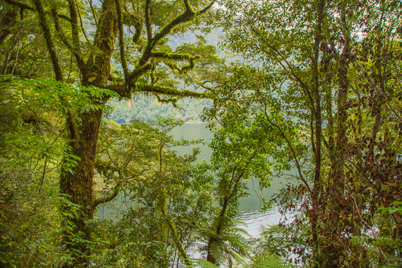 |
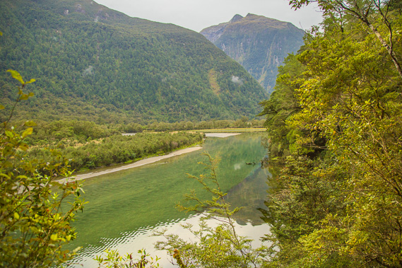
12:50 - View of Lake Ada from just before the 31 mile (49.8km) marker. The lake was formed from an enormous landslide which blocked off the river about 900 years ago. The lake was originally called Nohora, named after a Maori woman by the early greenstone traders. Nohora's story seems to have been lost with the passage of time. Donald Sutherland renamed it Lake Ada after a former girlfriend in Scotland, most likely in the ten years of his residence here before marrying Elizabeth Samuel in 1890. |
 |
13:15 - A telephone cable holder still stuck in a giant fuschia tree. This is the sole remnant of the phone line along the track. This holder was too stubborn to come out of the wood, so it stays here. |
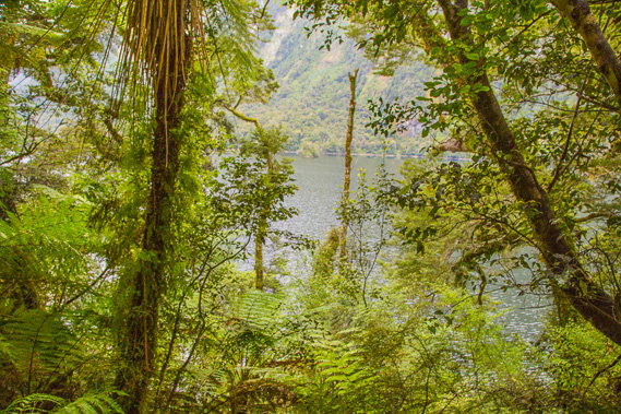 |
13:20 - Another view of Lake Ada. It looks very placid, but has several species of duck, tuna (eel) and brown trout. Long tailed bats are often seen in the summer evenings catching insects. Although it looks easily navigable. the landslide 900 years ago created the lake drowning the forest. The trees are still standing underwater making navigation of the boats sent from here upstream to the Boatshed very difficult. Quill (of lake Quill fame) established the boat route, driving iron standards into the submerged logs to help navigate the boats. |
 |
13:33 - I reach this little clearing just after the 32 mile (51.4km) marker. This marks the end of the road prisoners built from Sandfly Point in 1890. Alexander Hume, a prison inspector general, brought 45 prisoners, 7 wardens and a doctor to Sandfly Point. They built three corrugated iron hut for sleeping. The goal was to build the road up to Quintin Hut and over to Te Anau, but in 18 months they only built a mile of road to here, and only completed the first quarter mile of it. |
 |
13:35 - Waterfalls tumbling down the side of the hill. |
 |
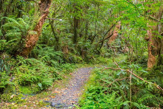
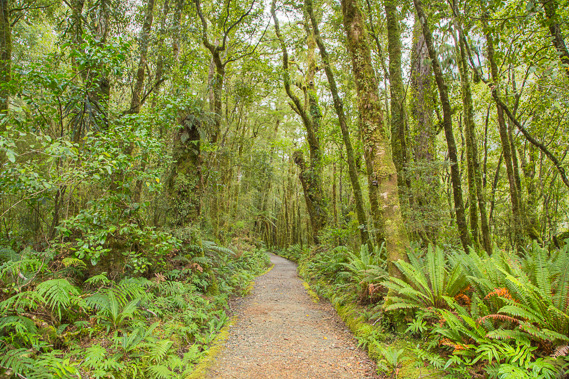
14:05 - The track here is in fantastic condition, just like the first section around Clinton. The valley floor is widening almost completely eliminating the undulation. |
 |
14:06 - The Arthur River draining out of Lake Ada along a rapid towards the nearby fiord. Any boats used on the river had to be dismantled and carried up this part of the track and reassembled at Lake Ada. |
 |
14:14 - Crossing a wooden road bridge across Camp Oven Creek draining the glacial valley between Devil's Armchair and Mount Phillips just past the 33 mile (53.1km marker). This would have been the water supply for the prison camp, hence its name. Only half a mile to go. |
 |
14:23 - The last quarter mile section of track is very wide and flat, passing through tall forest. This is all the completed road left of the abandoned prisoner project. Morale had been extremely low in the relentless heavy rain, the sandflies and lack of meat and fresh vegetables. Hikers raised fears about the lack of discipline being a threat to "the finest walk in the world". Two prisoners did escape, following the track towards Lake Te Anau, but they were caught 12 days later by police officers at the other end of the track. The project was abandoned due to its expense. No road has ever been proposed through here ever since, especially following the completion of the Homer Tunnel providing road access to Milford Sound via the Cleddeau Valley and The Divide. |
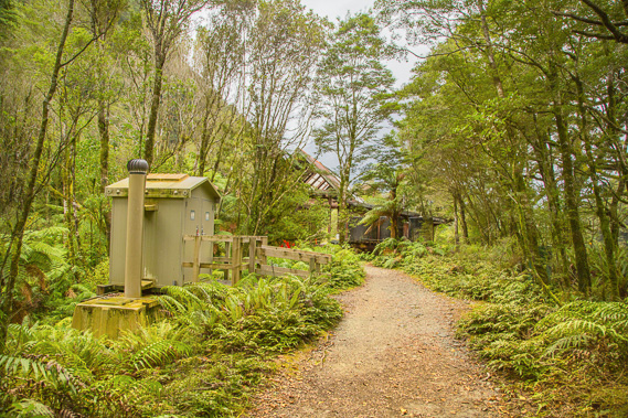 |
14:44 - Reaching Sandfly Point with quarter of an hour to spare. The hut is separated into two sections with the open verandah in between them. The building to the left is the independent hiker shelter, and the one to the right is for the guided walkers. |
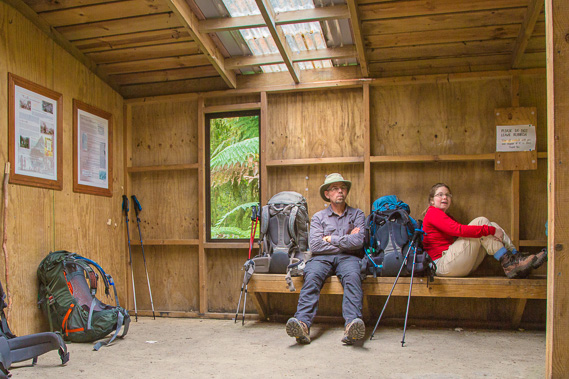 |
14:47 - This place is very well named. The sandflies are lethal here, so we all shelter inside the hut until we are called to board the boat. The Maori people called it Te Namu-a-te-Hine-nui-te-po. The legend tells of the great lady of death Te Hine-nui-te-po visiting the god Tu as he was hacking out his finest masterpiece Milford Sound out of the mountains. She decided it was so beautiful that people would want to live there forever. To remind people of their frailty and mortality she added a huge number of sandflies (namu) at this point. |
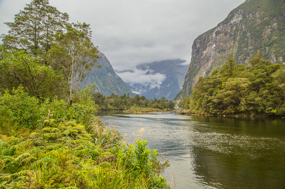 |
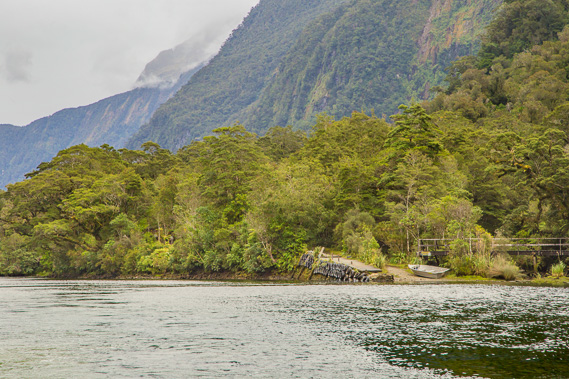
14:54 - We get the call to board the boat. Just a few metres from the shelter I get this view of the river running into the fiord. Milford Sound village is less than two kilometres away behind the trees in the centre. |
 |
14:55 - My final steps on the Milford Track as I head towards the boat. |
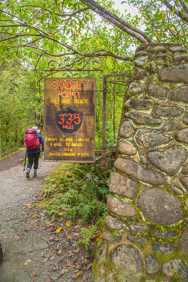 |
14:56 - Sign at the end of the Milford Track. There used to be a lot of boots hanging here, but they have been removed recently. |
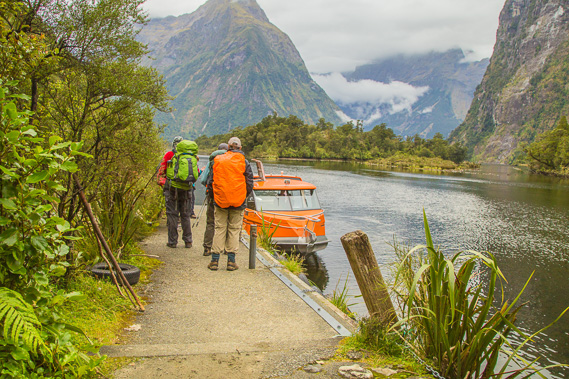 |
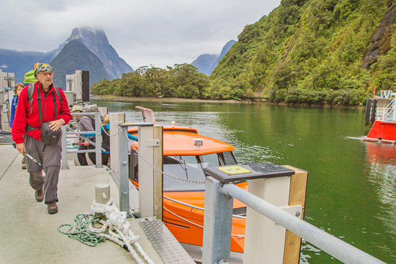
14:57 - The little boat, our transport to Milford Sound - a most welcome sight! |
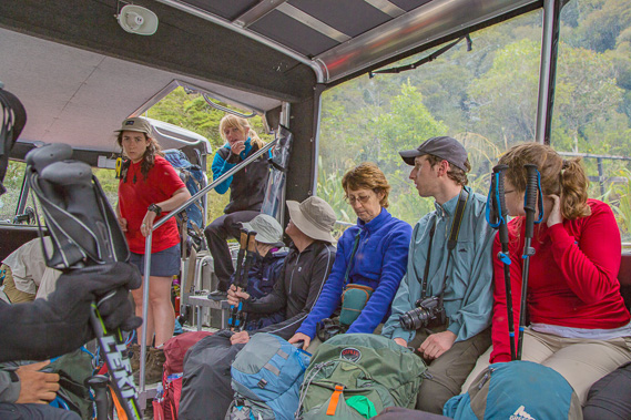 |
15:00 - Packed onto the crowded boat with everyone sitting around the outside and the packs filling up the middle. The boat is sitting quite low in the water with all the weight. From here it is just 20 minutes to Milford Sound. |
 |
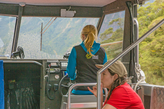
15:03 - Departing Sandfly Point, the small wharf and track quickly disappear bringing home the remoteness of this wilderness we have just hiked. |
 |
15:04 - Speeding off into Milford Sound. |
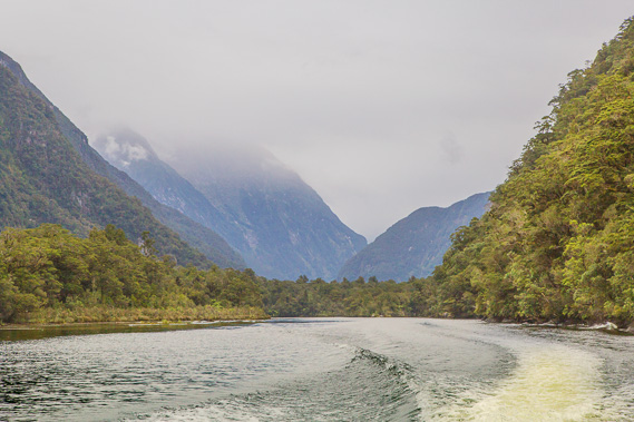 |
15:05 - Rain is falling on the mountains and seems to be closing in the Arthur Valley. We had crossed the pass in perfect weather just yesterday, but today will be a very different story with little to see apart from thick cloud. |
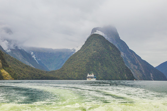 |
15:07 - Heading out into Milford Sound going to the terminal. Mitre Peak pierces the thickening layer of cloud. The Maori name Piopiotahi could either be the name of an early canoe sent from the ancient lands of Hawaiki for the collection of greenstone, or named after the pet bird of the god Maui. |
 |
15:12 - Back on shore at the point where Donald Sutherland first arrived with his dog in 1877, having travelled from Dunedin in an open whale boat. Here he established several one roomed cottages known as the "City of Milford", living here for 40 years mainly prospecting for minerals with the help of John Mackay when he was available. |
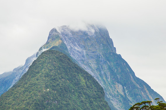 |
15:15 - Mitre Peak as the cloud starts to lift, but shorly afterwards closes in again with approaching rain. |
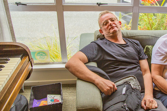 |
17:18 - At the Milford Lodge. I am very tired from hiking - too tired even to play the piano less than a metre away. Shortly after the shuttle drops us off here, heavy rain starts to fall. We timed our arrival very well. This is where most of the independent hikers stay when they complete the track. The guided walkers stay at another lodge closer to the harbour, near the "Milford City" huts where Sutherland would host the early tourists heading up the valley. Donald didn't like city dwellers, often being abrupt with them, or pretending he was deaf. Fortunately his wife Elizabeth was very hospitable. She successfully ran the accommodation for 30 years until Donald died in 1919. Elizabeth died in 1923 and was laid to rest next to Donald in their grave in the middle of the current village. |
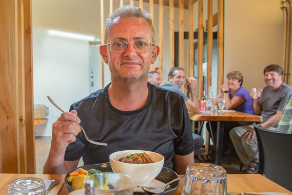 |
18:37 - Dinner cooked by somebody else, with some of my fellow hikers at the table behind me (and more behind the camera). We all agree this is a lot better than the dehyrated food we've been eating in recent days. |
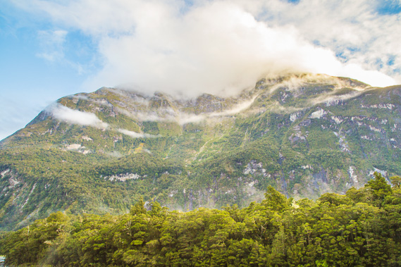 |
19:51 - Cloud clearing over Mount Sheerdown after the heavy rain had stopped falling. The Cleddeau River flows swiftly below the trees into Milford Sound. This valley is the route the Milford Road takes heading to the left towards the Homer Tunnel, then down to The Divide where the Routeburn Track ends. |
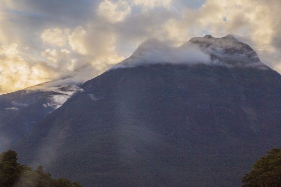 |
19:52 - Cloud clearing over Mount Phillips and Devil's Armchair above the end of the track in time for sunset. |
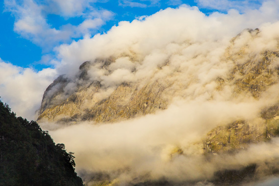 |
20:01 - Spectacular sunset cloud lingers over Mount Sheerdown. |
|