THE KEPLER TRACK was constructed in the 1980s to help counter the congestion on the Milford and Routeburn Tracks. The spectacular circuit starting within walking distance from Te Anau township was opened in 1988. The well graded track passes through a wide range of spectacular country from following New Zealand's second most voluminous river downstream, passing through rainforest wetlands, ascending cloud forest and traversing subalpine mountain tops overlooking spectacular freshwater fiords. What the track does lack in cultural history is more than made up for by the spectacular forest and scenery it passes through, and comes with less regulation and popularity than the Milford Track. The Kepler Track is named after the nearby Kepler Mountains, which in turn were named after the famous 16th Century astronomer Johannes Kepler who discovered the laws of gravitation which govern the planets and the sattelites we have been sending into orbit in recent decades, this is perhaps fitting due to the night sky in these mountains being amongst the clearest anywhere in New Zealand.
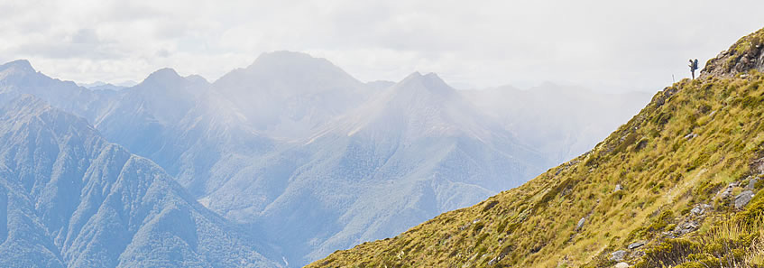
The trek begins in Te Anau, following the shore of the lake to its mouth before following the mighty Waiau River towards Lake Manapouri. The track diverts from the river at the mouth of Forest Burn to cross some beautiful wetlands before slightly descending to the lake to the first hut at Moturau. From there the second day heads up the deep Iris Burn valley gaining altitude until reaching the sheltered Iris Burn Hut. The third day is a challenging one with a steep climb out of the valley to the top of the exposed Jackson Peaks. The track follows the tops and sides of the mountains high above Lake Te Anau's South Fiord to Luxmore Hut under the shadow of Mount Luxmore. The final day is a long descent back to the shores of Lake Te Anau where a water taxi takes me back over to Te Anau. There are two car parks between Te Anau and Manapouri making this one of only two great walks that form a complete circuit of 61 kilometres. I started and finished in Te Anau, making the entire track 60.0 kilometres in length. The track can be hiked in either direction. Most people end up hiking it in the opposite direction to the way I did it, but thought the direction I took was easier and more scenic. |