Introduction to today's journey
The Save Manapouri campaign is still recognised as the single most significant threshold in the changed public and political attitude to nature conservation, environmental planning and management, and resource development in the country's history.
- Alan Clark, Chairperson, Guardian of the Lakes, 1972
THE MANAPOURI power scheme built in West Arm at the far end of the lake created a lot of controversy when it was proposed the water level be raised thirty metres. Such a rise in the lake level would not only flood the surrounding forest and wetlands, but would also completely stop the flow of the Waiau River and raise the level of Lake Te Anau by five metres. This created an uproar from conservationists and residents alike, who pointed out the eastern side of both lakes was loose porous shingle deposited from the glaciers, and raising lake levels would serve only to cause a lot of the water to be lost filtering through the shingle beds. Fortunately the plan to raise the water level was abandoned and the power plant was constructed with no change in the lake level.
Today's trek starts at Te Anau Village, follows the lake around to its mouth before crossing the penstocks and following the Waiau River downstream towards its mouth at Lake Manapouri. Upon reaching the mouth of Forest Burn, the track heads away from the river crossing a large wetland with little forested limestone islands rising above the swamp. Crossing a short hill, the track descends to the shore of Lake Manapouri's Shallow Bay to Moturau Hut, named after the original Maori name of the lake meaning "many islands" before it was renamed Manapouri meaning "anxious heart".
Today's Journey
Distance trekked today: 20.5 kilometres.
Total distance trekked to date: 20.5 kilometres.
 |
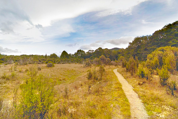
07:54 - Early morning on the shores of Lake Te Anau as I set off from the town, looking towards the Jackson Peaks which the Kepler Track goes around clockwise. The last day I will be coming down the hills to the right from Luxmore, with Mount Luxmore being the small pointy mountain to the right of centre. |
 |
07:59 - After a short walk above the beach, I reach the wharf of the perfectly calm and cold Lake Te Anau just before the track heads into the bush. Across the lake is Dock Bay, the site of a battle in 1785 when the Ngati Mamoe people fought the invading much larger Ngati Tahu tribe to remain independent. |
 |
08:02 - A little further along I look back to the town of Te Anau, the last civilisation I will see for a couple of days. Beyond the town the Murchison Mountains tower above the other side of the lake. The area was originally used by the Maori people on their routes to the greenstone fields in Milford Sound and further north along the west coast. European settlers first arrived in 1852, settling in these very stony soils on the eastern side of the lakes. Runholders settled most of these lands in the late 1850s for grazing. |
 |
08:08 - The wide lakeside track goes from Te Anau town towards the bird sanctuary and the start of the Kepler Track. |
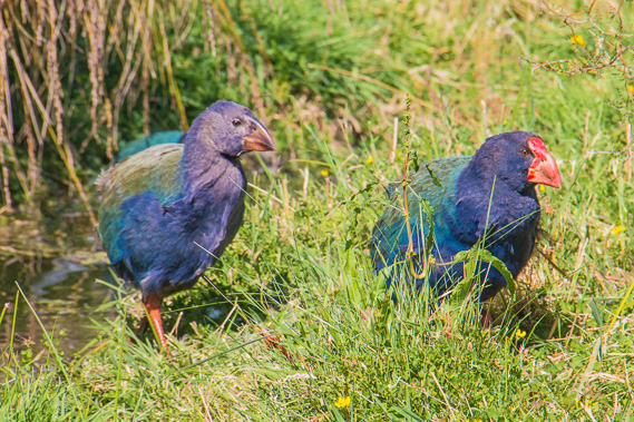 |
08:16 - I briefly stop at the bird sanctuary where there is a takahe breeding program to bring them back from the brink of extinction. A father (to the right) leads its almost fully grown chick through the grass set up in very similar conditions to the swampy tarns on top of the Murchison Mountains. |
 |
08:25 - I continue following the track through the bird sanctuary quickly getting views of the lake again. High cloud has quickly covered the sky, but it is still expected to stay fine throughout the day. |
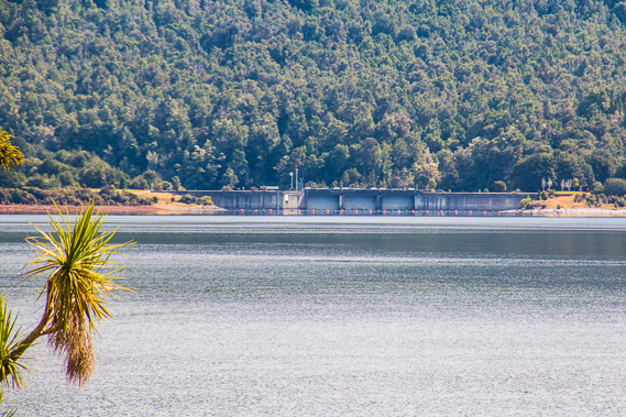 |
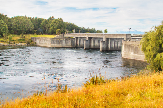
08:36 - Zooming in I get my first view of the control gates at the mouth of Lake Te Anau. These gates were built as part of the Manapouri Power Scheme. |
 |
08:41 - Following the peaceful shore I reach an old clearning looking back to Te Anau. This overgrown clearing was the site of Richard Henry's hut. He was the first settler at the lake living here between 1883 and 1894. He worked as Fiordland's first ranger at the time when the only reserve was at Resolution Island in Dusky Sound. He was known for his conservation efforts in transferring flightless birds there, and in discovering several new routes through what is now the Fiordland wilderness. |
 |
09:01 - Continuing around the bay passing some tall gum trees before entering scrubby native bush. The Kepler Track carpark is up on the hill to the right and the control gates are very near. |
 |
09:04 - The bush suddenly clears at the end of the lake. Some buoys hold up a net preventing any debris floating on the lake entering the control gates. |
 |
09:07 - Deviating from the track heading a little downstream from the control gates at the start of the Waiau River (Waiau is the Maori word for swirling currents of water). This is the river linking Lake Te Anau to Lake Manapouri. I will this morning be following the other side of this river downstream almost to where it drains into Manapouri. This is very close to a traditional campsite the Ngati Tahu people used on their journey between Southland and the greenstone fields of Milford Sound. |
 |
09:10 - Back on the control gates, zoomed into the far end of Lake Te Anau quite a long way away. In the centre is Mount Anau, where the start of the Milford Track crosses to the left. |
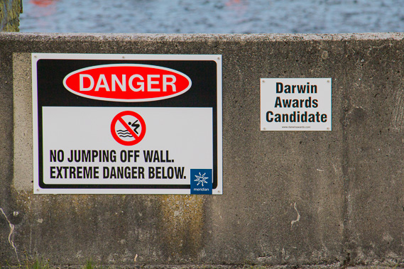 |
09:11 - Jumping into the water on the upstream side of the control gates is dangerous enough to qualify for a Darwin Award. |
 |
09:13 - The powerful engines controlling the control gates. These help to keep both lakes Te Anau and Manapouri at a constant depth to feed the water flowing into the Manapouri Power Scheme. |
 |
09:14 - Looking downstream as New Zealand's second most voluminous river flows towards Lake Manapouri. The Kepler Track follows the right hand side of the Waiau River, and a cycle track follows the left hand side towards Rainbow Reach. |
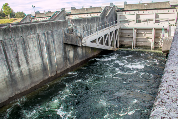 |
09:19 - Water flowing out the control gates. This was built as part of the Manapouri Power Scheme, but they initially wanted Lake Manapouri to be raised 25 metres, which would have raised the level of Lake Te Anau by five metres turning the river into an extension of the lake. There was much protest about raising the lakes, and that wouldn't have worked anyway because too much of the water would have leaked through the soft gravel deposits on the eastern side of the lakes. |
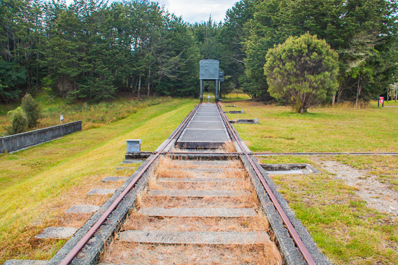 |
09:23 - The railway track allows parts of the control gates to be removed and maintained on dry land. At the end of the track is some maintenance machinery. |
 |
09:28 - I finally reach the start of the Kepler Track. This is one of the few Great Walk tracks that form a complete loop. The track to the right follows the lake around to Brod Bay before ascending the Jackson Peaks to Luxmore. About 9 in every 10 hikers head in this direction. I will be taking the other direction as I think it will be easier. The track to the left follows the Waiau River downstream towards Lake Manapouri. This is a fairly long walk today, but the grade will be reasonably level most of the way with some undulation. People doing the track the "normal" direction would find today the most challenging day with nearly a kilometre of ascent to above the bushline. |
 |
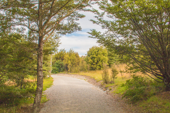
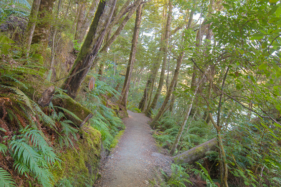
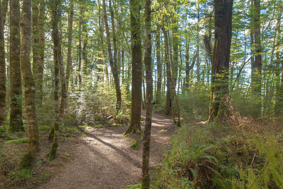
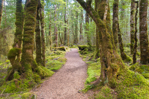
09:57 - The track through the forest above the river is in very good condition. The forest is thick which unfortunately means no clear views of the river the entire way downstream. |
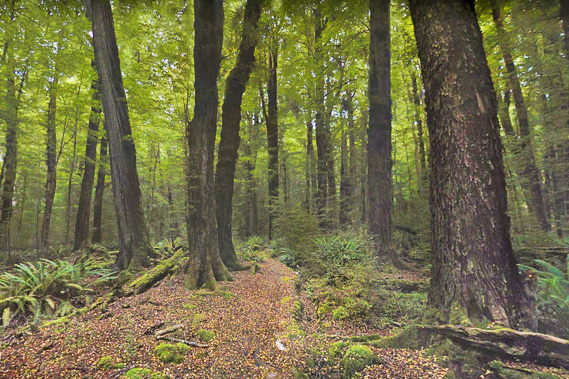 |
10:24 - The mountain beech forest thickens under the increasingly overcast sky. |
 |
10:53 - At one point the forest clears over what was once a farm. The track is a fair way from the river as it meanders to the east, so it is not visible from here. The sky is starting to clear. |
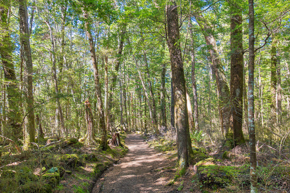 |
11:04 - Back into the forest after the clearing. The sun has come out as I continue downstream. The Kepler Track is relatively new without the depth of history of the other tracks in Fiordland. It was built in the late 1980s due to the Milford Track running at capacity and the less regulated Routeburn Track being overcrowded. The local community at Te Anau wanted a local track that would attract more vistors who will stay in the area, instead of the town being just a place to pass through on the way to the Routeburn and Milford Tracks. |
 |
11:26 - The forest is thick and dark, and there is little sign of the river even though it is seldom more than a hundred metres away. |
 |
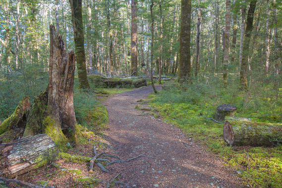
11:47 - The track remains in very good condition, but the forest is endless. Construction of the track began in 1987 once the $1.5 million was secured. It was opened in February 1988 to mark the 100th anniversary of the first crossing over what is now the Milford Track. Although it was opened, the Kepler Track wasn't finished until 1989, much of it being constructed quickly by machinery. It is the only major track contructed in recent decades. All the other great walk tracks follow traditional Maori routes. |
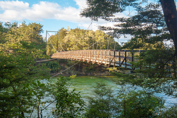 |
12:04 - I finally reach Rainbow Reach, where a large swingbridge crosses the river from a car park. Here a lot of hikers coming the other direction end their hike here, arranging a shuttle to pick them up from here and take them the ten kilometres back to Te Anau. I have chosen to walk here from the town. |
 |
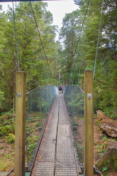
12:06 - I briefly leave the main track to take the swingbridge half way across the deep swift flowing river. There is no sign of Lake Manapouri yet even though I am over half way between the lakes. This is the river Anduin filmed in Fellowship of the Ring. After the movies came out, there was a lot of interest in renaming this river "Anduin", but it was later abandoned. |
 |
12:09 - The track crosses back over the forested bluff back to the junction from where I continue hiking along the main track. |
 |
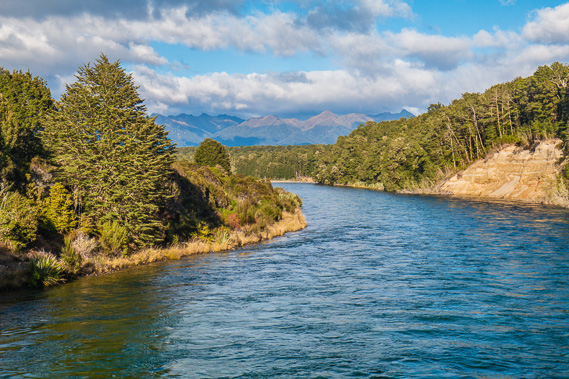
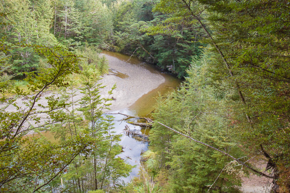
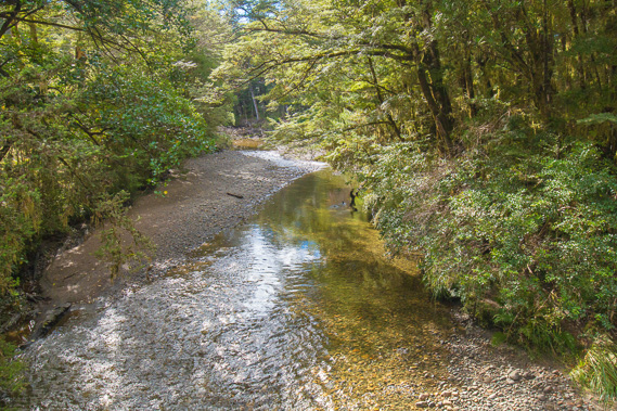
12:30 - The track comes very close to the river giving an actual view to the deep blue water meandering its way through the hills cutting through the glacial deposits between the lakes. |
 |
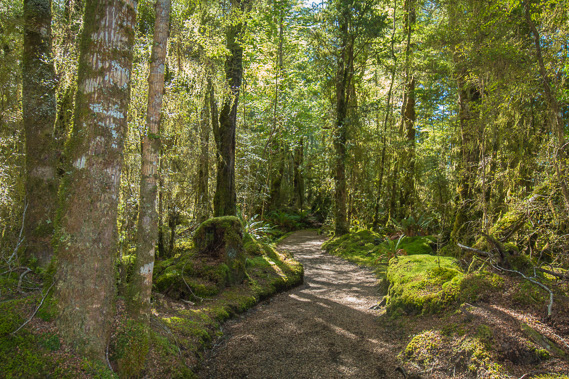
12:33 - Most of the time the forest is thick with tall beech trees and almost completely silent with the absence of birds. |
 |
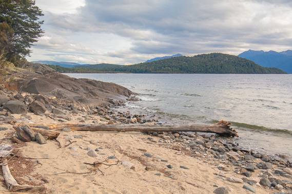
12:43 - The final view of the Waiau River as it goes down a rapid on its approach to the lake. If the flooding of Lake Manapouri had gone ahead, this would be a flooded channel with the water up to the base of the track. In the distance to the left are the Takitimu Ranges. Behind the trees to the right is a side channel of the river where only a small amount flows through. |
 |
12:47 - The terrace above the river is quite flat as the valley opens out. The river is still about twenty metres below the track. |
 |
13:02 - View of the side channel of the Waiau River. This was once the main channel, but the erosion of the river has cut this section almost completely off. |
 |
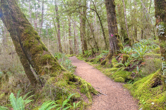
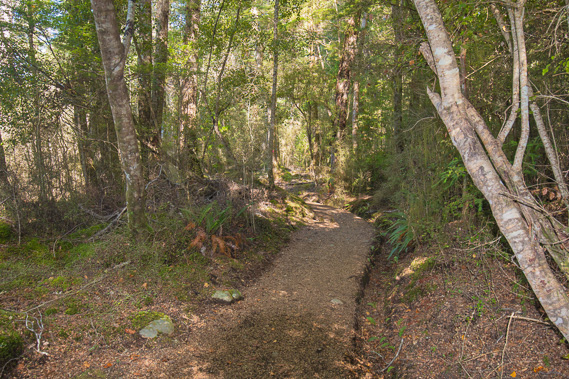
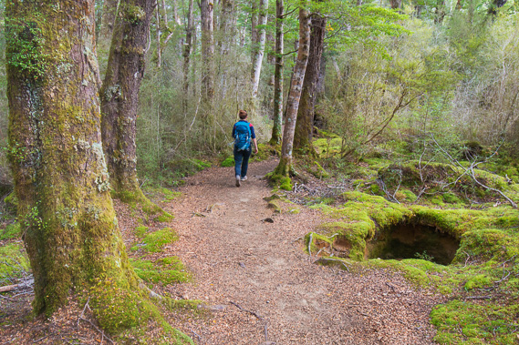
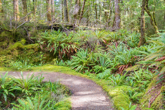
13:12 - The track continues through the flat forest. The mossy carpets of the forest here are amazing. |
 |
13:14 - Swingbridge over Forest Burn near its mouth at the back of the side meander. |
 |
13:15 - Forest Burn flowing gently from its catchment covering much of the southern side of the Jackson Peaks. The lower reaches of this river follow a former path of the Waiau River before the surrounding mountains were uplifted to their current altitude. I will be hiking along the tops of the Jackson Peaks above the sources of this river in two days. The Maori name for Forest Burn is Wai-takahea - takahe stream, probably because many takahe lived in this valley before they were hunted to near exitinction. |
 |
13:16 - The track continues through the forest too thick to afford any views as it starts to cross an elevated terrace between the river and Lake Manapouri. |
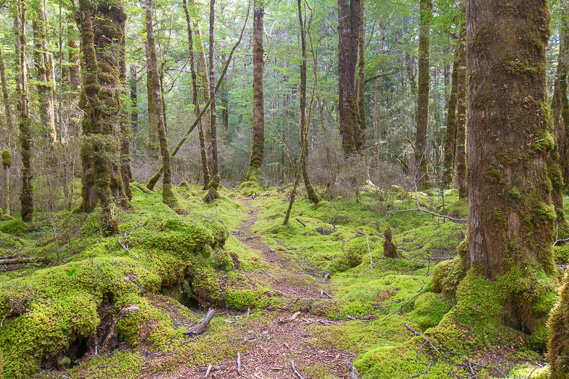 |
13:25 - The carpets of moss are very thick, but the track is in excellent condition. The track was constructed from scratch in the late 1980s and has always been in excellent condition. |
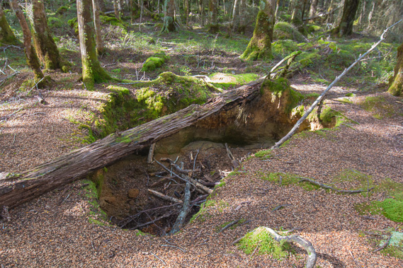 |
13:31 - The track rises over some small limestone hills. Occasionally I pass a large hole in the ground like this. There must be some caves underground here. |
 |
13:49 - One of quite a few day walkers who walk in from Rainbow Reach, and cross this section of the track to Moturau Hut. This is a very nice little day walk. |
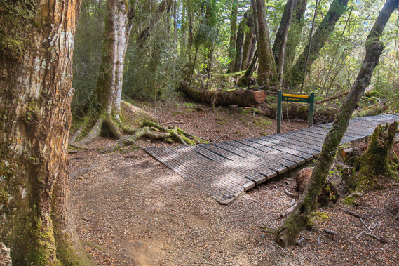 |
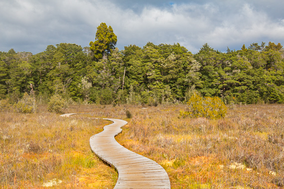
13:50 - The track continues to the left, but from here the boardwalk leaves the forest heading out onto swampland. |
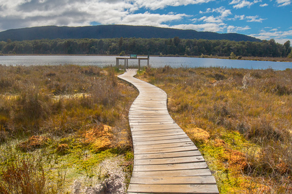 |
13:56 - The boardwalk continues for about two hundred metres over the spongy sphagnum moss swamp to a small lake. The swamp is called the Amoeboid Mire. It was formed during the last ice age when the side of the Manapouri Glacier covered this area in very thick ice. The melting of the ice created teh mire and the lake is the remnant of a large block of ice which took a lot longer to melt than the rest of the glacial cover. When it did finally melt, it left the big depression now forming the lake. |
 |
14:00 - Looking across the lake towards Jackson Peaks. Forest Burn flows from this valley. The track has come from the other side of the lower hills to the right. Tomorrow the track follows the valley to the far left before the following day going onto the mountaintops. There is almost no wind, just enough to slightly ruffle the water. The moss grows right to the edge of the lake. There are no streams draining this mire and the nutrients are very poor here. |
 |
14:01 - Following the track back into the forest. The saturated bog acts as a sponge for the forest, absorbing excess rainfall, and feeding the water out very slowly during dry times. The boardwalk floats on the sphagnum moss bog which is up to five metres thick. The layers of peat forms a historical record of pollen and plant remains for study. |
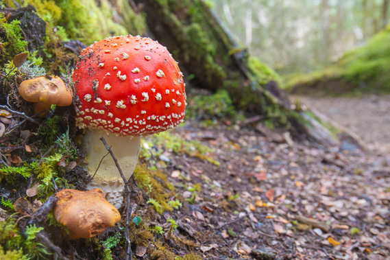 |
14:08 - There are a lot of fly agaric and other toadstools growing in the forest. These are all introduced species, but make for some very interesting forest floor. |
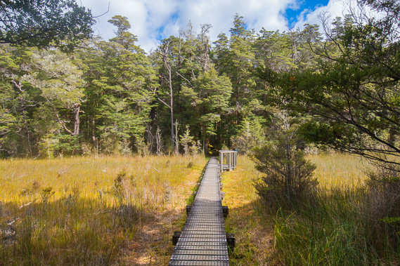 |
14:09 - The track comes out of the forest crossing a boardwalk iver a short swamp extending over a kilometre in either direction over what could have once passed as a river valley. |
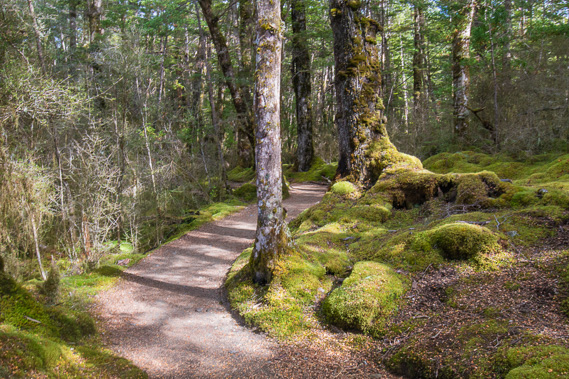 |
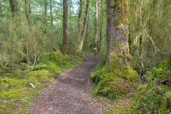
14:11 - Returning to the forest, the track winds its way around the ranges of tiny hills rising up from the swamps. |
 |
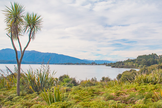
14:26 - I reach the junction. The track to the left goes to Shallow Bay where a private hut and the mouth of the Waiau River are located. The hut is to the right, so I follow this track. |
 |
14:30 - The track heading over a very low ridge soon to descend into Lake Manapouri. |
 |
14:48 - Around a ferny gully during the gradual descent. |
 |
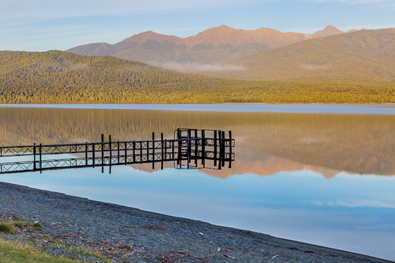
15:06 - First view of the hut at the top of a short steep section into the lake. |
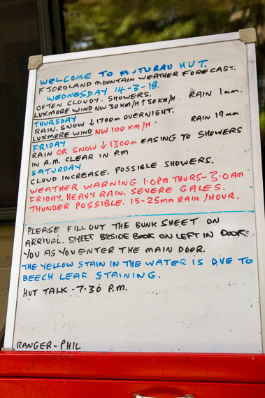 |
15:10 - Sign at the hut showing the weather conditions. Rain is forecast for tomorrow. Crossing the mountaintops the following day may be a problem - fingers crossed. |
 |
15:16 - One of the bunk rooms. Not many people have come from the other way yet, but will be arriving shortly, so fortunately one of the rooms is still empty so I score a bottom bunk near the door so I can quickly and quietly head off first thing tomorrow. |
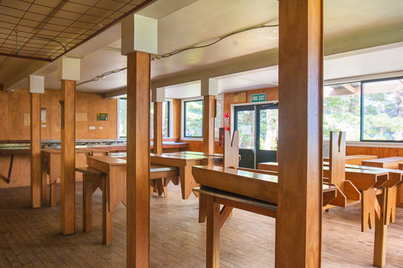 |
15:17 - Inside the communal area of the hut. There is gas for cooking and cold water in these huts similar to the standards in the Routeburn and Milford Tracks. |
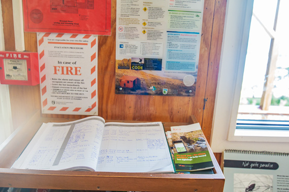 |
15:19 - The sign in book at Moturau Hut. All the huts on all the great walks have these intentions books. |
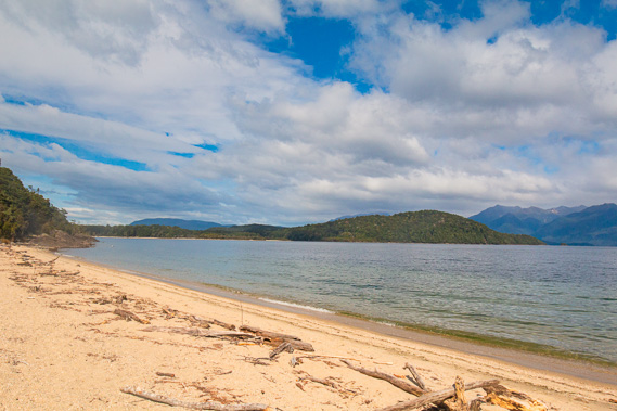 |
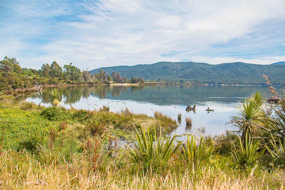
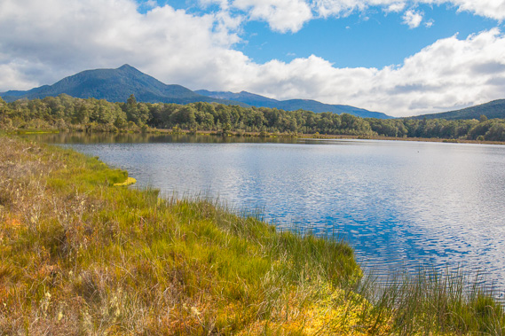
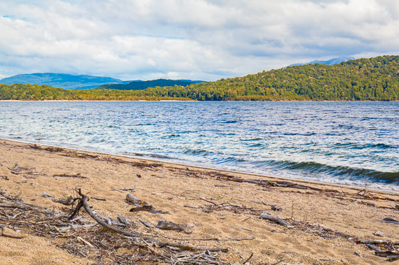
15:31 - The lake in front of the hut looking towards the mouth of the Waiau River in the centre, and the town of Manapouri behind the hill. It is clouding over in anticipation of tomorrow's rain. |
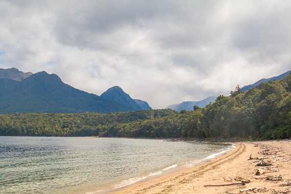 |
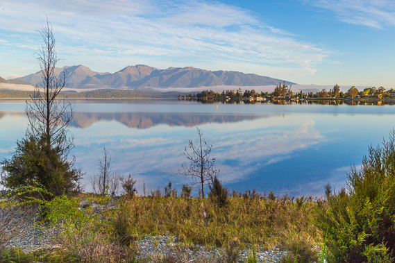
15:32 - View from in front of the hut up the Iris Burn valley tomorrow, where I will be following to the Iris Burn Hut at the bottom of the far spur in the bottom of the photo. Jackson Peaks are (obscurred) to the right and the Kepler Mountains to the left and centre across the back of the valley. |
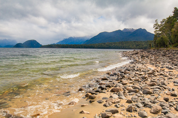 |
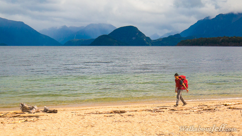
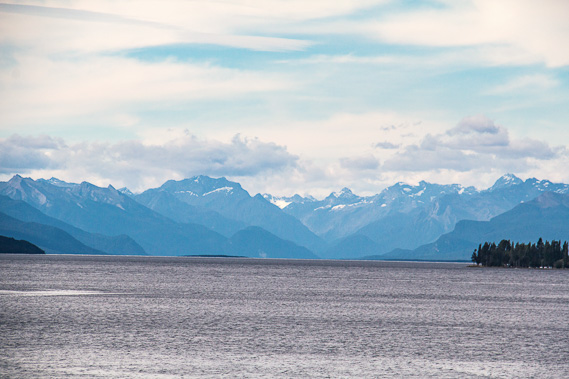
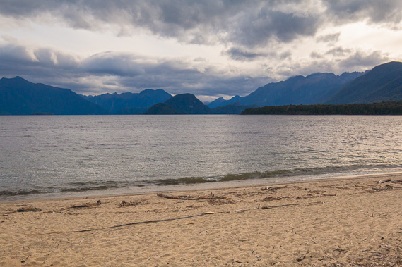
17:07 - At the far end of the beach where waves are breaking from the wind. The Kepler Mountains are to the right, and the lake continues a long way penetrating deep into Fiordland to the left into West Arm. Manapouri Power Station is at the back of West Arm, but completely invisible from here. All the water flowing down the Waiau River from Lake Te Anau plus the extra water accumulated from Lake Manapouri flows through the underground power station. |
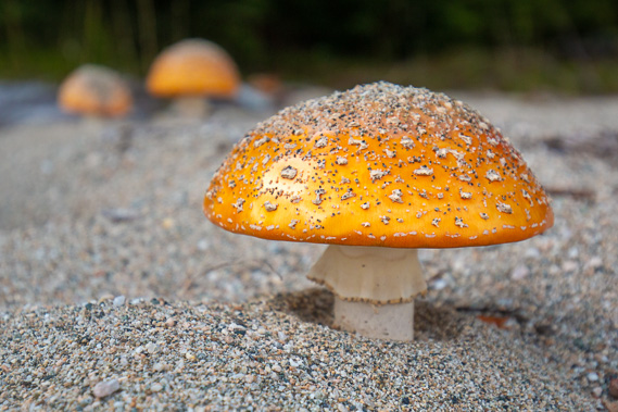 |
17:19 - Fly agaric toadstools grow on the beach. This is a very unusual sight, but they can grow here because the lake water is fresh and rainfall is frequent. |
 |
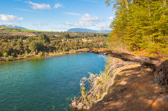
17:23 - Zoomed into Shallow Bay where the Waiau River drains into the lake in the dark patch in the centre. If the lake level had been risen by 25 metres, this would be a wide channel flooding up the Waiau River into Lake Te Anau. The wetlands I crossed earlier would have also been flooded. Many of the lake's 33 islands would have also been drowned, potentially destroying unique ecosystems. A Ngati Mamoe settlement was established around there a couple of hundred years ago. |
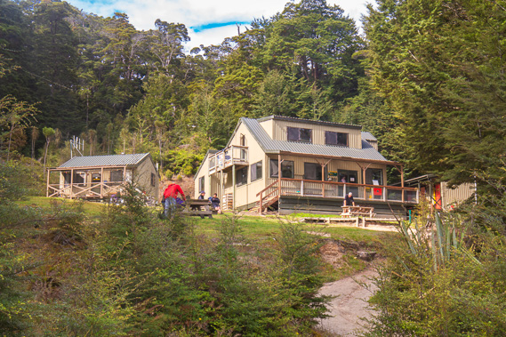 |
17:56 - Returning to the Moturau Hut with all its character. It looks like a nice homestead with a very nice Ranger's hut to the left. It was built in 1988 along with the other two huts whilst the track was constructed. I head inside and meet a hiker who I had hiked part of the Routeburn Track with. This fellow from Melbourne had just completed his tenth day straight hiking, having completed the Routeburn and Milford tracks, and now just one day away from completing the Kepler Track ready for a well deserved rest in Te Anau. |
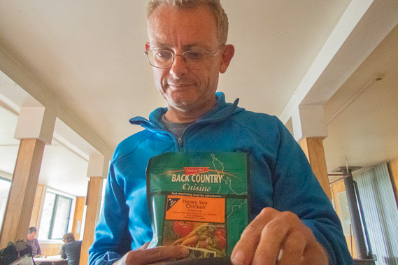 |
18:59 - Pulling out my Back Country Cuisine - going for a honey soy chicken tonight. These have kept me going very well on all the Great Walk tracks done to date, and will keep me going on this track as well. |
 |
19:09 - Returning to the lake after dinner. The clouds have lifted and I can now see Crooked Mountain. It is the first peak to the right of the dark hill (Te Tukeroa named after a prominant Maori priest, or "The Beehive") in the middle. The Manapouri Power Scheme entrance is at the left hand end of Crooked Mountain, and the power scheme itself is about 170 metres underneath the lake in the heart of the mountain. |
 |
19:10 - I also have a clearer view up the Iris Burn valley. It is cooler now and the sandflies are out, relentlessly biting. The lakes were first explored in detail by James McKerrow in 1862. He spent weeks paddling with an assistant up the many arms of the lakes. At the end of each day they looked for somewhere to camp and named many of the mountains, rivers nad islands. He named the Kepler Mountains (to the left) after the famous German astronomer Johannes Kepler. In the 1890s Thomas Mackenzie took a break from politics to explore the area. Upon returning to politics (in which he was prime minister for a while), he arranged for the protection of Fiordland which was permanently granted in 1904. |
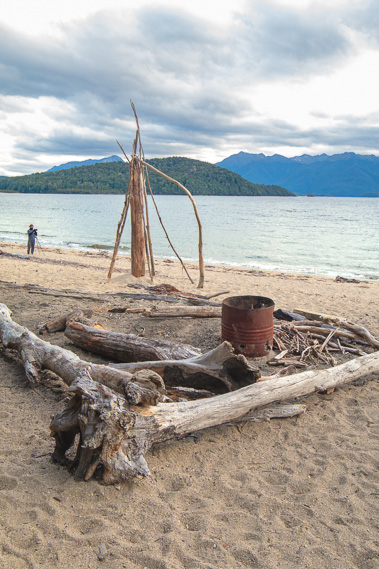 |
19:12 - An arrangement of drift wood on the beach in front of the hut. |
 |
19:16 - At the near end of the beach a little past the hut entrance. Manapouri township is behind the big hill in the middle, so there is no sign of civilisation from here. |
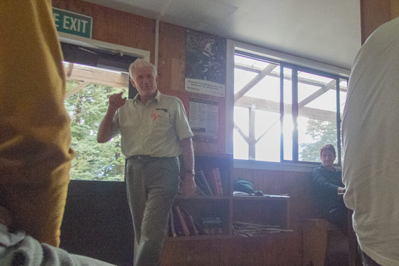 |
19:31 - I return to the hut in time for Ranger Phil's famously long (but most interesting) presentation on the area, particularly talking about the Manapouri Power Scheme and the protests that were involved in the late 1960s to early 1970s. He was part of all this, so it's an issue close to hs heart. He also describes the track in both directions, though it would seem I am the only one heading up the Iris Burn tomorrow. Everyone else here has come down from Iris Burn and will be walking out tomorrow, some getting the shuttle at Rainbow Reach, some getting picked up at the penstocks, and others walking all the way into Te Anau retracing my steps today. |
|