Introduction to today's journey
We ought not to ask why the human mind troubles to fathom the secrets of the universe. The diversity of the phenomena of nature is so great, and the treasures hidden in the skies so rich, precisely in order that the human mind shall never be lacking in fresh nourishment.
- Johannes Kepler, 17th century.
THE DEEP U shaped valleys of Fiordland were carved out during past ice ages, when much of the South Island was covered in ice. Layers of snow would fall on the mountaintops, and would never melt. Instead of flowing down the sides of the mountains as rivers, they would slowly move down the mountainsides as glaciers. The incredible weight of the giant rivers of ice would carve very deep U shaped valleys as the glaciers moved downstream.
When the ice ages ended, the ice would melt leaving the gaping U shaped valleys covering the Fiordland landscape. Rivers now flow through the bottoms of the valleys, with steeply cascading streams and waterfalls plunging from the mountains on either side. The sides of these valleys are very steep to this day, making them prone to huge landslides which occasionally come down during very heavy rain or during a big earthquake. The Iris Burn valley has one enormous landslide which came down only a few years after the track opened, creating a gaping clearing in this otherwise tranquil forested valley.
Today's trek starts from Moturau Hut, following the shore of the calm Lake Manapouri to the mouth of the Iris Burn. From here the track follows the river upstream along a straight deep glacial valley through pristine forest until eventually reaching a huge clearing at Big Slip. Upon crossing the heathland clearing, it returns into the forest to moderately rise to the top of a low saddle before descending to Iris Burn Hut.
Today's Journey
Distance trekked today: 16.2 kilometres.
Total distance trekked to date: 36.7 kilometres.
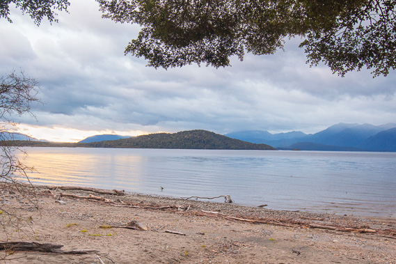 |
07:59 - Leaving the hut just before sunrise, I follow the dark track with the occasional view of the lake on this still cloudy morning. The weather forecast is for about 20mm of rain later today. Anticipating all the amazing scenery I'll be photographing up the valley today, I left early to get as far upstream as possible before the rain starts. |
 |
08:01 - It quickly becomes light enough to photograph the beautiful forest. The terrain beside the lake is quite flat. This area would have flooded if the lake level had been raised as part of the Manapouri Power Scheme's original plan. |
 |
08:03 - Crossing a bridge over a small stream with many fly agaric toadstools growing on the bank. |
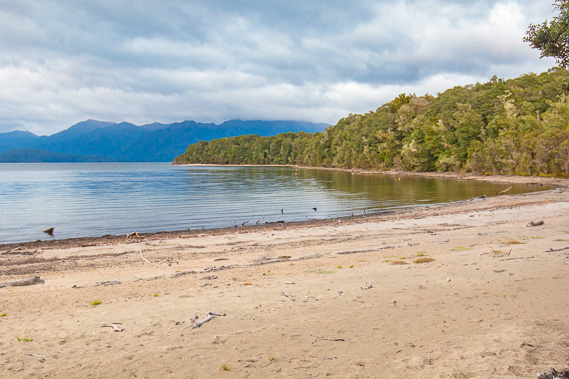 |
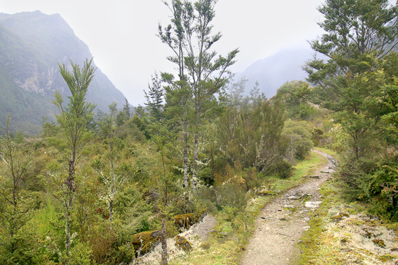
08:10 - Last view of the beach before the track starts heading inland towards the Iris Burn valley. From here over the following two and a half days the track goes over the mountains before returning to the shores of Lake Te Anau. The cloud overhead is thick but there is no sign of any rain. |
 |
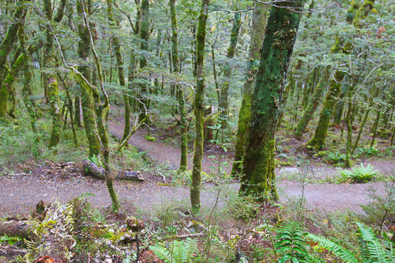
08:16 - The track remains in great condition as it heads over the low rise now showing the valley in the clearing ahead, but no sign of the Iris Burn yet. This seems to be the track of concealed rivers. |
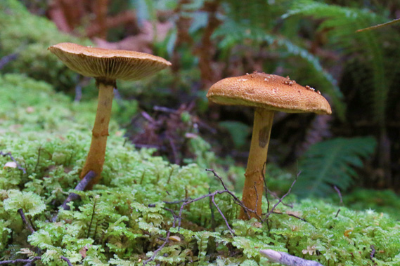 |
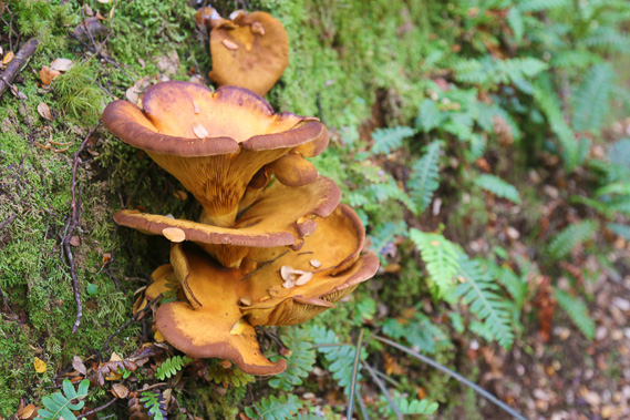
08:25 - Some toadstools growing in the moss beside the track. Conditions are perfect in the early Autumn with the high rainfall and falling temperatures for fungii to make an appearance through the perpetually wet mossy carpet. |
 |
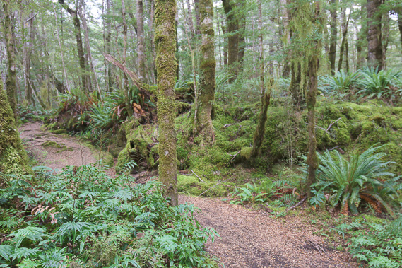
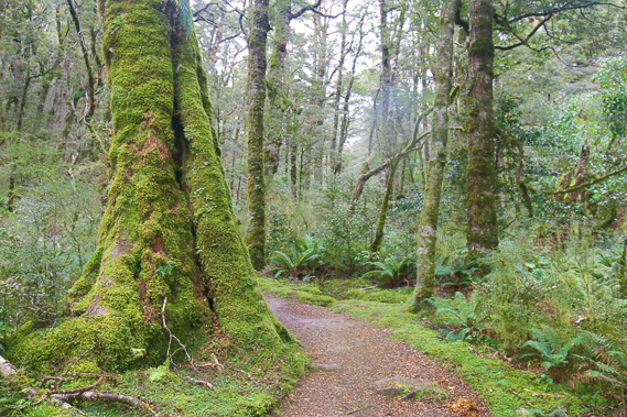
08:37 - The terrain is still flat as I start heading up the Iris Burn valley. The forest floor is covered in crown ferns. |
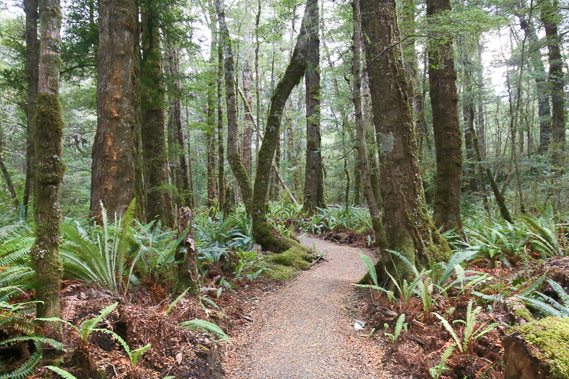 |
08:58 - The trees stand very tall in this quiet and idyllic forest. |
 |
09:11 - I finally reach a clearing and leave the track to get the first glimpse of the Iris Burn, and a view up the valley. The Iris Burn Hut is at the end of the spur dropping from the most distant mountain (Mount Tinsley) to the right, so there is still quite some distance to go. |
 |
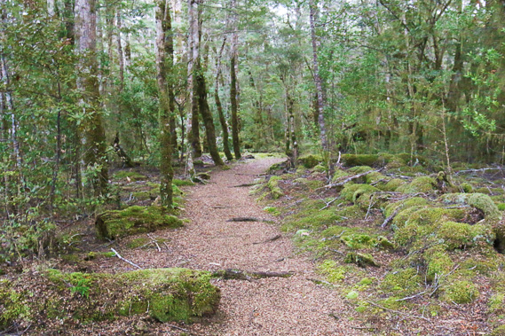
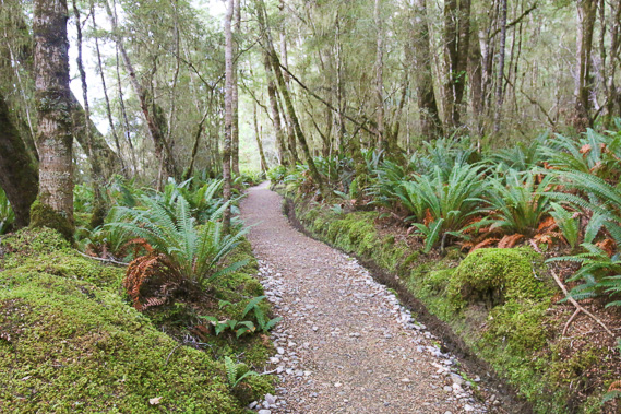
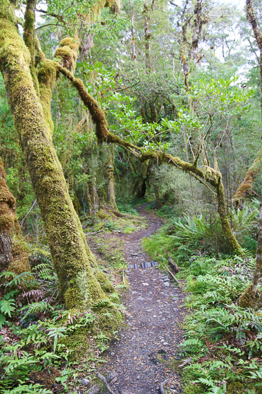
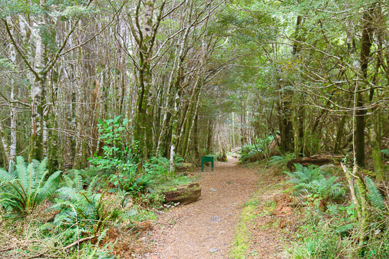
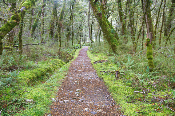
09:21 - Back on the perfectly manicured track. It seems as new as when it was built in early 1988. The kahikatea, totara and matai trees have largely been replaced with mountain beech as I now start heading into the mountains. |
 |
09:22 - The terrain starts to roughen as the valley starts to narrow. |
 |
09:25 - Some bracket fungii growing from the side of a rotting log. Dead trees are quickly decomposed by the mosses, fungii and grubs which efficiently break it down to provide nutrients for the rest of the forest. |
 |
09:42 - The forest gets more wild as I continue upstream. |
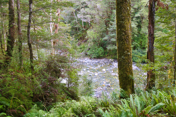 |
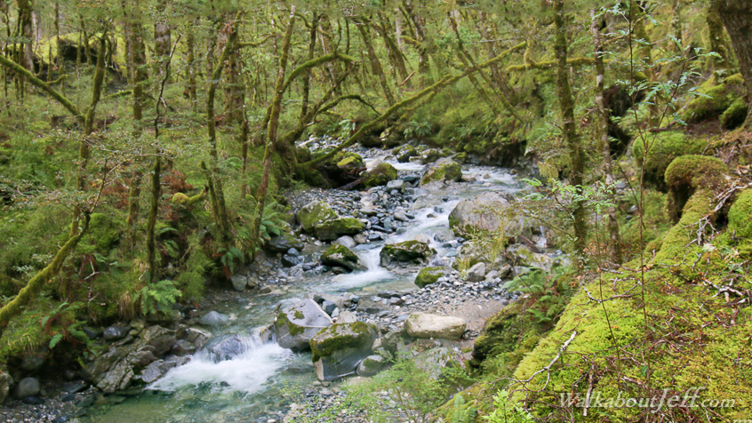
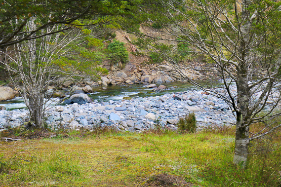
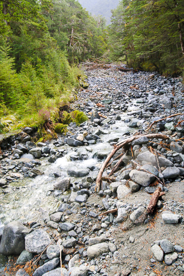
10:00 - Glimpse of the Iris Burn as it tumbles over small boulders below. Numerous pairs of the rare blue duck are found along its crystal clear waters, but they were elusive today. |
 |
10:25 - The sun tries to come out through a gap in the clouds. This is the last sunlight I see today. |
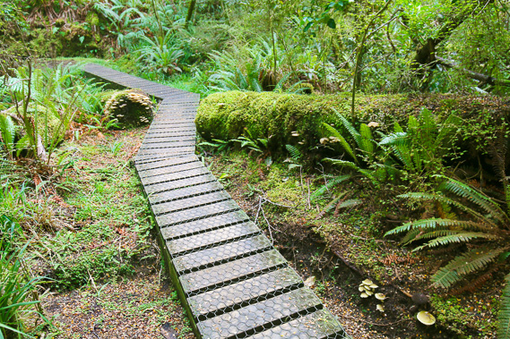 |
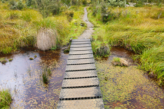
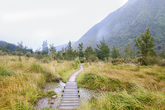
10:45 - The ground becomes boggy and sections of boardwalk allow easy access. |
 |
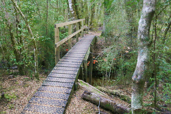
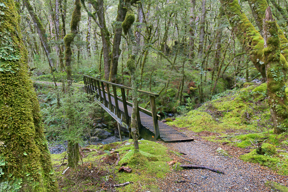
10:58 - I reach another bridge as the valley starts noticeably ascending. |
 |
11:11 - Another view of the Iris Burn now flowing more swiftly in a roaring rapid as I reach the start of a clearing. |
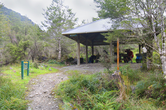 |
11:13 - I reach the Rocky Point Shelter at the midpoint of today's hike. The first hikers coming from the other direction are resting here at the half way point. They seem relieved that today is a relatively easy hike along mostly flat gently descending terrain after yesterday's traverse of the Jackson Peaks and the previous day's slog up the mountain to Luxmore. I have all this to look forward to over the next two days but will remain focused on today's hike. Here I stop for an early lunch before pressing further up the valley. |
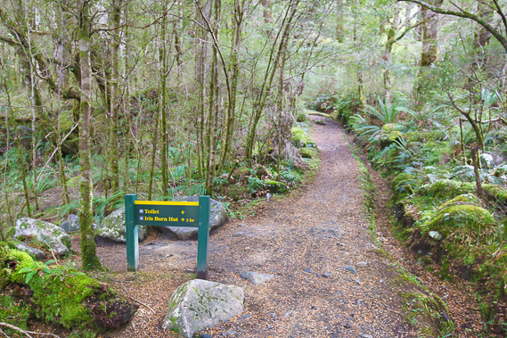 |
11:36 - A couple of minutes after leaving the shelter, I pass the toilet. Iris Burn hut is another three hours (at normal hiking pace) along the track. Shortly after this point I meet the three guys I started the Routeburn Track with. They hurried ahead on the first day to get to Routeburn Falls that day, and have always stayed about a day ahead of me finishing the Routeburn before doing the Milford, and now doing the Kepler in the opposite direction to me (as was everyone else today). The Kepler Track was created to ease the load off the Milford and Routeburn Tracks, but given the number of people (including myself) who complete all three tracks, the original purpose of this track has been lost. |
 |
11:53 - The track gets a little rougher as it goes over the terrain heading now obviously going uphill following the path of an old glacier. |
 |
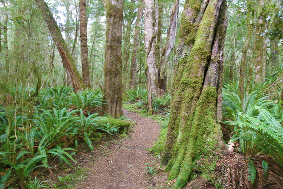
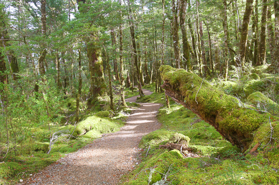
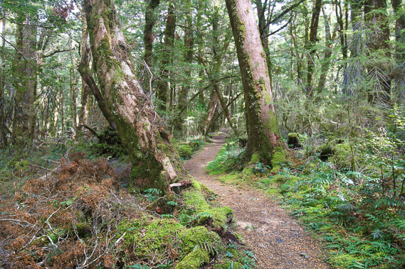
12:09 - The trees get taller and the forest more ancient in this almost untouched valley. |
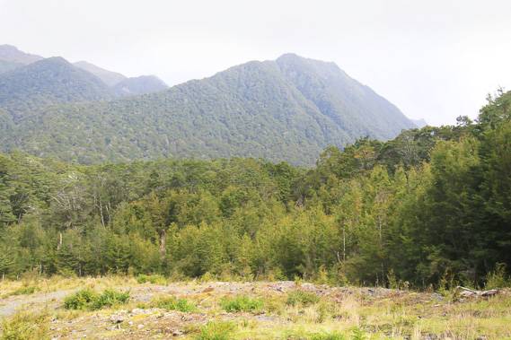 |
12:24 - Looking downstream at a creek crossing across to the Kepler Mountains. The mountains were named by surveyor James McKerrow in 1863 after German astronomer Johannes Kepler. |
 |
12:25 - Looking downstream at the next stream to more of the Kepler Mountains. Although the mountain range was named in the nineteenth century, some of the unnamed peaks were named in 2009 by historian Aaron Nicholson after famous New Zealand astronomers. The 1650m high Mount Pickering hidden at the back of this valley was named after the late Sir William Pickering. The 1537m Mout Tinsley is named after the late Beatrice Tinsley. I will be passing those mountains tomorrow, and if weather conditions are good, I should be able to see them. |
 |
12:26 - Looking upstream towards the Jackson Peaks. I will be following the tops of these peaks tomorrow. At the end of the bridge I meet today's ranger carrying a shovel hurrying down the track to do some maintenance. He tells me this is Margarine Creek because the sediment is spread out widely between the forest. |
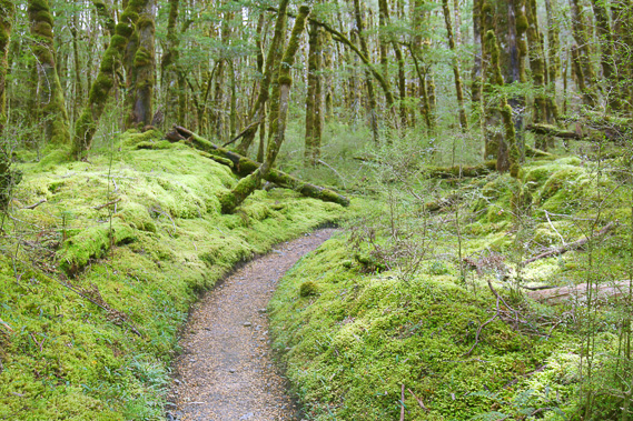 |
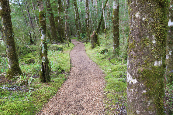
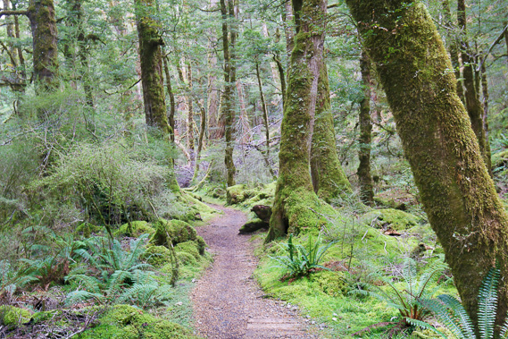
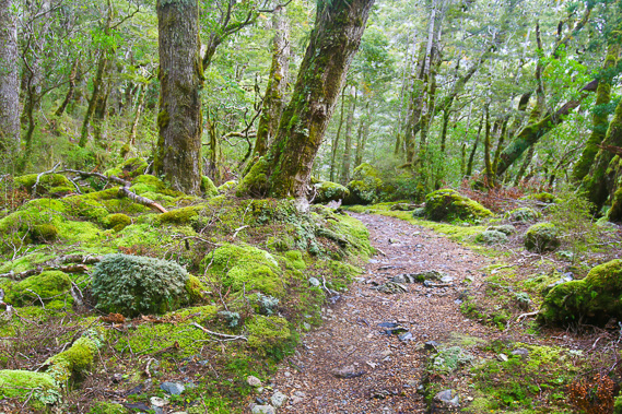
12:31 - The track remains perfectly manicured as it meanders through the thick carpet of moss. |
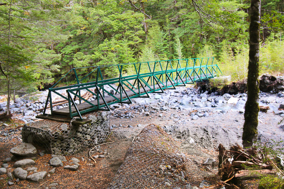 |
12:34 - I cross this bridge with the ends eroded away. The steep mountain streams are constantly changing course with every flood event being followed by track maintenance. |
 |
12:35 - Looking upstream from the bridge. The stream drains from Brian Mason's Crater Lake high in the Jackson Peaks (not visible from the track tomorrow). It was named after the prominant New Zealand geochemist and mineralogist working mostly in the USA for the American Museum of Natural History and later the Smithonian Institution. He wrote the classic textbook "Principles of Geochemistry" in 1952 which went through four editions over 40 years. |
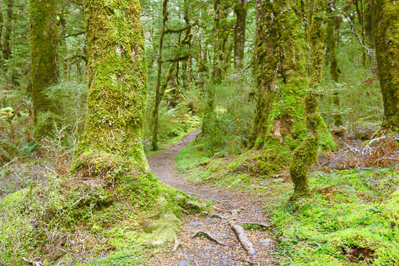 |
12:40 - Cutting through the forest of moss draped trees. Silver beech now starts mixing in with the mountain beech as the valley floor gains altitude. |
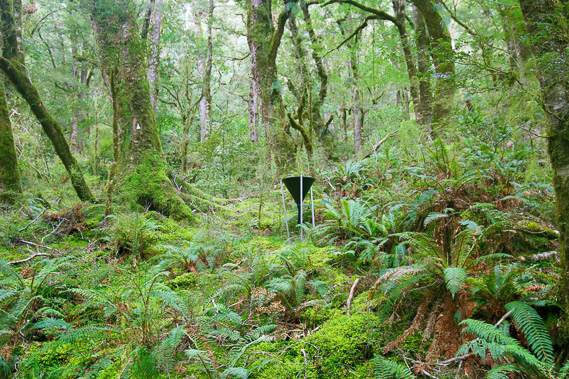 |
12:56 - An interesting funnel up above the track. It is used for some kind of scientific research, perhaps for collecting falling foliage and pollen. |
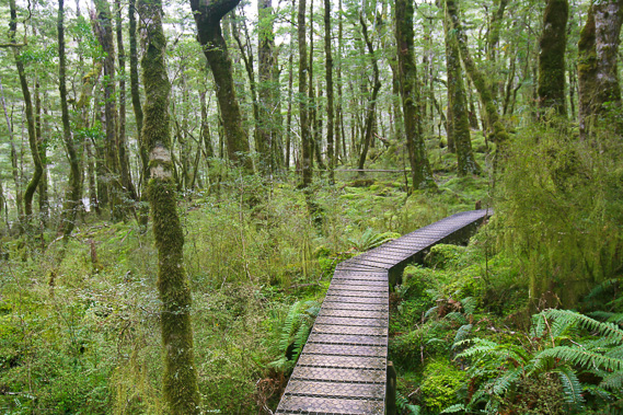 |
13:09 - A boardwalk crosses a swampy section of the forest. |
 |
13:20 - To get this bridge I had to head upstream along a rough cut track behind the big boulders behind the boulders on the other side. A recent flood brought a lot of boulders down the gully cutting off the original crossing. I am now following the track back down the other side to the main track. |
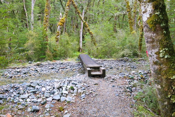 |
13:31 - Another bridge crossing a stream with a lot of rubble deposited in a recent flood. |
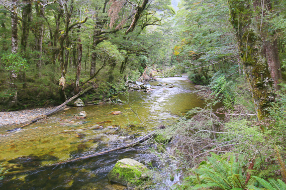 |
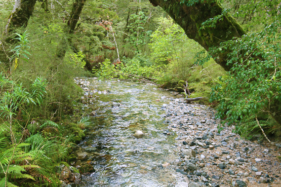
13:45 - Reaching another good view of the Iris Burn in a calm area between rapids. The water is crystal clear and there are numerous pairs of rare blue duck along this river, but I haven't seen any today. They are very shy birds. |
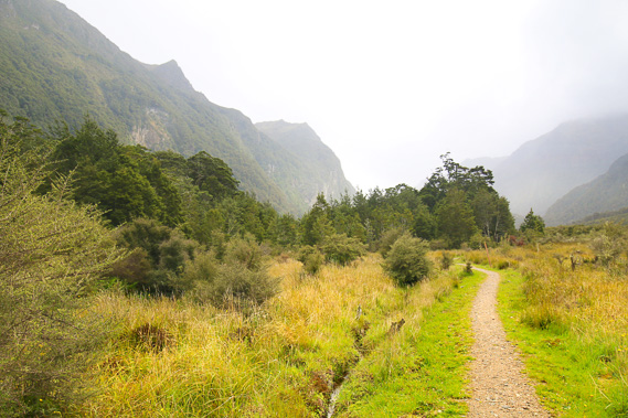 |
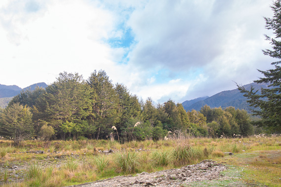
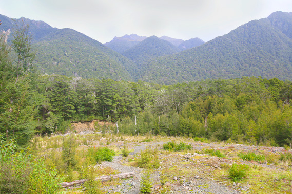
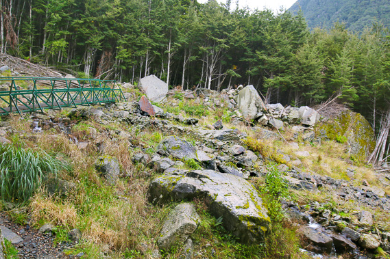
13:53 - The forest suddenly ends at the beginning of Big Slip. The Kepler Mountains are to the left and going around the back of the valley to include the mountains to the left on the other side of where the track climbs them. The Jackson Peaks are to the right now out of view. The cloud has lowered and drizzle has started falling. Fortunately there is no wind yet, but this is the change in weather that is predicted, and it is only going to get worse. For the first time today it is apparent I'm in a glacial valley, with a river of ice a kilometre deep carving out the landscape flowing down to its end where the Waiau River now flows into Lake Manapouri. |
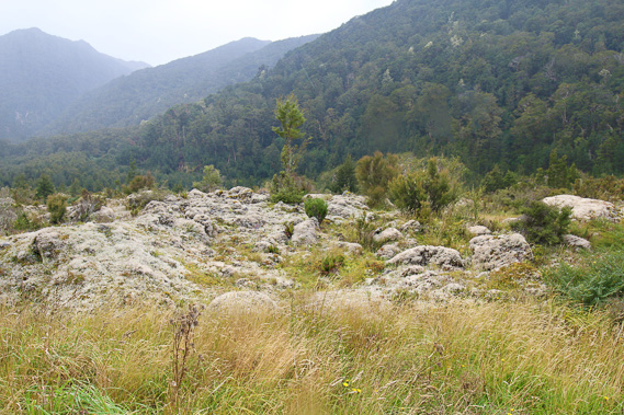 |
14:03 - Some exposed rocky formations on Big Slip as the temperature starts to drop. The forest and topsoil were wiped out from here when the Big Slip occurred. |
 |
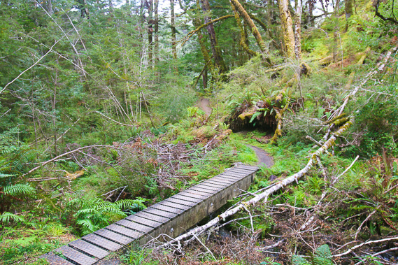
14:06 - Bridge over a small swampy section on Big Slip. The track has been completely dry so far (and will continue to be for the rest of the trek) thanks to these well constructed boardwalks and bridges. |
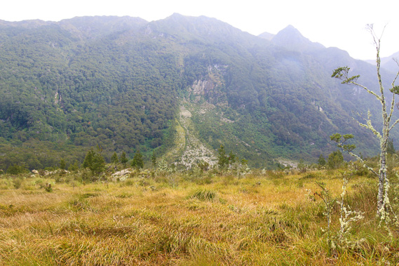 |
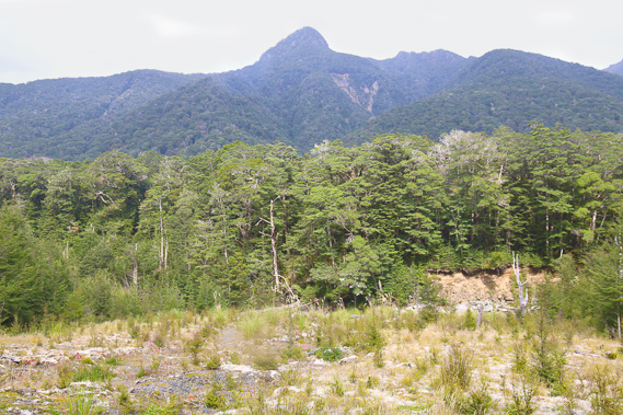
14:08 - The massive slip face coming off the Kepler Mountains where a large section of the hillside collapsed and covered the valley, burying the trees. This happened on 26 January 1984 not long before the original track was built and opened in February 1988. 300mm of rain fell in one day filling a rock fracture here causing the hillside to burst. The slip itself spread over 30 hectares of the valley floor where I am standing. The floodwater destroyed anouther 30 hectares of forest along the flat I had just passed through. This allows relatively easy construction of this part of the track. The trees take hundreds of years to grow, so this will be open space for a long time to come. Scrub has started regenerating. |
 |
14:09 - Crossing another swampy section of the swamp as the track approaches the top of the slip. |
 |
14:12 - The track enters scrubby forest near the top of the slip. The ground up here isn't as swampy as it is below, allowing the bush to regenerate a lot faster here. Three decades and the scrub is rising to about three metres. Another couple of hundred years will pass before this is mossy forest again. |
 |
14:22 - Back in the forest at the end of the slip, showing what the now grassy area of Big Slip will be like in a couple of hundred years. |
 |
14:28 - Crossing another pristine mountain stream before following it up towards a low saddle. |
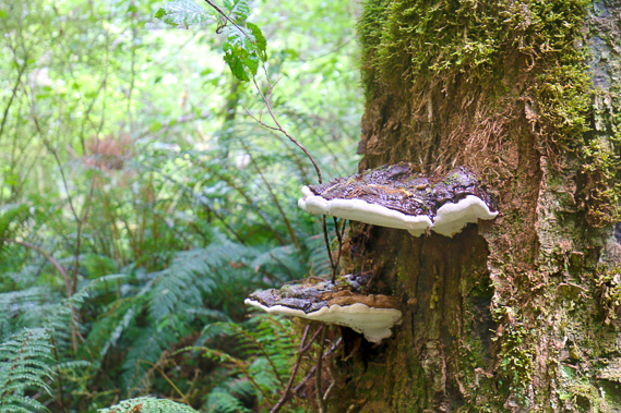 |
14:29 - Bracket fungii in a living tree. The tree remains alive feeding the fungii. When the tree will eventually die, the bracket fungii will continue feeding on its remains. |
 |
14:53 - The track ascending a gully towards a saddle to avoid a steep gorge which Iris Burn flows through. |
 |
15:02 - At the top of the saddle. This would have been the terminus of an old glacier flowing down this valley in a recent ice age. The more severe ice ages would have seen the glacier extending all the way down the valley and depositing its load at the end of Shallow Bay where the Waiau River flows out. |
 |
15:06 - The track zig zags moderately down steep terrain on the other side of the saddle. This would have likely been a deep lake at the glacier terminus before the gorge to the left of this hill carved itself out. |
 |
15:11 - Crossing a bridge over a big stream at the bottom of the descent. This is the stream which flows out of Hanging Valley. I will be following it upstream tomorrow to above its source at Hanging Valley Shelter. The hut and the end of today's hike is just a few minutes away. |
 |
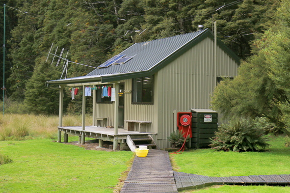
15:14 - The clearing at Iris Burn Hut is just ahead along the end of this straight section of track. |
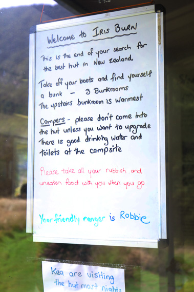 |
15:19 - Sign on the door of the hut. Ranger Robbie (who I met earlier at Margarine Creek) obviously thinks this is a great place, though Ranger Phil last night had warned of the leaky roof in the bunkroom. |
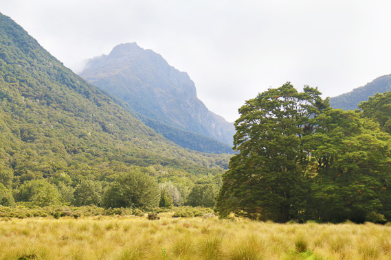 |
15:25 - View from the hut. The large clearing gives a good view to some of the peaks of the Kepler Range. From here is a half hour track to Iris Burn Falls. The rain is starting to fall moderately now and will increase. The clouds are sweeping down the sides of the mountains. I don't think I'll be able to go up to the falls. |
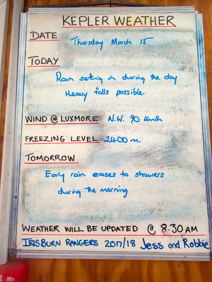 |
15:27 - The updated weather forecast. It is not looking good - thankfully I wasn't crossing the tops today with the wind now (supposedly) blowing at 90 kilometres per hour. Hopefully it will clear tomorrow before I reach the exposed tops. |
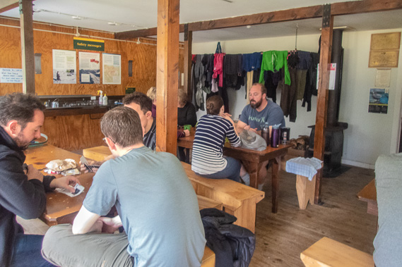 |
15:28 - Inside the hut. Everyone coming the other way have already arrived as they were advised to leave Luxmore early this morning to get off the tops before the heavy rain and strong winds arrived. Fortunately the change in weather ended up coming later than expected, so everyone got down safely before the rain started. |
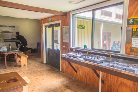 |
15:29 - The kitchen gas cookers all well set out under the windows with the view to the valley and rain. The tables are all in the middle of the room. |
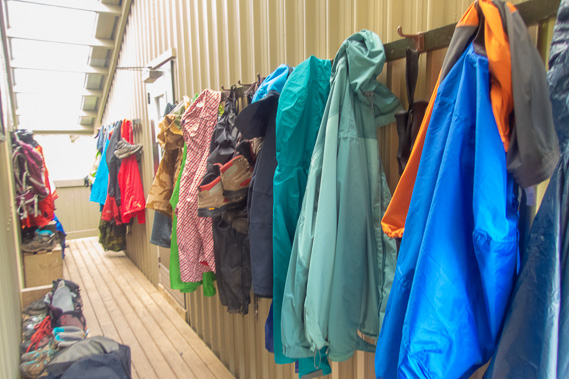 |
16:10 - A covered external hallway between the communal dining room and the bunk room where all the raincoats are hanging. |
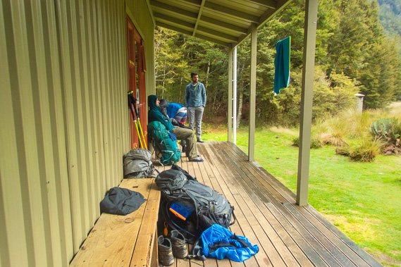 |
16:11 - Outside the bunkroom as the rain falls. The two people at the other end have just arrived having started at Rainbow Reach this morning, so they will be crossing the tops with me tomorrow. At this point I rule out heading up to Iris Burn Falls - it is too wet. |
 |
16:15 - The quaint ranger's hut which is shared between the two rangers who rotate here during the summer hiking season. A boardwalk running above the boggy ground gives dry access to the main hut. |
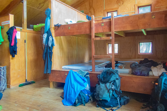 |
16:16 - Inside the bunkroom. Although I was one of the last to arrive and the hut full, I managed to score a bottom bunk allowing for an early departure tomorrow. There is no sign of the famous leak through the ceiling. |
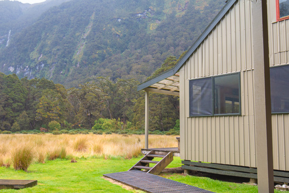 |
17:04 - Partial view of the main hut from outside the bunkroom. The rain is now falling too much to go out and get a full photo of the hut. A couple more people arrive hoping to camp, but the ground is very wet and they decide to upgrade to bunks in the hut. |
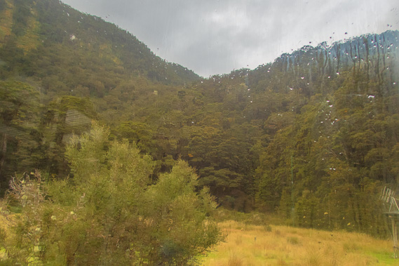 |
17:20 - Looking through the wet windows from the kitchen towards the saddle I crossed at the last part of the track. The rain is falling moderately so there won't be any trip to the waterfall today. I now prepare dinner. I have dinner with a group from Sydney who have come over the mountains today. A lot of Aussies do this track. |
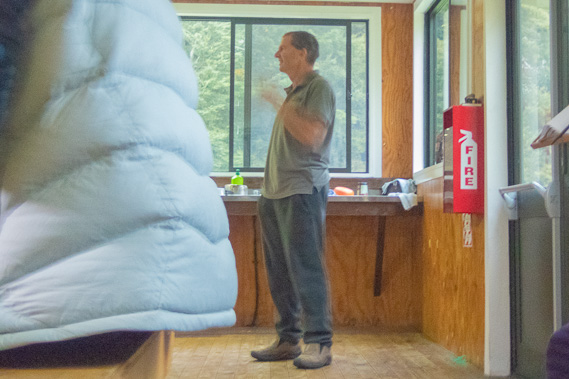 |
19:30 - Ranger Robbie doing his presentation. He covered both directions and warned everyone heading the other direction about the long presentation tomorrow night (for those staying at Moturau). He mentioned the leaky roof and the problem with not being able to get the approval to get the materials to get it repaired. This isn't exactly the sort of place where you can phone a tradesperson to deliver the materials and do the fix in a day. The repair materials will probably have to be helicoptered in - an expensive exercise. |
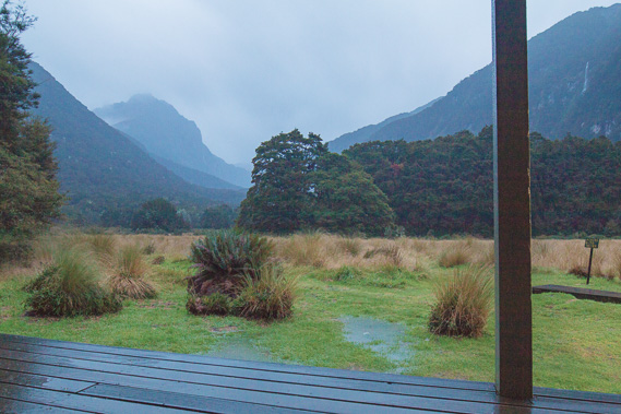 |
20:45 - The rain continues falling heavily creating big puddles in the grass. The cloud clears enough to see further up the valley in this final view before my early night. Robbie is a bit worried about tomorrow morning and advises me to depart late tomorrow morning, but he will get an up to date weather report from the ranger at Luxmore Hut at 7:30 tomorrow, so fingers crossed. Between now and then though, I need a good sleep in anticipation of the mountain crossing. |
|