Introduction to today's journey
The international year of astronomy was coming up (in 2009)... so I thought it would be nice to have a place where our famous astronomers could have a place to live.
- Aaron Nicholson, 2008.
ALTHOUGH the landscape in Fiordland is extremely rugged, with its jagged mountains held up by impossibly steep walls of rock, the mountains all rise to around the same height. When you reach the tops of the mountains, none really stand out as being significantly higher than the rest. The mountains to the west are higher than the mountains to the east though. This is because the mountains all form part of the Pacific Plate side of the mostly submerged Zealandia continent. This plate is overriding the northward moving Indo-Australian plate. The land here has lifted twenty to thirty kilometres, but has been eroded by the weather as it has been uplifted. Although the terrain is very high and jagged, it all used to sit under the sea, submerged as the Zealandia continent got stretched out in all directions making it thinner. Then with the emergence of the modern alpine fault which runs just offshore of the west coast in this part of New Zealand, the land under the sea rose forming these spectacular mountains.
Today's trek starts at the Iris Burn Hut and steeply ascends the side of the valley leading to an exposed ridge leading up to the backbone of the Jackson Peaks. The track goes over a few of these peaks before sidling around a few higher mountains overlooking the spectacular South Fiord of Lake Te Anau. Occasionally the track reaches the top of a saddle, from where both lakes Te Anau and Manapouri can be viewed from, but then the track continue sidling around the mountains, sometimes in a high quality even track, but sometimes a little rough as it negotiates its way over scree which is normally covered in snow over the long winter season. The track gradually rises as it sidles the mountains until reaching just below the summit of Mount Luxmore, from where it begins a moderate descent into a little gully plateau to Luxmore Hut.
Today's Journey
Distance trekked today: 14.6 kilometres.
Total distance trekked to date: 51.3 kilometres.
 |
07:39 - Steady rain has fallen all night and although it has stopped falling, it looks very gloomy and a very cold chill hangs in the air. I pack up anyway and Ranger Robbie advises the weather is looking good having just spoken to the ranger up at Luxmore. He says the first ridge up to the first shelter is the most exposed part of the track and if I don't reach it by 11:30 I should turn back. |
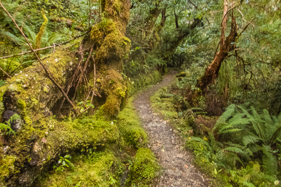 |
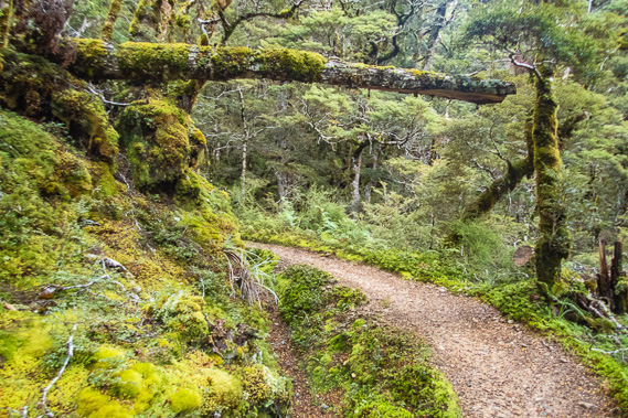
08:02 - I head up the track winding its way up the saturated forest. There is a lot of altitude to gain this morning as I ascend out of the Iris Burn glacial valley. |
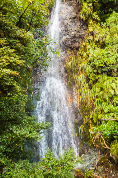 |
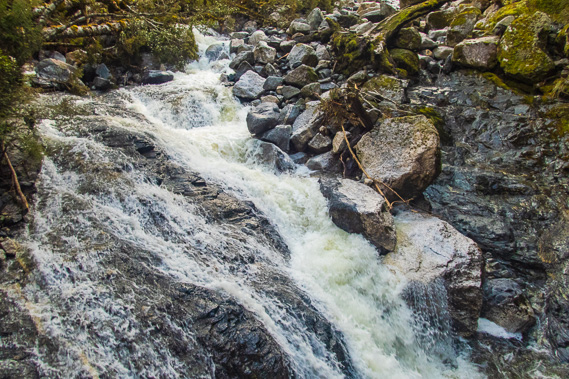
08:35 - The forest along the spur is very thick, but I finally get a good view of the waterfall of a swollen creek next to the track. |
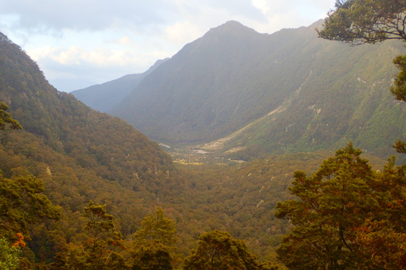 |
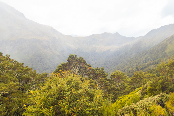
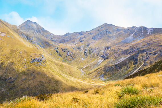
08:37 - Just above the waterfall is a clearing where I can see back along the Iris Burn Valley with a clear view of Big Slip. None of the mountains on the other side of the valley are named, even though some of them are quite impressive. There is blue sky over Lake Manapouri so conditions are looking more promising. |
 |
08:43 - The sun comes out over the mountains at the next clearing. Looking across the top of the hill of the saddle I crossed late yesterday, a waterfall plunges down the other side of the valley. |
 |
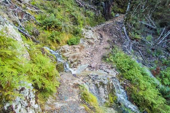
08:53 - A sudden descent down some stairs leads to this torrent. This is the same stream I crossed yesterday just before the hut. It is coming out of Hanging Valley plunging into Iris Burn Valley. The excess rainwater cascades vcer the bedrock. |
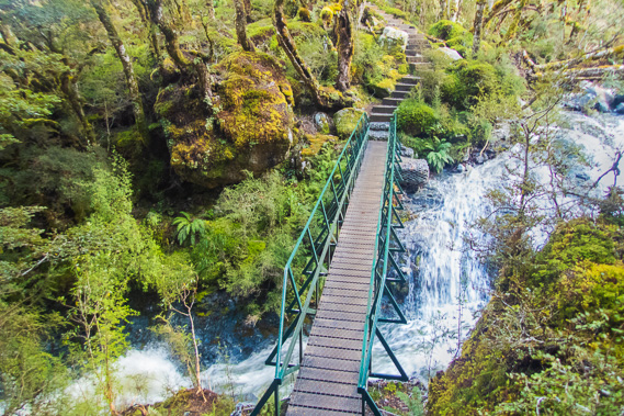 |
08:55 - Looking back over the bridge as I continue heading up the moderately steep track. This is the last major stream to cross on the Kepler Track. |
 |
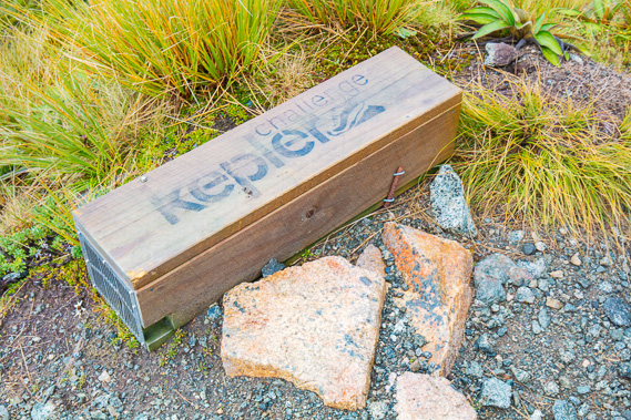
09:22 - The track moderates as it continues its long slog up the mountain. My pace is slow, a lot slower than those who partake in the annual Kepler Challenge in December. This very popular run goes around the entire track with the faster runner completing it in between 5 and 8 hours. I'm happy with my pace taking four days to complete the track. |
 |
09:28 - A temporary stream tumbles across the track as the forest starts to thin. There is no sign of erosion from last night's rain, but it is obvious a small slip has come down here fairly recently. |
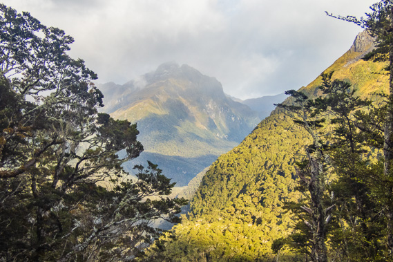 |
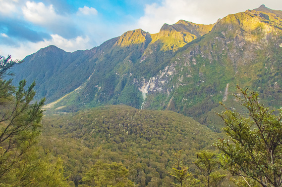
09:47 - View of the upper Iris Burn Valley through a gap in the forest. This is the 1689 metre high Spire Peak, the mountain I had seen from the bunkroom this morning and yesterday. At this height I can now see its summit. |
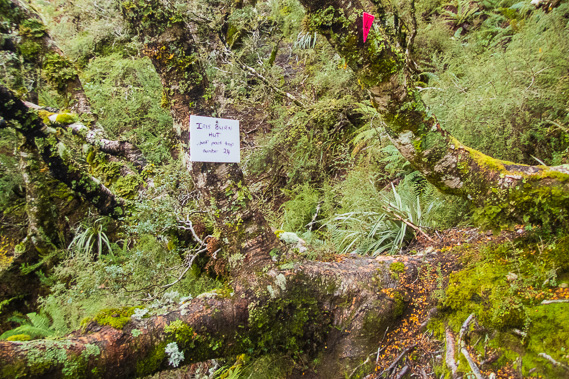 |
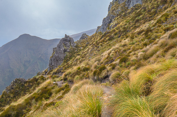
10:13 - A little sign at a bend allowing hikers coming the other way to count their way along the pink markers towards the hut. This is marker number 4. The hut is just past number 24. I'm assuming there are another 3 markers before I reach the ridge. |
 |
10:22 - Only a few minutes pass before I reach the tree line at just over 1000 metres above sea level. I can now see into Hanging Valley. Misty rain is falling and the air very cold. Hanging Valley Shelter is at the top of the hill in the middle of this shot about 350 metres above me. I have already climbed 550 metres - more than double yesterday's climbing and about two thirds of the altitude gain for today. |
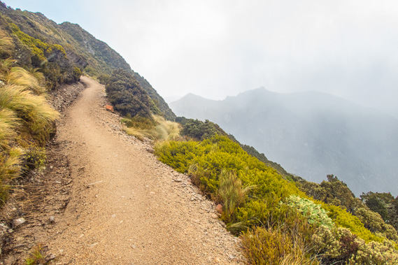 |
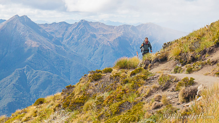
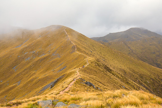
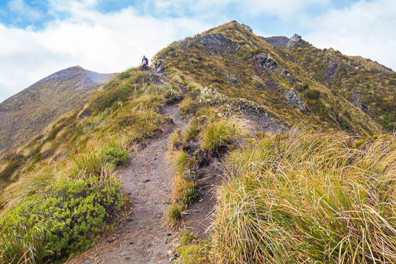
10:23 - The track whilst moderately steep is in very good condition as the top of the ridge now comes into view. The southerly head wind is now strengthening as it blows the tussock. The forest has given way to very low heathland scrub. |
 |
10:27 - View of the upper Iris Burn Valley with the Iris Burn Falls now visible. I had to abandon my short walk up to the falls with yesterday's rain, so I'm glad to have seen it anyway, even if it is from quite a great distance. |
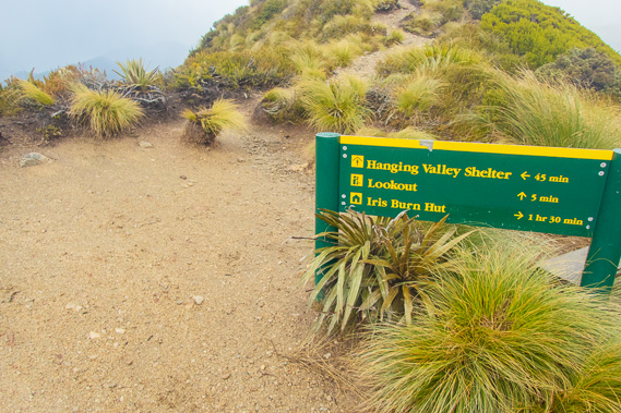 |
10:30 - I reach the top of the exposed ridge at 1167 metres above sea level - less than two hundred metres of climbing to go to Hanging Valley Shelter. There is a full hour to go before the turnaround time, but only 45 minutes to the shelter, so I'm making good time. |
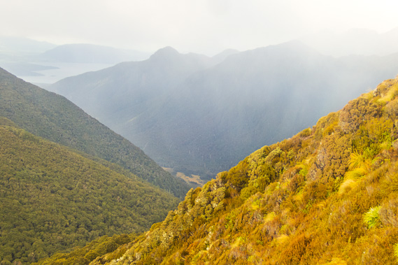 |
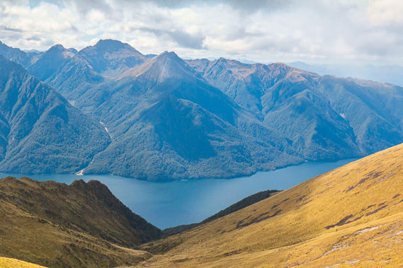
10:31 - View down the Iris Burn Valley and Lake Manapouri from the end of the ridge. |
 |
10:32 - Turning around I start following the top of surprisingly narrow ridge towards Hanging Valley Shelter at the highest point on the background. It seems quite a long way away. |
 |
10:36 - The steep sections of track climbing over bluffs have stairs with handrails making for a relatively easy climb. The cold wind is blowing reasonably strong, but not too much of a concern and certainly not strong enough to blow me over forcing me to retreat back to Iris Burn. The misty rain falling on me becomes pricks of pain as it solidifies into sleet. |
 |
10:46 - The narrow track continues along the ridge passing a tiny tarn during a short break in the sleet. |
 |
10:49 - The rocky terrain dropping into the valley is very steep, and would pose an avalanche danger. This marks the start of the avalanche danger zone, but because the track runs along the top of the ridge, it is not too much an issue here. |
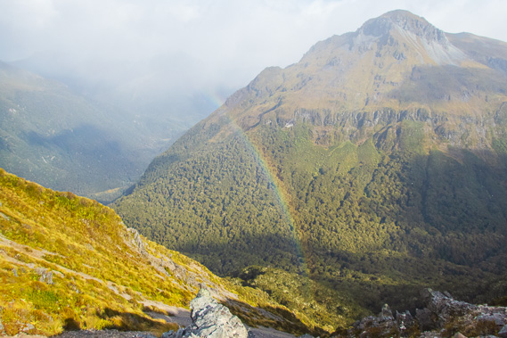 |
10:51 - A rainbow appears in front of the 1537m Mout Tinsley which I passed under before crossing the Hanging Valley Creek rapid. The mountain which is part of the Kepler Mountains is named after the late Beatrice Tinsley who researched and significantly contributed to the scientific community's understanding of the evolution of galaxies and the origin and size of the universe. |
 |
10:58 - The final ascent up the biggest bluff with the shelter somewhere at the top. The sleet is not so painful now as the ice particles are starting to look like small snow flakes. They melt immediately upon contact with the relatively warm ground, but settle on my raincoat for a few minutes. The first person hurrying the other way has just passed me speeding across the mountains in a terrible hurry to get down to Iris Burn. |
 |
11:17 - At the top of the bluff I can see the shelter at the highest point of the main track. Not far to go now. |
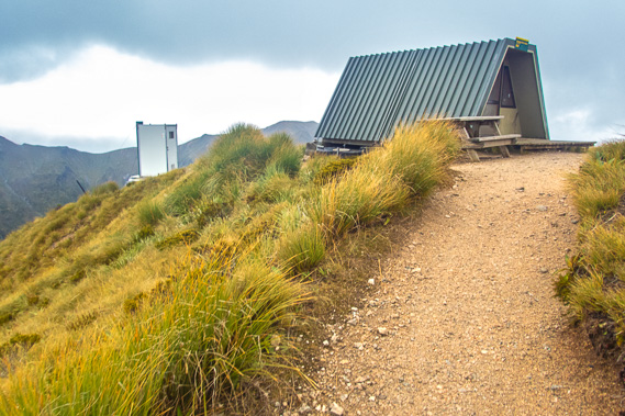 |
11:28 - I reach the shelter at 1356 metres above sea level just before the turnaround time, so I'm making reasonable progress with the most difficult and exposed section of track behind me. The wind is no more than a gently breeze, and with the most exposed ridge of the entire track already behind me, things are looking good for progressing forward to Luxmore. |
 |
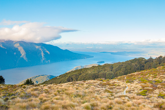
11:31 - First view of Lake Te Anau's south arm in a break in the clouds. The sun is trying to shine on the lake some 1150 metres below me. |
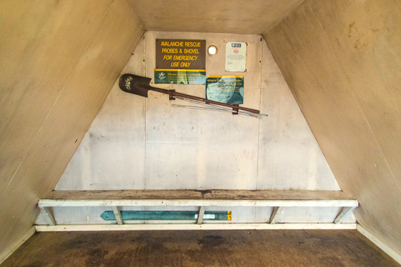 |
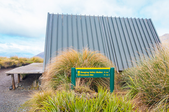
11:37 - Inside the emergency shelter. It is very basic and not a great place to have to stay the night, but it is life saving for any hikers stuck up here. |
 |
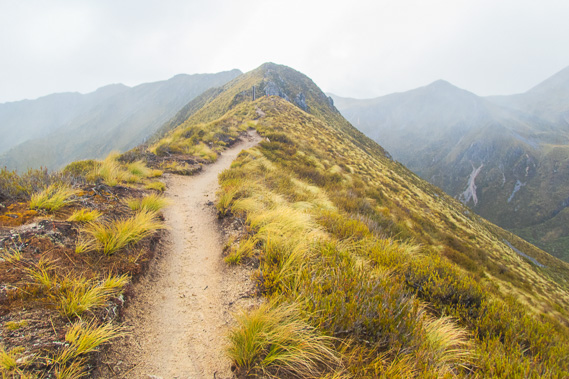
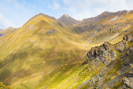
11:55 - From the shelter I start following the track along the tops of the Jackson Peaks. The mountains appear gloomy in the sleet haze. The second person from Luxmore Hut has just passed me hurrying towards Iris Burn. The drop to the right is considered an avalanche danger zone in winter, but the top of the track would still be reasonably safe in winter so long as the snow is not deep. |
 |
12:18 - More fast moving people are hurrying along the track towards me out of the mist. They will no doubt stop at the shelter for lunch before heading down to Iris Burn. |
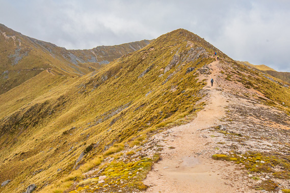 |
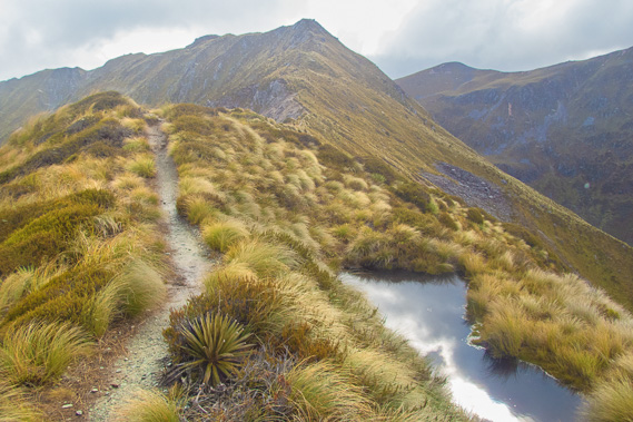
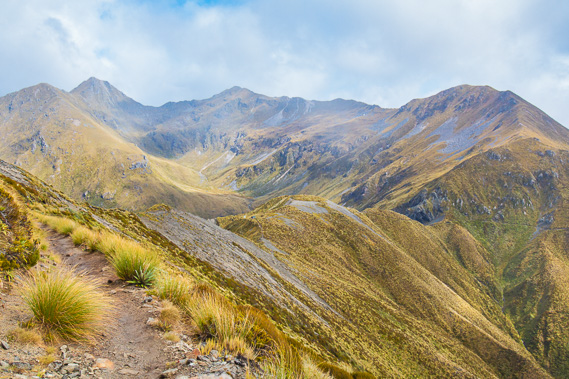
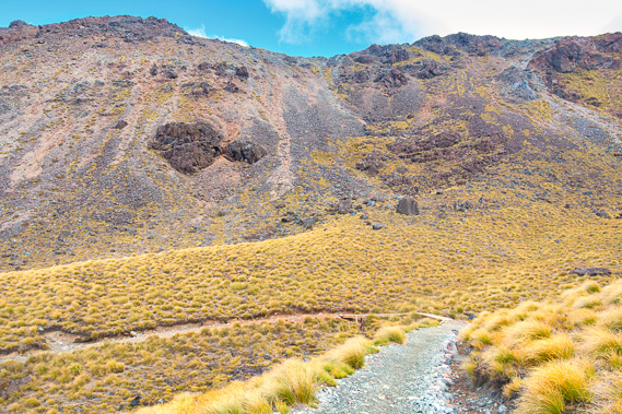
12:27 - The track continues along the tops for a while but will start crossing the sides of the peaks as they get higher. |
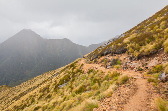 |
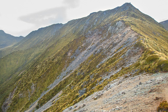
13:11 - The track now traverses around the side of the mountain with the 1354 metre high Forward Peak clearly dominating the view to the left. There is an avalanche danger along this section of the track between here and the other side of Mount Luxmore during winter and spring, with ten known avalanche paths crossing the track. Although anyone reasonably fit can easily negotiate these mountains on a day like today, only experienced alpine hikers should attempt this crossing between May and October. Fortunately there is no ice at all up here so there is no danger today. |
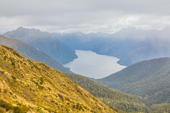 |
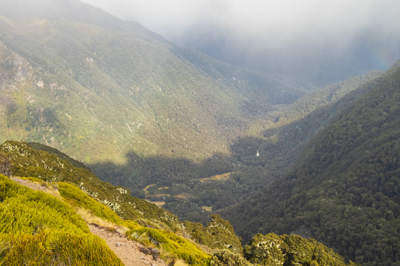
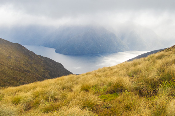
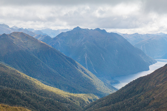
13:24 - Looking up the back end of South Fiord over a thousand metres below me. The 1558 metre high Mount Maury stands out to the left. This is apparently a very obvious landmark mountain when you sail into South Fiord from Te Anau. The mountains in the far distance form the main dividing range over which are the West Coast fiords of Charles and Caswell Sounds. |
 |
13:30 - The terrain becomes a lot more rugged as I head around an unnamed mountain of the Jackson Peaks. The mountain shelters me from the southerly wind and the occasional sleet that has fallen up till now has completely melted into a misty rain. No snow has accumulated at all thank goodness. Some of the severe blizzards can deposit up to a metre and a half of snow in a single storm creating snow pockets up to 3 metres thick. This is where the emergency shelters would come in handy. |
 |
13:45 - The track passes an avalanche path under the mountains. A lot of people have passed me coming the other way, so Luxmore Hut draws near. Each subsequent group passing me is slightly slower than the last, but all keeping a good pace. I haven't seen any sign of the other four people coming in this direction from Iris Burn yet. I'm guessing they stayed at the hut for a while waiting for the weather to clear. |
 |
13:46 - One of many stoat traps along the track keeping the vermin at bay and hopefully encouraging the return of the noticeably absent birdlife. Numbers have dropped off in recent years. |
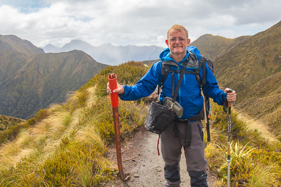 |
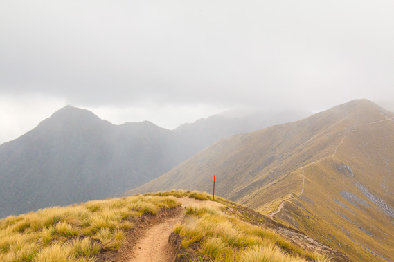
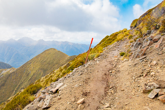
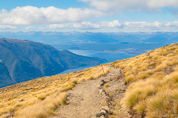
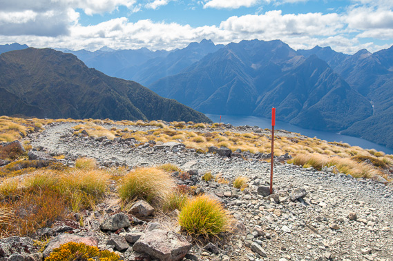
13:50 - At a bluff approaching Forest Burn Shelter. One of the four other people hiking from Iris Burn to Luxmore has caught up to me and takes my picture. The orange pole helps with navigation when snow covers the track. When the snow does settle it can often be thick completely hiding the well formed track. The orange markers help with navigating along the track in winter and spring. Fortunately the snow never settled today. |
 |
13:56 - The track and terrain steepens as I follow the top of the undulating ridge, leading the French fellow who took my photo a short time ago. One of the slower hikers coming from Luxmore comes over the top in front of me. His pace seems reasonable, so he probably left the hut quite late this morning waiting for the weather to clear. |
 |
13:57 - Looking at the top of the highest of the Jackson Peaks where a waterfall plunges out of a hanging valley. |
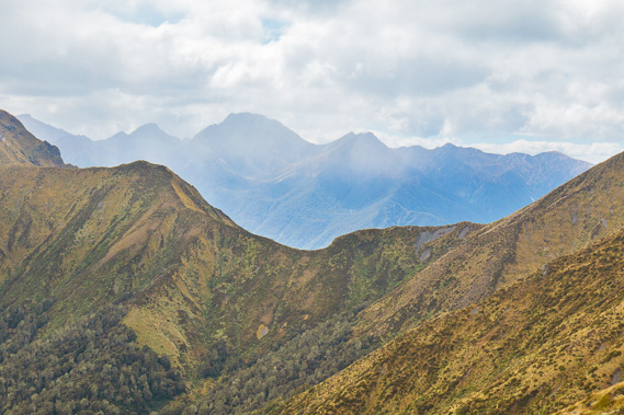 |
14:03 - View across a saddle separating Forward Peak from the rest of the Jackson Peaks. The Murchison Mountains tower on the other side of the saddle. South Fiord runs along the valley between the saddle and the Murchison Mountains. The tallest peak is Black Cone which is also clearly visible from Te Anau Village. Takahe Valley where the takahe were discovered is on the other side of the peak. |
 |
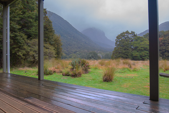
14:08 - Forest Burn Shelter at the bottom of the spur where I rest briefly talking with the French hiker before my final leg to Luxmore. There is no avalanche danger around this immediate area allowing the shelter to be built. |
 |
14:10 - Looking up the headwaters of Forest Burn, the small river I crossed over the swingbridge shortly after leaving the Waiau River two days ago. This is an old glacial cirque. |
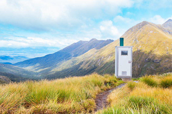 |
14:11 - The toilet at the edge of the drop into Forest Burn which flows down the valley to the left into the Waiau River at the end of the far ridge. Lake Manapouri is hidden behind the mountains. |
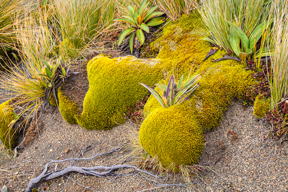 |
14:27 - Tight cushion plant vegetation near the shelter. These plants are so tightly packed to protect it against the ice and weather, and to make grazing almost impossible. |
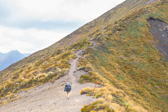 |
14:28 - The French Hiker goes on ahead as we leave the shelter and contemplate this steep section up the ridge to where the track goes around the mountain. |
 |
14:50 - I look back at this last view of the highest summits of the Jackson Peaks. The track had gone around the right hand side of these peaks before following the top of the low ridge now below me. None of these high peaks have names despite being the highest of the Jackson Peaks. The only peaks with names here are Mount Luxmore (about 2 kilometres directly behind me from this view, and Forward Peak which is about half a kilometre to the right). |
 |
14:51 - The track rises steeply but the rain has stopped falling. Two Canadian men from Quebec province were swept away to their deaths around here two winters ago despite receiving advice not to do the trek in the then treacherous mid winter conditions. |
 |
15:15 - View to Mount Maury from above the unnamed saddle between the main block of mountains and Forward Peak. The 1650m high Mount Pickering hidden at the back of the Iris Burn Valley and just visible at the far left was named after the late Sir William Pickering who was born in Wellington and became the director of the NASA Jet Propulsion Laboratory leading the development of the US unmanned space exploration program. |
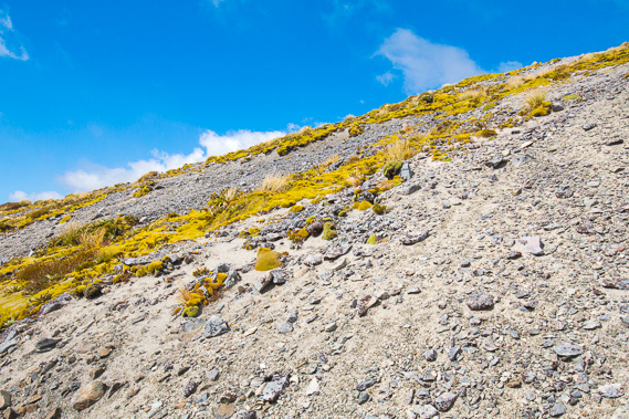 |
15:16 - Exposed scree slope eroded by avalanches. |
 |
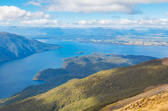
15:18 - Over the saddle and in front of Forward Peak, I now have a good view of the middle section of South Fiord with the Murchison Mountains on the other side. This is where the elusive takahe was discovered around some small lakes in an environment and altitude similar to here above the tree line. |
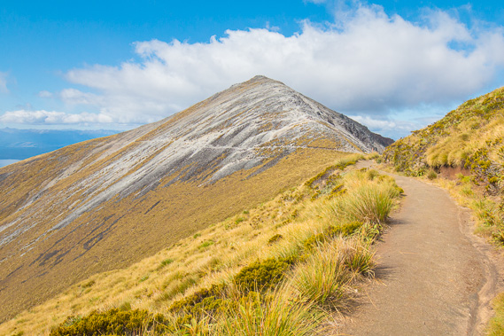 |
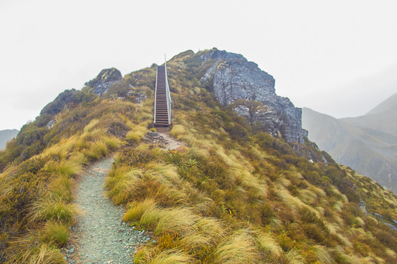
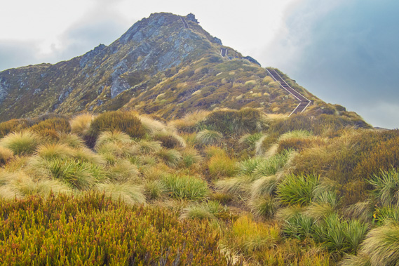
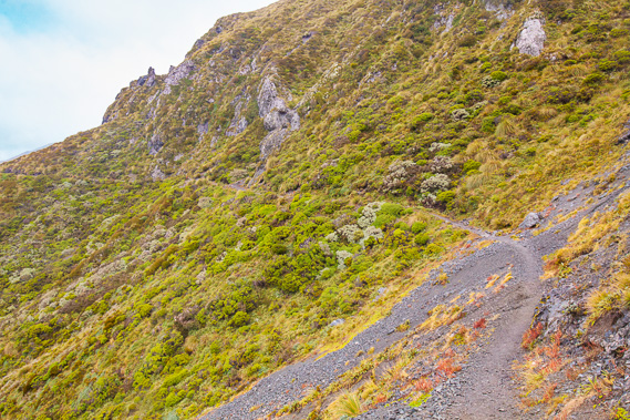
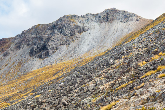
15:19 - Approaching Mount Luxmore, the last and most well known peak of the Jackson Peaks. Its Maori name is O-te-horua, probably named after a person called Te Horua, but lost in history. Luxmore Hut is directly on the other side of this mountain. Scars of scree are left from past avalanche activity. At 1402 metres above sea level, this is the highest point of the main track. From here it is a long descent of 1200 metres down to Lake Te Anau. |
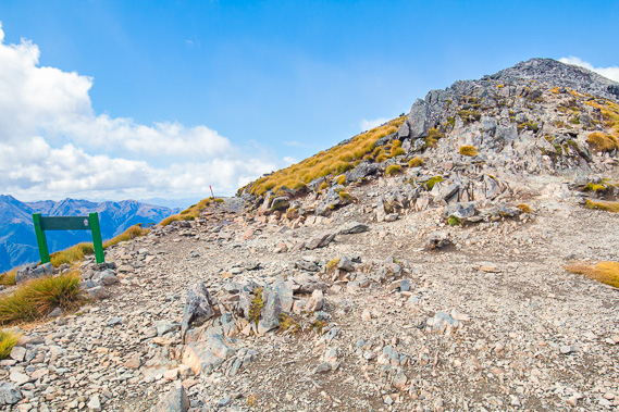 |
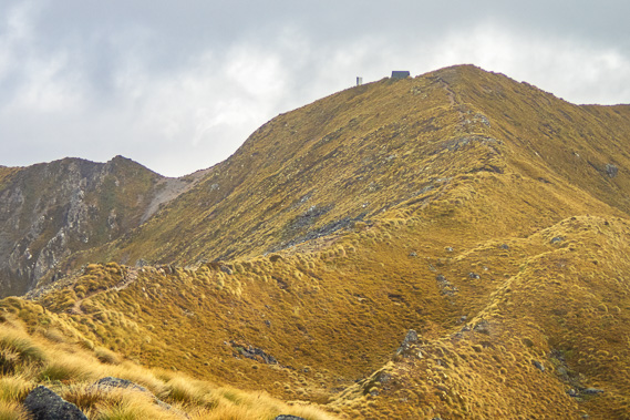
15:23 - At the turnoff to the summit of Mount Luxmore. The altitude has dropped to 1390 metres above sea level. From here a rough track heads up to the 1472 metre high summit which many day walkers do from Te Anau. Time is getting short so I head down the track toward the hut which is a 340 metre drop in altitude. |
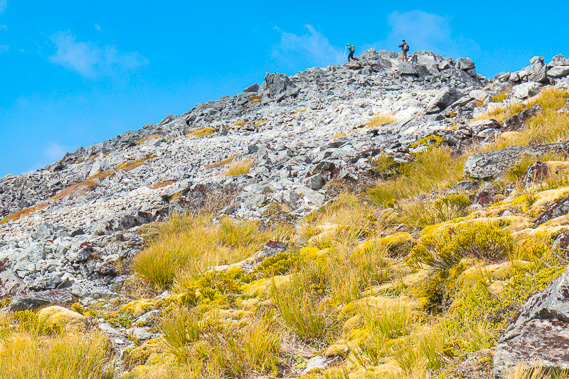 |
15:26 - There are people at the summit. |
 |
15:44 - The main section of Lake Te Anau comes into view with Te Anau Caves at the point in the middle as I descend around Mount Luxmore. Te Anau Caves is a limestone formation draining the creek underground from Takahe Valley. |
 |
15:49 - The track zig-zags down the scree. |
 |
15:54 - View of the mouth of South Fiord and Hidden Lakes. |
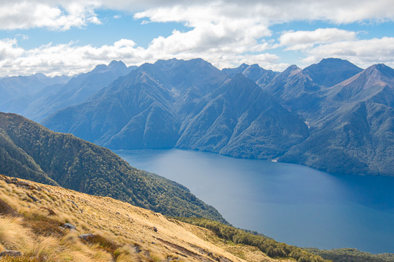 |
15:56 - View across South Fiord to the Murchison Mountains. The three arms of Lake Te Anau are the world's only fresh water fiords. |
 |
16:02 - Looking back up the dramatic formations to the summit of Mount Luxmore. From this side the mountain looks ominous. I've already dropped a fair bit of altitude heading towards the hut. |
 |
16:26 - Reaching a bend in the track at the bottom of a hanging valley under the mountain where a stream flows. |
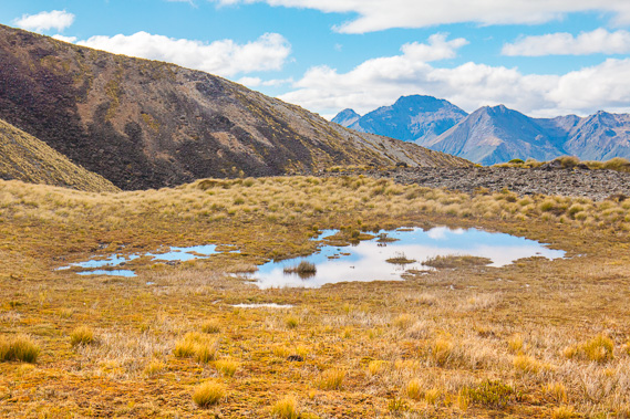 |
16:37 - Tarn and swamp at the bottom of the hanging valley as the terrain flattens into a small plateau. |
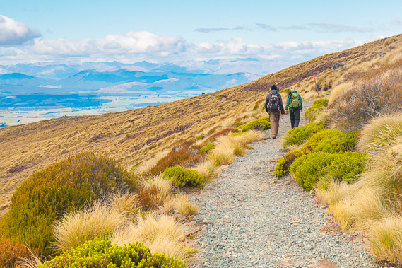 |
16:49 - Two of the others from Iris Burn pass me as the terrain moderates and I come out of the winter avalanche danger zone. |
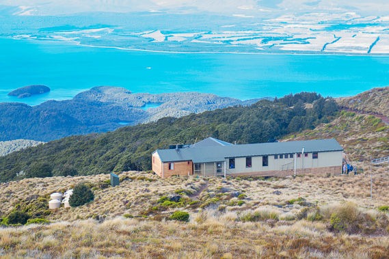 |
17:19 - After some more moderate downhill, I finally approach Luxmore Hut with Hidden Lakes in the distance. On the other side of the lake is farmland on the huge deposits of gravel dumped at the end of the glaciers which carved out the lake's fiords. |
 |
17:32 - I have arrived and catch the end of the ranger's nature walk around the surrounding heathland. |
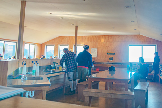 |
17:33 - The dining area is already busy with people who have climbed up from Brod Bay today. They all look fresh but tired from the long climb up from the lake. I meet a guy from across town in Brisbane who has climbed up from Te Anau today. Interestingly a lot of the people I meet here you ask where they are from and you end up comparing suburbs. |
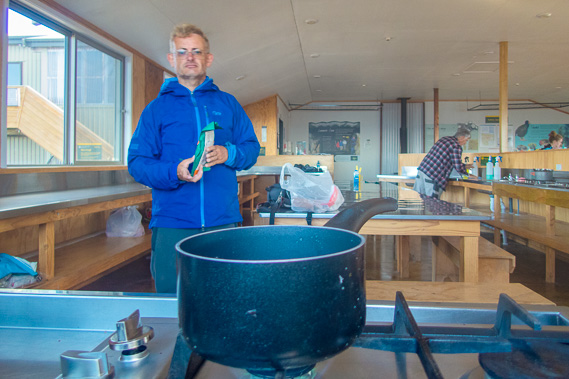 |
17:58 - I prepare dinner - another dehydrated meal. It's a bit monotonous, but very quick. Boil the water on the provided gas stove, pour the water into the packet, mix and leave for ten minutes. Very convenient on these long hikes. |
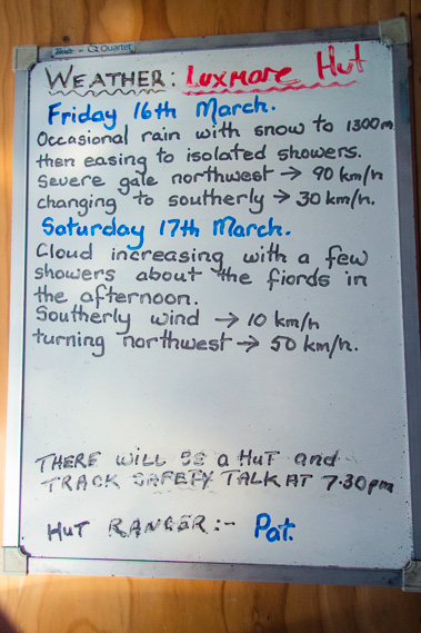 |
18:52 - Checking the weather forecast. It is looking good for tomorrow's descent. |
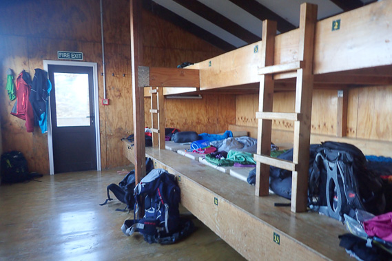 |
18:59 - Inside the bunkroom. Although arriving a little late, I was fortunate enough to score a bottom bunk. |
 |
19:14 - The sun draws low over the lake and the temperature of the still air is dropping surprisingly fast. |
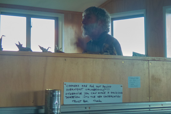 |
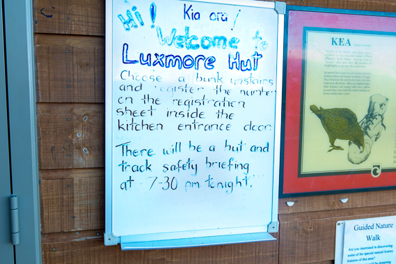
19:39 - Ranger Pat does his hilarious briefing, though mainly for the people who have come up from Te Anau today, as he explains the mountain section I have thankfully finished today. He tells of meeting all the rangers at the end of the Fiordland hiking season and they have a competition for most ridiculous dressing from clothes left behind at their huts. Apparently Pat usually wins. |
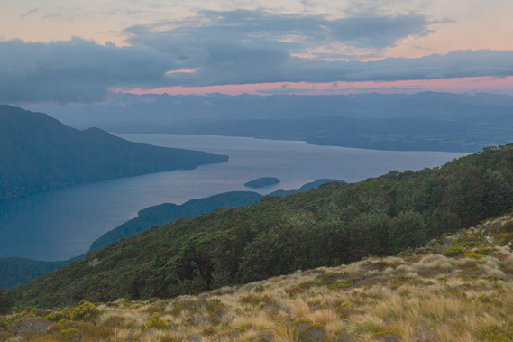 |
20:14 - The sky darkens over Lake Te Anau. The temperature has already dropped almost to freezing. It will be a lot warmer in the lowlands over 800 metres below. I planned to do some star gazing from the nearby helipad but it is too cold and much cloud still lingers overhead. |
|