Introduction to today's journey
I used to measure the skies, now I measure the shadows of Earth. Although my mind was sky-bound, the shadow of my body lies here.
- Johannes Kepler, 1630.
THE NOW overgrown land I had passed on the west bank of the Waiau River on the first day on this trek was once farmland owned by Jack Beer between 1890 and 1930. Beer's farm as it was known back then had 400 sheep. He sheared them year round as he was able to catch them. There was not enough grass on the farm to feed his sheep all year round, so he cut a track up the mountainside to the tussocklands above the bush line under Mount Luxmore, the area where the Luxmore Hut now lies. He would send his sheep up there to graze over each summer. The farm closed down in 1930 following his death, and the Luxmore tossocklands were very seldom visited again until the track was built over 50 years later. The original sheep track up the mountain had by then become overgrown and has never been redisocovered to this day.
Today's trek starts at the Luxmore Hut with an early morning diversion to Luxmore Cave before heading along the main track down the tussock ridge and into the forest where it moderately descends before traversing a dramatic limestone bluff. Once below the bluff, the track zig-zags through the increasingly thickening forest before eventually making a sudden exit from the bush at the calm pristine waters of Brod Bay. From there I catch a water taxi across the lake to the nearby Te Anau town.
Today's Journey
Distance trekked today: 8.7 kilometres.
Total distance trekked to date: 60.0 kilometres.
 |
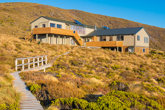
07:49 - First light of dawn on a very cold morning with the air temperature about minus six degrees. Makes for a very cold breakfast. |
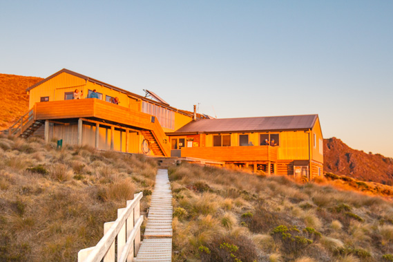 |
07:58 - I set off to explore Luxmore Cave. A thick layer of ice crystals covers the board walk and hand railings. The morning sun shines brightly on the hut. |
 |
08:04 - The side track to the caves rises above the hut with the spectacular Murchison Mountains behind. |
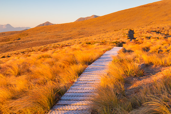 |
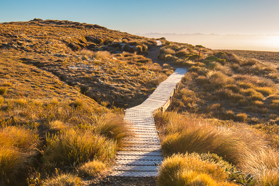
08:10 - The boardwalk covered in ice crosses the tussock prairie towards the caves. The sun is now shining brightly but even that feels cold. |
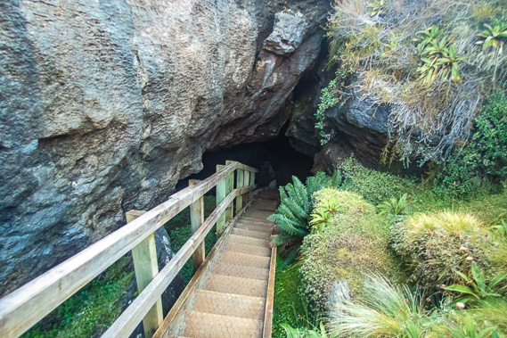 |
08:20 - Climbing down into the narrow entrance of Luxmore Cave. This is just one of around thirty caves in the area. |
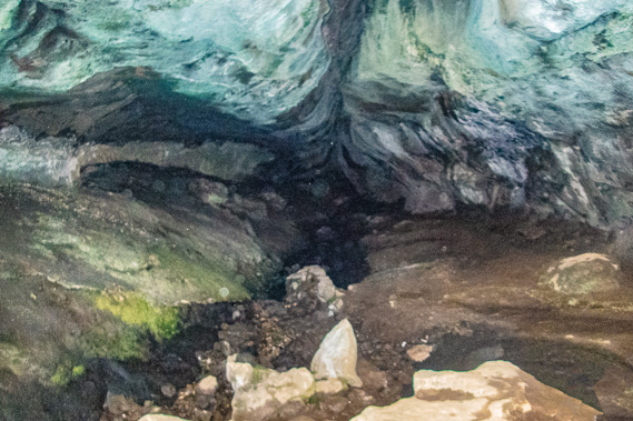 |
08:24 - Going deeper into the cave. The cave is a very sensitive environment, so I keep to the track and don't go in very deep. |
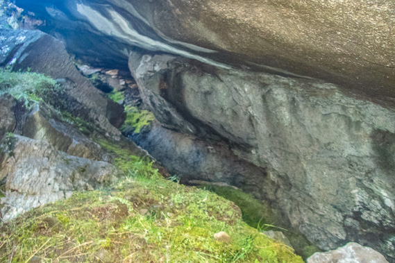 |
08:31 - Returning to the cave entrance where grass grows under the shelter of the rock. This spot would be clear of most of the snow and bitter cold of winter. |
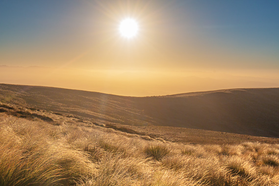 |
08:38 - Back on the surface the morning sun shines brightly and the cold air hangs very still. The motionless tussock covers the subalpine heathland. |
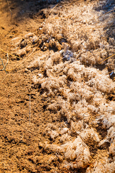 |
08:40 - Thick crystals of ice rise from the dirt beside the track. |
 |
08:44 - I crunch my way along the icy path back to the hut. |
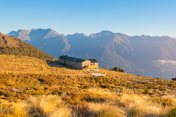 |
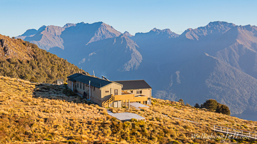
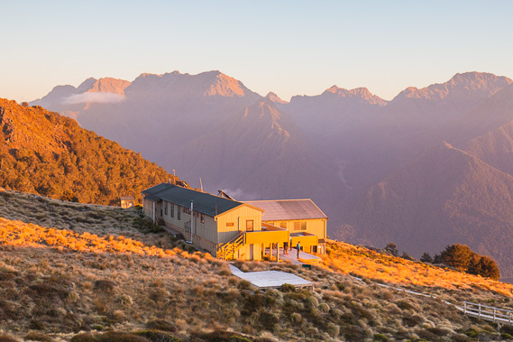
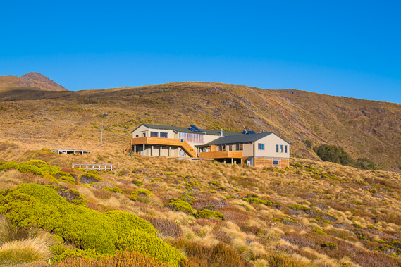
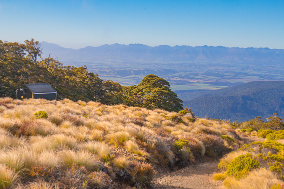
08:53 - The hut sits perched high above the fiord below with the spectacular Murchison Mountains rising into the clear sky on its other side. |
 |
09:00 - The ice is starting to melt as I return to the quiet hut to pack up and depart. |
 |
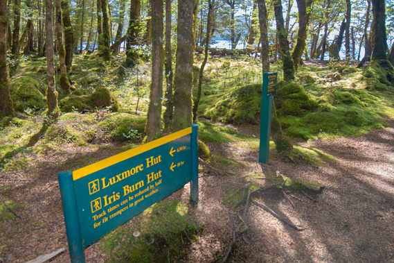
09:15 - I depart the hut heading down the main track. Most other people have already departed heading across the mountains towards Iris Burn. Today's conditions are perfect for them. |
 |
09:19 - The track heads into the sun following the wide ridge of limestone towards the lake. |
 |
09:24 - Ice is melting on the boardwalk quickly as I gradually descend. Farmers in Te Anau once herded their sheep up the mountain in summer to graze on this plateau. The steep track they made through the forest below has disappeared without a trace. |
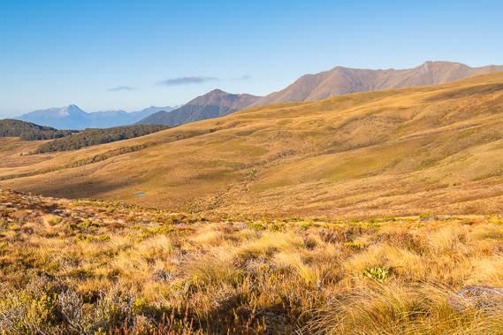 |
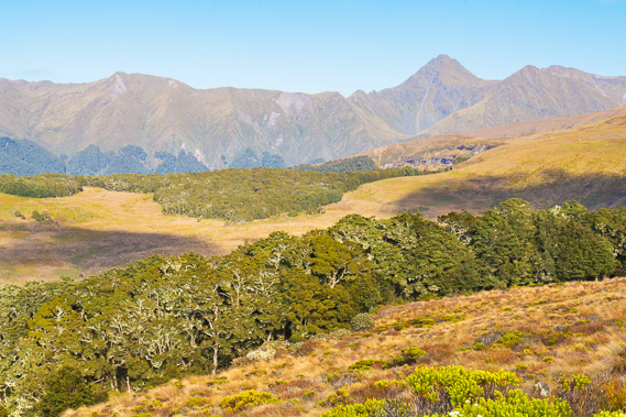
09:31 - View across the Jackson Peaks and the mountains beyond Lake Manapouri. In the distance is the pale granite Mount Titiroa stands 1715 metres tall. |
 |
09:37 - The spur along the end of the Murchison Mountains is flat like this spur and covered in limestone formations, including the famous Te Anau Caves. |
 |
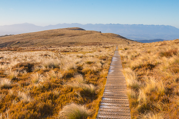
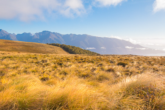
09:40 - The track across the tussock heathland is very wide and well graded. For people heading up to Luxmore this would be the final long drag of the climb. For people doing the Kepler Challenge run, this section marks the end of the steeper uphill section, though there is still nearly half a kilometre of climbing to the highest point of the track. There is a shorter run called the Luxmore Challenge, where runners on the same day as the Kepler Challenge run up to Luxmore Hut and back, still a greulling challenge. |
 |
09:45 - View of the lake with morning clouds now starting to rise onto the ridge. |
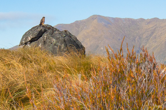 |
09:46 - A kea sits atop one of the large limestone boulders on the ridge. The kea is New Zealand's mountain parrot living in nests under trees at the treeline and spends their days searching for food on the vast alpine areas. These birds are now rarer than kiwis. |
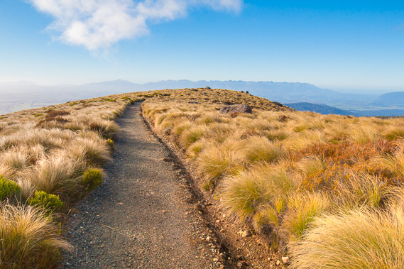 |
09:47 - This section of track passing through tussock near the edge of the plateau is almost like a road. |
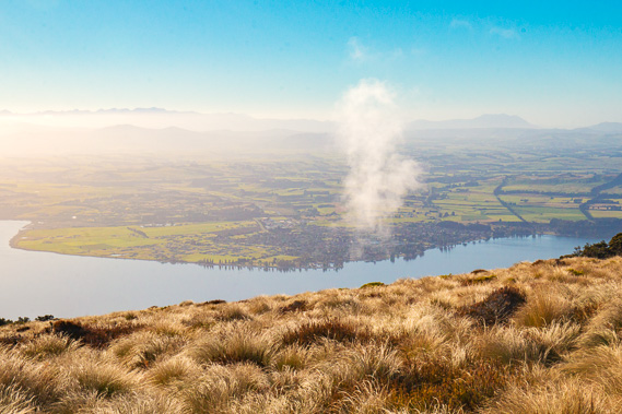 |
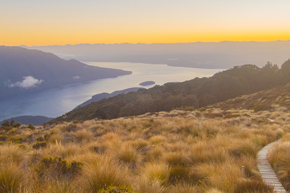
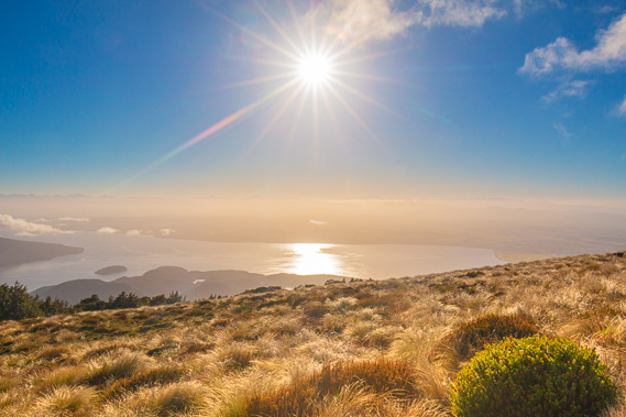
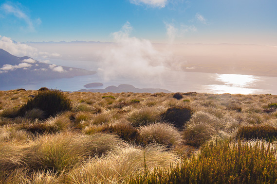
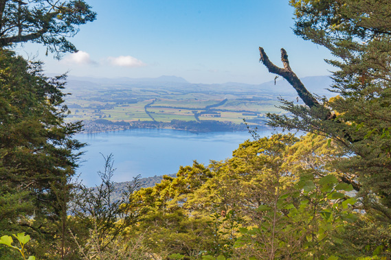
09:55 - First view of Te Anau town where I will be arriving in a few hours. The lake is perfectly still reflecting the trees growing along its shores. |
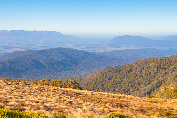 |
09:57 - View down Forest Burn to its mouth in the Waiau River, and a glimpse of Lake Manapouri. |
 |
10:01 - Reaching the bushline at 985 metres above sea level with a service hut tucked away. The track has already started its long descent. |
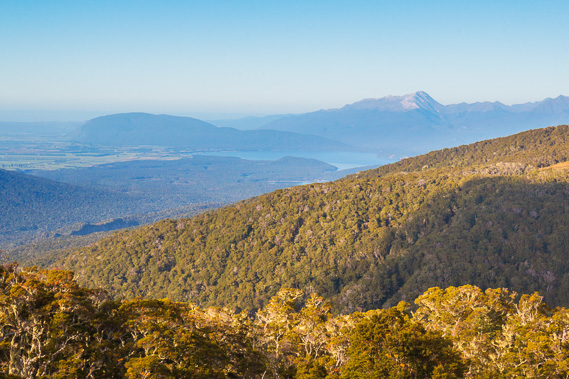 |
10:03 - Looking into Lake Manapouri and the lake at Amoeboid Mire I saw on the first day just visible above the bush. This will be the last clear view I get before reaching the shore of Lake Te Anau. |
 |
10:04 - View back into the Jackson Peaks before entering the forest. |
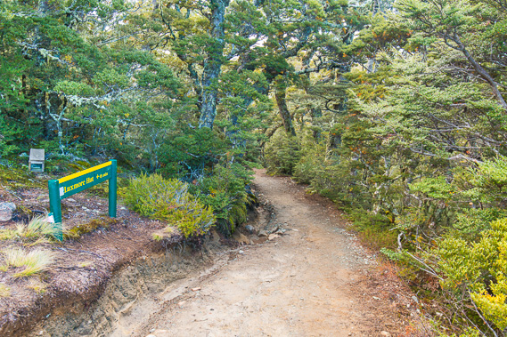 |
10:05 - Entrance to the forest where the moderately steep downhill begins. For hikers coming the other way, this is the end of the long steep section up from the lake. |
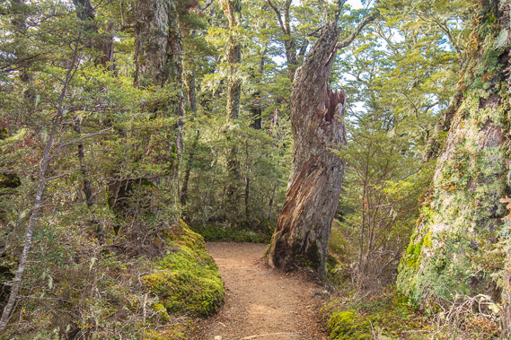 |
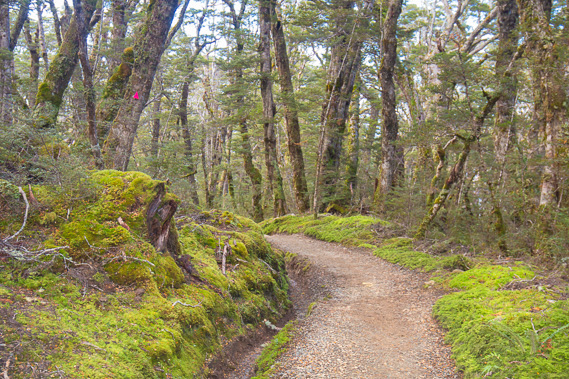
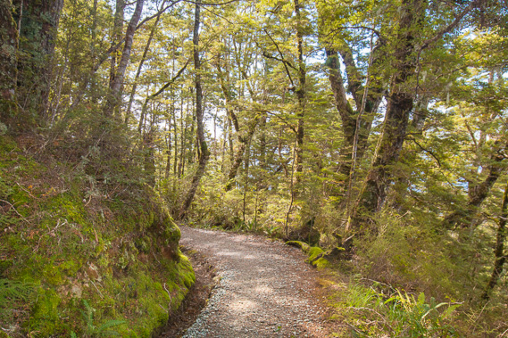
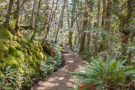
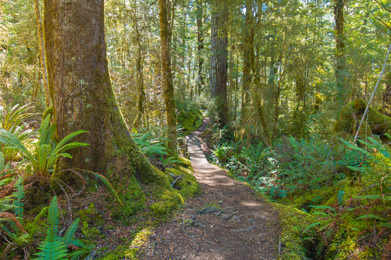
10:17 - Fortunately the track remains in very good condition as it winds its way through the forest of ancient gnarly trees. |
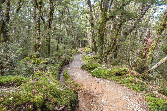 |
10:39 - The long trail continues following the ridge avoiding the trees. |
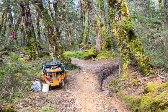 |
10:44 - Passing some maintenance machinery through a slightly boggy part of the track. |
 |
10:45 - The ridge drops off on a more moderate slope but the track continues to follow it steepening a little. |
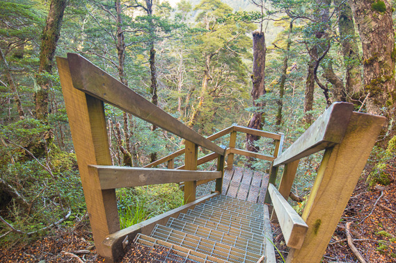 |
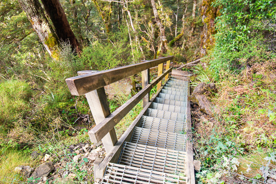
10:51 - The ridge suddenly ends at a bluff down which a good stairway descends. Here I'm about 760 metres above sea level and about 550 metres above the lake. |
 |
10:53 - The stairs descend the limestone bluff to a boardwalk which continues to traverse across it. |
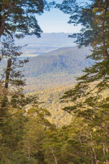 |
10:56 - Through a gap in the forest looking towards the valley of Forest Burn. |
 |
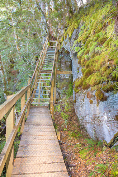
11:02 - The boardwalk sections continue under the bluff gradually descending. |
 |
11:10 - Another flight of stairs descends to the next level on the bluffs. These bluffs are part of the same limestone formation as the cave I explored earlier, all of which are formed from shells deposited at the bottom of a shallow sea before the alpine fault raised the land several kilometres high creating the spectacular mountains of fiordland. |
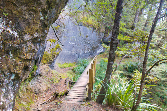 |
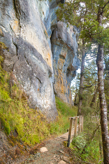
11:12 - The final bridge of boardwalk crosses a small slip before the track leaves the bluffs continuing it descent down the mountain. |
 |
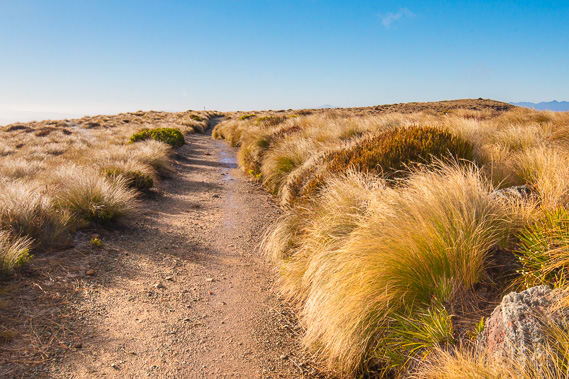
11:17 - The well graded track descends a moderate slope across the end of the ridge at the start of what will be many zig zags down the mountain. |
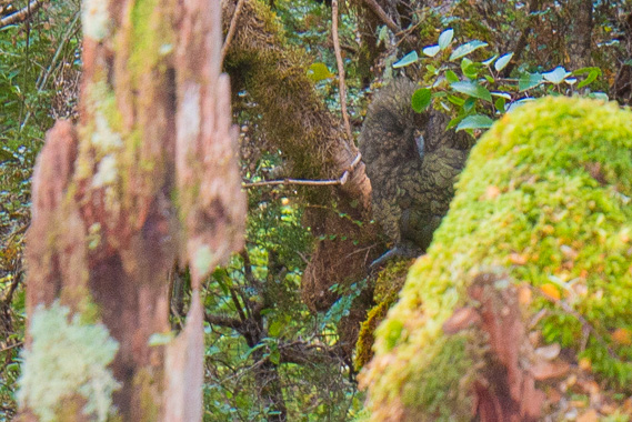 |
11:19 - A kaka hidden in the bush at one of the bends in the track as it zig-zags down the mountainside. This is the forest parrot, a closely related species to the kea. |
 |
11:27 - View through the forest to Te Anau. There is still a long way to descend. The hikers I pass going the other way are tired from the long climb with no sign of the top through the thick forest. |
 |
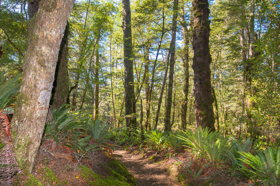
11:46 - The bush thickens and the trees get taller as I quickly descend into more temperate climes. The air is still and the temperature now comfortably warm. |
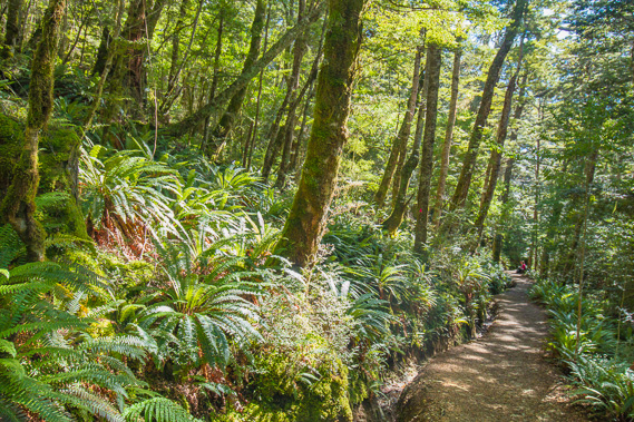 |
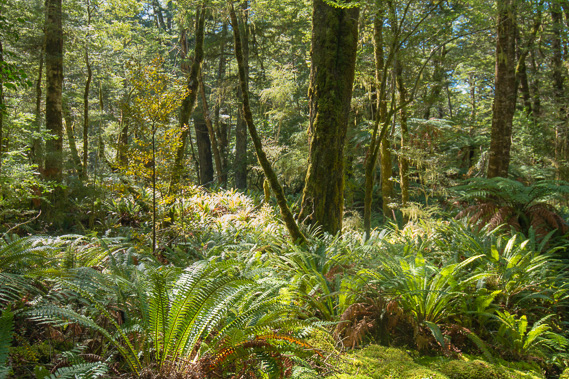
12:03 - The ground becomes covered in a thick layer of crown ferns capturing the strong sunlight filtering through the beech forest canopy. |
 |
12:43 - The descent is long, and I am still passing people slowly coming up the other way as they trudge up towards Luxmore. They have a long way to go. |
 |
13:09 - The terrain begins to level off indicating the lake is near and the descent almost complete. |
 |
13:23 - the track follows a widening gully reaching a small bridge near the bottom of the mountain. There is hardly a trickle in this creek, but it is the first creek I've crossed since the swollen Hanging Valley creek at the start of the ascent yesterday. |
 |
13:26 - Reaching the sign at the lake where the track turns inland and starts climbing the hill. From here the track follows the lake to the right until reaching the gates from where I can walk into Te Anau, but I have a boat booked to pick me up here in a couple of hours. The lake is visible through the trees. |
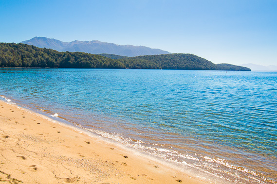 |
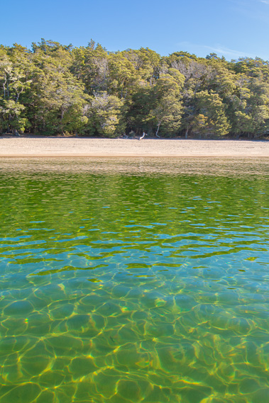
13:29 - I have reached my destination at the bottom of the mountain here on the golden shores of Brod Bay. From here I'm looking over Hidden Lakes towards Murchison Mountains. The lake is 204 metres above sea level. |
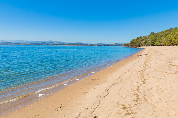 |
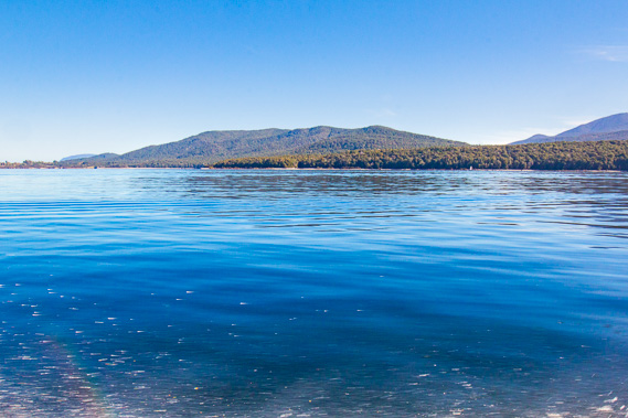
13:31 - Looking towards Te Anau across the deliciously pristine blue water. When the fiords were filled with glaciers, the water would have been an opaque pale blue colour from all the sediment dissolved in it. |
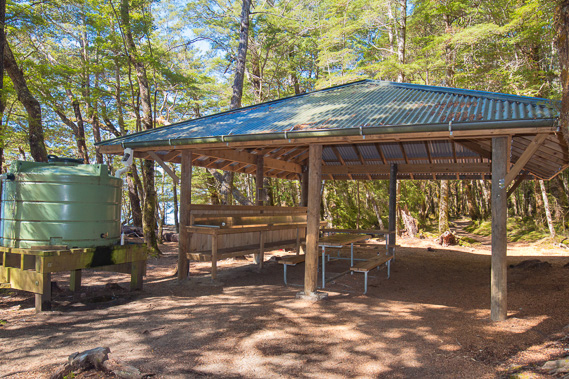 |
14:10 - Resting at the shelter at Brod Bay. There is a camping ground here. Hikers travelling with tents can camp here and at Iris Burn, but not Luxmore as it is too exposed up there (although you wouldn't have known this morning). Hikers with tents not wanting to stay in huts would have an enormous hike from here over the mountains to Iris Burn. |
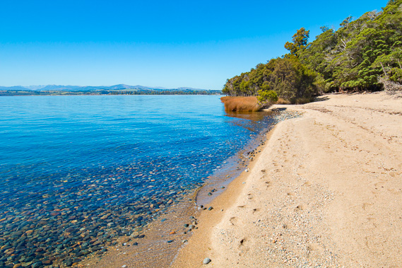 |
15:14 - Gravel in the bottom of the lake brought down by the glaciers as I explore the beach. The air temperature is starting to drop now. |
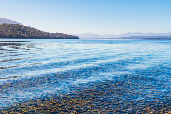 |
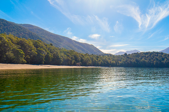
15:16 - The relaxing waters of the lake looking towards the Eglinton Mountains and the start of the Milford Track tucked away many kilometres in the distance behind the headlands to the left. |
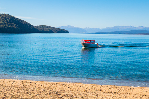 |
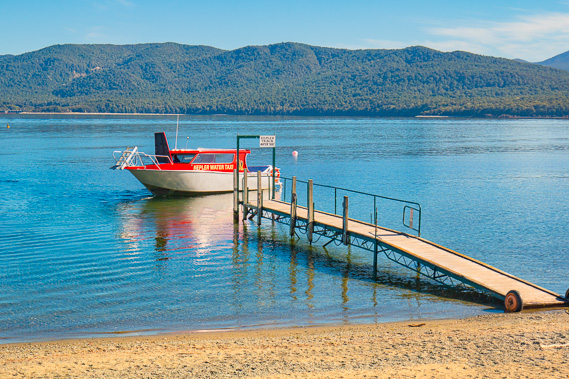
15:54 - After a very relaxing afternoon on the beach, the boat from Te Anau arrives to take me back to civilisation. |
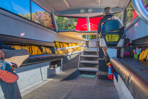 |
15:57 - On board the boat with two very fit daytrippers who managed to get up to Luxmore and back today. |
 |
16:01 - We cast off into the pristine waters of the lake heading back to civilisation at Te Anau. The track and camping ground quickly disappear in this remote wilderness. |
 |
16:03 - Heading out across the lake as high cloud begins to cover the sky. Luxmore hut is at the top of the ridge to the left - it looks a long way away. |
 |
16:05 - Speeding across the lake with the control gates just visible to the left. |
 |
16:10 - After the boat has dropped us off at Te Anau. It was a very quick trip saving two hours of hiking around the control gates. |
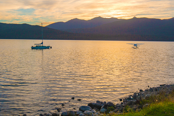 |
19:52 - After settling into my accommodation and a nice bath and dinner, I return to the lake to watch the sun setting over Jackson Peaks where I passed over just yesterday. |
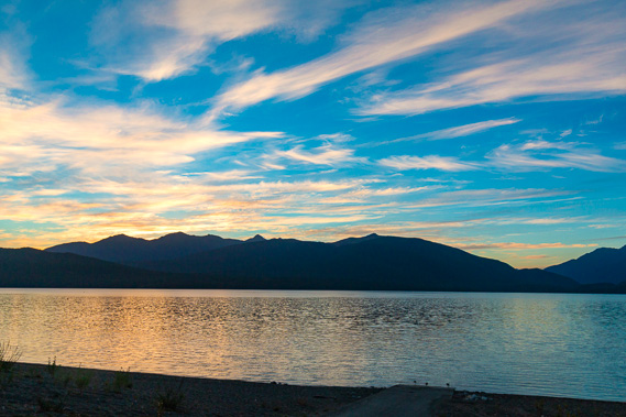 |
20:06 - One last view of the Kepler Track and Jackson Peaks. Mount Luxmore is to the centre right and today's hike took me from just under the peak to a point on the beach directly below it. The cirrus clouds covering the sky are bringing in rain from the west. I can relax tonight knowing I don't need to do any hiking tomorrow. |
|