Introduction to today's journey
"All the sealers speak well of this harbour..."
- Captain Edwardson, 1823.
ONCE a Maori village, Port William provides excellent anchorage. It was discovered and named by Captain John Grono of one of southern New Zealand's first sealing ships. A few sealers set up a camp here between 1809 and 1811, but the seal population quickly diminished and the indigenous locals were not happy with them. It remained abandoned by European settlers until the early 1850s when Captain John Howell, the founder of Riverton on the mainland established a whaling station at the port. The whaling was initially local in Foveaux Strait, but by the 1870s the operation changed to deep sea whaling. A commercial fishing venture started in 1862 but the harsh climate meant only smoked fish was profitable. An oyster bed was discovered just outside the harbour in 1868 but was quickly overfished. Gold was discovered at the far end of the beach in 1867 briefly starting a gold rush of prospectors from the mainland, but most returned empty handed. Saw milling took off around then over at Maori Bay, and at Paterson Inlet, but Port William did not have good timber. Settlements were surveyed all along the coast and released in 1873. Barracks were built for 150 people at the port, but only five Shetland Island families and three single men moved into the drafty buildings. The remoteness, harsh climate and lack of facilities resulting in the settlers leaving over the following few years. With the closures of the timber mills at Maori Beach and Kaipipi in Paterson Inlet in the 1930s, this excellent harbour remains uninhabited.
Today's trek begins at the start of the Rakiura Track at the end of the road at Lee Bay. From here I follow the track over rugged headlands along the northern coast of Stewart Island looking across Foveaux Strait towards the South Island. I stop at the abandoned logging village of Maori Beach before crossing over a forested bluff to the hut at Port William.
Today's Journey
Distance trekked today: 8.1 kilometres.
Total distance trekked to date: 8.1 kilometres.
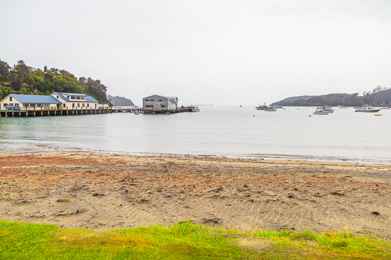 |
08:54 - Rain falls over Half Moon Bay in the early morning following two warm sunny days. It rains here two days in every three. In front of me is Stewart Island's port, the main transport connection with mainland New Zealand nearly two hours away. |
 |
09:02 - Passing Horseshoe Bay on the way to the start of the track. I take a van over the six kilometres having already done the walk around the headlands. It is a very gloomy day outside. Halfmoon Bay and Horseshoe Bays are the only inhabited parts of the island. Outside of these small settlements the entire island is uninhabited. Despite this, the track will be passing plenty of evidence of prior habitation by Maori tribes and the early European settlers. |
 |
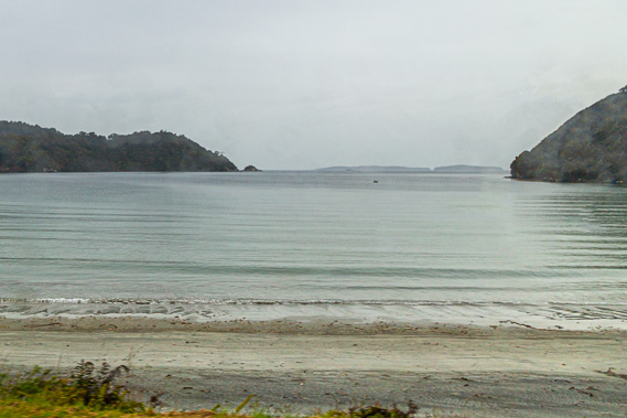
09:08 - Lee Bay at the start of the track viewed from the lookout. Foveaux Strait is normally notorious, but only the most gentle of swells breaks on the golden beach. The first day's walk is laid out ahead of me with tonight's destination at Port William in the little dip behind the dark headland in the distance. The hut is eight kilometres away taking the average walker three to four hours, though I'm expecting to take longer with all the photography I will be doing. Mount Anglem, the tallest mountain on the island at 980 metres high is mostly hidden in the cloud above Port William. The mountain was named after Captain William Anglem who very accurately charted the coastline. |
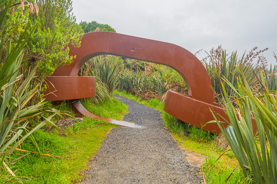 |
09:13 - Passing through the chain sculpture. Maori legend tells of Stewart Island being the anchor of the South Island, which was Maui's canoe. From his canoe he brought up the great fish (the North Island). This chain sculpture appears at Stirling Point in Bluff as symbolically the other end of the chain of the anchor. A plaque nearby also quotes Neville Peat in 1992 who said the island anchors in its rocks, rivers and rugged shores, an in its garnishment of plants and animals, the hope of generations unborn that places like this will always exist. This area also marks the point where the first telegraph cable was laid from Bluff, reaching the island here in 1902. Only seven days were allowed to lay the entire cable across the thirty kilometre strait plus five kilometres over the densely forested hills to Oban. Before the cable was laid, the only communcation was through messages delivered by sailboat. The cable frequently broke requiring expensive maintenance. The cable was replaced with microwave radio in 1947. Just before this chain link are a couple of metal plaques in the track, one saying "I must go over to New Zealand some day, Stewart Islander". The other has tomorrow's quote. |
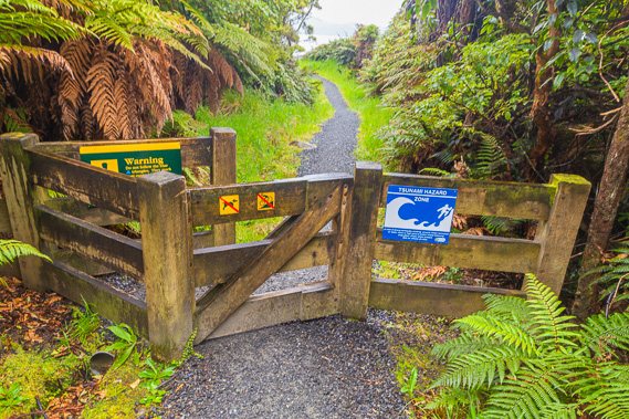 |
09:14 - Passing through a gate into Rakiura National Park. Earthquakes are common in this part of New Zealand, hence the tsunami warning with the recommendation to climb to at least twenty metres above sea level or go a kilometre inland. |
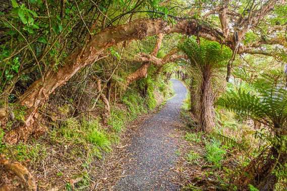 |
09:18 - The track passes along the steep hillside underneath huge fuschia trees. The track is covered in gravel making for a very easy grade. Around the next corner I pass the junction to Garden Mound Circuit, an alternative 45 minute track over a hill back to Horseshoe Bay. |
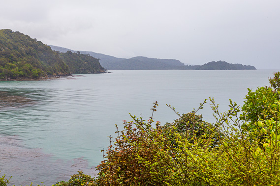 |
09:25 - Thick scrubby vegetation obscures the view most of the time, but I do get the occasional view across the calm turquoise waters of the coast. The low isthmus of Port William is already looking closer, but there is still a long way to hike over the rugged headlands. |
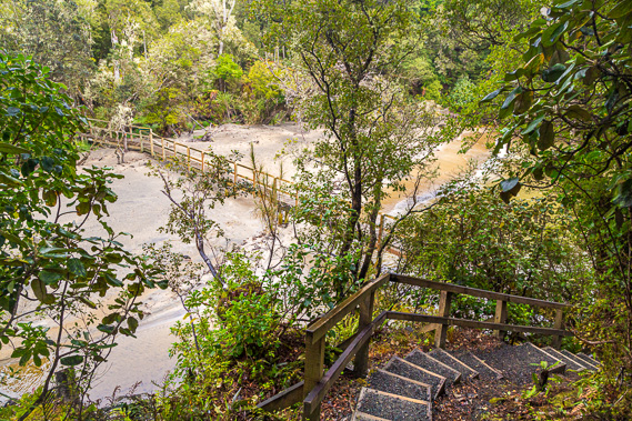 |
09:39 - The track steeply descends a stairway towards the crossing of Little River, with its estuary now flooded with the high tide. Fortunately a long timber bridge spans above the flooded estuary allowing me to stay dry despite the rain settling in. |
 |
09:42 - The bay at Little River viewed from the end of the bridge. A low tide track crosses the beach around the next little headland, but it is flooded with the tide in, so I take the high tide track. |
 |
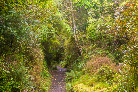
10:11 - The two tracks join at the top of the next spur before continuing its rise through the hills. Ground ferns glow in the steady rain quietly falling on the scrubby forest. The island was once covered in magnificent rimu, but most of the tall trees were removed during the logging days. The forest is now regenerating back to its former glory with mostly kamahi dominating, and will continue to be the mainstay of the forest until the rimu fully re-establishes itself in around a thousand years' time. The white striped trunks to the right are kamahi. In the bush lies a large pile of gravel laid over plastic sheeting. This will be transported to parts of the track requiring maintenance. A little further along is a sign saying this is Rakiura Maori land. Parts of the island particularly around Pegasus Harbour further south were gifted back to the Maori people in recent decades. This is another block which stretches over behind Oban to Paterson Inlet. |
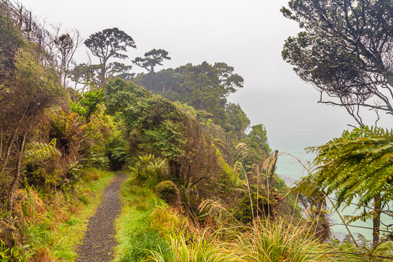 |
10:34 - The track comes out on the edge of a high bluff heading towards Peter's Point as I battle against the misty rain obscuring the sea. Peter's Point is named after Peter Garrity who grew strawberries and vegetables here to supply the whaling ships working in the area. Fruit and vegetables are very scarce in the natural bush, so small farms needed to be established near the ports to provide provisions to the sailers. |
 |
10:36 - Port William appears a lot closer now across the turquoise water, but there is still a long way to hike. The port is almost entirely obscured thanks to the moderate rain falling. The mountains in the distance behind the port are completely obscured as is the South Island some thirty kilometres offshore to the north. From here the track rounds above Peter's Point and gradually descends towards Maori Beach. Although the terrain is very rough, the track is of a very easy grade, following the long-worn route the Maori people and the early European settlers living along the coast followed to Oban. |
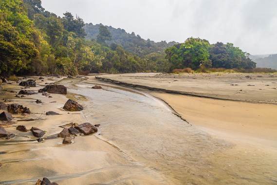 |
11:05 - Reaching the stream at the northern end of Maori Beach. A short cut crosses the stream to the beach, but the track continues following it upstream. Across the stream is a large sandbar which was initially the site of the Maori village Pa Whatataka, meaning "To be prepared". This perhaps indicates the hardships of living at these southern latitudes exposed to all the weather systems of the Southern Ocean. The village was long abandoned before European settlers arrived on this very same sand bar to establish the beach as a timber milling settlement. |
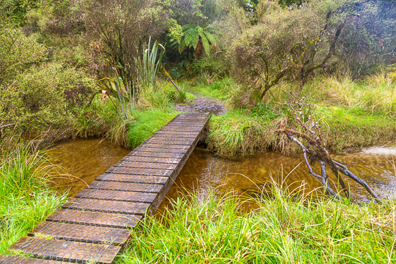 |
11:11 - The track follows the creek upstream to this bridge where it crosses over to the old settlement of Maori Bay. I wonder if there are any remnants of the old settlement or the logging industry. I am hardly across the bridge when I see ahead of me a side track heading to the left to the site of the old sawmill. |
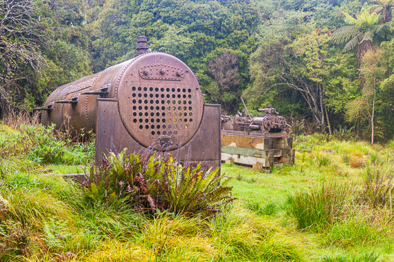 |
11:12 - The very short side track heads inland to a clearing with rusting machinery. This is all that remains of the Maori Bay sawmill at Maori Bay. This was the largest industrial site on the northern coast of the island. The village was abandoned in the 1930s and these rusting pieces of machinery are all that remains. When the sawmill was in operation, the air would have been filled with the noises of industry and thick smoke billowed out of the chimneys of the steam engines. The large machine was the old boiler which provided pressurised steam to power the power mill visible behind it. Tram tracks now removed directed the timber to the mill. The tramlines passed through the forest valleys to bring the timber here to the mill. Another short track led from here to a wharf on the beach where the milled timber was stacked onto boats for transportation to other ports around Australasia. |
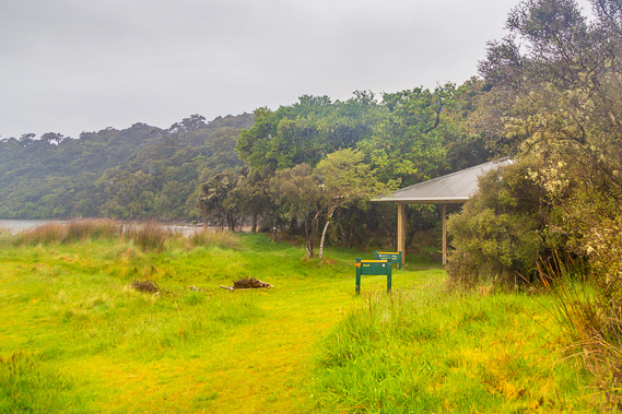 |
11:17 - Returning to the main track, I follow it another 150 metres towards the beach. Passing a plastic toilet building, I reach the Maori Bay camping ground. A small shelter sits against the scrubby bush and several vacant tent sites cover the lush grass growing on the sand bar. I put my pack inside the shelter and head out to the beach. Despite the relentless rain, the camping ground is very serene. This is a very tranquil area, but would have made for very tough living conditions during the sawmilling days. Sawmilling provided work when little other employment was available in New Zealand's early settlements. Sawmillers coming here brought their families with them and a school was opened here in 1920. The teachers working at the school had to be multi skilled as doctors and undertakers when needed. Childhoods here were said to be carefree here on this remote beach, but they have to hike barefoot to Halfmoon Bay 8 kilometres away to pick up supplies every Wednesday. Fortunately they were usually brought back by boat when weather conditions allowed. |
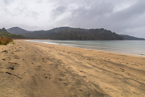 |
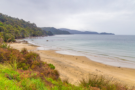
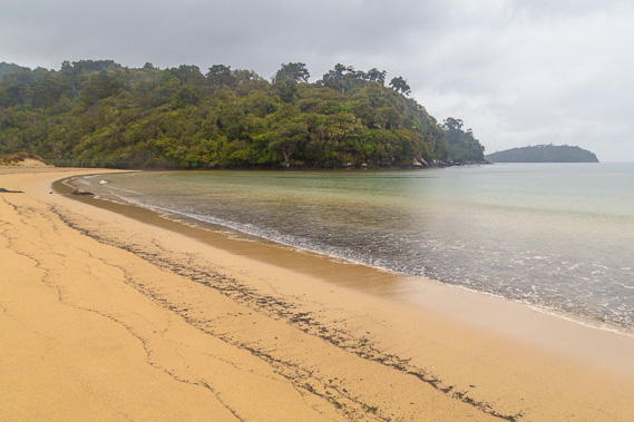
11:28 - The rain briefly stops falling, so I head out to the beach. Maori Beach extends quite some distance, ending under the forested hills I will later be hiking over. The bay here is called Wooding Bay, which forms the southern part of Port William. Behind the hills the highest ridge is known as The Paps, rising to 610 metres. This is a very pristine and lonely beach - I have not seen anyone at all since I was earlier dropped off at Lee Bay. |
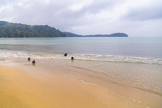 |
11:30 - Directly across from where the track comes out onto the beach, wooden stumps stick out of the sand. This is the remains of the old jetty where the timber was loaded onto the ships. Port William appears close in the distance. The milled timber was loaded onto ships at this jetty. The mill thrived from around 1861 to 1868 when transport to inland mills on the South Island mainland was improved allowing them to become more competitive. The timber milling here on Stewart Island gradually declined after 1868. By then most of the large rimu trees in this area had already been cleared requiring greater distances to get to the timber. With the declining timber trade and increasing government conservation efforts, Maori Beach mill was eventually closed in 1931. By then all the other sawmills on the island has closed. |
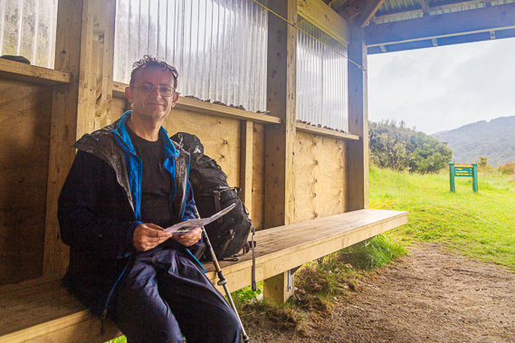 |
11:33 - Rain begins falling again so I return to the shelter to rest as the rain intensifies. Here I have an early lunch whilst waiting for the rain to clear a bit before heading across to Port William. |
 |
12:01 - After lunch the rain stops falling and the clouds are showing more definition indicating it will hopefully clear soon. I leave the shelter and start following the beach. This is about a hundred metres along the beach looking back over the rugged headlands of Peter's Point which I had earlier crossed. From this angle the point doesn't look rugged at all - certainly not showing the high bluffs I hiked above. Looking out over the sea I don't see any signs of whales. The beaches of Stewart Island are notorious for whale strandings. 65 pilot whales were stranded on this beach in December 2000 and all died here. The worst whale stranding recorded on the island was over on the remote Doughboy Bay (about five days intense hiking from here to the other side of the island ) where 328 pilot whales died in 1998. |
 |
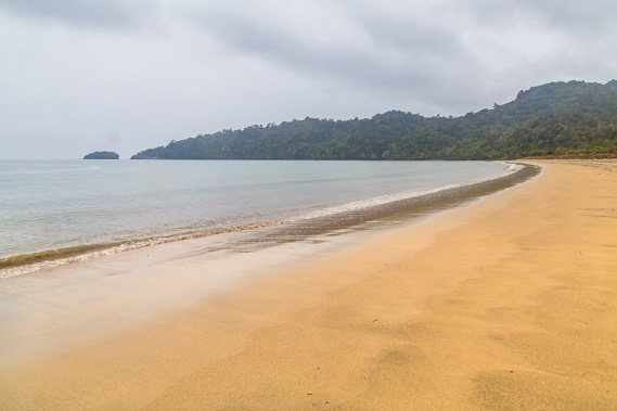
12:05 - Approaching the far end of the beach with Port William now disappearing out of view. From the end of the beach the track crosses the bluff for several kilometres before returning to the beach near Port William. The gentle waves lap against the golden beach very gently thanks to the shelter of the harbour and bays. This is impressively calm for the Southern Ocean. |
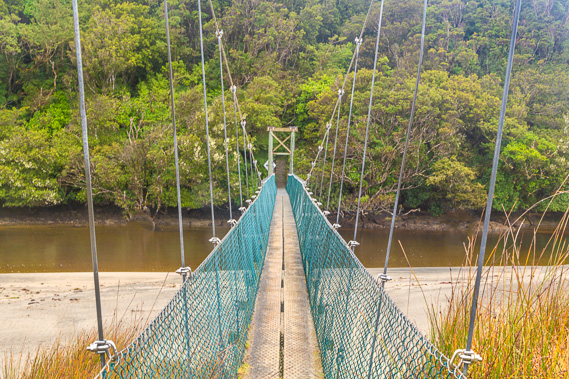 |
12:10 - A substantial unnamed stream flows at the end of the beach along a deep tidal lagoon. The tide is going out but the channel is still flooded. The track route which has followed the beach to this point doubles back along the soft estuary sand to a large swingbridge crossing high above the lagoon. This is the most substantial river crossing of the entire trek. The bridge has capacity for up to five people, but I have not seen any other people on the track today. The tide is going out but the channel here is still flooded. |
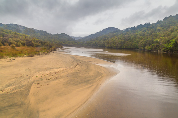 |
12:11 - From the middle of the swingbridge, I look upstream into the hills where I will be hiking through tomorrow as I cross the top of the island to Paterson Inlet. It looks quite rugged from here and no doubt I will be crossing this river further upstream when I head across this part of the island towards Paterson Inlet tomorrow. |
 |
12:23 - From the end of the swingbridge the track rises moderately through the dense rainforest. This forest has spectacular vegetation with not a beech tree in sight. Unlike the mainland, Stewart Island is largely free of beech trees, so the forest here is very different. |
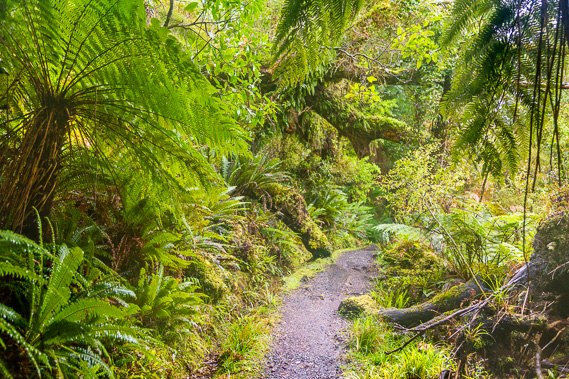 |
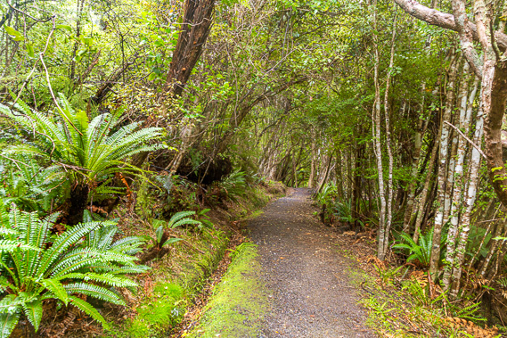
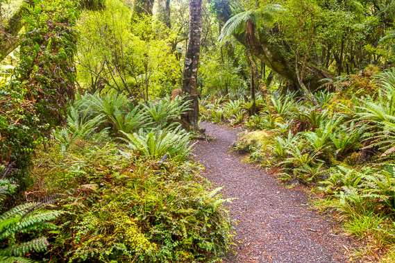
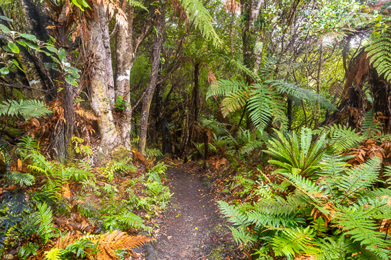
12:49 - A lot of ferns grow in this lush forest. The track is still in excellent condition having recently been covered in gravel. The climb up the hill is long and steady. I see a patch of blue sky overhead, so hopefully the weather will be clearing soon. The rain has stopped falling making for perfect conditions for photographing the lush forest. |
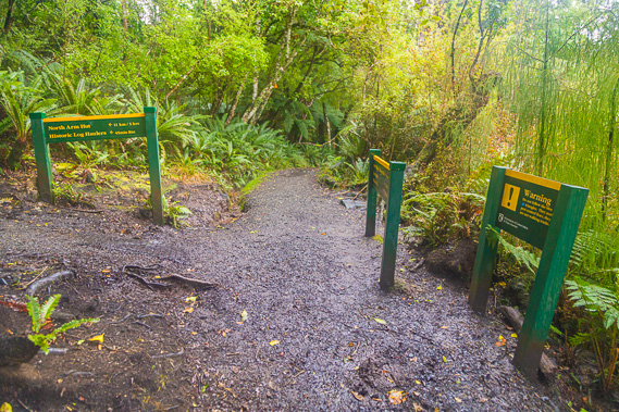 |
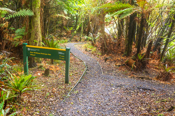
12:52 - I reach a junction where the main track continues towards straight ahead descending into Port William. I will be returning to this point tomorrow to take the track to the left heading over the hills towards North Arm, about 15km and 5 hours away (plus some extra time for photography). This long uphill section has risen 130 metre above sea level giving the altitude needed to cross the hills. From here it is 1.9 kilometres to Port William, and 1.6 kilometres back to Maori Beach. Tired after the climb from Maori Beach, I rest here for a while. |
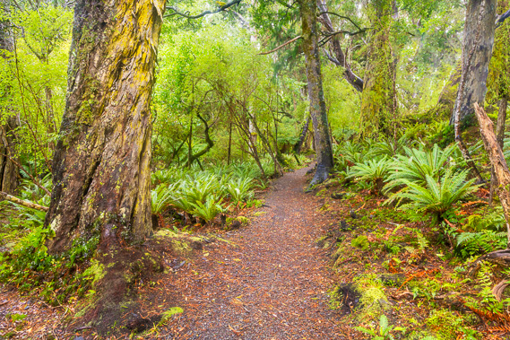 |
13:03 - From the junction I start the descent towards Port William. I quickly reach an area of ancient rimu trees which somehow escaped the logging despite their close proximity to the Maori Beach mill. These are magnificent specimens and would have covered the entire island before the logging began. |
 |
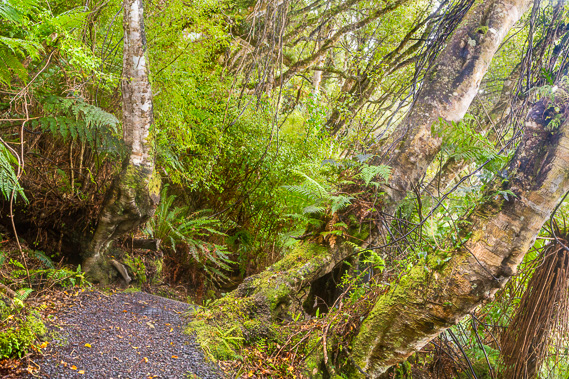
13:11 - Once below the exposed ridge, the forest becomes very tranquil, with vast systems of rainforest ecosystems of ferns and mosses densely packed into the forest. The track remains in excellent condition as it continues descending through the forest. |
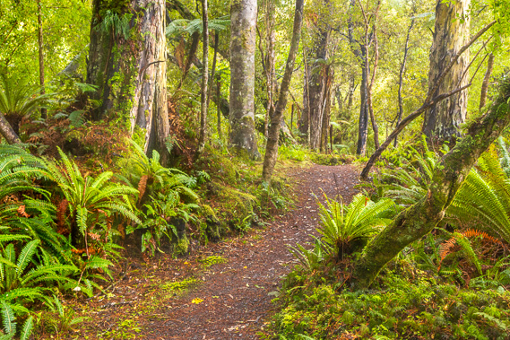 |
13:24 - Following the bottom of a little gully, this is a most amazing place to hike - some of the most beautiful forest I have seen anywhere in New Zealand. |
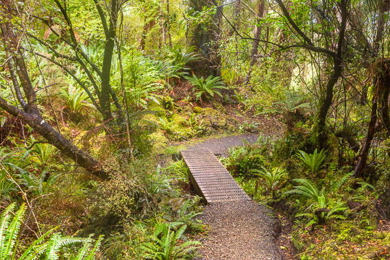 |
13:26 - A little bridge crosses the stream at the bottom of the gully as I continue towards Port William. A little further downstream I see a plastic pipe crossing under the track which carries the water supply to the hut. This is the nearest permanent stream to the hut. |
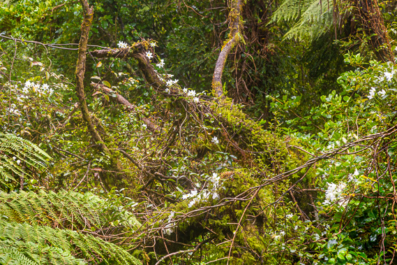 |
13:29 - I smell the sweet scent of flowers filling the air. Looking to the right down the gully, The trees just a few metres away are covered in a mat of sweet smelling flowers of a vine covering the trees. The track continues the long descent through amazing forest. |
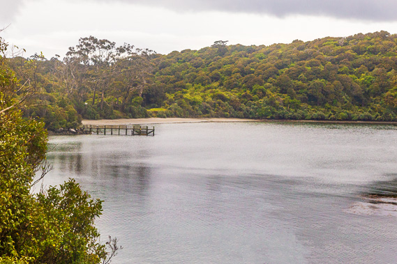 |
13:42 - Finally the first view of Port William, with the wharf extending in front of the beach, and the hut just visible above it nestled in amongst some huge gum trees looking very out of place here. |
 |
13:44 - The forest is too dense to afford any views but I know the beach is getting very near. Here the track suddenly steepens as I reach the start of a steep stairway leading down towards the beach. |
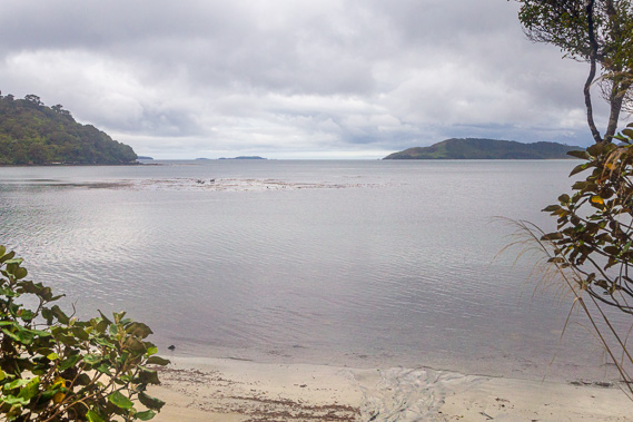 |
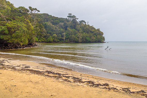
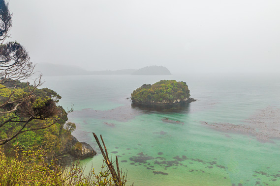
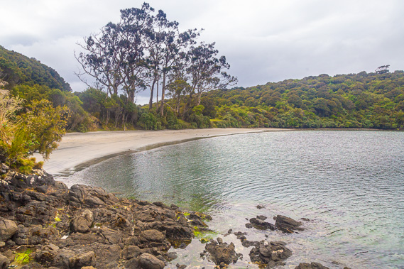
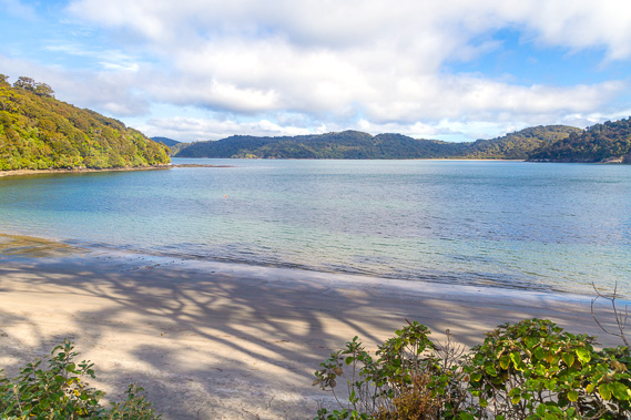
13:47 - Sure enough the stairs end up just above Magnetic Beach. Here the water is calm. Mamaku Point beyond Lee Bay (at the start of today's track) is now clearly in view indicating the rain has stopped falling. About a hundred metres offshore is a submerged reef with a lot of kelp growing off it. Before European settlement, the Maori favoured these sheltered bays which provided ample marine food to keep them sustained. Despite the Southern Ocean being very cold, it is very abundant in life. |
 |
13:55 - I reach the Port William/Potirepo Campsite, with spaces for several tents and a nice shelter similar to the one at Maori Beach. |
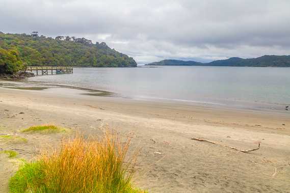 |
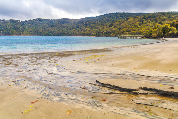
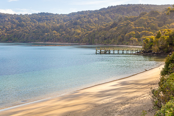
13:56 - Looking out from the front of the camping ground, I see across the brown sands of Magnetic Beach towards the wharf. Only the tiniest gap appears in the open sea as it is almost entirely blocked by the headland on the other side of Lee Bay. The lowest part of the ridge to the right of the point is where the road comes over from Horeshoe Bay and a little to the left of that is the start of the track I have hiked today. Port William was named by the sealing gang captain John Grono after an influential patron. |
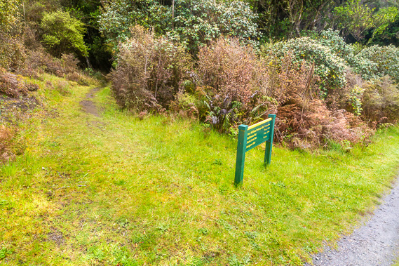 |
13:57 - A few metres from the end of the track is the start of Stewart Island's north west circuit, a 9 to 11 day hike over 125 kilometres around the northern part of the island. The first and last days of north west circult are the first and third days of the Rakiura Track, but the rest of the track is quite rough going through very remote country. The first hut at Bungaree is 3 to 4 hours away along rough undulating track. Tomorrow's trek along the middle section of the Rakiura Track bypasses these nine days of the challenging north west circuit. The Rakiura Circuit is just 32 kilometres long in total and I have already done a quarter of it. |
 |
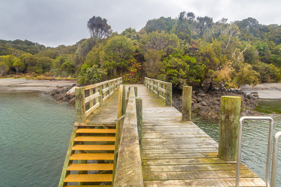
14:01 - Continuing along the track it goes into bush again reaching this junction, just a minute from the wharf and two minutes from the hut. I turn off to have a look at the wharf. |
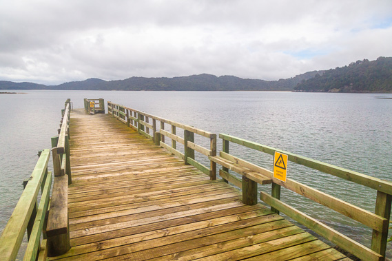 |
14:02 - The wharf was recently constructed and is very solid pointing across to Peter's Point and Lee Bay. To the right centre I can just see Maori Beach. |
 |
14:03 - From the wharf I look towards the hut hidden under the huge Australian gum trees planted by early settlers. |
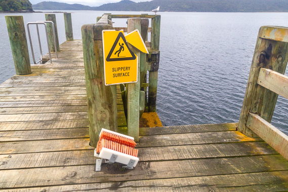 |
14:04 - There is a boot scrubber at the end of the wharf to prevent nasties from coming onto the pristine island. It has been isolated from the rest of New Zealand since the end of the last ice age about 10,000 years ago. More importantly Stewart Island is mostly free of the pests causing havoc on the North and South Islands. |
 |
14:06 - Looking back along the wharf to the little headland with the camping ground just off to the left and the hut to the right. |
 |
14:09 - I return along the narrow track back towards the main track. It winds its way between the scrubby trees. |
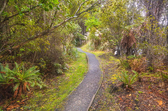 |
14:11 - The main track leading to the hut is perfectly maintained making for a very easy end to today's trek. |
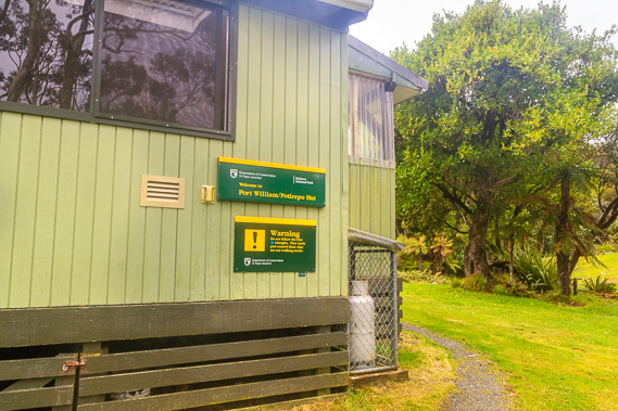 |
14:13 - I reach the hut passing the ranger's cabin whilst he works around the other side. He is the first person I have seen since being dropped off at Lee Bay. This certainly has been a much quieter track than those in Fiordland. |
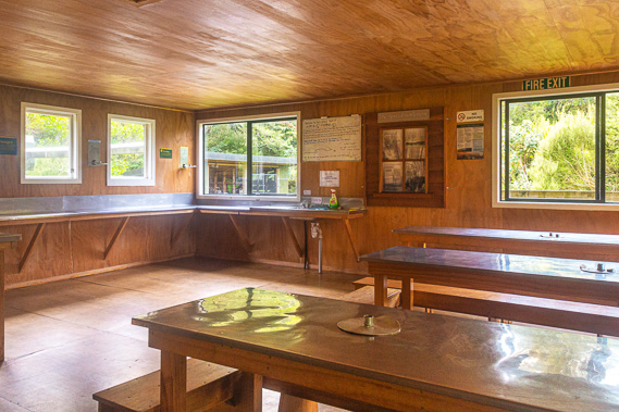 |
14:16 - The communal room of the hut. I am the first person here. I have not seen anyone since being dropped off in Lee Bay. Either this track is very quiet today or other trekkers were sensible enough to wait for the rain to clear befor starting their hikes. |
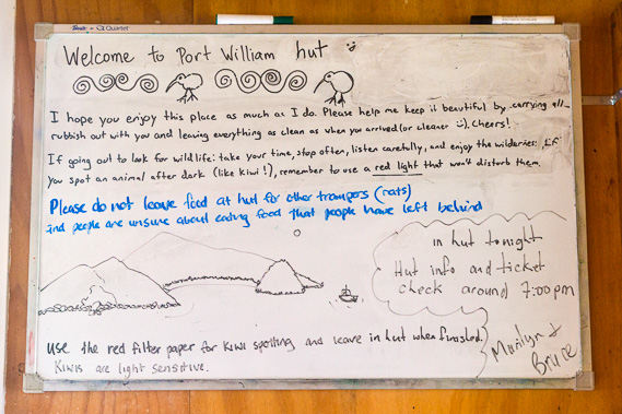 |
14:17 - The hut noticeboard. The rangers here are a married couple. Although there are instructions for finding kiwis, Bruce mentions a feral cat has been found here in recent days, so the chances of finding a kiwi around here are very low. |
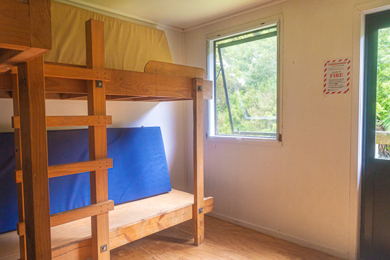 |
14:18 - I head to one of the two bunk rooms and get the first choice in bunks - a lower bunk near the door for a quick exit tomorrow. There are 24 bunks in total. |
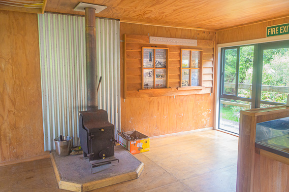 |
14:26 - The fire place in the communal area. This is a very welcoming hut, in much better condition than when I last stayed here near the end of 1994. |
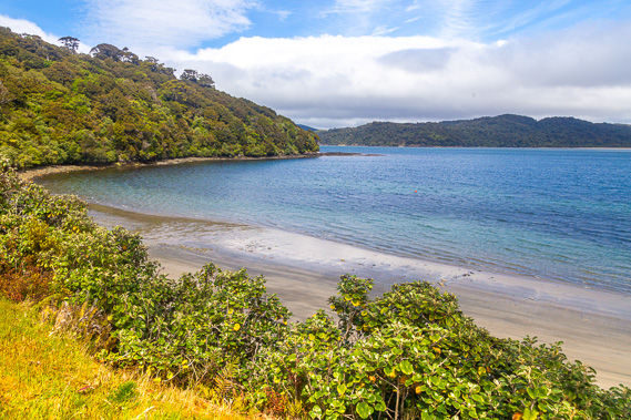 |
14:53 - Once unpacked and settled I head out to above the beach. The sky is quickly clearing now. This would have been the view from the early settlement. Here the sealers and whalers interbred with the Maori women living along the coast. Both Maori and Europeans lived harmoniously with the Maori teaching their local fishing practices and the Europeans provided new materials making the fishing tools easier to make. Barracouta (maka) were especially abundant here. |
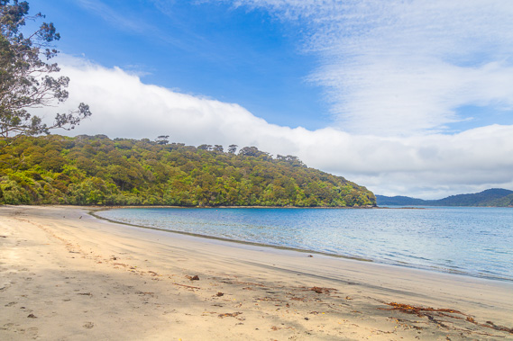 |
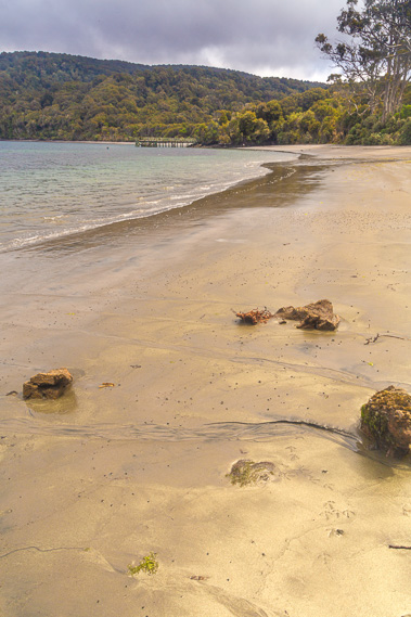
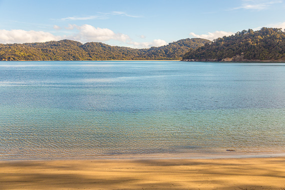
14:58 - I head down to the beach where calm waters lap against its edge. The tide is mostly out now. |
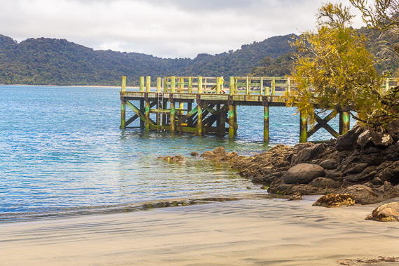 |
14:59 - The wharf at the end of the beach. The port was populated by sealers between 1809 and 1811. They were initially assisted by the local Maori, but with the rapidly declining seal population, the Maori people no longer welcomed them, so they left to other sealing areas. |
 |
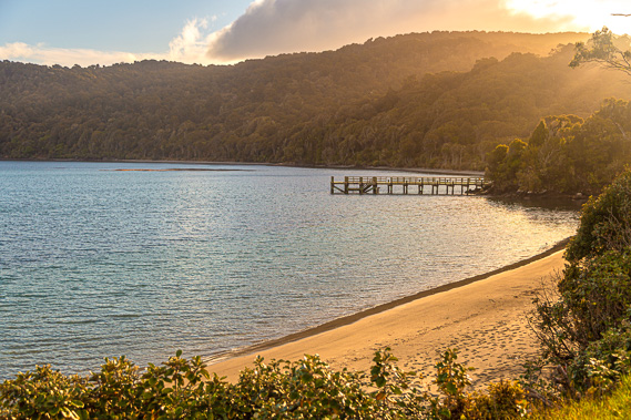
15:05 - I follow the beach to where a small stream comes out. The beach became a whaling station founded by Captain John Howell (founder of Riverton on the mainland) in the early 1850s. |
 |
15:08 - There is plenty of fool's gold on the surface of the sand. Real gold was once discovered at the other end of the beach past the camping ground in 1867 causing a very brief gold rush, but little was found and most prospecters returned empty handed. |
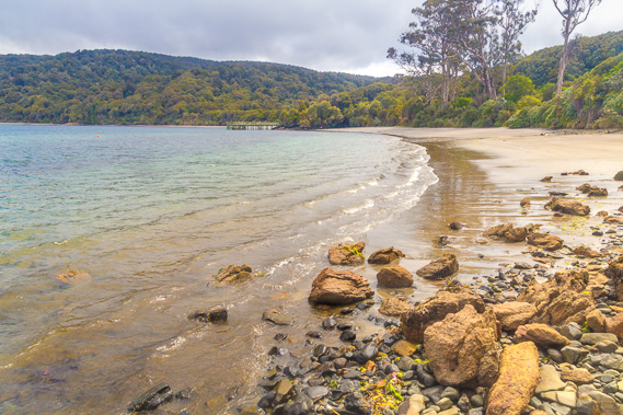 |
15:09 - View from the rocks at the end of the beach. From here I return to the hut and meet a fellow Aussie who has arrived and settled in. A lady from Otago also arrives. They both waited for the rain to stop before starting their hikes from Lee Bay today. |
 |
16:57 - I later return to above the beach. Clouds still cover much of the sky but they pass quickly from the south indicating the worst of the weather has cleared. Fishing was established here in 1862, but was soon abandoned with the lack of sunshine and too many blowflies made smoking fish the only viable venture here. A huge bed of oysters was discovered here at about the same time, but was almost completely wiped out within four years. They gained international reputation, but government controls were brought in to make the beds sustainable. |
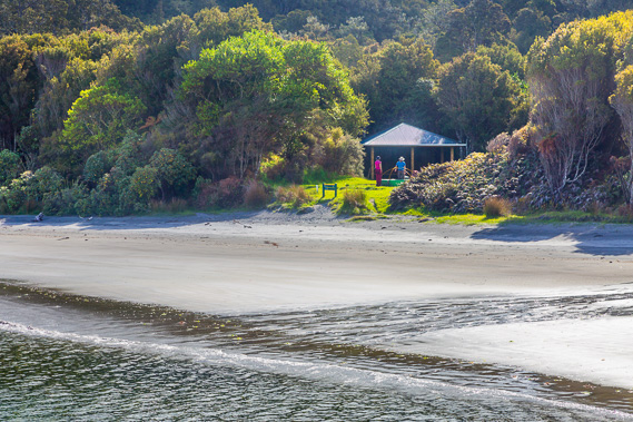 |
17:02 - I head to the wharf from where I see a couple setting up camp. They have the camping ground all to themselves. They have come from Lee Bay today and will be hiking the North West circuit. |
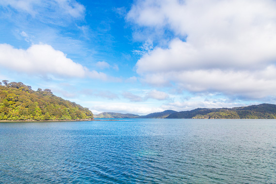 |
17:03 - The water is pristine but a cold southerly wind from Antarctica now blows across it. |
 |
17:09 - Heading back to the hut with the sun out. This seems to be an ideal location for a remote village, and that's just what the government did in 1864 when they marketed a utopian vision to attract Scottish settlers. The plan was to attract a thousand families to numerous settlements along the coast between Paterson Inlet up to Yankee River a couple of days' walk along the North West Circuit. The main port was meant to be here. By 1873 only three families from the Shetland Islands and three single men had arrived here settling into draughty barracks built for 150 people. Each family was allocated 20 acres. They were not successful in these very cold and damp conditions and each family moved across the strait to mainland South Island. The area was marketed again in 1875 but this was unsuccessful and the area has remained abandoned to this day. |
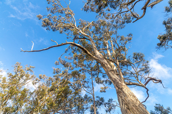 |
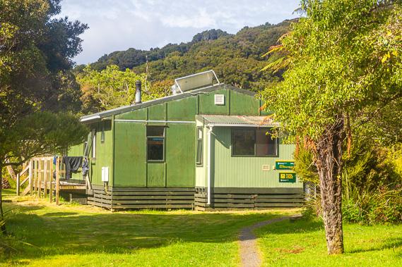
17:10 - Huge gum trees grow around the hut, planted by early settlers and now growing enormous. Gum trees grow much bigger here than they do in Australia as there are no koalas, termites, or other animals eating them. The native fauna are unfamiliar with these strange trees, so they leave them alone. |
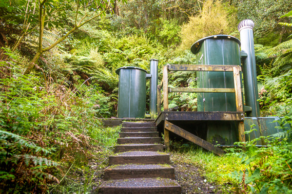 |
17:11 - The flush toilets sit behind the hut nestled in the bush. |
 |
18:28 - After dinner, I head back out looking across the beach to the wharf. The sun is out now and the rain of earlier today is already forgotten. |
 |
18:30 - The tide is out and the turquoise water is calm as I look across to Maori Bay. This would have been a very nice evening over at the logging village. |
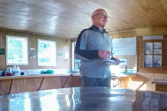 |
19:06 - Ranger Bruce does the briefing and checks tickets. He is a regular here and stays with his wife. He mentions he will be taking some time off in a few days to get a helicopter over to the remote Doughboy Bay and hiking out from there. As all three of us are hiking across to North Arm tomorrow, he describes the track and tells us what to look for. |
 |
19:40 - Following the briefing I return to the clearing where the sun is now low over the hills. The air is very cold now so I quickly return to the hut to chat. Nobody else has arrived. This certainly is a much quieter track than the crowded ones in Fiordland. |
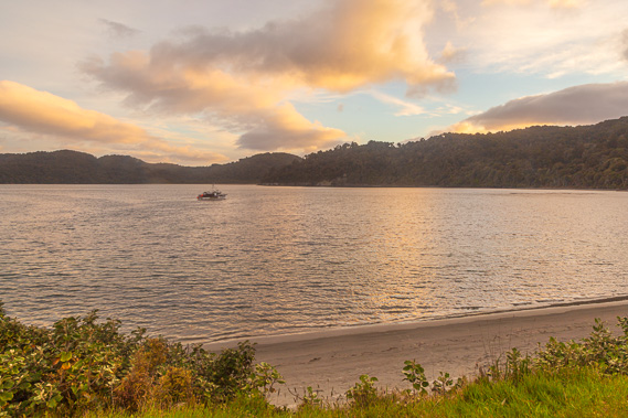 |
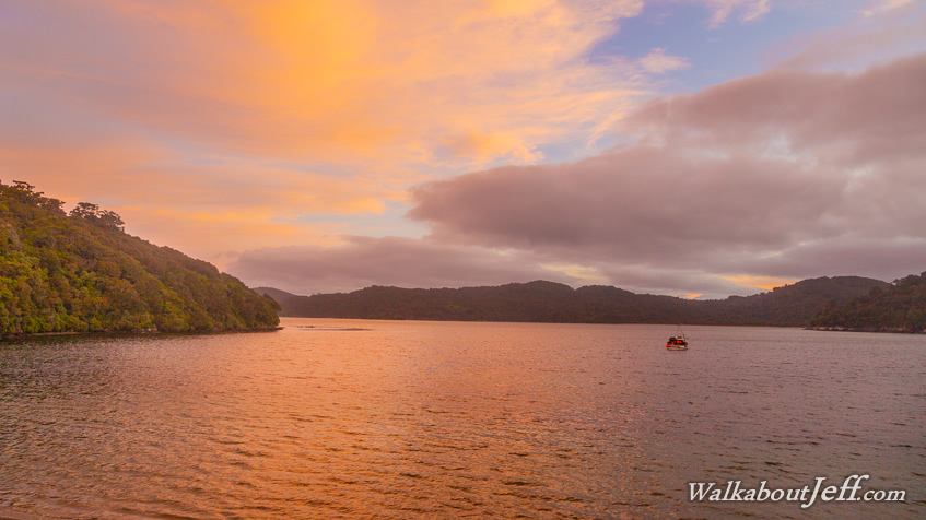
20:21 - I return to the beach for the late sunset as a boat arrives and anchors in the bay. Rakiura Track is the southernmost of New Zealand's great walks, and therefore has the greatest variation between summer and winter, with the longest summer days. The sun is setting but it will still be a while before the spectacular colours occur. Twilights this far south are very long. These sheltered waters have provided anchorage for many boats and ships over the years, but only one was ever built here. This was the 25 ton Surprise in 1839 built by Captain Jock McGregor when he gave up supplying meat and vegetables to the American whaling ships. He used it for trading many goods along the coast. McGregor settled here in 1836 building a thatched hut with his Maori wife Hinekawa. He also used the boat to rescue some exiled Maoris from nearby Ruapuke Island, and shortly after moved to Wanganui. |
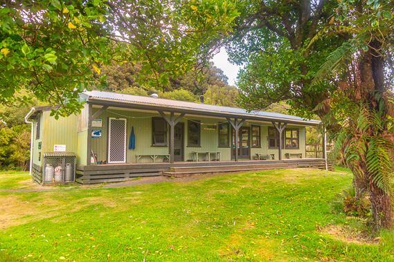 |
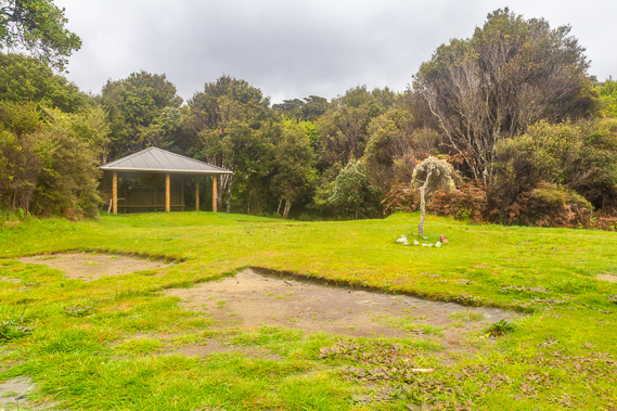
20:25 - The sheltered hut behind the viewpoint standing as the only structure in this part of the island now. The ranger's hut is at the left end, followed by the bunk room and the dining hall to the right. |
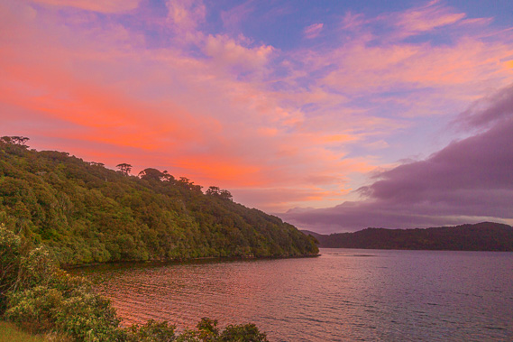 |
21:02 - The sky becomes more dramatic as the dusk turns to night. With a long day tomorrow I quickly turn in for the night. |
|