Introduction to today's journey
"The face of the earth is changing so rapidly that soon there will be little of primitive nature left. In the Old World, it is practically gone forever. here, then, is Stewart Island's prime advantage, and one hard to overestimate. It is an actual piece of the primeval world."
- Leonard Cockayne, 1906.
TIMBER milling was considered the most viable industry on remote Stewart Island over the late 19th and early 20 centuries. Milling settlements were set up along the coast, mainly in Paterson Inlet. One of the more significant milling villages was at Maori Beach, from here several tramlines were cut into the dense rainforest around 1900 to replace the horse and bullocks to carry the cut timber. The tramlines ran along the bottom of the deep valleys. and large steam powered log haulers were erected along some of the higher slopes to transport the heavy logs to the tramline. The equipment used was state of the art at the time. The milling suddenly finished in 1931, and much of the impressive equipment used in the logging has been left in the rugged forest to this day.
Today's journey starts at Port William just after sunrise, returning along yesterday's trail to the top of the hill leading to Maori Beach. Reaching the junction, I follow the track heading inland descending to two small river crossings deep in the rainforest before rising to follow the hilltops until eventually descending into a remote corner of Paterson Inlet at North Arm.
Today's Journey
Distance trekked today: 13.0 kilometres.
Total distance trekked to date: 21.1 kilometres.
 |
06:13 - A golden glow fills the eastern sky as the gentlest of swells breaks silently on the cold beach. Being the first up, I return to the hut for breakfast. The Maori name of the island, Rakura, means land of the glowing skies. The sunrises and sunsets are spectacular here, but perhaps also it is named from the aurora Australis as this is the closest inhabited island to the south magnetic pole. The solar activity is very low at the moment though, so any aurora sightings on this trip are very unlikely. |
 |
06:49 - I return to the bank above the beach to see the sun has already risen on the forested hills leading back up to the junction. North Arm Hut is 13 kilometres away, 6 hours hiking. Although it will take me longer with all the photography I plan to do today, there is another 14 hours of daylight today so there will be plenty of time to head across. |
 |
07:16 - I pack up and leave the hut stopping at the wharf just before the sun rises over the ridge. |
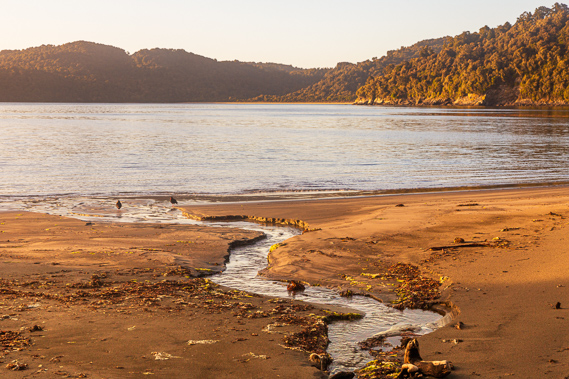 |
07:30 - Birds forage in the stream on the newly sunlit Magnetic Beach. |
 |
07:32 - No sign of life from the tent. Ranger Bruce mentioned this couple are hiking the north west circuit, so have another nine days on the track. |
 |
07:40 - Climbing the stairway from the end of the bay I have one last look at Port William as the sun goes behind a mid level cloud. The weather is going to be clear today. It is too bright to see the South Island which should be just visible in the distance. |
 |
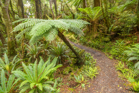
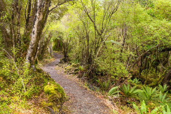
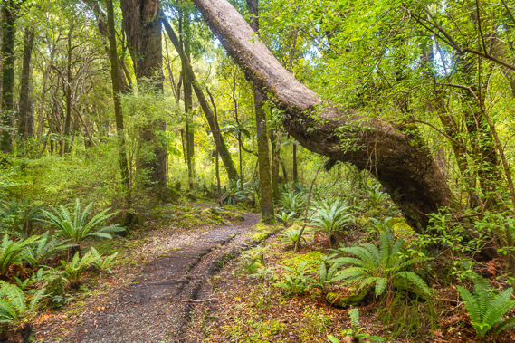
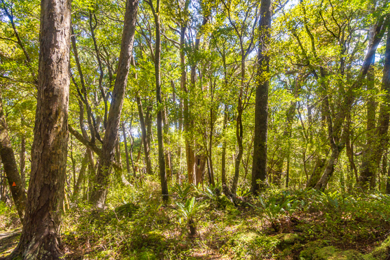
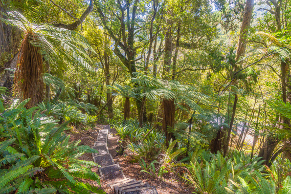
08:09 - I quickly ascend towards the junction, passing through the spectacular forest with the sunlight filtering through the canopy. |
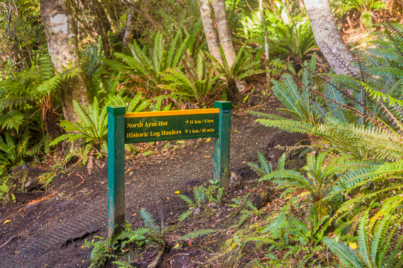 |
08:23 - I reach the junction about an hour after leaving the hut. From here it is new territory as I cross this section of the island towards Paterson Inlet. The sign says there is five hours hiking to North Arm Hut and 11 kilometres to go. I am making good time. |
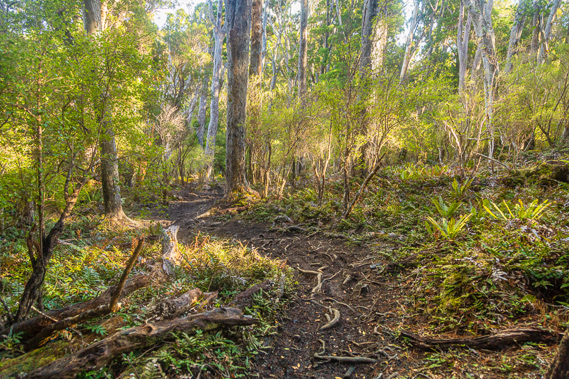 |
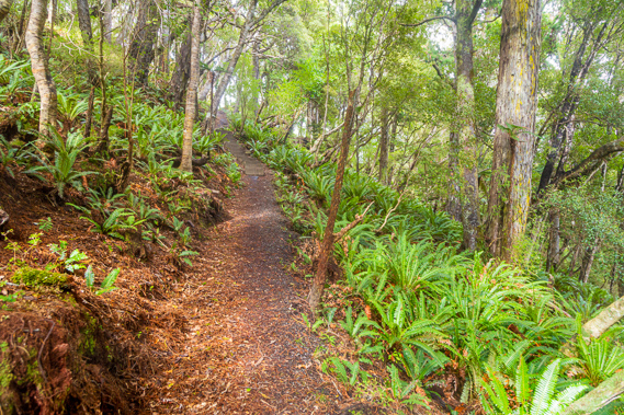
08:39 - The track is a bit rougher through here with a lot of exposed roots along the slightly descending trail. Although the track is modern, it closely follows the track the nomadic Maori people followed as they travelled to different parts of the island at different times of the year depending on availability of food. These tracks were created some 600 years ago. They did not have access to modern materials we use for our backpacks and hiking gear, but they made their own backpacks, rain parkas and protective clothing from weaving flax. |
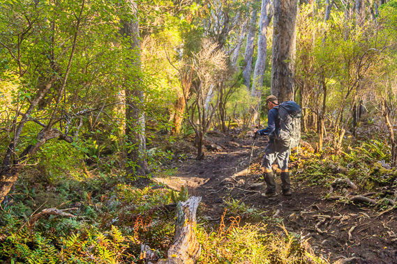 |
08:40 - I reach the top of the hill at about 180 metres above sea level before the track suddenly starts descending. The fellow at the hut quickly passes me keen to get to North Arm Hut. |
 |
08:48 - The track levels off going through regenerating forest once heavily cleared for the forestry. |
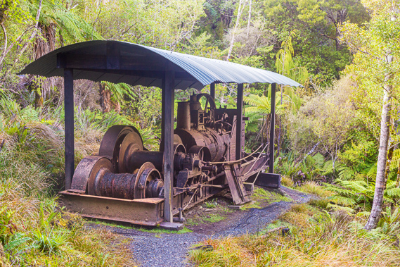 |
08:54 - About a kilometre and half an hour from the junction, I reach the remains of a steam engine log hauler used to bring the logs up from the valley below to the tram line to be taken to Maori Beach. This was abandoned in 1931 when the last sawmill on the island at Maori Beach was closed. They were left here abandoned probably because scrap metal had very low prices at the time, during the great depression and it wasn't economic to remove them. |
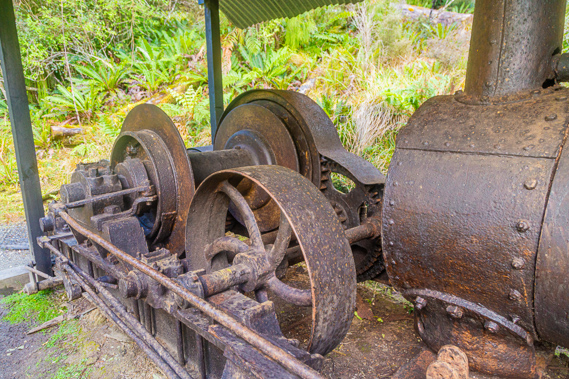 |
09:00 - A closeup of a flywheel and the boiler of this noisy machine in the middle of the forest. Log haulers were erected on the island from about 1900 as the technology had improved to the point where they were more efficient than horses and bullocks which were used until then. The two haulers here were manufactured by different firms in Invercargill One hauler dragged logs from where they were felled and the other loaded the logs onto wheeled trucks and lowered down into the valley from where horses tow them to the mill at Maori Beach. |
 |
09:07 - The track moderately descends along the old tramway into the valley. There is no sign of the tramline which was constructed from wood and will have rotted away in these humid conditions. The steam haulers would raise and lower the logs on the wheels along the tramway which was also used to transport workers up the hill. |
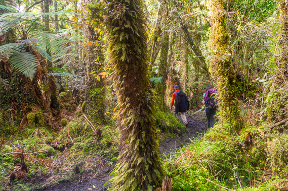 |
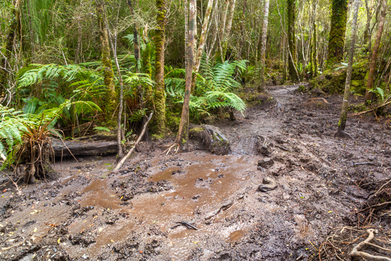
09:22 - Reaching the bottom of the valley the track becomes a little boggy and the old tramline heads off unseen to the left to continue down the valley to cross the river and continue to the Maori Beach sawmill. From the river crossing, the logs would be taken along a track across the top of the Maori Beach sandbar to the sawmill, or some logs were taken a little way up the valley along the Central tramway system to another sawmill which operated in the bush until 1924. A couple who had stayed at the hut overnight now pass me on their journey to North Arm. |
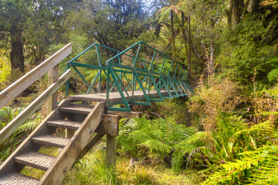 |
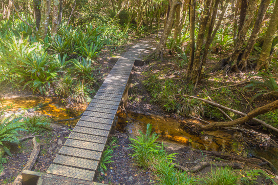
09:24 - Reaching the bridge over the first branch of the stream flowing into Maori Bay. The descent has dropped to about thirty metres above sea level now deep in the valley. |
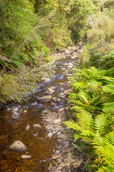 |
09:26 - The stream tumbles over rocks on its journey towards Maori Beach about a kilometre downstream. |
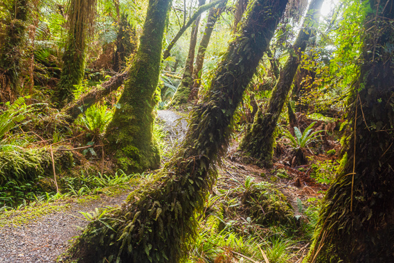 |
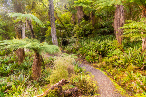
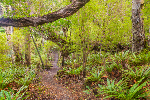
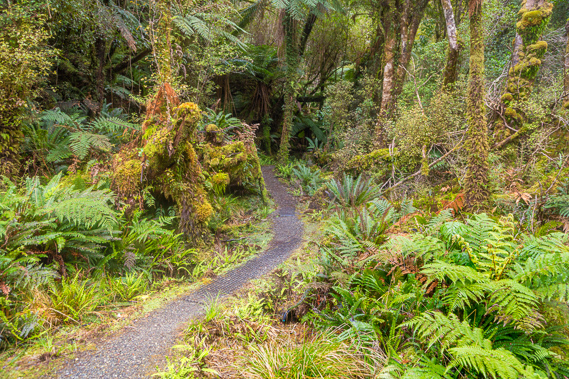
09:31 - The forest through here is very lush and spectacular, quickly regenerating in the humid environment. Although someone unfamiliar with the forest wouldn't be able to find any food here, the Nga Ngahere, as the Maori people call the forest, has a wealth of food, medicines, and fibres for clothing and containers. |
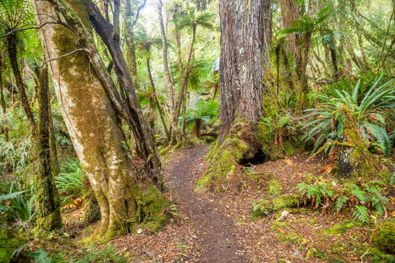 |
09:35 - The track winds its way between the remaining trees heading upstream along the main river of Maori Bay. |
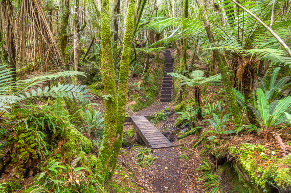 |
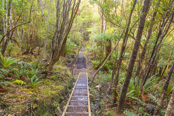
09:53 - Little bridges and stairs make an otherwise muddy track through the valley very easy going. |
 |
10:04 - Thick moss drapes everything. This part of the track follows the northern tramway system which heads upstream from the log haulers junction to a little bit past this point at the stream. |
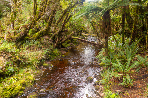 |
10:07 - Crossing the main stream flowing into Maori Beach at about 40 metres above sea level. The water is stained ochre from the vegetation, but otherwise pure. |
 |
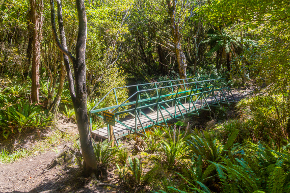
10:08 - The bridge over the stream heading back into the lush sheltered forest. Beside the bridge is a nice resting point. This is about as far as the tramway went. |
 |
10:10 - From here the track leaves the valley rising moderately into the hills. |
 |
10:17 - It is quite a climb gaining the extra altitude I earlier lost. |
 |
10:36 - Eventually the track does start to level off as it approaches the tops of the hills at around 180 metres above sea level. |
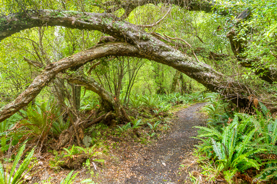 |
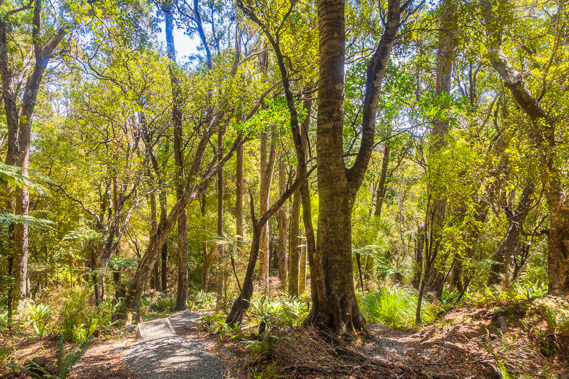
10:46 - The regenerating forest up here is still magnificent with trees growing over the track, leaning over due to the strong winds which often blow through here. Today the air is dead calm - rare for these latitudes. |
 |
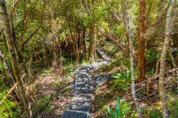
10:57 - The track here is covered in gravel making for easy passage through these otherwise boggy tops at the highest point of the track about 190 metres above sea level. This compares to the highest point of the North West Circuit at 400 metres above sea level. From here the track is almost level, descending very gradually. |
 |
11:16 - The terrain has largely flattened and some sections of the track are a bit boggy, especially in places like this where rainwater has accumulated. Fortunately side routes have been worn over the roots on the side of the track so I can keep my boots dry. |
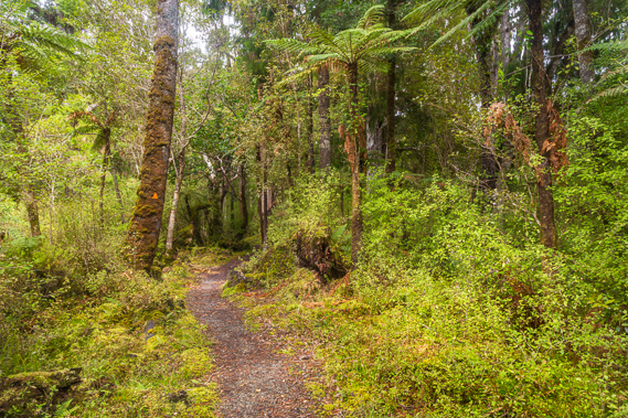 |
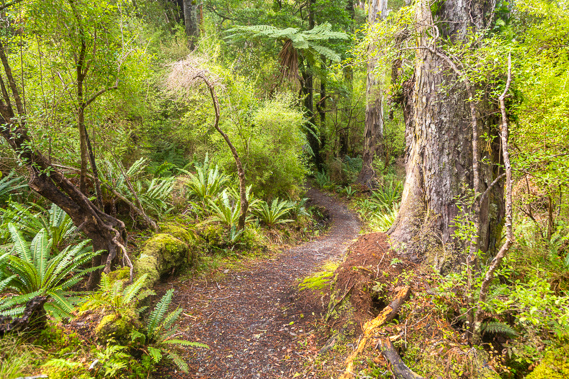
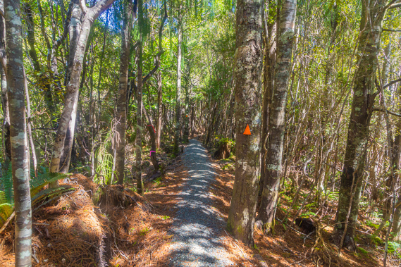
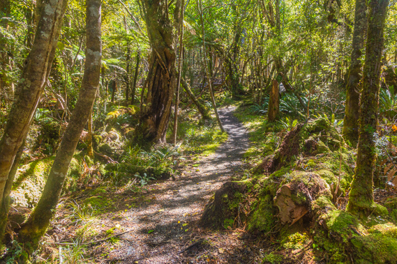
11:31 - Much of the track is still in great condition as I head through the silent forest guided by the orange markers. |
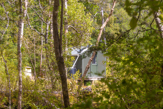 |
11:36 - A ranger's hut is hidden in the forest about fifty metres from the track. The sun has come out now and the track continues to descend very gradually along the tops of the hills towards Paterson Inlet. |
 |
11:51 - The track continues winding its way through the forest. There are few landmarks anywhere to be seen and I can only be guided by the sun which is almost due north now. |
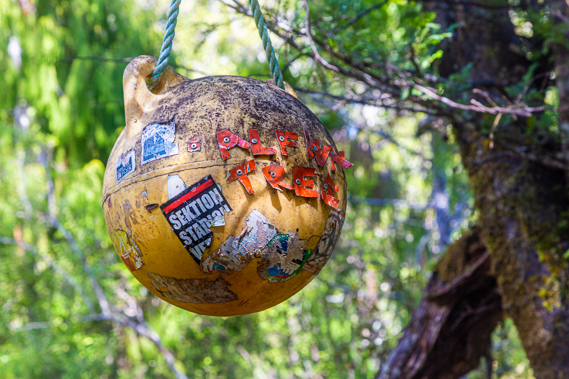 |
12:21 - I eventually reach a tree with a floating ball hanging off it two and a half metres above the track marking Half Way Tree. This is exactly half way between the start of the track at Lee Bay and the end near Oban. I have already hiked more than half of the trail with doing the extra bit at Port William. This means North Arm can't be too far away now. |
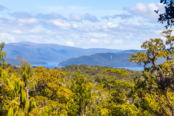 |
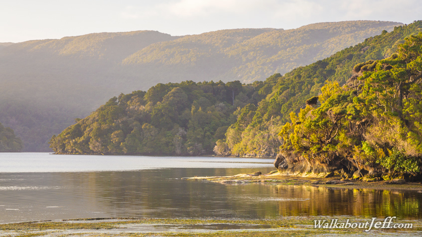
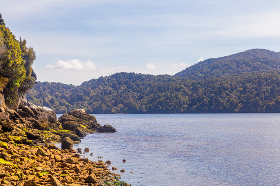
12:40 - Another twenty minutes pass before I get my first glimpse into Paterson Inlet, a flooded valley extending about two thirds of the way across the island. It was once a river system before the sea level rose flooding the valley at the end of the ice age around 10,000 years ago. |
 |
13:01 - Views are very few and far between though, as the track starts descending more moderately through the dense regenerating bush. The gravel has only been recently laid here and it is rounded on top so I need to walk carefully through here. |
 |
13:27 - The bright sunlight filters through the forest foliage. |
 |
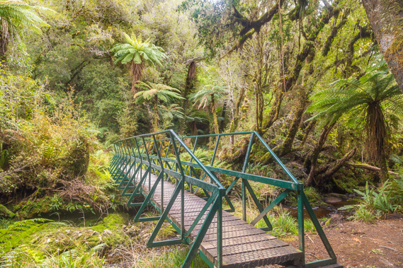
13:40 - Crossing a couple of streams about 40 metres above sea level. This area badly floods during heavy rain and there is a warning sign just before the bridge not to cross if the water is above the decking. |
 |
13:46 - Another bridge across another stream, again with a warning sign. These streams meet a little further downstream and flow into Sawdust Bay, which I will be passing tomorrow morning. |
 |
13:51 - Continuing through the regenerating forest under dappled sunlight. |
 |
14:06 - Reaching the end of the ridge, the track drops moderately down a new set of stairs. When I walked up this track in 1994 this was quite a muddy section clambering over roots. The steps and gravel makes this track completely dry. |
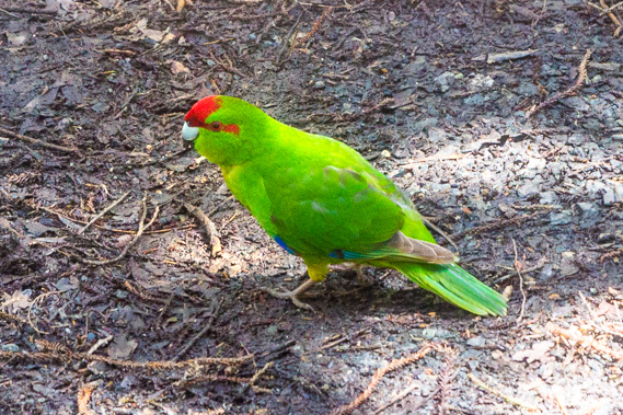 |
14:21 - Birdlife has been almost non-existent today, but I am rewarded with a parrot on the path directly ahead of me - this is a red crowned kakariki. These were once widespread throughout New Zealand but are only occasionally found in the upper half of the North Island, in a few scare spots on the South Island, and fairly common here on Stewart Island and a few offshore islands. |
 |
14:43 - I don't linger long, but continue descending towards Paterson Inlet. The filtered sun is bright and there is almost no wind. It has been a very calm day today. |
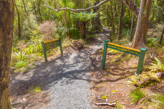 |
14:45 - The junction appears quite suddenly at the end of the stairs. The hut is just five minutes away ahead of me. The track to the left is the one I will be following tomorrow along Paterson Inlet back to Oban. |
 |
14:48 - Passing the camping ground, the track descends a line of stairs into a small bay. |
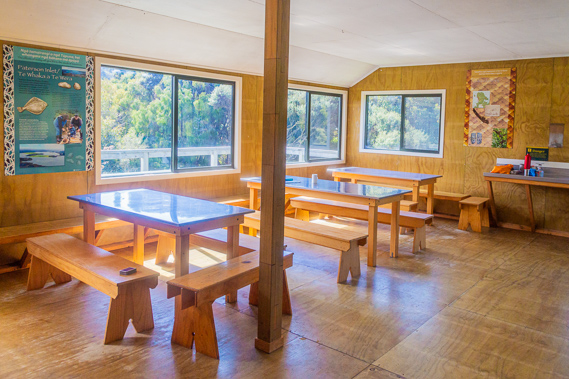 |
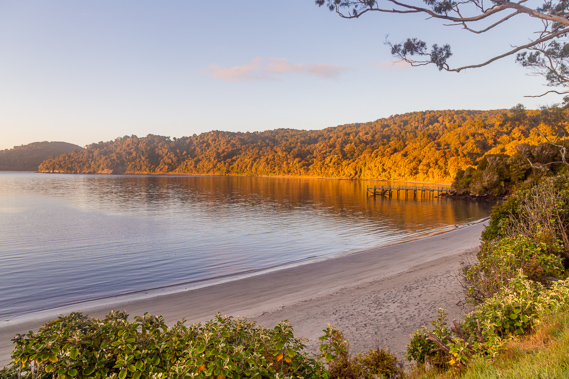
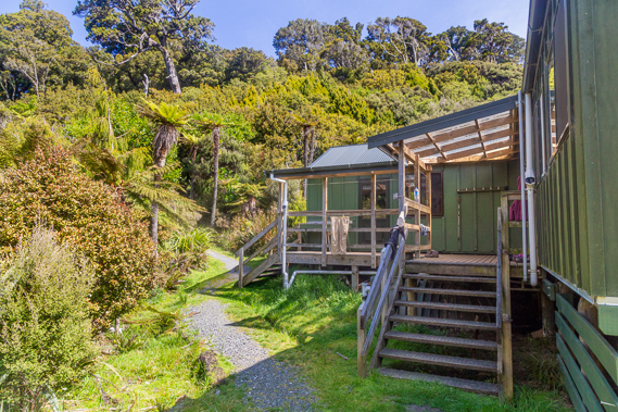
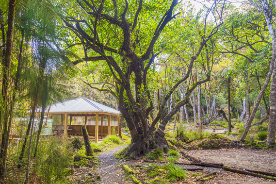
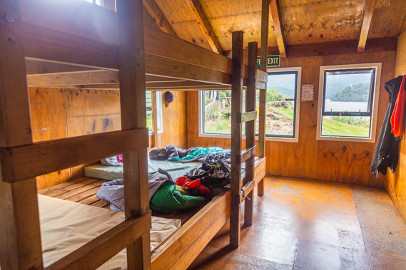
14:57 - Just minutes later I reach North Arm Hut which is very nicely built and cosy. I select a bed and relax with the others from Port William Hut having a late lunch. |
 |
14:58 - The hut has a little fireplace and the bunkroom is just through the door. There are 24 bunks, the same number as at Port William Hut. I am looking towards the original hut which I stayed in back in 1994, but this end of the hut was extended in 2012. |
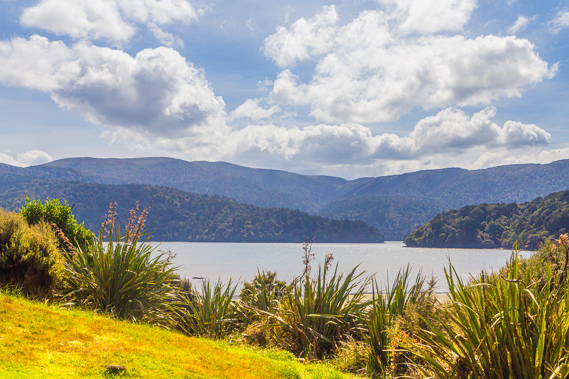 |
15:40 - View from the balcony of the hut looking over Paterson Inlet. |
 |
15:43 - I leave the hut following a short track to the inlet. |
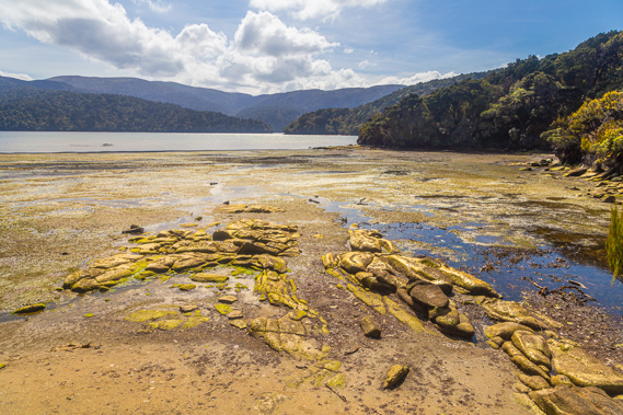 |
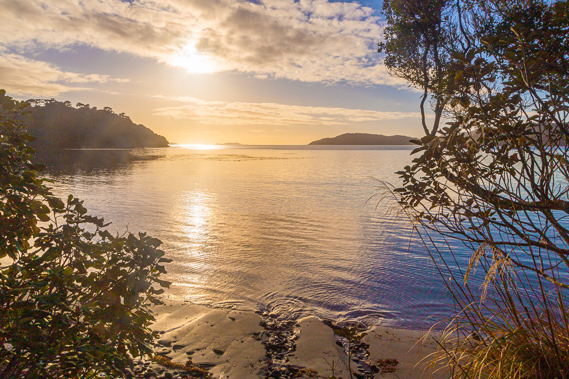
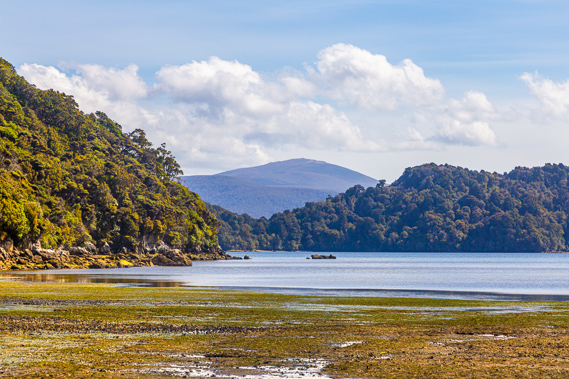
15:45 - The tide is a long way out but starting to come in. The air is still and there is hardly a sound. This area of North Arm was used as a seasonal camp by the Maori people who lived at Port William, and the track I have just hiked closely followed the route they followed to get here between the 13th and early 19th centuries. |
 |
15:46 - I decide to head towards the point whilst the tide is still out. |
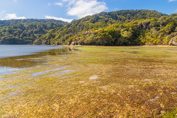 |
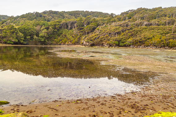
15:53 - The tide slowly rising over the sea grass. The inlet is protected as it is a unique envionment with all the fresh water flowing from Freshwater River and other streams into it makes it less salty than the open sea. |
 |
15:55 - This is as far as I can go. There are no signs of civilisation in this remote corner of the inlet. The Maori called this Te Whaka a Te Wera. |
 |
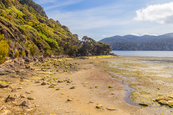
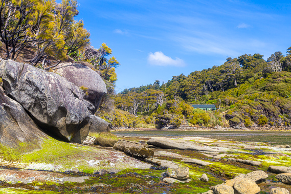
16:10 - I head back towards the other side of the beach. The rounded Mount Rakeahua towers in the distance. The South West Circuit goes around the other side of this mountain. Directly below the mountain on the other side of the inlet is Kaiporohu Bay. |
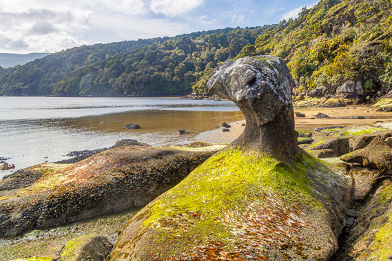 |
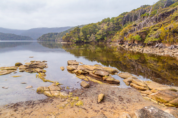
16:15 - Reaching an unusual shaped rock covered in algae which will be mostly submerged in the high tide. |
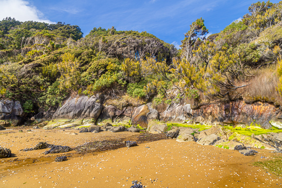 |
16:18 - Golden sand, rock formations and windswept scrub covers this exposed coast. The rocks on the sand hold clusters of mussels. |
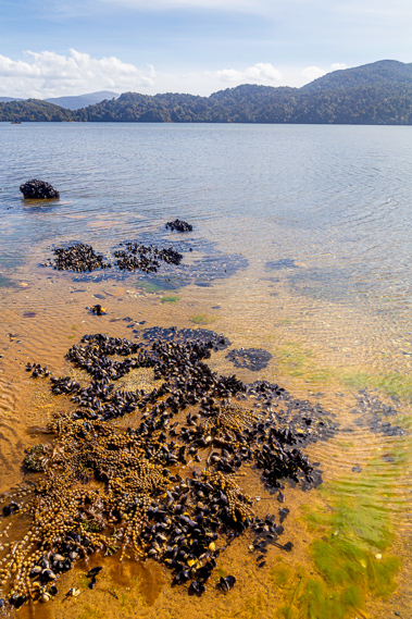 |
16:20 - There is lots of life in the shallow water. No wonder the Maori people travelled here each year. Migrating between here and Port William allowed the respective fishing grounds to recover over the part of the year when they are absent. |
 |
16:21 - I head back to the hut mostly hidden in the windswept scrub. |
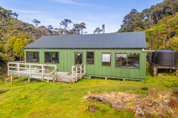 |
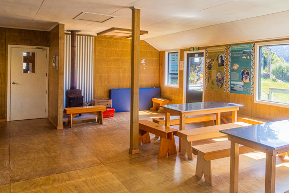
16:45 - Above the front of the hut looking to the balcony. The dining area is to the left and the bunkroom to the right. |
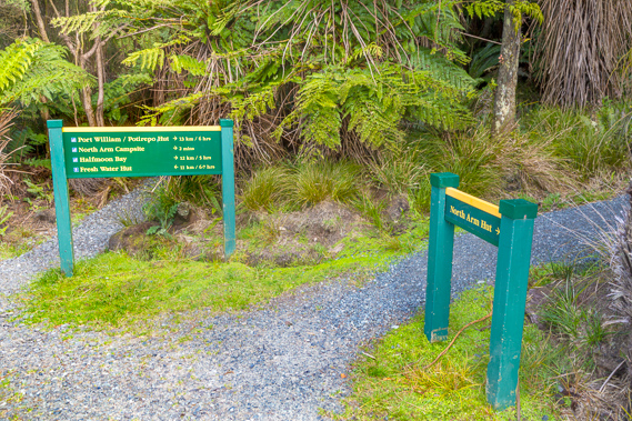 |
16:47 - I head back up to behind the hut at the first junction, to where the North West Circuit finally returns to the Rakiura Track after 7-9 days from Port William. This is the last hut hikers on the North West Circuit stay before returning to Oban. |
 |
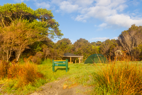
16:51 - I head back up the hill to the camping ground just a couple of minutes away. It is a very nice camping ground so long as it is not raining. A couple are setting up a tent in one of the four sites at the far end. |
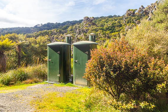 |
16:56 - Returning to the hut, the toilets above the hut viewed from the junction. Before going to the hut I have a quick look at the condition of the track over the North West Circuit to my right. |
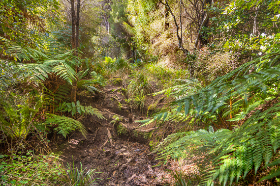 |
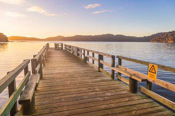
17:00 - I walk about 50 metres along the North West Circuit. The track is quite rough. This 6-7 hour 11 kilometre section between here and Freshwater Hut is meant to be the roughest section of the track as this is missed by a lot of the hikers who instead catch a boat at Freshwater Hut to Oban on their final day on the track (or catch a boat from Oban to Freshwater hut on their first day), saving two days of hiking. |
 |
19:29 - I return to the hut for dinner. This is the bunkroom. A group from Christchurch has arrived having hiked the swampy Southern Circuit over the past six days having been dropped off by boat at Fred's Landing. They are heading out to Oban tomorrow. |
 |
19:43 - I return to the inlet after dinner. The tide is quickly creeping in. It is only a small tide today with a range of about 1.5 metres, but can be up to 3 metres range when the sun and moon are aligned. I explore the foreshore as the sun sinks behind the hills. The calm waters of Paterson Inlet were ideal for the Maori people to travel by canoe. The sea on the other side can be very rougth, especially when crossing Foveaux Strait, which they had to do in double hulled canoes to prevent capsizing. |
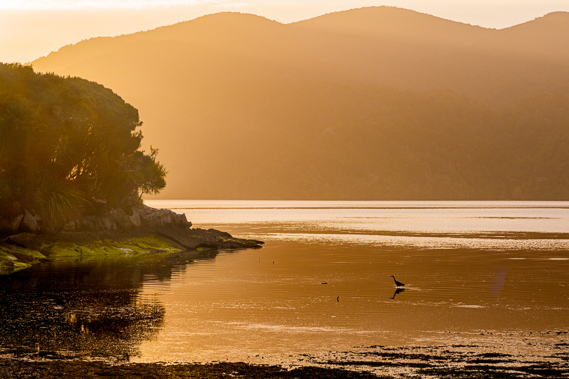 |
20:07 - The evening sunlight filters around the point as a spotted shag wades in the shallows of the incoming tide. |
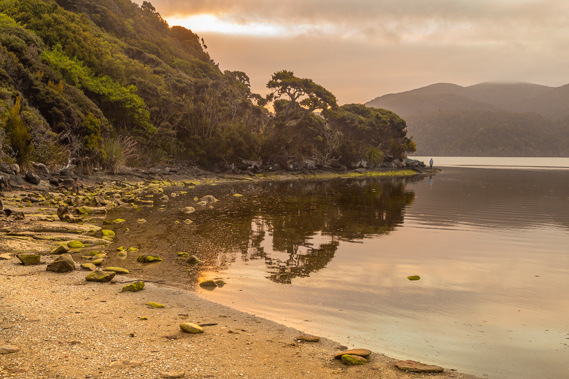 |
20:54 - I return to the inlet a bit later with the tide mostly in and a fellow hiker exploring the point. |
 |
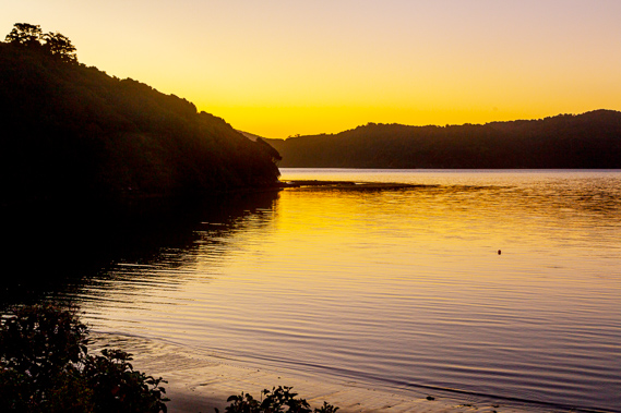
21:12 - The tide has come in a fair way but has a bit more to rise. I call it a night as the sky finally begins to darken. |
|