Introduction to today's journey
How the mountains dominate one completely when one is among them, imposing a way of life utterly different from ordinary life.
- Charles Brasch, 1950
THE SETTLEMENT of Jamestown at the mouth of the Hollyford River in 1870 necessitated the construction of a road over the mountains from Otago to the very remote West Coast settlement. Pack tracks were built over a couple of passes in the mountains to support the new town which was unaccessible by sea due to its treacherous bar. These tracks followed the Maori tracks across the mountains to their greenstone mines. In 1873, a road was built following the Route Burn. Upon reaching the notoriously steep gorge and on realising Harris Saddle was iced over for much of the year, the project was quickly abandoned. Instead a pack track was built up the precarious gorge to Routeburn Flats and a rough walking track continued from there over Harris Saddle and down the other side.
This route became largely unused due to the easier access over the Greenstone Pass to the south. In the 1880s a tourism route started where tourists were packed up to Routeburn Flats on horseback. This continued through to the end of the 1890s. A tourist lodge was built at the flats in 1909 along with the construction of swing bridges across the main streams and river along the gorge. Tourism really began to open up from 1912 when the Earnslaw began running regular services from Queenstown to the otherwise isolated Glenorchy. From the flats, the more adventurous would travel further into the mountains.
Today's trek starts at the Routeburn Shelter at the Queenstown end of the track. From there I follow the Route Burn upstream through a spectacular and narrow gorge leaping off the end of what had once been a hanging valley. Upon reaching the end of the gorge, the terrain dramatically changes with the valley opening out into the expansive Routeburn Flats, a large tussocky area where the two branches of the Route Burn meander around its tussocky fields under the dramatic mountains towering overhead.
Today's Journey
Distance trekked today: 7.5 kilometres.
Total distance trekked to date: 7.5 kilometres.
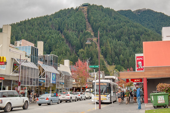 |
07:51 - Early morning in Queenstown as I head towards the pickup point where the minibus will take me into the start of the Routeburn Track. Today is overcast but no rain is expected. |
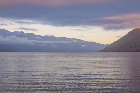 |
08:09 - Heading out of Queenstown passing Lake Wakatipu heading around the coast towards Glenorchy. A huge glacier once filled this valley. When the glacier melted the moraine deposited at the end of the lake to the right created this four hundred metre deep lake five kilometres wide and 75 kilometres long (New Zealand's longest and third largest lake), snaking its way down southern Otago. The Mataura River at the end of the lake used to drain it up till 18,000 years ago but is now drained by the Kawerau River to the left. |
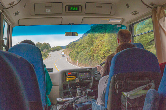 |
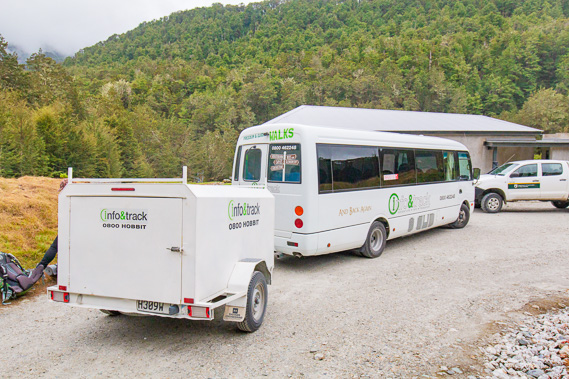
08:29 - Taking the shuttle along the 45 kilometre road around the lake with several other hikers. The winding road follows the old pack horse trail. Before the trail the steamship Earnslaw was the only transport along the lake avoiding these rugged mountains. In the 1950s there was a push for a road to be built, and it was finally opened in 1962, following a challenging construction along the side of the valley along what had been a bridle trail. |
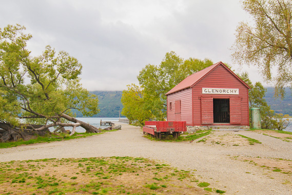 |
09:08 - We make a brief breakfast stop at the Glenorchy wharf, where the boat from Queenstown once landed in this remote valley before the road was built. The Earnslaw is still in operation now, but just as a tourist boat crossing the lake between Queenstown and Mount Nicolas station. |
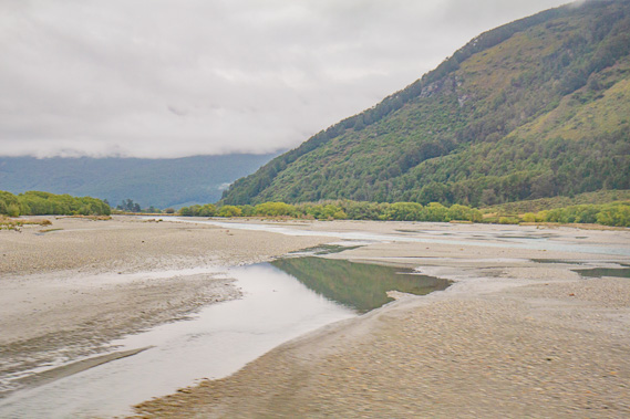 |
09:29 - Crossing the Dart River heading up towards the start of the Routeburn Track. Once across the river, the road is unsealed as we venture into increasingly remote territory. This is the Lord of the Rings Isengard location, though the mountains would not be distinguishable with this morning's cloud cover. Downstream is the remote community of Kinloch, wher ethe Bryant family who led guided hikes up the Routeburn for almost a century were based. There they set up "Glacier Hotel" to cater for their guests. This remote access straight from the end of the lake continued until this bridge was built in 1974 shortly after the road to Glenorchy was completed. This rendered the Earnslaw largely redundant, so it became a tourist boat going between Queenstown and Mount Nicholas. |
 |
10:00 - Stopped at the start of the track at Routeburn Shelter. We are already in Mount Aspiring National Park. The national park extends northward from the edge of upper Fiordland National Park up along the Southern Alps up into Westland. The national park was officially gazetted in 1964. From here we hike, unloading our packs and setting off on a trek over the mountains towards the Milford Sound Road. |
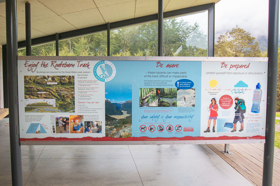 |
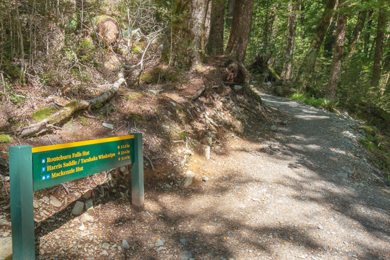
10:07 - I briefly look around the shelter before heading off along the track. The shelter is just an open shelter with toilets, benches to sit on, and noticeboards to read for people coming the other way and finishing the track here. The car park and shelter were constructed in 2007. The altitude here is 479 metres above sea level, the lowest point on the entire track. The information here includes quite a few suggested day walks along the first part of the Routeburn and on a few side tracks. The longest being all the way up to Harris Saddle with the return trip being 25 kilometres taking 7 to 9 hours. The shortest is the one hour Routeburn Nature Wal. |
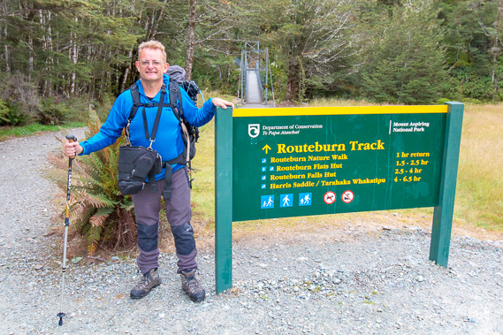 |
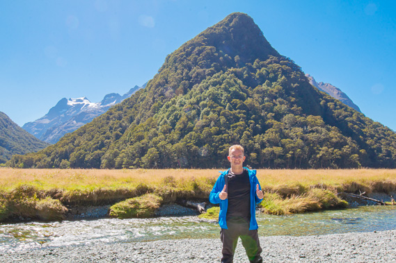
10:13 - My mug shot at the start of the track. This is normally a three day trek, but given all the photography I'm planning to do here, I've decided to do this in five days, staying in all four huts along the track. |
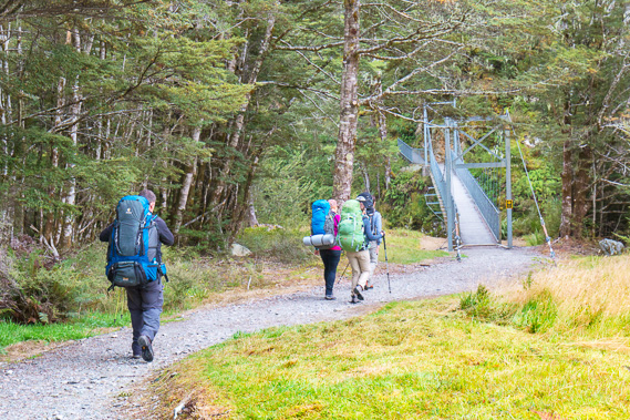 |
10:16 - The three randoms who took my mug shot at the start of the track. I took theirs as well. They quickly head off towards Routeburn Falls, the second hut. To all of our surprise, I would later meet them on the Kepler Track. Here they are approaching the bridge to cross the Route Burn. |
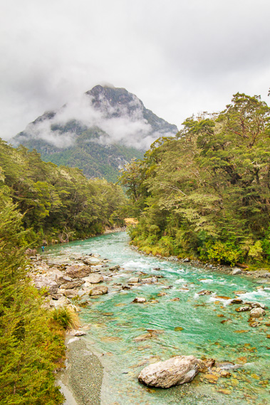 |
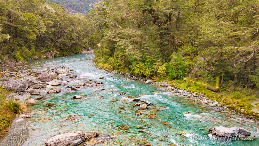
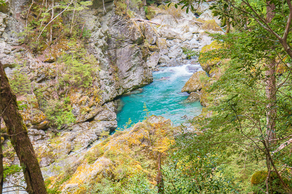
10:18 - The Route Burn. The track was named after this river (or burn as many small rivers in New Zealand are named). The water is crystal clear. I will be following this river upstream almost up to its source before heading over Harris Saddle into the Hollyford Valley in Fiordland National Park. In the background towers the 2079 metre high Upper Peak, much of the mountain lies hidden in the cloud. This is the northernmost part of the Humboldt Mountains. |
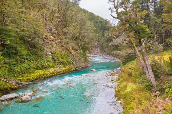 |
10:19 - Looking downstream along the Route Burn towards where it flows into the Dart River, then into Lake Wakatipu before flowing down the Shotover River into the Clutha River. The Clutha is New Zealand's most voluminous river reaching the coast on the eastern side of the island. |
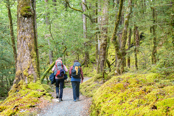 |
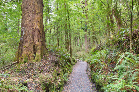
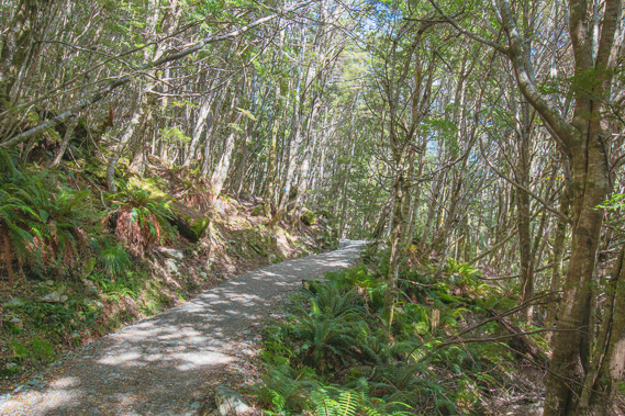
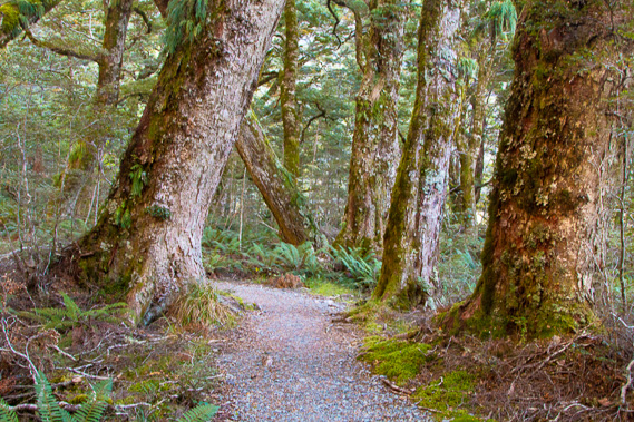
10:36 - The very well graded track follows a nature walk circuit through the dense beech forest. The track is covered in recently laid gravel and the surrounding forest floor is thick carpets of moss. The forest is very quiet, but yellowheads flitter around in the canopy overhead. The perfectly formed track winding its way around the forest of spectacular red beech as a couple of hikers pass me. They are probably doing the entire Routeburn Track given the size of their packs. There are quite a few people on the whole track without large packs, all doing the nature trail before heading back to Queenstown tonight. |
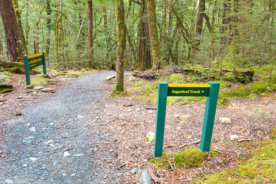 |
10:38 - Reaching the junction of the Sugarloaf Track, a rough and soft track heading up the hill through the moss to the 1154 metre high Sugarloaf Pass before descending to the valley on the other side to go over another four passes - the famous five passes track. I continue along the main track. |
 |
10:49 - Reaching the bridge since the swingbridge crossing Sugarloaf Stream. The nature trail turns off sharply to the left to continue its ciruit following Sugarloaf Stream and Route Burn back to the Routeburn Shelter. The swingbridge over Sugarloaf Stream is long and stable, hinting every other stream and river along this track is well bridged. |
 |
10:51 - Looking upstream along the fast flowing perfectly clear Sugarloaf Stream as it thunders its way parting the otherwise dense mountain beech forest. |
 |
10:57 - Once across the river, the track begins a moderate ascent in the dense forest. It continues with red beech, in this relatively dry forest on the lee side of the mountains. Annual rainfall will increase dramatically as I head westward, with Milford Sound and the wettest parts of New Zealand just twenty kilometres to the west. Back to the east, the rainfall drops of dramatically to New Zealand's driest terrain in Central Otago. |
 |
11:26 - Bridal Veil Stream tumbling down under the bridge I cross nearly half an hour out from Sugar Loaf Creek. This is a long exposure shot of the perfectly clear water. If it were a little closer then I'd definitely drink some - no doubt purer than the camelback of Queenstown water I'm carrying. About 700 vertical metres above here is the two hundred metre high Bridal Veil Falls feeding this stream. The falls are hidden in the clouds so not visible from the start of the track today. |
 |
11:34 - The track has steepend significantly. This is the steepest part of the entire Routeburn Track as it quickly ascends the valley below. It follows the old bridle trail where early tourists trekked up here by horse from the 1870s. Through this gap in the trees I can see down the Route Burn back to the start of the track and see I've already gained a fair bit of altitude. There is a long way to go through. The track started at 479 metres above sea level and there is nearly 800 metres of climbing before I reach the Harris Saddle in two days' time. |
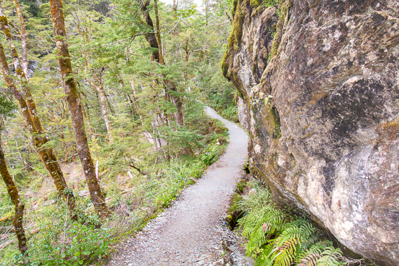 |
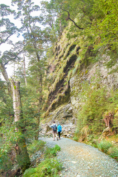
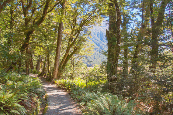
11:37 - The track continues rising moderately but fortunately the recently laid gravel over the old bridle path makes it reasonably easy so long as I keep a steady pace. The surrounding terrain as I enter the gorge becomes rough, with the track now negotiating its way around enormous boulders and outcrops. The echoes of the cascading river echo between the walls of the gorge. |
 |
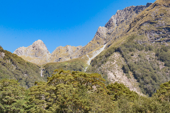
11:44 - First view of the river as it cascades steeply down the gorge. I have gained over a hundred metres of altitude Since Sugarloaf Creek so there must be a few waterfalls the river plunges over as drops down from here. The valley is very narrow with walls of rock rising hundreds of metres on either side. Building the old bridle trail in the 1870s must have been precarious. |
 |
11:49 - Through a gap in the forest I see the other side of the valley towers spectacularly for hundreds of metres above the river to the snout of the range extending around the back of Routeburn Flats. The gorge carves itself through the Humboldt Mountains, which are even higher than the main dividing range. If it were not for this gorge, the Humboldt mountains would be part of the main divide of the Southern Alps. |
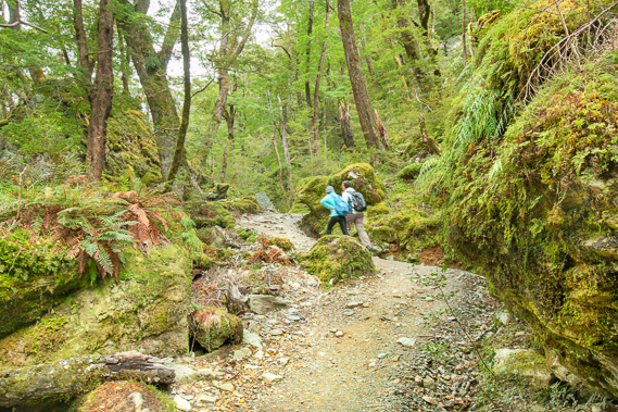 |
12:02 - The track continues negotiating its way around enormous moss covered rocks as a couple of day walkers stride on past. They are probably going as far as Routeburn Flats and heading back this afternoon. The boulders were carried down the valley by a glacier, and deposited here as it melted. |
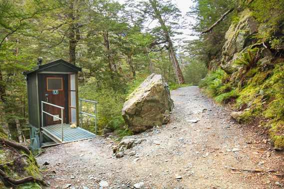 |
12:14 - I reach a toilet in a completely random place along the track as the valley seems to start opening out before me. The toilet sits on an elevated platform with a tank underneath on rails which can easily be moved out and taken out by helicopter when full. |
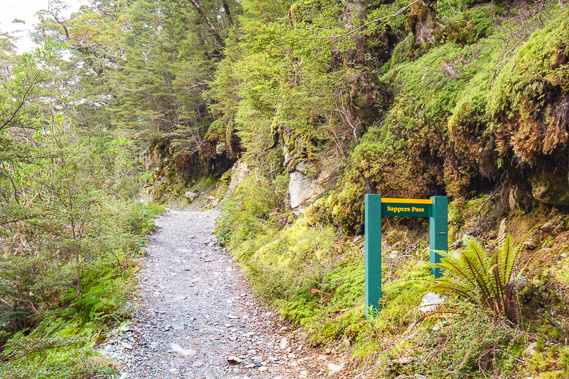 |
12:16 - Reaching the top of the moderately steep section at Sapper's Pass at around 660 metres above sea level. The track continues heading uphill from here, but only at a very gentle grade. There are no more steep sections from here to the Routeburn Flats Hut. |
 |
12:21 - Looking up towards a gravel bank in the river where some of the day walkers are able to access. This is Forge Flats, the site of an early blacksmith camp where worn out horses get their shoes repaired after the long climb up the hill. The cascades are substantially less now as the valley begins to widen. |
 |
12:26 - Despite the track being nearly level, the terrain remains very steep, with the bridle track cut deep into the side of the mountain towering almost a kilometre overhead. |
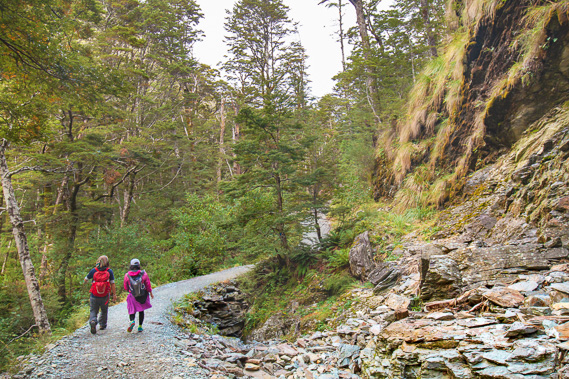 |
12:27 - Passing a landslide of schist that has come out of the hillside. The landslide created a relatively flat area for the track to be rerouted around. The valley is starting to widen up ahead. |
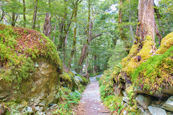 |
12:51 - There are still enourmous boulders deposited by an ancient glacier and some perhaps rolled down the mountains in past earthquake and avalanche activity. It has been a long time since they rolled down though as they are covered in thick carpets of moss and filmy ferns, drooping spleenwort and scrambling clubmoss. The grade of the track is almost level, and it's condition is still top notch with its new layer of gravel on its surface. |
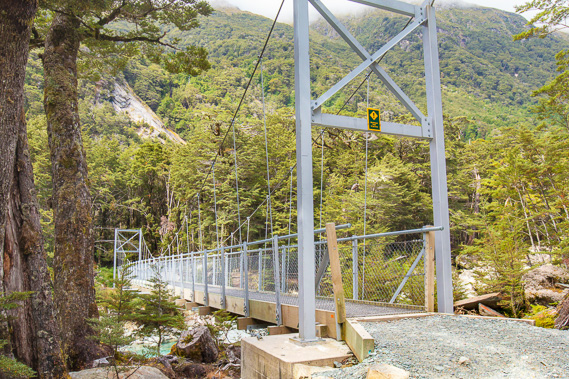 |
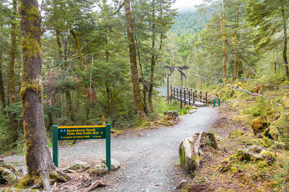
12:53 - Reaching the swingbridge crossing the Route Burn above the gorge at 675 metres above sea level. The bridge brings the track back on the same side of the river as the coming huts. From here all the way up to Harris Saddle the track will follow the left hand bank of the Route Burn. |
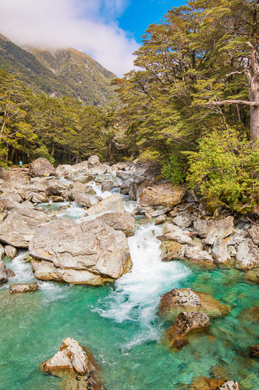 |
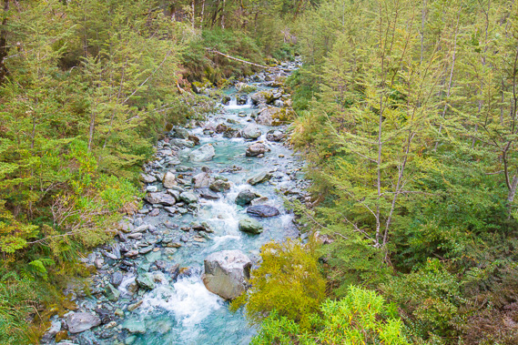
12:54 - Looking upstream along the Route Burn. The clouds are quickly clearing now, just hanging around the edges of the higher mountains. The water is amongst the clearest I have ever seen. If I didn't have my camelback full of water, I'd go down there and drink straight from the river. |
 |
12:56 - Reaching the other side of the river, the remaining clouds are lifting over the steep mountains I have traversed around up the gorge. The mountain in view rises almost a kilometre overhead with their tops still in the clouds. |
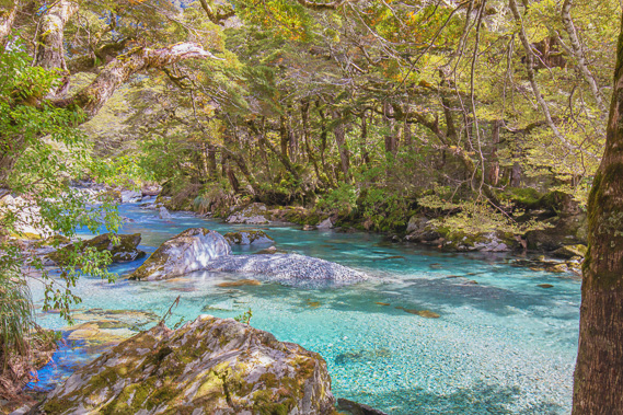 |
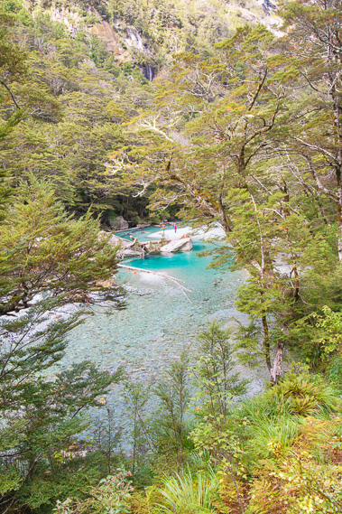
12:59 - The blue water of the Route Burn flows gently above the gorge as I continue upstream into the valley. The valley is quiet, absent of the birdsong that filled these forests for countless millennia until the predators wiped most of them out. |
 |
13:07 - The track continues around the side of the hill as the river flows on this side of the valley. The sun is out now, filtering through the beech foliage making stark contrasts between light and shade along the track. |
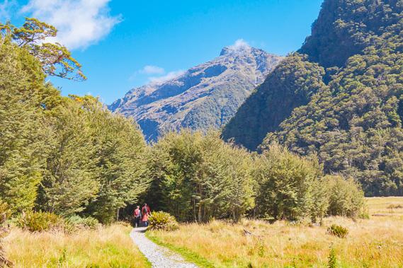 |
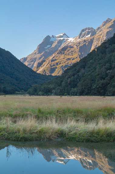
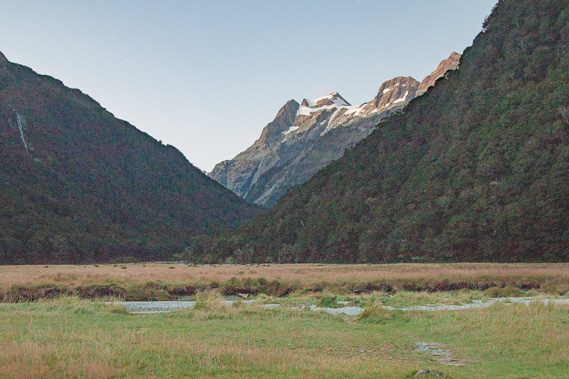
13:21 - I reach the first clearing at the start of Routeburn Flats. The mountain towering in the background is the 1912 metre high Mount Xenicus in front of which are the Routeburn Flats and Routeburn Falls huts. I will be following to the right of it over the next two days on my way to Harris Saddle to the left. |
 |
13:37 - The main track heads up the side of the valley towards Harris Saddle. Today I only go to Routeburn Flats, so I turn off to the right to follow the side track for another five minutes to the hut. I will return here to follow the main track tomorrow morning. Most hikers doing the track in this direction starting today will be heading up to Routeburn Falls Hut for tonight. Many stop at Routeburn Flats hut for lunch. |
 |
13:40 - The track passing through the forest towards Routeburn Flats Hut is very pleasant and level. The sound of the river is getting distant as it flows further out in the valley. |
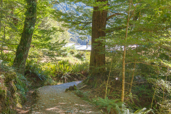 |
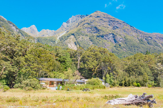
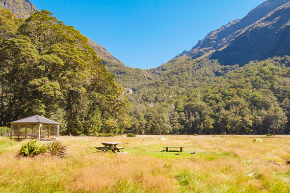
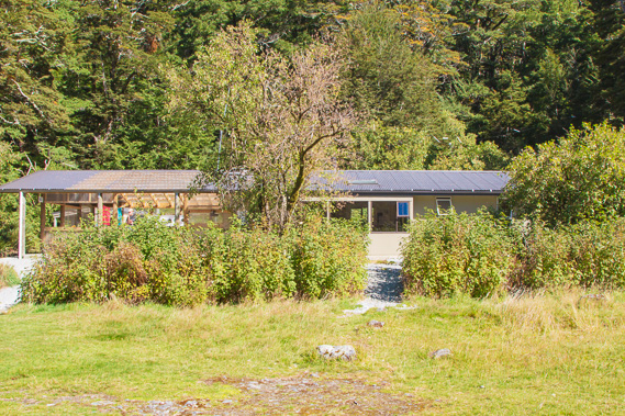
13:44 - Finally I see the hut as the track turns towards the flats. This is my destination for tonight, at 690 metres above sea level. The hut was constructed in 1976, replacing the old hut built in 1909. |
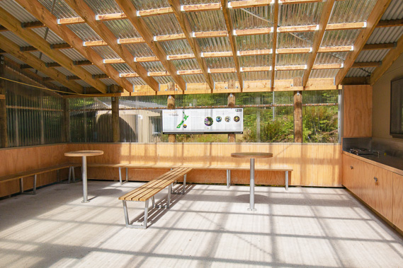 |
13:52 - The day shelter at Routeburn Flats Hut. This is a relatively new addition to the hut built in 2012, allowing hikers doing the more standard Routeburn Shelter to Routeburn Falls trek on their first day to rest for lunch without interfering with the main hut. A few metres to the right of here is the entrance to the main hut, where a weather forecast was available. The weather was for mainly fine but a couple of fronts were coming over onight, with strong winds through Harris Saddle (it is completely calm here). Tomorrow it is expected to be cloudy but clearing from late morning and the next day going over the saddle fine with a change in the afternoon. |
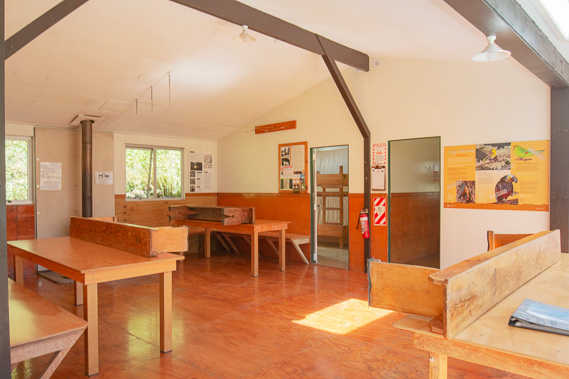 |
13:53 - Inside the main hut. Here I meet a young man from Sydney who has just arrived having run the track all the way from Lake Howden at the far end of the track having taken him just six hours. This is generally a twelve hour hike, but he managed to do the entire trek in half the time with a full pack, in his flip flops. |
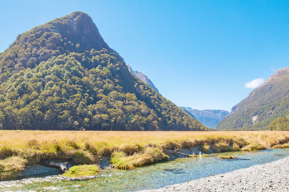 |
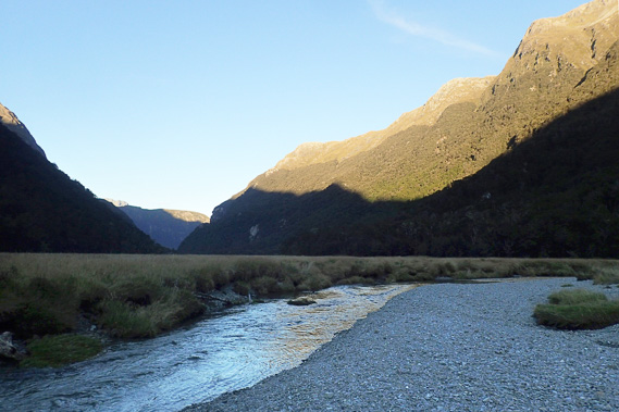
14:02 - Heading out to the river about a hundred metres in front of the hut once I've settled in, found a bunk and signed in. The river bubbles lethargically through the flatlands of tussock. Only a small amount of cloud lingers under some of the mountaintips. The start of the track at Routeburn Flats is just in front of the distant range. Looking back downstream from the first clearing. The dramatic gorge I have been ascending this morning is hardly visible. This would have at one stage been a hanging valley, where a glacier ended around the start of the gorge as it flowed in the much larger and deeper glacier of the Dart Valley and Lake Wakatipu. When the ice melted, a dramatic hanging valley was left and the river has since eroded the gorge. The retreating glacier would have left a lake, but erosion from the surrounding mountains have now turned this into a two kilometre long flat filled with gravel. Snow can sit here in this basin for weeks at a time in the middle of winter but for most of the year it is clear and the grass grows well. These flats are very prone to heavy frosts, and combined with frequent flooding, keeps the flat completely clear of trees as often the case in the South Island's valleys. |
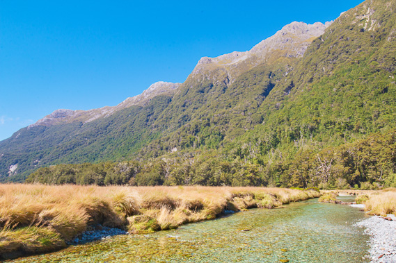 |
14:03 - This is the range I followed from the last bridge. The mountainsides are quite smooth having been carved out by a glacier. It rises to a series of unnamed peaks up to 1952 metres high. It is surprising they are unnamed and seldom climbed given the popularity of the track. |
 |
14:04 - Looking back to the hut. High above the hut is the hanging valley of Emily Creek, with the sharp 1815 metre high Emily Peak behind it. The track traverses across the front of this steep valley face, and over the next two days to Mackenzie Hut, works its way around directly to the other side of Emily Peak. In amongst the beech forest, the lighter coloured small trees to the right of the huts is ribbonwood, one of only a handful of deciduous native tree species in New Zealand. The beech trees are evergreen maintaining their colour throughout the year. |
 |
14:07 - In front of the mountain ridge which the north branch of the Route Burn flows from the valley to the left whilst the south branch flows directly behind me. This shot is taken by a lovely young Korean couple on a day trip where they got this far for lunch before shortly starting to head back out. This is a common day walk, with some of the fitter day walkers heading further up the track to the falls. |
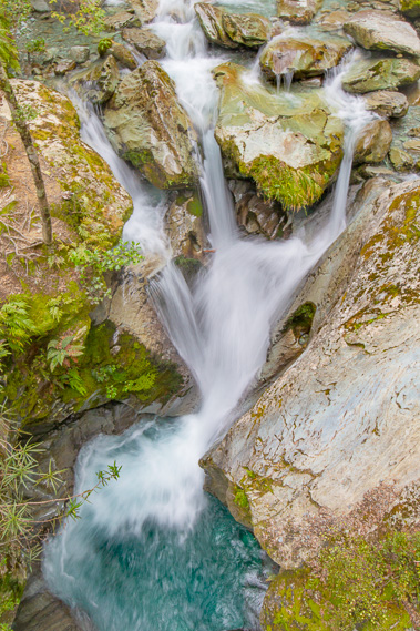
 |
14:19 - Emily Creek cascading out of the hanging valley in the distance. Emily Peak rises directly above the waterfall, with the 1607 metre high Emily Pass 200 metres below the peak to its right. This was named after Emily Forsyth who was the first person to traverse over the pass to Lake Mackenzie directly on the other side with her guide Jock Edgar in 1914. This is actually the shortest route to Lake Mackenzie, but I will be taking a longer, lower and far less precarious route over Harris Saddle further to the right to get to Lake Mackenzie. |
 |
14:28 - I follow a five minute track through the forest to the nearby camping ground a bit further up the valley. From here I can see the valley from which the south branch of the Route Burn cascades. The Routeburn Falls Hut is at the top of this saddle. That is where I will be heading tomorrow, and where most people starting the three day trip this end will finish today. |
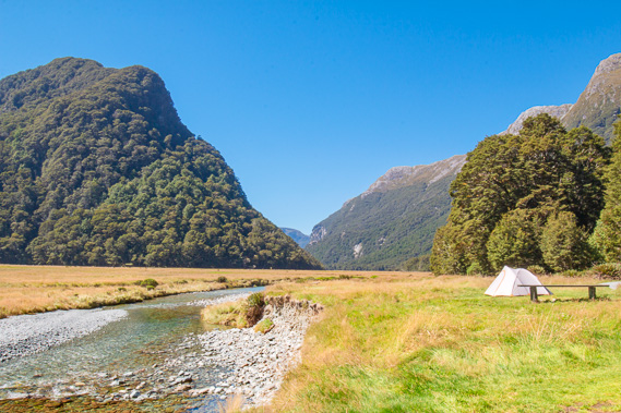 |
14:29 - A tent has been set up on the flats by one of the hikers. They have a very peaceful view over the river and valley. Hikers doing the three day trip with a tent have to spend the first night here as there is no camping ground at Routeburn Falls. There are camping grounds at Lakes Mackenzie and Howden. |
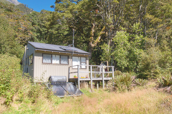 |
14:36 - I return through the forest back to the hut, passing the warden's hut just metres away from the main hut. It is small but looks quite elaborately set up. |
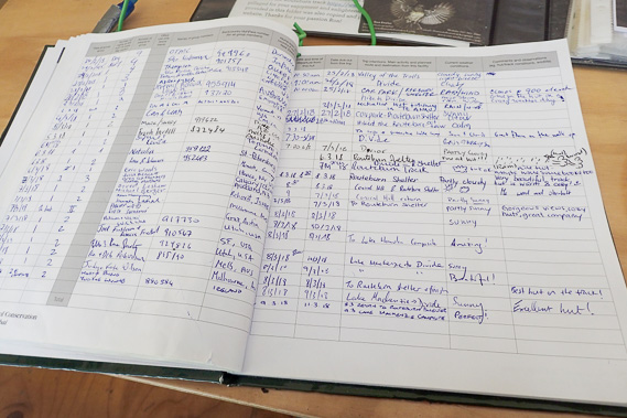 |
14:44 - Reading the comments in the intentions book. There seems to be a good mixture of people from New Zealand, Australia, and other parts of the world. The comments all seem positive as would be expected in such a stunning place. There is also a booking sheet where we need to put our tickets and bunk number in. A booking system was established in 1996 with the establishment of the New Zealand Great Walks to help cope with the large numbers of people now using the track - around 13,000 per year now. These huts do book out months in advance in the popular summer season, although it is not as insane as trying to book onto the Milford Track. |
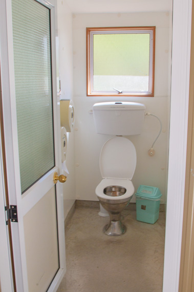 |
15:44 - Flush toilets - now common on the great walks, very different from the smelly flying insect attracting long drops once typical at all back country huts. |
 |
15:52 - The steep hill in front of the hut where the other stream goes around. Although it looks like a stand-alone hill, this is the end of the range extending from Mount Somnus. The end of the range has been cut off by the glacier running down the north branch before turning right around towards its terminus at the top of the gorge. |
 |
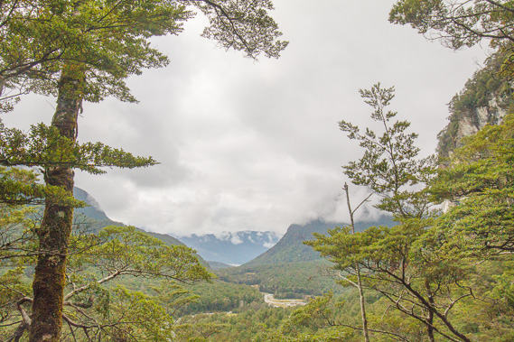
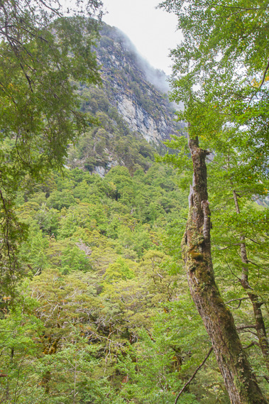
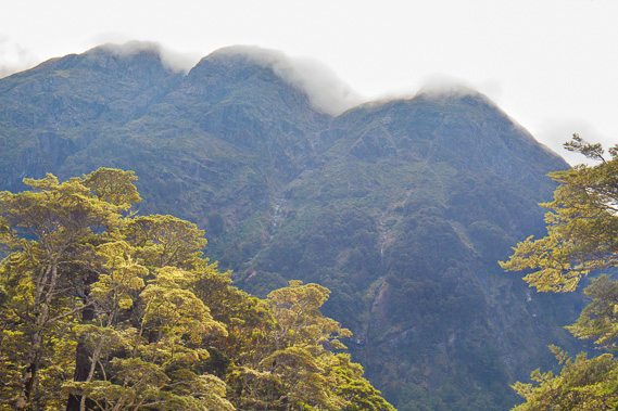
16:01 - A few people staying at the hut decide to explore the north branch valley track initially crossing the tussock fields before heading into the forest under the enormous Humboldt Mountains, the snow covered peak in the distance is the 2293 metre high Somnus with the slightly lower Mount Momus to its right. This range is actually higher than the main dividing range of the Southern Alps behind me. There are more mountains behind Mount Somnus on the other side of the Dart and Rees Valleys which are even more dramatic, but this morning's cloud had concealed their dramatic forms from view. |
 |
16:03 - The hut with the famous blackberry bushes in front of it. Apparently there is a good harvest every year in the middle of summer for the hikers to feast on. The blackberries have already finished for this season. |
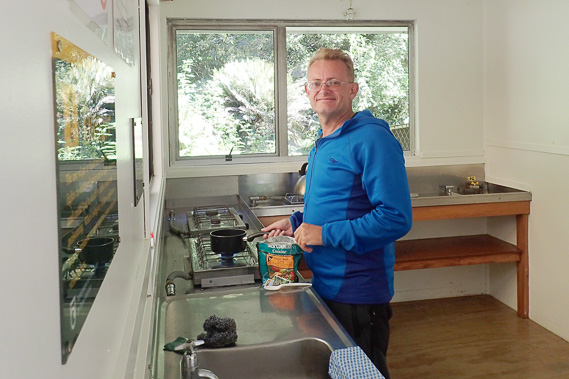 |
17:47 - I prepare a packet of dehydrated food for dinner. One of these packets produces a full meal for one. It's not as good as fresh food, but perfectly functional when on the trail. |
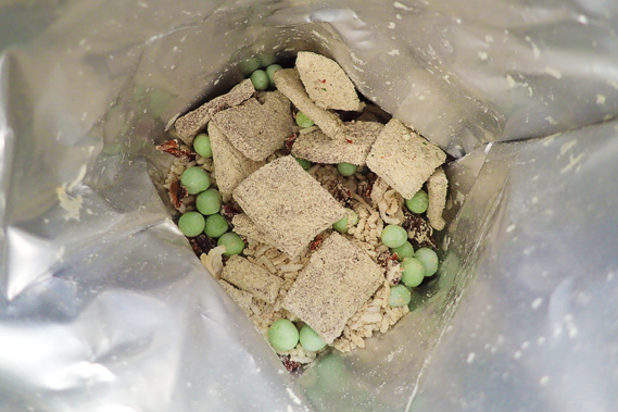 |
17:49 - This is what the food looks like when I open the packet. Very dry and not much there - the dehyrdation helps with it being very lightweight and ideal for these treks. |
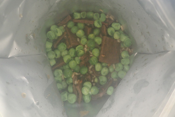 |
17:53 - What it looks like when I've added boiling water and let sit for about ten minutes. This is a full meal in a packet with nothing apart from the spoon to wash up afterwards - very handy modern cooking. Sure this isn't fine dining, but this functions extremely well on a long hike like this. Steam rising from the food steams up the camera lens. |
 |
18:00 - After dinner I follow the track back to the camping ground as the air quickly cools. The shadow of Mount Xenicus covers this area allowing me to get some good photography of the forest again. There are still a few red beeches here, but they prefer the warmer climes of the lower valleys. The trees here are mostly mountain beech and some silver beech, though they will be more common further up the mountain. The forest is quiet, but I do hear the faint tzeet tzeets of the iny rifleman, New Zealand's smallest bird. |
 |
18:15 - Reaching the camping ground, the mountain shadow has already stretched across the valley allowing the mountains to almost perfectly reflect in a pool in the river. |
 |
18:42 - The mountain shadow rises in the mountains as the air temperature continues to drop. I return to the hut. There have been huts here since 1909, and before that the flats were used as a camping base. The Bryant family ran guided hikes from their guesthouse at Kinloch at the head of Lake Wakatipu across from Glenorchy up to here for the night before leading their group up to the Harris Saddle. The family ran these tours for almost a hundred years. |
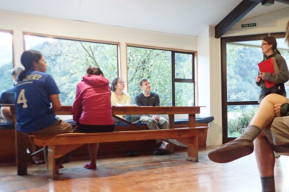 |
19:11 - The warden does an evening hut walk, covering most of the trail as some have (like me) come up from Routeburn Shelter. Others have come across the mountain from Lake Mackenzie and a few have even done from Lake Howden, an epic hike. Most of the others heading west are going to Lake Mackenzie tomorrow, and a few are going to Lake Howden. |
 |
20:07 - After the hut talk, I return to the valley where the air is quite cold and the sun has set over the distant horizon. |
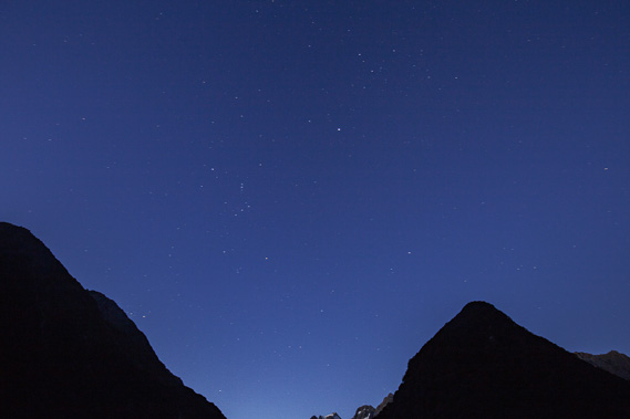 |
20:16 - The stars are coming out overhead (spot Orion...). There are some glow worms about a minute up the track, but by the time I get there they have all turned out due to other shining lights at them. Instead I head out in front of the hut to photograph the brilliant star field. There are occasionally long tailed bats, one of New Zealand's only native mammal. They are rarely seen though, and don't make an appearance tonight. |
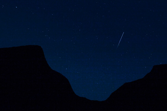 |
20:47 - Capturing the lonely trail of the International Space Station as it flies four hundred kilometres overhead, capturing the last of the sunlight as it fades out as it heads down towards the horizon. This is looking towards the gorge. |
|