Introduction to today's journey
There's no better place to find yourself than sitting by a waterfall and listening to its music.
- Roland R Kemler
THE ROUTEBURN track sits amongst a dramatic area of the Southern Alps, a little south of any of its taller peaks rising over three kilometres above sea level, but being closer to the Antarctic. These mountains are perhaps just as rugged, being part of an uplifted formation of what is now the Pacific Plate as it rides over the northward moving Indo-Australian plate. The plate boundary here runs along the west coast.
As the mountains have risen to high altitudes, large glaciers during the ice ages have deeply scarred the landscape with enormous U shaped valleys flowing into each other. Some of these glacial valleys are much higher than the valleys they flow into, creating hanging valleys, and today I traverse the side of one hanging valley, into the outflow of another. The rising landforms have also created dramatic fault line scarring the landscape creating spectacular ravines and turns in valleys throughout the Southern Alps. I will be fortunate enough to discover one of these fault lines where the Route Burn dramatically leaps from one hanging valley down towards the other.
Today's trek is relatively short, starting at Routeburn Flats, and following the side of the mountain along a moderately ascending track crossing Emily Creek and rising to the bushline to the spectacular Routeburn Falls carved deep along a fault line as it tumbles out of a hanging valley and cascades its way down the side of the mountain to the now distant Routeburn Flats. I stay at the nearby Routeburn Falls Hut.
Today's Journey
Distance trekked today: 2.3 kilometres.
Total distance trekked to date: 9.8 kilometres.
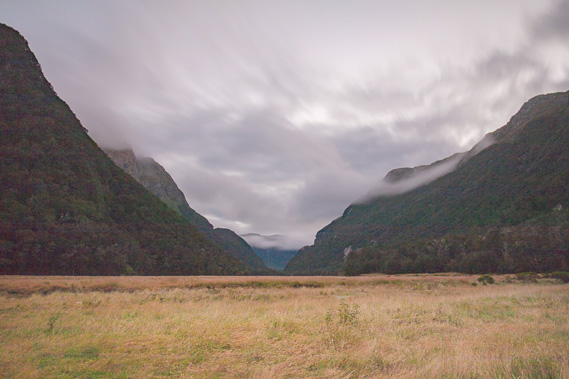 |
07:31 - Early morning at Routeburn Flats before sunrise. There is a chill in the air, but it is no colder than when I was out here last night. Some low cloud hovers over the mountains above the bushline, swiftly moving across from the south brought on by a small Antarctic frontal system. This hopefully means the cloud cover is going to clear to bring sunny weather for a couple of days. |
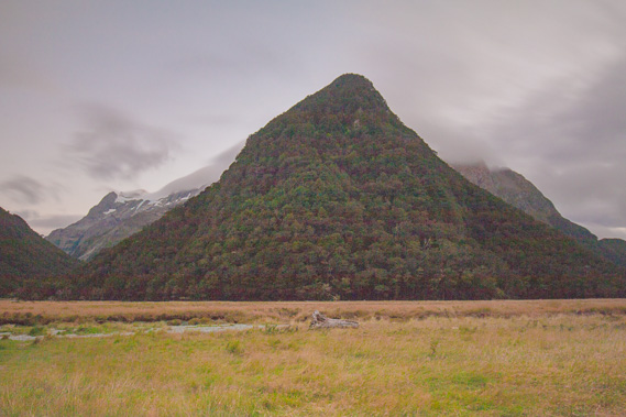 |
07:32 - The hill directly across the river towers up towards the sky. This would have been the view greeting the Bryant's guests as they prepared for the long hike up the mountain to Harris Saddle, a return journey they would have to complete before night fall. |
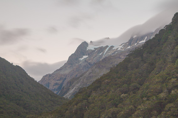 |
07:39 - Strong winds are piercing the mountaintops making them very cold and exposed. This is summer. During winter the snow would often be right down to the flats and even down to Lake Wakatipu, making the mountaintops a very harsh and exposed ice field. The pointy summit of Mount Somnus is just poking above the clouds created by the condensation from a rapid drop in temperature as they cross the sharp ridge. |
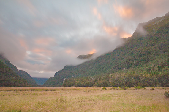 |
07:50 - The first light of the sunrise burns across the clouds over the valley as I have breakfast at the picnic table outside the hut. The cloud cover seems to be thickening now even though the weather forecast is for fine weather. Here the mountains make their own unpredictable weather. |
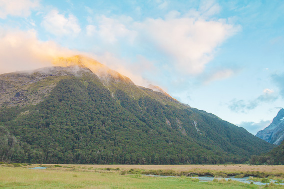 |
07:55 - The sunrise glows on the high slopes of Mount Xenicus as I sign out ready to head up the hill towards Routeburn Falls. |
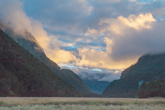 |
08:00 - Brightly glowing clouds hover over the dark gully of the Routeburn Gorge as I leave the hut. |
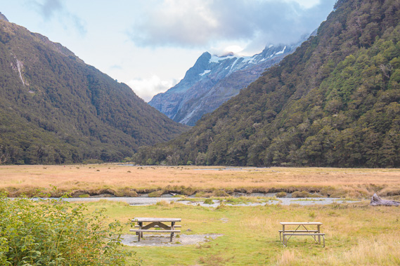 |
08:28 - I pause for one last look at the blackberry bushes and picnic tables in front of the hut as I set off up the mountain. |
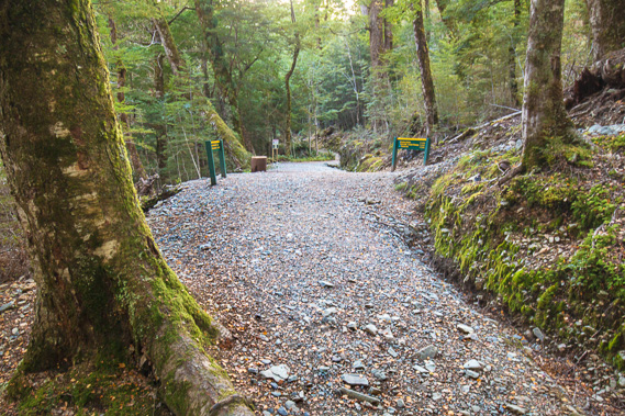 |
08:36 - Reaching the junction about five minutes from the hut. The track going straight ahead is the one I took yesterday, leading back down the gorge to Routeburn Shelter. The track to the right heads over the mountains towards the other end of the track. From this junction the track steeply ascends across the side of the mountain doubling back towards Routeburn Falls. |
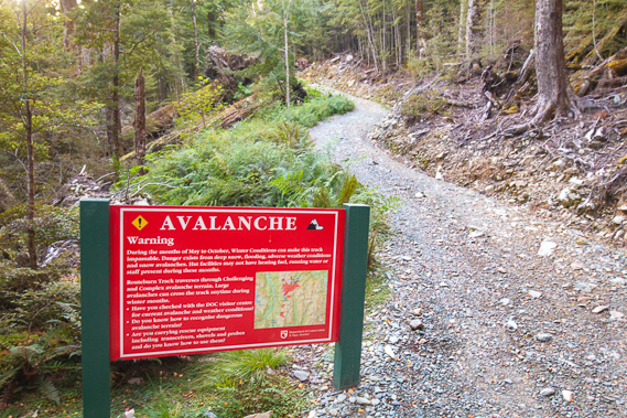 |
08:38 - A hundred metres past the junction I reach the start of the avalanche warning area. I'm under the mountains now and these are high enough to accumulate a lot of snow over winter bringing down dangerous avalanches into the bottom of the valley, particularly during the spring melt. Fortunately there is no snow on the mountaintops at this time of year and there is no heavy rain forecast so the avalanche and landslide risk is very low today. |
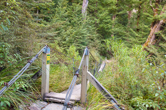 |
09:16 - After quite a slow climb up the gravel track (fortunately the gravel was laid only a few months ago making the track of excellent condition), I reach a swingbridge crossing a stream tumbling down the mountainside unseen through the scrub and boulders. This section of track is almost as steep as the steeper inclines along the Routeburn Gorge. |
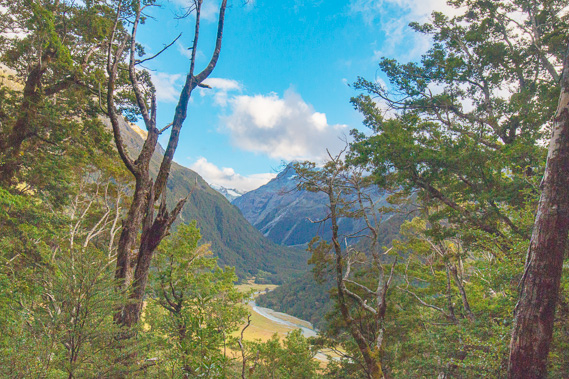 |
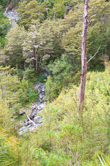
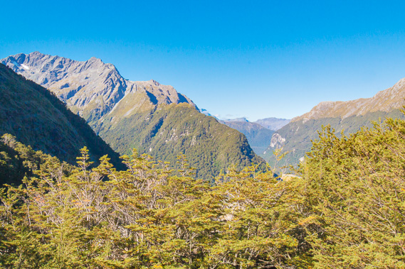
09:22 - From the bridge the track continues rising moderately, but not as steeply as the first section from the junction. I am already quite high above the Routeburn Flats. The thick forest of mountain beech conceals the view, but here I find a small gap between the vegetation to view the north branch of the Route Burn. |
 |
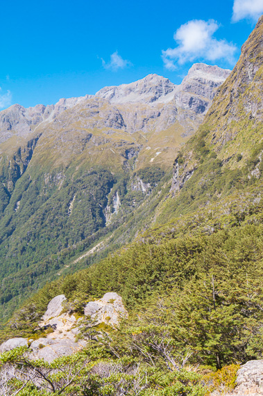
09:28 - Although the gradient of the track has moderated, the terrain becomes very steep as I traverse across the steep glacial valley under the hanging valley from where the Emily Stream drops. |
 |
09:33 - Crossing Israeli Creek. The cascading water tumbling down the mountainside spreads out over the rock from a narrow gap before disappearing under the boulders below the bridge. |
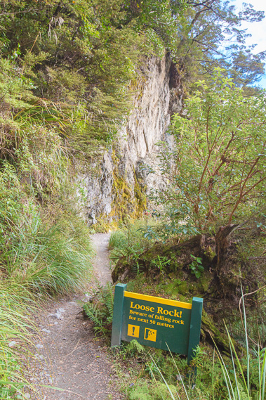 |
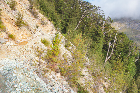
09:39 - The track has narrowed but remains in very good condition but I reach a very steep bluff with rockfall danger. I quickly pass through this area even though conditions are very good. It would be a different story in heavy rain though, with debris coming down the mountain. |
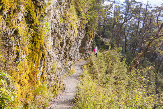 |
09:40 - The track crosses the very steep escarpment as the first hikers heading out from Routeburn Falls coming the other way appear. |
 |
09:42 - View back down to Emily Creek having crossed over its high swingbridge. I couldn't get any pictures from the bridge due to its precariousness and the number of people coming through. |
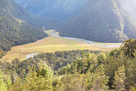 |
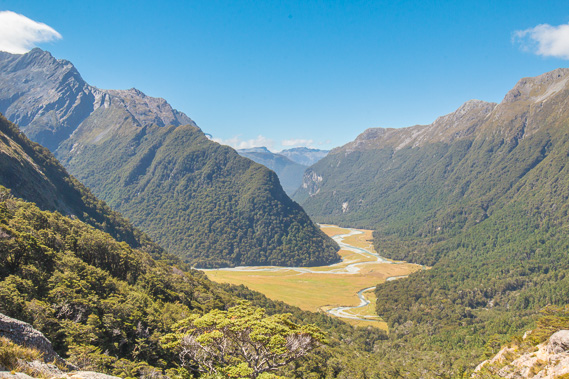
09:47 - The track opens out at the end of a bluff giving a spectacular view of the Routeburn Flats, showing the north branch of the river draining from its old glacial valley. I can just see the south branch poking out from behind the trees on this side of the valley. It is a long way down, but somewhere near here is the Routeburn Falls, which would have to be magnificent to be cascading so steeply down this mountain. |
 |
09:48 - The track crosses a landslide, the sole remnant of a huge storm that struck in January 1994 devastating much of this end of the track. All the bridges between here and Routeburn Shelter were washed out, an enormous landslide occurred here (it will take several more decades to completely heal) and hundreds of metres of track down the Routeburn Gorge were washed out. The damage was so severe the New Zealand army were brought in to rebuild sections of the track over two months before the track could be reopened. |
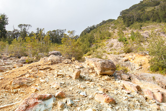 |
09:49 - Looking up the landslide where the boulders are still loose and will no doubt keep coming down during big storms until the very slow growing forest vegetation fully regenerates in a century or two. |
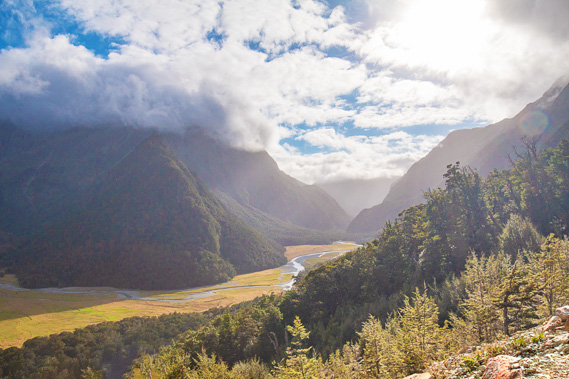 |
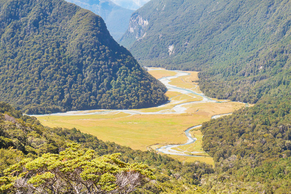
09:50 - View back down the Route Burn valley over the now distant flats towards the gorge as the morning sun climbs higher into the sky. The clouds have broken enough for the bright sunlight to stream through. |
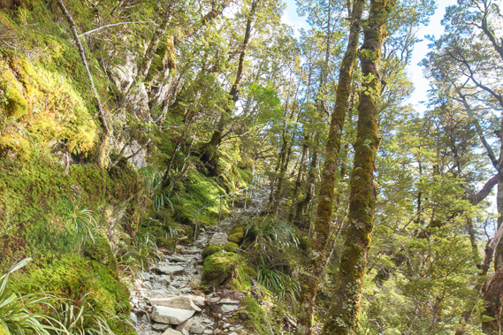 |
10:14 - Once across the landslide the track becomes a bit rough and rocky as it moderately ascends negotiating the steep terrain. The trees are significantly smaller now, indicating the bushline must be near. |
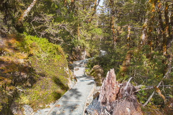 |
10:22 - Fortunately the rough terrain doesn't last long as the track here is newly constructed with boxing and levelled and compacted gravel. This must have been installed very recently as there is no rainwater erosion in the gravel at all. The terrain moderates here but the track still rises steeply. |
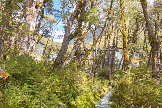 |
10:26 - The terrain continues to flatten as the track continues rising to some buildings that seem to appear from nowhere. These are the guided walker huts with the independent hiker hut (where I will be staying) to the right of this shot. |
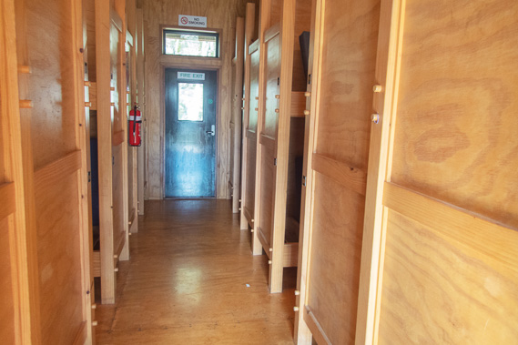 |
10:38 - Inside the bunkrooms. This hut was quite recently constructed in 1996, replacing the original hut built here in 1967. The guided walks hut looks relatively new as well, replacing the original hut built in 1968. |
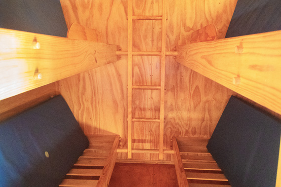 |
10:39 - I secure a bunk - one of the lower ones. The advantage of arriving in the morning after a short trek is being one of the first to arrive and get a good bunk. |
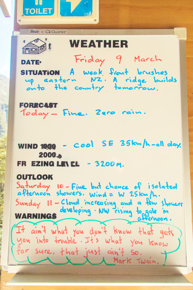 |
10:40 - The weather forecast - it is looking good for the rest of today and also for tomorrow when I cross the saddle. |
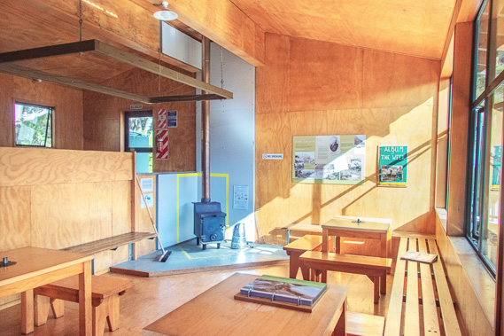 |
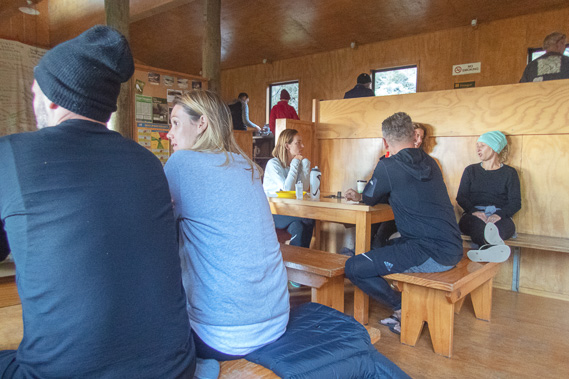
10:43 - Inside the main room of the hut, with a small log burner and several solid wooden tables for dining. The kitchen preparation area is to the left behind the wooden screen. The late morning sun streams into the dining area making this room comfortably warm. |
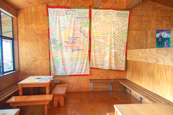 |
10:44 - Part of the dining area where large banners with greetings from multiple countries appear. The Great Walks attract a lot of international travellers, even more so than locals. |
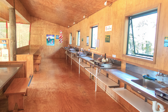 |
10:45 - The hut kitchen with plenty of space for food preparation and movement. It is very quiet here now, but no doubt will become a bit crowded at dinner time tonight. |
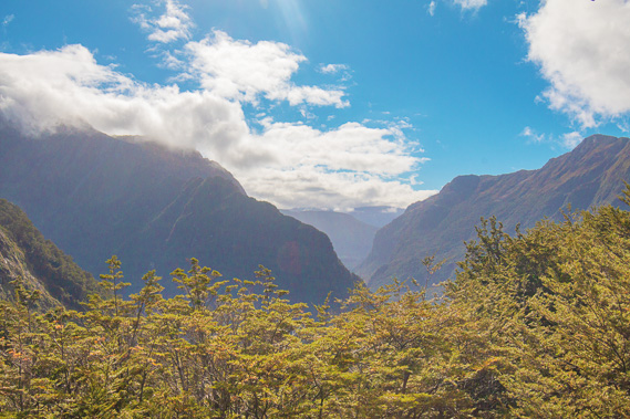 |
10:46 - View down the valley from the hut balcony. The mountains surrounding the Routeburn Flats and the precariously steep opening into the Routeburn Gorge are clearly visible, but the mountain beech trees hide the view of the flats. There is still some cloud around but it seems to be starting to clear now. The Maori name for the Route Burn is Te Komama which likely means "running out of a small opening'. The opening presumably refers to the gorge. |
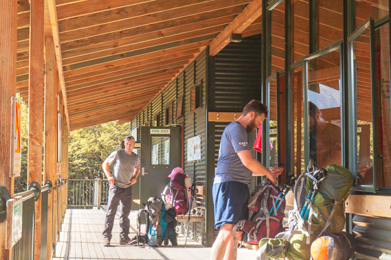 |
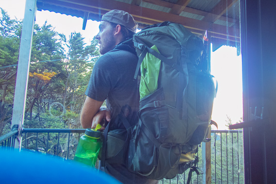
11:18 - More hikers arriving. These guys had an early start at Routeburn Shelter this morning making good progress up ascending the gorge and the mountainside. |
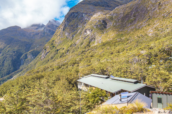 |
12:17 - I head up a short side track above the hut. The hut is sitting perched at the edge of the hanging valley with the roof of the warden's hut visible on this side of the main hut. |
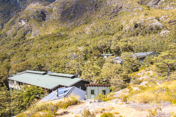 |
12:18 - The guided walkers' huts are behind the independent walkers' huts. This is one of three great walks where separate huts are available for hikers who prefer to be guided (the others being the Milford and Abel Tasman track). They are set in a much more sheltered position, but lack the dramatic views of the main hut. The weather here at around 1000 metres above sea level is harsh. The ranger records the rainfall during the season between November and April, with rainfall over the six months averaging 2200 millimetres. The annual rainfall would be close to double this figure. |
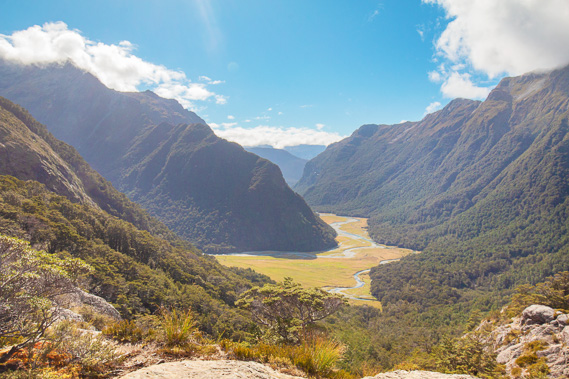 |
12:19 - I reach an exposed rock about fifty metres from the hut. From here I have spectacular unobstructed views over Routeburn Flats and down the gorge. The towering hill opposite the Routeburn Flats hut turns out to be a low truncated ridge at the end of the range, cut off by the glacier coming down the valley, at least as deep as the height of the bushline in a past ice age. The glacier abruptly turned here probably due to local fault lines moving the mountains as the Pacific Plate rides over the Indo-Australian plate about 30 kilometres behind me. |
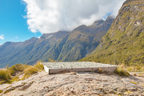 |
12:20 - The helipad above the hut, where supplies and emergency pickups come. Otherwise everything and everyone comes in on foot. |
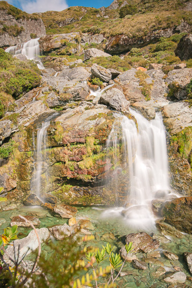 |
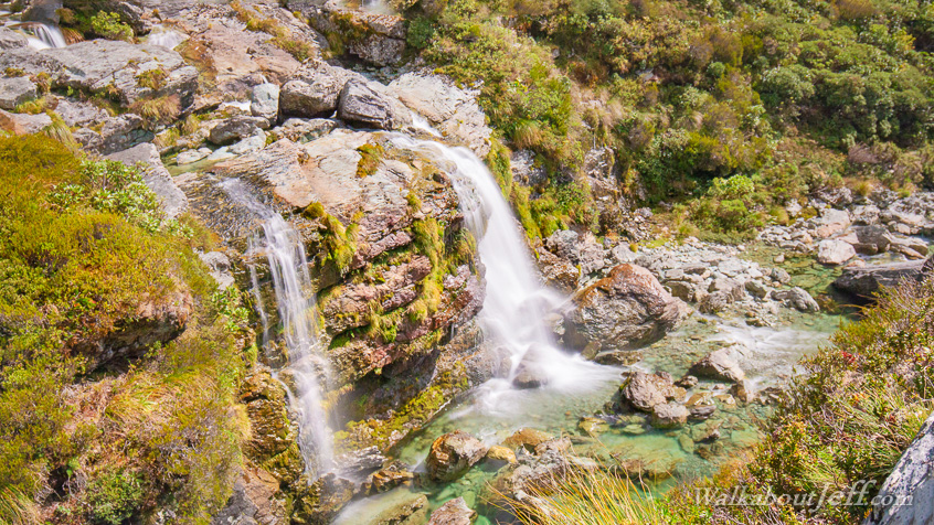
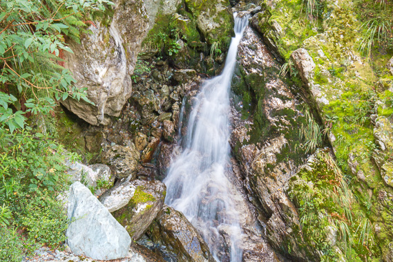
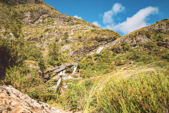
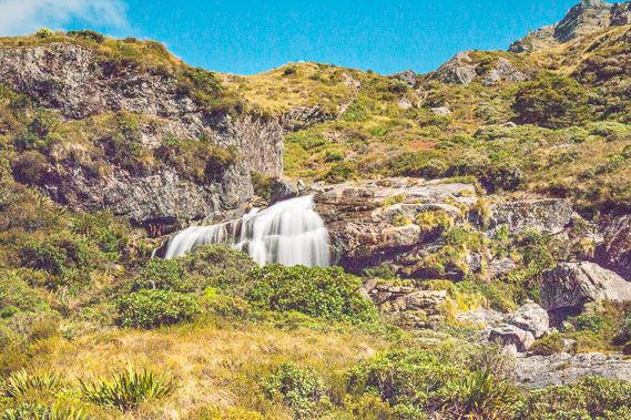
12:31 - Heading across a short distance from the outcrop I reach the spectacular Routeburn Falls, cascading down a total of 176 metres before tumbling down steep rapids through giant boulders all the way down to Routeburn Flats. |
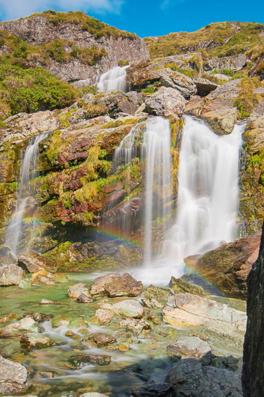 |
12:43 - I follow a steep ravine almost to the river and get this spectacular shot with a rainbow dancing across the front of the main waterfall. The waterfalls have been formed by a fault line running across them and going behind the huts. before crossing the front of Mount Xenicus. This has contorted the landforms and contributes to the glacier that once filled the north branch of the river suddenly turning to the left at what is now Routeburn Flats. The waterfall is slowly eroding its way through the tough Permian/Triassic Momus sandstone formation which is a lot more erosion resistant than the soft rock of the hanging valley behind it. |
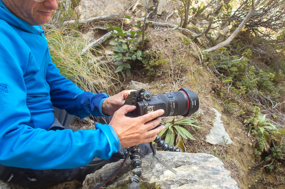 |
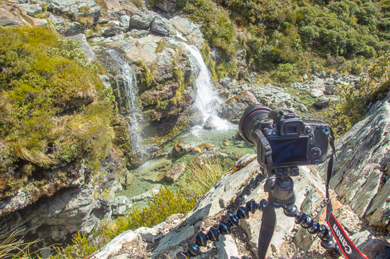
12:56 - Setting up the camera on a rock to take more pictures of the waterfall. I arrived here in the late morning. Although this morning's walk was quite a climb to this hut, it had been rather short, so I have all afternoon to get some good shots of the waterfalls and to rest up before tomorrow's big trek crossing Harris Saddle to Mackenzie Hut. |
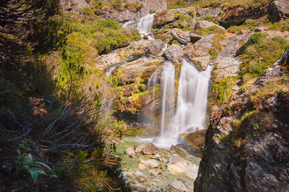 |
13:20 - Another view of the falls from a little higher in the ravine. The rainbow lingers in the bright sunlight. I could only do these long exposure shots using a ten stop filter which only lets in 1000th of the light, allowing me to keep the shutter open for several seconds. |
 |
14:01 - View above the falls where the track steeply ascends over the rock towards what is presumably a hanging valley above the cascades. This steep section is something will make for a tough start to wake me up tomorrow morning as I head up towards the saddle. |
 |
14:12 - I find another vantage point at the top of the cliff and set up the camera on my small tripod to photograph the waterfall. |
 |
14:23 - A waterfall above the main falls where the river starts its leap out of the hanging valley. |
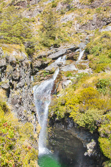 |
14:46 - Part of the falls dropping into a deep pool carved open along the fault line. |
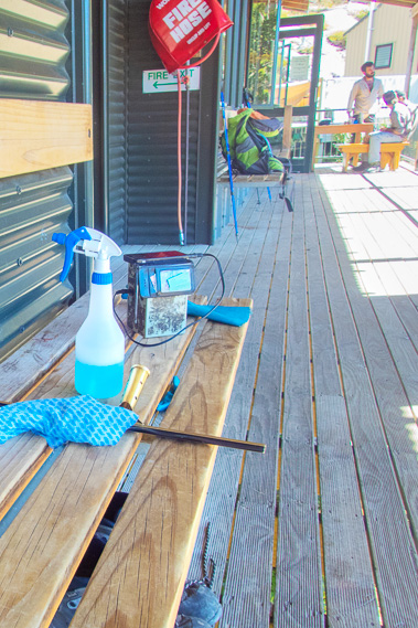 |
15:08 - Returning to the hut where the warden is doing some cleaning, and has a small radio bring the tinny sounds of civilisation to this otherwise remote outpost. |
 |
15:19 - I return up to the rock after a late lunch at the hut for a view down the Routeburn Flats. A few small clouds still linger over the mountaintops but the weather is otherwise fine with almost no wind on this normally exposed spur. |
 |
15:20 - The camping ground at Routeburn Flats is visible, but the hut is hidden behind the bluff to the right. The towering bluffs of Routeburn Gorge where I had passed this time yesterday are clearly visible. |
 |
15:24 - View towards the Emily Hanging Valley hidden behind the next ridge. |
 |
16:51 - View from the main porch of the hut. The dark shadows are starting to creep across the mountains as the sun begins to fall to the west. |
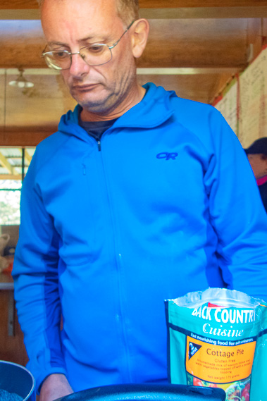 |
17:30 - I cook another dehydrated dinner. I did pick different flavours for each night to break up the monotony of eating dehydrated food every night. Tonight I'm having Cottage Pie. |
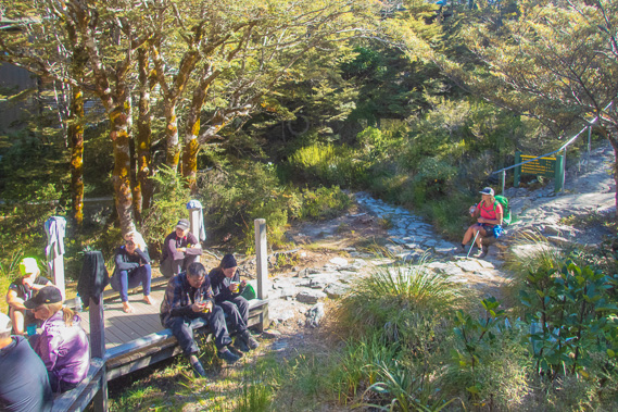 |
17:36 - Hikers who have arrived from Mackenzie Hut are having dinner outside in the shelter of the forest under the last rays of sunlight before the sun sinks behind the mountain. The porch is very cold now. It's amazing how cold it is when you are at 1000 metres above sea level. |
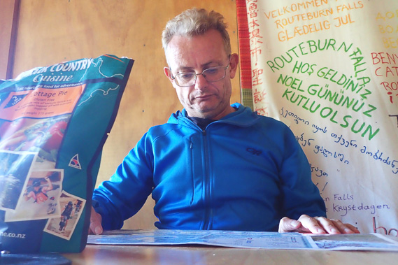 |
17:42 - Reading the map checking out tomorrow's route as I wait for the boiling water to cook my dinner in the bag. |
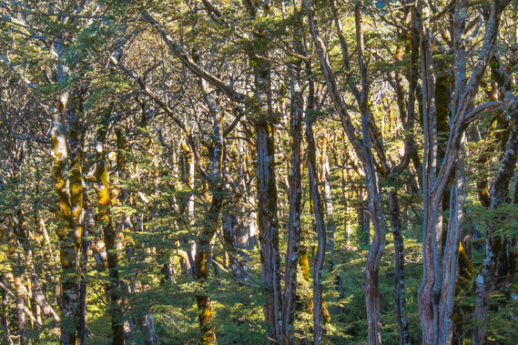 |
18:02 - The forest here at the bushline gets darker as the shadows lengthen. |
 |
18:19 - The hut is now full of people. This is a bigger and much bigger hut than Routeburn Flats. Most people hiking the track take three days, staying here and at Lake Mackenzie. Routeburn Flats is mainly for people who do an overnight trip through the gorge, and also for those who book late missing out on this hut. This is some of the more popular great walks, so booking well in advance is needed. |
 |
18:54 - A hiker has arrived from Lake Mackenzie and briefly resting here before doing the last bit down the hill to Routeburn Flats. |
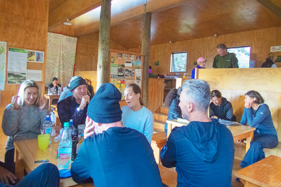 |
18:55 - Very busy hut tonight. The warden mentioned most people staying here tend to be overseas travellers, but there are two large groups of Aucklanders here tonight making the kiwi population more than those from overseas. |
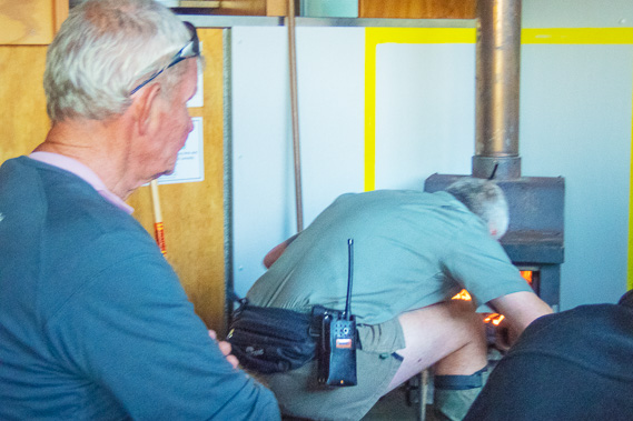 |
19:13 - The warden lights the fire as it is very quickly getting very cold outside with the plummeting subalpine temperature. |
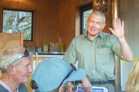 |
19:16 - The warden talking about the track and conditions, explaining how he takes the weather forecasts and customises it to the local conditions as he has worked here for a long time, but says he is quite young compared to some wardens on the Milford and Hollyford tracks. |
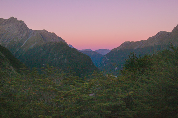 |
20:32 - The post-sunset sky is perfectly clear of cloud as the air quickly cools. It is now very cold out on the porch. |
|