Introduction to today's journey
Wooden bunks with fern at Routeburn - very hard; iron mesh at Howden, with some give - these creaked loudly but were much from comfortable.
- Charles Brasch, 1950
LAKE Mackenzie remained completely elusive to explorers until it was discovered by accident as the proposed track from Harris Saddle to Lake Howden was being surveyed in 1909. This surprise discovery eventually led to the construction of one of the main huts and camping grounds along what is now the Routeburn Track. It also gives access to this otherwise very remote corner of Fiordland.
The Greenstone Track heading up from the head of Lake Wakatipu crosses a surprisingly low pass before following Lake Howden. From the mouth of the lake it drops moderately into the Hollyford Valley. This track was for several centuries the favoured route of the Maori people crossing between Otago and the Fiordland greenstone routes to the south west, and to the West Coast settlements to the north. The much more difficult route over Harris Saddle was only used by those going to the small greenstone field at the bottom of Routeburn Gorge.
Today's trek starts from the remote Lake Mackenzie, heading up a rough and moderately steep track back up above the bushline before roughly maintainig altitude as it continues heading upstream high above the Hollyford River. Some of the terrain is dramatic passing a spectacular waterfall. Eventually the track turns and descends into another hanging valley to Lake Howden to the hut where the Routeburn Track intersects with the Caples Greenstone track.
Today's Journey
Distance trekked today: 8.6 kilometres.
Total distance trekked to date: 31.7 kilometres.
 |
07:41 - Looking south west from the hut as the first rays of morning sunlight hit the summit of the dramatic Mount Christina. Milford Sound is about ten kilometres behind it. |
 |
07:43 - Looking across the tranquil waters of Lake Mackenzie to the dramatic terrain of Emily Pass. Hard to believe Routeburn Flats is just on the other side of this pass. The lake sits in a small depression at 889 metres above sea level with no outflowing stream. The huts are inside the depression. |
 |
07:44 - Looking back up yesterday's track just visible as a scar crossing the mountainside. Thankfully that section is finished for me, but hikers heading to Routeburn Falls today will have to start their day negotiating this long climb as a tough to their journey towards Harris Saddle. |
 |
07:50 - I return to the hut for breakfast. The warden's hut is to the left. Although the new track heading through here between Harris Saddle and Lake Howden was first opened in around 1920, the first hut wasn't constructed here until 1961 making for an even longer walk over Harris Saddle. The current hut was built in 1982 replacing the old one. |
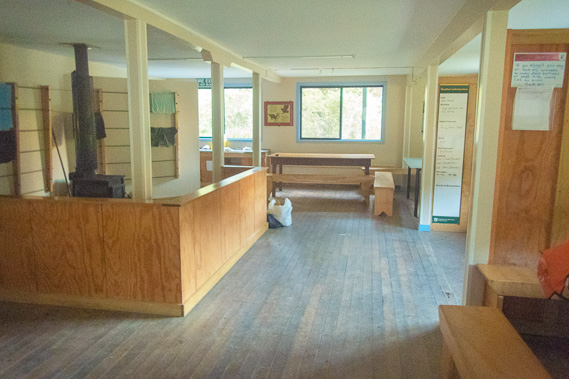 |
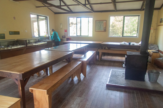
08:00 - Inside the dining area of the main hut. A large wood burner provides good heating and it is spacious to fit lots of people hiking this popular track. |
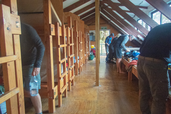 |
08:01 - The bunkrooms of the hut upstairs from the dining area. There are 50 bunks here in this nice A framed attic. Everyone is packing up to head off towards their next destinations along the trail. Some are walking out to the end of the track at The Divide, and others are heading the other way to Routeburn Falls. |
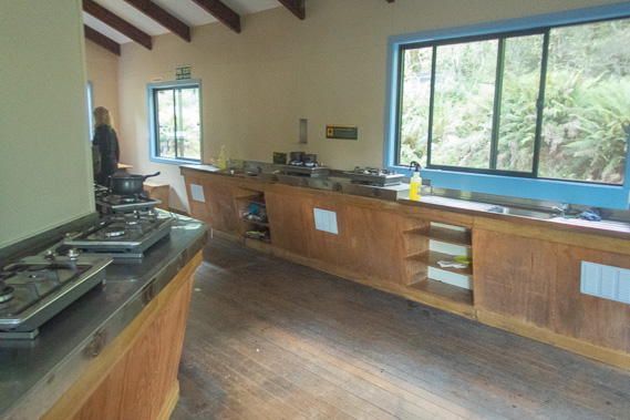 |
08:12 - The kitchen just behind the downstairs dining area. There are lots of gas stoves and sinks for cooking. |
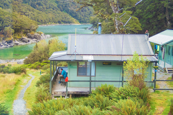 |
08:32 - The warden's huts and the turquoise water of the lake. The warden's hut was built in 1992 at the same time major renovations and extensions were done to the main hut to expand it for the increasing numbers of hikers. There is a camping ground a few minutes walk around the right hand side of the lake. This camping ground was constructed in 1990 following the end of a ban on camping in the basin. This is the first camping ground since Routeburn Flats. |
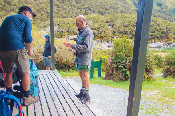 |
08:37 - Evan the warden is advising us of an update to the weather. It is looking good today for my relatively short hike to Howden Hut, but expected to cloud over later and rain tomorrow. The hikers heading across Harris Saddle are in for a good day today. |
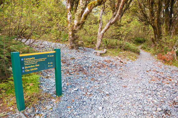 |
08:45 - Reaching the junction where I continue heading towards Howden Hut today, and onto The Divide tomorrow. Most people heading in this direction will be hiking out to the end of the track at The Divide today. Nearby the original track heading down Pass Creek to the Hollyford River leaves the main track. |
 |
08:49 - Lake Mackenzie Lodge, the guided walkers' hut is about five minutes past the main hut headng towards Howden. |
 |
08:50 - The track heads over the lip of the Lake Mackenzie Hanging Valley depression. Curiously there is no stream flowing out of the lake. The water draining it must seep through the gravel and boulders deposited by the most recent glacier to run down this valley. |
 |
08:53 - Looking back towards the lake before the track enters the forest. This is my last view of yesterday's track scarring across the side of the valley. |
 |
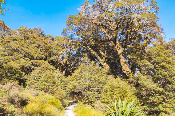
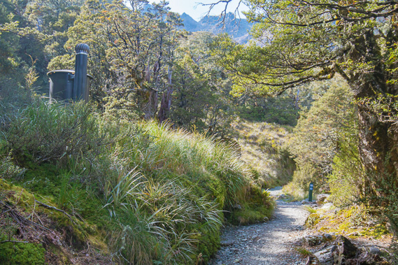
08:57 - The track enters the forest. It is narrow but covered in gravel. The undergrowth is very thick under the silver beech rainforest. |
 |
09:02 - The track becomes rougher making progress a bit slow over the lumpy and rocky narrow track. |
 |
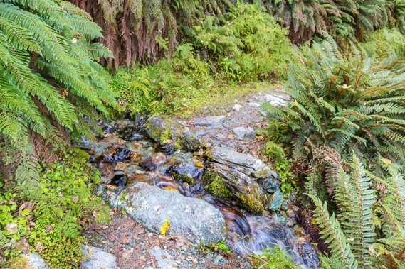
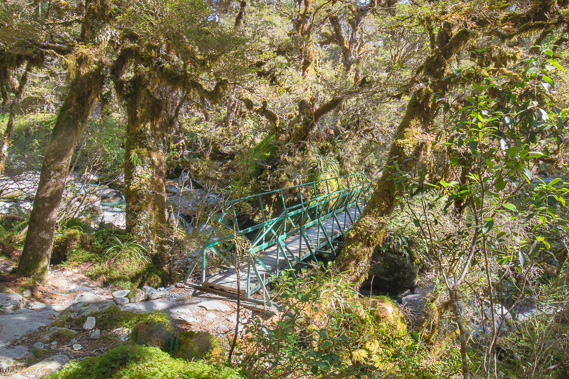
09:04 - One of several bridged streams I cross heading down the mountain past moss and fern covered rocks. |
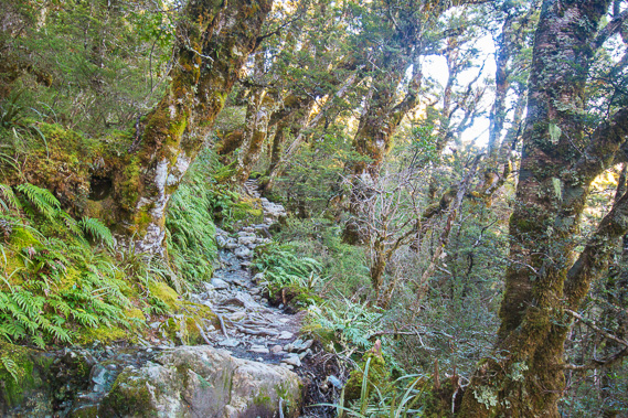 |
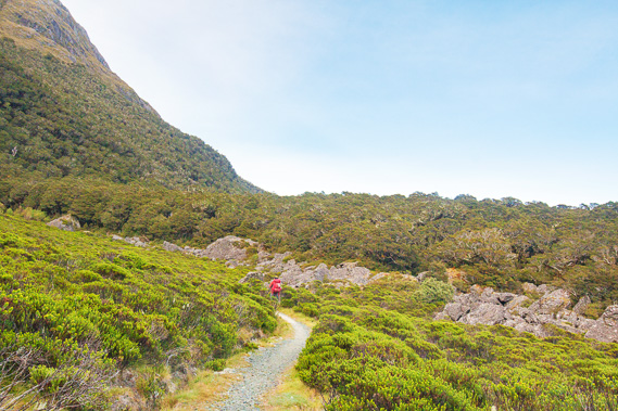
09:08 - The track becomes quite rocky once out of the hanging valley with moss covered silver beech clinging to the mountainside high above the Hollyford River. This is the roughest the track has been over the entire trek. |
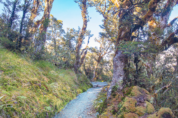 |
09:31 - Fortunately the rough track doesn't last long and once more we are back on gravelled track going through the thinning forest as I approach the bushline. |
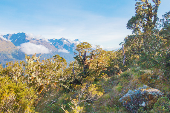 |
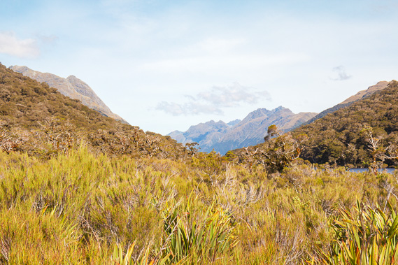
09:34 - View of the Darran Mountains through a clearing in the bush. Some low cloud lingers on the sides of the mountains and some high cloud is now passing overhead. |
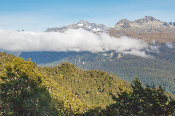 |
09:47 - View of the valley across to Mount Christina as a large bank of cloud passes the other side of the valley. |
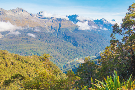 |
09:49 - First view of the Hollyford River 740 metres below me as it quietly flows down the dramatic glacial valley towards the Tasman Sea. |
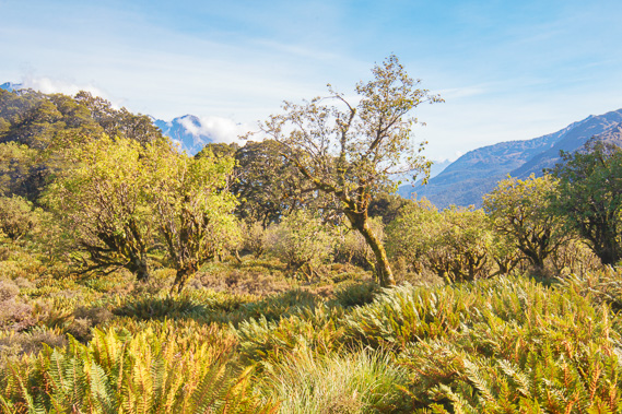 |
10:03 - The terrain flattens as I reach The Orchard, a section at the bushline at 1020 metres above sea level. This is named due to its spread out ribbonwood trees as if they were planted. The ground is covered in a thick undergrowth of ferns. |
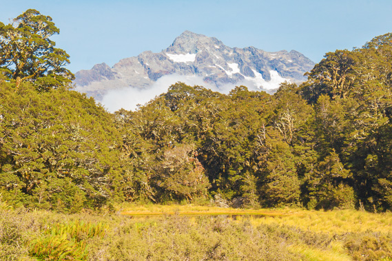 |
10:04 - Mount Christina rises dramatically above the far end of The Orchard. |
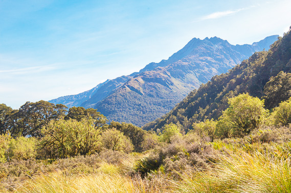 |
10:05 - Looking back across The Orchard to Ocean Peak, the mountain I had hiked around yesterday. The Lake Mackenzie hanging valley is behind the nearest ridge. |
 |
10:06 - Entering the bush with ancient cloud forest silver beech trees rising high. |
 |
10:22 - A little stream crosses the track. Since doing this track, a huge storm in February 2020 has brought down huge landslides from about here through to the end of the track, closing it this side of Mackenzie Hut for the the rest of the season. |
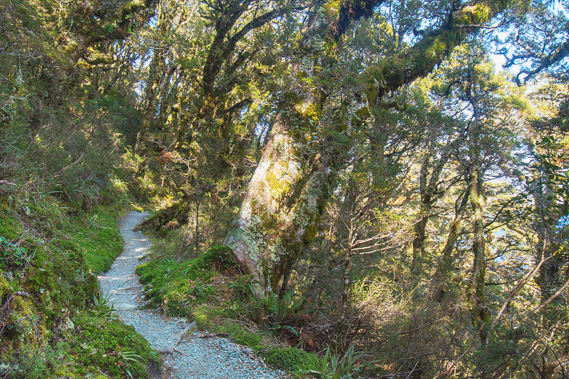 |
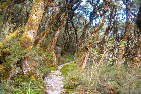
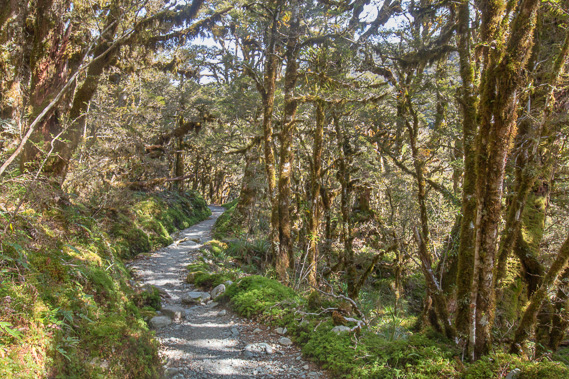
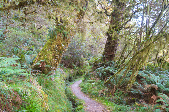
10:33 - The track remains in good condition as it winds its way between the massive trees. |
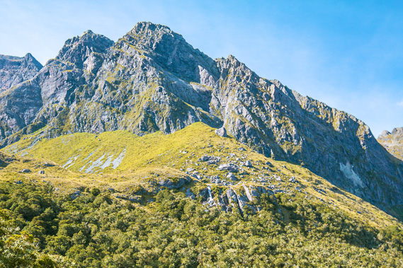 |
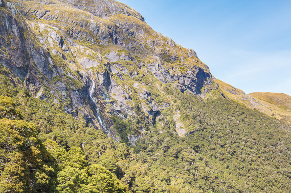
10:41 - Looking up a dramatic unnamed mountain on the other side of a hanging valley just above the tree line. I can see a waterfall dropping from the end of the hanging valley, draining an unseen lake. |
 |
10:42 - I reach a toilet randomly located in the middle of nowhere, perhaps the halfway point between the huts. |
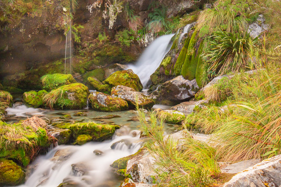 |
11:04 - Long exposure shot of a small cascade on Sunny Creek. Living up to the creek's name, the sun is out so I need to use the strong ND filter to keep the shutter open long enough to blur the water. |
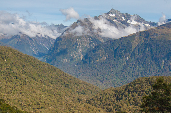 |
11:22 - Looking from a small clearing across the upper Hollyford Valley to Mount Christina as the cloud appears to start dissipating with a gentle breese now starting to blow up the valley. |
 |
11:25 - Getting closer to Earland Falls. |
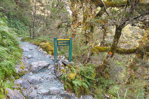 |
11:42 - Passing a high water track heading down the hill bypassing the waterfall. Conditons are normal with no recent heavy rain, so I stick to the main track. |
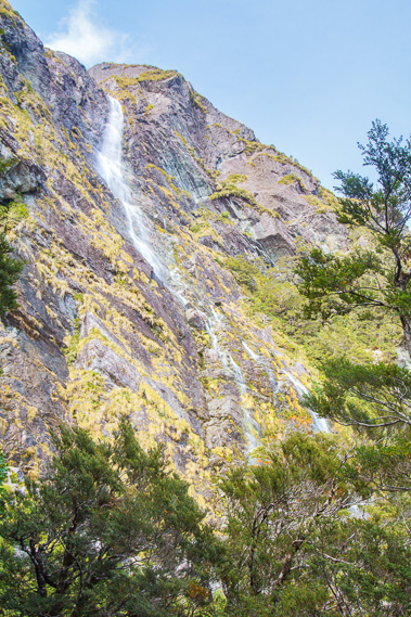 |
11:43 - The start of the cliff where Earland Falls tumble down out of Lake Roberts. |
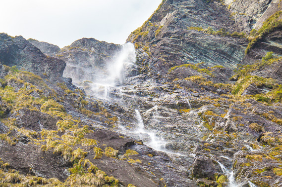 |
11:52 - The track passes directly below the waterfall as it quietly cascades down the mountain. The water would make the track impassible when in flood. |
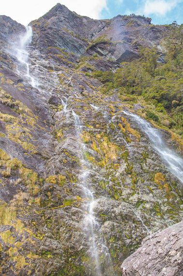 |
11:53 - The full 178 metre drop of the waterfall. |
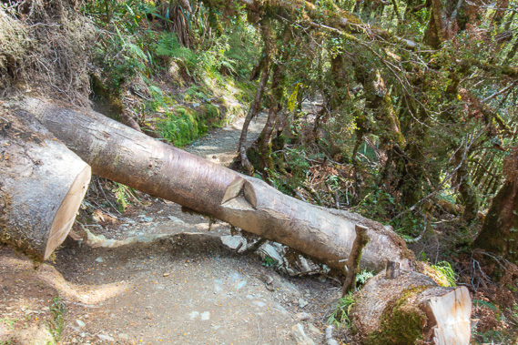 |
12:16 - I cross a fallen tree just past the waterfall with a step chainsawed into it. |
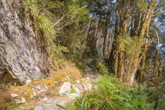 |
12:34 - The track begins a steep rocky descent as it continues passing the front of the cliff face. |
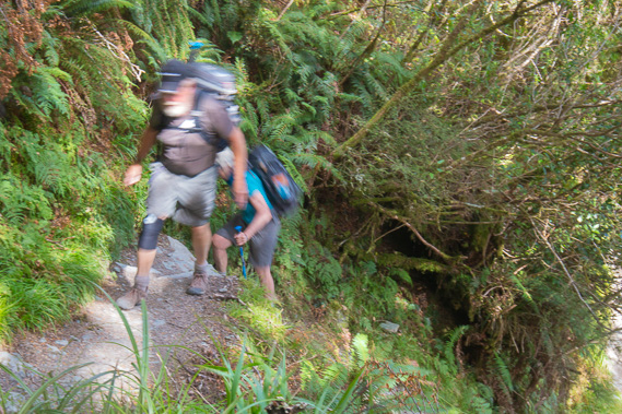 |
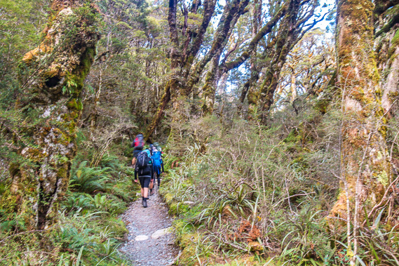
12:40 - Other hikers head uphill on their way towards Mackenzie as I steeply descend. This is their first day on the track. |
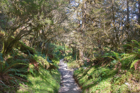 |
13:10 - Soon the track clears the cliff and the terrain becomes more gradual, but the forest thickens taking away any views. |
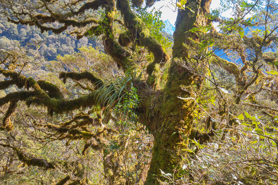 |
13:25 - Each ancient tree has its own ecosystem covered in moss and containing numerous epiphytes. The wind has picked up and the trees creak groaning like lost wookies. I name this spur "Wookie Point". |
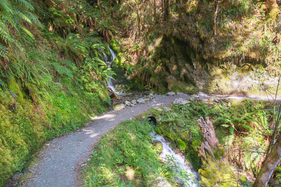 |
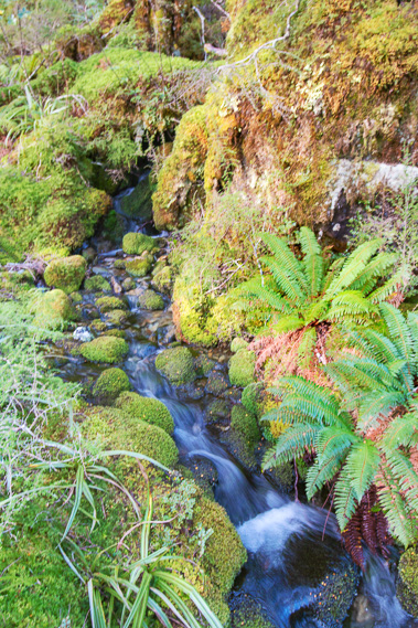
13:29 - A stream cascades down a gully under a culvert shortly after rounding Wookie Point. |
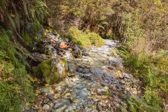 |
13:42 - Another stream just runs over the track |
 |
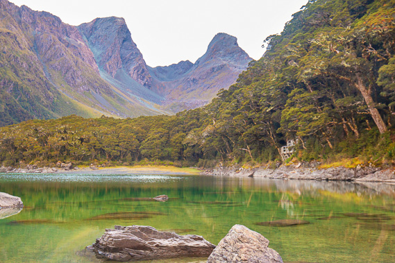
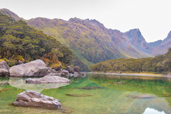
13:46 - The track turns into what seems to be another hanging valley. This turns out to be the valley containing Lake Howden, so I'm not far from my destination. |
 |
13:49 - Reaching a bridge crossing Pass Creek, where the original track up from the Hollyford Valley to the now nearby Greenstone Pass follows once leaving Howden Hut. The creek itself doesn't flow from the pass, but comes off the unnamed mountain I've been traversing around today. |
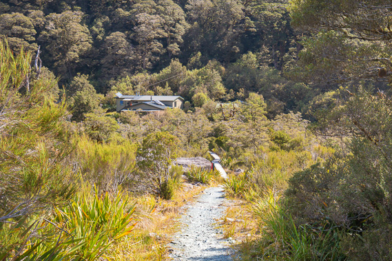 |
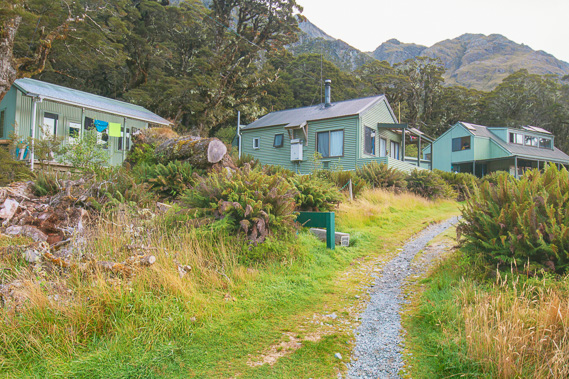
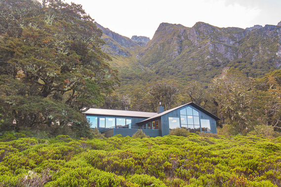
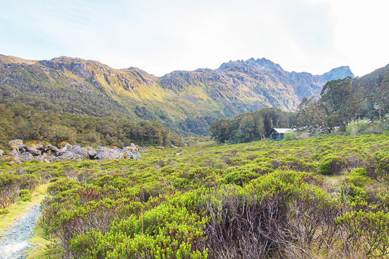
13:55 - Once across the stream, I see Howden Hut across a long clearing at the lip of another hanging valley. This marks the end of the track built from here back to Harris Saddle between 1913 and 1919. The hut is on an older track heading over a saddle into the Greenstone Valley to the right, and heading over to what is now the end of the Routeburn Track at The Divide on the Milford Road to the right. |
 |
13:57 - The Howden Valley and Greenstone Valley just before crossing the stream leading out of the lake. |
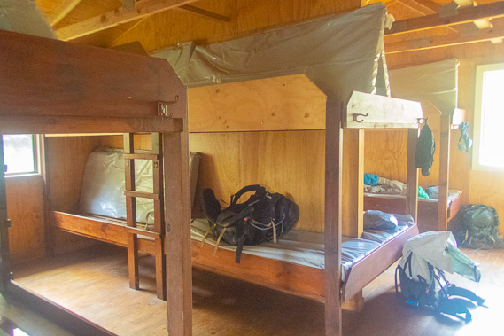 |
14:16 - Inside the hut bunkroom where I have secured my bed. |
 |
14:17 - The main room of the hut with kitchen and dining facilities and a wood burner. This hut was built in 1982 replacing another hut built in 1961 at the same time as the first Mackenzie Hut. That hut in turn replaced an old historic hut servicing the Greenstone Trail for many decades. The roof needed to be rebuilt in 1995 due to the accumulation of heavy snow in the winter causing the roof to collapse. Mackenzie and Routeburn Falls huts were also damaged by the heavy snow, not not as extensively. After this hike, the February 2020 storm bringing about a metre of rain to this area in 60 hours sent a large landslide into the side of the hut, severely damaging it. Fortunately there were no injuries. |
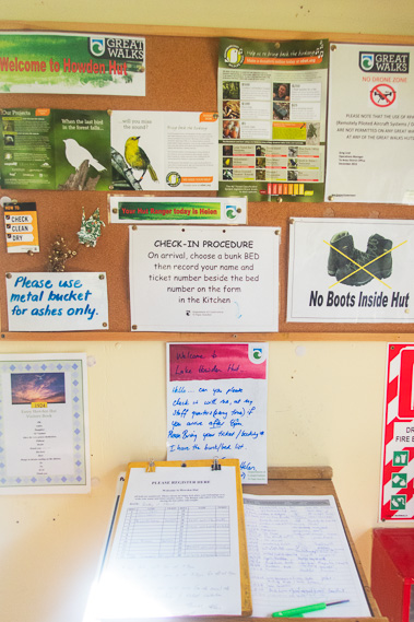 |
14:18 - The hut book and noticeboard just inside the main hut entrance where I sign in. |
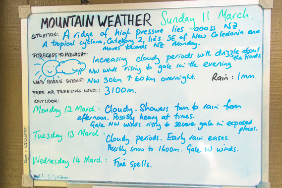 |
14:19 - The weather forecast. Cloud is supposed to increase to rain tomorrow. I have had a very good run of weather so far and tomorrow is my final day on the track, so I can dry out when I arrive in Te Anau tomorrow afternoon. |
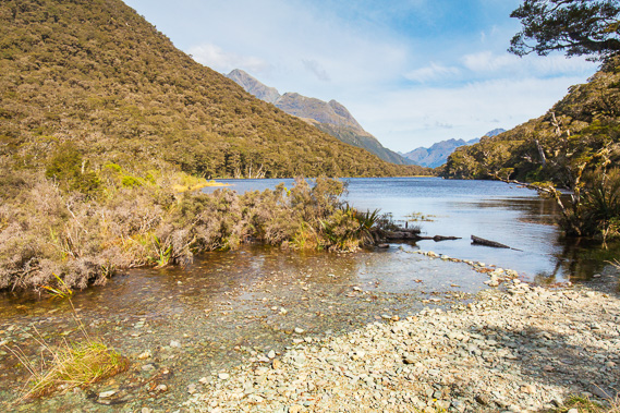 |
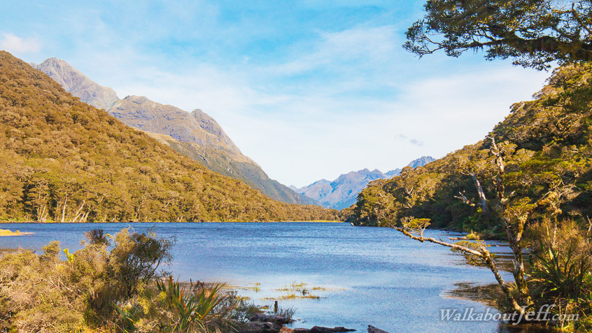
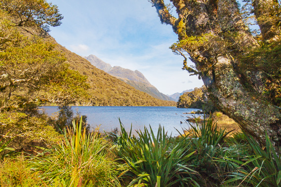
16:30 - Looking from in front of the hut to Lake Howden and the stream that flows from it. The main divide in this valley is just behind the lake, making it a lot less dramatic than Harris Saddle. |
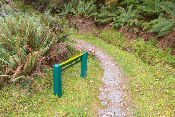 |
16:32 - I follow the start of the 61 kilometre long Greenstone/Caples Track heading from the hut up the side of the lake over the very low Greenstone Saddle and down the other side down towards Lake Wakatipu. The Greenstone Track was named for it being one of the main Maori greenstone routes between their mines near the start of the Routeburn Track/Lake Wakatipu, and around Milford Sound. The Caples Track was named after Patrick Caples who in 1863 explored the area naming the Harris Saddle and Lake. |
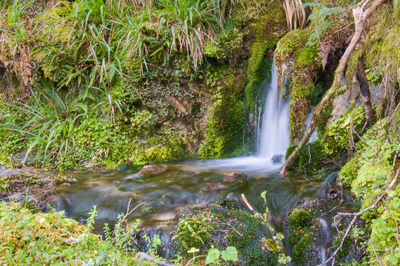 |
16:35 - A cascade tumbles peacefully beside the track. |
 |
16:40 - The track continues up to the saddle, where I turn around and return. |
 |
16:49 - Returning to the lake as the afternoon grows late and high cloud begins to wash over the sky. |
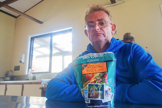 |
18:37 - My final Back Country Cuisine for this trek, having roast lamb and vegetables tonight. I think about a nice dinner of fresh food in Te Anau tomorrow night. |
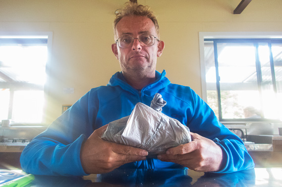 |
18:14 - It is after dinner and I have just cleaned up. This is the bag of all the rubbish I have generated over the past four days which will be packed out of the park. That's not a bad effort. |
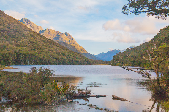 |
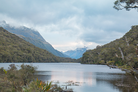
19:30 - I head back out to the lake soon before sunset. The low Greenstone Saddle is visible at the end of the lake. This is part of the main divide of the Southern Alps. The lake is 683 metres above sea level and the saddle is just 15 metres higher at 698 metres above sea level. The Howden Campsite is just on the other side of the saddle. From the saddle the track gently drops for a couple of days along the Greenstone River to its mouth at Lake Wakatipu around 310 metres above sea level. This route from Lake Wakatipu was therefore favoured over the Harris Saddle as a greenstone and exploration route. |
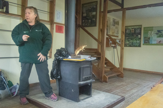 |
19:50 - The warden Helen does her presentation, showing a stuffed stoat. This is her first year working on the track. |
 |
20:21 - I briefly return to the lake after the warden's talk. The cloud has really thickened and is coming down over the mountains. It is getting quite humid so I know rain is on the way for my final day on the track. |
|