Introduction to today's journey
The clearest way into the universe is through a forest wilderness.
– John Muir
SOME of the North Island's most spectacular forest grows in Te Urewera. The goblin forest growing along the misty ridges of the Panekire Bluff are deeply awe inspiring. The remaining forests of the sheltered valleys have spectacular trees, creating a high canopy over perhaps New Zealand's most diverse undergrowth of ferns and broadleaf shrubs. The great landslide of 2200 years ago blocking off the lake flooded the valley, and to this day the remains of the ancient forest still stands preserved in the black depths of the lake. The branches of these trees once filled with birdsong now provide an eerie shelter for the native fish introduced here in past decades. Towering above the lake is the massive Panekiri Range, a huge outcrop of hard sandstone slower to erode than the surrounding mountains of mudstone, all uplifted as the Pacific Plate subducts many kilometres below.
Today's trek starts at Onepoto where the lake drains through underground cracks in the ancient landslide and through some penstocks feeding a power station down the mountain. The track moderately ascends from the lake over the towering Panekire Bluff, a sheer wall of sandstone rising half a kilometre above the lake. The track follows the top of the cliff through some of New Zealand's most spectacular goblin forest. Eventually the track eases into a gentle grade passing the spectacular viewpoint at Bald Knob before eventually reaching the remote Panekire Hut tucked away in the clouds.
Today's Journey
Distance trekked today: 8.8 kilometres.
Total distance trekked to date: 8.8 kilometres.
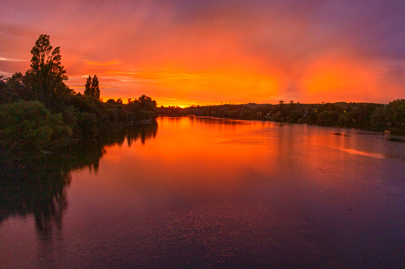 |
06:50 - I watch the sunrise from the bridge spanning the Wairoa near its mouth. The bridge was built in 1990 following Cyclone Bola, a massive cyclone that hit the town in March 1988 dumping nearly 900 millimetres of rain over a couple of days creating devastating floods. The old bridge was washed away during the storm and the one I am standing on was rebuilt to bridge the two halves of the town. |
 |
06:53 - The sky is mostly overcast with mid-level cloud soft from the north westerly which brings rain onto the west coast of the North Island. It dries out as the clouds cross the backbone of mountains stretching from Wellington north eastward to East Cape. Today we are heading inland towards this mountain backbone, but staying on the eastern side. |
 |
06:54 - Looking upstream the sky remained grey apart from some small low clouds hovering about the triangular hills of mudstone baked with brown grass. The hills above Takitimu Marae are glowing a rust colour as were the clouds hugging their tops. The Marae stands hidden in trees on the river's bend. For a few minutes the sun shines bright through the gap in the clouds, but I know this is the last sunshine I will be seeing for a few days. Quickly the brightness ahead of me dulls as the sun continued rising through the gap. |
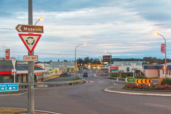 |
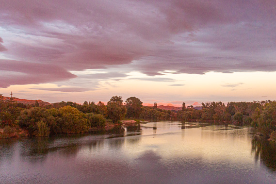
07:03 - Wairoa is the Maori name for long water, no doubt a reference to the river now silently meandering its way through the town to the nearby sea on the North Island’s east coast. It is now a town of around 4200 people at the northern end of Hawkes Bay. Although steadily declining in recent decades, efforts have been made to revitalise the town, particularly with the new space program soon to send satellites into low Earth orbit using rockets launched from the nearby Mahia Peninsula. Otherwise it is an isolated town well off the North Island’s main tourist routes. |
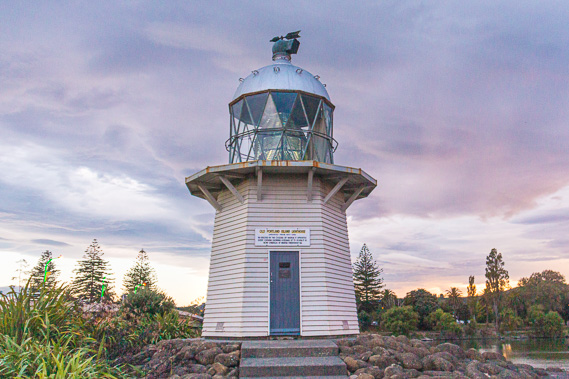 |
07:04 - The old Portland Island lighthouse stands at the end of the bridge, shining its bright light downstream. It was moved here in 1961 upon the installation of a more automated lighthouse on the island. |
 |
12:34 - The shuttle van pulls out of Wairoa two hours late due to getting stuck at a temporary bridge in a road works site. It had accidentally moved causing our driver to be stuck in a remote location away from mobile phone access with nowhere to go – either forward or backward to their base. By now drizzle has started falling in Wairoa. Thankfully the office had eventually been able to make contact with my hotel and finally the van arrived, the driver in her bright pink top rather apologetic. My mum and I are starting the track from Onepoto today and an older couple already in the van were starting the other end of the track. No doubt we will be passing pass them at around the half way mark in about two days’ time. |
 |
12:40 - After the long wait it is good to be leaving Wairoa behind us and following the river upstream towards the lake. Once out of town a sign says 55 kilometres to Waikaremoana and 218 kilometres to Rotorua at the far end of this road, one of New Zealand’s most remote highways. At one point the road crosses the Wairoa River continuing upstream until reaching the branch Waikaretaheke River which flows out of the lake. Here we turn northwards to Lake road following it into the hills. |
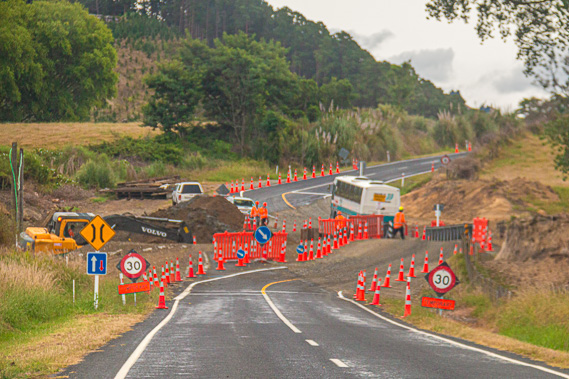 |
12:45 - We slow down entering the road work area at the Mangahohi Bridge. The road is diverted to the temporary bridge which had been moved by a truck this morning causing the delay in our pick up time. A bus slowly crosses it and fortunately makes its way across so we followed suit, passing several men in bright orange working and a large digger clearing the river base to the left ready to install the new bridge. |
 |
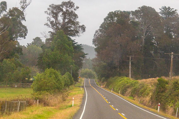
12:49 - Past the bridge the valley widens for a couple of kilometres before we cross the Mangapapa Stream where the sealed road turns to gravel. Although we are still closely following the Waikaretaheke River upstream, we are already over a hundred metres above sea level. The gravel road climbs a little steeper heading up the side of the valley. Although drizzle is falling, a vehicle travelling in the same direction some distance ahead of us is leaving us in a cloud of dust. |
 |
12:51 - As the road rises up the side of the valley, we can see across to a dark range rising against the cloudy skyline. The low cloud is tugging against the rounded summits of the range. This is the Panekire Range, which we will be following along the top of the ridge today and tomorrow morning. |
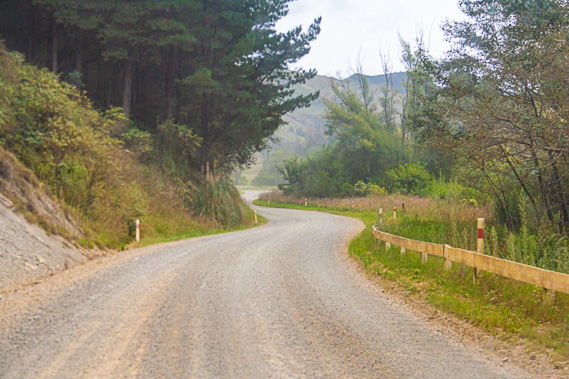 |
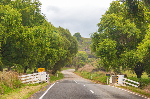
12:54 - The road drops to cross the cascading river before beginning an ascent of the valley on the other side. After two kilometres of gravel (or metal as they call it in New Zealand), the road becomes sealed again in anticipation of the long ascent of the great landslide holding back the lake. We cross a single lane bridge over the river and within a kilometre the road reverts to gravel as we begin the long climb up the hill. |
 |
12:58 - The road briefly turns to seal again as we reached Tuai, the village centre of the Waikaremoana Power Scheme. A side road to the right heads down to the power station about a kilometre away in the valley. By now we are three hundred metres above sea level, just over half the altitude of the lake’s surface but still about forty metres below its deepest point. From the village the road quickly returns to gravel and continues climbing the hill. Following the briefest of stops to pick up another couple who are starting from the far end of the track, we continue heading up the hill along the sealed road passing through scrub with tree ferns poking out of it. This is the first sign of the magnificent ancient forest we will later encounter. Forest had once covered the enormous landslide, but it had been cleared when the Europeans began settling here. |
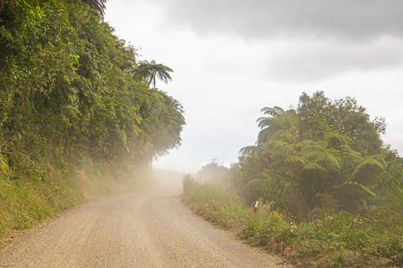 |
13:08 - The road rises above the valley once more entering thick scrub over rough terrain where the sandstone slip would have come down from the Panekire Range on top of the mudstone slip. Rain begins falling again as we pass through the scrub. |
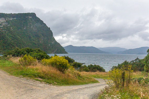 |
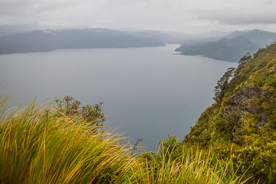
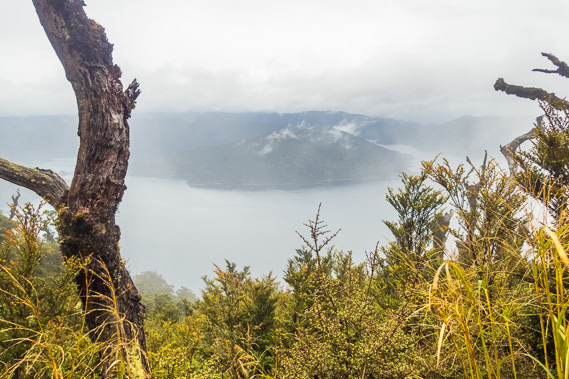
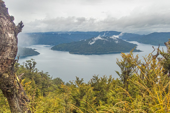
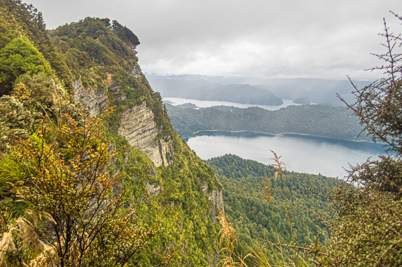
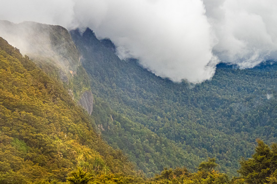
13:16 - Turning off just before the lake, the narrow gravel road passes through a tunnel of overarching tree ferns and scrubby forest to a small clearing at another junction. The road to the right heads down to the lake which we could now see for the first time. The bluish grey waters are ruffled to a choppy swell under grey clouds sweeping in from the north west. The drizzly rain is no longer falling. Rising from the east side of the lake is the steep scrubby cliff of the Panekire Range, towering about six hundred metres above the water. The range swept back so we could only see the first section of it to Te Rahui Point, above which stood a 964 metre high peak on the range. Beyond the range the rest of the lake is framed with low rolling ranges of soft mudstone emphasising the dramatic rise of Panekire. |
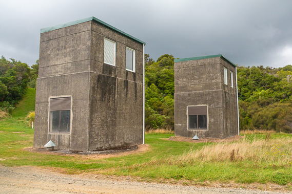 |
13:17 - On the other side of the road stand two concrete surge towers, square in the base and rising nearly double the height as the length of the base. These have vents out of them where water can escape if needed to prevent any damage to the turbines or fittings down at the power station. When the power scheme was constructed, new tunnels were built through the natural dam and the natural channels were blocked. This significantly reduced the seepage and lowered the lake level by five metres, reducing the load on the dam wall ensuring it will continue to remain intact for a very long time and survive all but perhaps the very largest earthquakes. There is still a possibility of the dam wall collapsing if a catastrophic earthquake were to hit the area. The collapse would create a spectacular tsunami-like wave of five cubic kilometres of water barrelling down the valley wiping out Wairoa in under an hour. |
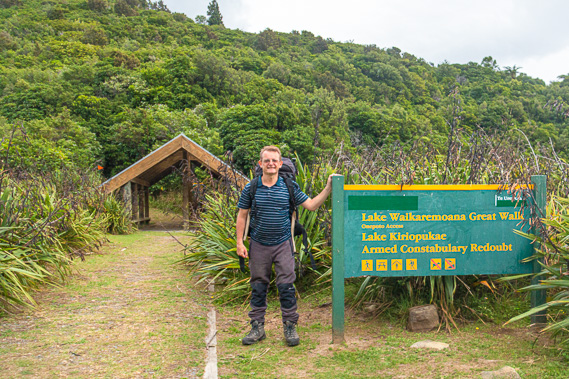 |
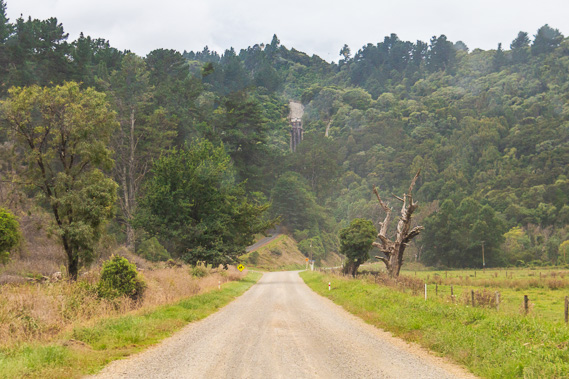
13:18 - The road ends in a small circular car park from where a one-lane wide grassy path leads about fifty metres to the entrance to a gazebo looking like a Maori shelter. I am standing beside the sign now ready to start the hike up the hill later than expected. Hidden from view beside the flax behind the sign are some boards containing information about the power scheme, the track and the wildlife. Passing these boards and passing through the little shelter, we are now on our way. |
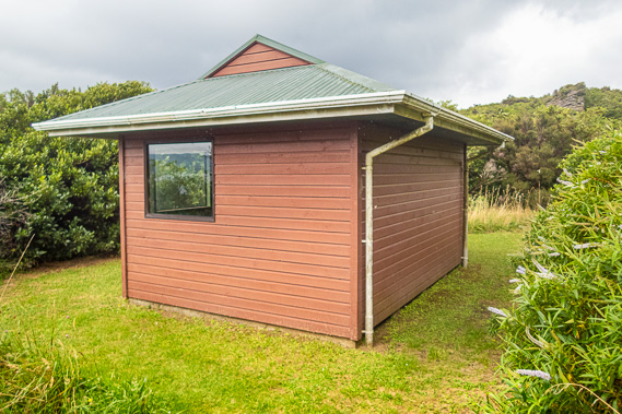 |
13:22 - Upon leaving the little shelter I follow the grassy track up a short moderate slope for a few metres to a small salmon pink hut shelter hidden in the scrub. This would be a place to stay for hikers travelling the other direction reaching this end of the track waiting for their transport out. The shelter is already some height above the 582 metre high lake, but for us this is just the start of a long climb to almost 1200 metres above sea level to Panekire Hut some five hours and 8.8 kilometres away. With the delayed start we will need to move pretty quickly to get to the hut before dark. |
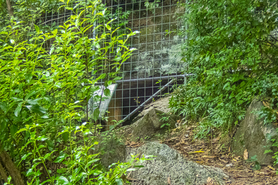 |
13:28 - The track rises along a brief climb before it descends a little over a low saddle. At the highest point is a set of wooden boxed stairs leading to a heavily fenced off cave. The fencing is completely sealed so there is no way of getting in. To the right unseen through the bush is a steep cliff dropping into the lake. The Maori villagers would travel to this cliff at night to collect the mutton birds nesting here. |
 |
13:32 - Once across the low saddle the track begins ascending again and through a gap in the scrub I have my first clear view of the lake. The ruffled grey waters are lapping against the rocky shore, with the natural dam with its broken crags standing firm. The more distant hills gradually grey out in the slight mist of the rain falling on the other side of the lake. The road we had travelled along follows the other side of the lake whilst the hiking track remains on this side. These both meet at the other end of the lake four days' hike away. |
 |
13:43 - Just past the viewpoint the track continues its ascent. We have now reached the start of the Panekire Range and the ascent will persist from here to the top. I reach a sign at a junction where a side track heads to the left down the side of the ridge towards Lake Kiriopukae. The lake has a stream flowing into it draining all the water from the left hand side of the Panekire Range up to a little past the Panekire Bluff summit which we will be passing in about three hours' time. |
 |
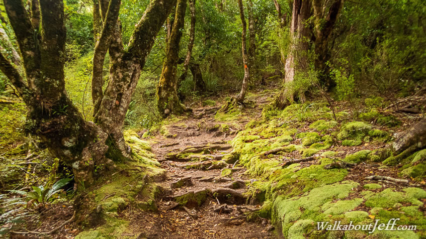
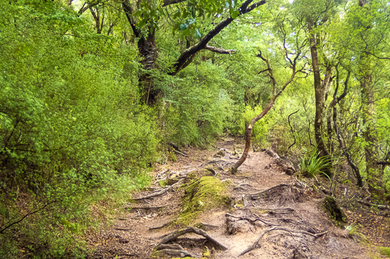
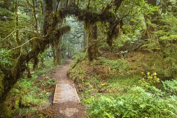
13:58 - The track rises steeply but fortunately it is a metre wide and in very good condition, as I'd expect for a Great Walk. The scrub by now has thickened into low forest of whitey wood (mahoe) and other scrubby trees. This area must have been cleared at some point, but been allowed to grow back over the past fifty to a hundred years. This was once the site of the Onepoto Pa and burial ground near the lake, visited by William Colenso in 1841, a year after the first European visit by missionary William Williams. The armed constabulary was set up here to capture the powerful Maori leader Te Kooti during the Maori wars when he was in the area in 1869. |
 |
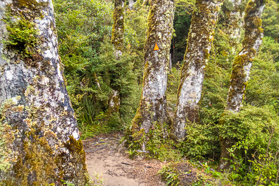
14:07 - Reaching thicker forest with very large trees beyond the limit of past clearing. This track was initially constructed between 1962 and 1972 by volunteer students at 14 local secondary schools. It quickly grew in popularity causing the huts to be overcrowded until a booking system was introduced in 2001 was part of the Great Walks system. Now there are about 8000 people doing the track each year. Due to its relatively remote location away from all the tourist routes, this is the quietest and least used of New Zealand's Great Walks. |
 |
14:36 - The track started off smooth, but now roots are poking out creating natural steps in the otherwise hiker hardened soil. The track follows just a few metres away from the edge of the cliff dropping into the lake to the right. The slope to the left is quite gentle. Occasionally the track veers to the right going around the ridge giving the occasional glimpse of the lake dropping further and further below us. |
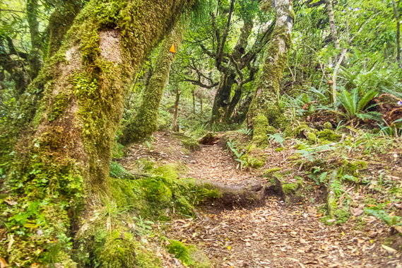 |
14:38 - As the track ascends, the trees gradually became bigger and more gnarly. Some have epiphytes growing on them. The track maintains a reasonably even grade rising moderately, but occasionally levelling off and in one place even descending briefly. There are a few spots where the larger roots hold large erosion channels carved deep into the soil from past downpours. Moss and ferns grow along the banks of these cuts, covering the floor of the forest. The naturally growing moss grow in tightly protective clumps. Some are a bluish grey and others more a yellowish green. There are several varieties each hosting their own tiny ecosystems in amongst the leaf litter of the forest floor. |
 |
14:39 - The ground is surprisingly dry. A fair amount of rainfall had fallen in Wairoa this morning, enough to get the ground wet. The ground here is still bone dry indicating only the lightest of drizzle has fallen here, absorbed entirely by the forest canopy. There is no rain falling here, but the thick air is very warm and humid, requiring me to take off my polar fleece top down to my tee shirt. Even with just the tee shirt the humidity makes the ascent hot work. Despite being on an exposed ascending ridge, hardly a breath of wind blows. The once strong north westerly must be completely spent ready for the coming southerly change. |
 |
14:40 - Although we are only a few metres from the edge of the cliff, views of the lake are few and far between, limited to the occasional glance of the emptiness of the overcast sky above the low mudstone hills straddling the other side of the lake. My Olympus camera had a GPS altimeter giving me an estimate of our height above sea level. From here we still have five hundred and sixty metres to climb, from 600 to 1160 metres above sea level. The climb is going to be steady until reaching the first trig at 964 metres above sea level. After the trig the ascent will be gentler rising and sometimes falling along the top of the range. |
 |
14:47 - Following the steepest part of the ascent, we reach a small clearing at the edge of the cliff where the forest gives way to low bushy scrub and flax hanging over the edge of the cliff. The lake is now hundreds of metres below us with neither Sandy Bay nor Onepoto (where we had started) visible anymore. I can see across to the low Ngamoko Range with its highest summit at 1099 metres above sea level. From here it is obvious the entire range in front of this peak has collapsed a couple of kilometres in this direction to create the enormous dam blocking the gorge creating the lake behind it. |
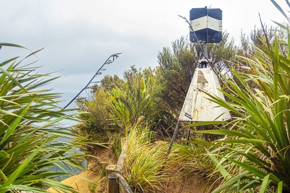 |
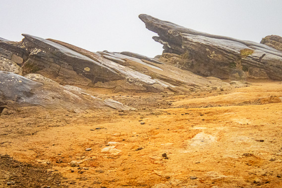
14:50 - We hike around a small knob rising to an orange sandstone platform. The rock is almost in pancake layers arranged in several very large boulders upon which we can stand. We continue around the next small knob to where the trig was standing in amongst the flax and scrub concealing most of the view. The A51J trig is 964 metres above sea level and 380 metres above the surface of the lake. Ahead of us is still nearly two hundred metres climbing to the top of the range. A low wooden fence surrounds the trig station to protect it. It has obviously been there for quite a long time being quite heavily weathered with the paint starting to peel off, but otherwise it stands upright in very good condition. |
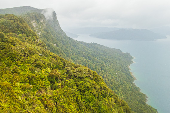 |
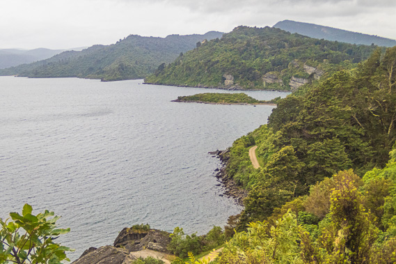
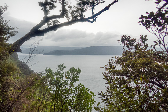
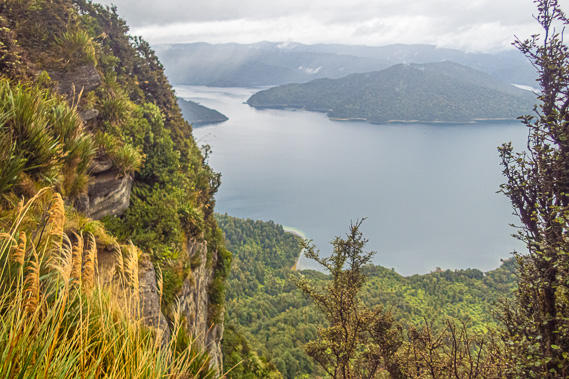
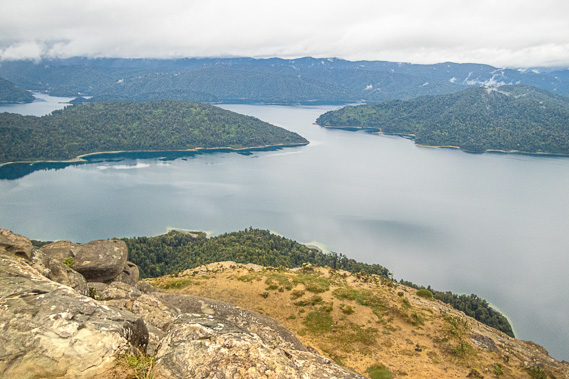
14:51 - Passing the little gap between the fence and a large clump of flax, we reach a large slab of sandstone completely free of any vegetation. From here I can see clearly along the face of the range around the coast out to Ohiringa Bluff about two kilometres away, and further around to as far as Papaotewhakau Point another half a kilometre before the lake edge sweeps back. Looking ahead to the left from the view, Te Rahui Point extends a little out from the cliff about a kilometre away. Looking beyond the end of the headland the broad lake splits into three arms. |
 |
15:31 - Behind the edge of the cliff the slope continues to drop moderately through more of the same thick goblin forest we have been hiking through. Small hazy pieces of cloud obscured the tops. A very fine mist is making the low hills rising from the other end of the lake difficult to see now. Whilst the air is now cool and very damp, it wasn't raining yet. |
 |
15:34 - Whilst resting here a couple of German guys passed us coming the other way. They are on a day trip heading up from Onepoto to the hut and back, and are now heading back down. There weren't any cars parked at the start of the track, but they may have been parked closer to the lake in Sandy Bay. They couldn’t remember how far away the hut is, but didn’t think it was too far away. They mentioned there were people staying there tonight and they already had a fire lit, something to look forward to when we arrive. |
 |
15:37 - Looking along the long arm of Whanganuioparua Inlet sweeping back along the front of the range to the east. This is the flooded valley of the Aniwaniwa Stream, flowing in from the north east. Not visible are the small settlements of Waikaremoana and Aniwaniwa Villages tucked away under the range. On the other side of the arm were low rounded mudstone hills covered in forest concealing the Ruapani Five Lakes and the larger Lake Waikareiti. These lakes were all blocked by the complex array of fault lines that have broken this easternmost extreme of the Indo-Australian plate. I visited these lakes in late 1994 discovering just how beautiful this area was. I recalled the forest and the lake being etched into my memory as being one of the most beautiful parts of New Zealand, and wanted to do this track at the time. |
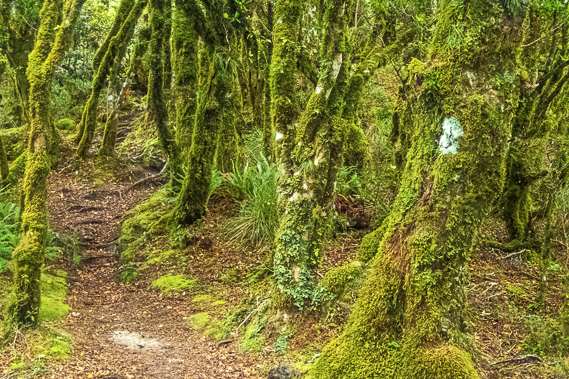 |
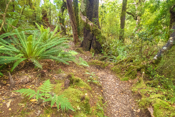
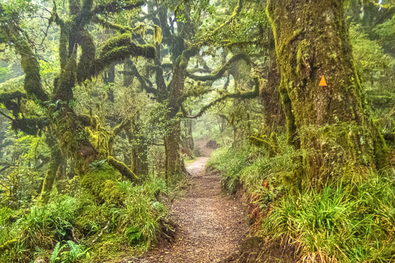
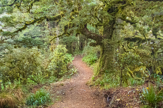
15:42 - We reach the top of the hill and have another view through the gnarled goblin trees out over the lake. The cloud is now very close overhead, indicating a change in weather is imminent. The trunks and branches of these trees are mostly covered in moss, as is the ground on either side of the track. It is very humid up here most of the time allowing the moss to grow so well. |
 |
16:01 - Misty cloud descends on the goblin forest making for a very quiet and eerie trek along the top of the range. Gentle rain now begins to fall. |
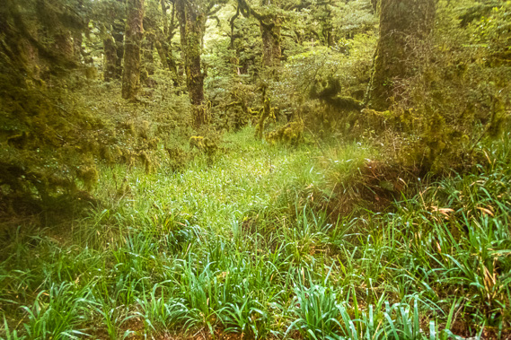 |
16:31 - The track passes around the left of Panekire Bluff, passing far enough below it to cross small wooden bridges over flat gullies with some sort of grass growing in them. The ground here would be rather boggy, especially following heavy rainfall. This grassy patch marks the start of the headwaters of the stream heading into Lake Kiriopukae back near the start of the track. |
 |
16:48 - Once around the hill I get another view through rather scraggy scrub out over the lake at the northernmost part of the track, this time looking up towards the Whanganui Inlet. Small wisps of cloud were hovering over the dark grey forested mudstone hills of the Puketukutuku Range, already appearing a little closer than it had earlier at the trig even though we won’t be crossing it for another three days towards the end of the trek. |
 |
16:50 - The mist briefly clears improving the view. To the left of the Puketukutuku Range I can see the gaping inlet of The Narrows (Te Kauangaomanaia) leading into Wairaumoana, the Wairau Arm of the lake, which we will be reaching tomorrow afternoon. The following day and a half will be spent walking up the length of Wairaumoana until we cross a saddle over the neck of the Puketukutuku Range on our final day. To the left of The Narrows extended the Whareama Range, a low group of forested hills behind which I could just see into the inlets of Maraunui and Marauiti, where we are planning to stay on our final night here. |
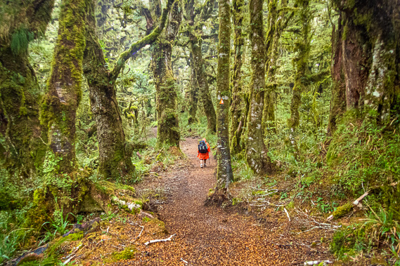 |
16:52 - Hiking through the goblin forest. From the lookout the track is wide and level making for easy walking. A quad bike could very easily be ridden along this section of track (thank goodness though they aren't allowed here). The forest here is taller and more magnificent, and one fallen log had hundreds of small bracket fungi growing on it to aid its decomposition. The moss and filmy fern covered forest here is a mysterious contender for Fangorn Forest, and feels just as creepy with the misty rain silently falling. The moss enveloping the tree trunks and branches are now soaking up the moisture. |
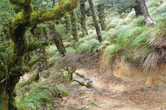 |
17:14 - The track rises around another hill – Puke Nui, the third hill along the Panekire Bluff. At one stage the forest thins with long clumpy grass growing on the gentle slope. The leaves of the grass are far to broard to qualify as tussock, but from a distance the grass clumps do look very much like tussock. |
 |
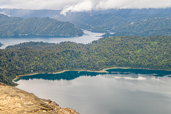
17:25 - The track continues around the top of the range until we finally reach another viewpoint out from the edge of the cliff. Looking below us the lake is in a small arm with a low range crossing between it and The Narrows. The hut we will be staying in tomorrow night is somewhere along the coast on the far side of the range, though tucked in a little left of what we can see. The cliffs dropping into the forest below are quite dramatic with layers parallel to the slope dropping on the left hand side of the range. It seems a particularly hard sloping layer of rock was defining the shape of the range, and to the lake side the cliff consists of softer layers dropping precariously down to the forest containing the rubble of what has eroded from the cliffs above. |
 |
17:32 - Reaching the next lookout where the cliff to my right is overhanging and the cliff to the left is near vertical. No wonder the track has to follow the top of the range before descending a few kilometres on the other side of the hut. In the gap in between the cliffs much of the view is obscured by toi toi with its creamy white soft seed heads. Normally a swamp plant, I am a bit surprised to see them all the way up here. Perhaps this is a testament of the high rainfall here on top of the cliff. |
 |
17:34 - The track once more leaves the edge of the cliff heading around the back of Bald Knob. It gradually ascends until reaching a white sign with handwritten instructions that the hut was about another hour away, and the side track to the right was about three minutes to the Bald Knob lookout. Deciding there is still plenty of time (around two hours before sunset), we take the short diversion up to Bald Knob anticipating what could be the most spectacular view along the entire trek. |
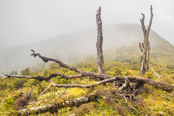 |
17:45 - The moderately steep short path up to Bald Knob is fairly easy going. The bush to the left quickly clears revealing a swampy alpine grassland with a saddle gently dropping about two hundred metres away before rising to another rounded hill. I am still in the stunted forest, but there are some dead trees just before the grassland. These trees have died naturally and were slowly rotting away. The soft fog lying over the saddle is quickly clearing away. We continue walking around the side of Bald Knob to where we could see the north-western end of the Panekire Range sweeping around a steep basin over the lake. |
 |
17:46 - A huge bank of cloud suddenly rolls over the range in the distance. It races up the forest on the other side plummeting down the side of the range with alarming speed. This is the southerly change I was expecting. There are only a couple of minutes before the entire range is completely enveloped in cloud. |
 |
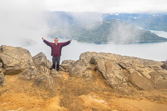
17:47 - We hurry to the large sandstone platform making up Bald Knob, considered by many to be New Zealand's most unfortunate place name, but there is no time to dwell on that. The cloud is quickly closing in, but there is just enough time to get a couple of good shots of the lake. |
 |
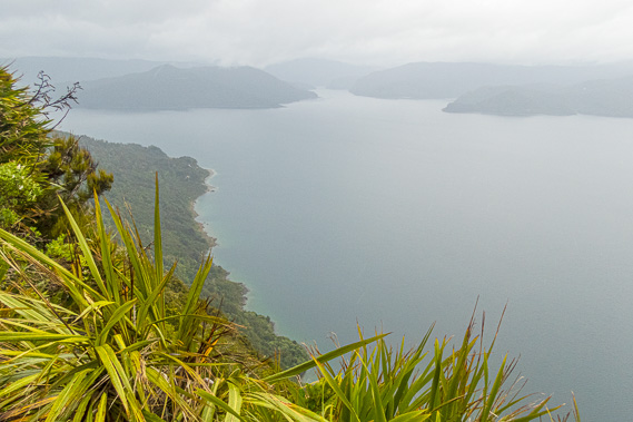
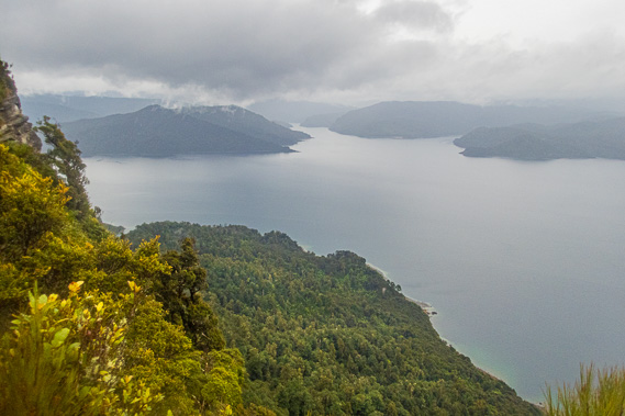
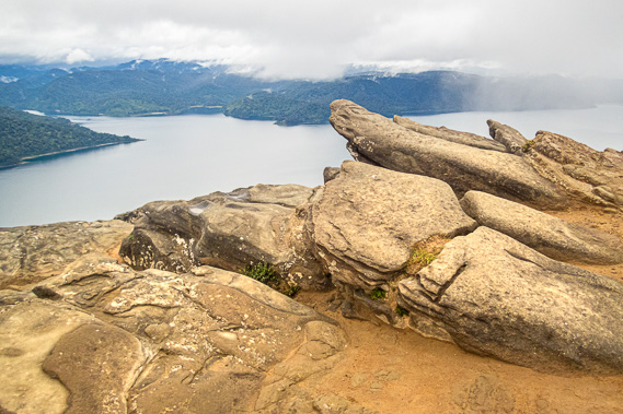
17:49 - I am standing at 1161 metres above sea level, about 660 metres above the surface of the lake. The flat wedges of sandstone point a little upward tapering into sharp arrows pointing a little into the sky to taper off overhanging the steep cliff below. The headland separating out The Narrows is quite close below now, with the Panekire Hut on the range directly above its end. I can now see into Wairaumoana where the other range extends out into the lake to conceal the Whanganui Inlet at the far end of the track. |
 |
17:50 - The blue grey water of Lake Waikaremoana below us against the peninsula is almost mirror flat, not living up to the lake's name meaning “Lake of Rippling Waters”, but not for much longer. A few low clouds hang in the gullies, but apart from that the view across the lake is quite clear. |
 |
17:52 - I pose at the edge of the cliff just as the cloud bank hits, quickly sweeping past and enveloping us in its thick cold dampness. The temperature drops very quickly and the wind picks up. We shelter amongst the rocks for a few minutes in the off chance it will clear again, but I know this being a southerly front means there won't be any clear views from here for a couple of days at least. Southerlies carry a lot of thick cloud and rain behind them. |
 |
18:02 - After a while we give up on any more views and pictures, and head back down the side track to the main track. The temperature continued to plummet and rain begins falling again - this time cold. This is a most dramatic end to summer with Autumn starting tomorrow, but at least it isn't cold enough to snow up here. |
 |
18:36 - I have my rain cape on, but needed to put the hood up to keep my head warm. We battle against the wind as we return along the side track before continuing along the main track towards the hut. The rough sign indicated the hut is an hour away. I suspect it will take us a bit longer than an hour in these conditions. |
 |
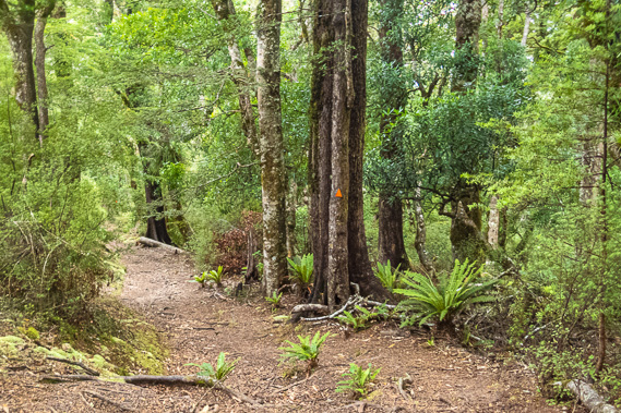
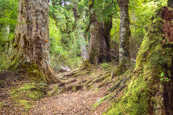
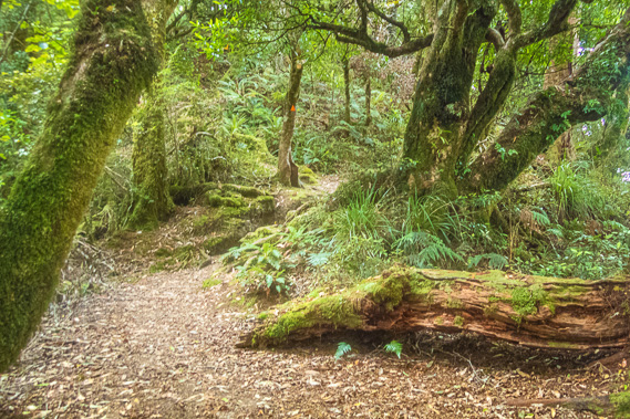
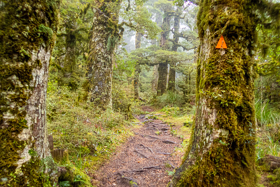
18:51 - The trees in this part of the forest are larger and more ancient than any we have seen so far. This is getting into very remote territory here in Te Urewera but the track is fortunately still in excellent condition and the trees sheltering us from the worst of the squall. A quad bike would easily be able to travel through here. Quite a few of the trees had fallen in the past with thick moss growing on their remains. |
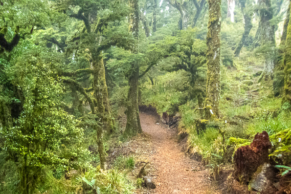 |
18:55 - At this point I can see evidence of an old track following the top of the ridge, with a cleared path going over roots. Moss now covers the old track as the new track winds around the hilltops in a fairly even altitude making for easier walking. The old track would have been a lot more challenging before the new track was built. |
 |
19:03 - From the Bald Knob junction we reach the bottom of the saddle we had seen earlier, then follow around the next hill, standing at 1186 metres high. This is the highest summit on the range only being a metre higher than the next highest point. The track now moderately descends as we quicken the pace. Time seems to almost stand still as rain continues falling and cloud swirls through the ancient goblin forest. The trees groan softly as their thick mossy branches sway in the wind. |
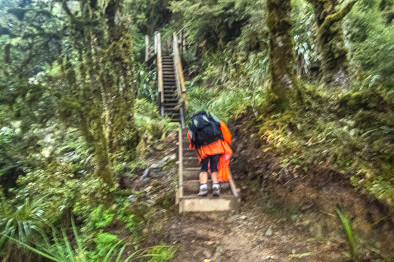 |
19:28 - The track continues dropping a little before going over the next small hill into a lower saddle. More than an hour has passed since leaving Bald Knob. The sky is gradually beginning to get dark with the sun close to setting. Fortunately we have head torches. Looking ahead in the fading light is a long staircase heading up into the forest ascending another hill. We had not seen any staircases so far today, and having hiked such a long way, much of it now in driving rain, it was disheartening to see a long staircase before us. Nine steps climb to a low platform from where a much longer staircase steeply rises. This leads to a small fenced wooden platform from where another staircase rises steeply to the right above some of the trees but against a small cliff face. This staircase continues right to the edge of the cliff presumably facing the lake (if not for the thick cloud) before turning left back to the original direction and climbing to what appears to be the top of the hill. |
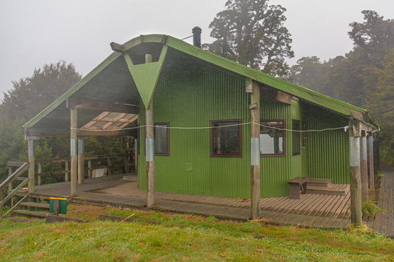 |
19:36 - A little short of the hilltop the stairs end following a moderately steep track up to a clearing where I instantly see the welcome sight of the top of the hut. I am thankful to have reached the hut, taking off my sodden boots outside and bringing in my pack. |
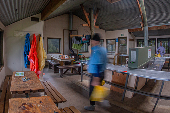 |
19:47 - With our arrival there are seven of us staying in the hut. Everyone else is in the main kitchen dining area. A fire is burning in the wood burner warming up the old hut and giving it a slight acrid smell. It initially feels like a sauna in here with having acclimatised to the cold conditions of the southerly outside. To the right of the dining area are two bunk rooms. Four of the people have occupied the far bunk room, and one the nearer one on the second level of the three level bunks. This leaves the lower level free, so we put our packs in the narrow room and roll out our sleeping bags at each end of the lower bunks. |
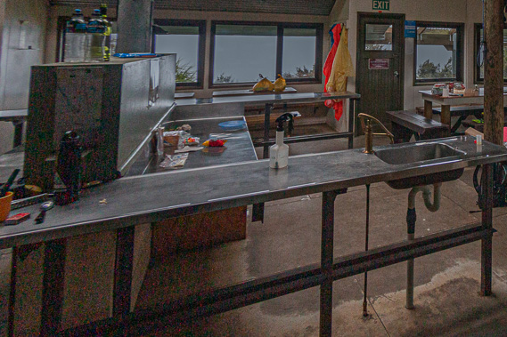 |
19:49 - It is quickly getting dark inside the hut, so we put on our head torches to prepare dinner. Looking out the window I can see the clouds swirling past us as light rain continues to fall. There is no chance of a view tonight and it will be highly unlikely we will get one tomorrow either. We unpack two packets of dehydrated food and get the gas cooker burning to boil some water which we pump with the small brass pumps. The packet sounds very interesting being sweet and sour chicken. Unfortunately with it being dehydrated and not being able to see the food in the darkness, not to mention eating out of a packet, the taste was a little bland. It was still good to have something to eat after such a long hike this afternoon. The others in the hut say they had not been expecting anyone to have arrived so late with the darkness setting in, but I explained about the damaged bridge delaying our transport. |
|