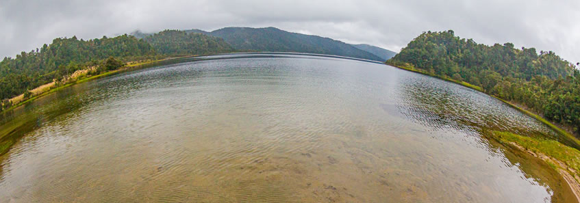
THE WAIKAREMOANA TRACK follows the western side of a pristine lake dramatically formed 2200 years ago. It could have been a huge cyclonic rainstorm or a large earthquake, or perhaps a combination of the two, but the event triggered an enormous landslide where the north-eastern end of the soft Ngamoko Range collapsed into the gorge completely filling it. The impact was so dramatic that part of the Panekire Range also collapsed landing on top of the original landslide. This catastrophic event created an enormous natural dam over half a kilometre high and several kilometres across. With nowhere to go the water filled the pristine valley submerging the ancient forests of the upper Waikaretaheke River. Lake Waikaremoana is now the North Island's deepest lake at 250 metres deep covering 56 square kilometres containing about five cubic kilometres of water.
The trek begins at Onepoto on top of the massive landslide now blocking the lake. From here it rises near the sharp edge of the cloud forest covered Panekire Range to its highest point at Bald Knob before going level to Panekire Hut. From there the second day descends through spectacular rainforest eventually returning to the edge of the lake in a small peaceful bay at Waiahoro. From there the third day continues around the edge of the lake to Korokoro Campsite from here a side track follows a river upstream to a dramatic waterfall. Returning to the campsite the track quite roughly continues undulating around the edge of the lake until reaching the old hut at Maraunui. The final day of this trek goes over much better graded track over bays and cutting headland peninsulas to a pickup point near Whanganui Hut from where a small boat crosses the lake back to the starting point at Onepoto. The walking track I followed, including diversions, totalled 42.4 kilometres. It can be hiked in either direction, and if not catching the boat at the Whanganui end, the track ends at the road another 4 kilometres from Whanganui Hut. |