Introduction to today's journey
Ina kei te mohio koe ko wai koe, I anga mai koe I hea, kei te mohio koe. Kei te anga atu ki hia.
If you know where you are and where you are from, then you will know where you are going.
- Maori Proverb
THE REMOTE Te Kaha Stream near Waiopaoa is the setting for the Tuhoe legend of Haumapuhia. In a distant past time before the Maori arrived in New Zealand from Hawaiki, and before the great landslide, the great chief Maahu Tapua Nui lived near the stream. It was fed by a sacred spring, so the family would gather water from another stream further away. On one occasion the water was getting low, so he sent his children to get the water. Two went to the stream of the sacred spring. Upon realising this the chief killed them in his anger turning them into stone. As the sun set his third child Haumapuhia headed to the forest to find them. Maahu saw her and assumed she too was going to collect water from the spring. He caught her and tried to drown her before she could say anything. Crying out to the gods for help. they turned her into a powerful taniwha. She swam downstream to the sea trying to get there before sunrise otherwise she would be turned to stone. She made her way down the valley still battling the chief carving out the long valleys. She reached the gorge, but the sun rose turning her into stone. In her final struggles, the mountains on either side of the gorge collapsed into the great landslide covering her and forming the lake.
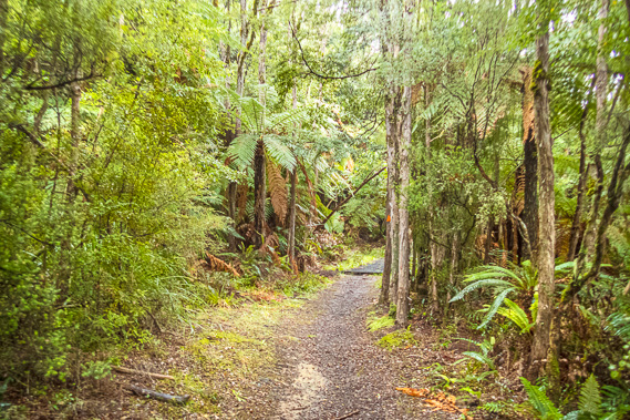
Today's trek follows the lake clockwise through rugged and remote terrain. The first leg from Waiopaoa to Korokoro is very well graded and easy to hike. Just before reaching Korokoro I turn off the main track following a rough side track up to the spectacular Korokoro Falls - a trip not to be missed. Upon returning to the main track, I stop for lunch at Korokoro camping ground before continuing following rough track over numerous small headland bluffs before reaching the Maraunui inlet and campsite. From there I cross a low saddle to the rustic Marauiti hut beside the lake.
Today's Journey
Distance trekked today: 14.6 kilometres.
Total distance trekked to date: 31.0 kilometres.
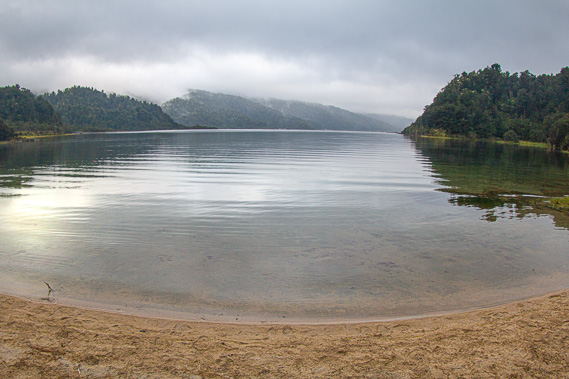 |
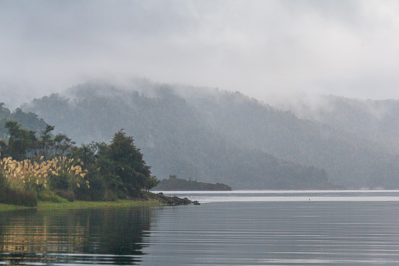
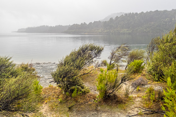
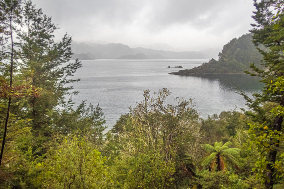
08:38 - Steady rain falls outside when I wake up. It stops falling after a few minutes, so I head outside into the cool dawn humidity and descend to the lake. Thick mist covers the hilltops with sheets of rain obscuring the lower slopes of the ridges we will pass today on our onward journey around the lake. The gentlest of breezes ruffle parts of the lake surface offshore. |
 |
08:39 - Waiopaoa is named after the paoa – a type of New Zealand flax growing around this part of the country. The bush is of a medium height with a yellowish green appearance and slightly droopy leaves. Like other forms of flax it was used by the Maori for making baskets and floor mats, but this was a separate species only found along the North Island’s east coast. Not many specimens remain in this area around here these days due changes in lake level over the past century. |
 |
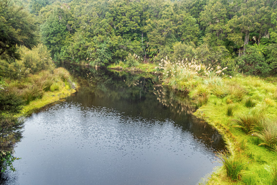
08:43 - I head to the left where the Waiopaoa Stream inlet is mirror smooth under the shelter of the sullen hills on either side. A squall drifts down the valley bringing more rain, so I hurry back to the hut reaching shelter just in time. |
 |
08:44 - By now most people in the hut are getting up. No one is in any hurry to leave though. Our group is following the rugged coast of Wairaumoana towards Marauiti. Everyone going the other direction are climbing up to Panekire for the night, a relatively short leg even though it will all be uphill. The spur to the top of the range is of a much gentler gradient than our steep climb the day before yesterday. |
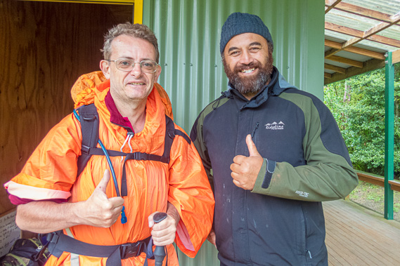 |
09:23 - The rain eventually eases off, so we all leave the hut at the same time. We say goodbye to Matt who will stay here for a few more days before the boat picks him up at the end of his shift. He will no doubt meet more hikers, welcoming them with the warmth of the fireplace and entertaining them with his guitar. |
 |
09:28 - We set off in the light drizzle leaving the comfort of the hut retracing our steps through the campground and along the short track back to the junction. The others in our group press on ahead. |
 |
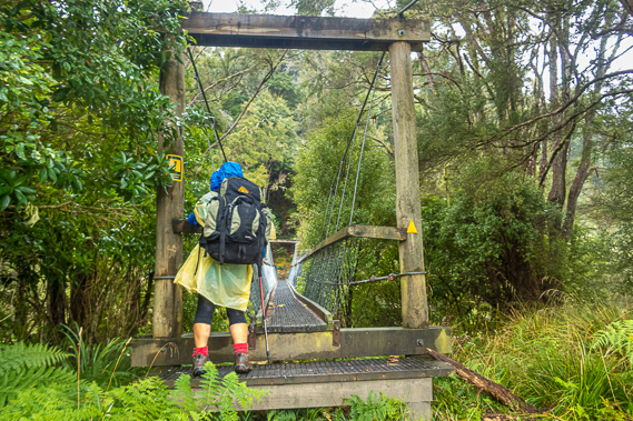
09:36 - A couple of minutes pass before we cross a wooden swing bridge over the flat ochre stained waters of the Waitehatere Stream. We had followed the spur above this stream from its headwaters yesterday after leaving the top of the range. The swing bridge is made from steel cables holding up a wooden floor and wooden hand railings. Strong netting covers the swing bridge from floor to handrails making it feel safe. |
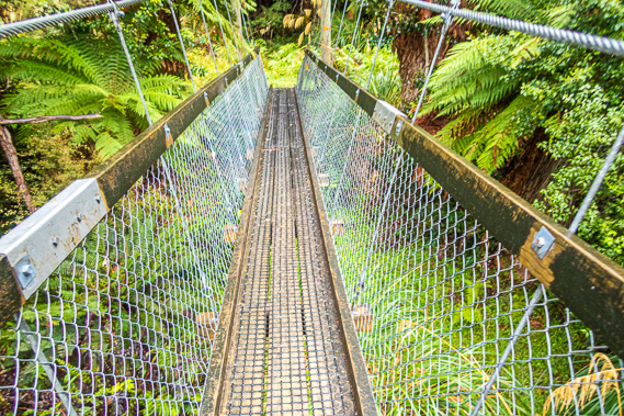 |
09:37 - I imagine all the swing bridges along the track are very safe now. At the far end of the track beyond where we will be catching the boat out, the swing bridge over the Hopuruahine stream is the longest bridge on the track with the notorious reputation as it collapsed whilst eight people were crossing it in September 2015. It was supposed to have been strong enough for a load of ten people, but it was later found to be caused by a manufacturing defect in a link. It had snapped causing one of the suspension wires to fail and the bridge to collapse on one side resulting in three of the group falling into the water below. Fortunately they all escaped serious injury. All the other bridges on the track were checked and fortunately the fittings weren’t of the same defective batch so they were okay. |
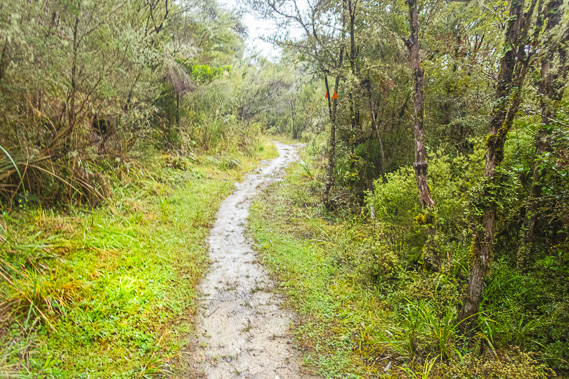 |
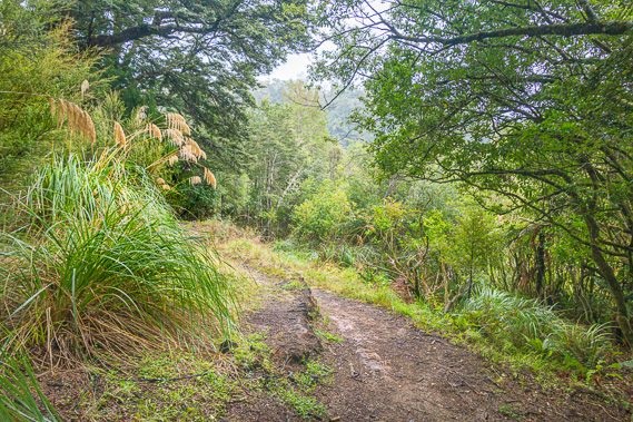
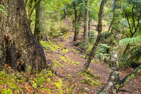
09:45 - Once over the swing bridge, the track follows around the small peninsula between the two streams. The track here is very different to what we had followed yesterday. This was flat with no slope, making the centre part a bit muddy from all the rain that had fallen over the past day and a half. Here we were walking through regenerating bush on teh shelf left after the lake level was dropped five metres when the power station was built. The scrub would have been a lot shorter in 1962 when the track was built, so it would have been a lot easier to cut through than the forest on the steeper terrain above us. |
 |
09:47 - We reach the point and looking across we could now see the tranquil gully which was the setting of the Tuhoe Legend of Haumaphuia. The sacred spring is in the forest behind the next ridge, and it was from there Haumaphuia escaped following the river along the bottom of the valley. The story goes the mountains on either side of the gorge collapsed burying her and forming the lake, submerging the forest which has remained largely preserved in its spooky depths to this day. |
 |
10:07 - The kanuka quickly gives way to a large grassy patch heading into the next valley through which the Waiopaoa Stream flows. We cross another swing bridge over the slightly larger stream which quickly widened in the tussock into the inlet. Once across the bridge, we reach a T intersection. The main track turns to the right towards the next headland. The track to the left is the Mangatoatoa Clearing Track. It follows the Waiopaoa Stream for a couple of hundred metres before climbing a spur to a ridge and over to the Mangatoatoa Stream which flows into the Waiau River and into the Wairoa River. |
 |
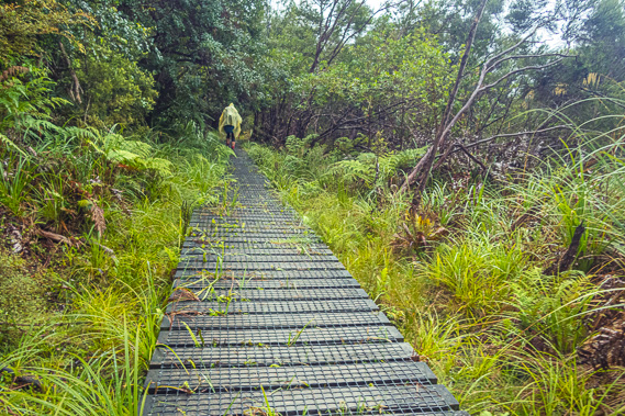
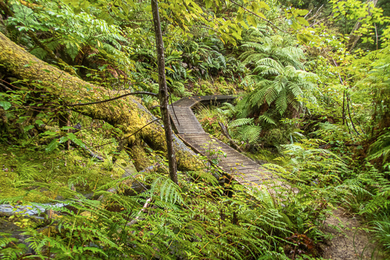
10:27 - The shelf widens as we enter a large grove of tree ferns. The ground would have been quite boggy underfoot so a boardwalk had been laid with wire mesh to make walking easier. At this point we assume the rest of today's track follows the lake like this, apart from a couple of low saddles and one more diversion inland we were about to take on our way to tonight’s destination at Marauiti. |
 |
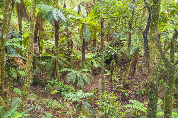
10:45 - The track around the coast continues for some distance rounding more headlands before we enter another big grove of ferns on a boardwalk. Then we reach a junction. The three routes of the track are lined with the thin trunks of fallen manuka to distinguish the track from the surrounding flat ground under the tree ferns. We are now an hour and a half out from Waiopaoa and making (what we think is) good time. The side track heads inland for thirty minutes towards Korokoro Falls. I recall from the comments in the intentions books in the hut this diversion was considered by many as one of the highlights of the walk. The other sign continued straight ahead to the Korokoro Campsite just five minutes away. We hide our packs under the tree ferns. I take out my gorilla tripod from the pocket and wrap it around the strap of my camera bag. Once organised we start following the track up towards Korokoro Falls. |
 |
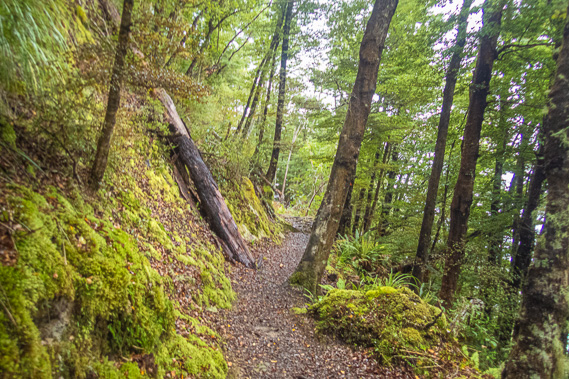
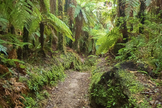
10:49 - The track quickly narrows to a just comfortably narrow groove with thick moss growing on either side of it. It quickly resembles the goblin forest we had hiked through on Panekire Range. The difference here is the flora is a lot more diverse in this sheltered valley. Rain continues falling but I now hear the rushing water of the Korokoroowhaitiri Stream. This very long name means a place of thunder where lamprey can be found. Perhaps the stream was first discovered during a thunderstorm. |
 |
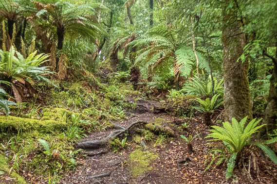
11:02 - By now the scrub has given way to small beech trees and mahoe. It is not long before the terrain steepens into a shallow gorge with the track undulating its way around roots and trees. Large ground ferns appear around us. The soil reddens from the bark fallen of the enormous red beech trees growing here. The track steeply drops into a small gully before rising on the other side. Here we see Jan and Ken from our group coming back the other way saying they had successfully reached the falls and we were making good time. The track continues undulating around old slips and over roots now ascending a moderate grade. I can now see the stream at the bottom of the steep bank. |
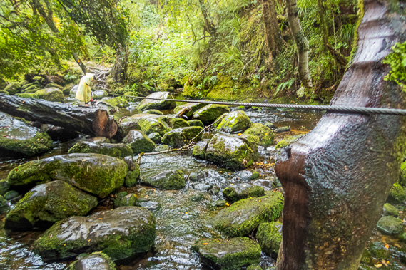 |
11:11 - We continue following the small river upstream until the track suddenly ends at a thick steel cable tied off between a tree on either side. We head across the river one at a time holding onto the cable and negotiating our way over the huge boulders. Most of the boulders are covered in moss, but they are clear and shiny where people have walked on them. It is quite an obstacle course as I negotiate my way across these slippery rocks wearing my tent-like rain cape and having the camera bag with the gorilla tripod swing wildly on its strap. Fortunately, the cable provides good balance, so long as I am pushing the cable in one definite direction. There is one spot in the middle where I need to swap to the other side of the cable, so need to get a good footing on a flat boulder, and swing the cable nearly a metre to the other side. Thankfully there weren’t any lamprey jumping out of the stream. I’m not sure whether there were any here these days – they may have all been fished out by the Maori settlers in times past. Korokoro is named after the lamprey Geotria Australis. It is an eel like fish with a sucker mouth highly valued by the Maori as a delicacy. |
 |
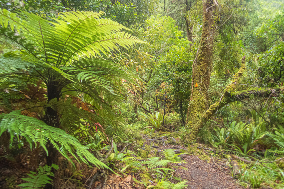
11:20 - We both reach the other side and continue following the track through the spectacular tree ferns. I notice the rain that had persisted all morning has now stopped falling. This was what I needed for the long exposure shots of the waterfall. Drops of rain always leads to disappointing results with spots of rain on the lens distorting and dirtying the image. |
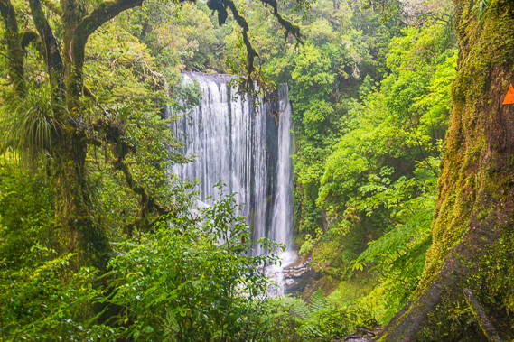 |
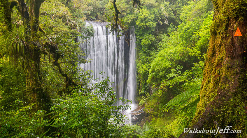
11:23 - The track steeply ascends to a small flat area between several huge moss covered beech trees from where we could see the spectacular Korokoro Falls through a gap in the trees. This is the end of the track and the westernmost point of this trek. The waterfall is quite a long way down, but we were almost level with the top of the falls and the trees form an excellent frame around them making the perfect spot for photography. |
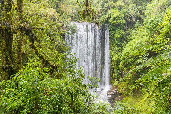 |
11:40 - I set up the camera on the gorilla tripod for some long exposure shots. Conditions here are perfect. The thick cloud overhead diffuses the daylight so I can get the most out of the colours and textures of the forest. The rain has completely stopped falling. There aren’t even any drops dripping from the trees overhead. This means I can keep the lenses clean without drops of water falling on them distorting the images. There is not a breath of wind. This means the foliage isn’t moving at all. The only movement is in the water tumbling over the edge and plummeting down to the boulders far below, giving the potential for some perfect waterfall images. |
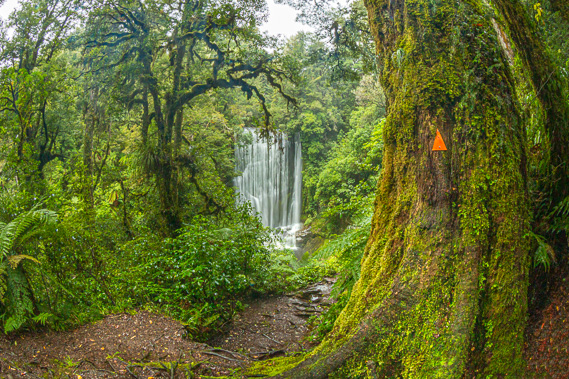 |
11:43 - The waterfall is putting on an excellent show, living up to a recent comment I saw in the Panekire Hut intentions book ‘Korokoro waters are like a flowing curtain of water (beautiful)’. The rain of the past day and a half has swelled the stream enough for a good volume of water to be falling but not enough for it to appear dirty. This stream drains quite a large area constrained by the Otaunoa Range running from south west to north east like all the other ridges and streams here. The water enters the waterfall quite evenly over a width of about eight metres. It drops twenty two metres to some boulders at the bottom where the water briefly gathers into a deep pool before cascading through the boulders downstream towards the lake. |
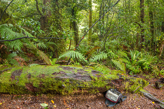 |
11:46 - This is the natural log seat from where the waterfall can be viewed from, except you do need to stand up to see it. The one thing missing from here were the birds that had once abundantly filled the forest with the beautiful birdsong of New Zealand. We had heard a few birds coming down off Panekire Range yesterday, but none at all this morning. Perhaps there are too many predators living on the new shelf from when the lake was lowered, but I had expected to hear some birds up here in this remote patch of bush. Perhaps the sound of the waterfall was masking any distant birdsong, or perhaps the birds are still sheltering from this morning’s rain. |
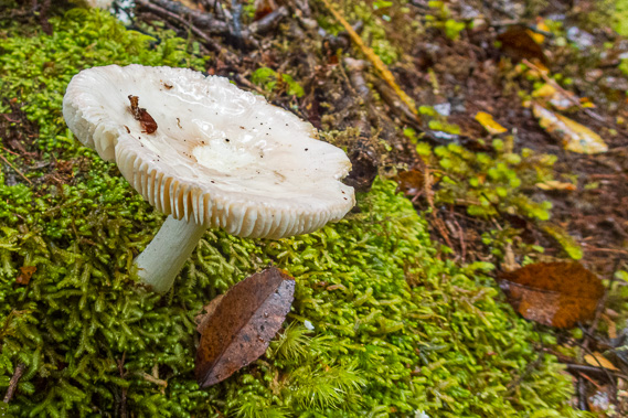 |
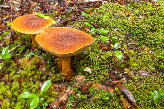
11:47 - With photography finished, I follow the moderately steep track downhill capturing a couple of toadstools on the way down. After a few minutes I reach the start of the cable. Mum was almost across having left several minutes before me, so I had timed my departure very well. I start to head across the boulders on the cable. Really every step was the same as those I had taken on the way across earlier, only backwards, so this crossing is actually quite a bit quicker than my first crossing as I was familiar with the boulders. With the crossing complete, we follow the rough track back downstream as it gradually improvs in quality. Finally we reach Korokoro Junction having taken about an hour and a half to complete the diversion to the waterfall. |
 |
12:27 - We put our packs on and continue following the main track. It quickly rises to a large wooden swing bridge crossing the Korokoroowhaitiri Stream. |
 |
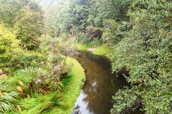
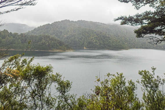
12:28 - The stream is hardly recognisable as the same stream we had followed cascading through mossy boulders. Here it is a mirror flat dead calm channel of black water extending out towards the lake about a hundred metres downstream. There is a fairly substantial bank of tall grass, tussock and toi toi before the scrubby forest starts, indicating quite substantial floods come down this stream during heavy rain. Upon reaching the other side of the swing bridge, the track ends in a T junction. A sign points to the camp now two minutes away. A sign in the other direction says Maraunui campsite is two and a half hours away, and presumably Marauiti where we were heading is about another half an hour even though it wasn't mentioned on the sign. |
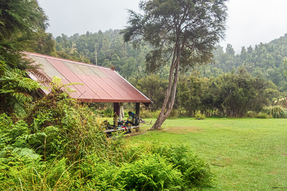 |
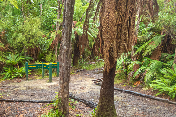
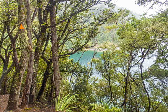
12:31 - We have already been hiking for three solid hours, so it was time for a lunch break. The track opens out to a large grassy area with a shelter identical to the one we had seen at Waiopaoa was set into the scrubby trees. The grassy area is bordered with toi toi through which we have glimpses to the calm waters of Te Korokoroowhaitiri Bay and out into the ruffled grey waters of the lake to the misty hills on the other side of Wairaumoana. There are quite a few people in the shelter, including Ken and Jan who have just finished lunch and are packing up ready to continue towards Marauiti. |
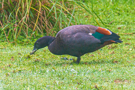 |
12:35 - Looking out in the camping ground of short recently cut grass, I see a male paradise duck foraging for insects. These are much darker than other species of duck, its deep metallic navy blue feathers were highlighted against the grey and dark rusty brown coloured body feathers. The females are a lighter brown with a white head. |
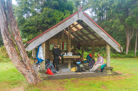 |
12:39 - There are another five older people at the shelter, including the older couple we had been picked up with in Wairoa two days ago. They are all hiking back the other way and are resting here having lunch. They appear tired from this morning’s hike from Marauiti.
|
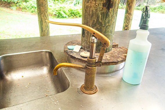 |
13:14 - They mention the tap water pump was broken, but I quickly fix it – the fitting holding it all together just needed screwing back in place. As we are preparing lunch we mention the beautiful Korokoro Falls to the other group, but they just don't seem interested. They are tired from the last leg they had completed and keen to get to Waiopaoa as quickly as possible. We relax under the shelter resting for a few minutes after finishing lunch. There is a long hike ahead of us following the edge of the lake towards Maraunui camping ground, followed by Marauiti Hut where we will be spending the night. |
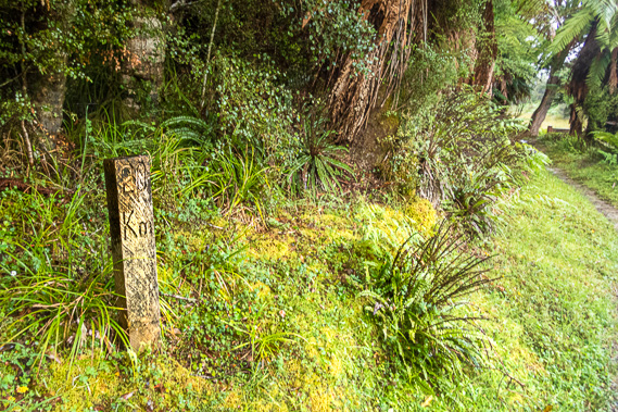 |
13:26 - The middle of a long track is usually the roughest, least maintained section. It is relatively difficult to reach by maintenance crews resulting in it usually being in poorer condition to the well-maintained sections of track at either end and close to the huts. The traverse across the bluffs between Korokoro and Maraunui is about to prove this is no exception to the rule. Upon finishing lunch at Korokoro, we leave the camping ground and the other group who are about to leave shortly afterwards. The track starts in a similar manner to the coastal track we have followed around the edge of the lake this morning. I spot a plank of wood sticking out of the ground saying 20 kilometres. This is how far we were from Onepoto, nearly half way along the 42 kilometre length to tomorrow afternoon's destination near Whanganui Hut. |
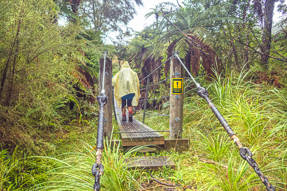 |
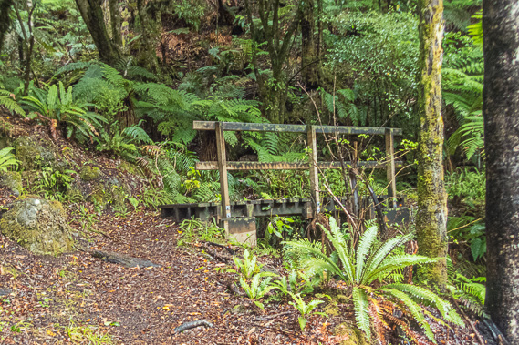
13:29 - The track crosses a rather long swing bridge over another stream. Once across the swing bridge the track suddenly becomes rough for a few minutes as it quickly ascends through mahoe and silver beech forest. The track nearly levels for a while before reaching a short wooden bridge to which the track rises steeply towards. |
 |
13:39 - From there the track continues gaining altitude and becomes increasingly rough. Moss grows on either side of the track with tree ferns, rimu and beech trees growing all around us. The terrain becomes very steep dropping into the lake below us. The thick canopy denies us all but short glimpses of the lake. |
 |
13:44 - A board walk takes us across a swampy section as rain starts falling again. It took us around to the first of a succession of little bays where the track easily traverses around the headlands, but becomes very undulating in the gullies negotiating the small streams damaging the track following successive floods over the years. |
 |
13:45 - The shelf that occupies the bays and headlands of the headwaters of Wairaumoana is non-existent here. These bluffs just plunge straight into the deep water some forty to sixty metres to the bottom of what would have been the Wairaumoana Valley. The river would have run close to these bluffs before the lake was suddenly formed by the collapsing mountains on either side of the gorge. |
 |
13:46 - Upon reaching the second headland the rain clears and for a couple of minutes a small patch of blue sky appears. The southerly must be blowing itself out now allowing the weather to start clearing. Will the sun come out later this afternoon allowing us to dry out before reaching the hut? |
 |
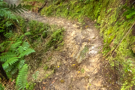
14:07 - Ferns, mosses and toadstools grow along the steep banks on either side of the narrow track. Now we understand why the group heading the other way were so keen to get to Waiopaoa without the diversion of the falls. At least by now they will be relieved that the track they are now walking on is in much better condition than this section of track. We head out of a gully to a rock where the track suddenly stops. Looking around we can see the markers heading straight up the face of the rock at quite a steep angle. We have to crawl our way up the dirty rock face. This is not at all easy under the load of our packs, heavy from the dampness of the rain. At one stage I have to shimmy my way for a couple of metres before reaching the track again. A slip has obviously come down the rock some years ago washing the soil off the rock. We scramble up the leaning rock face covered in dirty moss before reaching some roots where we could pull ourselves back up to the track. |
 |
14:10 - Fortunately that rock was the roughest part of the track entire track but at the time we wondered if it was going to get any worse. We round the following few bays towards Te Kopuru Point, its name meaning heavy passing clouds. The track has become easier and our progress faster. The gullies are drier, though one had a long section along a boardwalk where a slip had come down a few decades ago and tree ferns and bracken were still occupying the space amongst the moss covered decomposing fallen trees. This indicated we were approaching the end of the range, where we will round into the Marau. The terrain here is still very steep plunging straight into the deep lake and the track continues to undulate, but each successive bay is a little easier than the last. |
 |
14:18 - The name Marau means attack or raid. The history behind this has been lost to time. But there have been Maori settlements along the coast, and there are still private Maori huts here owned by some of the Tuhoe locals. The Ruapani people were the first settlers of the lake in around the year 1500. Nobody else lived in this remote and rugged corner of the country. Across the Huiarau Range was the Tuhoe Tribe of the Bay of Plenty. Although they occupied the lands on the other side of the mountains, their legend says their ancient people originally came from these mountains. |
 |
14:57 - In legend they say the Tuhoe peoples descended from Turoa who was the principal chief of the Mataauta canoe, and also from the ancient peoples of Te Urewera, Te Tini o Toi and Nga Potiki. Of particular importance in the legend was Potiki, who was the son of Hinepukohurangi, the mist woman, and Te Maunga, the mountain man. Potiki and his descendants (the Tuhoe) therefore became known as Nga Tamariki o te Kohu, the Children of the Mist. At some point in the seventeenth century, the Tuhoe people lost their land in the western Bay of Plenty due to other tribes and began to head eastward over their ancestral mountains in search for more land. The country there was extremely rugged but they found the Ruapani people successfully living in this otherwise difficult environment. |
 |
15:04 - The Tuhoe people peacefully settled here amongst the Ruapani, interbreeding with them over the centuries. This is very different to the invasions that normally occur when tribes move into already occupied lands. Perhaps this is because the Tuhoe people familiar with the flora and fauna of the Bay of Plenty were unable to survive in these rugged mountains around the lake without the direct help of the Ruapani. There is now no clear distinction between these groups with the Ruapani people subsuming into the Tuhoe Tribe. The Tuhoe are a particularly conservative iwi, determined to keep their ancient ways and highly reluctant to change. They say this is where their strength lies. As they say: ‘Na Toi raua ko Potiki te whenua. Na Tuhoe te mana me to rangatiratanga.’ ‘The land comes from Toi and Potiki. The power and prestige comes from Tuhoe.’ Their sacred mountain is Maungapohatu on the main dividing range (not visible from this track). |
 |
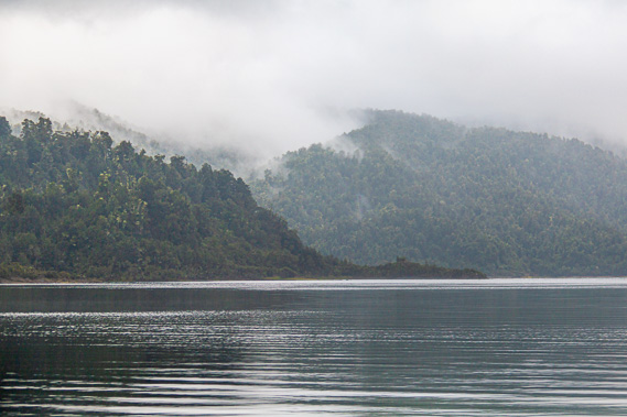
15:08 - Through the occasional gap through the trees at the headlands we can see across to the grey misty hills across the other side of Wairaumoana (lake of many waters) and to the lower slopes of Panekire. The cloud has completely covered the sky again and very light drizzle was falling. The patch of blue sky we had seen earlier was long forgotten. It will be some time yet before the sky clears. |
 |
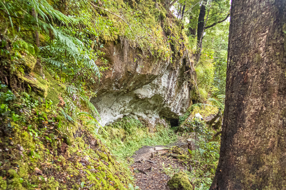
15:13 - Eventually the bays stopped entirely and the hill followed a straight line along the shore. The track narrowed as it passed under some rocky overhangs not deep enough to pass as caves. The track started to ascend moderately again as we approach Te Kotoreotaunoa Point at the end of the Otaunoa Range from where we will enter the Marau. |
 |
15:31 - The vegetation thickens as we round the point with the terrain not as steep as it has been over the past two hours. |
 |
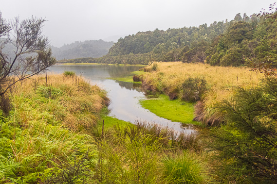
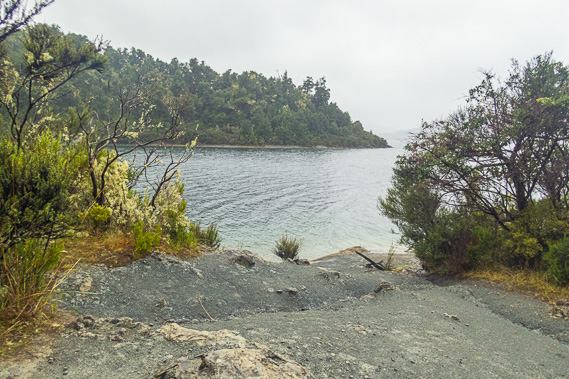
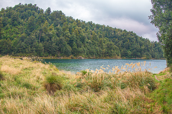
16:03 - It is some time after rounding the point when I finally see into the start of Maraunui. About five hundred metres to the north east is Te Taungatara Point, dividing the straight north western coast of Wairaumoana from the three bays of Maraunui – Maraunui Bay, Marauiti Bay and Te Kopua Bay. Directly across from this gap in the forest is the entrance to the Marauiti Inlet where we will be staying tonight, and the headlands we will be walking around tomorrow morning. Although the inlet is only a kilometre away, the walk to it will be a lot longer, having to go all the way around the back of Maraunui. We are already two and a half hours out from Korokoro Campsite. The sign at Korokoro has said Maraunui Campsite was two and a half hours, so if we are making average time we should be there by now. Here we discover the signs are not very accurate at all. We continue following the track, now heading westward into Maraunui. I am hoping the track will be easier through here, but it begins with a steep descent down towards the lake. The track does widen, but the undulation makes it quite rough slowing us down. |
 |
16:42 - It takes us forty minutes to follow the undulating track along the southern edge of Maraunui to reach a small clearing, where ahead of us we can see a private hut owned by the local Maori people. As we reach the hut we saw another one nearby. Both have with signs saying they are private property. |
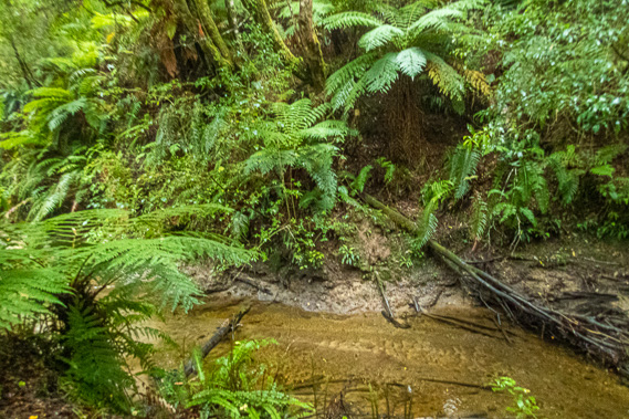 |
17:08 - The track quickly enters forest again and became a little boggy as we continued following Maraunui Bay for about half an hour until reaching the crystal clear Te Wharau Stream (meaning temporary shelter). We cross a little footbridge marking the westernmost point of the main track. We had ventured a little further westward at Korokoro Falls, but this was a diversion off the main track. |
 |
17:13 - The bank on the other side of the stream is a little precarious with the very narrow track cut into the dirt bank perched four metres above the creek. One section has slipped away leaving a precariously narrow section to cross. Fortunately we cross it without any problem. I recall Matt had mentioned it last night in the comfort of the hut when talking to one of the other groups under the soft candlelight. Five minutes after crossing the stream we reach another junction. A steep side track heads up the hill towards Maungaroa Valley (mountain with river), 3.5 hours away. The track heads up to the top of the nearby Pukekohu Range (misty hill) to several tracks going to different parts of Te Urewera. The sign at this junction says Korokoro Campsite is two hours away. It has taken us 3 hours 40 minutes. The Waiopaoa Hut was 3.5 hours away. It had taken us 1.5 hours to get from Waiopaoa to Korokoro Junction, so the timing of that section was fine, but this section was way out. Perhaps this part of the track had been measured when it was in excellent condition and has degraded substantially in the years since. The sign said Maraunui Campsite was 10 minutes away and Marauiti Hut 30 minutes away. Given the difficulty of the track since Korokoro, I give Marauiti an hour for good measure. |
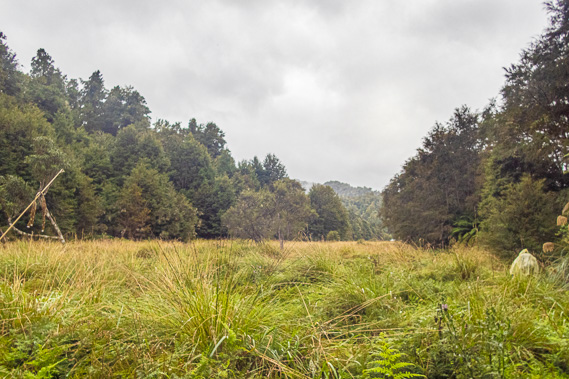 |
17:21 - We continue trudging along the track as the forest starts to clear into a flat grassy narrow valley. Fifteen minutes after leaving the sign we reach another junction with a side track leading through the long grass to the nearby Maraunui Campsite. The sign says Marauiti is 30 minutes away, so the last sign was definitely wrong. |
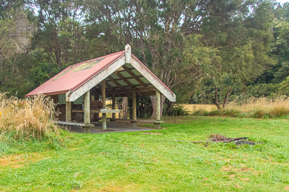 |
17:32 - We take a short break as I walked the final two minutes into the Maraunui Camping Ground on a flat short grassed area amongst the long grass. This campsite has a shelter identical to the other shelters we have seen earlier today. |
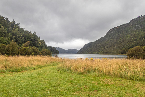 |
17:33 - From the shelter I can see the calm waters of Maraunui with a view back to the rugged point we had earlier rounded. I was keen to get to Marauiti, so I only stop here for the briefest of moments before returning to the junction. |
 |
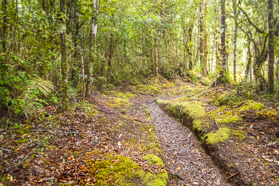
17:52 - From the junction the track crosses the Maraunui Stream over another small swing bridge before heading back into the bush. The rooty track rises through the beautiful forest towards an 85 metre high saddle crossing Whakaneke Spur. This saddle separates Maraunui from Marauiti where we were heading. The narrow track is well worn and carved deep into the soft soil by the flooding of past downpours. Following each flood the track had been cut to be evened out. Successive floods and cuttings have dropped the track down to its current level nearly a metre below the untouched mossy ground on either side. The track clambers over the stubborn roots of trees as it ascends past ground crown ferns and tree ferns, sheltered by the thick canopies of broadleaf trees amongst the beeches. |
 |
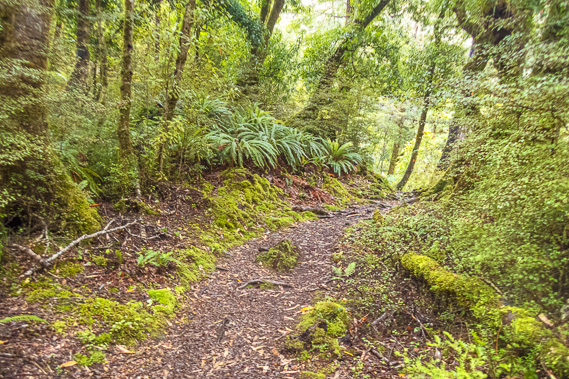
17:59 - We finally reach the top of the saddle from where the track immediately begins a steep descent along a moss sided chute under the tree ferns. The descent is steeper and the track was cut even deeper into the soft soil than the uphill track. After a couple of minutes I just make out through the thick foliage the pale golden colour of grass expected on the bottom of a swampy valley. This is hopefully Marauiti Valley from where we should be able to see the hut. The track now sidles the Whakaneke Spur to the right heading towards the lake. |
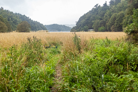 |
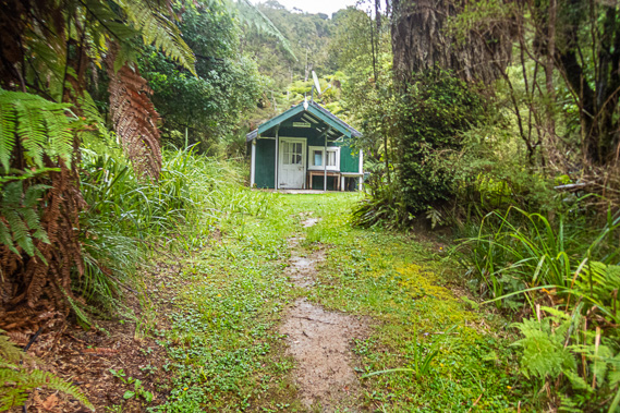
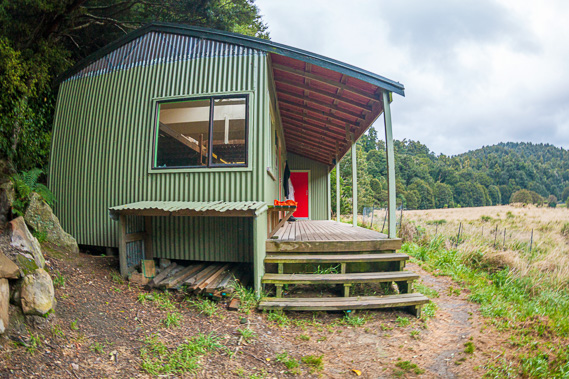
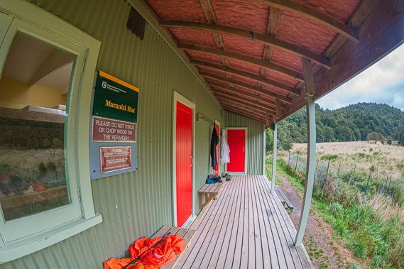
18:11 - Upon reaching the bottom of the hill we reach the clearing where the forest clinging to the hills on either side of the valley suddenly becomes long grass covering ground too swampy for trees to grow. The grass was standing a metre and a half to two metres high. Fortunately we are in New Zealand, where venomous snakes and any other dangerous animals lurking in the grass are non-existent. The track is narrowly cut through the grass. It has obviously been a few weeks since anyone has been through here to cut the surrounding grass back. I can see another sign a few metres ahead mostly hidden in the grass. More importantly, we can see the hut just a few minutes away. The hut is on this side of the valley just above the grass nestled into the beech forest facing out lengthways with a water tank on this side of it. The wooden hut appears quite old and I cannot see any activity outside, a plume of smoke rises from the metal chimney sticking up out of the middle of the roof. The sign says the Waiharuru Hut and Campsite is about two hours away – this is where we will be having our morning tea stop tomorrow on the way out towards our pick-up point at Whanganui. |
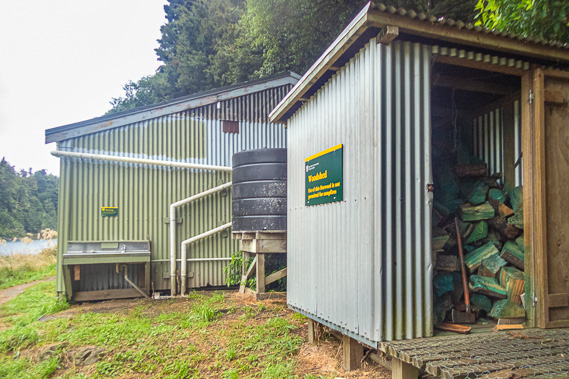 |
18:16 - We hurry to the hut, reaching it 4 hours 50 minutes after leaving Korokoro – so much for the three hours it is supposed to have taken. Adding this to the three hours from Waiopaoa to Korokoro via the falls, we have been hiking for 7 hours 50 minutes today. Just before the hut is a large wood shed, followed by a large rainwater fed water tank. We pull off our sodden boots before heading into the bunkroom. |
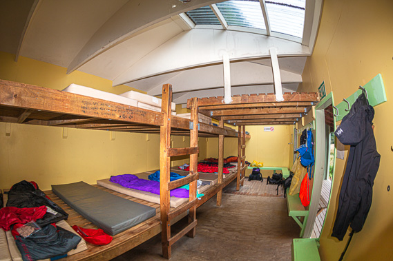 |
18:30 - There are two separate rooms in the hut. The bunkroom has a long line of bunks over two levels in a single room. Two doors lead from the verandah into the bunkroom, but no door directly into the dining room. We have to go out onto the verandah to get there. Opposite the bunks beside the walls is a low shelf for putting backpacks and gear. The others have all obviously arrived and put their bedding out. We put out our sleeping bags and unpack the food, taking it back out into the porch and into the other room closer to the woodshed. |
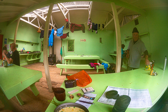 |
18:49 - The main room is hot and very humid with the fire going in the small wood burner evaporating the water from the wet clothes hanging on the rafters above. The room and furniture are painted a most hideous pastel green colour. I quickly lose my appetite despite all the hiking I’ve done today. Otherwise the rustic hut is seeped in the character expected of a timber hut built by hand in the 1960s to 1970s at the time the track was initially built. A lot of these huts have been replaced over the years, but the original huts still standing have the character and eternal charm having been exposed to decades of weathering in the harsh back country climate. This hut certainly is no exception, even if the interior décor is so hideous. I think the paint must have been some left-over from some construction site having been rejected (hardly surprising), and taken out here for use on this hut. Either that or whoever was responsible for this hut's interior decoration would better work in something less creative like accounting. Colour scheme aside it is good to be sheltered after a long hike and able to hang our wet clothes above the hot fireplace to dry.
|
 |
19:48 - The others sit around resting looking very tired. Roger was in this thick woollies on our side of the hut beside the windows. Jan and Ken were at another table near the gas cookers in the far corner from the door. Dean and Fiona were at another table beside the fireplace pottering around it. Nobody else was here so nobody had walked in from the opposite direction between the start of the track and here today. Perhaps they had been put off by the rain and were waiting for it to clear before starting the track. It is just us here tonight. We all commented on how ridiculously innacurate the signs along today's trail have been. The others had taken far longer than the nominal three hours to get here. Roger and Fiona, the couple we met yesterday, hadn’t bothered doing the falls, but even they said the trek had been hard today, even compared to yesterday when they had done the entire two day Panekire Range section of the track in a single day. Following today’s experience, we had to plan for tomorrow. We all had boats to catch. Ken and Jan were catching a boat at Hopuruahine Landing on the other side of Whanganui Hut. The rest of us were catching another boat about half an hour on this side of Whanganui. |
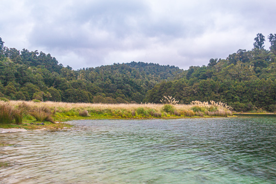 |
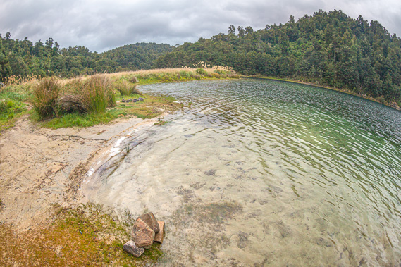
19:42 - With about half an hour before needing to start preparing dinner, I head outside and follow the short track past the long drop toilets down to the edge of the lake. The water here is almost crystal clear, lapping against the dirt and short grass. |
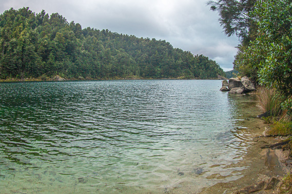 |
19:44 - I can’t see very far at all out of the inlet, only to the rocky headlands on either side. The end of the inlet is blocked off by the ridge we had crossed from Maraunui. The sky is still completely overcast but no rain is falling. I recall the last spots of rain were somewhere before entering Maraunui. The cloud is still thick though, so it is hard to tell if it will clear for tomorrow. There quietly reflecting on the beauty of the park, I can understand the importance of this area to the Maori. The Tuhoe people say Te Urewera is Te Manawa o te Ika a Maui, or the heart of the great fish of Maui. Maui was the ancestral being believed to have pulled up the North Island (the great fish) from his canoe (the South Island). |
 |
19:45 - In 2014, the Te Urewera Act was passed removing it from New Zealand's national parks list, but ensuring its natural state remains forever preserved by the Tuhoe. Like the Whanganui River, Te Urewera has been made a legal entity, with all the rights, powers, duties and liabilities of a legal person. The Urewera National Park had been formed in 1954, so the park lasted 60 years. Curiously the name Te Urewera means “the burnt penis” – highly unusual for such a beautiful rainforest. What is it with all this burnt penis and bald knob business here at Waikaremoana?
|
 |
19:46 - The Tuhoe people tell a tale of an elderly Nga Potiki chief who died after rolling over in his sleep whilst lying too close to a camp fire and fatally burnt his genitals. Chief Mura-karoko who was the son of Tuhoe-potiki, the original ancestor. A version of the story says he chose this death in protest of his sons’ treatment of his youngest brother, his ‘favourite child’. Another version tells he burnt the severed penis of his younger brother Mura-anini in a cooking fire. It was his revenge for Mura-anini’s affair with Mura-karoko’s wife. This was from the culture of sibling rivalry for inheritance and leadership rights in their communities. Curiously campfires are now banned from the park. According to Wikipedia, Urewera was the only national park in the world named after genitalia. |
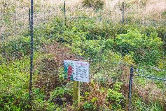 |
19:49 - I return to the hut. A few metres out from the verandah is a small area fenced off with chicken wire to protect some rare Ngutukaka plants from animals grazing on it. The Ngutukaka is a small shrubby plant now endangered from predation by herbivores such as pigs, deer, rabbits and rodents, all of which had been completely absent from New Zealand before people arrived in the thirteenth century. This bush is being protected and specimens are propagated in nurseries to help it recover in these valleys where they naturally thrive. |
 |
19:50 - Returning to the hut, we all prepare dinner. We have the last of the packet meal for this trek, but I find the hideous colour scheme to be an appetite suppressant. Anyone wanting to go on a diet would do well painting their kitchens this colour. Once we complete dinner and washing up and pack out bags packed, the sky outside is almost completely dark. We all returned to the bunk room and crawl into our sleeping bags for a well earned sleep. Fortunately, there are no snorers in our group. Exhausted, we all quickly fall asleep. |
|