Introduction to today's journey
Anei a kiwi. He taonga tuku iho. Tiakina – kei ngaro.
Here is kiwi. A treasure from ages past. Care for it – lest it disappear.
- Tuhoe proverb
THE FIRST European visitor to the lake is believed to have been missionary William Williams in 1840. He was an Anglican missionary from Nottingham who arrived in the Bay of Islands in 1826 where he set up a mission. Following the signing of the Treaty of Waitangi, he travelled in the Eastland area from the late 1830s arriving here from Poverty Bay (Gisbourne) in November 1840. It had taken him six days to hike from Wairoa to Onepoto Pa through thick forest and rugged hills. William described the lake as “a romantic lake surrounded by rough mountain scenery.” His group was well received by the small tribe and apparently already had a good knowledge of the gospel having received some books from the Rotorua mission. Their prayer books were already worn out in places.
Today's trek continues from Marauiti crossing a couple of low saddles but otherwise closely following the lake to the next hut at Waiharuru Shelter. From there it goes over a larger saddle passing the Puketukutuku Peninsula, a kiwi refuge fenced off from the rest of the mainland. Once over the saddle, the track returns to the lake at Tapuaenui camping ground and continues following an arm of the lake to its end at the Whanganui Hut. It is near this hut we are picked up by water taxi and taken back across the lake to Onepoto.
Today's Journey
Distance trekked today: 11.9 kilometres.
Total distance trekked to date: 42.9 kilometres.
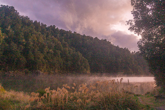 |
06:39 - The alarm buzzes a little before first light. Fiona leaps out of bed getting us up in a rather drill sergeant manner. We quickly crawl out of our sleeping bags and stagger into the deathly green dining room for breakfast. I see the stars are out though there were still a few clouds around. Looking towards the inlet I can see the first rays of the coming dawn. We quickly eat breakfast and pack up as per plan. I steal a couple of minutes slipping down to the water’s edge where a light fog haze covers the surface of the water subduing the brilliant yellows and purples of the forthcoming sunrise. |
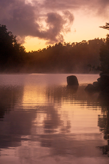 |
06:42 - There are a few dark clouds, but these lie low and drift to the north east, revealing an otherwise clear sky. This is most welcome after the past two days of rain. The southerly has finally blown itself out clearing to bring on what will be a brilliantly fine day. Knowing New Zealand though, this cannot be guaranteed. The water offshore is a little ruffled from a slight breeze, but here in the air is completely still with just the slightest of wavelets lethargically working their way towards the thin sliver of sandy shore upon which I stand.
|
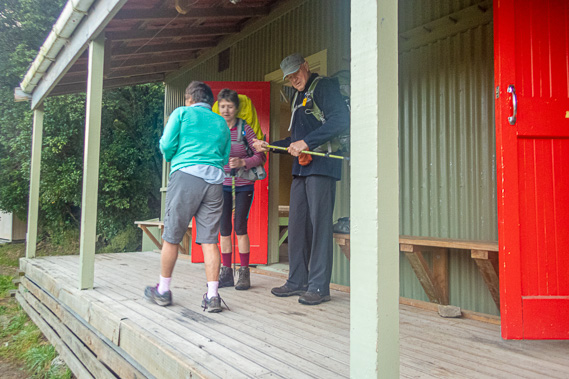 |
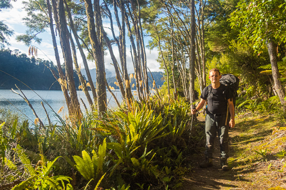
07:10 - Roger, mum and I are the first to leave the hut. Jan and Ken are almost ready, but Dean and Fiona decide to stay a little longer, having the entire bay to themselves for a while. Roger, who we have all established being one not to dally around, leaves first going on ahead at a fast pace keen to reach the water taxi landing point first. The harried walk will mean a long wait at the other end. |
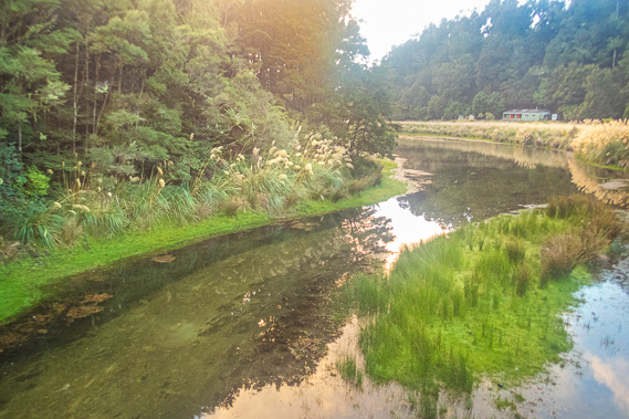 |
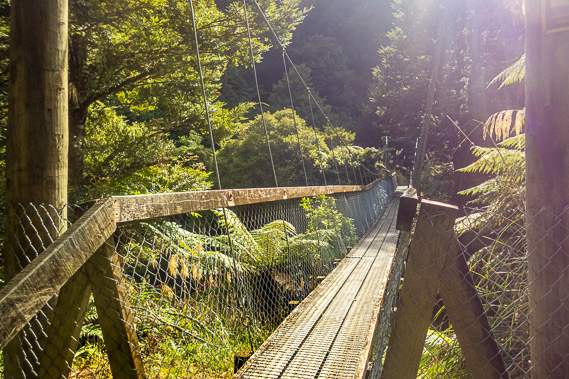
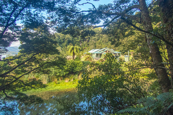
07:16 - We leave the hut following the track through the very long grass, reaching the sign advising (or perhaps suggesting, after yesterday's experience) the Waiharuru Hut was 2 hours, 6.2 kilometres away. Either the track is of a much easier grade than yesterday, or this sign was horribly wrong like the ones from yesterday. We follow the track towards Waiharuru catching the first glimpse of the risen sun just as we reach the swing bridge crossing Marauiti Stream. From the bridge I can see along the calm pool stretching around the next point towards its mouth in the lake. It is flooding some of the bright green short grass due to the lake being a little higher than usual with the recent rain. The hut stands nestled in the forest above the bend of the stream. The stream hugs the northern side of the valley quite tightly, framed with a line of toi toi. Once across the stream the track follows the side of the steep hill passing around huge boulders, but otherwise fairly flat and wide. It was definitely of a much better grade than the track we had walked along between Korokoro and Marauiti. In between a couple of the big boulders, we have a reasonably clear view back across to the hut and the lagoon, where Fiona and Dean are now swimming. |
 |
07:25 - We continue following above the edge of the inlet. The low rounded hills of the Whareama Range now appear about two kilometres offshore. These are the headlands stretching out to the right of the Waiopaoa Hut. Towering behind those hills is the slightly jagged Panekire Range looking quite distant with streams of sun rays crossing in front of it. |
 |
07:57 - It is not long before we reach the point marking the entrance to Marauiti. A flat rock extended out into the water between Marauiti and Te Kopua Bay. Now we have reached the point, the track which has been going in an easterly direction out of Marauiti now turns to the north east to follow a reasonably straight line all the way towards Waiharuru Hut, which is supposed to be two hours from Marauiti. The route between here and Waiharuru follows what appears to be a fault line running along the northern half of Wairaumoana, passing along the backs of three bays divided by headlands rising before suddenly being cut off a few hundred metres out in a line extending from the row of headlands we have clambered over between Korokoro and the entrance to Maraunui yesterday. |
 |
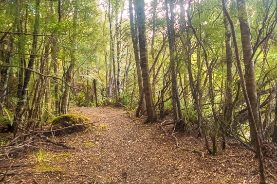
08:00 - Having just gone around the point, Jan and Ken caught up. Jan mentioned Ken had somehow developed a bit of a knee problem last night and it was slowing them down. They were getting a different water taxi from the rest of us, and their pickup point was about another half an hour past our pickup point, somewhere on the other side of Whanganui Hut. Our pickup point was just before the hut. Ken and Jan therefore had to move a little faster than the rest of us to make their launch which was coming at the same time as ours. We pass around another big boulder before the track quickly descends to a fairly flat area with even terrain though a little boggy as we head towards the back of the bay. The track through the leaf litter of the scrubby beech forest is now easily wide enough for a quad bike to go over with reasonable speed. I can see the forested saddle ahead. |
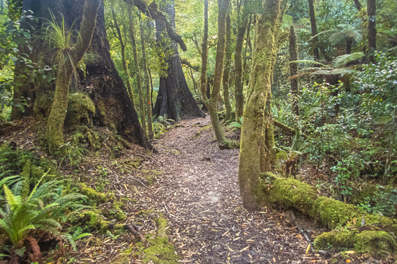 |
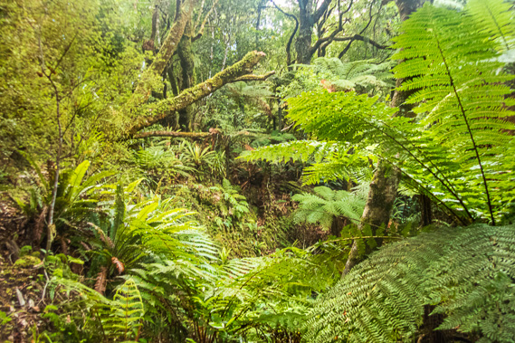
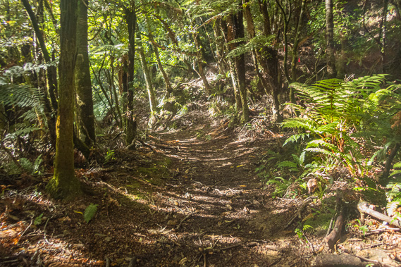
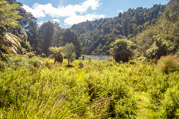
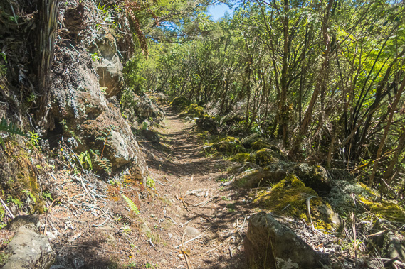
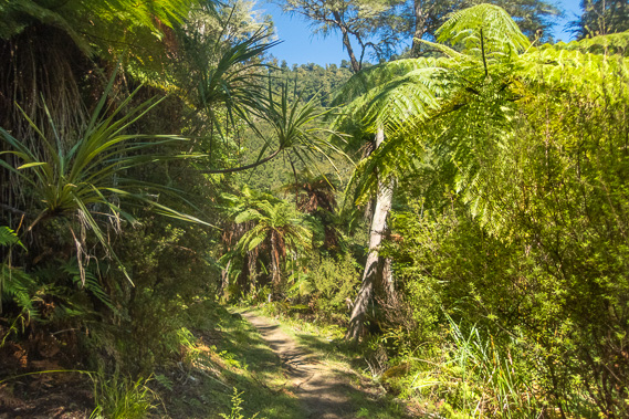
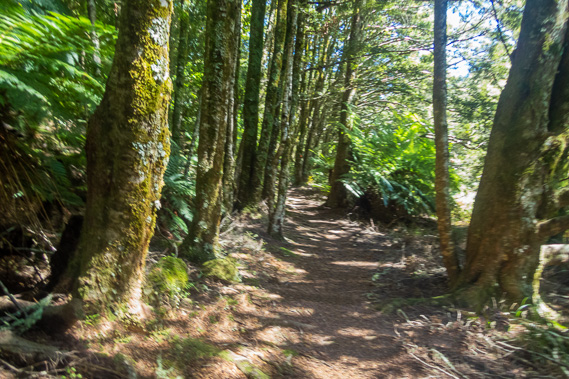
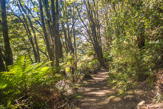
08:23 - In between the small headlands the gullies are full of many tree ferns and the ground covered in a thick carpet of large healthy crown ferns. These ferns provide perfect foraging for the elusive ground dwelling animals such as the kiwis. Eventually the track leaves the bay following a broad gully in the dense tree ferns towards the saddle. This is the first of three saddles we need to cross today, although the first two were very small. This first saddle only rises sixty metres above the lake, even lower than the Whakaneke Spur between Maraunui and Marauiti at the end of yesterday. The forest is pristine and refreshed from the rain fallen in recent days. Huge beech trees with buttressed roots tower above us blocking the sun trying to cross over the hill. The track is still in very good condition though, much better than yesterday's track allowing us to maintain a good pace towards our pickup point at Whanganui later today. |
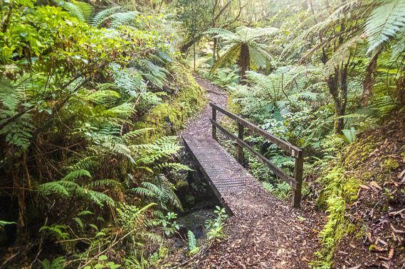 |
08:28 - Once we cross the top of the low saddle, the track gradually descends to a small wooden bridge crossing a small stream in the dense forest of tree ferns. The sun has come out on this side, filtering through the bright green foliage. |
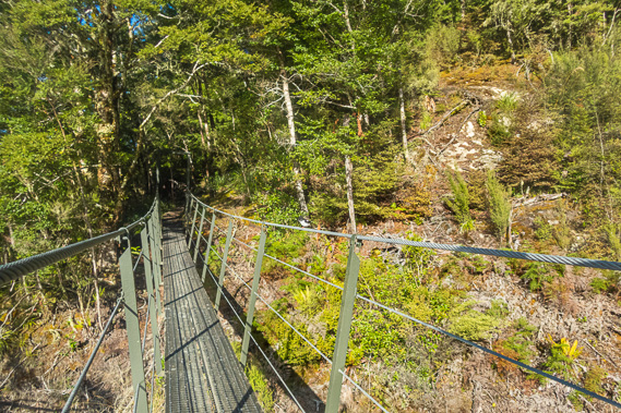 |
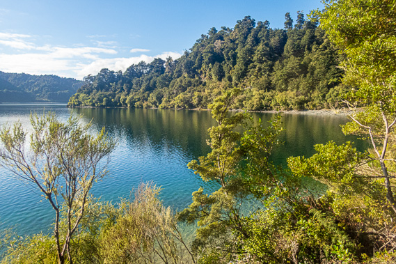
08:56 - Near the bottom of the saddle I see the pristine waters of Te Totara Bay. The track leaps across a swing bridge crossing the Waitotara Stream. The side of the bay is quite steep, so the track narrows a little with another swing bridge crossing a particularly steep gully. |
 |
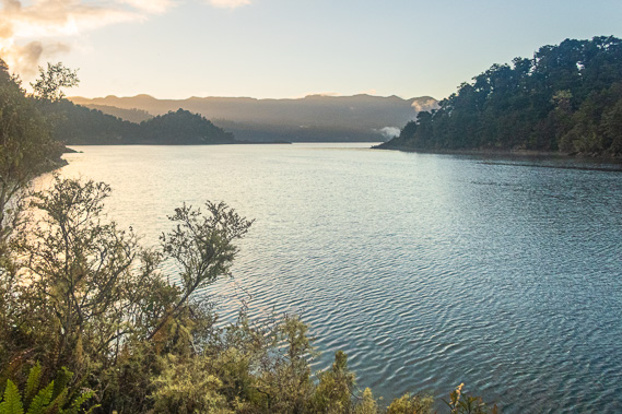
08:57 - From here I have a good view out of the bay through The Narrows into the start of the main section of the lake. Behind The Narrows stands the far end of the Panekire Range, now covered in a cloak of white cloud. It will be very foggy up there now, but the rest of the sky is now mostly clear with patchy thin low cloud. |
 |
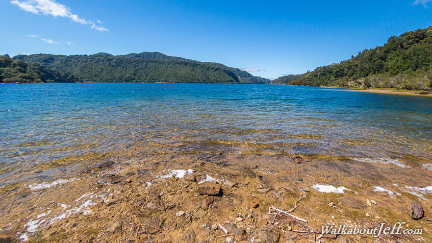
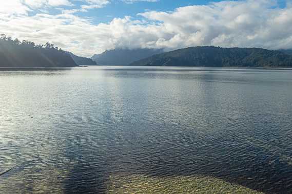
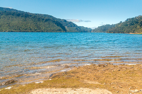
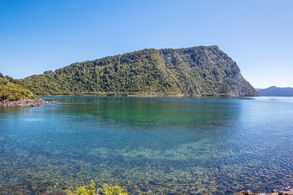
09:05 - We reach a short headland separating Te Totara Bay from Ahimanu Bay. From the headland I see back into the perfectly clear waters of Te Totara Bay and the low saddle behind it we crossed a little earlier. It was such a tranquil setting hardly a ripple on the blue surface of the lake. The sandy bottom quickly drops off into the black depths of the lake, not giving up any clues to the forest it had drowned 2200 years ago. |
 |
09:16 - We round the small point going along the wide track surrounded by thick undergrowth of crown ferns in the bright sunlight giving a brief view of Ahimanu Bay. The track begins a gradual ascent towards the next small saddle behind a small hill at the end of the bay. This is the last we will see the bay. The tall beech forest has now given way to thick scrub giving no views apart from the track immediately ahead. By now the track is boxed with wooden sleepers on either side holding in gravel, making an otherwise boggy walk very easy. The saddle is very low, rising less than twenty metres. The moderate descent on the other side quickly brings us to the next unnamed bay. The water here is a deep pristine colour. We pass the 33 kilometre milestone plank marker. Shortly afterwards we have another view across the almost mirror flat bay towards The Narrows, by now mostly concealed. The cloud is starting to clear above the Panekire Range now and overhead it is almost completely clear. |
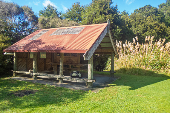 |
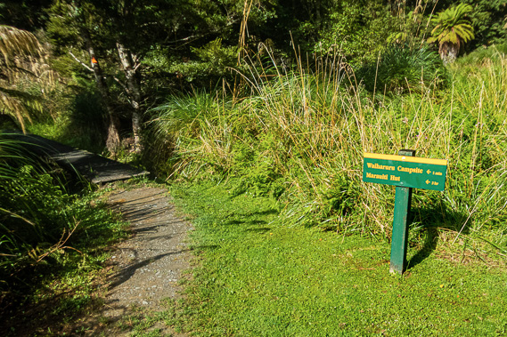
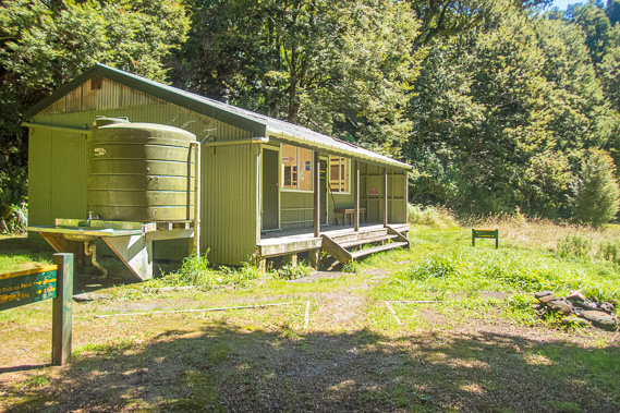
09:46 - We continue heading into Upokororo bay when we reach a sign pointing to Waiharuru Campsite at the start of a swampy area. This is going to be our resting spot and we are making good time. We turn off towards Waiharuru and less than a minute later reaching a large grassy area with a shelter identical to the ones we had seen in the other camping grounds. Ken and Jan are there, but Roger has already pressed on towards the launch pick-up point. We relax here taking in the views between the large clumps of toi toi across towards the clearing Panekire Range, towards where the hut would be on top of the ridge. Just across the other side of the grass looking towards a small valley stands two huts. They are cut off from the camping ground by some long grass. These are the new huts recently constructed replacing an old hut in the next bay further along the track. Given this hut is so close to Marauiti and also to Whanganui, I wonder if many people stay here at all, especially with such a long leg between Waiopaoa and Marauiti. Perhaps they are planning to build another hut at Korokoro. |
 |
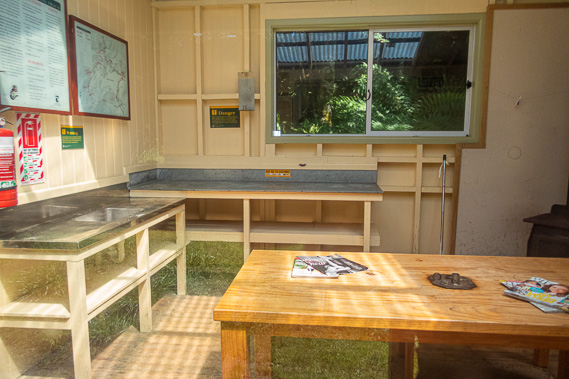
10:03 - Dean and Fiona arrived just as we are leaving. We head back onto the main track crossing a small swamp and bridge over a small stream before reaching the entrance to the 40 bed Waiharuru Hut. The lawn on this side is even more perfectly manicured, almost of golf course standard. There are actually two huts here, one being the large kitchen and dining area and the other being the bunkrooms. |
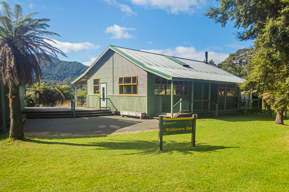 |
10:04 - This is the Rolls Royce of huts along the track, having replaced two older huts in the area. I wonder if many people do stay here though as most people complete the track in four days as we had done, and some (like Dean and Fiona) completing it in three. We are only a couple of hours out from Whanganui and another two hours back to Marauiti. As we had discovered yesterday the track between Marauiti and Waiopaoa is very long. The extra two hours going from here to Waiopaoa could make for a very long day. If this hut is intended to replace Marauiti, a new hut will have to be built at Korokoro, perhaps replacing the one at Waiopaoa. A sign here says the Tapuaenui Campsite is 2.1 kilometres away, taking an hour and a half over the saddle. Beyond Tapuaenui Campsite, Whanganui Hut where we were getting picked up is another 3.2 kilometres or one hour away. This put us at about two and a half hours away from the pickup point with just over three and a half hours before our boat arrives. Assuming these signs were correct, we have an hour of leeway to work with. Given yesterday’s signage though, we still aim to get to the landing as quickly as possible and use up the leeway waiting for the boat. |
 |
10:06 - From the hut the track heads up the valley for about a hundred metres before reaching a long wooden swing bridge over the Waiharuru Stream. Now Waiharuru means either roar/continuous noise water or fetid foul smelling water. The water is crystal clear so I assume it meant the earlier definition. It wasn’t exactly roaring though, so perhaps it had been named following a flood or maybe it does cascade over boulders further upstream. It crosses the flat waters of the stream sitting placid with a couple of ducks paddling along its length towards its mouth. |
 |
10:08 - In 1954 the area around here became well recognized for its spectacular forests and tranquil lake. The catchments of Lake Waikaremoana, Lake Waikareiti and a few other surrounding Crown reserves were collectively gazette as the Urewera National Park. The national park had no access apart from the gravel highway until 1962 when construction of the track began by student volunteers. It was built by secondary school boys over the following ten years. |
 |
10:16 - We reach the scrubby headland at the mouth of the stream. From there the track goes through the back of the large grassy area around the back of Upokororo Bay until reaching Upokororo Stream, the first of two crystal clear streams. We follow the thick forested side of the stream to a small wooden bridge, crossing it and continuing around the grassy flats that had once been the lake’s shelf. We then reach another stream where we cross on another small wooden bridge over the Waapu Stream before starting an uphill ascent. |
 |
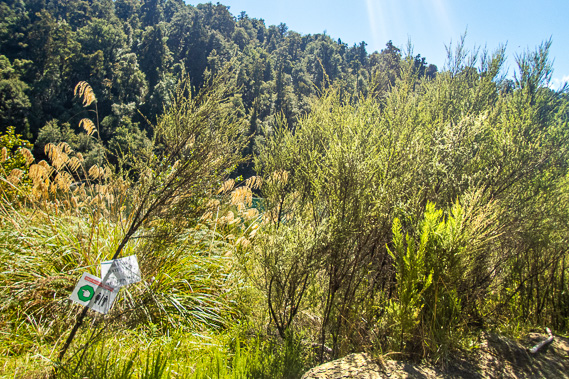
10:35 - Just past the bridge is a noticeboard discussing the kiwi recovery program on the peninsula. Dean and Fiona catch up to us here as we were reading though it. They didn’t stop, pressing on. We are going to climb to a saddle separating the peninsula from the rest of the hills. To our right the peninsula is fenced off to protect the kiwi population. The kiwi is the national bird of New Zealand. It was once very common with around 12 million of them freely roaming around the forest floor sticking their beaks into rotting wood eating grubs. They were a strange nocturnal bird now believed to be a close relative of the Australian emu, but separated by tens of millions of years. Isolated in the dense forests of New Zealand on difficult terrain, the kiwi has evolved into quite a small bird, losing its flight and its feathers almost turning into hair to insulate it from the harsh climate. In recent decades their numbers have fallen to below 100,000 due to predation from weasels, stoats and ferrets. The Puketukutuku Peninsula and the Waiharuru Stream catchment areas have been set aside as fenced kiwi refuges. |
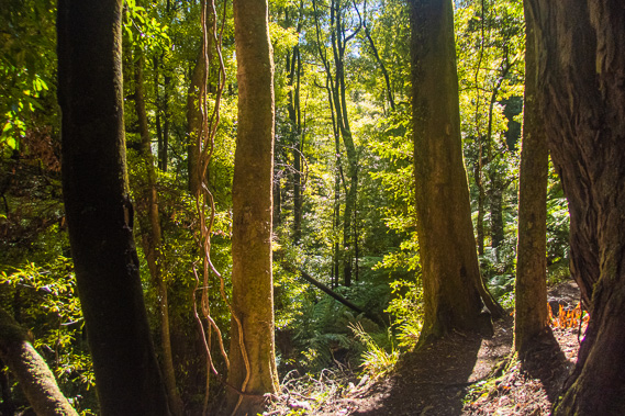 |
10:59 - The strong late morning sun filters through the tall forest to patches on the otherwise dark forest floor. The track rises to a low saddle but continues heading up the hill following a ridge. Ferns cover the ground and the forest canopy cut off views across the gully into the peninsula. The orange triangles continued leading the way as they have done all the way since Onepoto. The track rises moderately with a few steep sections over roots until reaching the top of the ridge about a hundred metres above the lake. The track follows the top of the ridge through dense tree ferns and tall beech trees for a little while before crossing to the left. The Kiwi Recovery Programme was set up in 1991 by a joint effort by the local Tuhoe Maori, the Department of Conservation, and Landcare Research New Zealand. |
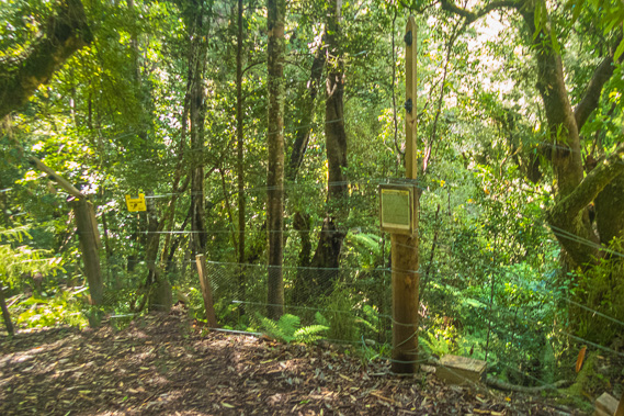 |
11:14 - We eventually reach the top of the saddle about 110 metres above the lake, cutting between hills on either side rising over three hundred metres above the lake. The thick canopy makes the forest here surprisingly dark. A short distance down the other side the track reaches the edge of the electric fence keeping all the pests out. The fenceposts are solid round trunks and the wire is well constructed making for a very strong fence. A small sign explains the Kiwi Dispersal Fence. The fence is here mostly to keep the kiwis in, preventing them from leaving the safety of the peninsula into the unprotected forest full of predators. The population is being closely monitored and when it reaches 250 birds, the fence will be removed allowing them to migrate further into the forest. The track moderately descends along a gully. The forest was still thick with a high canopy, but there is plenty of light ahead of us from the Whanganui inlet. We are making quite a good pace along the long descent. |
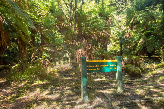 |
11:30 - Eventually we reach the shelf of the old lake shoreline. The forest is still thick here despite the smaller trees. In the midst of the dark forest floor we reach a junction. A sign at the junction points to the Tapuaenui Campsite a little to our right. |
 |
11:33 - I see it through the bush, a nice little campsite along the edge of the lake at the Whanganui Inlet. Tapuaenui means large footprint, the history of which has been lost to time. There are 12 campsites with no water supply. Being so close to Whanganui Hut and the start of the track, I imagine not many people stay here. With a boat to catch at the back of the Whanganui Inlet, there is no time to linger here. |
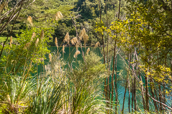 |
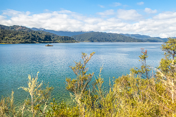
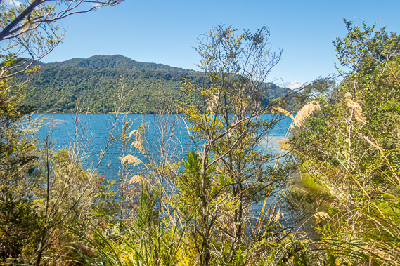
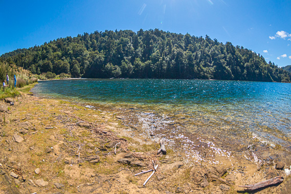
11:56 - We follow the track from the thick grove of beech forest to a large grassy area full of large thistles, brought over from England and now growing rampant in New Zealand. It returns into the forest above the pristine lake of turquoise water in Tapuaenui Bay. The hills are covered in thick scrub so clear views of the lake are few and far between. Where the scrub does clear, we have good views with toi toi growing in the foreground. |
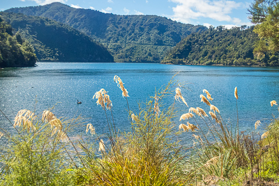 |
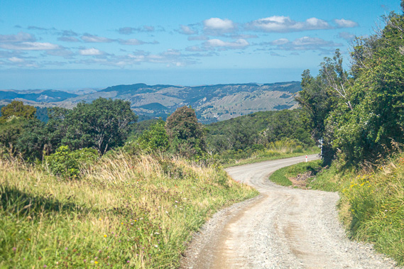
11:59 - There are a few black swan on the lake soaking up the sun. Looking across to the other side I can see a thin descending scar across the forested hills. This is the main highway between Wairoa and Murupara, heading up towards the Taupeupe Saddle on the main divide of the Huiarau Range (named after the feathers of the huia bird used by the Maori for cultural purposes) at 923 metres above sea level. The road winds its way around the other side of the lake. Although it is a highway, the road runns continuously gravel for ninety kilometres from Aniwaniwa to Murupara. This section is particularly rough due to the steep terrain. I don’t see any cars following the road, and if there are any, the rain of the past two days would be keeping the dust of the gravel road down. |
 |
12:08 - The track becomes a little rough, but not enough to slow us down too much. In flat sections the track is rather boggy underfoot, but without any significant puddles or bogs. We continue through thick scrub with the occasional grassy patch. A few trees have fallen over the track creating a few minor obstacles but otherwise we are still making good progress. Fortunately there is very little undulation. I find some round leaf fern growing beside the track, usually found in drier areas where other species of fern is unable to survive. |
 |
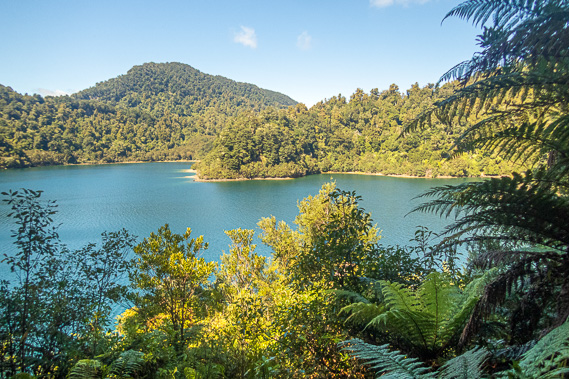
12:17 - We reach a gap where I see through the scrub across the lake to a distant grass clearing at the end of the Whanganui Inlet. This clearing marks the mouth of the Hopuruahine Stream which drains down from near the Taupeupe Saddle where the road crosses over the Huiarau Range, and is by far the largest stream flowing into the lake. It is also where the track meets the road, but most people don’t walk it that far. Nearly everyone gets picked by up boat at one of the launch pickup points. For Jan and Ken, the point is at the left of the grass clearing. For the rest of us it is earlier in the headwaters of the Whanganui Inlet which sweeps away to the left of the next spur. |
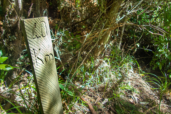 |
12:25 - The headlands rising out of the turquoise Whanganui Inlet become quite steep and the track a bit rocky as we reach the 40 kilometre milestone. We are forty kilometres out from Onepoto and just two to go to our pick-up point. From here the bush thickens and tree ferns begin to appear again. The muddy sections seem to be behind us now as we enter a small cove and cross a small wooden bridge over an almost dry creek. The forest quickly increases in age and height as we rise around a few small headlands. |
 |
12:35 - Hopuruahine means to capture the native flax that grows around this area, I assume being the same species at Waiopaoa. Flax is a big part of Maori culture. The very strong fibres of the flax leaves are used to make clothing and baskets, and mats for their houses. The early Maori used to follow the river upstream to the pass and cross over to their lands of Murupara heading down towards the Bay of Plenty. They created a walking track through the magnificent forest. This would have been a very remote area for them to travel. The lake was so isolated it made a good refuge for outlaws escaping the armed Europeans who pursued them. |
 |
12:49 - The most famous of these outlaws was the Maori warrior prophet Te Kooti who was originally from the Tuhoe tribal lands, of Ruapani blood. He moved eastward to the remote Chatham Islands in the 1860s. He returned to the North Island in 1865 at the times of the Maori wars to fight the Europeans, but upon finding his group was greatly outnumbered by the gun wielding Europeans, in 1868 he sought refuge here in his homelands where it was still very remote and unfamiliar to the foreigner settlers. He sheltered here until 1872 when the Tuhoe were conquered by the colonial settlers. From here he escaped to the King Country where he stayed under the protection of the Maori King. There he developed his religion to which would be widely followed by the Maori. |
 |
12:50 - The track finally drops to a very small grassy patch where we find a laminated A4 piece of paper attached to a two metre high twiggy kanuka shrub. This is the pick-up point. Another laminated sign directly underneath it points along the main track to the toilets, which I presumed are at the Whanganui Hut. We turn off the main track to the right along a short rough path to a large flat exposed rock where the others were resting. We had made it. Ken and Jan had continued onto the Hopuruahine pickup point, so we would never see them again. |
 |
12:53 - The bluff has a few very small shrubs growing on it, but it is mostly clear no doubt due to the large numbers of people who have waited here for boats in the past, and perhaps also due to the mice and rabbits that settled here when the lake was lowered. Fortunately the vermin wasn’t such a problem now. In 1998 the Electricity Corporation of New Zealand (as it was known as the time) successfully negotiated ongoing resource consents to continue to use the lake water for electricity generation until 2032 as it has done since the late 1940s. The agreements include operating limits on the lake – the water level varying only by three metres at the most, ranging from 580.29m above sea level to 583.29 metres above sea level. When the water level approaches the maximum, floodgates can open at Onepoto to let the excess water out. |
 |
12:56 - They are also required to use a range of environmental monitoring programs, including some to control the vermin population along the lake’s new regenerating shelves. The vermin populations impact on the bird populations which we had discovered are pretty sparse here as they are in most of New Zealand. The company also monitors the vegetation along the shelving. It also monitors the trout population in the lake. There are both brown and rainbow trout in the lake, and fishing licenses are available from the Waikaremoana Motor Camp. I haven’t seen anyone fishing on the lake. I think all the fishing happens from around Aniwaniwa. |
 |
12:59 - Looking out from the bluff, the water is crystal clear, creating a deep blue channel passing the rock for the boat to easily land. The channel conceals the deep gully where the stream flows towards the main river heading towards the distant gorge now deeply buried under the collapsed mountains at Onepoto. A small post with another laminated A4 page indicates the pick-up point. We can see out towards the entrance of the Whanganui Inlet which sweeps around to the right behind Tapuaenui Point into the main lake. A gentle sea breeze is bringing small wavelets breaking on the small beach at the bottom of the rock. |
 |
13:14 - With nearly an hour to go to our pick-up time, and needing to use a toilet, I head back to the main track and continued following it through the tall beech forest. The forest quickly thickens with large trees climbing above the rising valley. There is still a clear area where the lake extends back towards the mouth of the stream. After about five minutes I reach a gully with a small bridge over the Whanganui Stream. Once across the short bridge I see through the dark bush to the hut, sitting at the back of a grassy clearing. |
 |
13:18 - I ascend the short slope from the stream through the dark forest into the strikingly bright grassy clearing. There are no trees overhead allowing the bright sunlight to brilliantly illuminate the almost florescent grass leading up to the hut. The Whanganui Hut is a small version of the other huts, about the size of the Marauiti Hut but without the ghastly colour scheme, appearing to be more recently built, perhaps in the late 1980s to early 1990s. The inside of the hut is painted a soft peach colour which is a lot better on the eye than Marauiti. |
 |
13:19 - Nobody is in the hut. I guess this will only be used by people getting picked up early in the morning or being dropped off too late in the afternoon to have time to cross the saddle to the next hut. The small bunk room has eighteen bunks on three levels. The hut merges into the forest with a nice grassy patch extending from the front balcony across to the toilets on the other side. It would be a very pleasant place to stay here at the back of the turquoise Whanganui Inlet. This was as far as I am going. The track continues past the hut heading out the other side of the bay going around a scenic point looking into the Huiarau Inlet and the Hopuruahine River to the suspension bridge to the road. The point would be where Ken and Jan are being picked up. |
 |
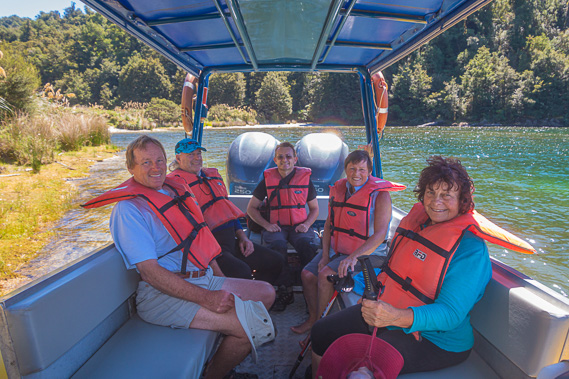
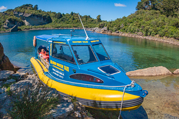
13:24 - After my toilet break I return along the track back to the boat pickup point. We sit relaxing on the rocky beach for another fifteen minutes before I see the boat tearing around the corner into the inlet. Over the following minutes, it follows the deep channel towards us before turning around and beaching on the bank behind us about twenty metres upstream from where we are resting. It has arrived about twenty minutes early ready to take us back to civilisation. |
 |
13:45 - From what I’ve read in the hut intentions books and heard from hikers and rangers along the track, the boat does normally arrive on time, but given the requirement to conduct any rescues as needed, it sometimes arrives quite late. I was talking to someone about a week ago, getting some tips from them as they had hiked the trail last year. They mentioned their group had to wait a long time as their boat arrived four hours late due to a rescue they had to do at Waiopaoa, probably someone who didn’t want to hike over Panekire. Fortunately the company that runs the boat also runs the van picking us up at Onepoto, so we will be arriving back in Wairoa tonight even if the boat was late. |
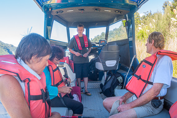 |
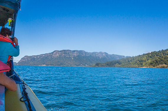
13:46 - The boat is a large inflatable seating up to around ten people. It has a small cabin at the front where the young driver can operate it and stay dry in even the most inclement of weather. A roof extendsd along its length to shelter us from the sun today, or the rain of previous days. He gave us life jackets and helped us and our packs on board. He starts a quick safety drill before casting off. The lake is considered safe for most boats but the conditions here can change very rapidly. |
 |
13:53 - Recalling the sudden southerly front on the range three days ago, this is a very routine change in weather. Normally the change wouldn’t be as dramatic as on the range, but the lake still has a reputation of going from almost mirror flat to a raging tempest with almost no notice. Fortunately, the weather is clearing today with the southerly having blown itself out. The clouds that had still covered much of the sky early this morning have all but gone, with hardly a breath of wind remaining. |
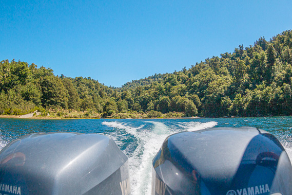 |
13:54 - Two powerful outboard motors propel the boat quickly through the almost completely flat water. It wasn’t rocking at all with any swell. The weather conditions are perfect with the clouds almost completely cleared. White water flows off the sides and creates a stream a long way behind the boat with a wake extending on either side behind us.
|
 |
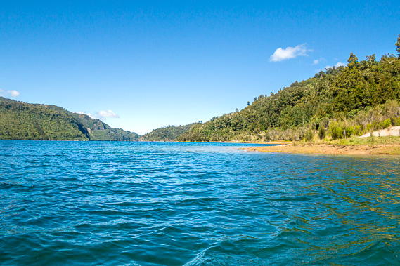
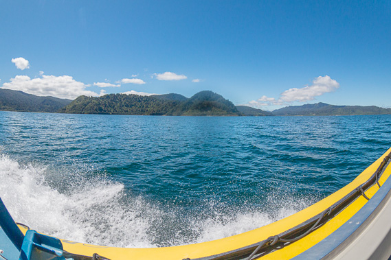
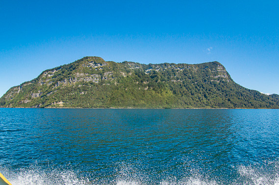
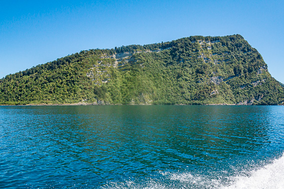
13:57 - From there we start going around the peninsula towards the main lake. We pass remote headland after headland, the triangular forested hills behind them the home of the kiwi population resembling what it would have been like during prehistoric times. The track along the side of the inlet is almost completely invisible from the lake. The rocky clearing disappears behind us very quickly. It is not long before we are passing Tapuaenui Bay and the saddle we have crossed the Puketukutuku Range behind it. From here the saddle appears very low, not at all looking like an hour and a half of effort at the end of a four day trek. |
 |
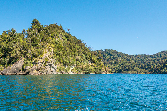
13:59 - As the Panekire Range continues to reveal itself, I spot Bald Knob towards the end of the high cliffs, the hill distinguishable from the others along the range as it didn’t have any forest on top of it (hence its name). Eventually I can see the dip above which the hill containing the Panekire Hut stands. From down here the hill seems no more than a diminutive bump on the range. It had hardly felt that way when we had been climbing the long staircase up the bluff as the approaching night was darkening the misty southerly rain, at its top reaching the welcome clearing with the rustic hut on the exposed ridge. Looking to the left the hills on the northern side of the lake are very low. A long bay stretches quite some distance, but still very small compared to Aniwaniwa coming up around the next headland. |
 |
14:00 - Over history there have been a few Maori settlements around the lake. Most of these have been lost in time, with just the remote settlements of Waikaremoana and Aniwaniwa on the other side of the lake still remaining. Even those villages have little evidence of the ancient settlements. Two groups of Maori occupied the lake before European settlement. The first of these groups were the Ngati Ruapani. Today they are based around northern Hawkes Bay and southern Gisbourne along the coast. The tribe takes its name from their ancestor Ruapani who was born around the year 1450 at the Popoia Pa on the Waiopaoa River about 21 kilometres north of Gisbourne. He was considered royalty being descended eight generations down from Papa, the captain of the Horourta canoe of the first Maori settlers who arrived two hundred years earlier. Ruapani was also directly descended from Kiwa, the canoe’s priest. He is also descended directly from Paikea who is believed to have crossed the oceans to New Zealand on the back of a whale. This mysterious Maori legend was made popular by the movie ‘Whale Rider’. Ruapani is also said to be descended directly from the Toi people and also Maia who is said to have crossed the oceans travelling on a gourd. Given all these lines, Ruapani was revered as the convergence of all lines of Maori greatness. Ruapani became chief of not only his tribe, but also became paramount chief of all the Turanganui tribes at around age 75 in 1525. The Ruapani Five Lakes across the other side of the lake are named as tribute of Ruapani and his family, who would have perhaps otherwise been lost to history.
|
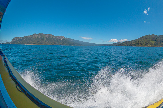 |
14:01 - I can just see through The Narrows getting a final glimpse into Wairaumoana to the bays we had walked past this morning. The flooded valleys we had followed the past two days are to become concealed from us forever as the sides of the gap closed. The hills from the Panekire Range seem to sweep upwards indicating there had been more uplift inland than there had been towards the coast.
|
 |
14:03 - The collapsed mountain has successfully held the lake back without bursting for 2200 years, and with the help of the reinforced intake at Onepoto, there is little chance of it bursting now. The middle of the lake here would have been a broad valley of a gently flowing meandering stream anticipating its leap down the gorge. Here the lake is around 250 metres deep - the deepest in the North Island. The river would have dropped about a 150 metres elevation as it dramatically cascaded down the narrow gorge. The collapse of the ranges on either side would have been a very dramatic event to watch. |
 |
14:07 - There is a bit of a swell here in the middle of the lake, with the Panekire Range hardly reflecting at all. Fortunately the swell hardly rocks the boat, just sending lots of spray off on either side of the boat, but none came into the boat itself. Looking behind us, the Whanganui Inlet is still directly behind us with part of the main dividing range now visible in the distance. There are some clouds still hovering to the right of the inlet but the sky is otherwise clear now. |
 |
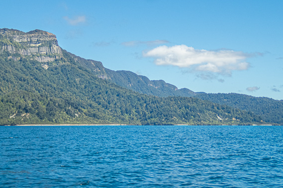
14:09 - The far end of the Panekire Range is now sweeping back soon to go out of view behind Bald Knob. We are getting quite close to the range now seeing the distinctive bands of the layers of sandstone deposited at different times over the past ten to fifteen million years when New Zealand was almost flat, being the final remnants of the Zealandia Continent before the new fault line opened up splitting the almost dead continent to bring it back to life to the new islands we now know as New Zealand. We are the only boat on the entire lake (although the other boat picking up the other couple couldn’t be too far behind). Few people bring boats up the long winding gravel road to this lake. Jet skis, houseboats and float planes aren’t allowed here. If it were not for the roar of the large twin outboard motors of this boat, the lake would be completely silent out here. Bald Knob disappears behind Panekire Bluff now showing only this end of the range, and the ascent from Onepoto now just visible. The round hill Raekahu at the constabulary at the start of the track was now visible standing clear above the skyline. |
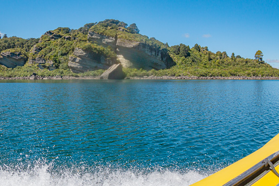 |
14:10 - The hills around Onepoto are very low, not giving away the enormous drop of almost six hundred metres on the other side. We approach our landing point at Onepoto Bay. The water is a lot smoother now, although still ruffled, but enough to create a reflection of the range. The ascent up the range is now clearly visible with the goblin forest above the top of the rising cliff lining the top of the range. In front of us the collapsed part of the range appears very jagged, showing a channel along which the lake once drained during floods, but the water escaps mainly through the seepage through the natural dam. Next to the old channel the collapsed range has dramatic rock formations from the broken range. These are the Onepoto Caves. I can see the layered strata in the rock appearing at different angles showing the enormous fracturing that has happened here as the mountains collapsed into the gorge.
|
 |
14:12 - The boat slows as we cruise into the calm waters of Onepoto Bay, with the caves on one side and more broken rubble on the other side from the collapsed range. The driver pulls the boat up against the rocks, ties it up securely, then helps us out onto the rocks, from where there is a short walk across to the beach of Onepoto Bay.
|
 |
14:16 - From the low ridge between Onepoto and Sandy Bays, I have a dramatic view across to the start of the Panekire Range from the bottom up to the first trig. The rest of the range sweeps around behind these first cliffs. The next land we can see is the kiwi refuge of the now distant triangular forested hills of the Puketukutuku Peninsula on the other side of the lake. The turquoise water is crystal clear allowing us to see the rocky bottom of this bay. |
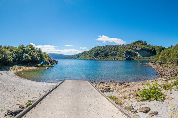 |
14:19 - The beach has a boat ramp in the middle of it going down into the crystal clear water of the lake with the bottom covered in huge boulders. The white overhanging rock faces of the Onepoto Caves are quite dramatic across the back of the bay. |
 |
14:27 - We only have a few minutes to appreciate the view before the van that had taken us from Wairoa to here just a few days ago arrives to take us back to the coast, back to civilisation. Crossing the low lip of the lake, the dramatic drop becomes immediately apparent as we look down the valley. |
|