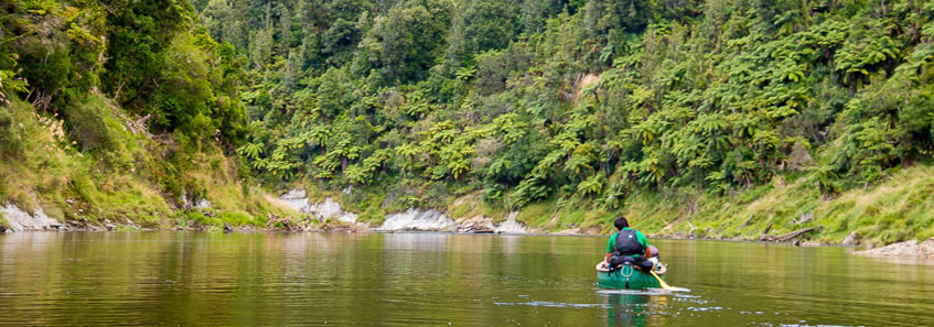
THE WHANGANUI JOURNEY is not a hike, but a canoe trip down New Zealand's longest navigable river. Whanganui River has a very deep cultural significance to the local Maori people. They tell of the legend of Mount Taranaki, once part of the group of volcanoes in the middle of the island making up the source of the river. Following a violent disagreement with Ruapehu, Taranaki was cast away to live in solitude from the rest of the group. Taranaki left the group, initially travelling west, then south carving out the deep and wide channel through which the river now flows. Upon reaching the sea, Taranaki turned to a north westward direction to stop in his current location where he rests to this day looking at his old clan. He often hides in cloud, but legend tells that one day Taranaki will return to Ruapehu and the rest of the clan following the Whanganui River upstream. Few Maori have settled along the river in fear of his return.
The trek by canoe begins at Ohinepane (though some people start further upstream at Taumaranui, and others start downstream at Whakahoro), stopping at numerous camping grounds as they head downstream. The river flows down the valley from Ohinepane passing Poukaria and Maharanui campsites (the latter of which I stay the first night). On the second day the journey continues to Whakahoro where the valley quickly changes to a very deep wildly meandering canyon as it enters the Whanganui National Park. Here the ancient forests cling to the hills above the high cliffs passing the Mangapapa Campsite eventually reaching Ohauora Campsite for the second night. On the third day the journey continues downstream passing the John Coull Hut and the mouths of the Tangarakau and Whangamomona Rivers before reaching the spectacular Mangawaiiti Campsite perched high on a ledge in the ravine. The fourth day continues downstream to Mangapurua where we land and follow a walking track to the mysterious Bridge to Nowhere before we return to the river and continue paddling down to Ramanui, opposite the Kieke Kainga marae. The final day starts with a gentle paddle through the most magnificent canyon of the trip before passing the mouth of the Manganui-a-te-Ao River and going down a succession of rapids to our final destination at Pipiriki, with a total paddle and hiking distance of 129.5 kilometres. |