Introduction to today's journey
E tohe e taa te purihi.
Persistence has its rewards.
- Maori proverb
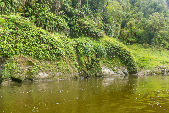
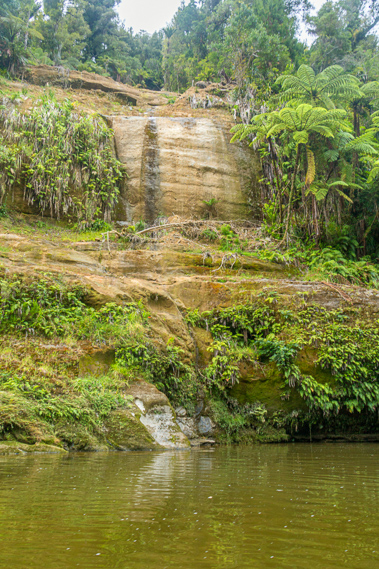
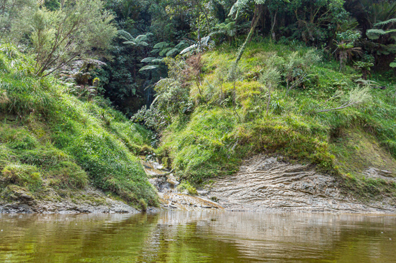
ON A remote ledge above perhaps the most beautiful part of the river was once a tribal village. Legend says the chief of this now abandoned village had a very beautiful
daughter who the young men of the river desired. They would travel from far along the river to see her. The chief would only give her to someone he saw as worthy. To be worthy, you had to paddle into the ravine beneath the village. The men of the village would throw rocks down whilst you paddle up to the creek and back to the river again. They said if you were successful, you were worthy of the chief's daughter's hand in marriage. It is not known if anyone succeeded. That part of the story is now lost in history along with almost all traces of this once mysterious village.
Today's journey continues downstream from Ohauora through the national park to John Coull Hut, were we stop for lunch. We then continue paddling downstream passing the mouths of the Whangamomona and Tangarakau Rivers before reaching the mysterious ravine and climbing up to the Mangawaiiti Camping Ground near the site of the abandoned village.
Today's Journey
Distance trekked today: 22.0 kilometres.
Total distance trekked to date: 83.5 kilometres.
 |
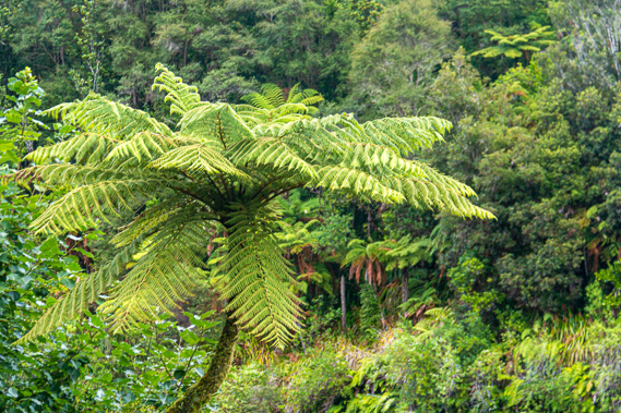
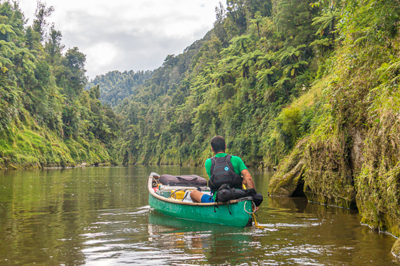
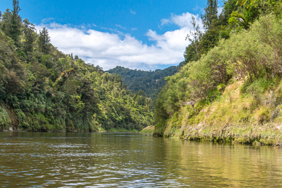
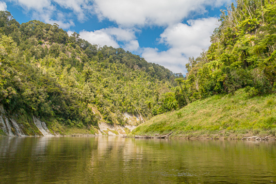
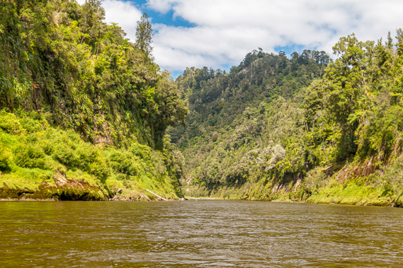
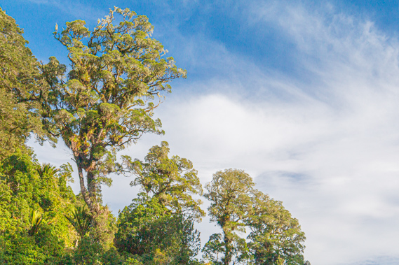
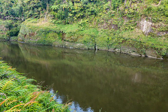
07:59 - The sky is just beginning to lighten when I get up. A layer of cloud covers the gaps between the forest canopy but no rain has fallen, and the dew on the cut grass is minimal. The cloud touches the hilltops. Cameron is already up preparing breakfast, but the others weren’t up yet. The river has dropped slightly overnight with the water a little clearer. The dark water slowly drifts past toppling over a small rapid where we will be heading down as soon as we cast off. Looking back to the camping ground the tree ferns stand strong under the overcast skies.
|
 |
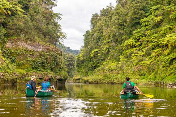
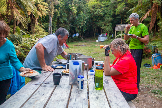
08:55 - I return to the camp. Most of the others are up now and breakfast is almost ready laid out over the rather cramped wooden picnic table under the shelter. The breakfast has a fair bit of variety in it with cooked bacon, scrambled eggs, hash browns and toast. There is also weetbix, muesli, tinned fruit and yoghurt. The other couple have a quick breakfast before packing up to paddle down to Mangapurua, around thirty kilometres downstream. They will be doing the Bridge to Nowhere early tomorrow morning before heading all the way down to Pipiriki. We are heading to the previous camping ground Mangawaiiti today, just 22 kilometres down the river. This will be significantly less than the thirty kilometres per day we have done over the past two days. We are already half way down the river (or half a kilometre short of half way to be exact). From here we are covering the same distance over three days. The shelter has an intentions book, but there are not many entries. Unlike most of the other great walks where most hikers are from the northern hemisphere, most of the entries in this book are from New Zealanders with quite a few from Australia and a scattering of people from Europe.
|
 |
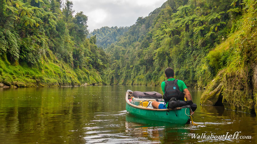
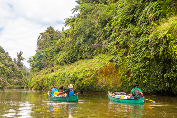
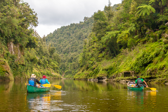
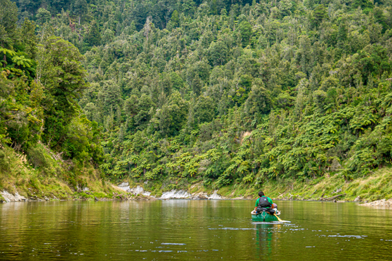
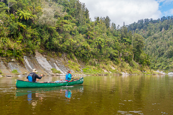
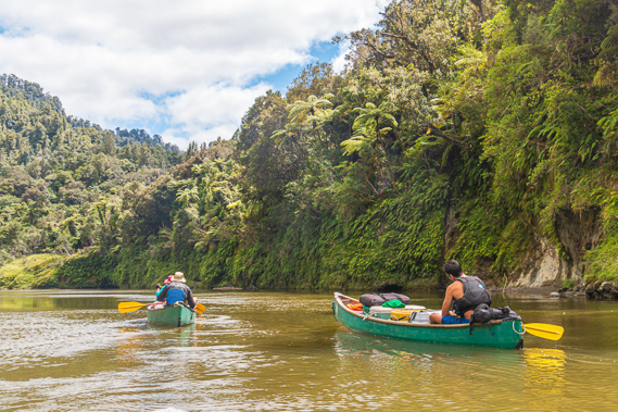
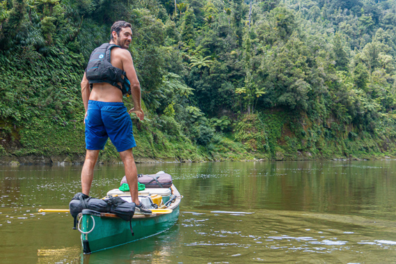
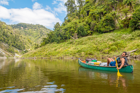
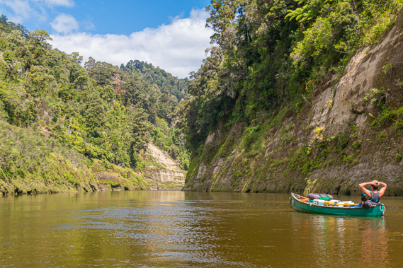
10:11 - Following breakfast we pack up our tents which are fortunately dry this morning unlike yesterday when they were saturated from the early morning rain. I pull my dry washing off my little line but somehow forget to take the line itself down. Once we are all packed up we carry our drums down the steps to the canoes. We quickly pack them up as Cameron carefully baggs the rope should we need it today. He mentions the rapid we were about to go down is one of the biggest we will see today, apart from a big rapid known as the Log Jam near our destination. Although it is still cloudy, the sun is trying to come out, so we all put plenty of sunscreen on. We take off and head down the Ohauora Rapid as it continues turning to the right bouncing a little over the white water. Once we are at the bottom of the rapid the river calms and begins a long gradual turn to the left going a full 180 degrees.
|
 |
10:19 - As we round the bend we pass the location where the Maori East-West Trail between Mount Ruapehu and Mount Taranaki once crossed the river. We were now almost exactly half way between the two volcanoes with this track once being the shortest route between them over the rugged terrain on either side of the river, although as far as the crow flies, we are still a little north of the half way line. The long overgrown and forgotten trail would be very difficult to navigate these days. Outside the national park any trace of the track is long gone with the clearing and ongoing maintenance of pastoral farmland. The high walls of the gorge makes any view of either volcano impossible. Just a couple of hundred metres gain in altitude would produce remarkable views of the mountains. |
 |
10:20 - Heading west the trail is believed to have climbed the spur to the top of the four hundred metre high hills and follows the ridge until reaching Heao Stream, a branch of the Tangarakau River where we will be passing the mouth of later today. From there the trail heads into Taranaki. Going eastward, the trail heads up to the top of the ridge running back across from Ohauora camp. No doubt there was a short side trail into Ohauora where travellers would have stayed the night and perhaps be rowed across the river. We round the back of the bend before heading into the Auroa Rapid. The 308 metre high Te Auroa Hill towers to the right and a large shingle bank rises around the bend to the left.
|
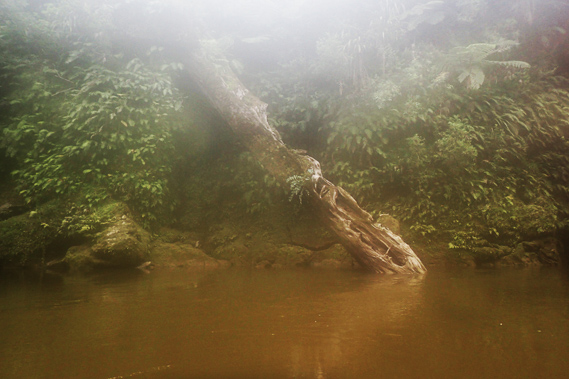 |
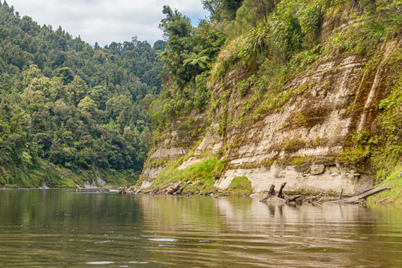
10:38 - We pass a large tree that had fallen into the river still standing upside down at a sixty degree angle. Cameron mentions a Maori family was photographed here sometime in the late 1800s, and the photo was quite famous having been taken in such a remote location. Despite massive floods over the years, the tree has remained wedged in its exact position since the photo was taken. He mentions the floods of June last year reaching a good eleven metres above the current water level. The vegetation here is torn off the soft mudstone in a line about ten metres above the water and small plants and ferns are already regenerating over the vertical bank that has been stripped clean from the flood.
|
 |
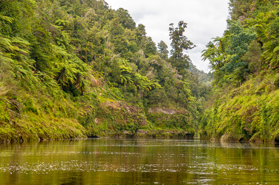
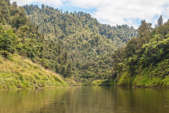
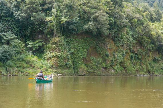
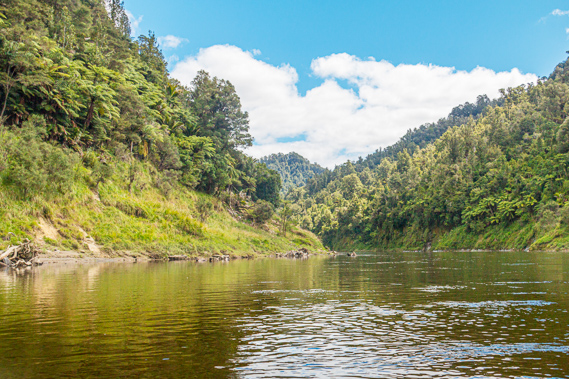
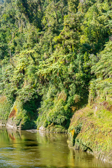
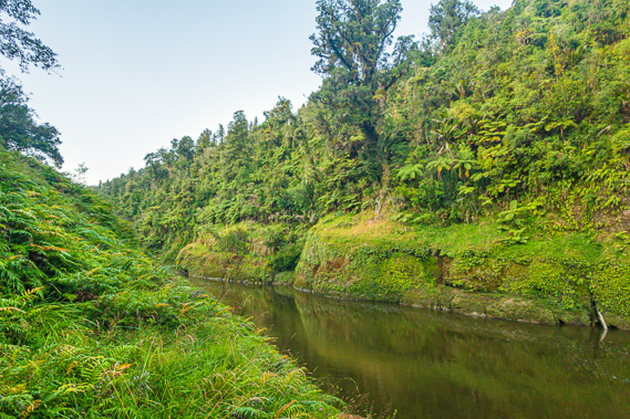
11:01 - Tree ferns hang over the green banks, with ancient forest draping the steep hills above the flood line. Although the terrain is now steeper than it had been at Ohauora, this certainly isn't the spectacular gorges we were winding our way through yesterday. There is a short break of calm water before we enter Whatakiwi, the first of ten rapids in quick succession. There was a rock in the middle of the river but the turbulence was minimal. The name of the rapid means an elevated place containing kiwis. The native nocturnal kiwi was once a very common bird dwelling the forest floor throughout New Zealand feeding on the grubs in the rotten logs. The introduction of predators has reduced its concentration drastically. Whilst there would still be kiwis in this area, they would be as elusive as the taniwha. During Maori settlement, they were would have been very commonplace along the river, and perhaps they were in particularly high concentrations around here.
|
 |
11:08 - The long bend ends at the slight Otumape rapid with a shingle bank to the right. The rapid marks the start of the Otaihanga Reach. This is quickly followed by the gentle Whakaawatea Rapid with some rocks sticking out of the water to the right. A little further along the straight is the very minor Parikarangaranga Rapid over a few submerged rocks. The name means echoing cliffs, where your voice would project bouncing off either side of the tall cliffs towering from either side of the river – that was certainly the case of Cameron with his excellent voice projection.
|
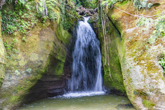 |
11:09 - Small waterfalls still draining yesterday's rainfall drip down the banks keeping the fernery very moist. The waterfalls are closely followed by the hardly noticeable Otaehanga Rapid, then the Pokorua Rapid at a point where the river kinks a little to the right. The rapid is just a little downstream from where the Pokorua stream flows into the river, named for the deep ravine it flows through. This rapid marks the start of several mineral sulphur springs bubbling up on the left bank. The stream flows into the river from a ravine to the left. A three metre high waterfall fans out plunging into this ravine about two boat lengths in. |
 |
11:18 - We pass through the very minor Oputara Rapid about half way along the straight before heading to the left side of the river following a flat channel to the left around a bank of shingle. |
 |
11:21 - The Maori and Pacific Islanders were excellent with navigation and used the stars at night to accurately plot their courses between the tiny islands over the great Pacific Ocean. Although there wouldn’t have been much use for this navigation through the narrow gorge and dense forests surrounding it. Here the river dictated navigation – you are either going upstream or downstream, and the Maori travellers knew every bend, every rapid, and every cliff along the way. |
 |
11:22 - We pass a short terrace above the river to the left covered in tree ferns. On either side much of the soil of the cliffs has been stripped by recent landslides. |
 |
11:45 - There is a short break before the Te Miro Rapid where the channel funnels between shallow breaks into some slightly bumpy white water. The rapid is named after the miro tree, otherwise known as the brown pine or Prumnopitys ferrunginea. It is a close relative of the matai having curved leaves arranged in two rows (unlike the matai which has them going in all directions perpendicular to the stems). We enter another kink in the straight where the Nikotapu Rapid passed some rocks and a little turbulence. This is the last rapid in the succession, and the end of the row of sulphur springs. We enter another short ravine but this one didn’t have any waterfalls in it.
|
 |
11:46 - Upon leaving the ravine we continue along the flat water slowly enough for me to continue a bit of photography. At one point I lose coordination and my paddle falls over the side. Fortunately the two ladies are just two boat lengths behind and pick it up for me. This is the second time I’ve lost my paddle in three days.
|
 |
11:52 - Upon reaching the end of the straight, the river turns seventy degrees to the left into the Kaiwaka Rapid. There was once a camping ground here but in October 1998 it was washed out by a big flood. The rapid has shingle banks on either side where the water is a little turbulent. The right hand side is quite grassy giving clues as the location of the old camping ground. A rock pokes out in the middle between the shingle banks. We follow one of the channels between the rock and the shingle. |
 |
11:54 - At the end of the turn the river begins to swing around 140 degrees to the right where a sign shows John Coull Hut is about two hundred metres away. At this point we enter the Hemotuke Rapid lined with rocks along the banks in between which the river is a little ruffled with minor turbulence. Ahead I can see a shingle bank to the right with the slope rising gradually above it. Cameron leads us onto the shingle bank.
|
 |
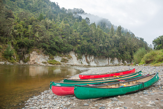
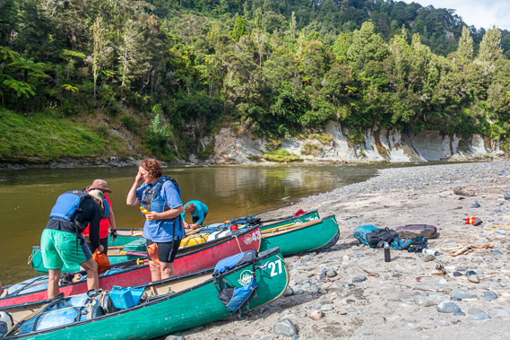
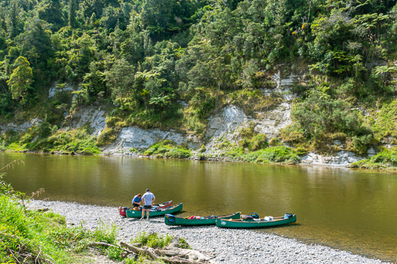
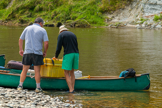
12:04 - Although the Whanganui River has a very strong Maori history extending over six hundred years, it also has a strong European history starting with the age of steam transporting people and goods along the river to support early colonisation of the North Island. In recent years, the river and surrounding national park has supported some strong growth in the tourism market. What happened though, in the quiet years between the times of steam and wooden canoes, and the modern times of plastic jet boats and canoes? We beach our boats on the gravel bank. The stones are flat and firm with a bit of mud in between them deposited when the river was higher in recent days. With the canoes dragged up out of the water we take one of the chilli bins and the water up the steps towards the John Coull Camp. |
 |
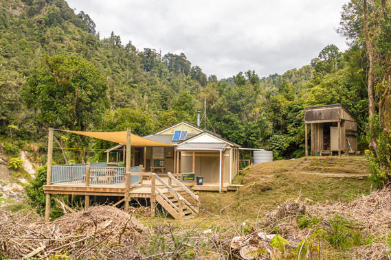
12:08 - This is the first European place name I have seen along the length of the river. Every other place along the river has a Maori place name apart from Settlement Road, and a few settlements downstream from Pipiriki. This place does have a Maori name though – Pukerua, meaning two hills. The hut and camping ground were named after an auctioneer in Wanganui who became a city councillor. John Coull was appointed as the first chairman of the Wanganui River Scenic Board in 1957. At the time the steam boat days were all but over. Tourism on the river was almost non-existent with the railway and highways now crossing the central plateau a far more efficient means of travel. This left the facilities along the river in a sad state of deterioration. The scenic board was tasked with managing the river, doing pest and weed control, clearing river channels, building huts and picnic tables, and erecting signs. John Coull saw a 17,500 acre block of crown land around this part of the river become scenic reserve to be forever protected. It was named in his honour. Over the years more crown land along the river became scenic reserve thanks to the effort of the Wanganui River Scenic Board. In 1986 these reserves were all combined to become the Whanganui National Park.
|
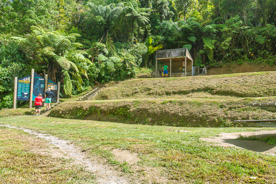 |
12:09 - The dead remains of several large trees are washed up along the bank at the top of the shingle beach. A three metre wide gap appeared between the trees through which a track scarred deeply into the grassy slope zig-zags up the hill towards the camping ground. We follow the track heading moderately uphill. The sun was by now starting to come out after an overcast morning. Perhaps the weather was going to clear for the next few days. The camp ground is sheltered in the scrubby trees. The slope had been levelled out to three flat step terraces big enough to support up to 26 tents during peak season. There would have been a lot of tents erected here last night with the large school group staying here overnight. It would have been rather crowded for the couple who stayed with us on our first night at Maharanui and paddled down here to stay last night. A large wooden picnic table stands at the entrance to the camp ground from where the track continues to the left along the bottom of the lower terrace heading towards the hut. At the end of the camp ground are two large printed signs from where a flight of stairs climbs the other two terraces to a shelter at the top of the clearing. The shelter is identical to the ones we have seen at the other camping grounds. We head to the shelter to prepare lunch. The large signs include a large map of the river, showing how far we have come downstream. It has been hard to keep our bearings with the way the river twisted and turned so much doubling back on itself so much, but since Ohinepane we have travelled a surprisingly straight SSW general direction up to here. Since leaving Ohauora this morning the river has been very straight with only small bends giving the illusion we have travelled a long way.
|
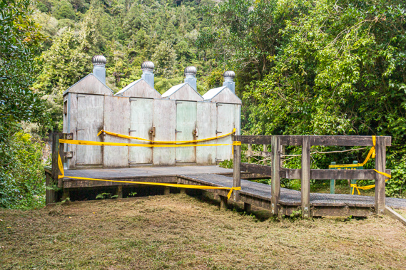 |
12:12 - From here the general direction turns to the south east towards Pipiriki where it will continue in that direction further downstream before gradually turning to the south towards Wanganui. Looking at the map more closely, we had another kilometre or two heading SSW before turning eastward, then south eastward. This bend was the second most westward part of the river, the most westward being at the back of the next bend. We prepare the lunch of more buns with salad vegetables and meat that is still fresh despite this being our third day on the river. We relax at the picnic table under the shelter before exploring the camp ground. We are the only group here at the moment. No doubt a lot more people will arrive from Whakahoro later today. I returned to the signs at the lower terrace and continued along the track towards the hut. The gravel track between boards had been constructed very recently. Three new toilets have recently been constructed beside the track, opposite four old run down toilets that have been taped off and closed. Just past the toilets is a gully where a big landslide has come down during the storms in June last year. The landslide damaged the septic system under the old toilets and came just centimetres from taking out the toilets.
|
 |
12:13 - Beyond the toilets the landslide had wiped out some of the track and just missed the hut, depositing an enormous amount of vegetation debris dragged down the hill. The hut and track have been repaired since the landslide, but there is still a huge amount of debris strewn down the hill from the track. Above the track the gully is perfectly clear.
|
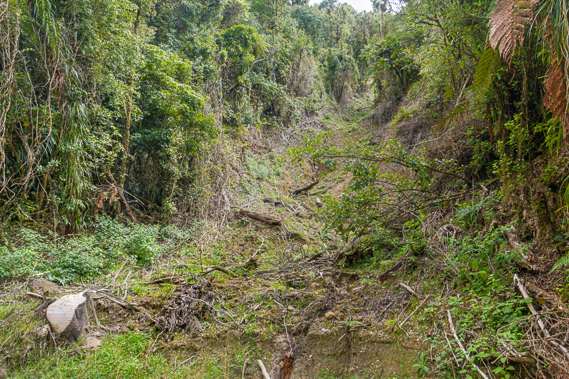 |
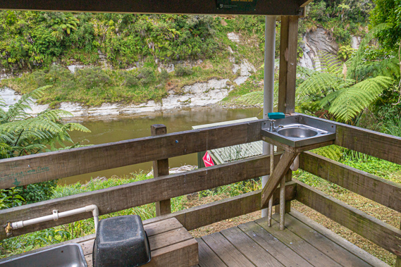
12:14 - The momentum of the landslide was substantial enough to completely clear out the slope and dump everything from just below the track. I continue following the track around to the hut. A wood shed full of wood stands above the track. The entrance to the hut is a large verandah with shade cloth over it. The hut is only a few years old. There are two large hexagonal picnic tables on the verandah. This will make a very pleasant place for meals in good weather.
|
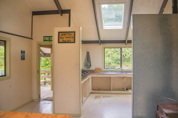 |
12:16 - The original hut was constructed at Puketapu, about a kilometre downstream. That had been the scene of a significant historical battle and the hut had been built on a marked cemetery. Following protests from the Whanganui tribes, the hut at Puketapu was dismantled and a new one built here in the mid 1990s. A hand written whiteboard welcome sign is out the front door. Aside from the usual take your shoes off and make sure your canoes are well above the water in case the river rises, there is information on the weather (well the previous two days anyway). There are also warnings against leaving food in tents due to the large numbers of rats roaming the area day and night. To the right of the main entrance is the entrance to the smaller ranger’s hut. The ranger isn't here though, but is apparently there much of the time between 1 October and 30 April each year. Inside the hut is a large dining table and a large sign with some historical information about John Coull, the inspiration for the hut. A small wood burner stands in the middle of the hut. No doubt this warms the hut very nicely during cold weather. Around an alcove is the kitchen with several gas burners and a window overlooking the river. An open cupboard under the burners has a stack of old magazines for bored people to read. Next to the kitchen is the bunk room with two levels of bunk platform designed to sleep twenty four people. The intentions book has a bunch of entries mostly from New Zealanders, with a few Australians and the occasional entry from travellers from other parts of the world. Like most other intentions books I had seen around the country the back pages were well and truly coloured in by bored creative people who have stayed here recently.
|
 |
12:21 - People doing the more common three day journey tend to stay here and at Tieke Kainga, the only two huts along the river aside from the one at Whakahoro at the start of the three day journey. The three days on the river are on average longer than the days we have spent on the river. Our first two days had been long and demanding, but our final three days will be a lot easier. Staying at the huts during the season cost $32 per night, as opposed to the camp sites which are $14 per night. Outside these times the huts are not attended by the wardens and are not maintained. They are quite a bit cheaper then, where Back-country Hut Passes may be used, but who would want to canoe the river during the winter rainy season? The camp sites are free during the off-season. Another part of the sign said Tieke Kainga, the next hut, is 40 minutes by jet boat and 5 hours by canoe, and Bridge to Nowhere is 20 minutes by jet boat and 3.5 hours by canoe. We haven’t seen any jet boats this morning, or any of yesterday, not since a little before Ohura. The camping ground we were heading towards tonight was Mangawaiiti, which is ten minutes by jet boat or 2.5 hours for us by canoe.
|
 |
12:53 - I return to the camping ground and after relaxing a little longer we return to the river with our chilli bins to pack up and continue travelling down the river towards Mangawaiiti. Heading down to the river I look across to the other side where a stream is flowing out over a small shingle bank into the very clear water before it heads downstream into a rapid. My bony bottom has started getting very numb on the wooden seat towards the end of the leg so it is a relief to be walking again. There are just 9.5 kilometres to go to our camp tonight. Having less distance to travel today is making a difference with not so much pressure to reach our destination and having plenty of time to relax along the way. Here we are fifty kilometres from our final destination in Pipiriki, and 138.5 kilometres upstream from Wanganui.
|
 |
12:55 - Hidden from us across the river a little downstream is a terrace around 20 to 25 metres above the river upon which the Mangapapapa Pa stands completely concealed from our view, and perhaps for good reason. The pa and nearby camping ground was used by the Maori for a very long time, probably centuries. It has been abandoned for several decades but in recent years the local Whanganui iwi have returned to the site. Around 100-120 people come up the river to camp there for around two weeks two to three times per year. Once packed up, Cameron goes for a quick swim. The others decide to wait until reaching tonight's camping ground at Mangawaiiti, but the water will apparently be a lot muddier there. We continue heading downstream, having learnt about the gap in the recent history between the age of the steam boats and the modern age of plastic boats.
|
 |
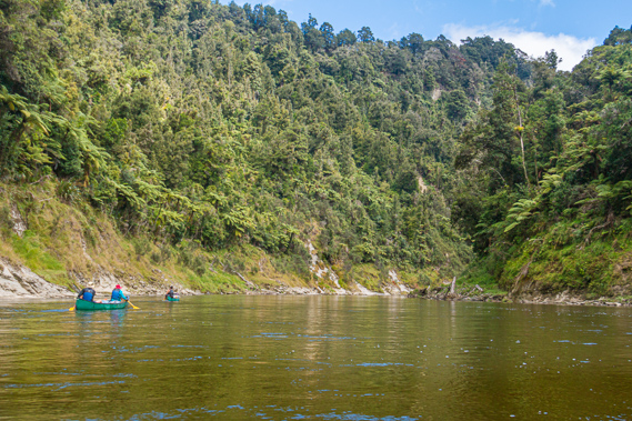
13:17 - From John Coull we have just 9.5 kilometres paddling to Mangawaiiti. Over these kilometres we will be reaching the westernmost point of the river, where two major tributaries flow in before the river turns a general eastward direction after having tracked south westward over the past two and a half days. No sooner have we cast off from the shingle beach we enter the Tokakotuku Rapid as the river turns a seventy degree right hand turn. The shingle bank from John Coull continues as a narrow bank along the right side of the river, and a large shingle bank appears to the left. We bounce down some white water for a short distance passing a shingle island in the middle of the river. The water calms as we complete the bend over the following kilometre. The banks on either side are covered in long grass up to the flood line from where old forest covers the triangular hills.
|
 |
13:21 - After about a kilometre and a half just before the river turns the other way into the start of a 150 degree turn, we reach the Puketapu Landing to our right. The Tokakotuku camping ground used to be here but that got washed out in the 1998 flood along with the Kaiwaka camp we had passed earlier. The landing has mostly been washed away. This is just before the start of the swift and turbulent Reperepe rapid. Here a landslide from a creek covers about half the width of the river.
|
 |
13:23 - The water calms down for the rest of the long turn as we continue drifting along. The banks on either side steepened and concentrations of tree ferns cling to the very steep muddy banks. To the left we spot a family of ducks, with five chicks all still with their fledgling down. We have seen quite a few ducks along the length of the river, but no families this big.
|
 |
13:37 - At the end of the turn the river turns right about forty five degrees as we pass through the long Kaiaroa Rapid, named after the bidibid Acaena anserinifolia which is a native creeping plant with toothed leaves. It has white flowers which produce fruits of burrs making them easy to disperse. The other guy in my boat explains after the river tearing away all of the vegetation during large floods, the creeping plants very quickly cover the exposed mudstone creating good shelter for ferns and mosses to establish themselves as part of the regeneration process. If it were not for the frequent floods, larger broad leaf weeds and shrubs then establish themselves followed by the large trees which would gradually complete the regeneration after around a thousand years. That being said the regular floods roaring down the valley ensure the forest will never have a chance to regenerate for the lower ten metres or so above the current river level. |
 |
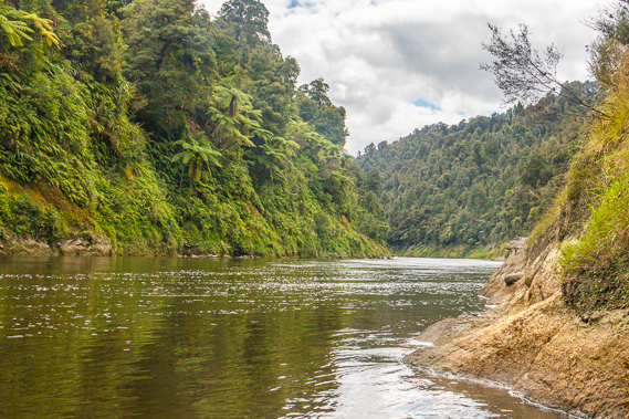
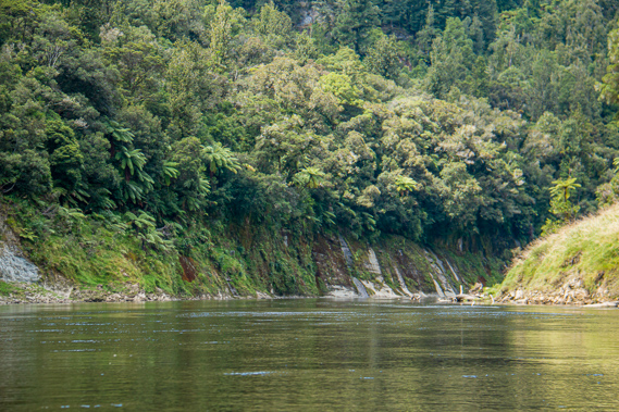
13:56 - The rapid funnels over huge rocks with a shingle bar to the right at its entrance before that disappeared and another shingle bar started to the left. The river has narrowed substantially through the gorge. We remain in the middle where it isn’t as turbulent as along the banks. The water is becoming quite a bit murkier now. For the most part the canyon walls have been fairly smooth, but we enter an area where the walls are jagged, with caves heading into the rock between jagged headlands. The sharp spurs are constructed from tough erosion resistant rock. We enter a short straight with the Kauwaewhaere Rapid. A small shingle bank forms to the right but otherwise it is minimally turbulent.
|
 |
13:58 - We are about two kilometres downstream from John Coull when we reach the mouth of the Tangarakau River coming out to the right at the start of a 120 degree turn to the left. It was named by the legendary Tamatea as being the place where he stopped to cut timber to repair his canoes, the name meaning “to fell trees”. Just above the river is the hardly noticeable Kawhakarewa Rapid, the name meaning “to put afloat”. This is most likely a reference to where Tamatea floated his repaired canoes to continue heading upstream on his exploration towards Lake Taupo, the inland caldera sea in the middle of the North Island. The water of the Tangarakau River was dirtier than the main river due to draining a large area of farmland before reaching the national park. The river flows south from its source to the north east of Whangamomona to this point where it drains into the Whanganui. Most of the way upstream is the town of Tangarakau off the half way point of the Forgotten World Highway ninety minutes from both Taumarunui. and Stratford. In around 1925 it was a sizeable community of around 1200 people who settled there to work on the railway building tunnels and viaducts through the rugged terrain. The mouth of the Tangarakau River is a significant place in our journey. This is the westernmost point of the Whanganui River. We are almost exactly half way between Mount Ruapehu to the east and Mount Taranaki to the west, and close to the western extreme of the national park. The Tangarakau River also marks the boundary of the Ngati Maru ki Taranaki tribe. The tribal boundary runs along the river down to and including the first of the farms we will reach tomorrow approaching Tieke Kainga. From the river the tribal territory covers much of the Forgotten World Highway eventually tapering out over the northern half of Stratford up to the next town Midhurst, and from there forms a wedge between a couple of streams up Mount Taranaki. The land of the Ngati Uenuku continued to follow the east bank of the river.
|
 |
13:59 - From here the river turns to a generally eastward direction towards the Bridge to Nowhere before turning south eastward. The direction continues to be very general as the river still meanders wildly through the very deep gorge. We continue around the turn reaching the Tahunaroa Rapid. It is quite shallow with a log jam and other deposits from the Tangarakau River. At the end of the turn we enter a short straight. The water is calm through here. Cameron talks about some of the outdoor education camps he used to run back home. He mentions they used to run races where you have to power a canoe down a straight without any paddles. He showed us that to do his you have to stand up near the back of the canoe and bounce up and down. The bouncing motion propels the canoe forward.
|
 |
14:00 - We reach the Otapapa Rapid at the start of a 90 degree turn left. This encloses a long shingle bank along the left side. A large rock to the right funnels the water into the rapid, but produces very little turbulence. By now the river is narrow again with steep rock face mostly covered with some exposed faces up to the dense tree fern coverage and ancient forests clinging to the steep hills rising high above us. In the middle of the turn we pass the Omaruhika Rapid where a few rocks break the surface to the right leading to a shingle bank from a stream. This is followed by a long thin shingle bank to the right. This rapid is 54 metres above sea level.
|
 |
14:02 - The turn leads into another short straight before turning 120 degrees back to the right. The transition point between the stripped off vegetation of the lower cliffs and the thick forest at about eleven metres above the river is stark. A large flood had come down the river in June last year where the water rose to that level stripping off all the vegetation below the line. It would have been a spectacular flood. Down in Wanganui City, low lying suburbs were flooded as the river rose nine metres carrying 4000 cubic metres per second draining from these hills. It would have been a spectacular flood to see, but it would have also been extremely dangerous with the water flowing so swift and turbulent. Today the cliffs are dry with small ferns and ground cover plants covering much of the cliff, with the occasional small waterfall tumbling down its side into the river. |
 |
14:06 - Appearing around the end of the turn is the Mangatoatoa Rapid. We can see the river funnelling between a sandbank at the mouth of a creek to the left and a small shingle bank to the right. It is enough to produce some bouncy white water swiftly passing us by another rock and shingle bank to the right.
|
 |
14:07 - The bend ends at the mouth of the Mangatotara Stream, another stream with totara trees used by the Maori to construct canoes from, to the left. This is quickly followed by the Te Kowhai Rapid (named after the yellow flowering kowhai tree) at the start of a seventy degree turn to the left. The water between the grassy banks on either side is shallow, but unbroken. |
 |
14:08 - At the end of the turn we enter the short unbroken Te Maori rapid into a short straight where the Whangamomona River flows in from the right through a ravine so narrow we almost miss it. Here we are 50 metres above sea level and 103 kilometres downstream from Taumarunui. At the junction the main river turns about 30 degrees to the left. Here we are just 2 kilometres short of our camping ground at Mangawaiiti. The water flowing from the Whangamomona is clearer than the main river now almost opaque from sediment from the Tangarakau River.
|
 |
14:10 - The name Whangamomona is in reference to rich, fertile land. Some parts of the papa clay area was good land, but the rest of it was in very poor condition, unsuitable for farming even if the terrain wasn’t so steep. Whangamomona had been identified by the Maori as being fertile land. When the European settlers arrived in this area, they quickly recognised the fertility of the land and established farms long before the surrounding infertile land became reserves that would eventually become the national park. The original European settlers arrived in 1985 and upon confirming the soil was good, a small rural support town was established there in 1887. In the absence of any road or railway at the time, a track was cut from Whangamomona over to the nearby Aotuhia Valley and downstream to a ridge across to the Whanganui River further downstream near Tieke Kainga, where we will be staying tomorrow night.
|
 |
14:12 - The settlers initially lived in canvas tent shelters as they cleared the land. The cold, constantly humid conditions caused these tents to quickly deteriorate, forcing the settlers to build tiny huts built from the trunks of the ponga – the New Zealand silver tree fern. The settlers lived in these huts until they were completely on top of the vegetation clearing. Once their farms were established they were able to build their cottages from pit sawn timber. Conditions were very tough for the settlers with the 1930s depression hitting very hard. They coped by each having a few cows which they milked and sent the cream 20 kilometres across the track to the Whanganui River near where we will be staying tomorrow night. From there the steam boats take it downstream into Wanganui. Thanks to the high rainfall and soft mudstone though, history records the farmers describing the track as being a ribbon of mud six foot wide and six foot deep. The track to the river has long been abandoned with the Forgotten World Highway providing good access into the area from Taumarunui to the north east and Stratford to the west. The farms along the track away from the highway were also abandoned, with the decaying remnants of the cottages and crude farming equipment now buried deep in the tangle of vegetation slowly regenerating back into the forest it once was. With the highway and railway established, Whangamomona finally received electricity in 1959, sealing its permanency. The town’s success didn’t last though with its remoteness sending the town into a gradual decline. The school closed down in 1979 and the post office shut its doors for good in 1988. All that remains is the hotel and a few scattered farm houses. If it were not for the promotion of the Forgotten World Highway, the town would have probably been wiped off the map by now.
|
 |
14:30 - Just below the Whangamomona River is Te Auropae, the famously notorious Log Jam. Cameron tells us to follow him closely as there are extensive snags on either side of the river, now running quite shallow from the sediments of the Whangamomona River. The log jam is due to timber naturally washing down the Whangamomona and Tangarakau Rivers during successive flood events. Although there are a lot of branches poking up out of the swift water, we are able to easily navigate through it. In early days this part of the river is completely blocked with the rubble of washed down trees that have accumulated here into a massive obstacle course impossible for the steam boats to pass through. When the river was cleared and the rapids improved for boats to travel, an entire channel had to blasted through the log jam. The channel is clear now, but new logs can come down here at any time, and wedged logs can easily become dislodged. The log jam begins at a camber in the river and continues through a short straight towards a 40 degree turn to the right. Approaching it we can see large menacing logs blackened with water logging poking out of the dark water on either side. Ahead of us is a shingle bank in the middle of the river with a rock bank in front of it. This bank splits the river into two channels. We follow Cameron down the left channel before the two channels combine at some more rocks and we continue for the next two hundred metres or so with a lot of logs poking out above the water on either side of us.
|
 |
14:48 - Fortunately we pass through the log jam without any incident. At the end of the short reach we go around the next bend over the Hikuotemotu Rapid which has a grassy bank to the right with more logs jammed against it. Fortunately this rapid has almost no turbulence. By now my seat is starting to get quite sore again, which by now indicates that we were getting close to our next destination. The hard paddling from the first day is causing my arms to ache as well even though paddling is now a lot more natural - helped by having a strong farmer behind me at the back of the boat. The corner turns us into the Mangawaiiti Reach, a gradual bend to the right towards a sharp bend to the left nearly a kilometre away under a four hundred metre high triangular hill.
|
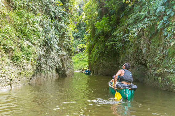 |
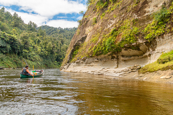
14:53 - We head into a deep ravine to the right, avoiding a large rock just submerged in the middle of the river. The ravine is around five metres wide with walls rising vertically out of the water for about twenty metres to the forest above. Although the walls are vertical, they are covered in small ferns growing comfortably in every little crack clinging to the wall. Above the walls are tree ferns and larger trees. |
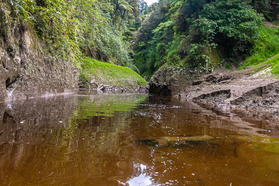 |
14:57 - We paddle up the ravine for about a hundred metres before the right hand side opens up into a grassy clearing where the gently flowing Mangawaiiti Stream flows into. The stream follows the bottom of the cliff which continues on the left hand side. The name Mangawaiiti means small stream. We relax here for a few minutes as Cameron explains there is a kainga above the downstream bank. Legend says the chief of this village has a very beautiful daughter who the young men of the river desired. They would travel from far along the river to see her. The chief would only give her to someone who he saw as worthy. To be worthy, you have to paddle into the ravine, and the men of the village would stand against the edge of the ravine and throw rocks down. They said if you successfully paddled up to the creek, and back out to the river, and survived, you were worthy of the daughter’s hand in marriage. That would have put most suitors off. I don’t know if anyone actually did succeed. That part of the story seems to be lost with history.
|
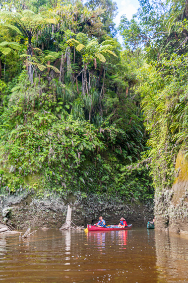 |
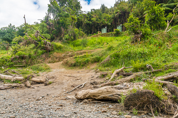
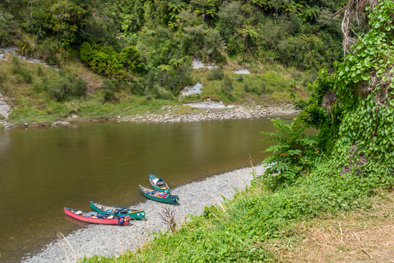
14:58 - We leave the ravine and continue downstream past the bluff for about forty metres to a very muddy beach where we land in between some large logs that have washed down to here through the log jam. There is another rock just beneath the surface out from the beach so we have to avoid that. The beach stands at the bottom of the cliff and initially I wonder why we stop here before I could see a track cut into the cliff steeply rising to the right back towards the ravine to some wooden steps. The steps lead to the Mangawaiiti camp and the old long abandoned Mangawaiiti Village. Perhaps the village no longer exists because the chief’s daughter was never married off. |
 |
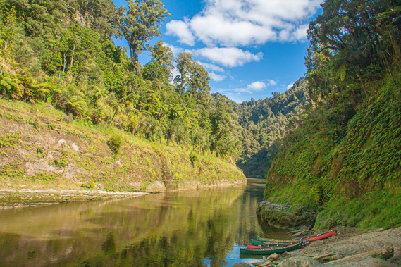
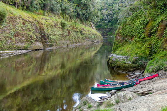
15:03 - The beach of soft waterlogged silt at Mangawaiiti is very boggy, but we quickly pull the canoes up the steep bank to where it was a bit drier. The silt has eroded down a small landslide into a steep bank rising about a metre to a fairly level flat with a step over a spring-fed trickle of a creek to the start of the track. Fortunately the moderately sloping track across the cliff face is solid. We unpack the canoes and Cameron ties them together using his magic rope, tying them off on an exposed log that has embedded itself into the silt perhaps when a small landslide had come down. Directly across the river the gorge has a large landslide that had come down stripping away all the vegetation. The debris has long been washed away, leaving the lines of stratification sloping gradually downwards in the direction of the river. The cliffs and hills across the other side of the river are capturing the strong sunlight. The cliffs along this side of the river are shady from the afternoon sun starting to sink in the sky over the hills behind the camping ground.
|
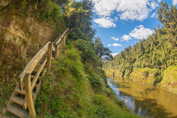 |
15:09 - Once all the gear is off the canoes we start carrying it in the first of several trips up the metre wide track cut into the cliff face rising across the papa cliff to the start of the forest, where it ends in a steep wooden staircase with a handrail against the edge. The staircase rises about ten metres before doubling back and continuing to steeply rise through the thick forest of tree ferns to a grassy terrace. Without the stairs this would have been quite a difficult climb. |
 |
15:14 - It seems very remote here, having travelled 22 kilometres downstream from Ohauora today, and 83.5 from Ohinepane. Taumarunui is 105 kilometres upstream from here. There are 19 kilometres to go downstream tomorrow to Tieke Kainga, our shortest day on the water, but with a good hike in the middle of it. We are just 40.5 kilometres away from our final destination at Pipiriki. We have done 27 rapids today – mostly small ones, and 113 of the 146 rapids for the trip. There are just 33 to go over the next two days. I notice this is the only camping ground along the entire river that isn’t immediately before a moderate rapid.
|
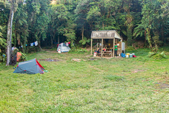 |
16:17 - The grassy area is quite small, enclosed from all sides by thick scrubby forest. Directly ahead is a small shelter identical to the one we have seen in all the other camping grounds. The grass is fairly short, but fortunately not freshly cut like the grass at Ohauora. We are the only group here, so we unpack our tents and put them up. By now (our third night) we are pretty good at it, certainly not fumbling around like we had done on the first night at Maharanui. The ground here is quite rough, with roots sticking through the ground. This is in stark contrast to the almost perfectly smooth terraces we have pitched our tents on at the previous two camp grounds. We spread out our tents over the camp sites. I put mine up in a small corner near the tree ferns and close to a large picnic table. The others put theirs up in different corners of the clearing.
|
 |
16:26 - This camp ground seems to be smaller than Ohauora. The larger clearing here gives it the same capacity as John Coull with 26 camp sites, 6 more than last night at Ohauora. As we are putting our tents up a young couple arrive, having started at Whakahoro early this morning and are aiming to finish at Pipiriki late tomorrow. They put their tent up just on the other side of the shelter hut. Their tent is tall enough for them to stand up in, something we were very envious of as our tents are only hip height.
|
 |
16:32 - I rest for about half an hour as some of the others headed back down the track to swim in the murky water near our canoes. |
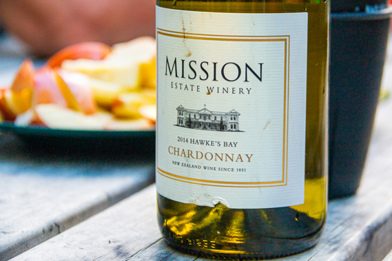 |
17:11 - Once they return we settle at the picnic table outside my tent. Cameron lays out some Hawkes Bay wine, cheese and crackers, and apple slices to eat as we relax before I head back down the short track to have a better look at the gorge.
|
 |
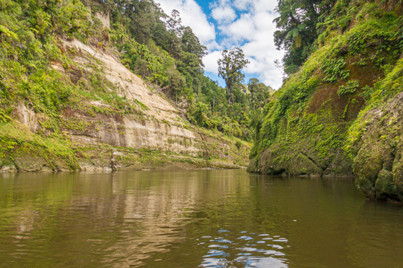
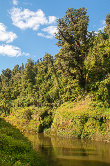
18:06 - The sky is blue apart from a few small clouds drifting across from a slow south westerly gentle breeze just rippling the water. There had been a little bit of head wind coming downstream, but hardly enough to slow us down. The southerlies in New Zealand are often very strong and would make progress heading downstream against them very slow. The green water hazily reflected the magnificent mosses, ferns, tree ferns and large trees of the primordial forest we were deep in. The line between the ferny undergrowth now covering much of the lower bluffs and the tree ferns was very obvious, showing the level of last June’s flood.
|
 |
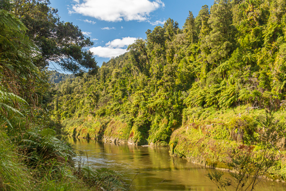
18:33 - There is a less obvious line several metres above where the huge trees started. Floods even more spectacular than last year’s 11 metre flood has come through here in the past ripping out even the large trees. Such a flood must be absolutely terrifying to watch, with the muddy water roaring and all the trees being carried downstream. Little gullies had scarred themselves deep into the soft rock down the cliff wall. The water moved silently at quite some speed without breaking the surface. There is a stream of bubbles generated from the turbulence of the rapid at the Log Jam. From this far downstream it is possible the river could rise even if the weather is clear. Heavy rain upstream will cause the river to rise. The placid rapids we have been passing through could easily become treacherous even for the most experienced canoeists.
|
 |
18:45 - I return to the picnic table where the others are chatting. Cameron is in the shelter preparing dinner but doesn't want any help. He has it all under control and probably wants his own space anyway. I sit there with them to wait for some cloud to cover the sun, but the sun remains bright repelling the cloud so it seemed. The toilet is above the camp sites. After last night I have put my tent some distance away from its entrance through tree ferns a little further up the hill. Beyond the two toilets was a track heading further up the hill, towards the site of another part of the small kainga that once stood precariously here above the river and the ravine. Upon my return dinner is ready - a very nice red lamb curry with garlic pita bread. This is followed by a pavlova cream dessert topped with kiwifruit, pavlova being the New Zealand invention (not Australian as is often wrongly claimed).
|
 |
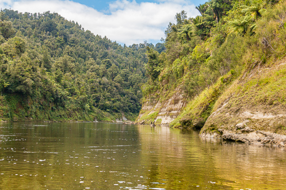
19:28 - After dinner and washing up I return down the track to the gorge. The sun has fallen low enough for both sides of the river to be shady. I can’t see far upstream at all as the canyon swings around to the left. Looking downstream the river continues for a few hundred metres before sharply turning at the end of the ridge to the left against a sharp hill rising over 300 metres above the river. The canoes sit on the muddy beach. The submerged rock and a couple of upended tree bases with the remains of the roots stick out just offshore. These trees would have washed down here a long time ago and now sit here waterlogged in the calm water. |
 |
19:31 - The village is on one of the most scenic parts of the river, where bluffs jut out into the river and dark crevasses dig deep into the cliff. This area would have very spiritual significance to the Maori. Maori tradition states that all things have a mauri, its own personality and life force. Every animal, tree and land form has its own mauri that had to be respected. Further upstream the names of a couple of rapids we had passed gave reference to the blessing one had to give to a canoe before launching it. The Maori canoes had been carved from living totara trees, considered to have a strong mauri and a special blessing was needed to acknowledge the life force that was being taken away from it to become a canoe. The people do not have the right to take away the mauri of anything without direction from its associated ancestral god, or by a ritual where evidence needed to be given that its change or removal was necessary for the well being of the people. This is hardly the sort of thing done with our fibreglass canoes being mass produced in some factory from synthetic materials. The river definitely has its own mauri. The Maori people respect it and treat it as a living being. They say the river has spiritual guardians at every rapid and corner watching over it.
|
 |
20:12 - The transitions in vegetation are stark, showing the lines of past floods. Rivers are never at a constant rate of flow. In the three days we have been travelling along the river, the water level has dropped significantly. A big rain storm three days before our start raises the river level by over a metre at Pipiriki and two metres upstream around Ohinepane, making it quite dangerous in the upper reaches. Fortunately the levels are back down to safe levels by the time we start. I watch as the water flows silently by, devoid of the sounds of any boats, fish or birds. It is very quiet here, even with the sun about to set. In days gone by the chorus of birds at this time of day should have been almost deafening. The stoats have all but wiped them out over the past two decades. Still the river seems to have a strong mauri. This part of the river is completely untouched apart from the camping ground. It is too rugged and remote to settle outside the little terrace marking the camping ground and formerly the village. The Maori claim the river was their first highway into the central North Island, back in times when the entire river was pristine like this. The Europeans have upset the balanced mauri by sending paddle steamers and jet boats on it, and by creating roads along the upper and lower reaches using the gravel dug up from the riverbed. I return to the camp ground as the sky starts its gradual darkening. The others are all heading off to their tents so I followed suit.
|
|