Introduction to today's journey
Ko te pae tawhiti whaia kia tata, ko te pae tata whakamaua kia tina.
Seek out the distant horizons and pull them closer, hold steadfast to the ones that you have already attained.
- Dr Rangitakuku Metekingi, our uncle of Whanganui, Ngati Apa
LEGEND tells of New Zealand being discovered by a fleet of great canoes bringing the first Maori settlers from the legendary Hawaiki around the year 1350AD. One of these was the Takitimu waka led by the explorer Tamatea Pokaiwhenha. Tamatea was said to have sailed into the entrance of the Whanganui River settling at Putiki a little downstream from the current location of Whanganui city. There he set up a battlement called Putiki Wharanui O Tamatea Pokai Whenua, which translates to "the place where Tamatea tied his topknot with flax". Upon settling there, Tamatea headed upstream to eventualyl reach the river's headwaters and crossed over to the large inland sea of Lake Taupo. He named several features along the river, including the Tamatea Cave, where he sheltered as he paddled upstream.
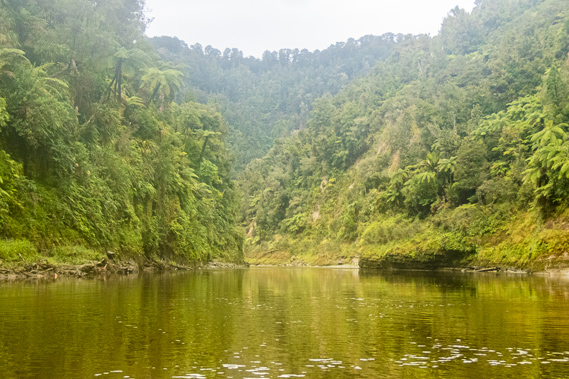
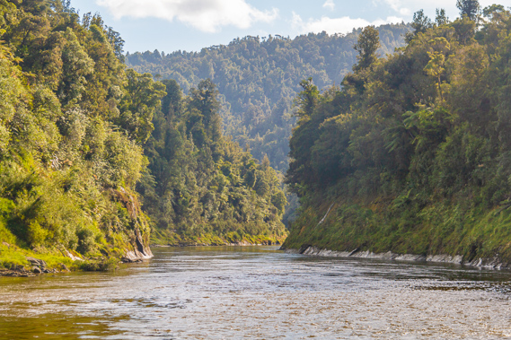
Today's journey continues downstream from Maharanui entering the national park winding through spectacular forest clad meanders carved deep into the valley. Following a lunch stop at the Mangapapa campsite perched on a ledge in the beautiful gorge. We continue downstream through the increasingly dramatic gorge to our destination at Ohauora near the legendary Tamatea Cave.
Today's Journey
Distance trekked today: 30.0 kilometres.
Total distance trekked to date: 61.5 kilometres.
 |
07:05 - The rain starts falling just before first light. The entire night has been perfectly clear with a strong full moon, but I am now awoken by large drops of rain falling on the tent. Fortunately there is no wind, but this was going to be a good test of how well we novices had put our tents up yesterday. With another long day of paddling ahead of us we need an early start. Fortunately the big blow up mattress had stayed inflated all night creating a comfortable sleep. Getting up from the soft air mattress proves somewhat difficult thanks to a bit of stiffness and a little sunburn from yesterday’s effort under the strong summer sun. |
 |
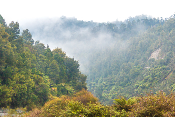
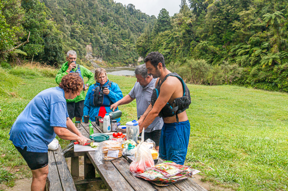
07:10 - Upon getting up Cameron is already in the shelter preparing breakfast. The wet clothes from yesterday I had left hanging were as damp as I had left them, and I quickly bring them in before the rain will start to drip too much from the foliage of the small tree sheltering it. Below me the river seems to be running a little dirtier than it had done last night, and the water running a little lower. It flowed past quietly tumbling down the Papanui Rapid before gradually turning to the left hiding away behind the hills. The rapid was named for the mist that uniformly covers the sky, which is exactly what is happening now. The cloud cover is mostly above the surrounding hills, but the occasional small bank of cloud about halfway up the forested hillsides drifts sluggishly upstream. A particularly large bank of cloud drifts upstream towards us, bringing a squall of rain. Seeing this we scurry to the shelter for breakfast. The picnic table under the shelter is cluttered with our breakfast, with muesli, other cereals and an assortment of plastic plates and cups. Cameron is cooking pancakes which which will go really well with the jam and maple syrup. |
 |
07:37 - The other couple who arrived late yesterday are quickly packing up for an early start another long day heading down to John Coull today. This is a couple of hours downstream from where we are staying tonight. Rain continues falling as we pack up breakfast. It is still falling when it is time to pack our tents. Fortunately I have already done most of my packing apart from the mattress and the tent during the break in the rain before breakfast. Although my drum is out in the rain, it is sealed and waterproof. The rain stops falling just long enough for me to deflate my mattress and insert it into my drum, fortunately not taking up too much space. Dismantling the tents is a good deal easier than it had been putting them up. The flies are very wet though, and being wrapped up in their bags means the tents are going to be very damp and musty when we put them up at Ohauora this afternoon. |
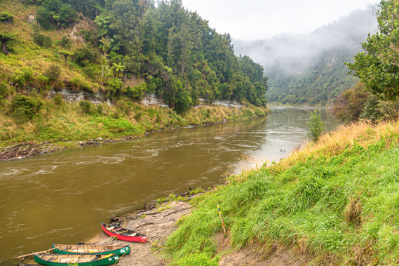 |
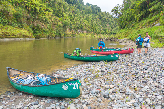
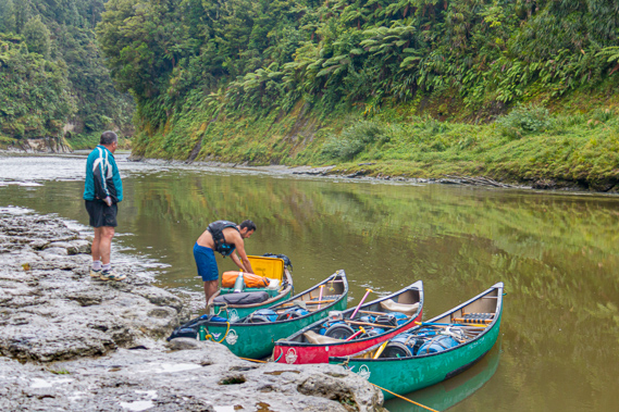
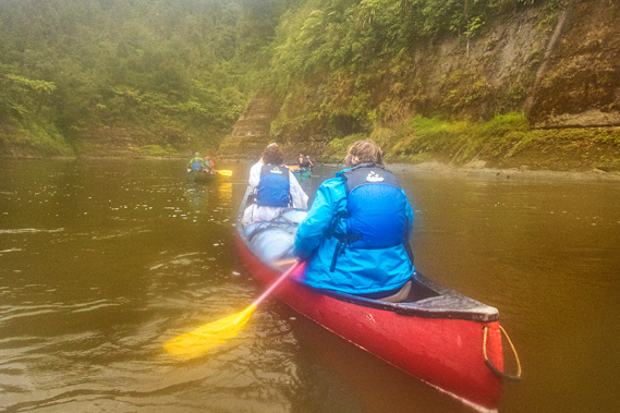
07:37 - Finally with everything packed up we have the daunting task of getting everything down the stairs to the canoes. Fortunately the stairs are in good condition. If it were just a muddy bank then it would been tricky. By now the air is thick with mist as the drizzly rain falls. Cameron reallocates us into different canoes. I am moved to the front of one of the guys who had tipped three times yesterday. Whatever Cameron saw of me will apparently very much reduce the chance of him tipping his boat over. Whilst we continue packing, Cameron is busy feeding the rope into the bag. He doesn’t want any of us helping as it may be needed in an emergency. When he throws out the end, the rope needs to go out in a straight line without any chance of entanglement. The rain falls heavily when the rope is packed, so we all climb on board a little stiff from yesterday and nervous about the upcoming trip. Fortunately the water is warm. |
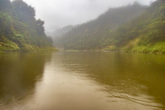 |
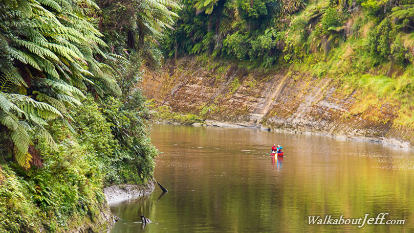
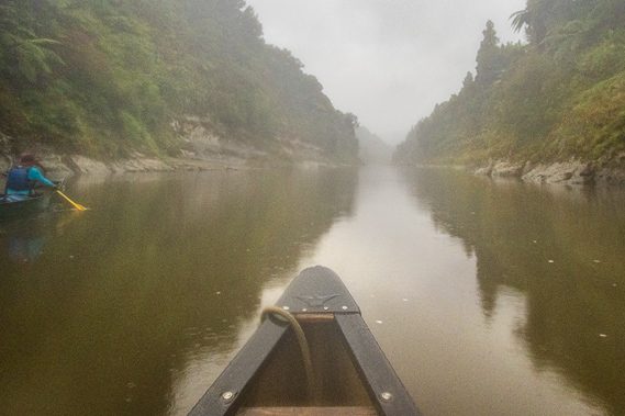
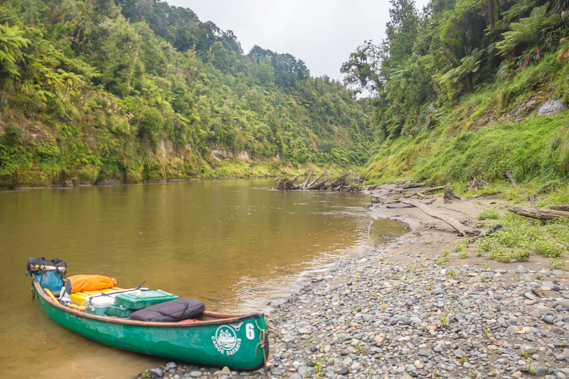
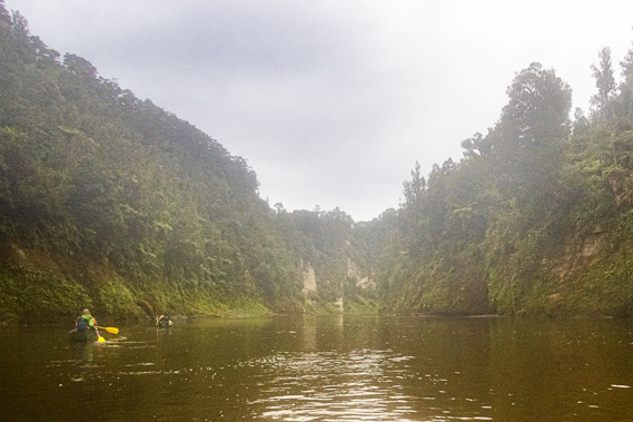
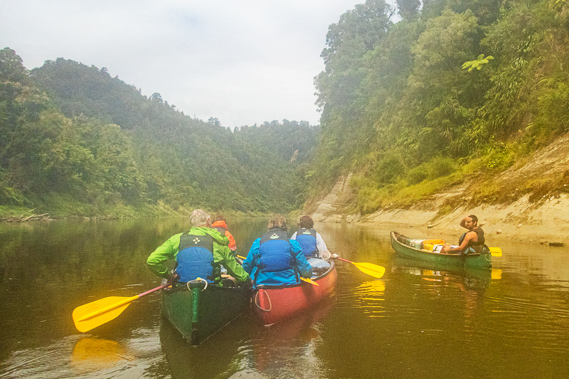
08:26 - Once everything is tied in we cast off bringing a surprising amount of mud from the silt bank into the boats. My shoes are caked solid with mud, but they weren’t going anywhere and I’ll just need to clean them off at the next stop. We head across the gentle eddy into the main current running along the other side of the river. From there we head off down the gentle current of Papanui Rapid followed quickly by Waikukutea Rapid before the water calms. The calm water gives us the opportunity for us to start getting a feel for each other’s styles. He is a very strong paddler and seems to have the steering sorted out. With having been a farmer all his life he will be used to steering from the back perhaps with having driven forklifts. I feel higher in the water at the front but that is because he is a lot heavier than me causing the bow to lift out of the water making the boat less manoeuvrable. The fog quickly closes in. We are about a third of the way along the straight when we reach the Otahapa Rapid – well it would be a rapid if the river was higher. Rock ledges follow either bank but otherwise the water is smooth, just fast flowing through the narrower channel between the hills. |
 |
09:16 - We pass Waitoto Salt Spring. In early times, the Maori would travel along the river to this spring to bathe in the mineral water and collect it to cure medical ailments. About half way along the reach there is a fairly shallow rapid but not too turbulent. We take the slightly deeper right channel of the Mangaukauka Rapid as there is a rock just sticking up above the surface in the middle of the river. The first three canoes pass it fine, though I have to be a little evasive around a couple of boulders sticking up quite shallow beneath the surface. The ladies only see the largest of these rocks at the last moment and suddenly turn crashing into it on the middle. They are briefly wedged and almost fall downstream onto the rock. Fortunately they lean the other way at the last moment and are able to free themselves from the rock. That is a very close call. |
 |
10:22 - The river calms and deepens quickly following the rapid. To our left we can hear the hissing of a waterfall through a dark narrow ravine at the mouth of the Waipahihi Stream. We continue following the reach as the hills on either side grew higher when they were visible through the misty cloud. Rain is still falling from the fog as we paddle the greenish grey water towards the end of the long reach where we enter a succession of small rapids. To the left just after the last of these rapids we pass the mouth of the Makomako Stream crossed by a derelict swing bridge a little upstream in the bush. Looking ahead as we round a sharp right hand bend we can see an old homestead. We have reached Whakahoro, the landing where canoeists doing the shorter three day journey down the river start. A wide gaping ravine opens up just in front of the homestead. This is the mouth of the Retaruke River, where Lackey's Landing is situated. This is one of the most intact steamer landings on the entire river from where a track leads up to the homestead on top of the terrace, which extends back along the Retaruke River forming what is now the tiny settlement of Whakahoro. The homestead sits on the site of famous fighting pa of Makakoiti. The name means boundary, indicating the northernmost limit of the river boundary of the Ngati Uenuku tribe – the children of the rainbow. The tribe lived nomadically along the left hand side of the river stretching eastward up to the plateau around Raetihi and Ohakune. This boundary also marks the downstream extent of the territory of the Ngati Haua who are based in Taumarunui and occupy the upper reaches of the river we have so far travelled along. Nearby was a basic camping ground with 36 camp sites, making it the largest equal to the camping ground at Ohinepane. The camping ground marks the start of the Oio Road. This is the last road access to the Whanganui River until we approach Pipiriki nearly ninety kilometres downstream. To the right of the Retaruke River ravine are a set of concrete steps headed up the hill to a short track. The concrete steps are all that remains of what was known as the Houseboat Landing. The houseboat providing accommodation at Ohura River for people travelling the three day steamboat route was moved downstream to here in 1927 following the completion of the road extension from Taumarunui to Te Maire. The houseboat remained here at the mouth of the Retaruke River until it was destroyed by fire in 1933. A short distance up the hill is the Whakahoro Hut equipped with sixteen bunks, electric lighting and a wood stove making for quite an upgrade of accommodation from the camp sites. This was the first of three huts along the river. |
 |
10:54 - Cameron mentions Whakahoro is our point of no return. From here we are entering the river's upper gorge. If heavy rain is forecast upstream, then we would have to abandon the trip here. Aside from the occasional camping ground, two walking tracks, an isolated settlement cut off from the grid, and a few long abandoned settlements, we were now committed to staying on the river all the way down to Pipiriki 87.5 kilometres away. Fortunately the rain forecast for today isn’t expected to be heavy, so conditions are safe to continue downstream into the remote lands of the children of the rainbow – the mysterious Ngati Uenuku. This point is 36.5 kilometres downstream from Ohinepane and five kilometres from our start this morning at Maharanui. People doing the three day journey from here paddle 87.5 kilometres downstream over three nights usually staying at the two huts at John Coull and Tieke Kainga. |
 |
10:56 - Reassurances aside, the next rapid is going to be quite substantial. I can see the channel narrowing into a turbulent patch of white water into the Whakatara Rapid. We keep left of the main current as there are a lot of snags on the right hand side from trees washed down the Retaruke River causing quite a bit of danger with the main current flowing straight through them. I see some of the snags breaking up above the water. Looking ahead I see a high bluff covered in beech forest, the site of Pariatua Pa. Pariatua was the god or demon of the floods – again another bad omen at the start of the long remote stretch we were entering. An enormous signal drum was based at this pa and guards watching over the river could use it to alert the clans at Whakahoro and Makakoiti that an invasion was imminent. There was not much of a break from the last rapid before reaching Kaiwhakauka Rapid. We paddle parallel to the wall of rock towering from it before paddling hard across the slow eddy landing on a gravel beach. The ladies hit the rock wall fairly hard thanks to not turning in time. Fortunately though they easily recovered with no spills. We stay here for a few minutes to rest and take a few pictures. The rain has stopped falling and the mist has almost completely cleared. |
 |
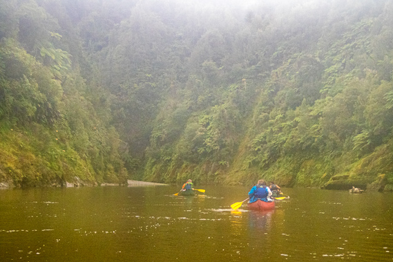
11:00 - Two canoes suddenly appear heading down the rapid. They would have started at Whakahoro a short time after we had passed. They are no doubt on the three day journey unless they had started at first light at Poukaria which would have been highly unlikely as they would have paddled very fast to get this far down the river in such a short time. They are very leisurely in their paddling suggesting they must have just started from Whakahoro. Once down the rapid we wave out to them as they continue paddling downstream disappearing out of sight around the bend where a large tree had fallen into the water and was still sticking out. |
 |
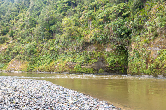
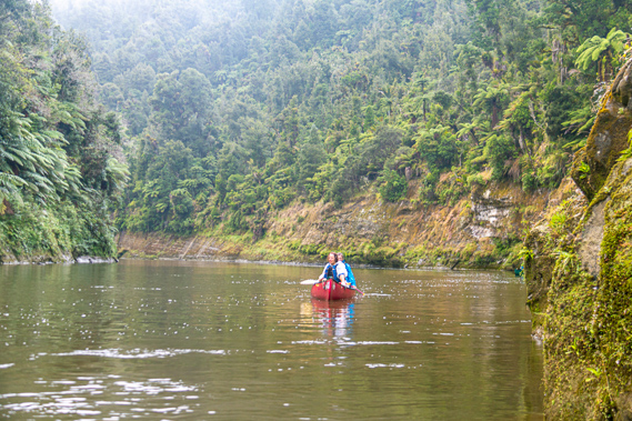
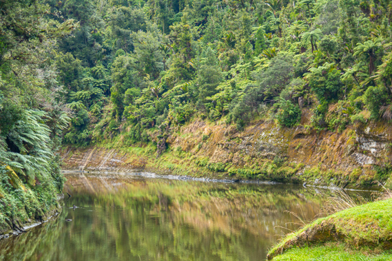
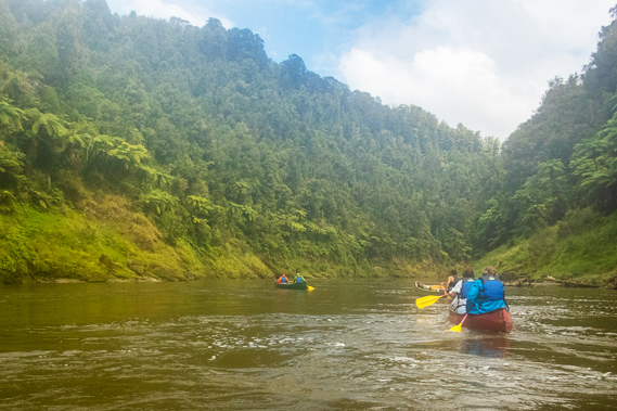
11:07 - With having rested, Cameron announces the next stop is about seven kilometres away, the same distance as we have already come this morning. We cast off from the gravel beach heading across the calm waters of the deep pool to the middle of the river to avoid the fallen tree at the point. Upon ending the turn we enter the start of a three kilometre long straight at the start of a hill towering over 400 metres above the river. The gorge is spectacular with layers of mudstone jutting out over the river. The softer layers erode away faster than the slightly harder layers leaving distinctive shelves. We have seen this regularly since setting off from Ohinepane yesterday, but these nearly horizontal formations were becoming more dramatic. Here they are sloping gently downward giving the illusion that the river is mysteriously climbing a gentle upward grade. The mist quickly descends and rain starts falling again. |
 |
11:10 - At the end of the straight the river turns 90 degrees to the left with the Waikoriri Rapid in the middle of the bend. Once more Cameron stands up to look at the rapid. Fortunately the river is running fairly high but there is the risk of snags in the river, and boulders in the middle of the river towards the end of the rapid forming a small island. The main channel goes to the left of the island. A large shingle bank stretches out into the right hand side of the rapid and white water runs along the banks on either side. Luckily the path we take isn’t too turbulent. From the bend, the cliffs suddenly grow higher and closes the gorge in. The bend turns into a short straight where in the middle of it the water became shallow without any banks as we enter a couple of moderate rapids around a couple of bends. |
 |
11:47 - The last of these rapids stands under the former Owairua Kainga. The pa is at the end of the very narrow peninsula making it a very good defence post for the Ngati Uenuku. There is a brief respite from the rapid before the second part of it where the large shingle bank to the right continus with channels flowing through it. A new shingle bank starts to the left in the second rapid. |
 |
11:56 - The straight ends in a 200 degree swing to the right into Mangapapa with a sign high on the bank indicating the camp ground was just a hundred metres away. The name Mangapapa is the New Zealand privet, a three metre high native shrub with waxy light leaves and slender brittle branches. The almost calm Mangapapa Rapid runs swiftly but almost mirror smooth. A short distance down the river is a small ravine and a terrace on the other side of it where Cameron leads us into. The remains of some stairs are carved into the mud but they were so worn and slippery they are almost impossible to climb. Cameron tells us to stay put while he finds a suitable place to land. The landing place he has in mind is just before the next substantial rapid, and we will have to land there very carefully otherwise we will be carried downstream. Cameron heads off downstream but we were at the entrance of the ravine and can’t see him. The ladies arrive and join us in the ravine. |
 |
12:08 - About ten minutes later Cameron returns and asks us to follow the bank one boat at a time where he will catch us and tie our boats together. We head in single file, our boat first, along the shortening bank until the grass stops and the eroded dirt bank is just half a metre above the water. There we see Cameron on the shore with his boat tied up. We drift in beside his and he loops the front of the boat before catching the others. From there we awkwardly climb out of the front of the canoes and scramble up the short bank of hardened mudstone. Once on shore we fumble a bit finding a couple of outcrops big enough to securely tie the boats up to. Once secured we collect a couple of the chilli bins and the water and follow the gentle grade track through the eroded holes of the mudstone onto the grassy slope heading up towards the Mangapapa camping ground. |
 |
12:15 - The mist has lifted to the top of the hills giving a clear view of the mirror smooth water, even though it is running quite rapidly. From where we have tied the boats up the bank morphs down to a shingle bank upon which the entire river flows over into the Ohei Rapid against a high cliff face completely bare of vegetation apart from one tall tree fern leaning out about thirty degrees looking ready to drop. On the other side of the river a large shingle bank starts on the other side as the rapid crossed to hard up against the cliff before following it downstream turning a little to the right. At the top of the grassy terrace are two solid picnic tables and a short track into the bush to a toilet. It is a very nice camping ground of 17 plots with spectacular views over the river. We have travelled 15 kilometres from Maharanui today, exactly half way to tonight’s destination at Ohauora with another 77.5 kilometres to paddle to Pipiriki. |
 |
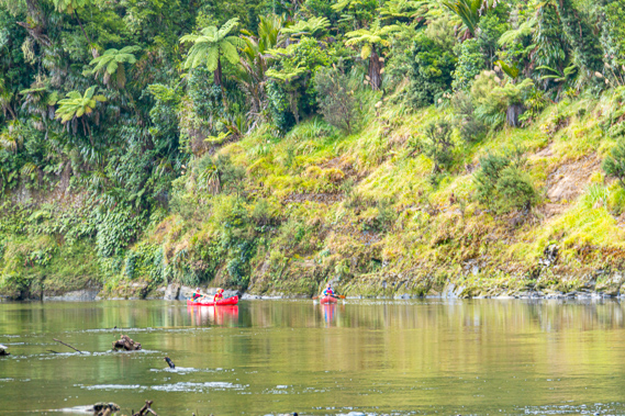
12:22 - We unpack the lunch which is very similar to yesterday’s with fresh meat and vegetables. As we are preparing lunch a large school group passes canoeing down the mirror smooth water towards the rapid. The boats and canoeists reflected almost perfectly in the water. There are a couple of kayaks in the group as well. As they pass Cameron calls out in his amazing projecting voice asking where they were heading. |
 |
12:25 - The big group are heading to John Coull tonight, the standard first night for the three day trip from Whakahoro. He seems relieved at that as we were just aiming for Ohauora tonight. Cameron told us the place we were staying tonight, Ohauora, is a much nicer camping ground than John Coull. Apparently a large slip has come down beside John Coull hut in a big storm last year causing a lot of damage and the toilets there are really gross. |
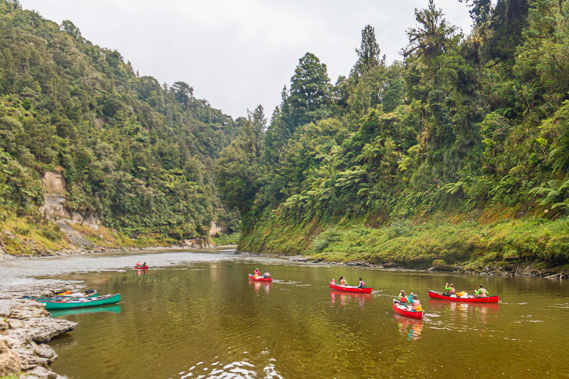 |
12:38 - We watch the entire group go down the Ohei Rapid one by one. Some handle it very well with almost text book precision. Others turn a little too late crashing into the bottom of the tall rock face cliff. There are sixteen boats with about thirty people in the group. It’s going to be rather crowded at John Coull tonight, so the couple from last night were going to be in a busy camping ground. At least they will be arriving first and getting the first choice of camp sites. The canoes quickly disappear around the bend heading further down the spectacular gorge. |
 |
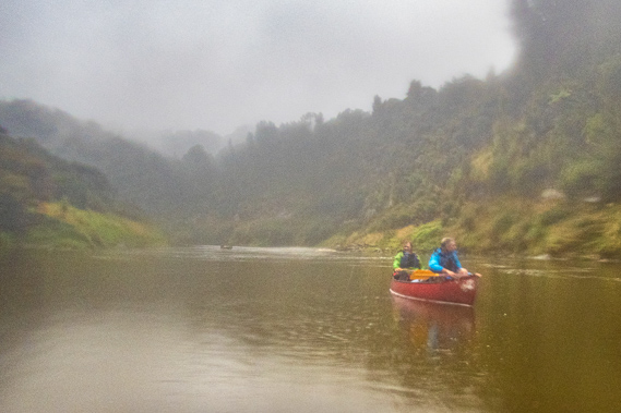
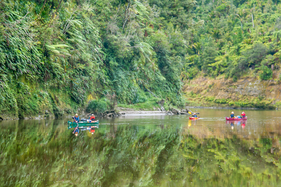
12:48 - As we are putting cheese and pieces of salad on our buns another couple row past in a red canoe heading down the rapid and disappearing. As we are packing up after lunch another canoe passes heading downstream, heading around the bend under the fern and moss covered cliffs with tall tree ferns hanging overhead into the dense Gondwana beech rainforest draping the steep hills above. The entire King Country would have been like this in the times preceding European settlement. The forest would have been unbroken apart from the occasional kainga perched on the infrequent terraces along the river. Like us, these people passing us are committed to the vast remoteness of travelling down the river with completely devoid of civilisation. |
 |
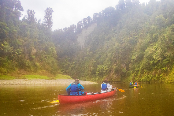
13:08 - We return down the slope from the Mangapapa camping ground to the boats and packing everything in them before climbing on board. Another canoe with a couple rows past heading downstream. It is going to be a bit tricky casting off from here with Cameron letting each boat go one at a time and staying here to properly coil his rope in the bag. He instructed us to quickly cross to the middle of the river and head down the rapid before paddling across to the shingle bank to the right. Once we arrive we need to wait for the other boats. |
 |
13:16 - Our canoe casts off first, heading across the current, then pointing into the Ohei Rapid. The vertical bluff it is undercutting is only a few hundred metres from the river on the other side. Here the river will eventually cut right through turning the winding channel we were about to go around into an oxbow lake, the likes of which are noticeably absent on the entire length of the river apart from one dried out oxbow lake about half way between Pipiriki and Wanganui. About half way down the rapid we turn across the current heading parallel to the cliff face and successfully cross out of the fast current to the start of the slow eddy which we quickly cross onto the rock bank on the other side. |
 |
13:42 - Upon reaching the bottom of the rapid we wait as the others all make their way across to the rocky beach without any incidents. Cameron is still at the landing meticulously packing his rope back into its bag before climbing into his boat and heading across to the rest of us. Once we are all back together again we continue following the river downstream entering the Wairingia Rapid with its shingle bank extending from the bottom of the cliff to the left and some snags showing through to the right. There is a little turbulence on the surface, but this is easier than the previous rapid. |
 |
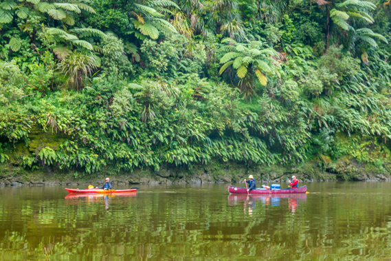
13:55 - The clouds have by now closed in and rain is falling, this time heavier than it had fallen earlier today. The last couple we had seen passing us just before we left Mangapapa are in their canoe sheltering under an overhang as we pass them. They have a strong European accent and seemed quite happy to be staying put there until the rain stops falling. We continue downstream in the heavy rain. At the end of the straight is a sharp eighty degree turn to the left marking the end of the horseshoe we are heading around. The Kokiri Rapid marks the start of the turn passing a large shingle bank on the peninsula to the left over a shallow section going diagonally across from the right. Although quite shallow, the water isn’t too turbulent. |
 |
14:06 - Rounding the bend looking straight ahead is an overhanging cliff called Man-O-War Bluff. It looks like the bow of an iron clad battleship even with the anchor hole in the right place jutting out from the steep surrounding slopes covered in a forest of tree ferns. The Maori called this Kokiri-a-Koinaki because the chief Koinaki once jumped off the top of the bluff to escape an attack, the literal meaning being Koinaki’s rock thrust forward. A pa once stood on top of the bluff, and a kainga called Onepoto (meaning short beach) was set into the forest at the other end at what could perhaps be called the stern of the ship. Now this has been replaced with a private camping ground. The view from there must be amazing. Across the river on the flat peninsula is where the Kirikiriroa Pa used to stand. This was part of a large kainga where in the early 1920s it was reported the peninsula was abundant in fruit trees and wild pigs naturally growing and breeding following the abandonment of the village. |
 |
14:13 - Directly ahead stands Kawau Hill rising about 250 metres above the river. Above the old village to the left stands another plateau about 20 metres above the river. We turn the bend around the peninsula to start following a straight heading almost directly back towards Mangapapa. At the start of the straight is the Horowhenua Rapid with a small shingle bank jutting to the right creating some turbulence in the shallow swift water. This is almost immediately followed by the Ohuaitu Rapid where the river is compressed into a channel between a rock bank to the right and then a shingle bank to the left. The water going over the rock bank creates quite a lot of turbulence. We follow Cameron heading into the middle of the rapid before moving across to the right to avoid the shallow bank to the left. The straight then calms and the rain begins to ease off. We remain together in the group heading towards the steep cliff near the knife edge. About two thirds of the way along the reach the river speeds up at the Tapuitopo Rapid but there is no turbulence, rocks or shingle banks. |
 |
14:25 - At the end of the straight we reach the Ohuhoe Rapid as the river starts a seventy degree turn to the right. There is minor turbulence and a shingle bank to the right. It cuts into the cliff with the high razorback cliff edge the only thing between here and the Wairingia Rapid just downstream from Mangapapa. Eventually these two rapids are going to erode through the cliff and the river will simply pass through here, perhaps leaving an oxbow lake around Man O War Bluff. It is apparently possible to climb the cliff along a scrubby gully steeply rising to the saddle at the top, and down to Mangapapa on the other side. The climb would be quite a difficult scramble on either side taking quite a bit longer than paddling around the peninsula. Across the other side of the river is a flat terrace about twenty metres above the river. We continue paddling around the bend reaching the Te Maai rapid as we enter the next short straight. There is a bit of white water with a shingle bank to the left along the rather long and shallow rapid. Near the end of it we spot another overhanging rock to the right known as the verandah. The worst of the rain has mostly eased off by now so we dodn’t need to shelter under it. I wondered how the couple we had passed under a similar formation earlier were going. Were they still sheltering there, or had they started continuing along the river behind us? |
 |
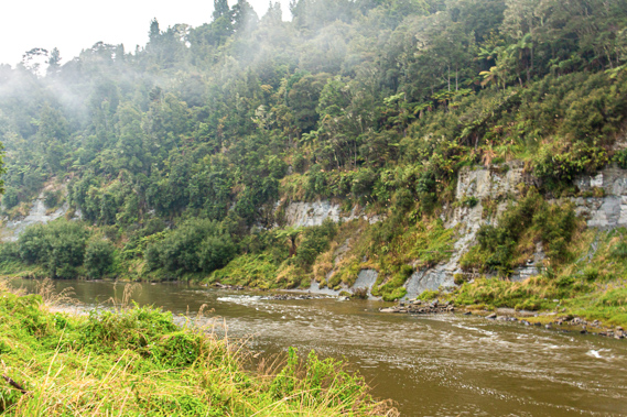
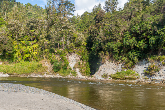
14:26 - At the end of another seventy degree turn to the left we reach the Mamakutapu rapid at the start of a 140 degree turn to the right. The cliffs are very steep on both sides of the river here, and there were significant shingle banks on either side. This funnels the river into a double row of white water between them but only for a short distance. We continue around the turn until reaching the Tarepokiore Rapid almost at its end turning into a short reach. A large landslide had come down to the left in 1875 completely blocking the river. The dam it created burst not long afterwards and the resulting rapid created a dangerous whirlpool to the left which was capable of spinning even the largest river steamers when the water was high. To resolve this dangerous hazard the area was blasted filling in the deep hole. This largely eliminating the whirlpool making it a lot safer for boats. Twenty seven snagging teams camped at the abandoned Kirikiriroa village in May 1903 having upon completed clearing the log jam further downstream at Tangarakau. History records their biggest job by far was filling in the Tarepokiore whirlpool rapid. At the time it was around twenty metres deep and dangerous enough to completely spin the largest boats coming through here. They carved away part of the bank of the landslide and used the debris to fill the hole at the vortex. To this day the area is still called the whirlpool even though it is seldom in action. |
 |
14:32 - Past the reach the river passes the Kahaumia Stream before turning 150 degrees to the left. At the entrance to the corner is the Taereaka Rapid with 3 large rocks across the river creating quite a bit of turbulence. We pass between two of these rocks then followed a long shingle bank to the left. The bend turns sharply and towards its end a bank of shingle and rocks on either side compresses the river into a tight spot down the Opakaua Rapid, but it was too deep to become turbulent. At the end of the bend is a short straight followed by the Matapihi Rapid with some logs and rocks creating turbulence to the left so we kept to the right hand side. The moderate grassy slope to the right has an abandoned canoe about a metre above the water. Perhaps someone had stopped here to go into the bush for a toilet break, or maybe the canoe had washed down during a recent flood. |
 |
14:42 - The river turns into a 120 degree bend to the right and into Raratu Rapid. There were some rocks and logs creating turbulence with a particularly big rock to the right at the end of the gentle rapid.
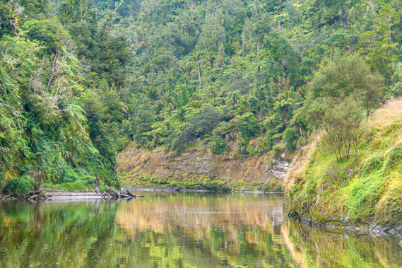
The turn finishes as the fog clears, the rain stops and even some blue sky is starting to show through. Perhaps we will be able to dry everything out later this afternoon. We follow a long straight apart from a fifteen degree kink in the middle where the Tautarakapua Stream flows out to the left. A shingle bank to the right shallowed the water, but the current was pushing to the left towards a large snag, so we navigate the Paparangiora Rapid to the left over the shallower water where it is mildly turbulent. The name Paparangiora means to strike a healthy sky. This was very relevant to us with the weather clearing and the sun now trying to come out. Upon reaching the end of the straight we enter the Tartarakapua Rapid at the start of a thirty degree turn to the right. There are large shingle banks to our left with a small channel running through it. A classic V leads into the main channel to the right of the river. It is very narrow with definite white turbulence. Once down the white water we need to stay right to avoid some large submerged boulders to the left. Once we reach the end of the bend the Ohineika Rapid with minimal turbulence but some protruding rocks marked the start of a 160 degree turn to the left. |
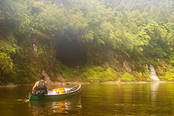 |
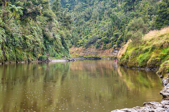
15:18 - At the back of the bend we go through Kakanohue Rapid, before we reach Tamatea’s Reach. The camping ground was just around the next bend. About two thirds of the way along the reach we pass the Otawhare Rapid with a long narrow rock bank to the left but little turbulence in the water. Looking ahead to the left I can see Tamatea’s Cave – otherwise known as Tararoa. This sacred cave was named after the legendary explorer Tamatea Pokaiwhenua, the captain of the Takitimu waka, one of the great canoes that brought the first Maori settlers to New Zealand from the legendary Hawaiki around the year 1350AD. Tamatea is said to have sailed into the entrance of the river settling at Putiki a little downstream from the current location of Wanganui city. The full name of the battlement was Putiki Wharanui O Tamatea Pokai Whenua which translates to “the place where Tamatea tied his topknot with flax”. Upon settling there, Tamatea headed upstream eventually reaching the headwaters and going onto discovering the large inland sea of Lake Taupo. He named several features along the river including this cave. The Maori stories tell of Tamatea sheltering in the cave as he paddled upstream. It is now considered sacred, so people can’t stay there. |
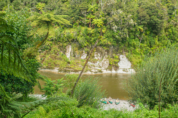
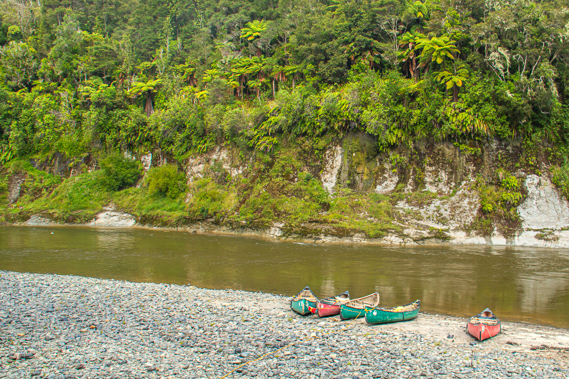
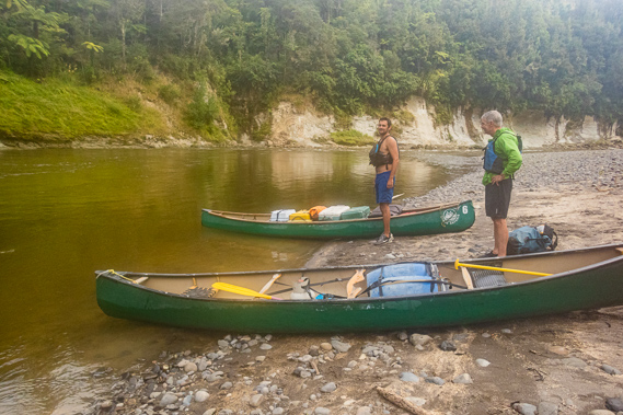 |
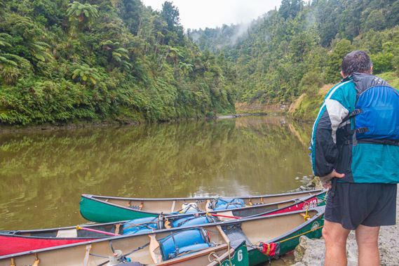
15:23 - About forty metres upstream from the cave is a rock projection in the cliff face called Te Ure-a-Tamatea, meaning the penis of Tamatea. Someone had a rather warped sense of humour here as the other name for the cave is Tararoa, one interpretation being the vagina of the river. I will say no more… Looking to the right is a sign saying that the Ohauora camping ground was just two hundred metres away. We enter the bend as we pass the cave, through the Arawhata Rapid, meaning steps or stairs. There is a little bit of short lived turbulence. The rapid marks the start of a large shingle bank extending around the peninsula we are rounding. At the end of the short rapid Cameron directs us through the eddy to land at the beach, completing out canoeing for the day. Cameron ties the boats up together to a post. Although we have travelled quite a long way downstream from our lunch stop at Mangapapa, the horseshoe meanders of the river meant we have not really travelled very far at all so far as the crow flies. |
 |
16:36 - Following two days of paddling, we are almost half way along the journey, 61.5 kilometres downstream from our start at Ohinepane, and 62.5 kilometres from Pipiriki. We have done just over thirty kilometres per day over the past two days. From here we just need to do twenty kilometres in each of the remaining three days. We have gone down 34 rapids today, significantly less than the 52 we had done yesterday. In total we had gone down 86 of the 146 rapids between Ohinepane and Pipiriki with just 60 to go. The largest rapids will be on the last day though, but hopefully we will by then be ready for them. After all we had no incidents at all today, though none of the rapids were as big as the big ones yesterday. Hopefully we are not going soft on this middle section of the river. My bottom is sore from two long days of paddling. I think today's canoe was more uncomfortable than yesterday's one. |
 |
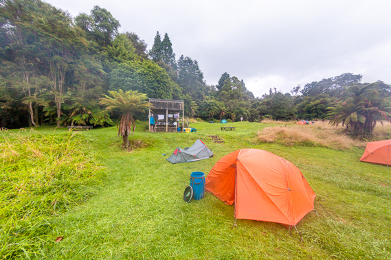
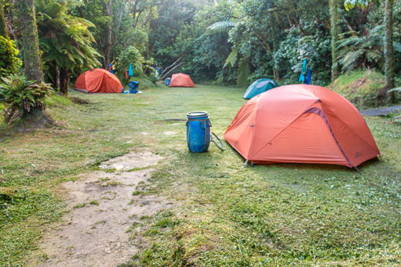
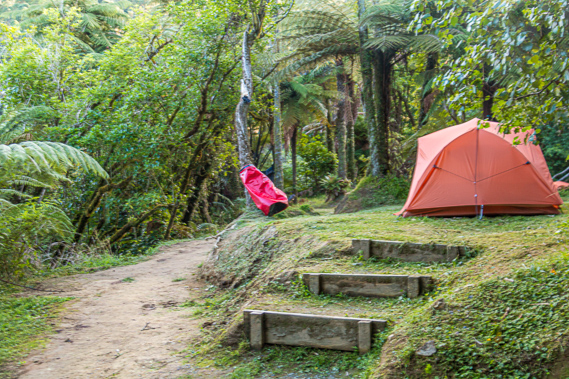
16:58 - We collect some drums and took them up to the path which is undercut from fairly recent flooding. It is a bit of a scramble up the metre high bank over some dead logs and branches to the dirt path rising moderately into the bush above. Once on the path it is a steep ascent on soft dirt up the side of the hill to a staircase into the tree ferns and small trees. Wasps are buzzing around indicating there was a nest nearby. Ahead is a shelter identical to the one we have seen in the other camp grounds. The shelter stands on a narrow terrace about ten metres wide. The small trees form natural rooms in between the a few grassy areas with the capacity for 20 camp sites, even though it does not seem any bigger than last night’s camping ground at Maharanui where there have been only 12 camp sites. |
 |
17:03 - After a few trips everything is up near the shelter. We grab our barrels and move them to our selected camp sites. I move mine to the left to the main clearing. We returned to find our tents from the big bag. Fortunately there are no wasps in the camping ground or near the shelter. The nest must be down the bank. As expected the tent is very wet from this morning’s rain. Fortunately the sun is out by now and the spot I have selected is sunny. There is a chance that it is going to dry before nightfall. I start putting up the tent. The ground here is flat like it had been last night, except the grass has only been very recently mown in the last day or two. The cut grass is still on the ground creating a huge mess. I clear it as best I can before rolling out the saturated tent. |
 |
17:05 - I put the poles together pretty quickly. From there the tent goes up very quickly. I decide to keep everything in the drum whilst the tent dried. Although there is no breeze I could see the fly drying out. It was then I smell the awful stench of the toilet some distance in the bush above my camp site. If these were bad I couldn't imagine how bad the ones at John Coull would be. I set up a small washing line between two trees and hang my wet clothes from yesterday and today on it in the strong sunlight.
|
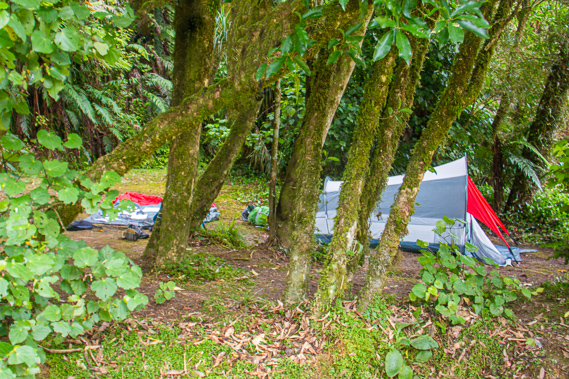 |
17:06 - I head back to the nearby shelter. Cameron is setting up in the shelter for afternoon tea. He had already put up his tent in a dark alcove completely covered in trees on the other side of the shelter. Another canoe has arrived and the couple in it were beaching it just downstream of our canoes. We recognise them as the couple we passed sheltering under the ledge just before Man-O-War Bluff earlier this afternoon. They set up their tent in the big space back towards the treesbefore coming back to the shelter to introduce themselves. They were from the Czech Republic and explained that canoeing is a big thing there, but the rivers they were familiar with have cafes every hundred metres or so. The remoteness of the gorge had come as a huge surprise to them, having started at Whakahoro this morning. They had seen no traces of civilisation all day here in the remotest part of the North Island. They were thoroughly enjoying the remote ruggedness of this area though. |
 |
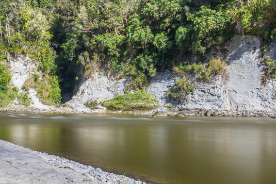
17:14 - I head down to the rocky beach where the scrubby hills spread out above the low cliff. The hills here are quite low, certainly a long way off the vertical cliffs and steep forested hills of the gorge we passed through today. Just downstream from across the entrance is a small ravine where the Ohauora Stream flowed into over a papa shelf. It is a very narrow ravine I couldn’t see into, but apparently behind it is a very good swimming hole. Ohauora is the Maori name for place to be fit and healthy, and in good spirits. This described us quite nicely having completed half of the journey in two days and with the sun shining drying everything out. The name was originally given to a Maori kainga village based across the river on the terrace to the upstream side of the little stream. Although the Whanganui has the reputation of being New Zealand’s longest navigable river, it is also considered to be the world’s most difficult navigable river. Before the river cleared to Taumarunui, there was no way the paddle steamers would have been able to proceed through the big rapids upstream from Pipiriki and through the small, narrow, and shallow rapids up this end of the river. |
 |
17:16 - Special tunnel drive steamers were used for the middle section of the river from Pipiriki through here up to the Ohura River where the house boat was located. The boats were especially designed to run through the conditions this part of the river threw at it. The Ohura was one of these boats at 26 metres long and 3.6 metres wide. It was a rugged looking boat with a lot of character with two levels of seating very much like some of the boats I had travelled on rivers through Asia. Despite its large size, the Ohura floated in just 12 inches of water. The first deck wasn’t very high at all so I imagined sometimes water would get in whilst negotiating its way through rapids. It was a steam boat billowing huge amounts of smoke over the river as it chugged its way along. The Ohura didn’t have the paddle wheels on its sides or back like the steamboats to Pipiriki. They just wouldn’t work. Instead the Ohura used a very new ingenious tunnel drive. It had twin shafts, each with two propellers in steel tunnels that collected the water, rose it to the level of the propellers (which would have otherwise only been half submerged). The tunnels had flaps to keep the propellers submerged when the boat was stationary, but otherwise the tunnels scooped up the water, and pushed it out the back propelling the boat forward fast enough to negotiate the rapids up to the Ohura River. Once past the Ohura River though, the rapids really were too rough and small for the Ohura to negotiate its way upstream. The smaller tunnel drive steamers Waiora and Wairua were used for the third day for the final stage between the Ohura River houseboat and Taumarunui. These boats were smaller at 20 metres long and 2.4 metres wide and a single level, like the longboats I had travelled along the upper reaches of the Amazon in, except these didn’t have a roof apart from the wheelhouse |
 |
17:39 - A terrace covers the top of the hill, where once the Ohauora Kainga once stood. It has been long abandoned and the regenerating scrub had all but wiped the wooden village off the map. From the shelter there is a clear view between the tree ferns over part of the river. Although a little dirty, the river stands bright between the pale bluish grey rocks of the shingle bank and the white scrubby cliffs rising to the hill on the other side. The others join me for crostini and toppings – an avocado topping on toasted French bread along with billy cooked hot water (or tea or coffee) as we relax. |
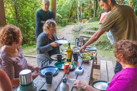 |
18:33 - Cameron has prepared some very nice barbecue steaks to go with pasta and a kumara salad for dinner. Kumara is a tropical sweet potato native to some of the Pacific Islands. The original Maori settlers were familiar with the sweet potato and brought it down to New Zealand. Unfortunately the climate here is a lot colder than where they had come from, but somehow they quickly found a way to cultivate the kumara to grow very well here, and continue to use it as a staple in their diet. For dessert we have an apricot chocolate chip cake with icing. Once finished dinner we wash up quickly to let the other couple prepare their dinner. |
 |
19:10 - There is another track heading down from the tents down to the river. Until a couple of days ago the grass would have been completely overgrown, but it had been cut at the same time as the grass in the camping ground. This is an easier way down to the river. From this end of the shingle bank I can see downstream. The Ohauora Rapid which we will be going down first up tomorrow morning creates a bit of rough water heading into some more rough water downstream before the river disappears around one of its countless bends heading towards the ocean still a hundred and fifty kilometres downstream. With the sun getting low I return to the shelter. |
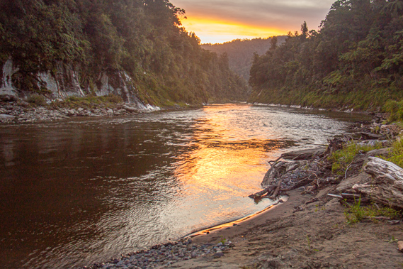 |
20:17 - I later return to the river to watch the sunset. Yesterday the sun had set directly behind the hill, but tonight it is heading towards the downstream side of the river. There is still some high cloud lingering overhead so there is a good chance of a colourful sunset. |
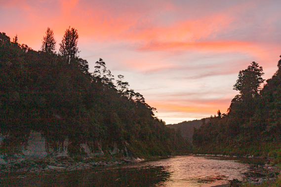 |
20:20 - The sunset is initially uneventful with the sun slipping behind the horizon and the valley quickly going dark. It is almost all over when the high cloud suddenly captured several bands of bright orange and pink from the last rays of sunlight filtering through the dusty upper atmosphere, fine dust carried over from the deserts of Australia. |
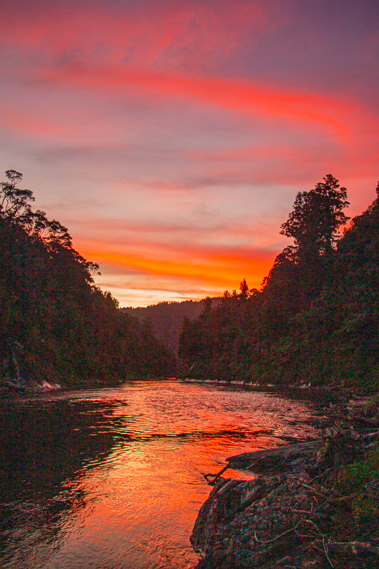 |
20:25 - The spectacular colours of the sunset reflect in the dark waters of the river, quietly bubbling away completely free of humans, perhaps ready for the taniwha to claim it for the night. In the darkness I return up the hill to the tent guided by the light of my head flash light. Everyone else has already turned in for the night, so I crawl into the tent and fall asleep. |
|