Introduction to today's journey
E rere kau mai te Awanui. Mai i te Kahui maunga ki Tangaroa. Ko au te Awa ko te Awa ko au.
The great river flows. From the mountains to the sea. I am the river, the river is me.
- Maori proverb
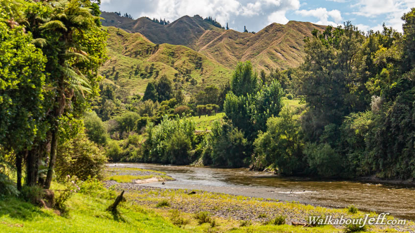
THE UPPER reaches of the Whanganui River passes through the North Island's King Country. This covers the rugged hills between Waitomo Caves across to the start of the volcanic plateau and down the river to about Pipiriki, our final destination in five days. "King Country" is the English name used by the British since the New Zealand Wars of the 1860s. Before the wars, the area was known as "Te Rohe Potae" translating to "Area of the Hat". The story goes that the second Maori King Tawhiao put his large white top hat on a large map of the North Island declaring all the land it covered to be under his mana (authority). The land he claimed with his hat was already inhabited by the Maniapoto tribes causing bitter disputes which continue to this day. The land here was considered too rugged to be of much use to the Europeans but in 1883, an agreement was struck with the tribes to survey the land and start purchasing large areas for settlement. The rugged terrain of the King country though has resulted in it being sparsely populated to this day, with only a few small towns such as Te Kuiti and Taumaranui established in the best pockets. Taumaranui was established where the Ongarue and Whanganui Rivers met, allowing the combined river to be nagivable. The Maori would transport the pakeha (Europeans) downstream until a regular steamship service would be established through this remote wilderness.
Today's journey begins at our base in Ohakune at the base of Mount Ruapehu. Our group is taken across the plateau towards Mount Tongariro, the source of the Whanganui River, before heading downstream to Taumaranui, considered the most upstream extent of the river's navigability. From there we follow the Forgotten World Highway along the river downstream before reaching our starting point at Ohinepane. After a crash course in canoeing, we set off downstream along the meanders of the river through various rapids stopping at Pokaria for lunch, before heading further downstream to Maharanui campsite at the edge of the Whanganui National Park.
Today's Journey
Distance trekked today: 31.5 kilometres.
Total distance trekked to date: 31.5 kilometres.
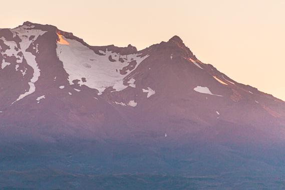 |
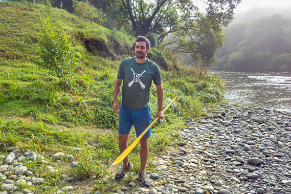
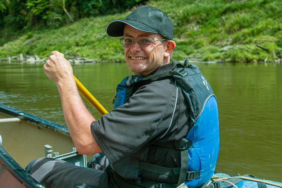
06:56 - A crisp pre-dawn chill greets us in Ohakune as the first sunlight of the rising sun touches the summits of the 2797 metre high Mount Ruapehu. There is little time to linger though. We have breakfast and do the final packing for the 7:00 start downstairs at the base. We carry our awkward loaded waterproof drums down and meet our guide Cameron from Upstate New York. We also meet our driver Guy who will take us up to the top of the river, and will pick us up at the other end at Pipiriki.
|
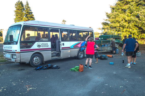 |
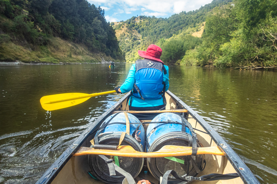
07:38 - A pile of blue life jackets lay on the ground outside the door of the bus. We all put them on before finishing loading our drums into the trailer under the canoes along with several chilli bins and other drums labelled with our supplies for the trip. Each drum and bin had a piece of masking tape on it to mark our names, or in the case of our supplies, what is in it.
|
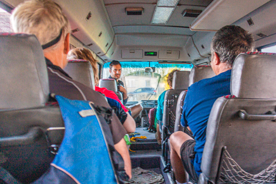 |
07:50 - Once everything is packed we climb aboard the bus. It was fairly old and basic and the windows were covered with a thick layer of dew from the humid fine night. I take one of the back seats whilst everyone else filters in the other seats spaced out along the old bus. Cameron sits in the front seat next to Guy, starting an introduction, passing around a disclaimer form but assuring us that what we are signing our lives away for was perfectly safe.
|
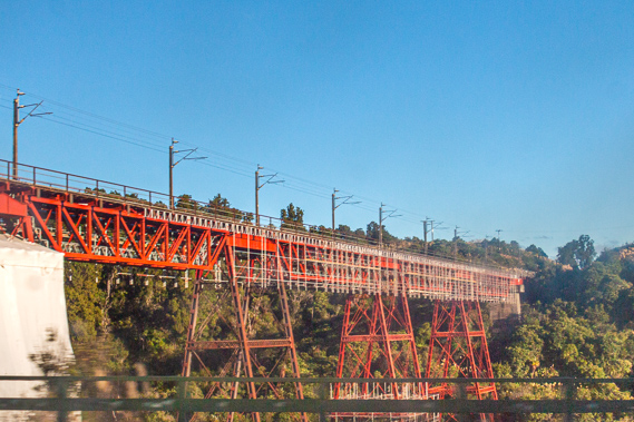 |
08:08 - We enter the deep valley of the headwaters of the Manganuioteao River. Occasionally lahar activity washes down this river, as it did in the 1970s poisoning the lower reaches of the Whanganui River. We will be passing the mouth of this significant tributary on our final day on the river. The road descends deep into the canyon whilst the main trunk railway line crossed over its top in an enormous viaduct well clear of even the worst lahar activity.
|
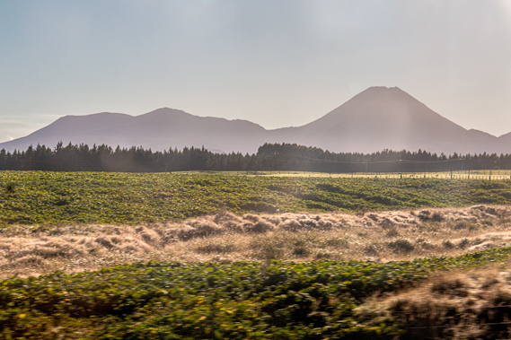 |
08:18 - As we continue around the base of Mount Ruapehu, the distinctive triangular and round peaks of Mounts Ngauruhoe and Tongariro respectively. The Whanganui River actually begins on Mount Tongariro, just to the west of the summit. It forms the next valley to the north of the Mangatepopo Stream which the Tongariro Crossing starts from. From the bottom of the mountain the river meets the Mangatepopo Stream and turns northward towards the Te Whaiau Dam where most of the water is diverted into the power scheme. What water doesn’t go into the scheme continues in a north westerly direction to combine with the Whakapapa River as it heads towards Taumarunui.
|
 |
08:37 - We divert from the mountains beginning our descent from the plateau towards Taumaranui. The water diverted into the power scheme now drains into Lake Taupo and down the Waikato River heading northwards. The Waikato River which drains Lake Taupo is the longest river in New Zealand, going up the middle of the North Island to Hamilton, and eventually turning off to the west coast a little south of the Auckland area. |
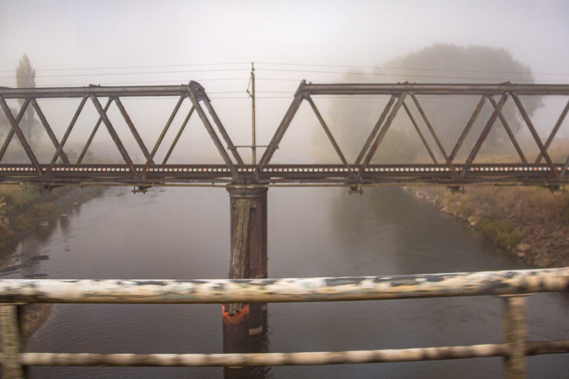 |
08:43 - The fog has completely enveloped us by the time we reach the bottom of the valley. The road and railway crosses over the gloomy Whanganui River. Both bridges are pretty basic. This is right on the 39th parallel of latitude marking the border between what had once been the Auckland and Wellington provinces from 1853 through to their abolition in 1876. Once on the other side of the river we enter the small town of Taumarunui. |
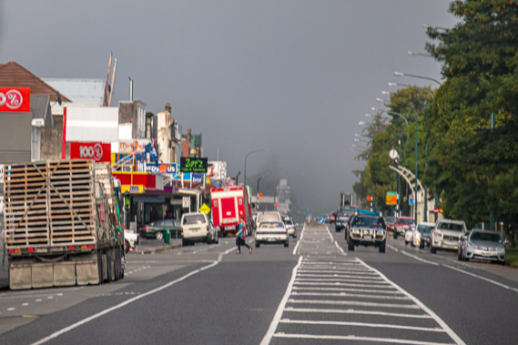 |
08:46 - Taumarunui town centre. This town has for centuries been an importantly strategic Maori settlement at the confluence of the two rivers. It marks the start of the vital canoe route from the middle of the North Island to the coast at Wanganui city 234 kilometres downstream. Taumarunui marks the border between three tribes (or iwi), namely the Whanganui tribe along the length of the river to the south, the Ngati Maniapoto of the Ongarue River and Waitomo to the north and the Ngati Tuwharetoa of the upper reaches of the Whanganui River and Lake Taupo to the east. The three tribes always lived together peacefully in this area before in the times before Europeans arrived in New Zealand.
|
 |
08:47 - We almost reach the end of town and cross the Ongarue River when we suddenly turn off the main highway. Where the Ongarue River meets the Whanganui River, the volume of water becomes enough for the river to become navigable - or it would still be if the headwaters of the Whanganui River were not largely diverted into the power scheme. We are now in the King Country, which formed during the New Zealand wars of the 1860s when the British colonial forces invaded the Waikato. The King Country was given the Maori name Te Rohe Potae or Rohe Potae o Maniapoto, translating to “Area of the Hat”. The story the locals tell is the second Maori King Tawhiao put his large white top hat on a large map of the North Island declaring all the land it covered could be under his authority (mana). It wasn’t quite that simple though. The land was already inhabited by the Maniapoto tribes. Bitter disputes arose between the tribes following the invasion. These disputes continue to this day.
|
 |
08:50 - The Ongarue River meets the Whanganui River to become big enough to canoe downstream from here in most weather. Some travellers start canoeing from Cherry Grove, traditionally known as Nga Huinga. Although Cherry Grove is 234 kilometres upstream from the mouth of the Whanganui, the river here is only 175 metres above sea level. This was the middle of the summer dry season though, so we were heading about twenty kilometres downstream to start at the more common launching point of Ohinepane. The Maori began transporting white people (known to them as pakeha) along the river in early days until a regular steamship service was established. Cherry Grove, then known as Taumarunui Landing, eventually became the last stop of Alexander Hatrick’s steam boat from Wanganui.
|
 |
08:52 - The final stretch of road between Taumarunui and the start of our expedition follows New Zealand's most rugged highway. Officially called Highway 43, it is much better known as the Forgotten World Highway. This is a 148 kilometre long winding road heading westward roughly following the railway eventually reaching Stratford at the base of Mount Taranaki. It takes about three hours to travel this notorious road crossing saddles and passing through narrow tunnels and precariously clinging to the edges of 60 metre high gorges.
|
 |
08:54 - Following the flat fields, we reach Te Maire Bluff where a single lane bridge leaves the highway crossing the river atop cylindrical piles. The next bridge downstream is a derelict swing bridge at Jerusalem nearly two hundred kilometres down the river followed by the railway and road bridges in Wanganui city. We continue downstream crossing over another large bluff before reaching the entrance to the Ohinepane campground about twenty kilometres out of Taumarunui.
|
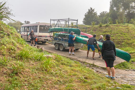 |
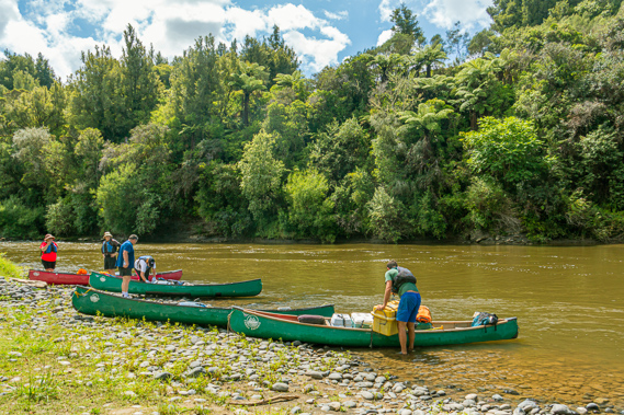
09:12 - With the van backed down a steep boat ramp beside the river, we unload the canoes and gear. The end was ragged indicating the lower section of the ramp had been perhaps sheared off during a past flood, or had originally ended there, but there had been some flood erosion. The boat ramp was installed here as another place to launch when the waters at Cherry Grove are too low as is the case most of the time now.
|
 |
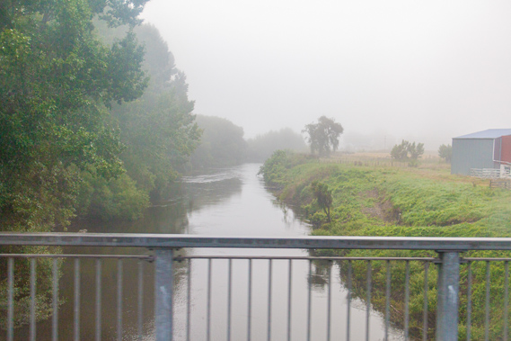
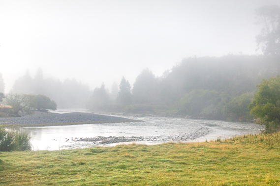
09:17 - The bank eases into a deep dark pool of almost mirror smooth water gently flowing past before funnelling into a rapid downstream as it disappears around the bend. The water is a little higher than usual due to recent rain, but a lot lower than it had been before the upper river was diverted for the Tongariro Power Scheme in 1973. The local Maori say much of the energy of the river was lost when it was diverted. Although the river is running 60 centimentres higher than normal, it is only sixty percent of the level that was considered to be dangerous, so we were fine to proceed with our expedition with fine weather forecast for most of the week apart from a little rain tomorrow.
|
 |
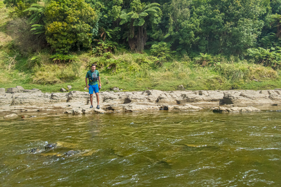
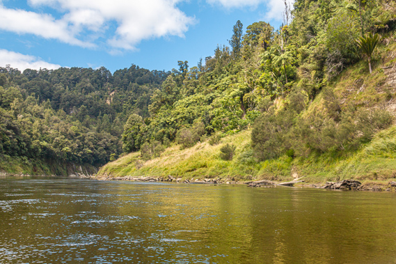
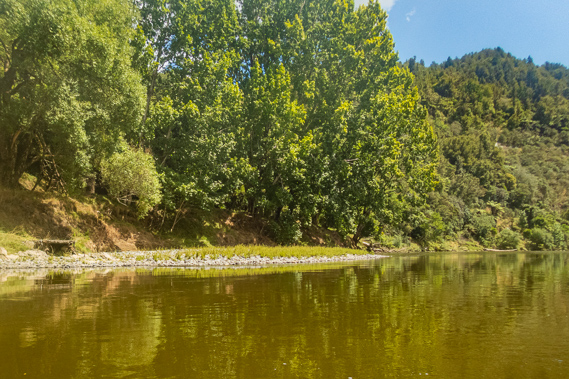
09:18 - Looking upstream the water is fairly flat as it rounds the bend around the small peninsula we are standing on. Across the river a steep grassy bank rises to a scrubby forest covering the low hills. The cool fog was lifting now with the air clear for the first ten metres above the water. This is one of the foggiest parts of New Zealand, and further north, Hamilton City is considered the foggiest area in the world. This bluff at Ohinepane was once a quarry but has been converted into the first of several camping grounds along the length of the meandering river, and the only caping ground with road access.
|
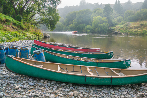 |
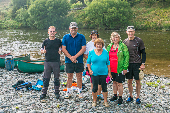
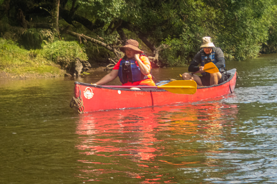
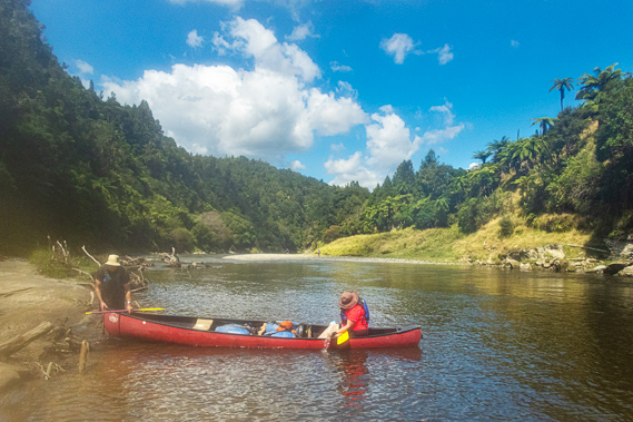
09:25 - We line up the canoes with their bows at the edge of the water and the sterns further up the bank. Each canoe has a small plastic or wooden seat near each end. They can actually go either way around. With the canoes, supplies and equipment now all by the river, we gather around in a circle for the briefing. None of us have any past canoeing experience, but a few of us have done some kayaking. We were all most certainly beginners. Fortunately for us Cameron is a qualified school physical education teacher. That really showed very well when he did his demonstration. He also has a very clear voice with excellent projection, which will work very well in the remote canyons of the gorge downstream.
|
 |
09:27 - After a few minutes of practicing using a paddle and learning how to power and steer the canoes. I have read there are around two hundred named rapids on the river between Taumarunui and Pipiriki, and given we are just a short distance downstream, there will be a lot to get through. We are at 135 metres above sea level on a right angle bend around the peninsula in a pool between the Te Pera and Ohinepane rapids.
|
 |
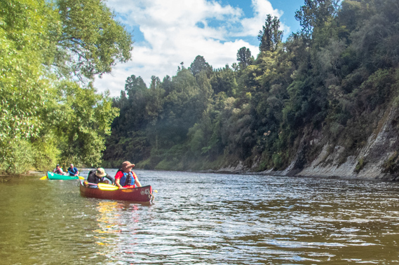
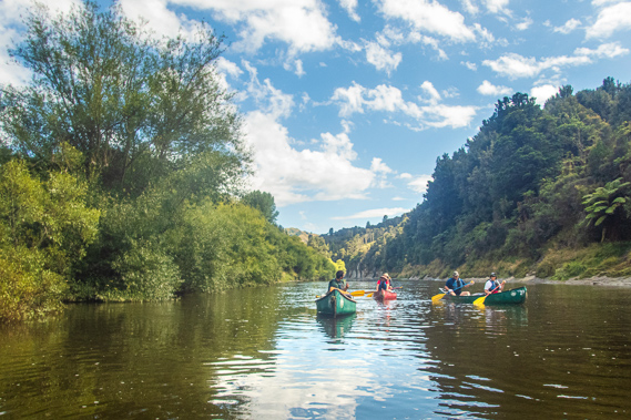
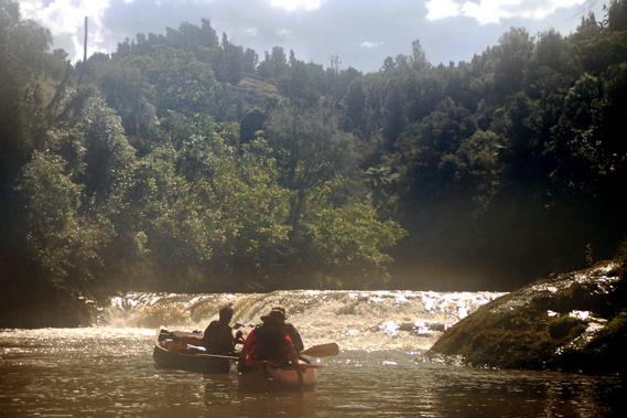
09:29 - Cameron mentions this is a particularly small group. He normally leads groups of between 10 and 20 people, and when there are more than seven there would be two guides, one at the front and one at the back. As we are a particularly small group we apparently only need one guide to take us downstream and to do all the cooking. He mentioned this first rapid was one of the biggest that we were going to go through today. If we could get through this okay then we should be fine for much of the rest of the day. Once the briefing was finished and our heads exploding with information, we packed the canoes and launched them into the calm shallows. When he was happy with our control of the boats about ten minutes later, he led us down the middle of Ohinepane Rapids, the 47th rapid downstream from Taumaranui.
|
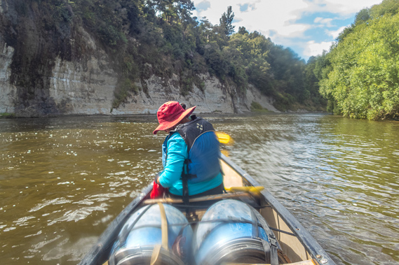 |
10:51 - The water entering the rapid flowed into a classic vee shape, which we entered single file. This first rapid is our test to see whether we can make it down the 124 kilometres of river intact. The canoes accelerate to a fast pace as we turned clearing a large shingle bank. The channel split into two around a shingle bank. We take the left channel as the right channel goes hard into the bank almost disappearing under the willow trees growing out of the slightly submerged bank. The water is quite bouncy and the bow drops low enough at each wave for a bit of water to splash on board getting my pants a little wet, but fortunately none of us lose our balance and capsise. Despite the bouncy waves the canoe seems to sit well in the water. At the bottom of the short rapid there is a quick succession of two much smaller rapids. There is some water sloshing around in the bottom of the boat, so I quickly bail it with the cut off milk container out as we continue downstream.
|
 |
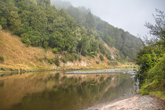
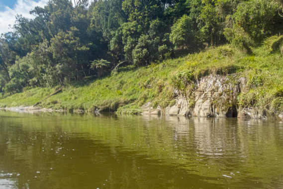
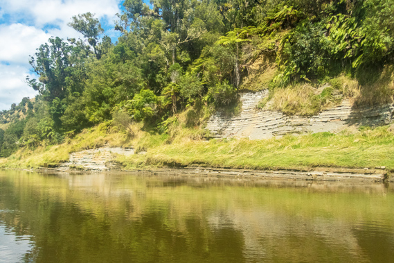
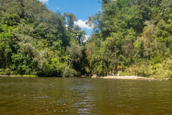
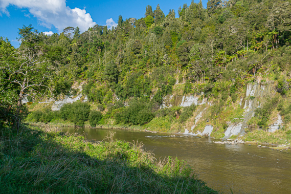
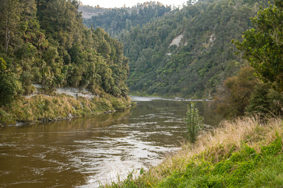
10:52 - The mudstone is stratified into thin pancake-like layers, deposited from countless volcanic lahars and ashfall events from the volcanoes in their 950,000 year history. Each layer has its own story to tell concealed from a distant past, like the layers of an onion or the rings of a tree. At one time this area would have been a continuation of the large plateau encircling the volcanoes, but the uplift of the land from the subduction of the Pacific Plate has caused the river had cut deep into it leaving the steep rolling hills that now surrounded us. A tall bank on the right marks the mouth of the Te Aukopae Stream. Just in front of the stream is the Aukopae landing, one of the many stops along the river for the old steam boats that used to navigate their way up and down the river between Wanganui and Taumarunui.
|
 |
10:53 - From the end of the straight the river begins a long swing around to the left enclosing a large peninsula at the end of the hills we have been following. The land here is privately owned but largely covered in scrubby forest. The forest conceals a Niu pole that had been erected by the Hauhau for traditional religious ceremonies during the wars of the King Country in the 1860s. The peninsula was once a kainga (a Maori military village) called Arimatia. The people there didn’t take well to the missionaries when they arrived in Wanganui in the 1840s. They headed all the way downstream from here to threaten them in an unsettling period for the fledgling settlement at the mouth of the river. |
 |
10:54 - We are most of the way around the bend when we reached the Waiari rapid. A large sweeping shingle bank runs to the left mostly concealing some huge outcrops of bedrock. This rapid is nearly as big as Ohinepane, but the bounce of the pressure waves is a little easier with no water splashing into the boat. We pass a large eddy to the left at the bottom of the rapid. From here we enter a short straight following the peninsula now doubling back in the opposite direction from the first stretch we followed from Ohinepane.
|
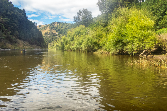 |
10:55 - Once past the peninsula the river bends about 30 degrees to the right to wind in between the increasingly elevated hills rising to about two hundred metres above the river. By now most of the cloud has cleared and the sun is shining. In the relative calm along the next straight I am able to start taking pictures with my waterproof Olympus TX-4 camera, strapped to me and easily accessible.
|
 |
10:56 - At the end of the turn we reach the Taurakawa rapid, a classic vee shape in between a sandbank to our left and some big rocks to the right. The water passing through the rapid remains unbroken. Although we have already travelled several kilometres along the river, we are now only 800 metres away from our start as far as the crow flies. By now we are used to our canoes and have settled into a steady routine, but still struggling a bit with the steering. Being at the back of the canoe means I am steering like I would a forklift, except I have hardly ever driven a forklift – only briefly about twenty five years ago.
|
 |
11:00 - The river begins to bend to the right, at the start of a 150 degree turn doubling back. Toka-a-te-atua rapid is in the middle of the bend. Cameron stands up in his canoe to get a better view before directing us to head to the left to avoid a long shingle bank on the other side. The channel is quite narrow and rough before suddenly shallowing over a shingle bank. Once around the bend we enter another reach of calm water. A steady current pushes us along but the water is otherwise flat. To the right hidden in the bush is the historical Nukunuku farm which containing a small private camping ground and museum. The museum includes the tombstone to the Reverend Richard Taylor who set up his mission in Wanganui in the 1840s and travelled up the river.
|
 |
11:01 - After only the briefest of calm patches we reach Komako rapid where the water was quite swift but with little turbulence. Following the next straight we reached the Ohineperu rapid, named for a small spring of water near here. It was at the start of a thirty degree turn left. At the start of the rapid a few large rocks poke through the surface amongst a rubble of submerged rocks on either side. There is no turbulence though as we pass through another set of submerged rocks. When the river is higher I imagine this would be quite a substantial rapid. Once around the bend we enter a straight and into Tiwhapaua rapid. Here the water is very fast flowing but not turbulent. A large shingle bank stretches against the left bank and there are a couple of big rocks to the right.
|
 |
11:15 - We hear a jet boat approaching as we continue following the short straight, so we head across to the right bank and point in towards the middle of the river as it hurries past. It creates quite a steep wake causing our canoes to bounce. We resume along the straight before an eighty degree turns to the left into the Pararoa rapid. To the right just above the rapid opposite the Paparoaiti Stream is some bush hiding a cave used by the steamers to store postal supplies for the local settlers to collect them when they are in this area. Boulders stick out of the water to the left and a rock ledge occupies the right hand bank. This is a hard layer of mudstone which the middle of the river had penetrated through, and the layer will continue for some distance. The main channel of the river is to the right close to the rock ledge as a long rock bank appears in the middle of the channel. There is a ring bolt in the rock used by the steamers to winch themselves upstream against the strong current they would have been otherwise unable to negotiate.
|
 |
11:48 - Following Cameron our canoe is at the back of the group as we enter the rocky Whaiwhakaata rapid. We are drifting a little off course steering frantically with me still not used to the backwards steering around the exposed rocks when we suddenly got beached on one. We are stuck fast by the current against the rock. The others all continue down the rapid, with no way of turning back. Thankfully Cameron sees us at the bottom of the rapid, gets the others to beach on calm bank, and spends the following five minutes walking along the rock bank. It it rather awkward and slippery, but I’m sure he’s done a lot of rescues in his time here on the river. Embarrassingly for me this is the first rescue of this trip. Will this be our last? The others have been so nicely coordinated but thanks to my dyslexic steering I am the first stuck. At least the canoe is still upright, so we are mostly dry apart from a few splashes. Cameron arrives across from us and wades into the shallow swift water to gently pull us out of our wedged predicament and let us go downstream. The rest of the rapid was smooth as we turn into the eddy with them while we wait for poor Cameron to walk back down the rocks to his boat.
|
 |
11:53 - The little eddy marks the only bit of calm water between Whaiwhakaata, the rapids we have just come down, and Takapauopuhi rapid. Once Cameron catches up with the rest of us, we entered the rapid at the right turning bend at the bottom of Koiro Hill. At this point the long rock bank ends and another shingle bank starts to the right. |
 |
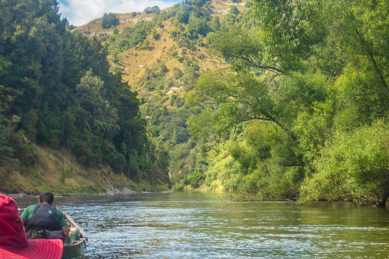
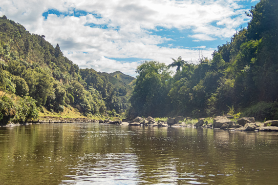
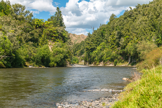
11:56 - The short rapid marked the start of a peaceful almost mirror flat straight. The gorge here is narrow and huge boulders litter either side of the river at the base of the high hills where they have rolled down from. Despite the earlier challenges we are now making great progress down the river.
|
 |
11:57 - Upon reaching the end of a straight the river turns 90 degrees to the left, entering the barely noticeable Whatanuku rapid. Half way around the bend we pass the mouth of the Ruataniwha Stream coming out in a shingle bank to the right as we head down the Koiro rapid. Ruataniwha means a hole with a taniwha monster in it. The Maori believe the deep water holes of the rivers and coasts have huge monsters in them, often describing them as snakes or crocodiles even though New Zealand has never had either of these. It is believed that these stories were brought with the earliest Maori people from the Pacific islands where these animals had been common. We enter another straight from where Cameron announces he can see our lunch stop.
|
 |
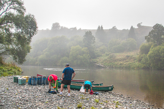
12:28 - A turn at the end of the straight ends with a large shingle bank at the landing of the Poukaria camping ground marking the start of a two kilometre straight. We have travelled 14 kilometres downstream from Ohinepane, with another 17.5 kilometres to go to tonight’s destination. By now the sky is partially covered in mid level cloud. We pull our canoes mostly out of the water onto the large grey stones standing over soft mud. Weeds grow almost to the water’s edge and increase in concentration up the gentle slope. The view on the other side of the river is concealed with mixed bush and tree ferns.
|
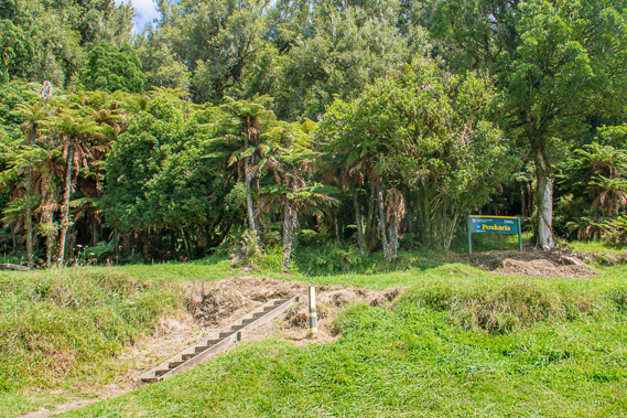 |
12:29 - Poukaria is the Maori name for digging a hole for a support or a post. Thick forest covers the ground above about three metres above the river, indicating floods often reach that high. A wooden staircase is set into the steep bank up to the terrace. It did feel very remote here even though we were still in a farming area. There is another picnic table in front of the shelter, and a couple of small wooden platforms nearby for campers. We are the only group here, so we set up on the open picnic table with some thin buns which we cut putting all sorts of tomatoes, cheese, cucumber, lettuce and ham onto. There is also tea, coffee and muffins. We aim to eat the most perishable food first before it deteriorates in the latter part of the trip. |
 |
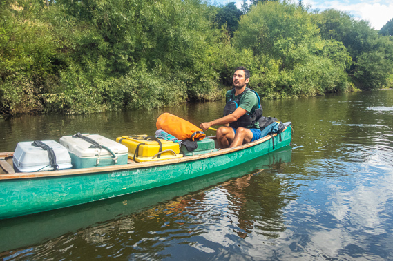
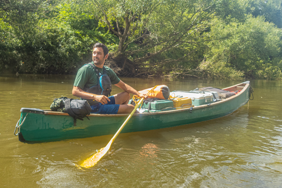
12:59 - Following lunch we pack up and return to the river, loading the food bins onto the canoes. We all change our positions. I am now in the front of one of the canoes providing power without needing to steer. Cameron wants to mix and match us a bit so each boat would be going at about the same pace without any of us falling behind. We set off, quickly heading towards the other side of the river into the deeper water to pass through the Poukaria rapid. The waves break slightly as we follow the river to the right of the main current which goes into the willows growing on the far bank.
|
 |
13:21 - We soon go down the swift Topahehipehi rapid with its flat mudstone islet to the left called Pehipehi-a-aurangi. Maori legend tells this is the haunt of the taniwha Tutanatakino, the god of the stomach. The Maori say that for good luck on the river, you pay tribute to the taniwha by pausing here and place a simple offering of a fresh leafy branch on the rock. So far we have not had any incidents apart from my boat getting wedged in the rock earlier today, so I think we are all feeling safe and non-superstitious, so we don’t put any leafy branches up on the rock gambling on our luck that the remaining 109 kilometres to Pipiriki will be easy going and incident free.
|
 |
13:38 - We continue paddling around the bend going into the Ruawhakakainga rapid right in the middle of the bend. The water was fairly swift and non-eventful, but at the end of the short rapid Cameron leads us into the eddy to beach at the shingle bank to the right. Looking across the river the hill drops into a gully on either side. Just downstream from the gully is the rubble of a few broken concrete slabs and bent iron stanchions. This was once the Kirikau Landing, the most upstream point the steamer from Wanganui would reached until 1927. From here the travellers would take a coach along the precarious road over the Ohinepane Saddle to the crossing at Te Maire, then follow what is now the Forgotten World Highway the to Taumarunui. From 1927 Hatrick’s steamer was put into service along this difficult section of river from here all the way into Taumarunui until it ceased running in 1939.
|
 |
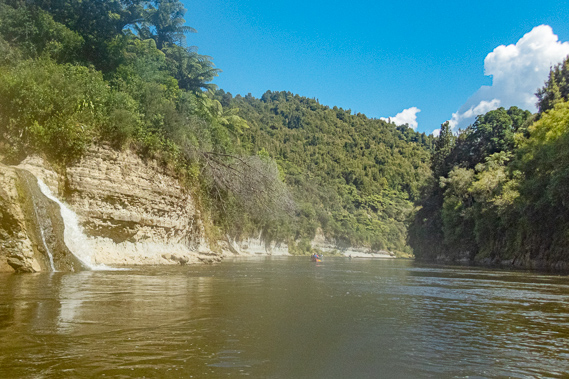
13:50 - Kirikau Stream is completely concealed from this angle, but Cameron points out a ravine with a pretty waterfall coming down the back of it. We are already a few metres downstream from it and the current here is quite swift, so we will have to paddle up the eddy as far as we can go before crossing the river as fast as possible, then point our nose into the ravine and paddle in quickly before the current drags the back of our boats downstream. This sounds pretty technical given we were still novices, but we all decide to give it a go. After all, if we miss the entrance we can just go back into the eddy and try again.
|
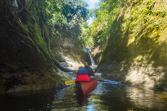 |
13:56 - We all paddle upstream single file, and head around. My boat misses the entrance first go but after watching one of the other canoes go in, we make it into the ravine on the second attempt after going around the eddy. For a while it looks like we are going to completely miss it, but the current suddenly slows allowing us to paddle hard into the entrance of the ravine. A few more hard strokes and we are in the complete solitude of the calm water. The water is very shallow over a silt bank before deepening into a narrow pool. Ahead of us a small waterfall tumbles into another pool cut off a little too narrow for us to get into. The sides of the soft mudstone ravine rise about sixty degrees out of the water to the top of the terrace. There was no telling that Kirikau Village is just above the top of the small waterfall.
|
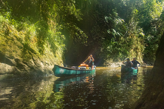 |
14:01 - It was very quiet in here with just the two canoes. The intense mottled lighting is a bit too much for a good shot. With photography already finished we hear the others yet to come in talking as they approach the entrance probably on their second attempt. There was a loud whoomph - we all instantly know what happened. Their boat has tipped over in their attempt at getting into the ravine. Fortunately Cameron was still out there and after a couple of minutes both boats came limping into the ravine. Fortunately all the barrels they were carrying had remained intact. Now the possibility of tipping out was becoming a grim reality. After a few minutes in the confined ravine we paddle out and continue heading downstream.
|
 |
14:07 - The turn continues through slow calm water. It quickly straightened out as we passed Kirikau landing and the long low grassy shingle bank following it. The calm doesn’t last long. The water is a little bumpy but not turbulent as we start a ninety degree bend into the Te Auroa rapid. A string of large rocks covers the bank to our left. The water down this part of the river was a lot clearer than it had been earlier this morning. The river continues turning another ninety degrees until we were going in the opposite direction to what we had been going at Poukaria. The camping ground is just a short distance over the ridge for a short while before the river turns ninety degrees the other way.
|
 |
14:40 - We stop at the shingle bank for a few minutes before continuing on. The bend ends in a straight. The left bank is a continuous cliff rising about five metres out of the dark water. Just past the rapid is a waterfall where the Otuiti Stream plunges down the cliff into the river. Following a short straight we make a seventy degree turn to the left to the Owhawhe rapid with shallow water and narrow channel between gravel banks on either side. The water wasn’t turbulent but at the end of it my boat suddenly caught the edge of an eddy and quickly spun around. We recover the situation and returned to the main current intact but we'd fallen a bit behind the rest of the group and heading down several more rapids in succession. One of these is the big Kirikau rapid which funnels in between a rock bank to the left and a shingle bank to the right. My canoe drifts off course causing us to get wedged in one of the rocks.
|
 |
14:53 - This time we are stuck fast as the first two canoes continue heading downstream. Cameron does see us and pulls over to a gravel bank on the right hand side of the river at the bottom of the rapid. This time we are stuck fast not going anywhere, but perhaps easing the weight off at the front would set it afloat again. This would require me quickly getting out and back in again. Unfortunately having been cooped up in the front of the boat since Poukaria I struggle to get my weight balanced as the boat suddenly lurches with the change in loading. To prevent completely falling in I grab a nearby rock and the boat and my oar happily float off down the rapid. By the time I get my balance the canoe is long gone downstream with its other occupant. An upside down canoe suddenly passes with two of the others clinging onto it, let go of it to land and follow me. This is going to keep Cameron busy collecting everything and everyone at the bottom of the rapid. I start following the bank along the river. The rocks are very slippery and the steep bank is covered in thick layers of tough weeds that cut my hands. After the slow scramble the three of us reach the end of the rapid where Cameron has successfully collected our canoes and my oar – a task he has no doubt done many times before.
|
 |
15:14 - We climb back in our canoes and continue downstream along (thankfully) a succession of hardly noticeable rapids. Cameron tells us the river was going to be mostly calm with just a few smaller rapids from here until our final day when we reach the big rapids. When the river had been cleared for navigation in the early 1900s, steam boats would travel up and down the 243 kilometres between Wanganui and Taumarunui taking three days to go one way. Two bases needed to be set up for the overnight stays. The first of these was in Pipiriki, where we will be leaving the river in four days’ time. The second night’s stop was just ahead of us. The river turned gradually to the left to round a small peninsula once the site of a long abandoned Maori village, the Kainga Pehimahaki.
|
 |
15:58 - The river is smooth as we continued around the 170 degree turn around the peninsula, but towards the end Cameron stands up to get a better view of the Ruangarahu rapid. A shingle bank appears to the left with some white water entering it. Cameron tells us to follow him carefully as this was a tricky rapid. As we head through it there is a training wall to the left where boulders had been encased in wire netting baskets. From the end of the wall submerged boulders continue following the line with the current running swiftly between them. Once we are past the submerged wall there was a rock ledge to the right hand side where the main channel turned into it passing a large shallow bank and boulders crossing from the left to the middle of the river. The couple who have already fallen out twice this afternoon hit a rock and fell out again but the rest of us managed to get through it okay. From there we follow a few more bends and tiny rapids during which our boat falls a bit behind the others.
|
 |
16:21 - Once through one rapid we can see the other boats have gone around a small point to the left. We join them to be greeted with a wide waterfall about a metre high. This is the rather dirty Ohura River which runs mostly through farmland. This was the smaller of two waterfalls the river goes over before reaching the Whanganui. The Ohura River’s source is just above the coal mining town of Ohura on the Forgotten World Highway. When the coal mine was spent in 1965 the town quickly declined and is continuing to do so. Across the other side of the Ohura River is the Maraekowhai village (name means Maori meeting place under the yellow flowering kowhai trees) with the Whareriki Pa. The second night of the steamboat journey up from Wanganui would be spent here at Maraekowhai. People would stay in a large houseboat that Captain Alan Marshall had successfully floated down from Taumarunui in 1904. Cameron tells us we were about seven kilometres short of tonight’s camping ground. Here we were down to 95 metres above sea level, half the elevation of Taumarunui.
|
 |
17:50 - From the river junction we continue downstream along the now wider valley, starting with the Kahuitara rapid down the middle. The river is quite shallow here with sediment and logs washed down from the Ohura River. The water was a little bumpy but otherwise smooth. Once past here, the river is fairly calm with a couple of very minor rapids. After a brief respite we enter two more medium size rapids, the latter of which my boat gets caught in the eddy once more setting us behind the other boats. The rapid took us into the next reach, but quickly we entered the Waikutupara Rapid with a large shingle bank to the left. This rapid marks the start of the Whanganui National Park and also the start of the Stratford District on the right hand side of the river. The river from here follows the boundary between the Stratford and Ruapehu Districts. Shortly after this we pass a sign high on the right bank indicating we were only two hundred metres from Maharanui.
|
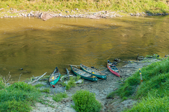 |
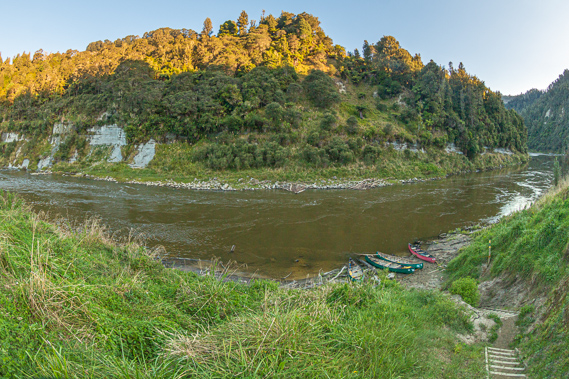
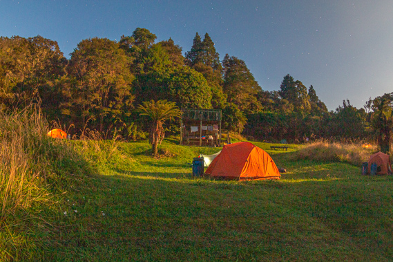
17:51 - Looking to the right bank we can see the Maharanui camping ground coming into full view above the high bank. We paddle down the vee of the Maharanui Rapid and deliberately into a small eddy half way down the rapid landing on the tiny muddy beach at the bottom of a stairway up the steep bank. We haul the canoes just out of the water onto the muddy and Cameron pulls out his rope, put it through the little loop ropes at the front of each canoe and ties them together on a slightly leaning round fence pole obviously erected for this purpose. If the river is to rise overnight the boats won’t be going anywhere. We unbuckle all the straps which have successfully held everything in place down the 52 rapids we have negotiated over the 31.5 kilometres from Ohinepane. We have dropped about 35 metres elevation today, to about 91 metres above sea level.
|
 |
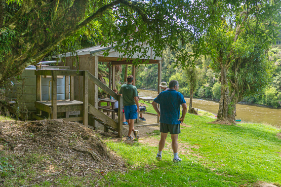
19:06 - We grab a few barrels and lug them up the steep wooden stairway on what would have otherwise been a very muddy and difficult path up the steep bank. We reach a gently sloping cleared river terrace. Just above the top of the cliff is a solid picnic table marking the start of the first level for the tents. Behind that is a short steep rise to the next level at the back of which is a shelter identical to the one we had seen at Poukaria. We drop everything at the back of the first terrace before returning on several trips back down and up the stairs to collect everything else from the canoes. We leave our paddles in the canoes wedged a little under the seats to hold them fast.
|
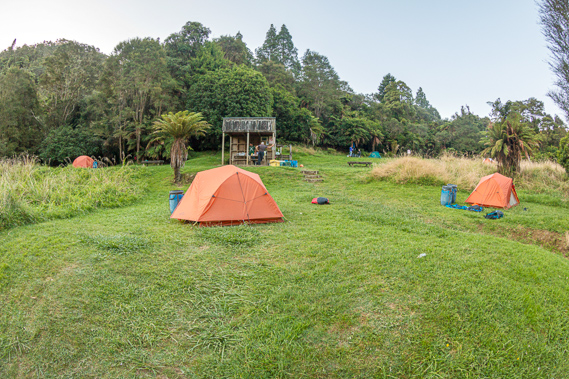 |
19:08 - We started putting up our tents. Fortunately I had the foresight to book my own tent. The couples each have one tent between them. Our five tents occupy five of the twelve spaces. Unfamiliar with the design of this tent I have a look at what everyone else is doing with their tents. They all appear equally baffled, but somehow we together work out the solution as Cameron starts setting up for dinner at the shelter. The couple across from me have brought large blow-up mattresses. They are going to be a lot more comfortable than the thin blow-up mattresses the rest of us had been given. Unfortunately for them both mattresses couldn’t fit into their tent, so after some negotiating I end up scoring one of those mattresses and I gave them my little one. The mattress took up most of the floor space but there was room to put some of the rest of the gear into the tent and the rest of it locked up in my barrel outside the door. I strategically put my barrel just in front of the peg I figure I’d most likely trip over. Then I was all set up. I found a nearby tree to set up a portable clothes line to hang my wet clothes.
|
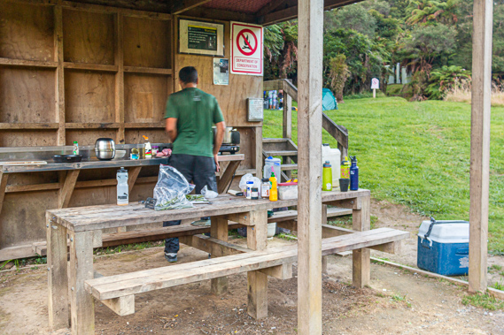 |
19:10 - We all finish setting up at about the same time so we join Cameron in the shelter to help him prepare dinner. He has everything very much under control so we all go to the large picnic table to relax after the long day’s paddling. Cameron brings us some cheese, crackers and Hawkes Bay wine. I’m normally not a drinker, but I am on holiday, so why not? The Maharanui camping ground stands on what was once a Maori kainga, or village, just across the river from what had been the larger Mangaohutu village. At the time the earliest European settlers arrived, there were 143 kainga along the length of the river. That was an average of one village every two kilometres. We passed several of these today and will be passing more villages further downstream. I imagined though now we were in the national park about to enter the rugged gorges, there will be more distance between the villages. The sun has mostly set by now with only the tops of the hills across the river still illuminated. The temperature has quickly dropped so I put on my polar fleece top. Cameron is cooking the dinner and had nearly finished.
|
 |
19:11 - Not long before dark a canoe arrives coming around the corner from upstream with a couple paddling their way down. These are the first people we have seen since Ohinepane. The young couple beach their canoe near ours and unpack. He was from France and she was from England. They are on a gap year travelling the world. They are travelling alone and have canoed all the way down from Cheery Grove in Taumarunui, so they are exhausted. They have paddled 53 kilometres since setting out early this morning going down 98 rapids. They have no canoeing experience before today, and say they have fallen out many times in the rapids. Most people canoeing down from Cherry Grove would have camped at Poukaria tonight, but for some reason this couple had continued onto here for the night. They go further up the hill to pitch their tent as we head up to the shelter where Cameron has finished preparing dinner. It is very well prepared with pasta spirals with chicken, bacon and asparagus sauce and a spinach salad. Desert is fruit salad and ice cream which have still remained reasonably solid despite the day on the river under the sun. We have plenty of food left over after eating, so we gave some to the other couple to save them needing to cook anything after their long day.
|
 |
21:11 - The river was historically the most efficient means of travelling through the otherwise notoriously rugged King Country. The terraces along the river prime real estate for the Maori Before the King Country wars of the 1860s there would have been a lot of people living in the villages along the river. The river would have been extensively used over hundreds of years, giving rise to the 247 rapids between Taumarunui and Wanganui being named. Of these, we are going down 146 rapids between Ohinepane and Pipiriki. I guess the Maori had pushed their boats along the shallows of the shingle banks or rocks to get up the rapids. They would have known every little rapid and reach intimately. Not only was every rapid named, but every cliff, terrace, hill, and other obvious feature had its own name, each with its own history.
|
 |
21:12 - Following dinner and washing up we return to the picnic table whilst Cameron puts up his $70 tent he had bought from a cheap department store – the sort of place where I’d never venture. My clothes hadn’t dried much, but I bring the driest ones in anyway and decide to leave the others out overnight hoping there won’t be a heavy overnight dew.
|
 |
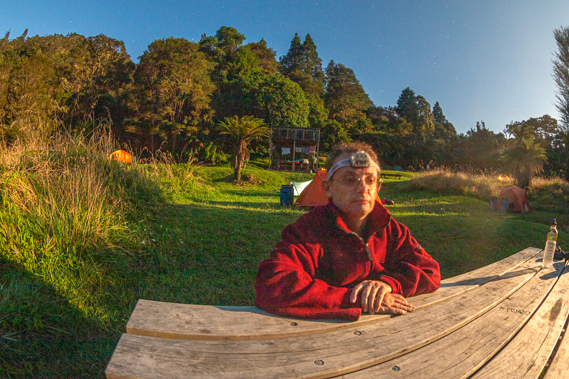
21:16 - The sky gradually darkens with the sun having set, but it wasn’t dark for long. Soon the big full moon rose over the hills across the river towards the Mangaohutu Valley. This brightly illuminated the camping ground and surrounding hills, giving me a great opportunity to do some long exposure photography. Nobody travels the river at night. The Maori never travelled by night out of fear of the taniwha which they believed to be nocturnal. I didn’t stay up for long. The others had all shuffled off to bed and like them, I am exhausted from all the hard paddling. I crawl into the tent and stretched out on the large blow-up mattress in the warmth of my sleeping bag to quickly fall into a dreamless sleep.
|
|