This week in South East Queensland
16 - 22 July
ANTARCTIC frontal systems bring rain and snow to the southern coasts of the Australian continent. Some of these frontal systems make it all the way here to the subtropics, but have to pass vast areas of inland desert to get here. These deserts suck out all the moisture bringing perfectly clear skies and cool winds.
I start today at Point Danger at what will be the end of the trek and catch two buses and two trains over the morning up to the pristine Rainbow Beach. I start the 1096 kilometre long trek here passing a spectacular formation of sand cliffs unlocking clues to the natural history of the massive Cooloola Sandmass. Double Island Point marks the end of the beach and the end of my first day. Here I am rewarded with a senationally clear night for star gazing.
Today's Journey
Distance hiked today: 15.1km
Total distance hiked to date: 15.1km
 |
05:40 - Before starting the hike, I reach what will be the end point of the trek at Point Danger at the bottom of the Gold Coast. From here I briefly look over Snapper Rock up the Gold Coast towards my starting point at Rainbow Beach some 255 kilometres north of here, and three degrees - 3670 metres below the horizon. The sky is quickly getting light so I need to go to my start point to commence the journey at sunrise. |
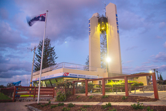 |
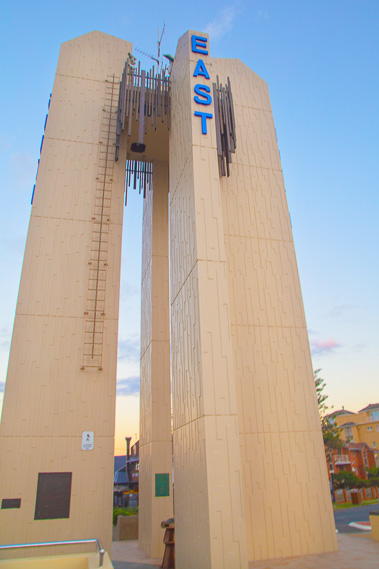
05:57 - The Point Danger lighthouse and marine rescue centre, my official starting and end point of this trek. This is a very modern lighthouse, completely different to what you would expect lighthouses to look like, but it functions perfectly sending its bright light over the sea to guide ships around the reefs of Point Danger. |
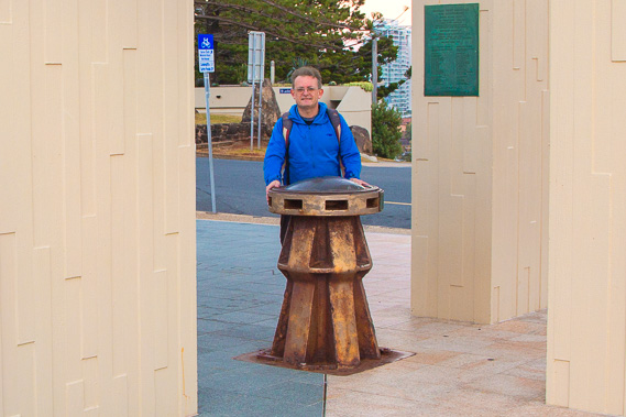 |
06:14 - This is my official start point under the Point Danger lighthouse a little before sunrise. Queensland is to the right and New South Wales to the left. |
 |
06:33 - From the light house I look out to the winter sun about to rise directly over Point Danger. |
 |
06:35 - Leaving the tower just as the sun rises. I need to walk quickly to get my two buses and two trains up to Rainbow Beach 370 kilometres away by lunch time. |
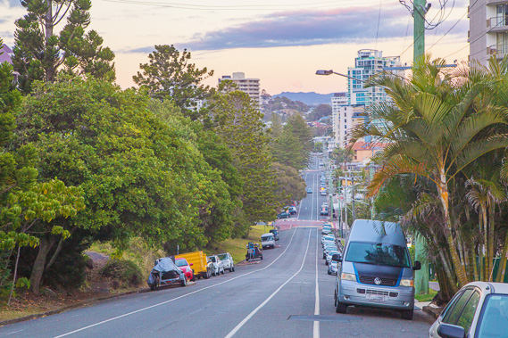 |
06:37 - Walking along Boundary Road, marking the boundary between the states, formed when Queensland secured independence from New South Wales in 1856. Hopefully this trek will reveal some of Queensland's history as I explore the coast. |
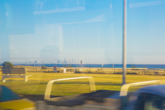 |
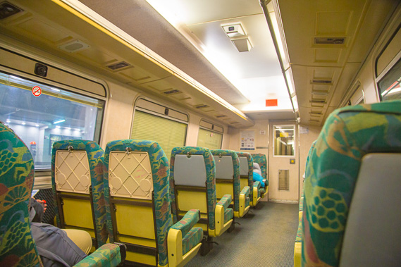
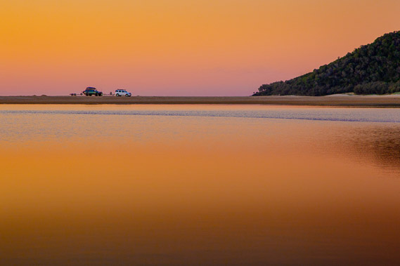
07:01 - I manage to catch my bus which speeds off towards Varsity Lakes Station, the southernmost train station on the suburban train network. I see Gold Coast city through the window. Sadly there are reflections and glares (and blurs) all over the place out these windows. Fortunately I'll be hiking once I reach Rainbow Beach, so from this afternoon there will be no more windows to obstruct the view. I will be following this part of the beach on my final day on day 52. |
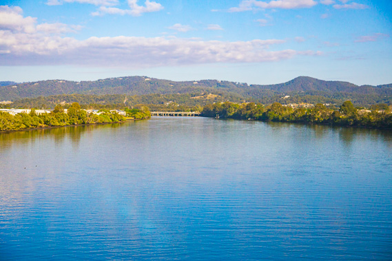 |
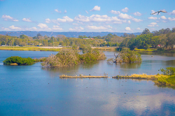
07:58 - I catch the train northwards to Queensland's capital city Brisbane. Here I'm crossing the Coomera River at the northern end of the Gold Coast. Tamborine Mountain is in the background, forming part of the Tweed Volcano system which will later be a substantial landmark on my two approaches to the Gold Coast. I will cross the Coomera River in February on day 32 before heading up onto the islands for 17 days. |
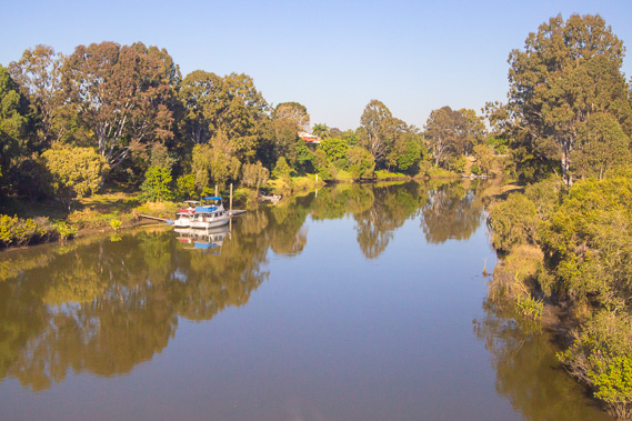 |
08:18 - Crossing the Logan River nearly half way to Brisbane. I will be crossing all these rivers by footpath as I head down the coast. The rivers are all too dirty and full of dangerous sharks to swim across. I will be crossing the Logan River in February on day 30 of the trek. |
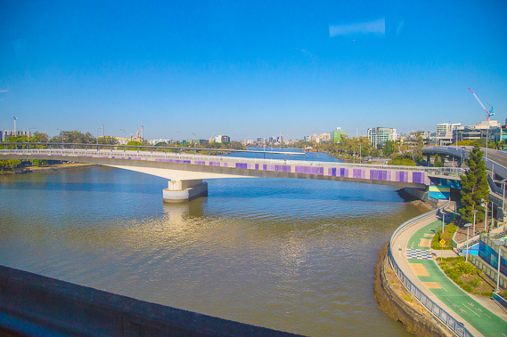 |
08:58 - Crossing the Brisbane River as I reach the city centre. I will be hiking along the path running along the side of the river in December on day 22 when I head upstream towards Ipswich before heading back down the other side. |
 |
09:37 - I reach Central Station with just enough time to quickly change over to the daily Gympie North train. This heads up to the northernmost extent of the railway suburban network, from where I'll catch the bus up to Rainbow Beach. |
 |
10:20 - Crossing the Caboolture River north of Brisbane. I will be crossing this river near its mouth in October on day 16 of the trek. |
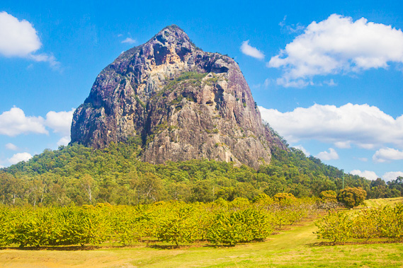 |
10:36 - Passing the spectacular Mount Tibrogargan in the Sunshine Coast hinterland. This is one of the Glasshouse Mountains, a specacular arrangement of extinct volcanoes. These mountains will appear as a spectacular backdrop along parts of the southern Sunshine Coast on day 11 and on the southern end of Bribie Island on day 14 of the trek. |
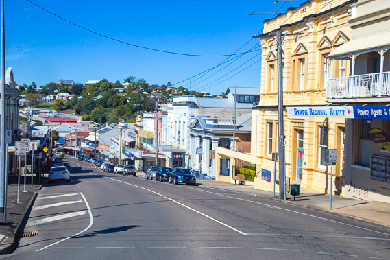 |
12:55 - The train heads largely inland to Gympie, arriving at 12:39. I left the train taking a shuttle into the town centre from where I'm now taking a bus the remaining seventy kilometres up to my starting point at Rainbow Beach. |
 |
13:36 - First view of the Cooloola sandmass, an enormous system of forested sand dunes which I will be hiking over on days 2 to 6 of my trek. |
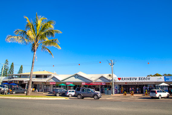 |
13:47 - I am dropped off here at Rainbow Beach at the starting point of the hike. I have travelled 370 kilometres travel by railway and road from Point Danger this morning to get here. This trip took just five short hours, so will stop here briefly for lunch before beginning the 52 day 1096 kilometre trek along the coast back to Point Danger. |
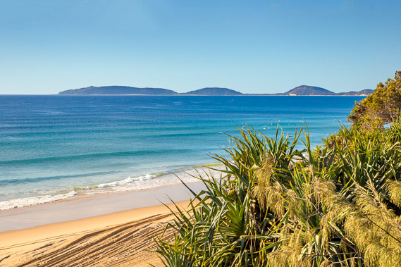 |
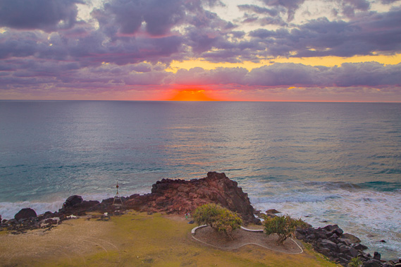
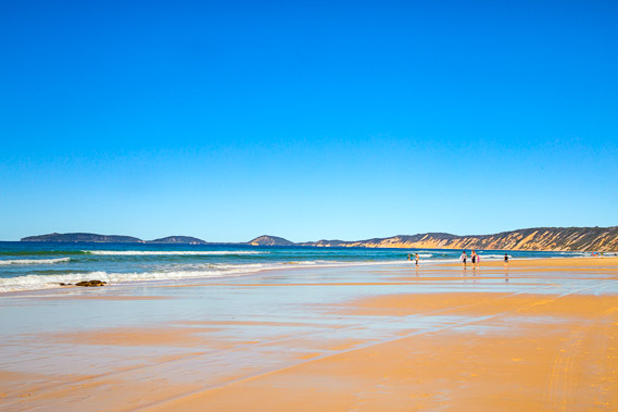
13:58 - Pristine waters of Rainbow Beach from a viewing platform beside the surf club. Double Island Point is in the distance about thirteen kilometres away. The lighthouse is just visible on top of the last hill. This is my intended destination for today. |
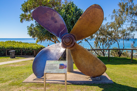 |
14:00 - The propeller of the "Cherry Venture" which ran aground and wrecked on the other side of Double Island Point in 1973. Although the waters along the coast are usually pristine as they are today, many ships have been wrecked all along this side of Australia, and no doubt I will find quite a few of these shipwrecks on my travels. |
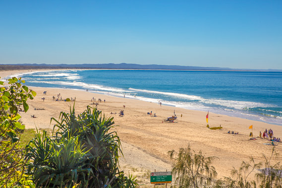 |
14:02 - Busy Rainbow Beach. Apparently Australia's longest surf wave breaks here. The hills in the distance form the southern part of Fraser Island, the world's biggest sand island. I will explore Fraser Island in another adventure. The island extends about four hundred kilometres up the coast, and its end marks the start of the 2100 kilometre long Great Barrier Reef. Looking further along the coast, the long sand bar in the distance is the northern end of Rainbow Beach, ending at Inskip Point. Between the point and Fraser Island is Hervey Bay, the southernmost area where whales migrate from Antarctica to give birth in the warm tropical waters. |
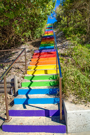 |
14:06 - Steps down to the beach. Fortunately these steps are open and safe, allowing me to head down to the beach to start the long hike towards the Gold Coast hundreds of kilometres away. The steps didn't look special going down them, but looking back these steps were bright rainbow colours. Although keeping with the name of the beach, I will soon find out the beach is named after something more spectacular. |
 |
14:09 - I have now reached the beach, at the northernmost point of the entire trek towards Point Danger. From here the journey will be generally southward. I've chosen to hike in this direction to keep the sun out of my eyes as much as possible. Here in the Southern Hemisphere, the sun passes to the north during the middle of the day. Having the sun behind me much of the time will also ensure I get better lighting for the photography. The tide was nearly out as I start following the long sweeping beach towards Double Island Point. |
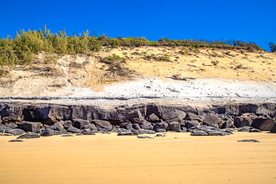 |
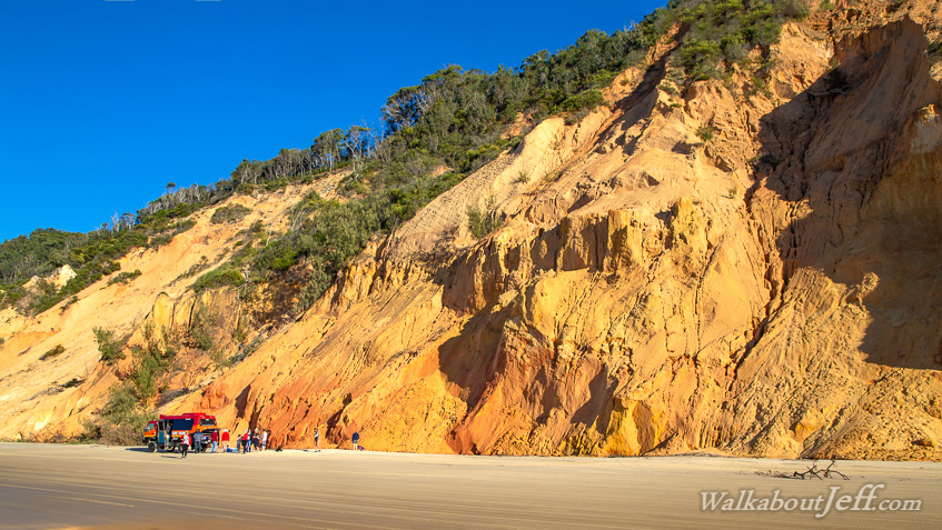
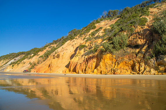
14:18 - Two layers of sand on top of Mudlo Rocks. The sedimentary rocks were formed during the Cretaceous. The white sand at the bottom is from an ancient sand dune formed here 750,000 years ago. These are amongst the oldest dunes on the Cooloola and Fraser Island sand complexes (and by far the oldest in the world). The white sand is almost pure silica. The yellow sand sitting on top of it is from a much younger sand dune discoloured from the vegetation that has grown on it. |
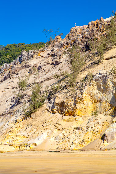 |
14:30 - Spectacular sand formations at the bottom of the Carlo Sandblow. A man stands at the edge of the cliff at the bottom of the sand blow. Different colours of sand indicate different dunes that have formed here in different times over hundreds of thousands of years. Sand cones at the bottom of the formations is the sand falling down from the sand blow. The black sand around the bottom of these sand cones is ironsand, left after the tides wash away the lighter sand falling down the cliff. |
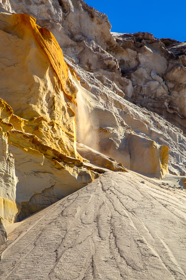 |
14:36 - A two metre high "sandfall" of sand constantly flowing down the face from Carlo Sandblow forming the sand cone. The wind is blowing the sand across the sand blow and over the edge. Some of the layers are a surprisingly bright yellow. |
 |
14:41 - Discoloured layers of sand under the bright blue sky. The different colours indicate the different types of vegetation that have grown on the successive dunes over the millennia. A parked 4WD gives scale to these huge cliffs. |
 |
14:54 - Fresh sand cones at the bottom of a landslide. The marbelled effect makes them almost look like a viscous liquid running down the face of the landslide. |
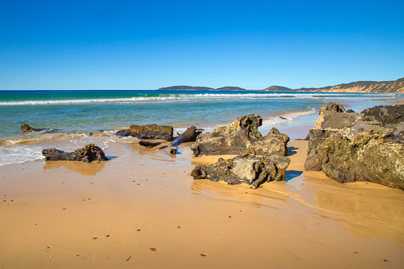 |
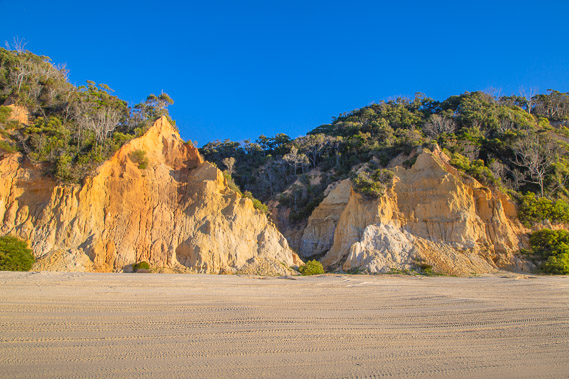
15:04 - Middle Rocks - another Cretacious sedimentary rock formation presumably marking the half way point along the beach. Double Island Point doesn't really look any closer thanks to the sweeping curvature of the beach. |
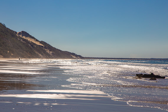 |
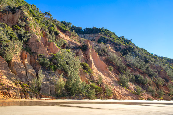
15:05 - Looking back along the beach from Middle Rocks. I can now see into Carlo Sandblow. Rainbow Beach village is at the end of the cliffs, located at the sweet spot between the unstable cliffs and the swampy flats sweeping out towards Inskip Point. The sand remains wet at low tide due to water seeping out of the sand hills. The tide comes in twice a day right up to the edge of the cliffs, cutting away at the northern end of the Cooloola Sand Complex stretching a good fifty kilometres southward from here. This gives an almost perfect cross section of the 140,000 to 750,000 year old dunes making this a geologist's paradise. |
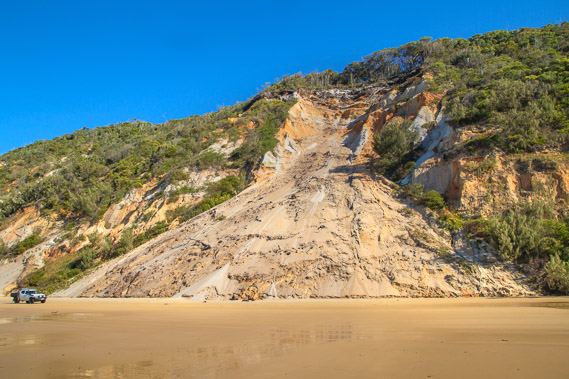 |
15:20 - A 4WD passes a large landslide. Fortunately the beach sand is very firm despite being constantly wet. At low tide it looks easy to drive along, so long as you watch out for the rocks and logs. High tide is a totally different story with the waves coming right up to the bottom of the sandhills. |
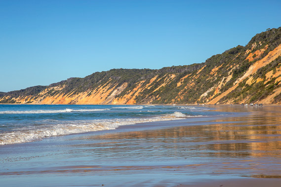 |
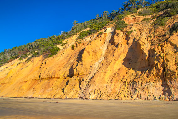
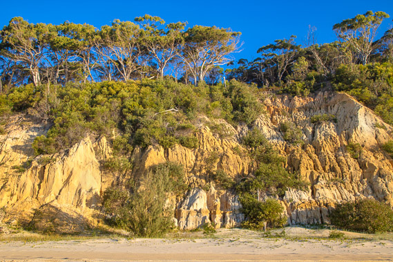
15:30 - Dramatic coloured cliffs in the distance. I still have a couple of hours of hiking past this spectacular cross section of the Cooloola Sandmass. |
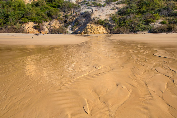 |
15:31 - One of several significant streams flowing out of the bottom of the sand hills. The water accumulates in the sand mass from rainfall, holding it like a sponge. There are quite a few points along these cliffs where the water escapes flowing out of the base of the cliffs. These streams come from rather random locations, with no indication of valleys through which stream normally flow. |
 |
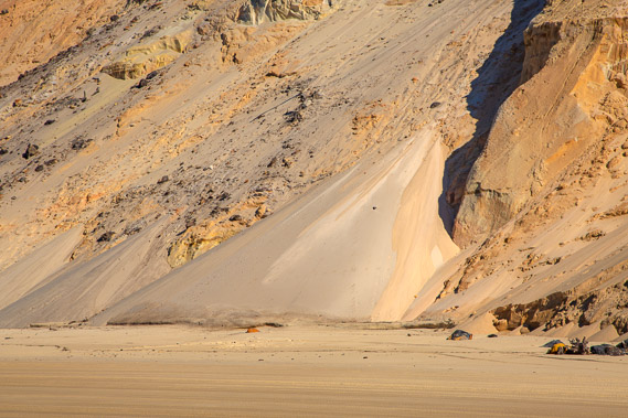
15:43 - A very large landslide that has come down in the past few years. The tides nibbling at the edge of the landslide is causing the slip to continue falling creating the wrinkled patterns in the sand. |
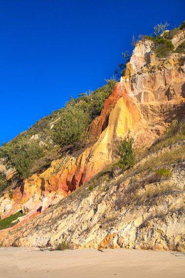 |
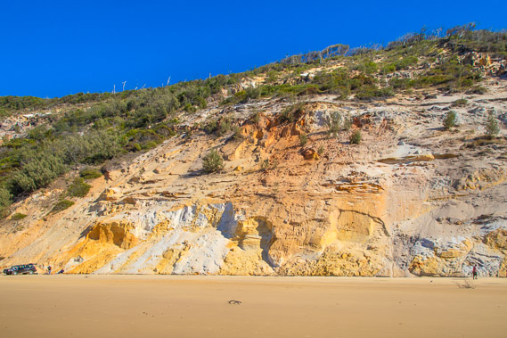
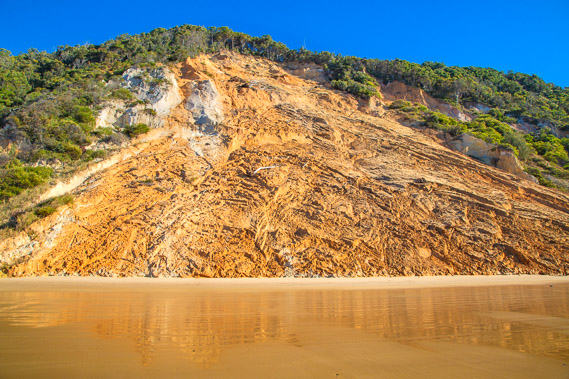
15:46 - This is why Rainbow Beach is so named. Spectacular colours of ochre in the soft sand rock stand out against the neighbouring bright yellows. Though as a colour "purist" I have to say only the red to yellow part of the spectrum is covered here. The other colours are drawn from the vegetation and the sky. These colours are all natural. The steeper formations are compacted sandy soil getting eroded into the sea. No doubt these formations are common throughout the Cooloola sandmass, but would be buried tens of metres deep below the forest. |
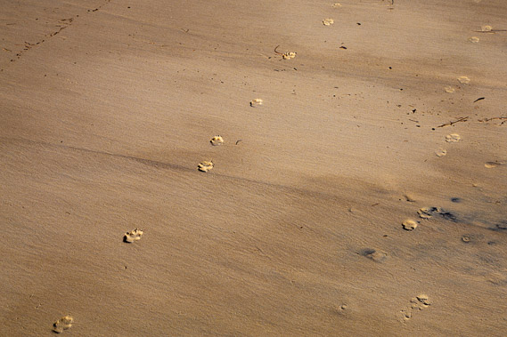 |
15:48 - Dingo footprints fresh after this morning's high tide. These are dogs introduced from Asia by the Aboriginal people tens of thousands of years ago, and are now considered native animals. |
 |
15:59 - Dramatic sand crags sheltering the scrub growing in this impossible terrain. These formations make Rainbow Beach the Grand Canyon of beaches, even if it is only a one-sided canyon. |
 |
16:05 - Bright yellow sand hills. A tour van has stopped at one of the ochre outcrops. A few tour companies drive along Rainbow and Teewah Beaches on their way to or from trips to Fraser Island. I'm not sure if any parts of the Fraser Island coast are this spectacular, but I'll have to go there some day to find out. |
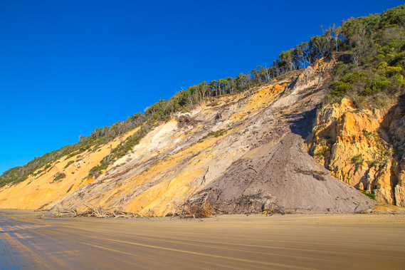 |
16:15 - Another large landslide with trees brought down. The darker brown sand would be coloured from the topsoil formed from the forest. The trees look very healthy for what should be such a difficult soil to grow in, but they are helped by special native fungi adapted to grow symbiotically with the trees. |
 |
16:20 - An obvious line between the layers of sand. It almost looks like a fault line, but would just be a layer of sand deposited during perhaps some extreme weather event several hundred thousand years ago. |
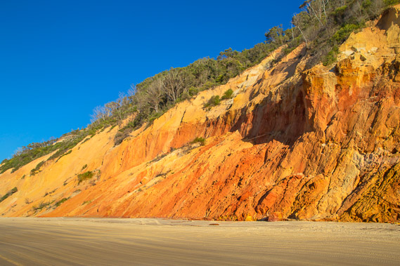 |
16:26 - Spectacular ochre slip. The ochre colour is deposited from some volcanic rocks, but there probably aren't any volcanics around here, so they would have been carried here from the erosion of some soft volcanic rock further along the coast. |
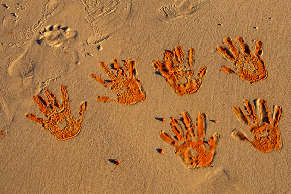 |
16:28 - Handprints of ochre left by a child. This somewhat reminds me of Aboriginal cave paintings where this ochre was one of the colours used. Those cave paintings are often tens of thousands of years old. It's a totally different story here though. The tide is starting rise again with the nearby waves rubbing out these hand prints within half an hour. |
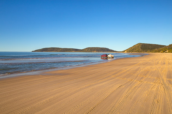 |
16:32 - A vehicle and boat out on the sand bar. Countless tyre tracks shows how busy the beach has been today. A lot of people head out to these beaches during the weekends to escape from the cities and do some relaxing fishing. |
 |
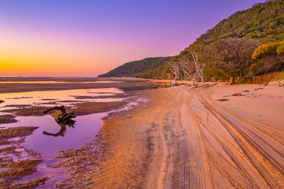
16:35 - A ravine in the dunes though no stream flows out of it. The beach is substantially wider here giving the cliffs more of a chance, and more time to form spectacular formations without being washed into the sea. Only the biggest tides and storms would reach these cliffs. The cliffs are significantly lower at this end of the beach with more ravines and spurs in the cliffs. These cliffs have more obvious layers in them. The ocean at Teewah Beach is only two kilometres away now, so these dunes are much younger, perhaps 150,000 to 200,000 years old - still very old by any standards. |
 |
16:39 - Trees and scrub growing on the low multi layered cliff. It would be amazing to see a timelapse of the formation and erosion of these dunes. |
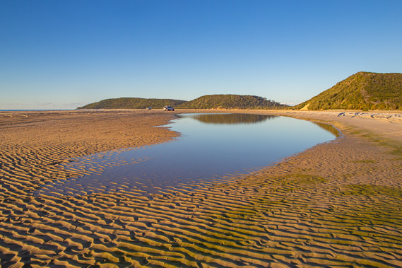 |
16:43 - The first of several tidal lagoons at the eastern end of the beach. It seems the sand being eroded off the cliffs moves eastward along to this side of the beach. Double Island Point now appears quite a lot closer, but I will need to keep to near the sand hills to get around the channels now filling these lagoons. Ripples formed from the wave action of this morning's high tide dried out and petrified into suspended animation with the low tide. |
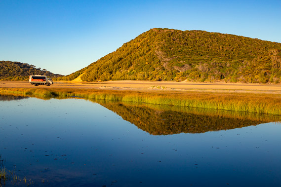 |
16:47 - Another tour vehicle leaving the beach heading towards the track across the sandspit to Teewah Beach. I have reached a perfectly still deep lagoon formed by the shifting sandbards. The wind has completely died down now. The track begins at the tiny white marker on this side of the big sand hill. |
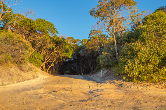 |
16:54 - Leisha Track - a sand track crossing the sandspit to Teewah Beach about a kilometre away. I will reach the other end of this road tomorrow morning from where I will start following an inland track towards the Cooloola Great Walk. A block of toilets is nearby - the first sign of civilisation since leaving Rainbow Beach. |
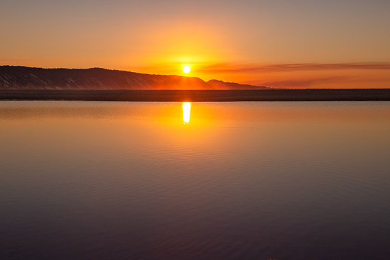 |
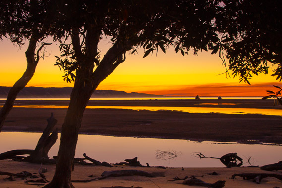
17:01 - The sun sets over the sand cliffs behind dusty high cloud in the distance. This is the first cloud I have seen in this otherwise perfectly clear day. Rain is forecast for tomorrow, so this could be the first sign of the system sweeping across the country from the northern tropics. |
 |
17:18 - Two vehicles are still out on the sand bar but they will have to move soon with the tide coming in. Earlier today A towing truck passed carrying a 4WD that had been completely submerged in this morning's tide. |
 |
17:26 - The sweeping sand flats are just starting to flood from the incoming tide as the temperature starts to drop. The best thing about these clear cold westerlies blowing in from the deserts is the brilliant evening colours along the shore. Fortunately the wind has completely dropped. |
 |
17:29 - The channels of the estuary silently fill with the incoming tide as I briefly stop at a picnic table nestled in the dark forest. |
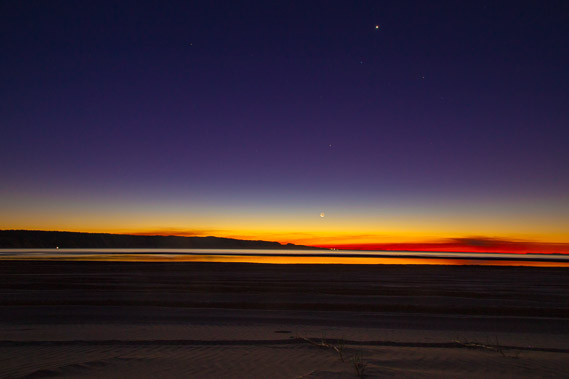 |
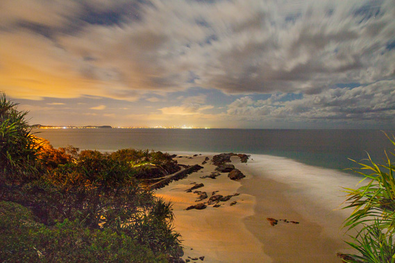
18:00 - The sky finally darkens leaving only a thin wedge of the closing dusk. The almost completely dark moon is setting just behind the sun. Mercury is just visible above the moon, and Venus is clear near the top of the image. |
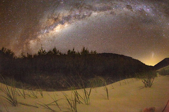 |
18:42 - The centre of the galaxy is brilliant tonight as it rises above the low sand hill behind me. The glow through the gap in the hills is from Sunshine Coast City some sixty kilometres away. This is the brightest glow in what I think is the darkest place in South East Queensland. With that in mind, everything's perfectly aligned for tonight being the best night for viewing the stars and planets on the entire trek. |
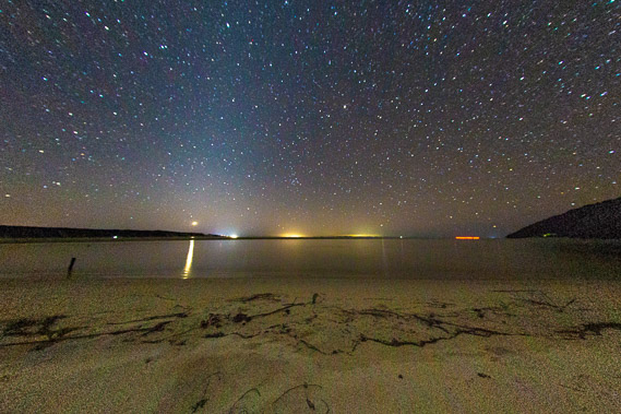 |
20:09 - Double Island Point is near to the right. A boat passes the headland. Venus has almost set, and the only signs of civilisation are the whites lights of Rainbow Beach, adn the yellow haze of Maryborough and Bundaberg The other white lights in front of the dunes and along the horizon are boats anchored in the bay. The red line is a boat heading around the point to find anchorage in the bay. I sit out here to photograph the stars whilst the tide comes right in. A dingo passes foraging what the outgoing tide has left stranded on the sandbars. It is terrified of my head torch, perhaps mistaking me for a 4WD. |
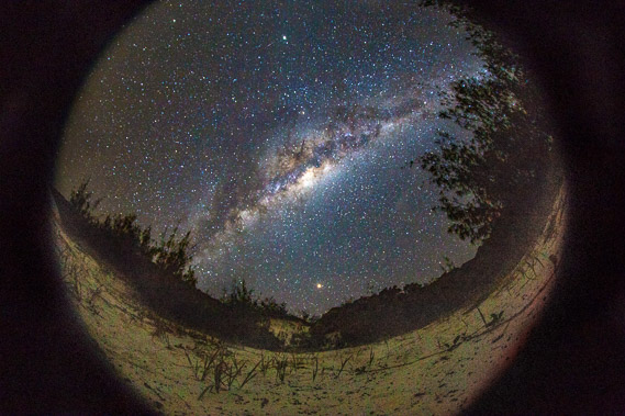 |
20:16 - The centre of the galaxy continues to rise, with Jupiter bright near the top of the image, Saturn just above the galaxy, and the brilliant Mars rising above the sandhills. Mars is almost at its closest at around 55 million kilometres away. The centre of the galaxy on the other hand is 25,000 light years away, so what I see here is what the middle of the galaxy looked like 25,000 years ago. This was even before the land here was settled by the Gubbi Gubbi people some 18,000 years ago, one of the last coastal areas settled by Aboriginal People. The tribal lands follow the coast from Rainbow Beach all the way down to the Pine River just north of Brisbane. |
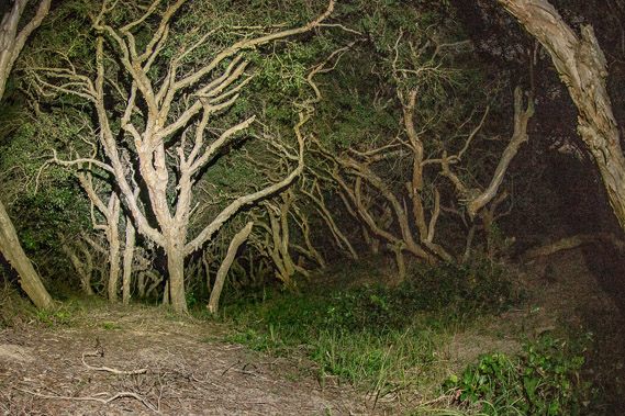 |
20:46 - The gnarly forest creating an eerie enclosure as I leave the beach following a track up towards the lighthouse. The air is almost dead still despite the strong westerly winds earlier today, and with the expectation that headlands are generally very windy. |
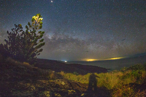 |
21:45 - Near the top of the hill with a final view back to Rainbow Beach (the white light), Maryborough, and Bundberg (the yellow glows). Clouds are starting to fill the western sky. |
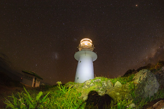 |
21:51 - First view of the Double Island Point lighthouse. The two "smudges" to the left of the lighthouse are the Magellanic Clouds, a whopping 158,000 light years away. I'm looking at what they looked like 158,000 years ago at a time when the youngest dunes of the Cooloola formation were being formed. |
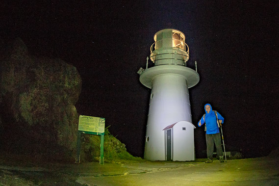 |
21:56 - Standing in front of the lighthouse just before midnight having achieved the end of the first of 52 days exploring the coast. I started the day eighteen hours ago at the very modern Point Danger lighthouse, and finish the day at the very traditional Double Island Point Lighthouse hundreds of kilometres up the coast. The camera is set quite low making the lighthouse look really small. I'm about half way between the lighthouse and the camera, with the door being of normal height. |
|