This week in South East Queensland
23 - 29 July
THE SUBTROPICAL winters are normally dry and mild, but significant rain events can happen at any time of year. Although starting fine, a rain system was coming across the country from the tropical west coast about 4000 kilometres away.
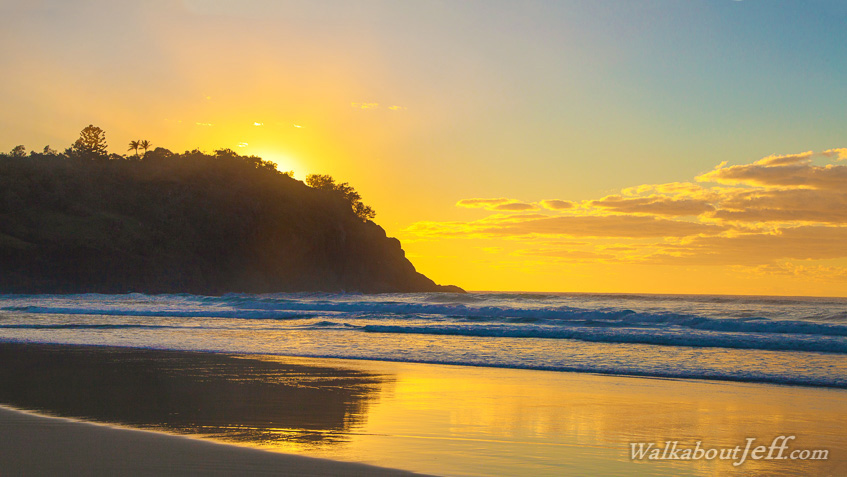
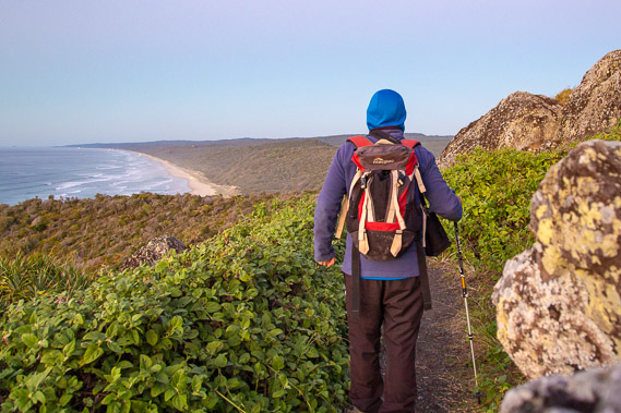
Today's hike starts at the spectacular Double Island Point lighthouse, heads southward along the top end of Teewah Beach before turning off inland into the forested Cooloola sandmass. As I head deep into the heart of the sandmass, I encounter some of the region's most spectacular rainforest as the rain started falling.
Today's Journey
Distance hiked today: 21.4km
Total distance hiked to date: 36.5km
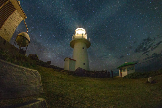 |
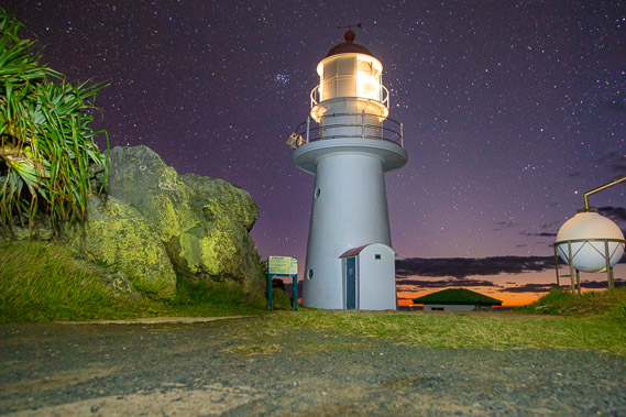
04:16 - The lighthouse sends beams of light over the starry night helping the boats and ships navigate their way along this remote coast. The small building to the right of the lighthouse is a visitor information centre. Double Island Point was named by Captain Cook, thinking these hills looked like two islands (he must have been some distance offshore when he passed). He had originally written "Fiddle Point" as the headlands look like a violin on its side, but he then crossed it out and called it Double Island Point, and the name has since stuck despite there being no islands here. |
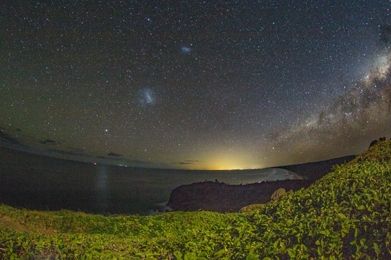 |
04:32 - Looking south from the lighthouse down Teewah Beach. The Magellanic Clouds and setting Milky Way point to the faint glow of Noosa and the Sunshine Coast. The lights of Noosa 53 kilometres to the south are just visible on the horizon. Behind the glow of the Sunshine Coast are Brisbane and Gold Coast cities, but their light pollution is below the horizon. Brisbane city is 172 kilometres away, and from this point it is about 1480 metres below the horizon. My end point at Point Danger is 250 kilometres to the south, about 3650 metres below the horizon. |
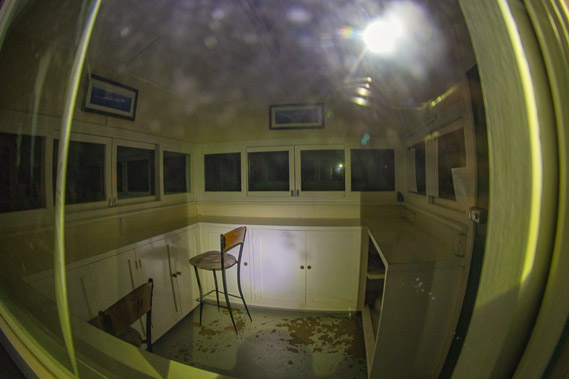 |
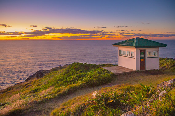
04:41 - Looking inside the tiny information centre in front of the lighthouse. A notice outside the building advises times when a volunteer guide is in attendance. It is attended about two hours a day and dependent on the tides when they are able to travel along the beach. Obviously this remote outpost is abandoned by night. |
 |
05:20 - The first hint of light appears in the north eastern horizon. The air is quite cold at around 14 degrees, but a lot warmer than most of the rest of SE Queensland which is experiencing its coldest night of the year. Most coastal areas have dropped into the single figures and some areas inland have dropped below zero. The remote elevated point is above the cold air and well insulated by the warm sea by a slight breeze. The horizon glows red. Red sky in the morning is shepherd's warning? Rain is definitely forecast for today, but the sky at the moment is mostly clear with few clues to the coming rain. |
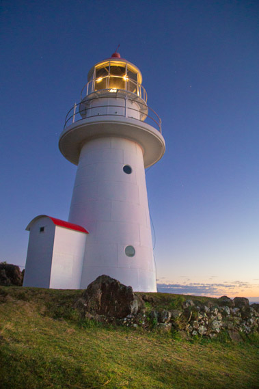 |
05:56 - The lighthouse is still working, giving navigaton to the early morning boats. It was originally built in 1884. Originally powered by burning oil, then kerosene, then electricity from a generator. The generator was replaced with solar power in 1992. This automated the lighthouse no longer requiring an on-site operator. |
 |
06:05 - Daylight creeps onto the hilltop as the sky continues to lighten bringing forth the day. |
 |
06:07 - The sun will soon rise and start to warm the air. A couple arrive having followed the same track I had come up last night. They are carrying sun chairs and set them up in front of the light house looking for whales migrating up the coast to their nearby breeding grounds. No whales are visible over the now spectacular dawn sea at the moment, but with a bit of patience, they will definitely see them. |
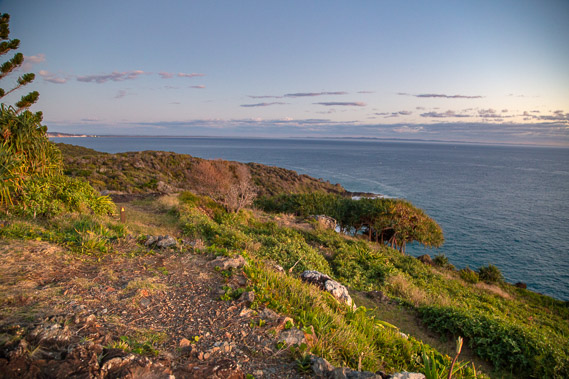 |
06:08 - A final view of Rainbow Beach and Fraser Island back along the track I came up last night. There is a lot more cloud in this direction, having crossed the country from the tropical north. |
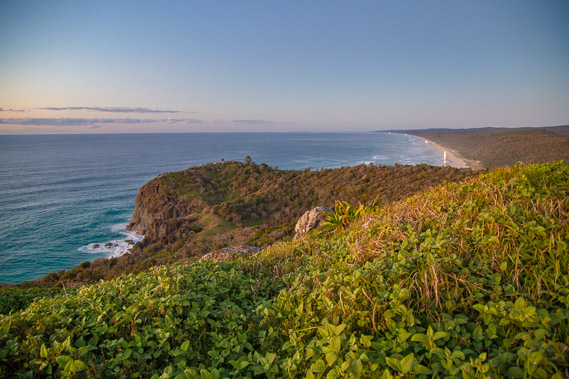 |
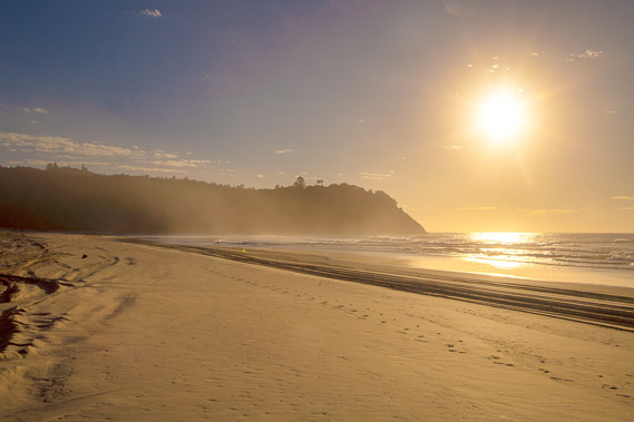
06:10 - Teewah Beach is now busy with numerous vehicles crawling along looking for a fishing spot for the morning high tide. Noosa Head is just visible as a slight bump on the horizon at what appears to be beyond the end of the beach. Noosa Heads actually marks the end of this beach sweeping over sixty kilometres in length. |
 |
06:14 - The track descends above the rugged cliffs booming with the sound of the breaking waves. |
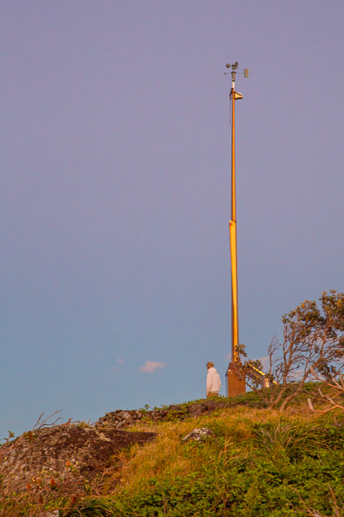 |
06:15 - The weather station anemometer near the lighthouse. This was where Australia's strongest non-cyclone/tornado wind gust of 196 km/hr has been recorded. Ironically the air is almost perfectly still this morning. |
 |
06:16 - I head down towards the beach following an even graded track above the precipitous cliffs made of volcanic rock. Double Island Point is the remains of a small volcano, one of many dotted along the coastline and inland areas of Queensland. Nearly all the headlands I'll be passing on this journey are volcanic, their solid remains hold in the enormous sand masses brought up the coast. |
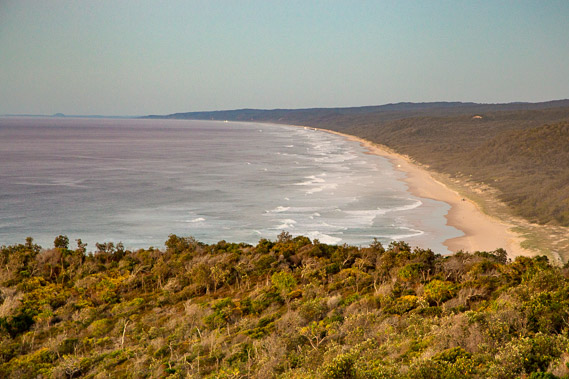 |
06:19 - Descending towards Teewah Beach. The forested hills behind the beach are those of the Cooloola Sand formation, all part of the Great Sandy National Park. My journey over the coming days will take me along the top of this sand formation. |
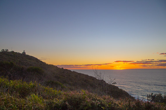 |
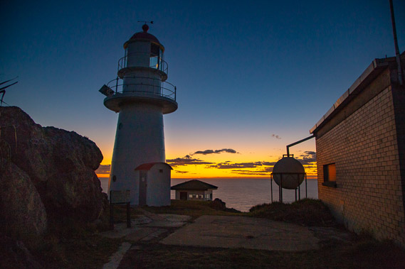
06:30 - The sun about to rise over the horizon. Already the light house near the top of the hill is looking quite distant. The light has turned off now with there being enough natural light to navigate around the point. |
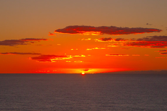 |
06:31 - The sun rises over the horizon setting the clouds on fire. Although I'm only half way down the hill, the air feels noticeably cooler, but the rising sun will warm things up over the coming hours. |
 |
06:38 - The track meets a steep road heading down to the beach. The road is for servicing the lighthouse. All of Australia's lighthouses are automated now, but occasionally need servicing. This road is so steep it is lined with wooden railings to give the vehicles some grip as the soft sand would otherwise make access impossible. |
 |
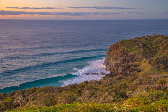
06:43 - The road comes out of the scrub overlooking the exposed rocks over the beach. Large barrelling waves having travelled across the Pacific Ocean break onto the beach. |
 |
06:49 - I've now reached the beach. A small outcrop sits in front of the bluffs already awash with the incoming tide. These are the last rocks I will pass until I reach Noosa Heads in five days' time. I glimpse a whale about two hundred metres offshore. I'm sure the couple up at the lighthouse will be spotting it soon as it continues heading north to its breeding grounds. |
 |
07:18 - The rising sun over Double Island Point. It is quite cold down here at sea level, but not for much as but I already feel the strong warmth from the sun. Even in the middle of winter the sun is strong. |
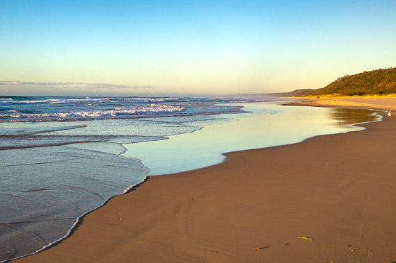 |
07:29 - Waves break on the beach as the tide comes in. The sand is still fairly hard here, but a bit further along the beach it is going to be quite soft and slow going. Hopefully with the early bird drivers having found their fishing locations, the narrow beach will be relatively quiet of traffic over the next couple of hours. |
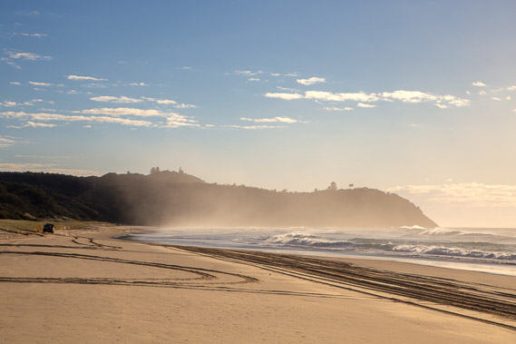 |
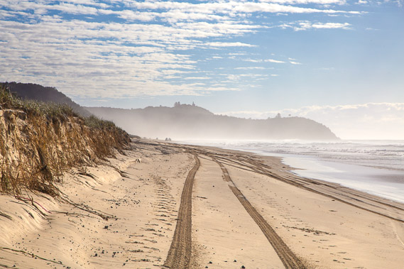
07:34 - The waves generate a salt haze adding mist in front of the volcanic headlands. The lighthouse is now visible again on top of the highest hill. The beach is rather carved up with the tyre tracks of vehicles going up and down the beach this morning. |
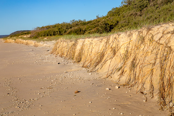 |
07:44 - Recent tides have eroded the sand hills. Unlike the sand cliffs I had passed yesterday on Rainbow Beach, these little sand hills are very recent, perhaps only a few decades old at most. The exposed coastline is constantly changing with the tides quickly depositing and taking away sand at will taking it northward. Geologists believe around 1400 tonnes of sand passes any given point along the coastline every day, carried by tides and currents. |
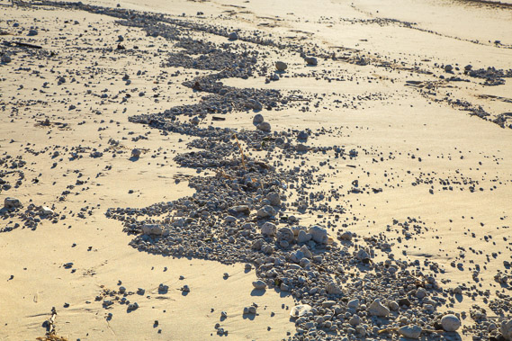 |
07:52 - The erosion of the sand hills has exposed a lot of pumice which the waves of the full tide move into these patterns. Pumice is a very light volcanic rock that floats in water. An underwater volcano north of New Zealand erupted some years ago ejecting more than a cubic kilometre of pumice into the ocean. Much of this pumice drifted here to the Australian coast, and washed ashore forming part of the new sand dunes. I'm expecting to see pumice along most of the shore all the way down to the Gold Coast. |
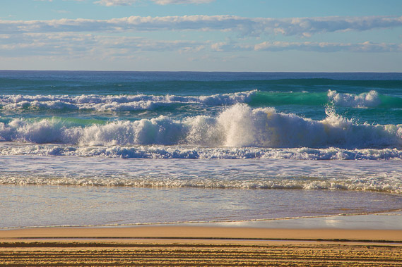 |
07:56 - The waves get larger as the tide continues to come in. Looking straight out from here, the ocean extends all the way to South America nearly half way around the world. This exposes this area to all waves generated by storms or tsumamis anywhere in the Pacific Ocean. |
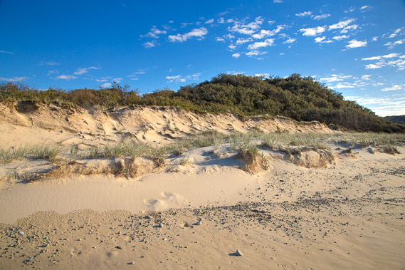 |
08:05 - The low recent sand hills of the sandspit joining the Cooloola Sandmass with the rocky Double Island Point. The first rise is sand recently deposited, with spinnifex grass holding it together. The low cliff shows substantial erosion happened here some years ago before the sand started to return. The scrubby hill behind the cliff is an older sand formation, perhaps a few thousand years old. |
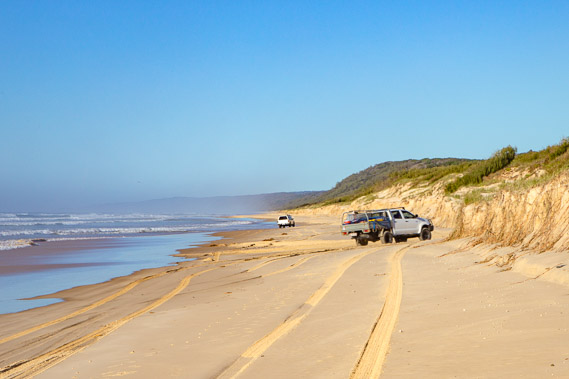 |
08:09 - A vehicle turns into the Leisha Track. I passed the other end of this track late yesterday. It surprises me any vehicles are going across now as much of Rainbow Beach would be flooded with the high tide. A few hundred metres further along the beach is where the "Cherry Venture" was wrecked. Most of the shipwreck was removed about a decade ago, but some remnants would still be visible at low tide. Unfortunately the tide is mostly in now, so no chance of seeing it. At least I got to see the propellor yesterday. |
 |
08:11 - A final look back to Double Island Point. From here I'm going to head inland to explore the massive sand dunes following the Cooloola Great Walk. I think this beach is going to look pretty much the same along the next 40 kilometres or so down to Teewah Village where I intend coming out in four days' time. If I were to continue heading down the beach, the point will get smaller and smaller until it will eventually disappear under the horizon. |
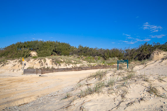 |
08:12 - The Leisha Track, with wooden barriers to help keep the sand back. The entrances to these roads are always quite soft being the most likely place where vehicles get bogged. Just below the surface of the sand is a rubber matting laid to prevent the bogging. |
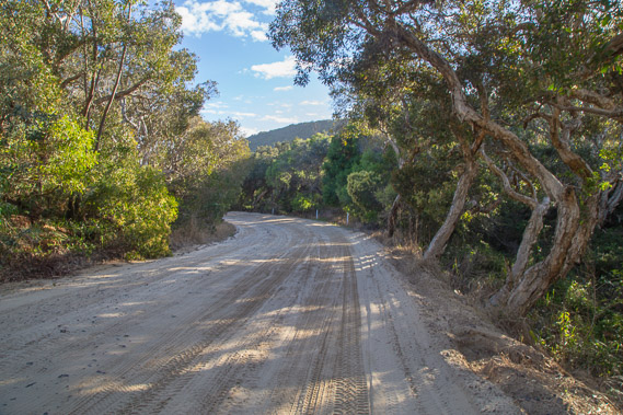 |
08:20 - Following the Leisha Track back towards Rainbow Beach. Several vehicles do pass me heading across. I wonder if they know they won't get much further than the end of this track? The sand here is quite hard with a layer of coarse gravel laid underneath to make the road easier to drive along. |
 |
08:42 - I reach the walking track about half way along the Leisha Track near its highest point. From here the walking track follows the top of the sand dunes above the cliffs I followed yesterday along Rainbow Beach. This is the high tide track returning to the town, but I'll be turning off after ten kilometres to head southward along the Cooloola Great Walk. |
 |
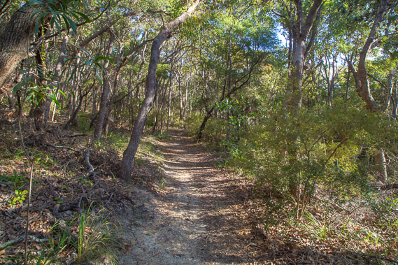
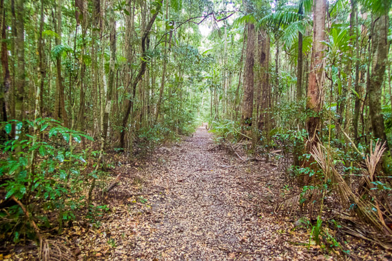
09:45 - The dunes are covered in dry eucalypt forest and grass. The track continues endlessly through the forest. The undulating nature of the track makes the going quite a bit slower than yesterday when I walked along firm and perfectly flat sand along the beach. I am only a couple of hundred metres at most from the edge of the cliffs overlooking Rainbow Beach, yet the thick forest denies any views. Although I had crossed streams coming out of the bottoms of the cliffs, the bottoms of the gullies are all dry. All water here flows underground. |
 |
10:20 - I reach a small clearing. High cloud has covered much of the sky, but the sun still manages to filter through. I don't think it will be shining for much longer though as the air is already feeling quite humid. |
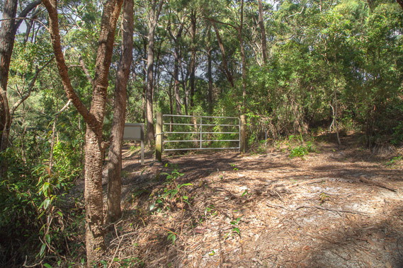 |
10:31 - The track reaches a gate with an entrance to the Freshwater Road crossing the sandmass from near Rainbow Beach all the way out to Teewah Beach about seven kilometres south of Leisha Track. I can hear quite a few vehicles on this road being the high tide track. Access along Rainbow Beach would be nearly impossible now. |
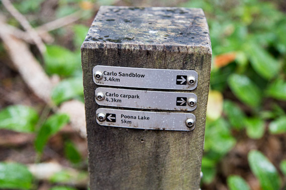 |
10:54 - A short climb up yet another sand hill brings me here at the junction of the Cooloola Great Walk. This is a solid wooden signpost at the junction, typical of the signposts I will encounter at future junctions along the trail. From here I could return to the top of Carlo Sandblow and onto Rainbow Beach just five kilometres away, but I'm heading south towards the Gold Coast, so need to head towards Poona Lake, and beyond to Kauri Walker's Camp tonight. |
 |
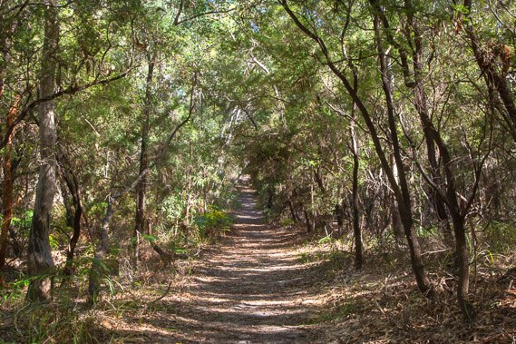
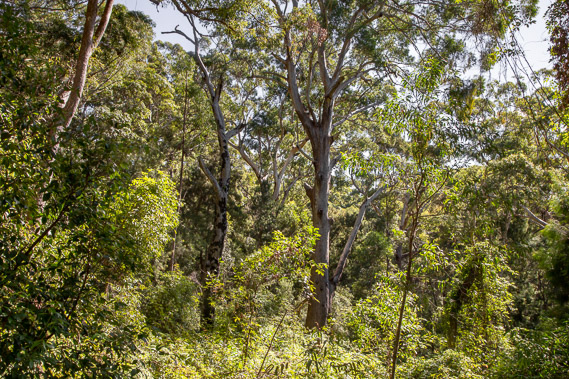
11:04 - The track ascends to the top of the dunes, over two hundred metres above sea level. The forest thickens as I head southward away from the Rainbow Beach cliffs and the effects of the salt spray. It is not long before the dry eucalypt forest changes to schlerophyll forest with piccabeen palms indicating this is quite a wet area. Speaking of wet, it hasn't started raining yet, but the cool air is very damp now. |
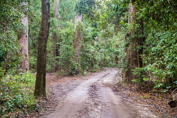 |
11:16 - Crossing the Freshwater Road, the high tide vehicle route between Rainbow Beach village and Teewah Beach. The tide is going out now, so I no longer hear or see any of the vehicles I could hear earlier. The beach at low tide is a lot easier to drive along than these narrow winding roads. Steady rain starts falling from here, now the weather has closed in. |
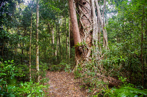 |
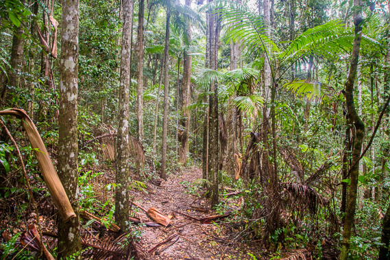
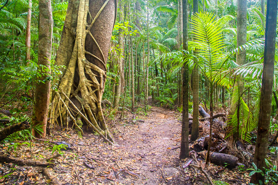
11:55 - A strangler fig grows around another tree. The strangler figs start life growing in a branch junction. It sends a root down to the ground, then establishes itself around the host tree, keeping it alive for around two hundred years before killing it off and becoming an independent tree. Hard to believe I'm still exploring a coastal sand dune. Under the thin layer of leaf litter, the ground is still almost pure sand, with the trees somehow surviving in it. The rain falls steadily in this subtropical rainforest. Rain doesn't often fall in the normally dry winter, so this is welcome relief for the rainforest. |
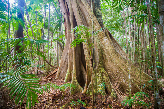 |
12:31 - Spectacular buttress roots in amongst the tropical palm trees. The broad buttress roots help hold the tree in the soft sandy soil. From here, the track begins a gradual descent along the top of the dune range from its 220 metre height above sea level. Despite being quite a way inland, I can still hear the waves breaking on Teewah Beach. |
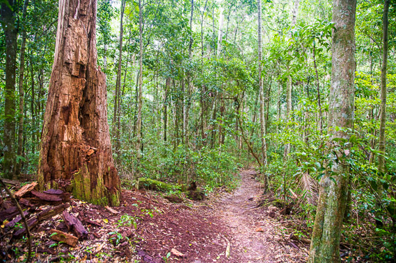 |
13:22 - A dead tree still standing, but its wood is rotting off it providing much needed nutrients for other vegetation. The nutrients would quickly leach deep into the soft sand, beyond reach of most of the roots. |
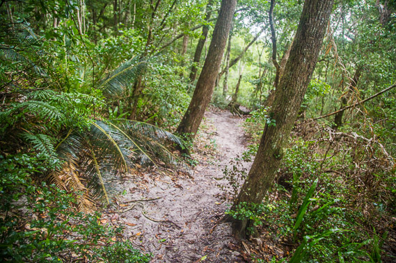 |
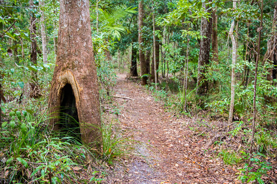
13:38 - The track now sidles the dune range as it descends into a valley towards Poona Lake. The rainforest gives way to an area of schlerophyll forest, with large cycads growing on the ancient forest floor. The jungle thickens. Fortunately the track is very well maintained with no rocks to clamber over, just perfectly graded sand with only the occasional root to step over. Without the track these dunes would be very hard to navigate. It is hard to tell the track is descending towards a lake. |
 |
13:48 - At the end of the descent, the track comes out on this beautiful sand spit on the shore of Poona Lake. The rain is falling quite heavily now. This is a bit unusual for winter, but heavy rain does fall once or twice each winter. A couple grumbling about the rain were leaving just as I was arriving, following a short track back to their vehicle on Freshwater Road. |
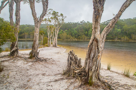 |
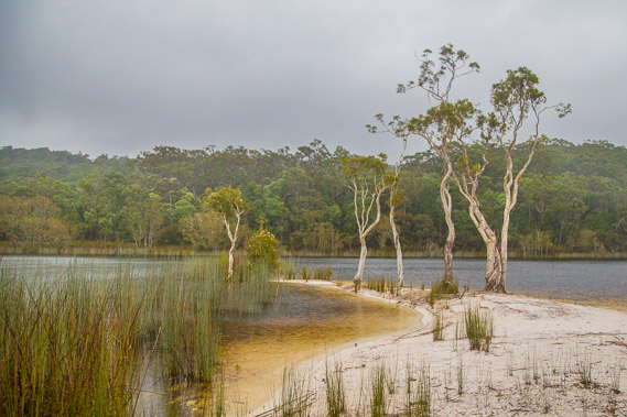
14:00 - Poona Lake is a perched lake at around 155 metres above sea level. Here the water table runs above the bottom of this depression forming a permanent fresh water lake. It is pristine with the pure white sand surrounding it. The water has a red tinge to it due to staining from tannin from the surrounding tea trees. The sand is exposed here due to the people who visit the sand bar. The rest of the lake is untouched and surrounded with reeds growing in the shallows. |
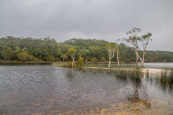 |
14:03 - The sandspit juts out into the pristine water held together by twisted paperbark trees. This lake would be incredibly inviting in summer, but not so in today's cool rain. This water would also be free of the dangerous sharks and jellyfish found in the ocean. I imagine there would be venemous snakes hiding in the reeds though so it's not entirely free from danger. |
 |
14:31 - Following a brief stop at Poona Lake (I would have stayed a lot longer had it not been raining), I continue following the track through the forest a few metres in from the lake until reaching a valley descending from it. Freshwater stream drains the lake into the valley. This is the first stream I have seen all day. The track follows the valley above the stream as the rain continues falling moderately. |
 |
14:37 - The rainforest in this sheltered valley is spectacular. It is hard to believe this is the middle of a large complex of coastal sand dunes. Coastal rainforests on sand dunes is very rare - not found anywhere else in the world apart from here and on Fraser Island. The stream draining the lake would ensure the water table would be shallow enough to be ideal for this rainforest to flourish. |
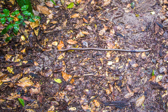 |
14:45 - A digaster longmani earthworm crosses the track. This one is a good half a metre long with the diameter of a little finger, though they grow up to two metres in length and can be a lot thicker. These large rainforest worms live exclusively in the rainforests of SE Queensland collecting the leaf litter and dragging them underground into the little white mounds they leave in the sand. By burying the litter, they help them to break down and feed the living trees. Normally these are nocturnal (and rarely seen by day), but rain does bring them to the surface when their burrows get waterlogged. |
 |
14:59 - The valley widens as I head along the long valley downstream towards Freshwater Lake. The rain is starting to ease off now. |
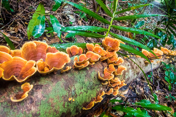 |
16:02 - The cooler conditions of winter bring the normally dormant fungi to life decomposing fallen vegetation. Spectacular bracket fungi are growing here on a fallen palm tree. |
 |
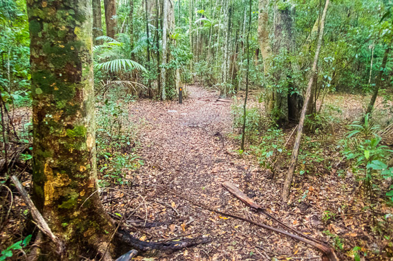
16:16 - Five kilometres downstream from Poona Lake, the Great Walk abruptly leaves the Freshwater Valley track (still some distance from the diminuitive Freshwater Lake, the Freshwater day use area and Teewah Beach) and steeply rises across the face of a sand dune range. It almost immediately leaves the rainforest passing through dry eucalypt and scrub. The rain has now stopped falling my my lens is quite damp (as you can see at the top of this image). Progress is a bit slow having walked all the way out from Double Island Point today. |
 |
17:07 - Upon reaching the top of the dune gaining almost all of the altitude I had lost going down to Poona Lake and down the Freshwater Stream, the forest thickens into a large stand of Australian Kauri trees (Agathis robusta - not to confuse with the New Zealand Kauri, a completly different species). Here I'm just a couple of minutes hike to today's destination at Kauri Walker's Camp. |
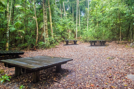 |
17:09 - The communal area of Kauri Walker's Camp where low wooden tables have been constructed for cooking. The campsites are cut into the bush nearby along a track. The rain has completely stopped falling so I put up my tent before it starts again. |
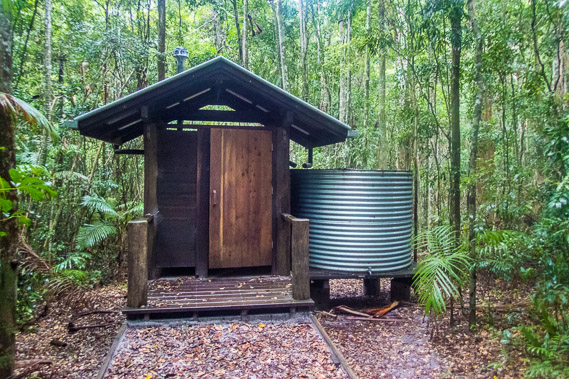 |
17:10 - The water supply and flush toilet at Kauri. These are the only facilities in the camping grounds along the great walk. The water supply sometimes dries out during winter and spring drought conditions, but quite a lot of rain has fallen today with more expected tonight, so a shortage of water won't be a problem. I filter and fill up my 3 litre water bladder ready for tomorrow. |
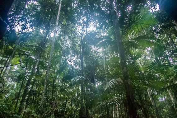 |
17:17 - Looking up into the palm trees at around sunset. With the cloud so thick tonight the sky quickly darkens without any hint of the spectacular colours expected of a sunset. The camping ground is in rainforest under a middle canopy of piccabean palm trees and an upper canopy of native Kauri trees. Rain begins falling again as the sky darkens. This could harldly be considered a coastal photo, yet I can still hear the waves breaking on Teewah Beach about three kilometres to the east. I remind myself I'm somewhere in the middle of the world's largest coastal sandmass. |
|