This week in South East Queensland
20 - 26 August
THE LAKES along the Noosa River were formed when the sea level rose 120 metres following the end of the last ice age. The sea level increased at a rage faster than the river system could deposit sediment into the valley. The rising sea level created the lakes partially filling the valleys behind the sand masses. As I continue exploring the coast southward, I'll discover large bays and channels once valleys, but now swamped by the sea.
Today's trek takes down the southern end of the Cooloola Sandmass, dropping to the southern end of the long Teewah Beach. I follow the beach to the first signs of civilisation at Noosa North Shore.
Today's Journey
Distance hiked today: 13.8km
Total distance hiked to date: 105.9km
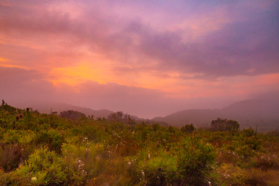 |
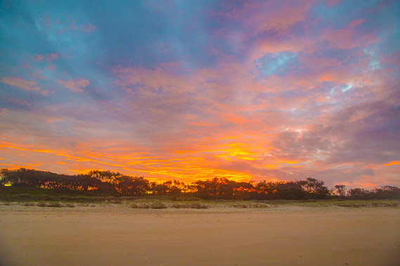
06:19 - The brilliant colours of the early dawn break through the layers of cloud. The entire sky turns pink with the colours of the sun filtering through the layers of clouds. |
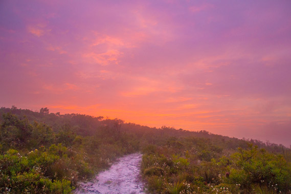 |
06:20 - Looking back up the main track towards the rising sun through a light mist. |
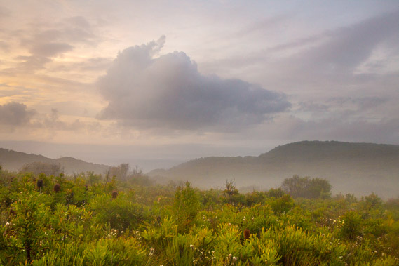 |
06:52 - With the sun up, the mist covering the lowlands on either side starts rising to cover the sand hills as I leave the camping ground. |
 |
06:53 - Mist covers a low saddle on the main range. The track will shortly turn to go down to cross this saddle, and continue a general descent to the end of the range where the sand mass is no more. |
 |
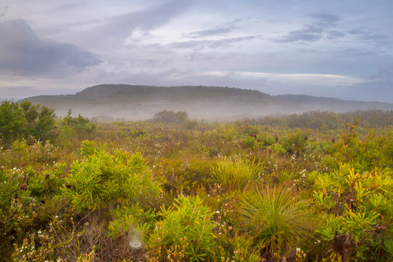
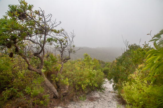
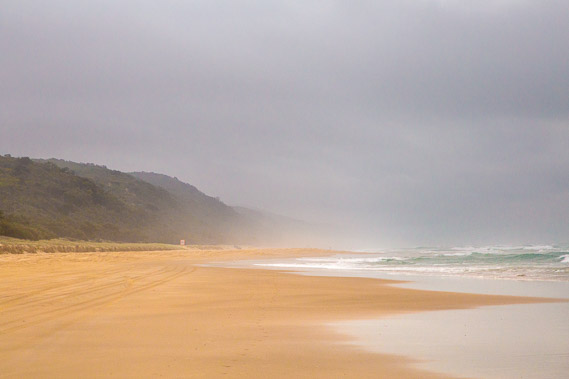
08:30 - The thick mist closes in as the undulating track makes a general descent towards the end of the sandmass. The lush vegetation sucks up the moisture in the air. |
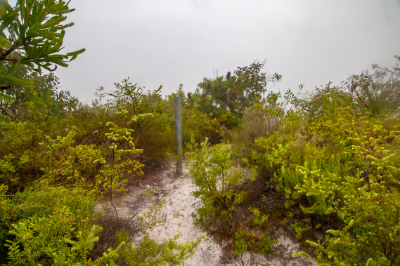 |
08:34 - A 150 metre long side track heads up Mount Seewah to the summit unceremoniously marked by this pole and a nearby trig point. |
 |
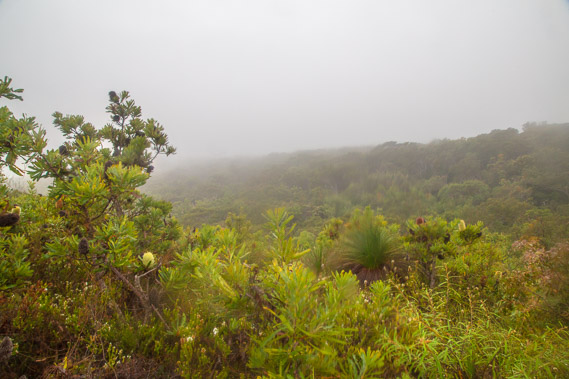
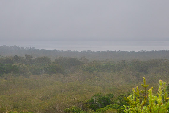
08:35 - View (or lack thereof) from the top of the 120 metre high Mount Seewah. Others have told me there are good views down to Noosa and looking back up along the range from here. All I see today is thick mist concealing the sand hills. The waves breaking on the shore sound quite loud from here, even though the beach is invisible in the thick fog. Fortunately I had great views coming into Brahminy yesterday. |
 |
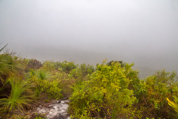
08:37 - Heading back down the short track from the top of Mount Seewah. It is a gloomy day, though no rain falls. This is certainly no day for views. It is not long after reaching the junction the track drops below the level of the cloud but by now I'm in a low valley, so the ridges on either side conceal any views. |
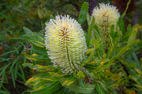 |
08:41 - A nice banksia in flower. These shrubs thrive along the coast. This is named after the botanist Joseph Banks, who travelled with Captain Cook and discovered this shrub in Botany Bay in Sydney. These grow along the length of the east coast. |
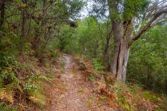 |
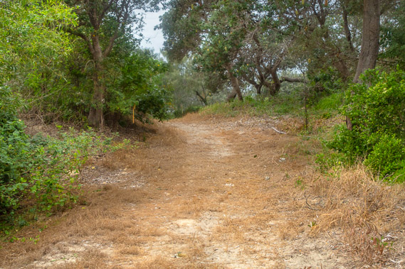
08:54 - Heading down the front of the sand range. The forest here has substantially thickened. |
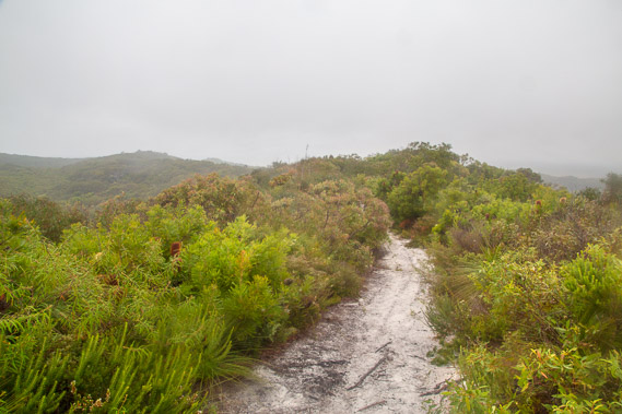 |
09:00 - Following the initial descent the track goes to the top of a long spur and once again in scrubby heathland. Looking back I get an idea of how much the range is descending. |
 |
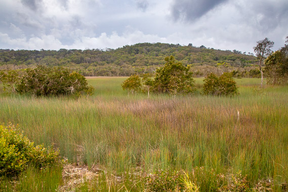
09:11 - From here I have a good view over the lowland swampy heathland now drawing across the sothernmost end of the range towards Teewah Beach. The gloomy grey Lake Cootharaba is just visible past the trees. I'm hoping to reach its edge later this morning, but at this stage not expecting any good views in this hazy mist. |
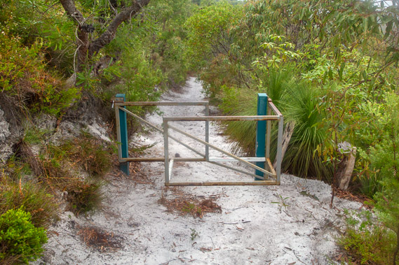 |
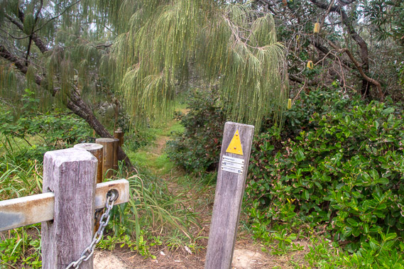
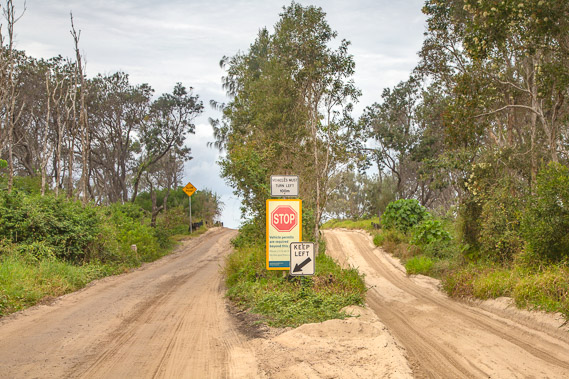
09:13 - An obstacle course gate supposed to let only walkers through. The easiest way through is to go around its right hand side by the grass trees without having to step over the bars. This is a last resort stop to prevent any vehicles from going up onto the sandmass. |
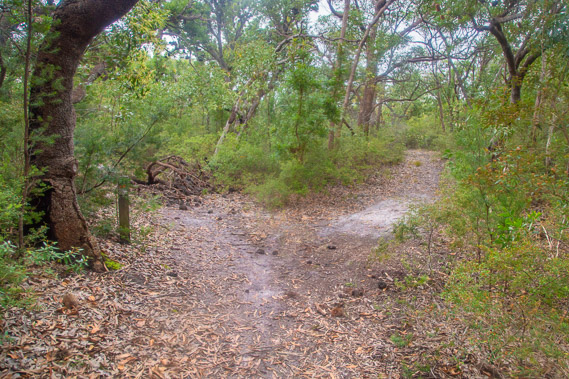 |
09:19 - Upon reaching the bottom of the range, I quickly reach a junction. The main track to Teewah Village nearby is mostly blocked by a fallen tree. The track to the right is a shortcut to a track heading across the now flat sandmass to Lake Cootharaba. I decide to take my chances and head towards the lake. Fingers crossed. |
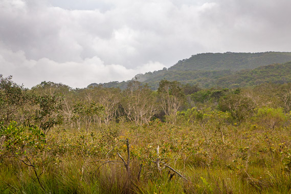 |
09:44 - Looking across the swampy heathland from the Teewah Landing road (just a 4WD sand track) towards Mount Seewah. The cloud is lifting now but I imagine the views still aren't any good. |
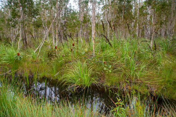 |
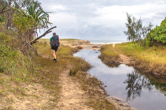
09:59 - After passing through a small area of large trees, the road heads straight along an elevated bank through a paperbark swamp. Reeds grow at the edge of the pools of black water. |
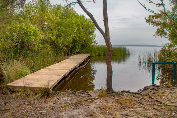 |
10:07 - After nearly two kilometres of following the road above the swamp, I reach the small wharf at Lake Cootharaba. This is the nearest boat landing to Teewah Village, and therefore called Teewah Landing. |
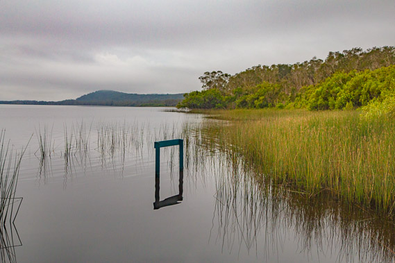 |
10:08 - Looking northward along the lake towards the sandmass range I have followed over the past four days. There is too much reed and swamp forest to see much of this large lake. The sign out in the water no doubt says "Teewah Landing". The vegetation would make the sheltered wharf hard to find. |
 |
10:12 - Returning along the road through the paperbark swamp heading towards Teewah Village two kilometres away. The elevated sand road is completely dry along its entire length, depsite the black pools it passes. |
 |
10:59 - Passing the junction where I had come down from Brahminy, the swamp becomes a sea of reeds, though no areas of water are visible in this swamp. Here I meet two rangers in their jeep checking the tracks. These are the first rangers I have seen anywhere in the park. |
 |
11:03 - At the end of the swamp the track saunters over a low sand dune. I can hear the beach is very close now. |
 |
11:05 - Once over the top of the tiny dune, the Great Walk track leaves the road at a gate to head around the back of Teewah Village and follow the dunes above the beach. I follow the track for about a hundred metres but notice here it is narrow, winding and undulating, with lots of encroaching vegetation. I think walking along the beach will be a lot easier. |
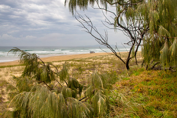 |
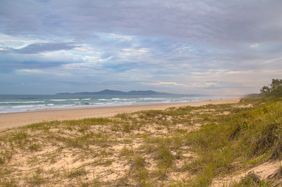
11:06 - First view of the beach over the foreshore dunes. The dunes are held together by spinnifex grass. The tide is in, but starting to head out. A lot of 4WDs pass in either direction ploughing up the soft sand. I decide to stop here in the dunes for an early lunch whilst waiting for the tide to go out a bit further leaving a safe beach to walk on. I can see the hills of the Noosa Heads in the distance through the trees. |
 |
11:18 - Upon finishing lunch, I head across the very soft roughed up channels of sand right up to the sand dunes to the hard sand where the water had covered at high tide. Teewah Village starts here and goes to beyond the trees visible to the right. |
 |
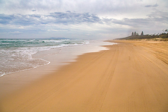
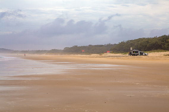
11:22 - A lot of vehicles are going up and down the beach making this rather precarious. Looking northward in a rare break in the traffic, I can see the steep sandhills sweeping back, but the thick salt haze generated by the breaking waves limits visibility to a few short kilometres. Double Island Point is probably over the horzion now, but with this thick haze there is no way to tell. |
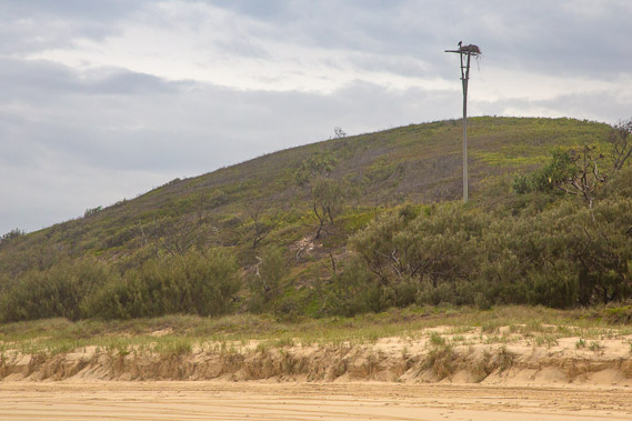 |
11:25 - I didn't get to see any brahminy eagles at Brahminy last night or this morning, but I see one nested on top of a pole here at the start of Teewah Village. Hopefully I'll get a closer view of one further along the trek as they are common along the length of the South East Queensland exposed coast. |
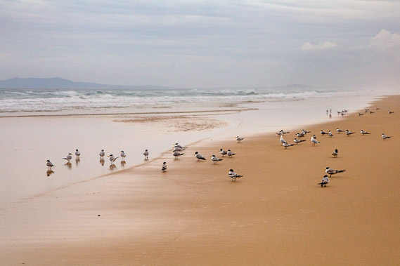 |
11:28 - Lots of crested terns foraging the foreshore rummaging around whatever the tide has brought in. These are some of the permanent populations of birds living here year round. The birds of the coast are a mixture of permanent and migratory birds. The migratory birds have not arrived yet, as they are still in their northern hemisphere breeding grounds in Siberia, Mongolia and Alaska. |
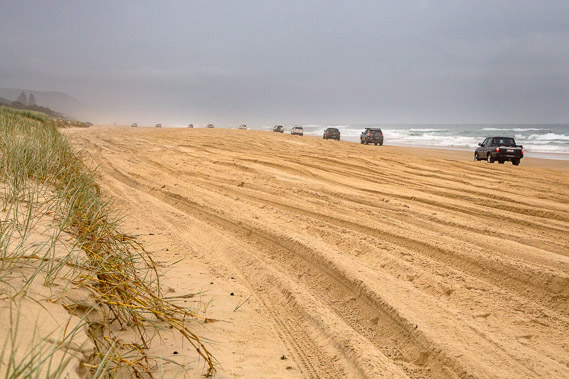 |
11:50 - After a few kilometres I return to the dunes for a rest. Here is a typical scene of a convoy of vehicles heads up the beach. I assume they are heading towards the beach camping ground about twelve kilometres further up the coast stretching up to ten kilometres short of the Leisha Crossing. Given the amount of traffic on the beach, the camping ground must be a bit crowded today. This beach seems to be as busy as a motorway. This is quite a culture shock for me after four days of isolation on the walking track. Since leaving the Leisha Trail to start the great walk, up to Cootharaba Landing, I had only seen about fourteen walkers. As you can see the beach is carved up right to the sand dunes. It is very difficult walking across these ruts in the soft sand. |
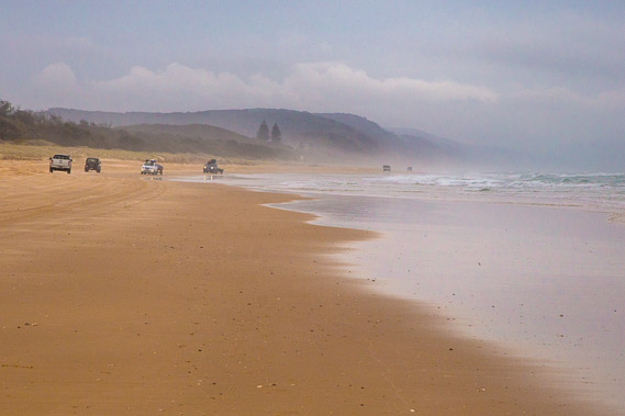 |
12:24 - More vehicles heading up and down the beach. The clouds are clearing now, having risen above Mount Seewah and Brahminy. The higher hills behind Brahminy are still in the clouds. |
 |
13:07 - Noosa Heads is starting to look closer as I approach them along the beach. This beach sweeps all the way to the start of the heads, but I'll need to take a big diversion around the mouth of the Noosa River before reaching the heads around this time tomorrow. The river comes out a kilometre or two before the heads, separating the resort beach of Noosa from the main beach on this side of the river. |
 |
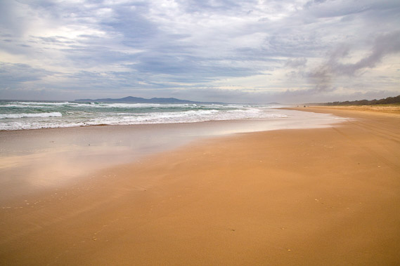
13:15 - Zooming in on Noosa Heads. The headlands look like an offshore island, reminding me of Kapiti Island in New Zealand. Perhaps this was the illusion Captain Cook got when he saw Double Island Point, thinking it was two islands separated from the great sandblow. The tide is quickly going out giving more space for the hooning vehicles to pass. The big waves now break over a sand bank before passing a deep gutter before breaking on the shore. |
 |
13:54 - After eight kilometres of beach heading southward from Teewah Village, I reach the entrance from where the road heads across the swampy heathlands to the ferry crossing the Noosa River. From this road entrance further along the beach, vehicles are not allowed on the sand. |
 |
14:04 - I follow the road in from the beach for about 200 metres before reaching this point where the great walk crosses over. |
 |
14:08 - From the road, the great walk track almost immediately goes back to the beach when it reaches the mouth of a stream, the first I have seen along this beach. The guy I met just this side of the Cooloola Sandblow yesterday passes me having come out from Dutgee today. He was aiming to finish the great walk later this afternoon and was in training to do a trek in Colorado. |
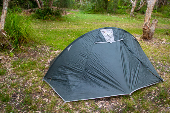 |
16:41 - Upon reaching the beach, it is just a short distance hiking to the Noosa North Shore camping ground. I check in and pick one of the private bush sites to pitch my tent in amongst some surprisinly large grey kangaroos. They quickly disappear before I had a chance to get the camera out, never to return. |
 |
17:09 - Following an early dinner, I head along a short track from the camping ground back to the beach. The sun is ready to set, but at this point I don't think there's going to be much of a sunset tonight. The cloud seems to be too thick, but I have my fingers crossed. Some of the best sunsets I have ever seen have been in conditions like this. |
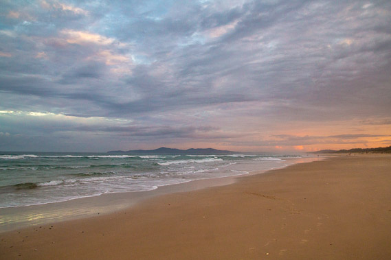 |
17:18 - The sun does find a gap between the cloud and illuminates the sky inland of noosa orange. |
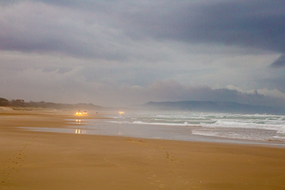 |
17:19 - More vehicles heading along the beach getting off it to head back to the ferry before darkness falls. Fortunately this part of the beach is closed to traffic, but the lights of the cars moving along the beach highway are constant as they have been all day. |
 |
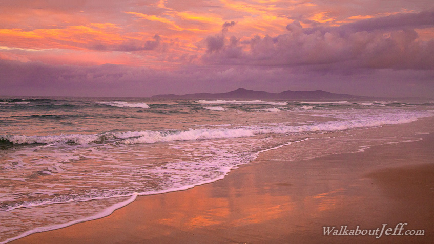
17:20 - Bright colours appear behind Noosa. I think this is going to be a great sunset. A few more people come out onto the beach further along to witness this spectacle. |
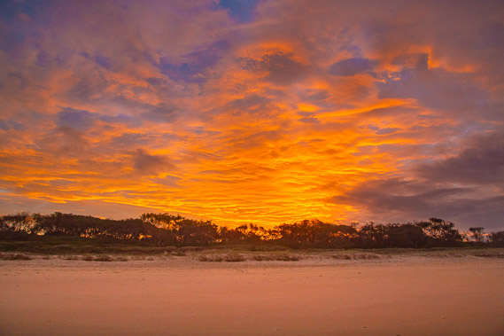 |
17:28 - Looking behind me the sunset is burning like hot coals above the camping ground. The sun is now below the lower cloud, filtering through the gap to create this effect. |
 |
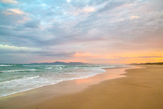
17:29 - The colours are brilliant in every direction, and to think I nearly didn't bother coming out for this sunset because it was too cloudy. The weather does look ominous over the sea. |
 |
17:30 - The colours stretch northward towards a large dark mass of cloud, perhaps bringing rain to the sandmass. Will it rain here tonight? |
 |
17:32 - The sunset fire quickly extinguishes as the sun slips unseen over the horizon allowing the darkness of night to sweep in from across the ocean to take its place. |
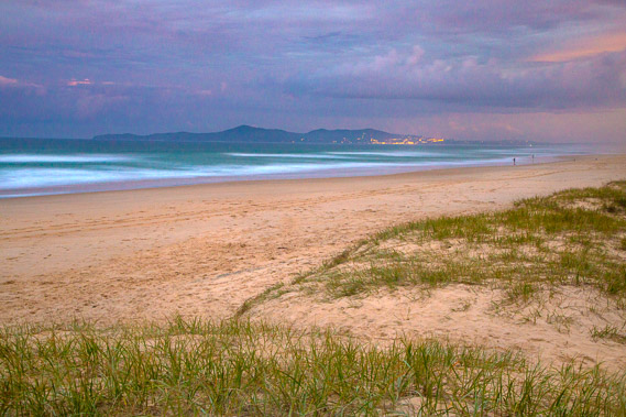 |
17:39 - Returning to the dunes, I prop the camera onto a post to get this long exposure shot of the last light of the dusk. Fortunately there is no wind to blur the grass. |
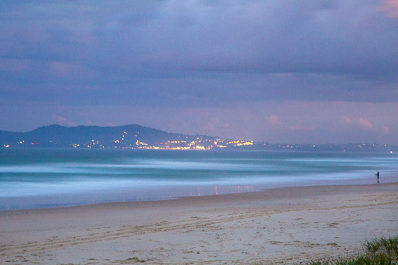 |
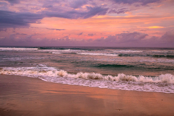
17:43 - The lights of Noosa are illuminated across the right hand side of the headland as a sole fisherman catches his dinner in the darker waters of the gutter between the beach and a submerged sandbar offshore where the biggest waves are breaking. I'm hoping to be hiking through Noosa tomorrow afternoon as I begin my trek along the Sunshine Coast. For tonight though, this is my last night camping along the Cooloola Coast before returning to civilisation tomorrow. |
|