This week in South East Queensland
13 - 19 August
THE SHORT subtropical winter is quickly coming to an end with the worst of the nasty westerlies almost fully past. The spring flowers now begin coming out covering the heathlands in spectacular seas of colour.
Today's journey takes me back onto the Cooloola Sandmass thr0ugh the stunted forest before suddenly coming out onto the enormous Cooloola Sandblow. This is one of the world's best parabolic sandblows stretching almost the entire width of the sandmass. After returning into the forest the track winds its way towards the southern end of the sandmass where the vegetation on the descending slopes become scrubby heathland giving spectacular views up and down the coast.
Today's Journey
Distance hiked today: 20.3km
Total distance hiked to date: 92.1km
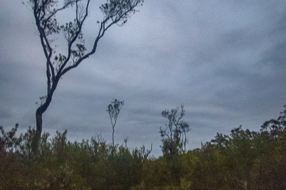 |
06:12 - The thick low cloud covers the sky this morning. Once more I leave at first light not expecting to see any colours in the sunrise filtering through the everglade forest. |
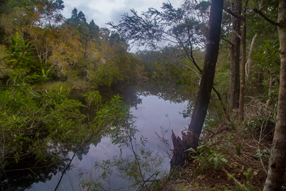 |
06:45 - The track follows the Noosa River downstream, mostly through forest, but there is the occasional view to the silent meandering waters. The trail deliberately keeps away from the river to prevent problems with erosion during the frequent summer floods. Summer storms are particularly savage through this river system. |
 |
06:48 - Reeds grow across the other side of the river at the mouth of a small stream. I imagine what the river would have been like during the last ice age when the sea level was 120 metres below its current elevation. It would have flowed more swiftly through a deeper valley. Now the river is very placid like this along its entire length with no rapids. |
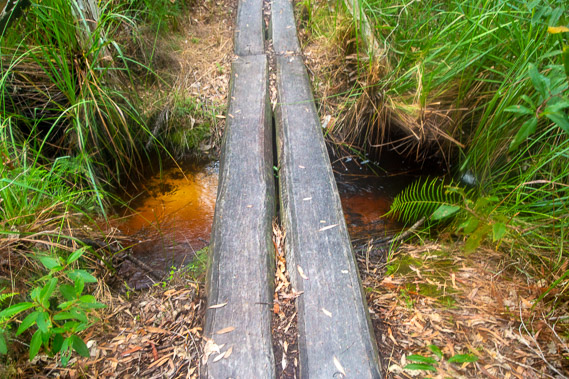 |
07:02 - One of several bridges crossing a tannin stained streams draining the swampy plain into the river. |
 |
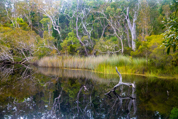
07:16 - Crossing a service road to some of the numerous campsites for kayakers who paddle the river. I haven't seen any kayaks today or yesterday but people do paddle up the river to quite some distance upstream to the end of its navigable length near its source. There are no rapids or swift sections to negotiate. The only hazards are the numerous submerged trees that have fallen in during past floods, and the bull sharks lurking in the river's depths. |
 |
07:23 - Mist hovering the distant sand hills crossing at a saddle I'll be reaching soon now the track has left the river heading across the heathland forest plain. |
 |
08:52 - The track winds its way over a series of nine switchbacks heading up the hill. The track is very well graded, not only being the great walk, but also the main trail for kayakers heading up to the Cooloola Sandblow some ten kilometres from the river. The bush is very scrubby with very few big trees as it approaches the saddle to start following the top of the ridge. Without the track, navigation through here would be extremely slow through the thick scrub. |
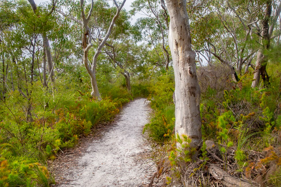 |
09:10 - Upon reaching the top of the saddle, the track meanders its way along the top of the ridge, not as high as the ridges of previous days. The scribbly gums through here are small but very attractive amongst the undergrowth. The mist that had earlier pervaded these hills has now lifted, giving what would be a clear view if it were not for the forest. |
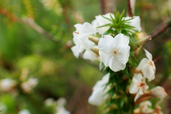 |
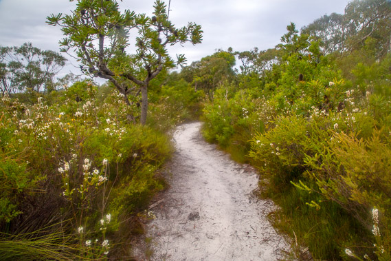
09:21 - The wildflowers here are tiny but very beautiful, most species growing in clusters at the top of the little branches they hang from, doing their best to attract the native bees. These are the earliest of the spring flowers turning this end of the sandmass into a mass of spectacular colour. It is already looking pretty amazing here. |
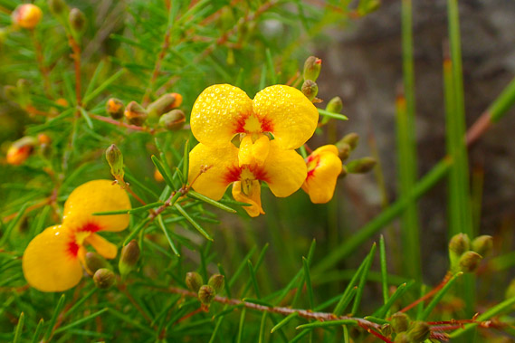 |
09:28 - Some of the flowers are very colourful. This one is still covered with the morning dew from this morning's fog. This area should be swarming with native bees - it would be paradise for them. |
 |
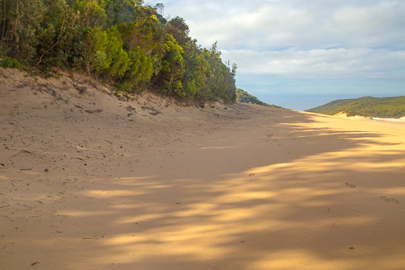
09:37 - A short steep section of track follows a damaged stairway leading to the start of the Cooloola Sandblow. The track had been so wide and easy graded up till now, but from here the sands are quickly shifting. Perhaps this is an indication of things to come. |
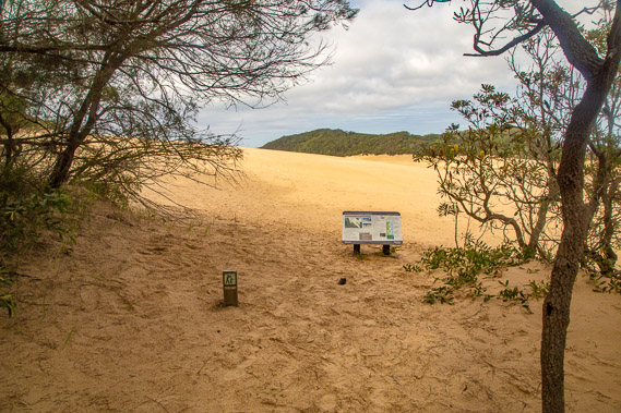 |
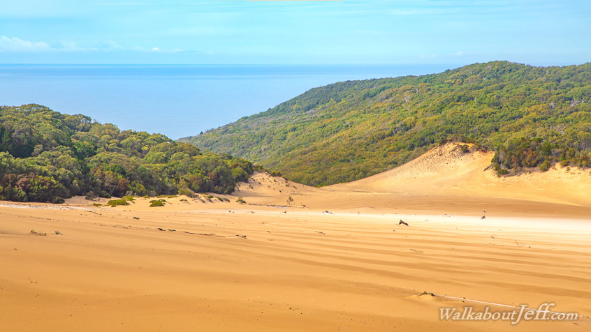
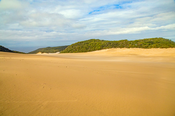
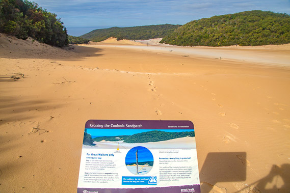
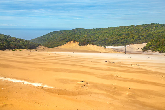
09:38 - I negotiate the steep section no problems, getting this first view of the Cooloola Sandblow at the top. The small notice indicates the route across the sand blow and the good photo stops. The track leaving the other side of the sand blow is a good two kilometres away, almost impossible to find without the navigation. |
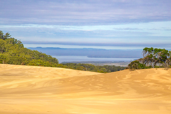 |
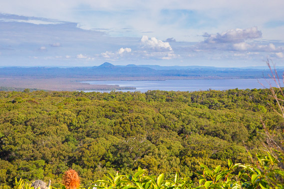
09:41 - View across to Lake Cootharaba, the main lake the Noosa River flows into. The exposed sand of the sandblow has an amazing marbelled pattern. Different shades of colour indicate different size grains of sand, and how the wind has blown them across the sand blow. These patterns are constantly changing whenever the wind blows. |
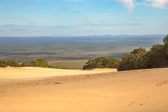 |
09:42 - View up the Noosa Valley where I had hiked this morning and yesterday afternoon. The wide valley is completely uninhabited and reserved as a national park. Hard to believe the three cities of the South East Queensland metropolis lie only a short distance to the south (left of this image). |
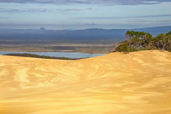 |
09:44 - View of the smaller Lake Cooloola with the Noosa River passing just on the other side of it. The lakes formed when the sea level rose following the last ice age forming various sand bars across the river. The very slow moving river has brought down very little sand to fill the lakes into regular valleys, so the lakes remain. |
 |
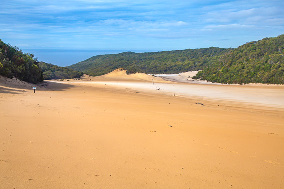
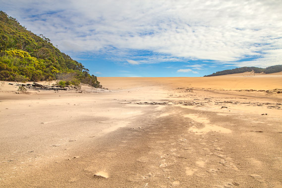
09:47 - Looking towards the low saddle over the two kilometre long sandblow. The route across it initially follows the left hand side of the exposed sand. For the first time in several days, the sea is now visible appearing as the dark grey area through the low valley at the end of the sand blow. |
 |
09:49 - The first half of the route follows the side of the sand blow. The sand blow is eroding the side of the forest, expanding the area of exposed sand. At some point the other end of the sand blow will start revegetating, and the forest will once more cover the parabolic sandblow to become forest again. Countless sandblows have formed over the sandmass over the millennia creating all the ridges and valleys I've been hiking over in recent days. |
 |
09:55 - At the top of the saddle of the sand blow, looking down the other side. I head towards the sign to the left as that is part of the track. The sign will provide instructions on where to go from there. This part of the sand mass is just under two hundred metres above sea level. The sand I can see across the top of the sand blow would be between 150,000 and 400,000 years old, formed in numerous formations overlapping each other. Geological drilling has happened here, to see how deep the sand goes. I recalled at Rainbow Beach a layer of the Cretacious bedrock was a couple of metres above sea level. Geologists have found the sand drops to the bedrock here at around fifty metres below sea level, and some of the sand hidden down there is believed to be up to two million years old. The oldest sand visible in the current sandmass is the 750,000 year old layers at the base of the Carlo Sandblow by Rainbow Beach. |
 |
09:57 - Wind patterns in the yellow sand as I get a final glimpse into the Noosa Valley. The cloud cover seems out of place over this wind blasted desert. Geologists explain this sandmass as being like a field of upside down glaciers. Ice glaciers carve deep valleys into the bedrock of the mountains through which they flow. This sandmass flows as parabolic sandblows forming an enormous upside down glacier along the coast. |
 |
09:58 - The sign points the way. In the distance is a log sticking in the ground. I just need to track directly to the log, and continue another 750 metres to the track entrance on the other side. The sand is of different colours from pure white to a dark brown. |
 |
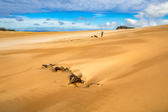
10:01 - A valley at the end of the sandblow dropping towards the sea. The beach is not visible from here, so people down on the beach wouldn't ever see the sandblow unless they came up here. Layers in the sand. I follow the footprints towards the dead tree. |
 |
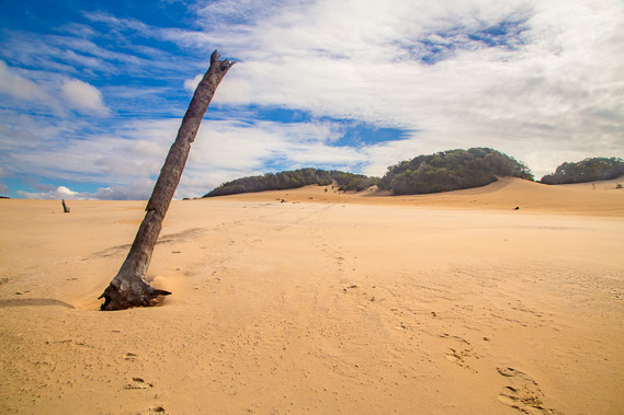
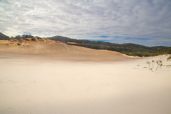
10:02 - Dead vegetation and sand patterns. The remains of a forest in the middle of the sand blow. The sand blow starts in a weakness in the hill, and gradually propogates, consuming any forest in its path as it carves its way across the dunes. These logs have been sand blown for decades. The sand patterns point from the south easterly prevailing trade winds. Fortunately the wind is calm today, so I'm not sandblasted. What was once a forest is now a vast sandy desert. This is the largest example of the parabolic sand blows unique to these sand masses. |
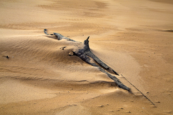 |
10:03 - Blown sand deposited around a dead branch. The sand here in this particularly exposed part of the sand blow is quite coarse. Although there is almost no wind today, a strong prevailing south easterly trade wind blows over this part of Australia over much of the year. The wind captures the sand deposited on the beach and blows it over the sand mass. An average of several tonnes per day have been deposited on this sand mass over the past two million years. |
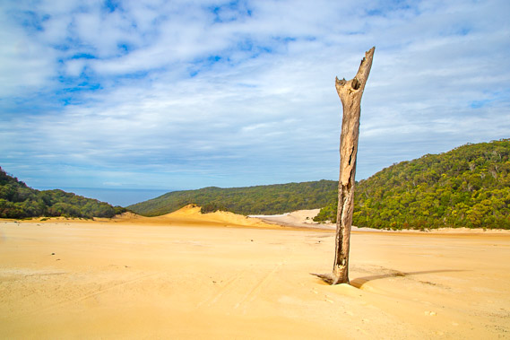 |
10:05 - The landmark tree. Once part of a healthy forest, this is the only tree still standing in the whole mass. This part of the forest was overcome by a sand ridge burying it suffocating all the trees. The top of the ridge has continued moving to the north west causing the level of the sand to drop again to perhaps a few metres above the original level of the forest exposing the top of this tree still standing, and the branches of other trees succumbed to the sand blow. This tree makes a very good landmark. I can't yet see where the track returns into the forest 750 metres away, but I follow the footprints of the two people who arrived at Dutgee last night. Strong winds from earlier yesterday have wiped out all other traces of footprints crossing the sand blow from others who have passed here in earlier days. |
 |
10:06 - Looking back up the hill where I've just come down from. I have already dropped 40 metres of altitude since the saddle, and have quite a bit more of a gentle descent to come. |
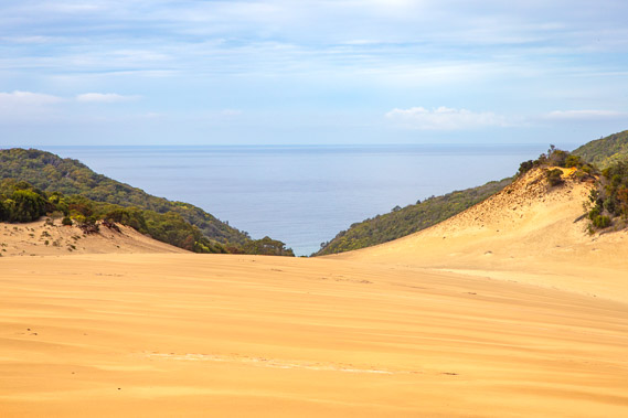 |
10:11 - Looking towards the grey sea where the start of the sand blow seems to rise quite steeply between a gully, amplifying the prevailing south east trade wind when it does blow. Perhaps the shape of this little gully was the catalyst for creating the sand blow in the first place. I can clearly hear the waves breaking on the beach, a good one hundred metres below the edge of the gully. |
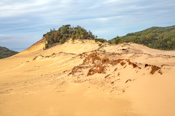 |
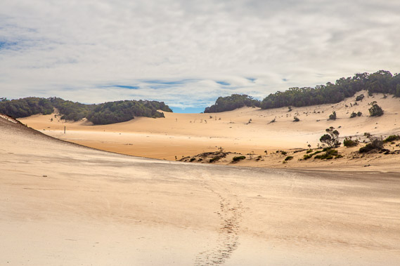
10:16 - A sandy ridge held together by coffee rock. Coffee rock is the name given a very soft rock or perhaps hard soil formed from the deposits on the bottom of a sill lake or swamp that was once here. The sand formations have greatly changed over the life of the sandblow. The terrain here at the lowest point of the sandblow is quite different. This is actually a depression, but the coarse sand now absorbs any rain water quickly preventing the lake from ever reforming. |
 |
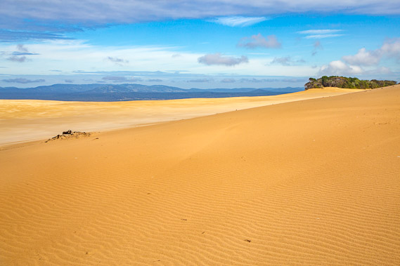
10:20 - Looking back at the saddle from the bottom of the depression. The landmark tree and sign are both a long way behind me now, but still visible to the right. The sand here is quite coarse with different shades of different consistencies and densities blown by the wind. On a windy day the pale finer sand would be fiercly blowing around like a blizzard sandblasting everything in its path. |
 |
10:26 - Looking up a side blow. The sand here is almost pure white and very soft. The wind through this side section isn't as strong as along the main sand blow. |
 |
10:27 - At the end of the sand blow into the depressoin and back up to the standing dead tree to the left, and beyond almost to the saddle. Since leaving the saddle, I have dropped about 80 metres altitude to around 120 metres. I imagine hiking this uphill in the middle of summer would be brutal under the hot sun. |
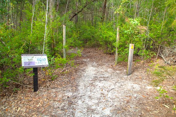 |
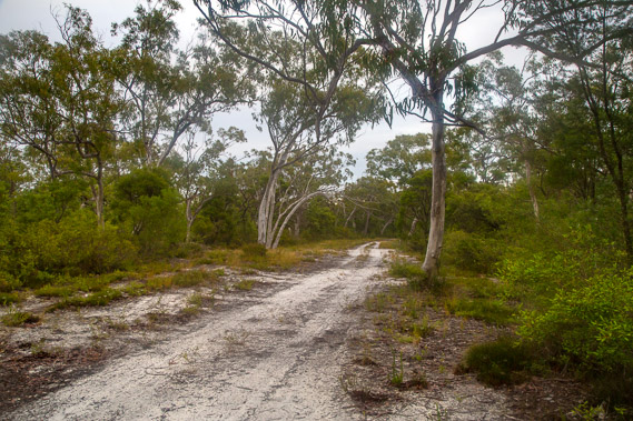
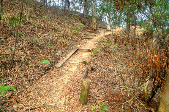
10:34 - Small sign where the track enters the forest. Another set of poles marks where the track could be closed off. Fortunately there isn't a chain between these poles so the next section of track is open. I'm expecting this section of track will be rougher than the track on the other side of the sand blow as only great walkers pass through this remote area between here and Brahminy. |
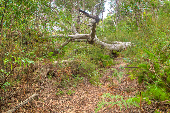 |
11:04 - A fallen tree over the track a short distance in from the sandblow. I am now half way between Dutgee and Brahminy. This tree fell some time ago as the temporary track around it is very well worn. Here I meet a guy heading the other way. He started from Brahminy early this morning and was heading to Dutgee, before walking back out in the opposite direction to Noosa tomorrow. |
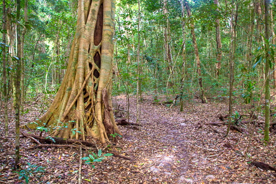 |
11:46 - After an initial steep section through scrub, the track drops off quite steeply into a small valley. I reach the bottom of the gully passing through a very small patch of schlerophyll forest. This thick forest only lasts for a couple of minutes before the track leaves the gully. The forest thins and dries as it heads up the moderate slope back towards the top of the main range. |
 |
12:49 - On top of the ridge the bush is once more very scrubby. The track turns westward to continue climbing a spur above a deep gully before reaching the main ridge of the sandmass. The thinning scrub on the top of the main ridge gives the occasional glimpse out to the lakes. |
 |
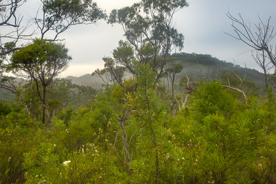
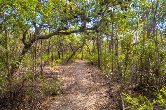
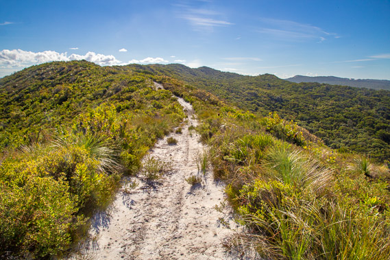
13:12 - The track continues climbing to the top of a hill at around 170 metres above sea level. Here the scrub suddenly becomes stunted, as the bush starts to give way to open heathland. |
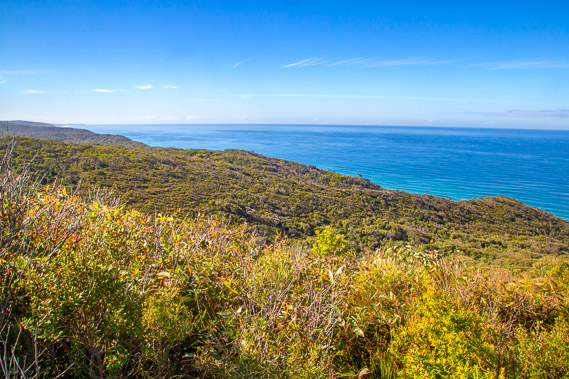 |
13:45 - Just after the summit heading downhill along the ridge I get a clear view northward over the heathland scrub all the way up to the barely visible Double Island Point. Three mornings ago I was on top of the point looking southward towards these hills. Now I get to look back having hiked 68 kilometres traversing the sandmass. The winding track has meant I have only travelled about 35 kilometres as the crow flies. |
 |
13:49 - Going a little further along the track, I zoom in as much as I can to Double Island Point. It still looks a long way away, so remote and lonely. |
 |
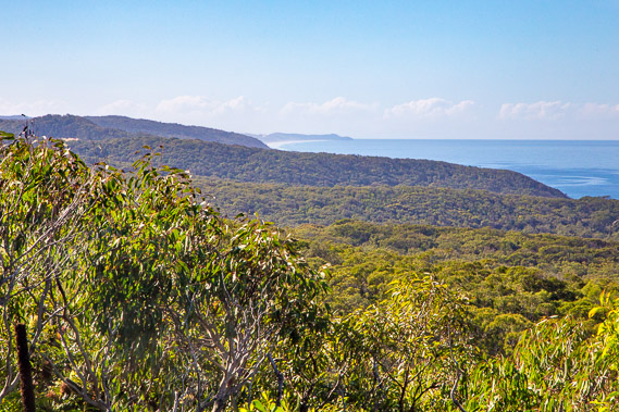
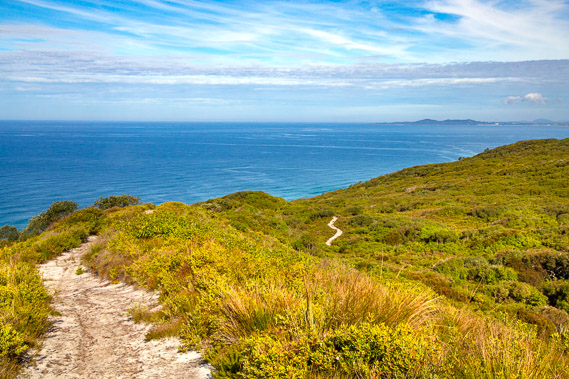
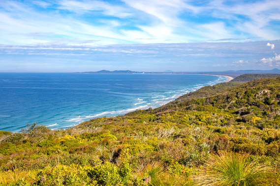
13:50 - Looking the other way ahead the ridge drops off giving a view southward of the lakes to the right, and along the coast to Noosa Heads to the left. Low cloud still hovers over the Sunshine Coast, and spectacular cirrus clouds sweeping across the sky move quickly out into the Coral Sea. Tonight's destination at Brahminy is around the other side of the next hill looking quite flat from up here. |
 |
13:51 - Zooming in on Noosa Heads, some of the buildings of Noosa are just visible, and behind the heads to the right is faint triangular outline of Mount Coolum, which I hope to climb in about four days. To the right of Noosa is the long sweeping beach of the southern end of Teewah Beach sweeping a continuous arc from the heads all the way back up to Double Island Point. |
 |
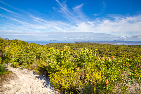
13:54 - Lake Cootharaba is still visible over the next layer of forested dunes which I'm heading down towards. This end of the sandmass is lower and narrower than the other end near Rainbow Beach. Eventually this massive sandmass will peter out altogether. |
 |
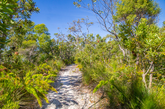
13:55 - Looking back up the track along the main dune. The forest has become heathland exposed to the prevailing winds. These hills provide shelter to the rest of the sandblow allowing the spectacular forests I have explored in recent days to thrive. |
 |
13:56 - Looking down the track as it winds its way down the sand dune mountains towards Brahminy, and to Noosa Heads which I'll be going around in under 48 hours. Dingo footprints appear along the track, indicating they use this easy access as they forage these exposed slopes by night. |
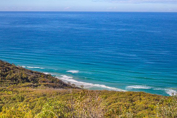 |
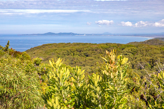
13:59 - For the first time in four days I see waves breaking on Teewah Beach having come across the vast Pacific Ocean. The track now becomes very soft sand zig-zagging its way down the hill once more entering forest losing the spectacular view. The sand has always been firm up to now, but the soft sand indicates its exposure to the trade winds, explaining why most of the track has been a couple of kilometres inland up to now. |
 |
14:36 - The track comes out into a small section of heathland from where I can now see the the beach comes into view sweeping around to Noosa. |
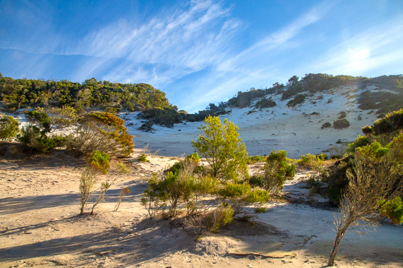 |
15:16 - Another steep drop into a gully comes out a this new unnamed sandblow. This is quite small only covering a few hectares, but could one day become as big as the Cooloola Sandblow as it cuts its way into the forest. The track crosses this sand blow before reaching another spur with a good view of the beach as it swings inland around the hill to Brahminy. |
 |
16:06 - The junction at Brahminy. The camping ground is only 20 metres behind me. A big relief after having hiked just over 20 kilometres from Dutgee. |
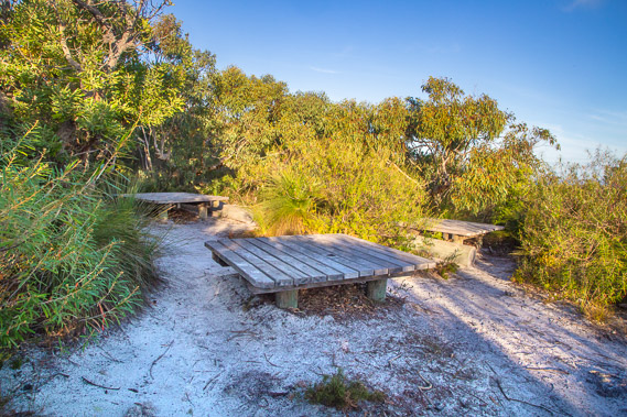 |
16:07 - The communal area at Brahminy. The previous camping grounds were all in the bush. This one is more exposed on the top of the descending ridge in scrubby heath. This openness is quite welcome. If the sky is going to be clear tonight, I may be able to get some more spectacular astrophotography. The camp is otherwise very similar to the other camping grounds with these low tables, a toilet and water supply hut, and a track to several little private campsites. |
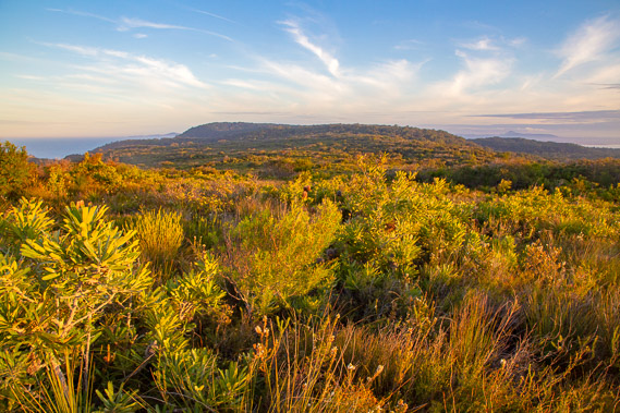 |
16:59 - After putting up my tent, I head back ou to the main track in time for sunset. The heathland foliage becomes golden as the sun sinks towards the horizon. This is known in photography circles as the golden hour, the best time of the day for landscape photography. |
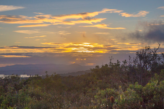 |
17:05 - The sun setting behind distant cloud behind the Noosa Valley. |
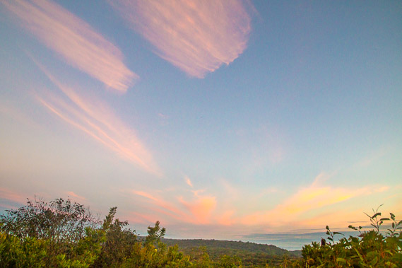 |
17:28 - Cirrus clouds stream overhead in their perpetual jet stream capturing the last of the sunlight. From around 6000 metres above sea level, the wind is nearly always blowing from the south west all year round. It crosses the country from the Great Australian Bight over the Nullabor and across the deserts to here. The jet stream brings clear weather over winter, but during summer it provides the engine for delivering spectacular thunderstorms. Thankfully it is winter as this would be a terribly exposed place to experience a thunderstorm. |
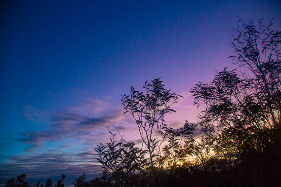 |
17:49 - The last light of dusk viewed from my tent. Fortunately the air is still keeping the vegetation motionless during this long exposure shot. This would not be possible if the trade wind was blowing. |
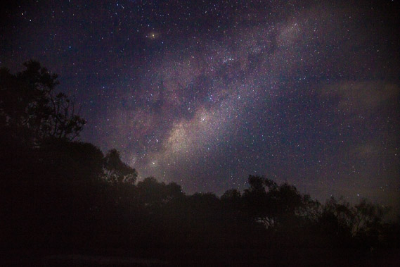 |
18:33 - The milky way rises over the scrub shortly before the moon rises. Saturn is visible above the galaxy. Shortly afterwards a cold damp mist rises and closes in. |
|