This week in South East Queensland
6 - 12 August
THE COLDEST time of year comes almost always in early August, when cold westerlies blow in from the deserts. With the cold winds comes Brisbane's annual show - the "Ekka" as is locally called. Originally run in the middle of the hot summer, it was at some point moved to this time of year when the apparent temperatures are at their coldest. Huge crowds gather in the confines of the exhibition grounds behind the city centre, ride the sideshows and look at the mostly rural exhibits. The tightly packed crowds and cold weather combined guarantee everyone coming down with the flu over the following weeks.
Today's hike takes me far away from the crowds traversing through the remotest part of the Great Sandy National Park. I start at Litoria, heading back up to the top of the Cooloola Sandmass main ridge before dropping down its western side into the vast everglade heathlands of the upper Noosa River.
Today's Journey
Distance hiked today: 14.8km
Total distance hiked to date: 71.8km
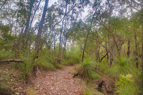 |
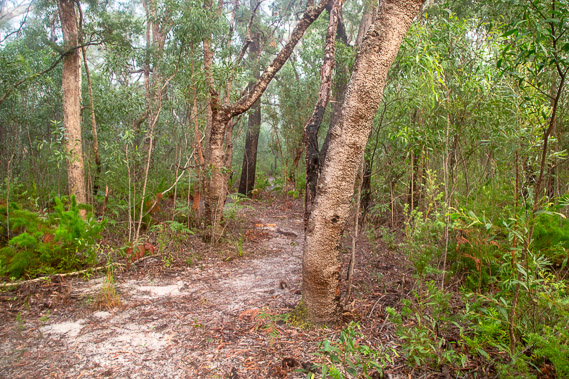
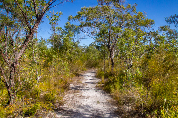
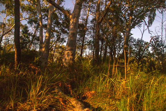
06:16 - Thick cloud has come in overnight. I leave Litoria at first light, immediately going into a moderate ascent towards the top of the ridge. The forest here is dry eucalypt with Xanthorrhoea grass trees growing under the regenerating trees. The grass trees are very slow growing at one centimetre per year. Most of the taller eucalypts would only be around twenty years old, but the smaller grass trees are over a hundred years old, survivors of the past logging industry. Low cloud has moved in this morning, a fog from a chilly night dropping into the single figures. |
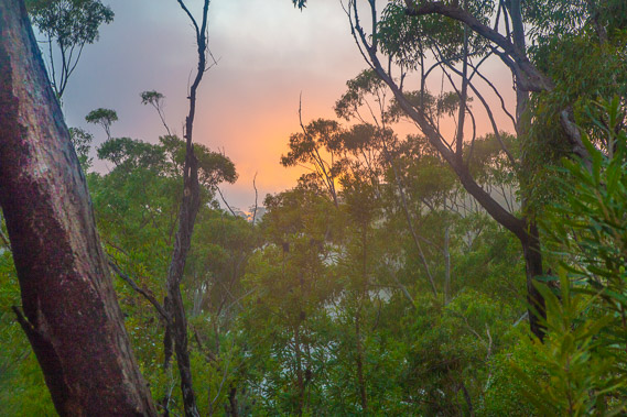 |
06:29 - For a couple of minutes the rising sun captures beautifully in the mist creating an orange fiery glow. This is a pleasant start to hiking the remotest section of the Cooloola Great Walk. Although shorter than yesterday's effort, this section of track is two days' hike from civilisation in either direction. |
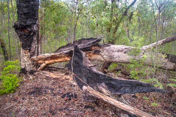 |
06:50 - The sky goes grey again as the track levels off along the top of yet another sand range. The trees are all small but I occasionally pass a large one. This tree is burnt out from a large forest fire that had swept the area a couple of decades ago. Forest fires are just a fact of life in the Australian eucalyptus forests, but the fire had burnt severely here killing off many of the trees. Fortunately there were a lot of seeds in the ground. These seeds have a special characteristic of only being able to germinate when burnt in a forest fire. This is exactly what happened here. The fire came through burning down all the trees. The seeds germinated producing the small trees now covering this ridge. |
 |
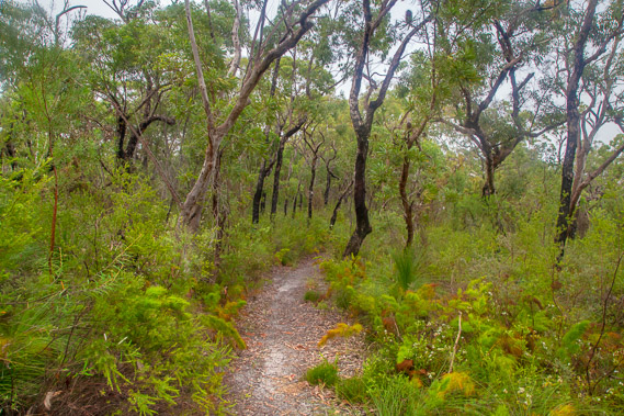
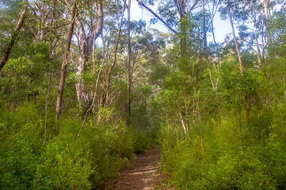
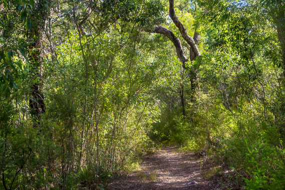
07:03 - The track fortunately stays in good condition as it weaves its way through the scrubby forest. |
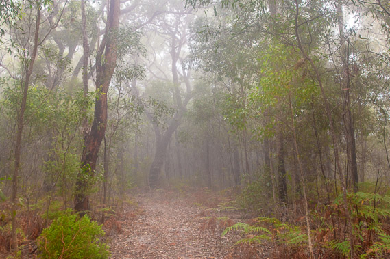 |
07:14 - The thick mist closes in, making the forest dark and eerie. Visibility along the top of the ridge drops off markedly. I can hear the faint sound of waves breaking on Teewah Beach quite clearly from here. |
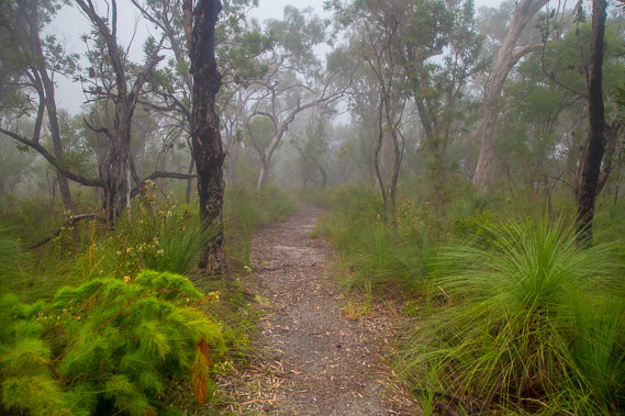 |
07:27 - The undergrowth becomes lusher with the bright green fern-like rope rushy plant, grass trees, and to my surprise, a lot of wildflowers. |
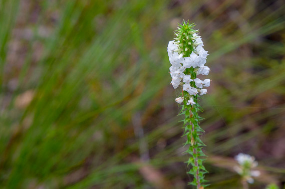 |
07:29 - This is one of the many flowering shrubs. This track is well known for its wildflowers, but these do not normally appear until spring. This is perhaps the first sign of the global climate change phenomena I see on this track. |
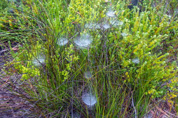 |
07:31 - Mysterious horizontal spider webs cover much of the lower foliage. These small webs are normally invisible during the day, but the thick dew deposited by the mist has made them into spectacular additions in the foliage. They are everywhere around this part of the ridge as a vast array of traps to capture any insects buzzing around. |
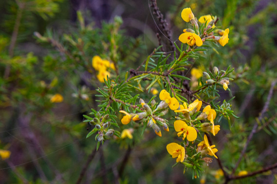 |
07:38 - Another wildflower. These are abundant from here on for the rest of the track now the rainforests are behind me. |
 |
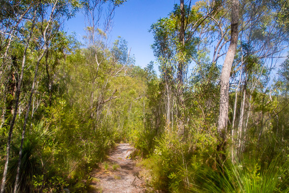
08:17 - The thick mist rises as a gentle chill breeze begins to blow from the west. This low cloud is going to clear very soon. |
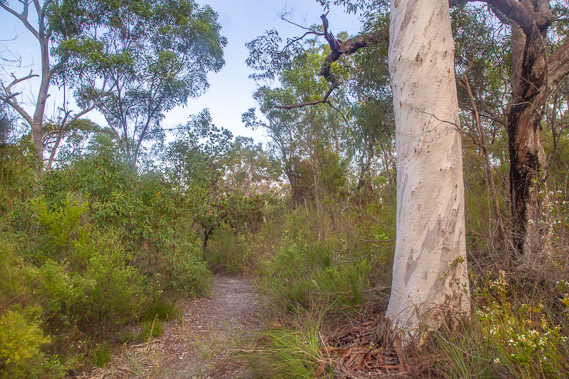 |
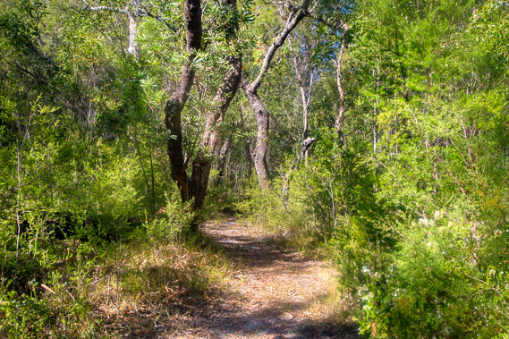
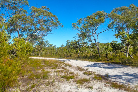
08:29 - Sure enough the misty cloud clears. The air is dry and cool. The white tree is a scribbly gum, the first of the big trees I have seen today. The track is now descending into a valley, again with no flowing water. |
 |
09:06 - Upon reaching the bottom of the valley, it passes a swampy patch before turning to the right to follow a gully. The valley rises on a moderate grade as the wind strengthens and the air continues to cool. |
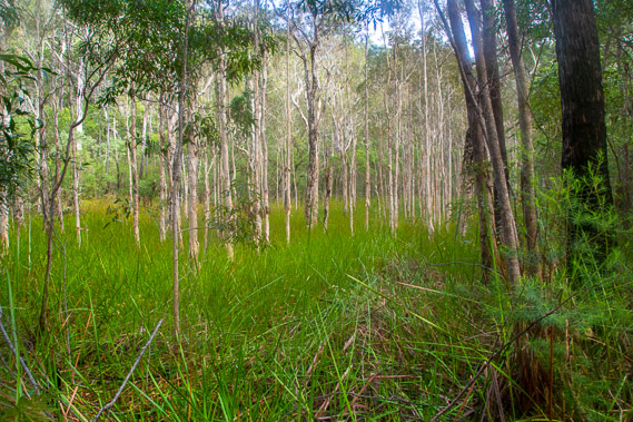 |
09:16 - The valley levels for a few minutes passing another small swamp. This swamp has a thick carpet of reedy grasses hiding any pools of water. |
 |
10:13 - The level section doesn't last long. The track continues to rise quite steeply along the top of the valley towards the top of the next ridge. The wind is quite strong here. August is well known for its strong westerlies blowing in from the deserts of inland, fed by Antarctic frontal systems hitting Australia's southern coast. These used to be quite marked with strong winds keeping the daytime temperature below twenty degrees, but have come earlier and with less severity in recent decades. |
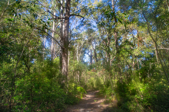 |
10:55 - Winding around the domed hills along the top of the ridge, the trees become a lot taller, having well left the earlier area affected by bushfire. The trees sway in the wind. Far away to the south in the middle of Brisbane is the exhibition (or Ekka as everyone calls it). The westerlies always arrive at the time of the Ekka along with huge crowds filling the city to ride on the side shows and look at the farm animals. Being as crowd-phobic I am, I've timed this week very well with hiding out here in perhaps the most remote corner of South East Queensland, two days' hike in either direction from any civilisation. |
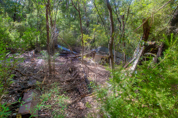 |
11:24 - After some distance winding around the tops of the range, I reach Ramsay's Hut. It is clearly marked on my map, but has been reduced to a tangle of metal being encroached by the thick undergrowth. Apart from the huge tree stumps this was the only remnant of the forestry days. Decades before helicopters were even thought of, it would have been a long hike into these remote sandhills (as I have now found out). The forestry workers built a hut here to stay in whilst they cut the trees down. Aside from the two walkers' camps, this is the first sign of civilisation I've seen since leaving the Leica Track. |
 |
11:26 - The track from the hut was once a single lane dirt road, making for a very easy gradual descent. The foliage becomes even thicker, yet provides little shelter from the biting cold wind. Westerlies have traditionally blown in late May and mid August, marking the beginning and end of the subtropical mild winter respectively. In recent decades these winds have started later and finished earlier. Perhaps there will be a time when these westerlies will only blow in mid July, then will perhaps disappear for good as the climate continues to warm. |
 |
11:47 - The track abruptly turns off the road (with its continuation being overgrown almost beyond recognition. The walking track descends towards a gully. As altitude drops, the forest gets thicker and taller. The wind still blows, but perhaps not as much as strong as it had done on the tops. |
 |
12:24 - Sunlight filters through the foliage. Although the air is cold, the sun shines strong. The branches creak as they wave with the wind. |
 |
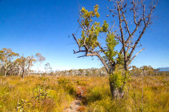
12:57 - Reaching the bottom of the gully, the ridges quickly dissolve away behind me and the land becomes quite flat. The track remains pure white silica sand. The tall trees have given way to scrubby heathland. The sand here is too swampy for the bigger trees so there is no more risk of falling branches breaking in the wind. The scrub remains too thick to get any views beyond the flat plain I have now entered. |
 |
13:02 - The track crosses a service road heading up and down some distance back from the upper Noosa River. The river has no bridges, so the service road would have come off the Rainbow Beach Road further upstream beyond the river's sources. The wind seems to be dying off now. In the past these August westerlies have blown for several days on end. Now they only seem to last for hours, or a day at most. These winds are the remains of the Antarctic frontal systems hitting the bottom of the country bringing cold rain and snow to the higher mountains. The wind then blows over the deserts sucking all the moisture out of the air leaving perfectly clear sky by the time it reaches the coast on this side of the country. |
 |
13:15 - The ground flattens and becomes too swampy to support any trees. Shortly I'll be getting views across the plains of the Noosa River. |
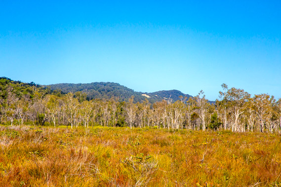 |
13:18 - Looking across the heathland towards the hills I'll be climbing tomorrow. The patch of yellow sand is part of the Cooloola Sandblow. These hills are a continuation of the sand mass I have been following for the past three days, and will be returning to tomorrow morning. The dunes on this side of the mass are around 200,000-5o0,000 years old. The shifting meanders of the Noosa River would have slowly eroded this side of the sand mass over the millennia, widening the plain. |
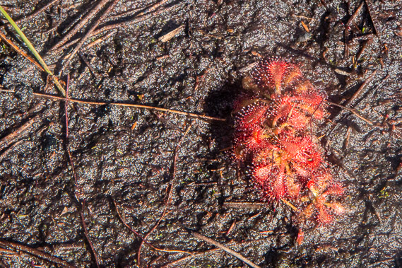 |
13:20 - The ground is very swampy, but still firm enough to walk on without getting at all bogged. The soil contains very little nutrient so plants like this sundew have adapted accordingly. With an almost complete absence of nutrients, these sundews supplement their diets by trapping mosquitoes in their honey-like dew drops and feed on their rotting carcasses. |
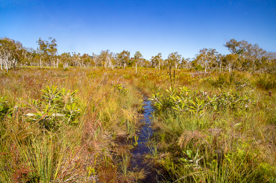 |
13:27 - The track becomes wet (but fortunately not muddy). This plain would have been a tidal wetland at some stage after the last glaciation when the sea level rose to 3-5 metres above its present level. Sand blowing across the sandmass has been deposited here gradually increasing its elevation to become today's swampy plain, the northern end of one of two everglades on the planet. |
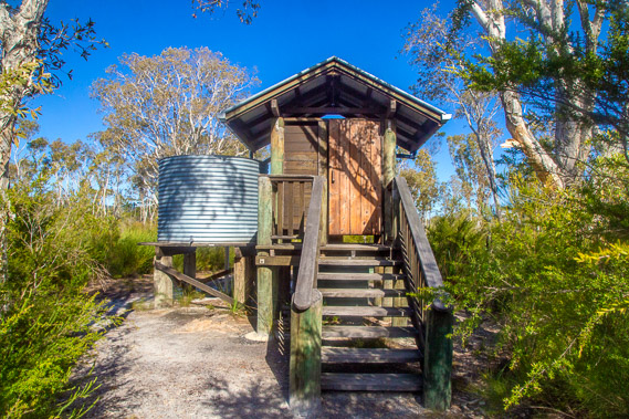 |
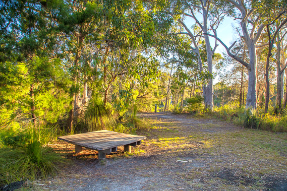
13:50 - Entering a sparsely scattered forest, I suddenly reach the Dutgee camping ground. Like the previous two camping grounds, this has a toilet and water tank. This area is prone to flooding though, so these have been elevated a metre and a half off the ground. A short trail off the main track crosses a small stream and leads to the campsites. Here I set up the tent before exploring the rest of the camping ground. |
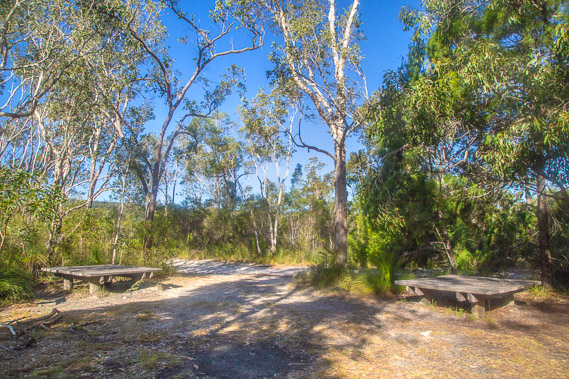 |
14:20 - Returning past the toilet, I continue along the track for another hundred metres before reaching the communal area beside the river. This is a very spread out camping ground, perhaps set up as a compromise to get an obscurred river view from the communal area and provide the camping spots at the highest point of this flood prone plain. |
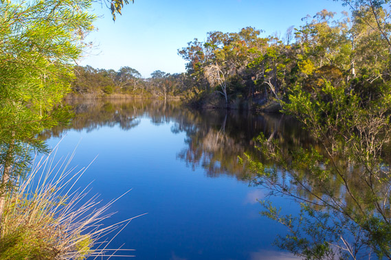 |
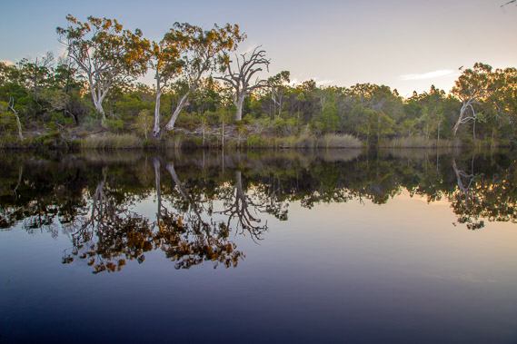
14:25 - The Noosa River viewed from near the communal area. The wind has entirely died down allowing the surface of the water to smooth out and become almost mirror flat. Just half an hour ago the surface would have been too rippled to have produced any reflection at all. |
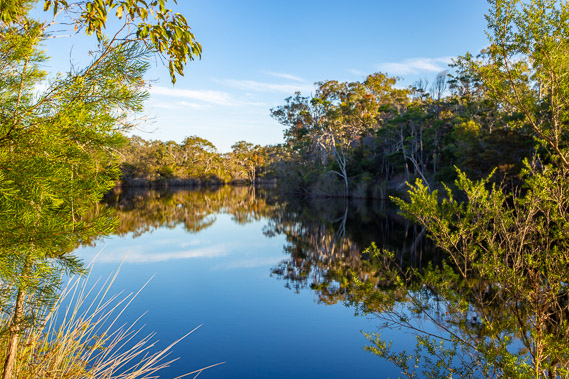 |
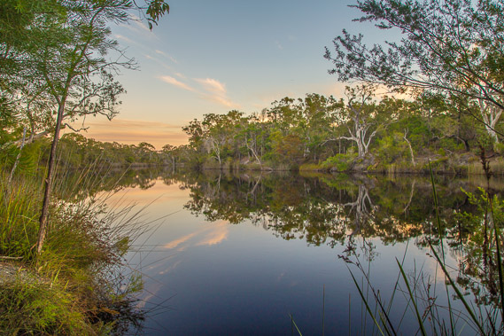
16:29 - I come back just before sunset. The river running through the everglade is now mirror flat as the high clouds continue racing overhead. |
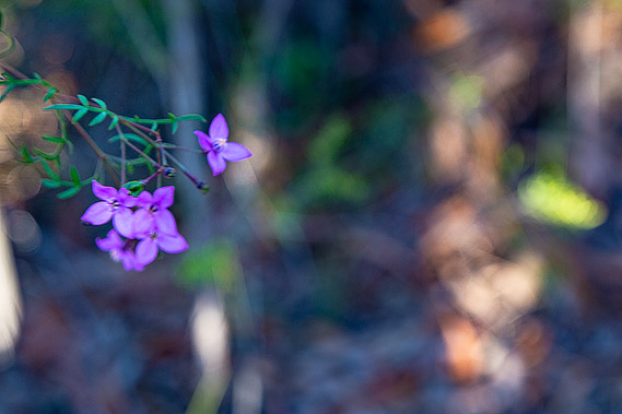 |
16:33 - The dutgee flower, giving the camping ground its name. Dutgee is the Aboriginal word for the Wide Bay boronia (Boronia rivularis) These are supposed to start flowering in spring, but it looks like climate change has got this one as well. |
 |
16:38 - The late afternoon sun filters through the communal area. It is very quiet here. A young lady hikes through and sets up camp for the night, but I don't see her again. |
 |
17:09 - The ancient trees holding the river bank together reflect perfectly in the cold still water. If the air temperature was warmer, a swim would be tempting, but these dark waters hide large bull sharks lurking in their depths awaiting their next meal. |
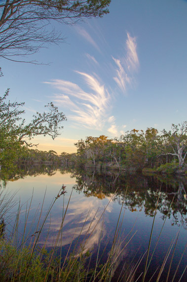 |
17:10 - Spectacular cirrus clouds cross the sky at around two hundred kilometres per hour along the jet stream The wind has completely died out here in the valley, but still blows strong at altitude. |
 |
17:23 - The water level doesn't seen to change due to tides. Perhaps I am too far upstream for the tide to affect the river level, particularly as the main river flows into two lakes before reaching the sea. This is a very good kayaking area, with another 16 camping grounds accessible along the upper Noosa River. I haven't seen any kayaks or boats along the river today, but it would no doubt get fairly busy in summer. |
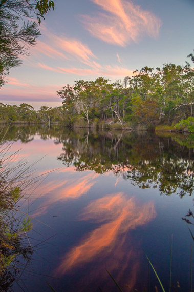 |
17:34 - More cirrus clouds capture the last rays of sunlight filtered over the western deserts adding a fast moving fire to the upper troposphere. |
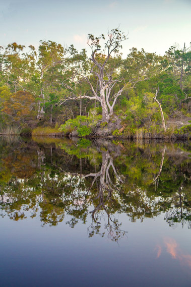 |
17:38 - The huge scribbly gum on the other side of the river reflects perfectly in the water. These trees obviously like the constant supply of fresh water. |
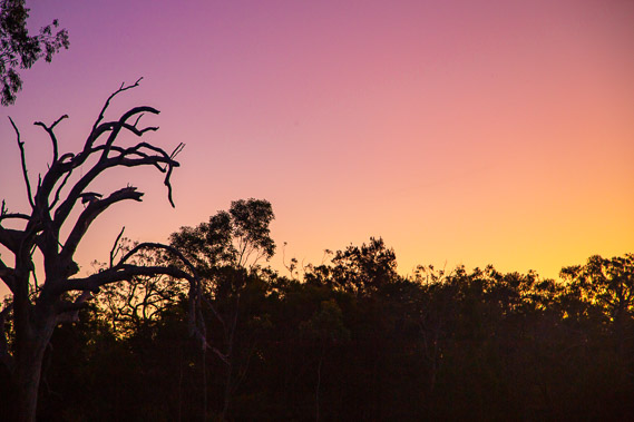 |
17:48 - A dead tree stands dominant in the forest across the river as the colours of the brilliant sunset change. The sun has to pass through hundreds of kilometres of atmosphere capturing the fine desert sands suspended in the air. |
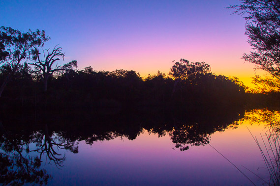 |
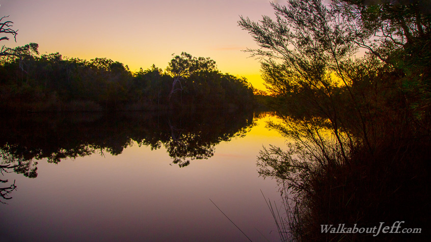
17:52 - The last night of the still evening. The river is mirror smooth perfectly reflecting the silhouette of the forest. Only the foreground tree and reeds provide confirmation this photo is the right way up. |
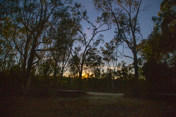 |
18:24 - About an hour after sunset the moon rises over the distant sandmass. The stars are strong. Shortly after taking this photo a sole hiker arrives and briefly rests here. He has come out from the far end of the track at Tewantin today, and will this evening hike up to Litoria. Tomorrow he plans to hike all the way to Rainbow Beach via Double Island Point. Obviously he's very fit and not weighed down by a heavy camera. I thought that was extreme, but I would later read of people hiking the entire trail in one day. Clearly not snap happy nature hikers like me! |
 |
18:38 - The moon rising in the sky behind the trees illuminating more cirrus clouds as they hurry across the sky. The wind has started to pick up again so I head back along the track to my tent. It seems a long way in the darkness. |
 |
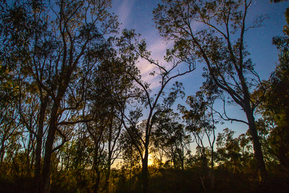
18:40 - I take one final shot of the forest during a brief respite in the wind before it starts again. The wind now makes any night photography impossible, but tomorrow is another long day, so the early night is needed. |
|