This week in South East Queensland
10 - 16 June
THE MAY westerlies (as I have always called them) are getting later and later each year. So much so they should be renamed the June westerlies. The early winter westerlies hit with a vengeance this week. The vast deserts and savannahs on the other side of the Great Dividing Range have significantly cooled and the prevailing high altitude jet stream suddenly comes down to low altitude bringing cold wind from inland to the coast, and making an abrupt start to winter. During these westerlies, the air temperature drops to around twenty degrees and at night calms down to below ten degrees. You know winter has started when the westerlies arrive, but these don't compare to the more harsh westerlies occurring at the end of winter.
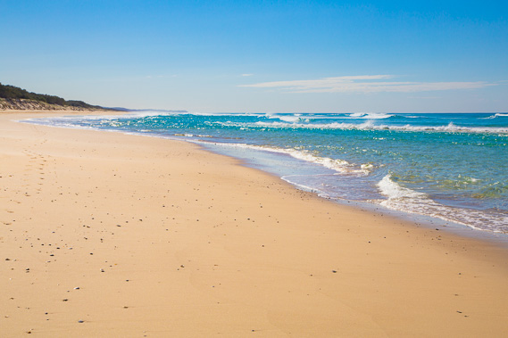
Today's trek starts from Point Lookout, from where I start hiking down the very long and relatively featureless ocean beach. In the early afternoon I spot the first of the camping ground tracks, and eventually I find track 5 marking two thirds of the way along the island's 38 kilometre long coast.
Today's Journey
Distance hiked today: 23.9km
Total distance hiked to date: 1033.7km
 |
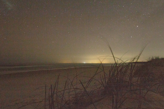
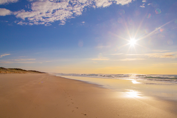
05:02 - I leave Point Lookout before first light. About half an hour down the beach I spot the rare Zodiac light, the reflection of dust particles around the ecliptic (disc around where the planets orbit the sun) and successfully capture it in this image. |
 |
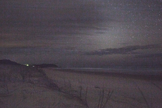
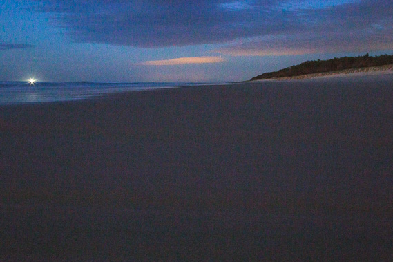
05:04 - Although the Gold Coast is still over the horizon, the haze of the city lights are clearly visible on the horizon. The lights to the left are those around Coolangatta, my final destination. The bright white light is a fishing boat. |
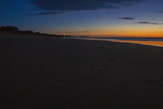 |
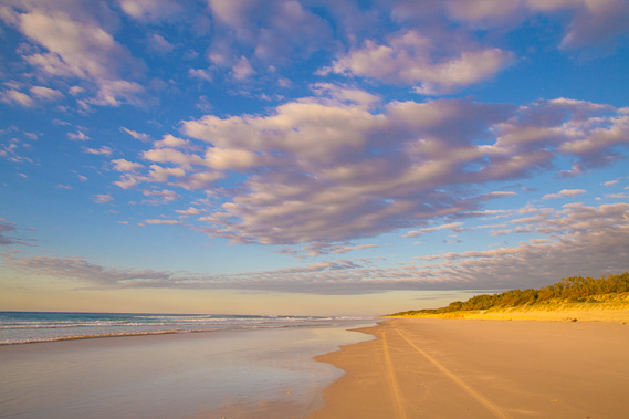
05:42 - Looking back to Point Lookout at first light. This is quite a cold morning with a westerly wind blowing. The temperature is only just over ten degrees, a dramatic drop from previous nights througout the long autumn. |
 |
05:47 - The fishing boat is not too far away and the lights of the Gold Coast reflect off the clouds. |
 |
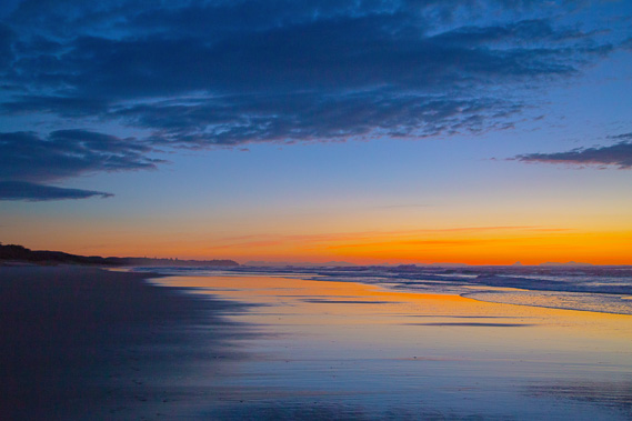
05:56 - The sky lightens as the cold westerly wind bites. This wind is late this year, usually occurring in May, but in recent years with climate change this has been happening in June instead. Cold winds occur for a few days in May/June and in early to mid August each year, marking the start and end of winter respectively. |
 |
06:07 - The sky lightens to the north east towards Point Lookout, close to the shortest day of the year. |
 |
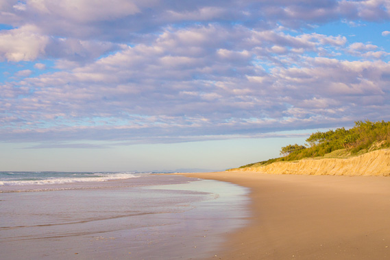
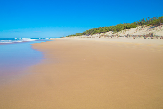
06:09 - The coast looking south seems to be endless. The sand hills are being eroded by the sea removing sand. Apparently if a large tsunami come over from New Zealand or across the Pacific, this section of coast would be the most severely affected of all South East Queensland. Luckily the islands would block almost all of it from Moreton Bay and the sand hills inland from here are arount two hundred metres high. |
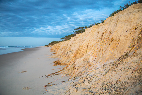 |
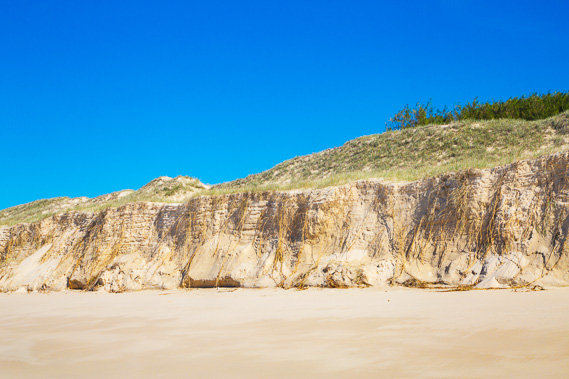
06:16 - The sand cliff here is about three metres tall, indicating a lot of erosion is happening in this part of the beach. The overnight tide reached the bottom of the cliff, making access along here quite difficult. Fortunately the tide is heading out so I should get a smooth run downt the coast for the rest of today. The campsite I have booked is 23 kilometres south of Point Lookout. |
 |
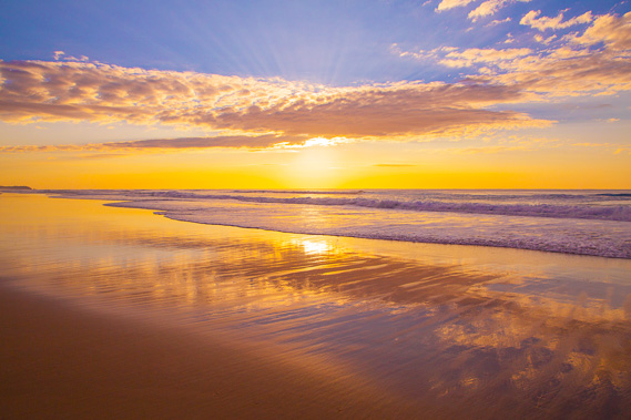
06:22 - The sun ready to rise and hopefully warm up the cold windy air. |
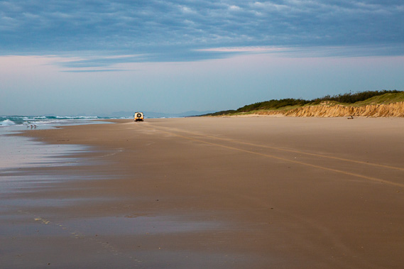 |
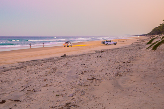
06:24 - A four wheel drive makes its way along the beach. This is the only practical way of travelling the 38 kilometre length of beach as the camping grounds at the other end of the island have no facilities or water supplies. I have had to carry a couple of days' water supply from Point Lookout. |
 |
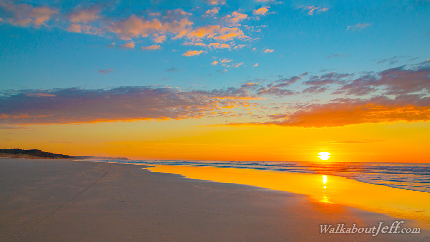
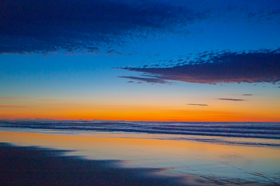
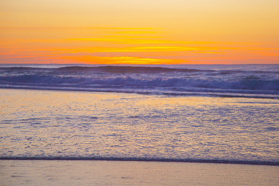
06:33 - The cold sun rises over the horizon lighting the clouds spectacularly. The sunrises are normally spectacular in the early winter. |
 |
06:43 - Sunlight on the golden sand banks of pure silica as I stop for breakfast. The sand and scrub behind it provides shelter from the westerly winds. |
 |
07:03 - It's a long hike down the beach with nothing coming up over the horizon yet. |
 |
07:11 - The golden sun behind a cloud as it hurries overhead pushed by the prevailing high altitude jet stream. |
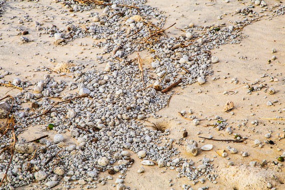 |
07:26 - Pumice washed up on the beach from the eruption of an underwater volcano on the Zealandia continent several years ago. The eruption produced an enormous raft of a cubic kilometre of pumice floating on the surface to eventually be deposited all around the Pacific Ocean. |
 |
07:28 - First glimpse of the Tweed Volcano, specifically the Springbrook area behind the Gold Coast. My final destination is slowly coming into view even with several days of hiking to go. |
 |
07:45 - Point Lookout is disappearing behind me as the sun rises in the sky. The winter solstice is getting near so the sun won't climb to much more than forty degrees above the horizon about half an hour before midday due to this coast's proximity on the eastern end of the time zone. |
 |
08:05 - Zooming in on the Tweed Volcano, around eighty kilometres away as the crow flies and steadily rising above the horizon as I progress along the beach. |
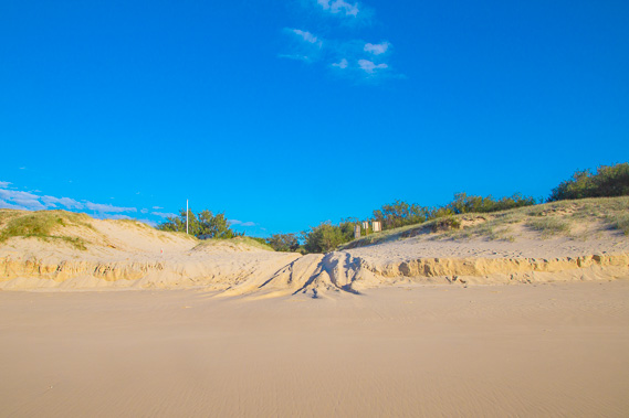 |
08:09 - Entrance to the main sand road crossing the middle of the island from Dunwich. Several roads have been constructed over the island mainly to service the sand mining that has been going on here since it started in the 1950s. The mining will be ending over the next few years, drawing an industry on the island to a close. Access onto the road is a bit difficult at the moment due to the recent erosion along the coast. |
 |
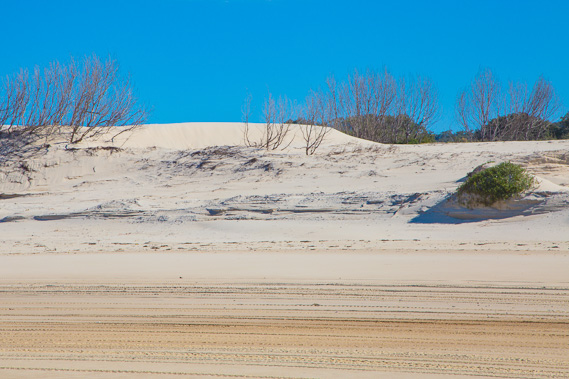
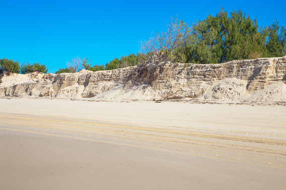
09:22 - The coast continues forever with the older cliffs here draped in spinnifex grass in the weeks since their formation to hold them together. Hopefully over the coming few years new sand will be deposited here to rebuild the coast lost by erosion. |
 |
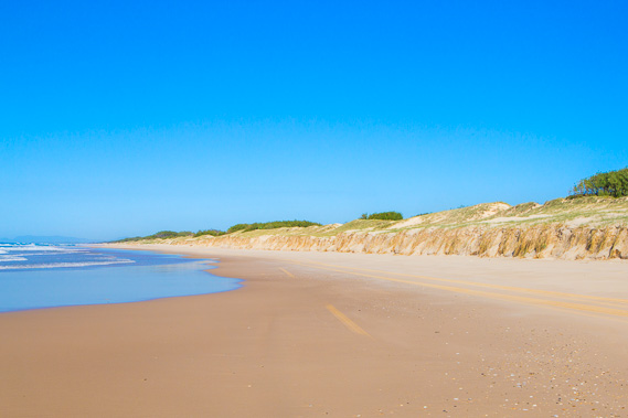
10:25 - The regrowth doesn't last long. Some of these cliffs are around five metres tall. It seems the entire coast is getting eroded with the sand taken away and carried northward along the sand corridor towards Fraser Island. With such a large proportion of the coast eroding away like this, something must be slowing the great train of sand heading up the coast towards Fraser Island. This happens most years from the summer to autumn low pressure systems and occasional cyclone heading down the coast. During winter and spring, sand is deposited to restore the beach, but with rising sea levels, more sand disappears each year. |
 |
11:05 - Zoomed back to Point Lookout, already starting to sink over the horizon. I'm about nine kilometres along the beach. |
 |
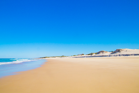
11:08 - The coast ahead just goes on forever. Fortunately the air has warmed up, but it isn't hot like it has been over the past seven or eigtht months. |
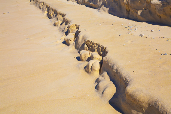 |
11:21 - Eroded sand formations washed from last night's tide. |
 |
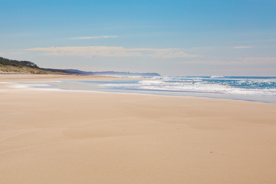
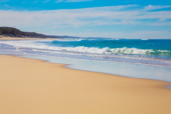
11:43 - Eventually around midday the coast begins to turn more easterly making this otherwise very straight section of coast look like a beach again. |
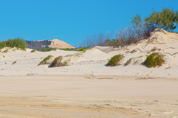 |
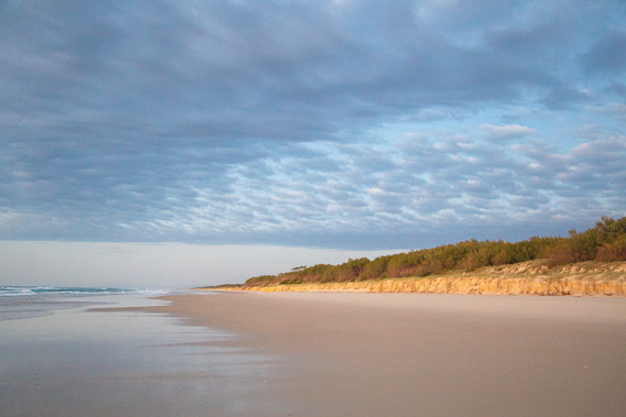
11:44 - The sand hills start to lose their vegetation and a tall orange sand dune towers in the distance. This island is quite fragile with not as much bush cover as Moreton Island. Between the foreground sandhills and the higher sandhills inland is a huge swamp running almost the entire length of the island drained by the slow flowing Freshwater Creek which comes out at the bottom of the island. |
 |
12:12 - Spectacular little wind blown sand hills. Normally these are sandblasted from the prevailing south easterly winds, but today they are being blown by the westerlies from the other direction. |
 |
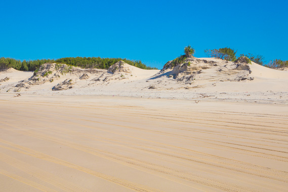
12:16 - A sand hill that smothered a forest. This seems to be quite a common occurrence on this island of shifting sands. |
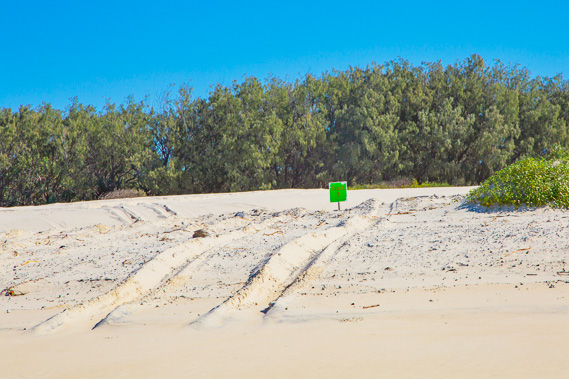 |
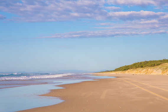
12:27 - Track to the first camping ground, with the tracks of four wheel drives negotiating the soft sand to reach the campsites. There are fifteen different tracks going to the campsites along this part of the coast along the southern half of the island. I'm aiming for camping ground number five, exactly two thirds of the way along the 38 kilometre beach. |
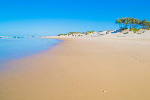 |
12:59 - The coast continues for a long distance with low sand hills rising off the beach. This coast seems very fragile, yet it provides excellent shelter to southern Moreton Bay. |
 |
13:03 - Another smothered forest along this desolate section of windswept coast. This area is having sand deposited with each tide, and the prevailing winds of the last summer have blown dried out sand onto the sandhills, gradually building them up and causing them to advance over the forest. |
 |
13:42 - The exposed sand dunes seem to go on forever as I continue heading down the beach looking for track 5 to my campsite. I've only seen tracks 1 and 2 so far so there are still a few more kilometres to go. |
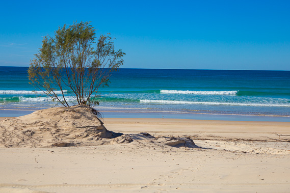 |
13:57 - A solitary tree sitting on an eroding sand hill as I stop for a break. The roots of the tree keep the little hill together as the rest of the bank is eroded away with each tide. I see whales in the distance offshore heading up the coast towards Hervey Bay, but they are too distant to clearly photograph. There was not enough room in my pack for the big telephoto lens. |
 |
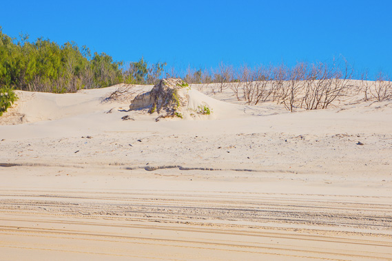
14:34 - Reaching some cliffs in the sand near where I'm expecting more tracks. Do these six metre high cliffs mean some of the camping grounds are inaccessible? Given almost everyone camping here travel by four wheel drive, if the tracks to the campsites are cut off by erosion, they are closed. |
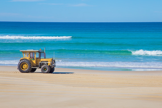 |
15:04 - A tractor goes by - it's mostly been four wheel drive cars heading up and down the beach, but has also been the occasional tractor as well. Perhaps these are picking up small boats from Jumpinpin Channel at the bottom of the island. |
 |
15:25 - Looking back along the beach. Point Lookout is a long way away now, some 23 kilometres away. |
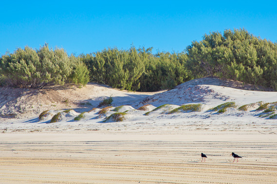 |
15:46 - It is already late afternoon when I hear sounds from one of the campites along the track I'm looking for. The campsite is hidden behind the trees here, but the road is just a hundred metres further along the beach. A pair of oyster catchers forage the sand. |
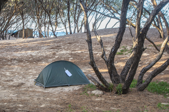 |
16:22 - I quickly find the entrance to the camping ground and set up camp behind a dune just behind the beach. |
 |
16:37 - I return to the beach near sunset. I was hoping to see Gold Coast City as the taller buildings should be up over the horizon by now, but the salt haze to the south is too thick. |
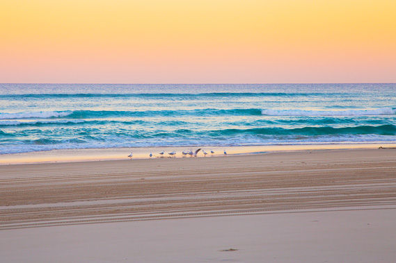 |
16:57 - Birds foraging the shore at sunset to get their supper before heading back to their nests for the long night. |
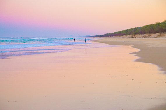 |
17:13 - Campers fishing in the ocean as the purple night sky draws overhead following the sunset. |
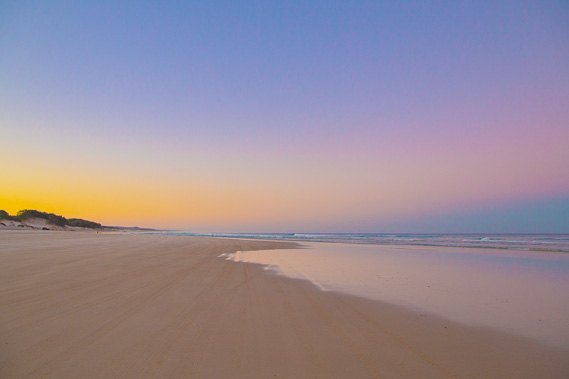 |
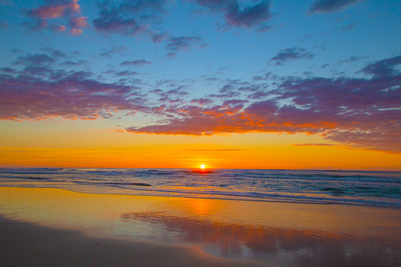
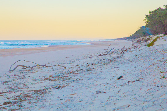
17:26 - Point Lookout is a good 23 kilometres back along the beach. The final glow of the sunset quickly fades away over the island. |
 |
17:33 - Final view of the beach and exposed coast as everyone settles in for the night under the roar of the beaking ocean swell. |
|