This week in South East Queensland
17 - 23 June
THIS WEEK marks the winter solstice, the shortest days of the year. The sun this week is up for less than ten and a half hours. Fortunately though the early winter westerlies are over, so most mid winter days are calm. Although the days are cool, the sun feels comfortably warm and the high humidity found over much of the year is completely absent. As a bonus, this marks the best time of year for photography, with the air being so stunningly clear. The sun is starting to set later, but the mornings are still creeping earlier, so for those of us who find it a bit hard to get up in these cold mornings, the worst is yet to come.
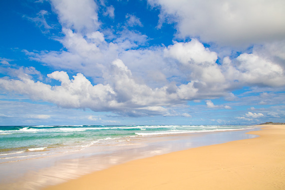
Today's hike starts at the campsite two thirds of the way down North Stradbroke Island. I continue heading down to the bottom of the island, crossing the deep channel to South Stradbroke Island from where I continue hiking along its peaceful remote beaches before eventually reaching the North Currigee track to where I make the short crossing of the island to the camping ground.
Today's Journey
Distance hiked today: 28.6km
Total distance hiked to date: 1062.3km
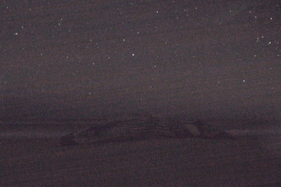 |
04:42 - Leaving the camping ground before first light. I see the lights of the Gold Coast and see a dead whale beached up to the left. It is extremely dark, but I get a quick shot before the smell gets too bad. It must have died a couple of days ago yet it hasn't been eaten by the sharks. |
 |
04:55 - View back to Point Lookout with the stars out in the sky as I adjust better to the almost non-existent lighting here. |
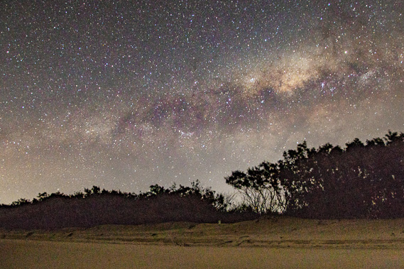 |
05:03 - A spectacular view of the galaxy now I'm finally hiking in an area dark enough to see it under the clear winter sky. The view is very clear here as it hovers over the area around Jacob's Well, the area of minimal light polution between Logan and the northern Gold Coast. As the year continues to advance, and the earth moves around its rotation of the sun at one degree per day, the early morning view of the galaxy will rise higher and higher in the sky. |
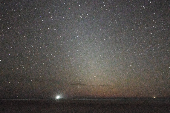 |
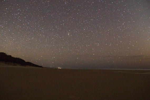
05:06 - A good view of the zodiac light leading on what will be the shortest day of the year. Tonight's zodiac light reflecting the dust particles of the inner solar system is even better than last night's view due to the lack of light pollution at this end of the island. The Pleaides is just above the horizon. |
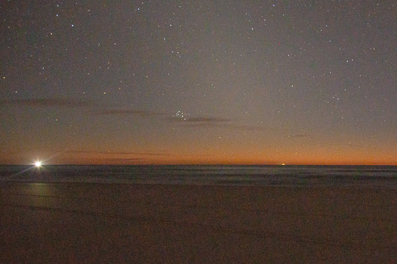 |
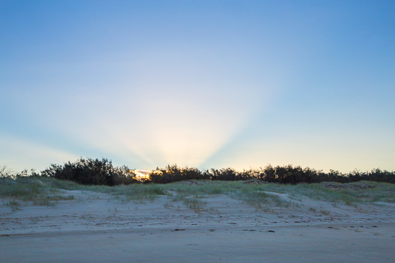
05:16 - First light of dawn at around 5:30AM with a fishing boat on the horizon. |
 |
05:49 - The sky lightens on this cool winter morning. Zoomed into the Gold Coast. I can see the buildings of Surfer's Paradise and Southport (a little to the right). |
 |
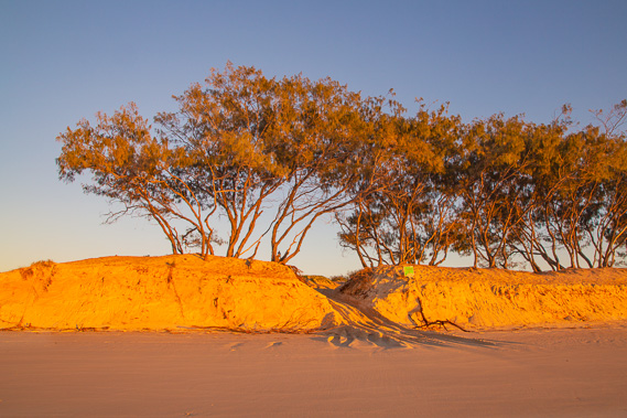
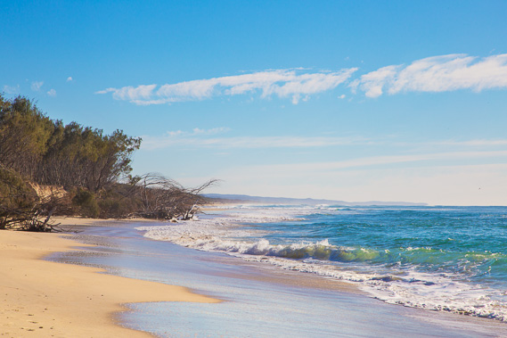
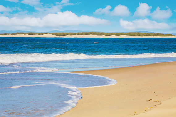
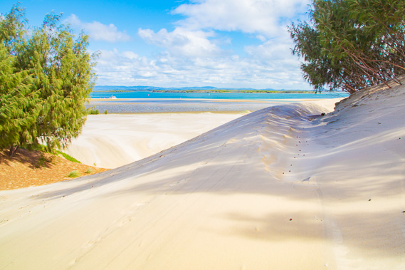
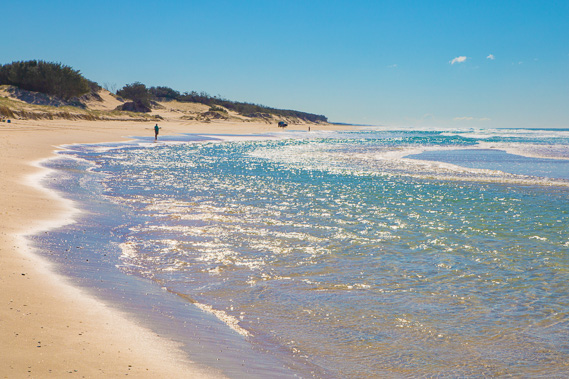
05:56 - Towering sand cliffs rise out of the wet sand. The waves of the overnight tide broke right up to the cliffs. It seems almost all of this island is eroding along the coast. |
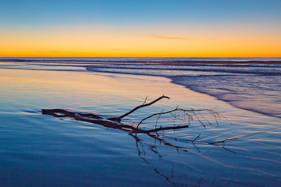 |
05:59 - The sun is soon to rise as I pass the remains of a fallen tree awash in the water. |
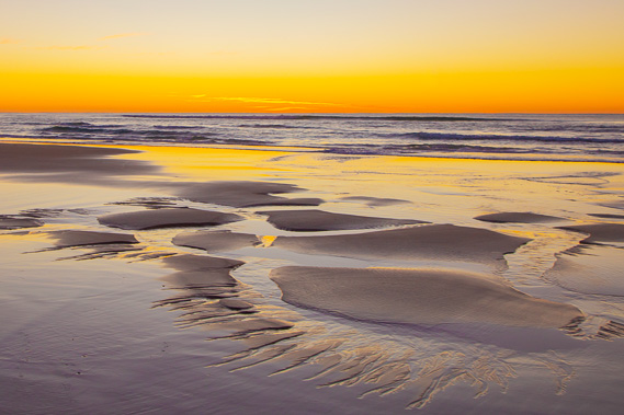 |
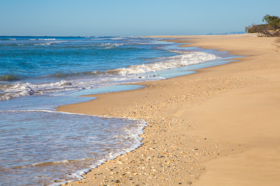
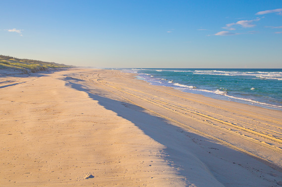
06:20 - Beautiful patterns in the hard base sand as it is eroded with each tide and dragged out to sea to be transported further along the coast towards Fraser Island. |
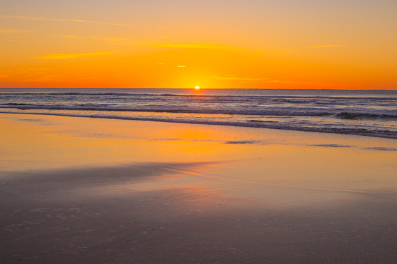 |
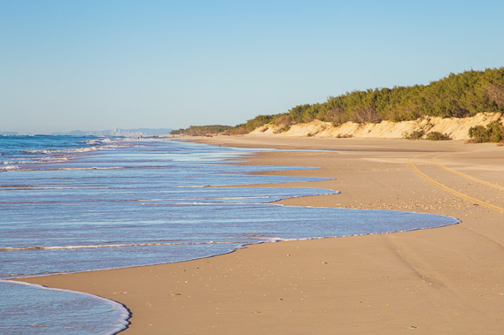
06:35 - The sun silently rises over the horizon at 6:36AM, bringing on the shortest day of the year lasting only 10 hours and 22 minutes. This isn't the latest sunrise though. I'll need to wait a couple more weeks for this. The sunsets are already getting later each day now occurring after 5:00 PM. |
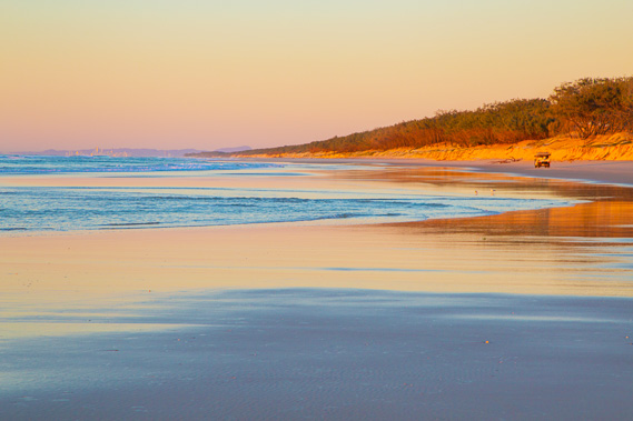 |
06:40 - The vehicle passes by, no doubt a fisherman finding a spot before the tide comes in. Looking down the coast with the sun shining on the cliffs, I can now see the gleaming buildings of Gold Coast city in the distance. |
 |
06:44 - A track up to another camping ground. These tracks would be difficult to drive up with all the erosion happening. |
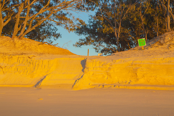 |
06:49 - Track 10 is too eroded to climb. A tractor attempted to recreate this track yesterday without success. |
 |
07:01 - I rest in a break in the cliffs at some low sandhills that have somehow stayed intact in the midst of all the erosion. From up here I get a good view all the way back to Point Lookout now almost invisible in the cold morning sunlight. |
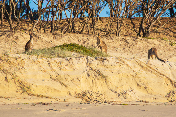 |
07:11 - Large kangaroos on the cliffs basking in the morning sunlight. There are a lot of kangaroos here on this island. When the island split into two, the kangaroos thrived on North Stradbroke and the smaller wallabies thrived on South Stradbroke. They are most commonly visible in the cool of the early morning and evening, retreating into the forest in the middle of the day even at this time of year. |
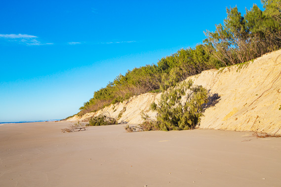 |
07:34 - More tall cliffs towering ten metres high and eroding with trees falling off as the bank cuts away. |
 |
07:46 - The tide is quickly rising, so I need to progress quickly to make it down to the bottom of the island. The tidal range along this part of the coast is around two metres on a large tide. |
 |
07:51 - It is quickly clouding over to the north, some of which is coming this way. Although yesterday's wind is largely absent, the clouds quickly move across the sky largely driven by the jet streams running over five kilometres overhead. |
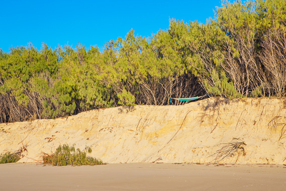 |
07:52 - A hammock at the top of the cliff at one of the southernmost camping grounds. The views across the ocean from there would be spectacular, but not for much longer. |
 |
08:12 - I reach the last campsite at track 15. From here the beach suddenly narrows with fallen trees creatign a bit of an obstacle course. I'll need to pass quickly before the tide gets in too much. |
 |
08:35 - Past the fallen trees I needed to negotiate. Fortunately there was a rough walking track scrambling over the holes left by the fallen roots against the bank so I didn't get wet. |
 |
08:36 - The beach widens again as I approach Jumpinpin at the bottom of the island. |
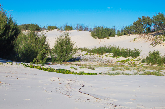 |
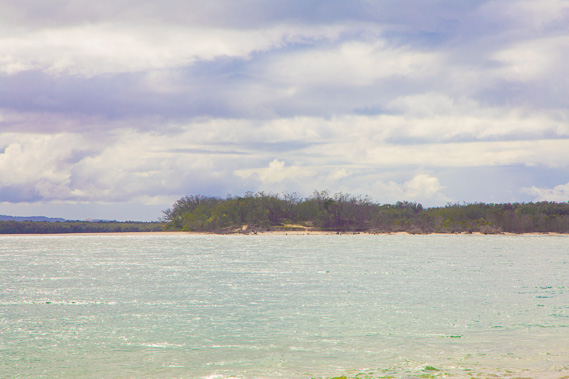
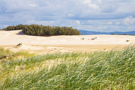
08:52 - Sand dunes extending inland. I can't go any further than this because there are signs saying this area is closed as it is extremely fragile and of cultural significance. This is the same area around the bottom of the island that resulted in me having to island hop across to Russell Island to Lamb Island earlier this year before crossing to the other side of North Stradbroke. |
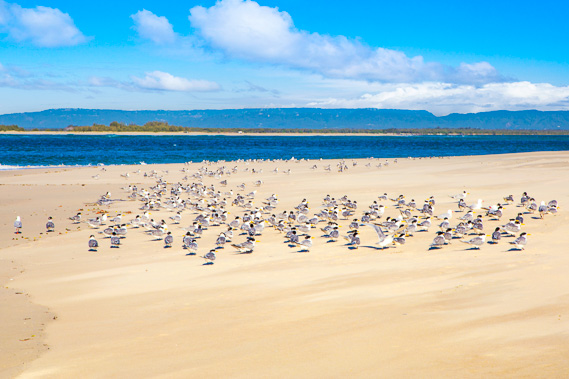 |
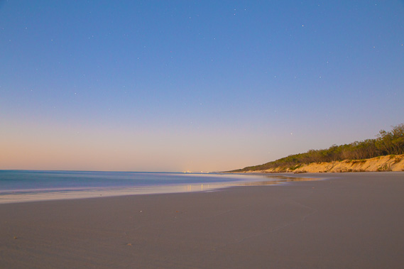
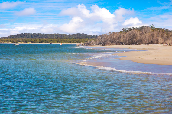
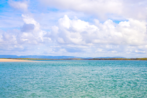
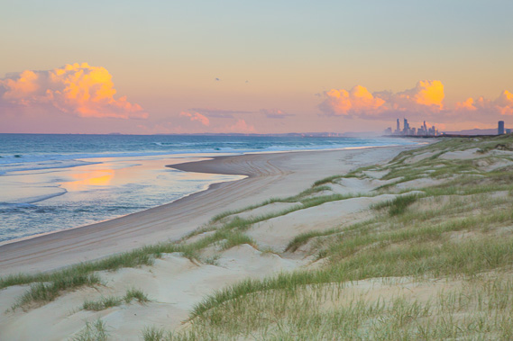
09:10 - I return to the beach with my first clear view of South Stradbroke Island appearing bright against the blue mountains of The Tweed Volcano. The mountains appear blue partly due to distance, and partly due to the oil vapours emitted from the vast forests of gum trees covering them. Despite looking blue, they are actually called the Green Mountains. The Blue Mountains are another thousand kilometres down the coast inland from Sydney. This is the last clear view I get before the clouds quickly cover the sky. A large flock of permanent birds stand on the sand as they prepare to catch fish in the channel against the rapid incoming tide. |
 |
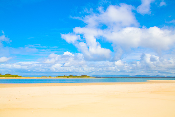
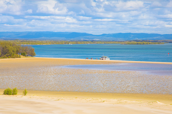
09:11 - At the end of Jumpinpin channel where I await my boat crossing to South Stradbroke. |
 |
09:25 - Heading off from the beach across the deep passage cut between the islands. The bush at the end of the beach is the start of the protected area, with the inlet of Freshwater Creek coming out beyond the first point. |
 |
09:30 - Crossing to South Stradbroke as the clouds quickly cover the sky. The two islands were one until a big southerly storm in 1896 broke the channel through and the islands have been separate ever since with a deep channel now between them swiftly carrying the tides in and out of Moreton Bay. |
 |
09:41 - On the shore at South Stradbroke looking back up to North along the protected south coast. The clouds have thickened so maybe there's rain on the way. To the left of the point is a bit more of the view into the large lagoon where Freshwater Creek comes out after running almost the entire length of the island through the swamp about a kilometre inland running parallel to the beach. |
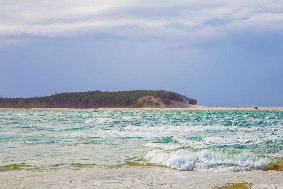 |
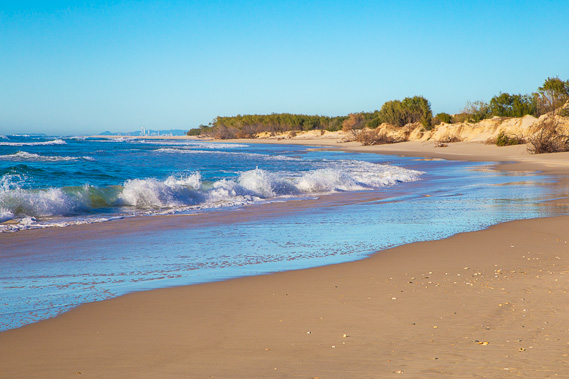
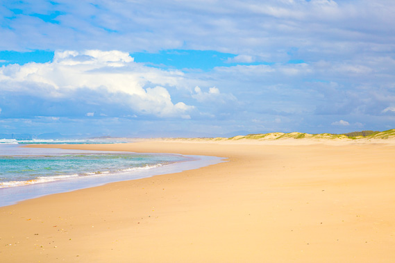
09:42 - A short distance along the coast the waves are rough where they break on the sand banks in a similar manner to what they had done over South Passage between Moreton and North Stradbroke Islands. |
 |
09:46 - I head across the sand bar to a small inlet from Moreton Bay. I follow the top of the sand bar. |
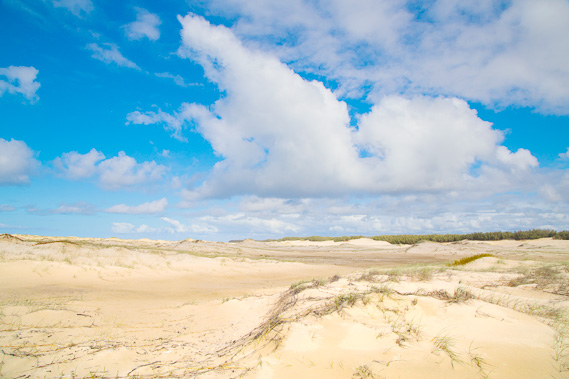 |
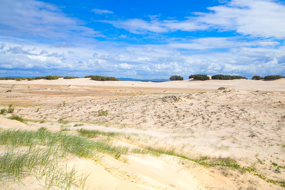
10:01 - Reaching the start of the dunes on South Stradbroke. I follow these dunes rather than the coast for a while, just to break things up a bit. It is a bit of a desert out here with large dried ponds in the sand. |
 |
10:14 - Some sand hills in the pristine sand windswept by the prevailing winds. |
 |
10:23 - I climb a sand hill approaching its layered summit. |
 |
10:26 - From the summit of the sand dune I can see a tour boat beached just a few metres away from where I was picked up to take me across to Crusoe Island what seemed like a long time ago. Obviously my path heading down South Stradbroke will be very different to the one I took along the bay. |
 |
10:39 - Looking back to the sand desert I just crossed and the hill I climbed (to the right). I stop here for a late lunch. |
 |
10:41 - Looking back to North Stradbroke. I don't think there will be any rain today with a reasonable view all the way back to Point Lookout. |
 |
10:47 - The tourists come over the hill exploring the dunes. No doubt they will come out here to the beach, so I decide to set off towards North Currigee where I am aming for tonight. |
 |
10:57 - The beach goes around a few gutters, but its good to be on hard sand again now the tide is going back out again. It should be straight forward the rest of the way down to the camping ground. |
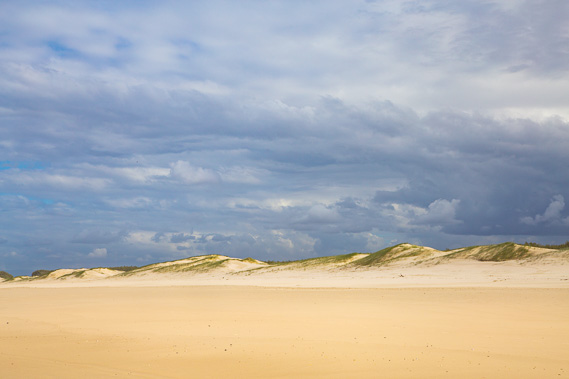 |
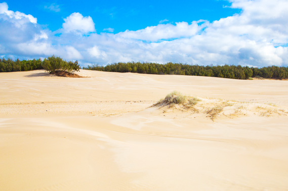
11:01 - The rolling sand hills stand out under the thick clouds. |
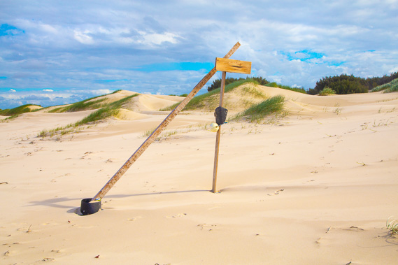 |
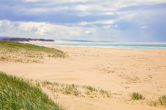
11:23 - An interesting sign without any words. Perhaps this is a local's fishing spot, or a sign pointing to buried treasure. Here I realise there are no four wheel drive vehicles or tracks on this beach. It's very quiet compared to North Stradbroke and Moreton Islands, making this (in my opinion) the best of the islands hiking around. Moreton was also great for hiking, but there were a lot of four wheel drives hooning up and down the beach. The traffic is completely absent here. |
 |
11:57 - Clouds continue to fly overhead but there is no rain. |
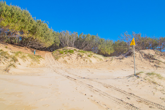 |
12:18 - I eventually reach the road track crossing the island to Tipplers village. From here the camping ground I stayed at fifteen days ago is just one kilometre away along this track. |
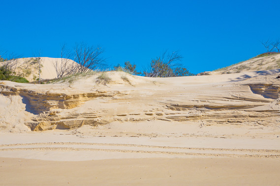 |
13:05 - I continue down the coast, passing wind blasted sand cliffs showing the layers deposited by past tides when this area was being built up. The clouds clear as quickly as they had arrived this morning. Another gentle westerly is blowing, adding a surprising amount of windchill to the twenty degree midwinter air. |
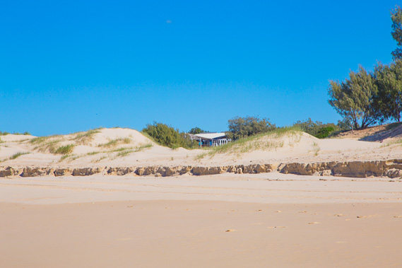 |
13:43 - I spot the first sign of civilisation since leaving Point Lookout yesterday morning. This is the Couran Cove Surf Club about a kilometre's walk across the island from the resort. I'm making very good progress towards North Currigee. |
 |
13:49 - I pass a local fisherman looking back up the coast, with North Stradbroke very disant now A vehicle has come out from near the surf club, the first I've seen on the island, no doubt belonging to a local. |
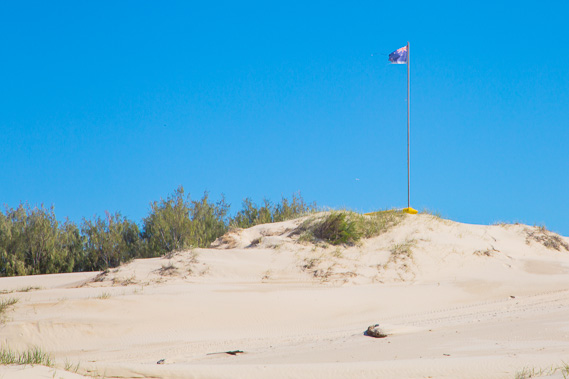 |
14:05 - A large flag just south of the surf club telling wanderers where to take the track back to the resort. |
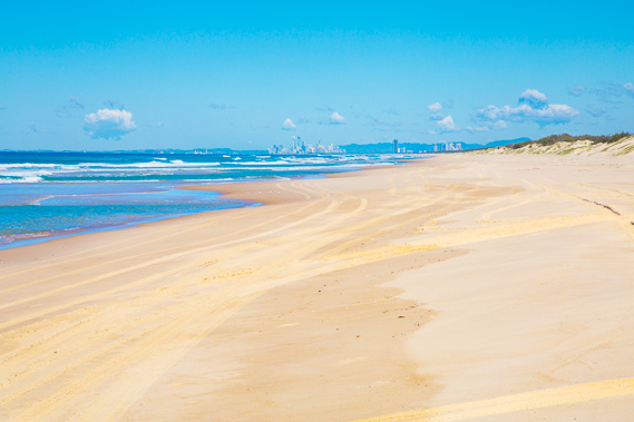 |
15:07 - The Gold Coast city is looking a lot closer now. I'm aiming to reach the city around lunch time tomorrow. |
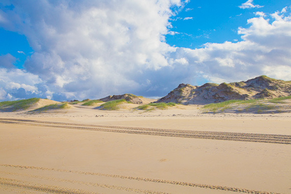 |
15:44 - More clouds are building as I pass more interesting sand hills in the mid afternoon as the shadows in front of the hills start drawing towards the beach. |
 |
15:52 - Climbing to the softer sand of the high tide level. Point Lookout has completely disappeared in the soft salt haze. |
 |
16:20 - Large clouds go over the Gold Coast as I reach the entrance to the short road track heading across to North Currigee. I decide to stop here to watch the sunset. |
 |
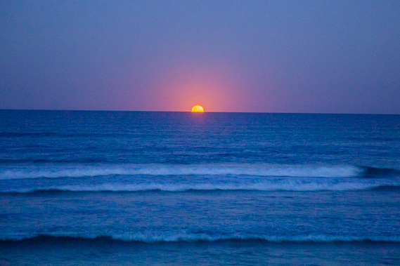
16:29 - The sun seems to drop undramatically over the horizon at the 4:58PM sunset. |
 |
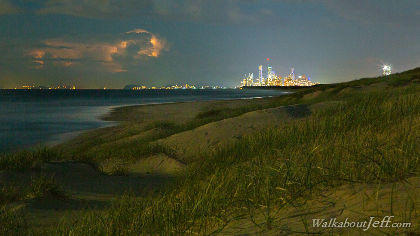
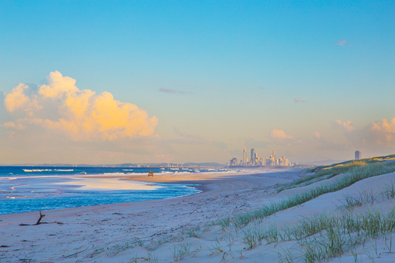
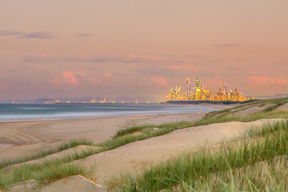
16:47 - But the setting sun captures over the clouds behind the Gold Coast. I can see down to Coolangatta on top of the sand hills. This is my first visual of the end of the 52 day trek. |
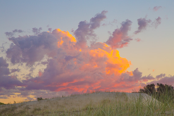 |
16:58 - Burning clouds behind me as the sun sets over the horizon behind the island. I wonder what it would look like over the bay from the camping ground? |
 |
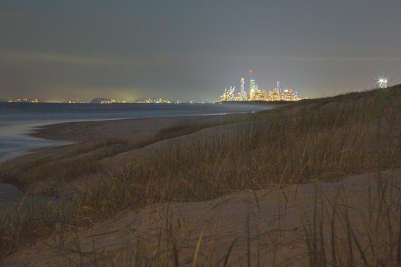
17:28 - The city lights up at last light in this long exposure shot. This time tomorrow I'll be right in the midst of the city. It will be very chaotic compared to the serenity of this peaceful location. |
 |
17:39 - The full moon rises. |
 |
17:54 - Darkness over the Gold Coast as a small thunderstorm crosses on the other side of the city. I can clearly see the city centre, and the dark outline of Burleigh Head, and to Coolangatta. From here I return along the sandy track back to the camping ground under the light of the full moon. |
|