This week in South East Queensland
24 - 30 June
TODAY I travel in time, starting at the remote South Stradbroke Coast which resembles the Gold Coast before the 1910s. In the decades since, houses have appeared, and replaced by high rises. These in turn are now being replaced by spectacular sky scrapers of glass towering high over the beach. I experience these massive changes in time in a single day after so much time hiking remote beaches.
Today's trek starts at North Currigee, from where I spend the early morning hiking the remote coast to the bottom of South Stradbroke Island, and cross over the cut to The Spit, where it becomes increasingly croweded as I approach the middle of the Gold Coast City. I head into Surfer's Paradise and head up to the top of its tallest building for the sunset.
Today's Journey
Distance hiked today: 17.4km
Total distance hiked to date: 1079.7km
 |
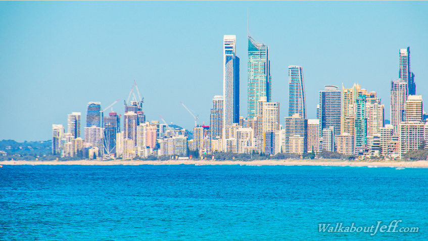
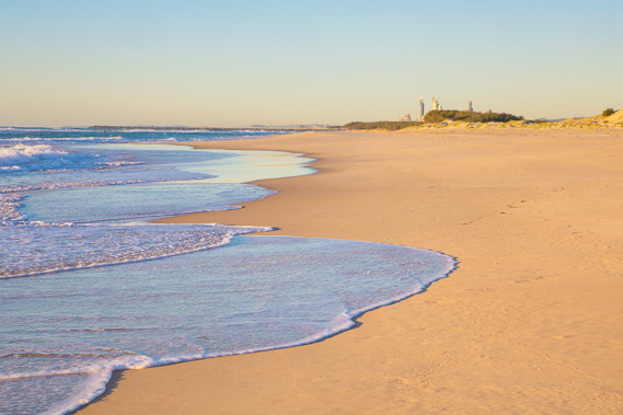
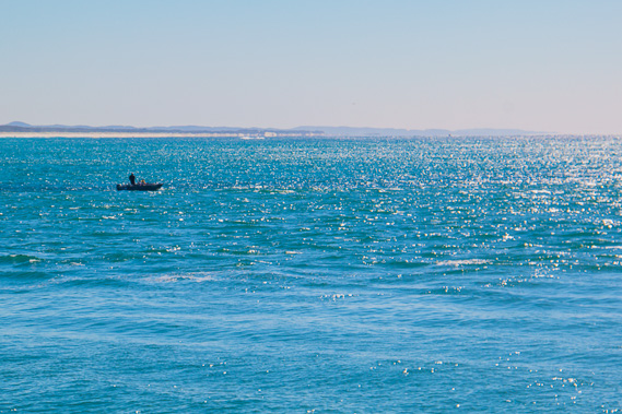
05:17 - Returning to the beach before first light. The Gold Coast is a beacon leading the way from this lonely beach. |
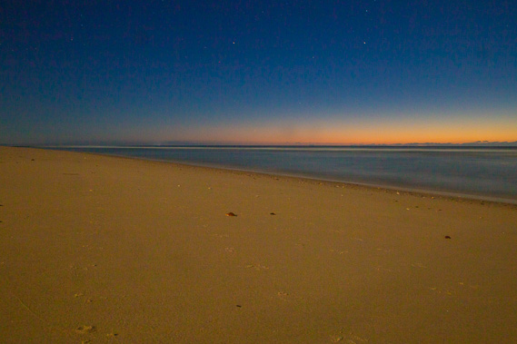 |
05:29 - First light over the sea with only a little bit of cloud out over the edge of the continental shelf. Here the continent drops off into the deep ocean for only a couple of hundred kilometres before rising again to the submerged part of the sunken continent Zealandia. This part of the continental shelf is not as steep as expected due to an enormous underwater landslide which collapsed the edge of the continental shelf. Parts of it have the potential to further collapse bringing a large tsumami to the coast. Fortunately these events only happen around once in a million years at worst. |
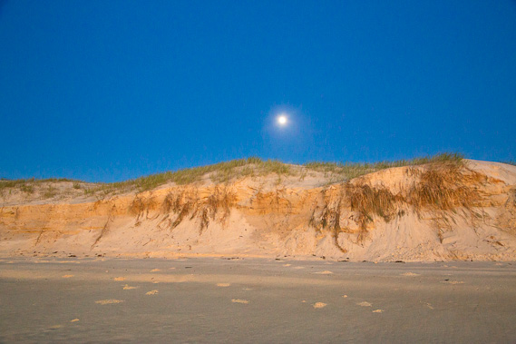 |
06:10 - The full moon hovers above the sand cliffs dropping towards the horizon. As in other parts of the world, the sun crosses the sky low in winter and high in summer. The moon on the other hand crosses the sky high in winter and low in summer, making last night very bright. |
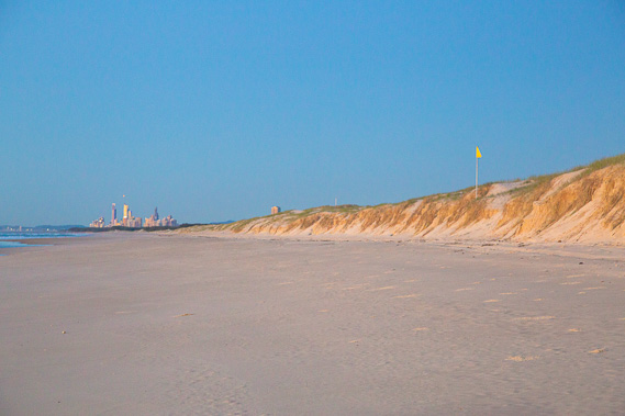 |
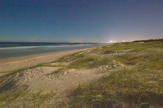
06:11 - Reaching the track crossing over the narrow island to South Currigee only a few hundred metres away. The Gold Coast is getting closer. |
 |
06:36 - With moments before the sun rising, the buildings of the Gold Coast are already gleaming with golden sunlight. The closing scene of the movie Voyage of the Dawn Treader (Narnia) was filmed here. |
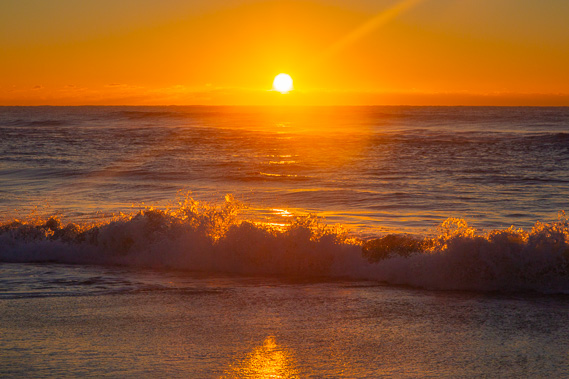 |
06:38 - The rising sun captures the breaking waves once it has risen above the clouds. The water temperature is still well over 20 degrees at this time of year so there will be a lot of surfers heading out along the Gold Coast now. In this still remote location, I have this section of the beach to myself, but not for much longer. |
 |
07:01 - The tide is starting to come in. This is the last morning the tides dictate my pace. Once I'm across the channel onto the spit I'll have solid walking tracks to follow should the sand of the beach be too soft over high tide. |
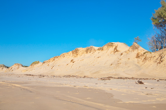 |
08:11 - Passing the point where I crossed the island on the way up seventeen days ago. This sand hill is mostly eroded soon to completely diappear. |
 |
08:23 - A few early morning surfers who don't like the crowds of the Gold Coast come up here to the island for more private surfing. The breakwater north wall of The Cut is now visible down the beach. |
 |
08:24 - A sand pump outlet sending sand from the channel out to here so it can continue its journey up the coast. |
 |
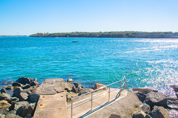
08:28 - The wall breakwater at the bottom of the island keeping the sand out of The Cut. |
 |
08:31 - Looking across the Gold Coast seaway from the top of the rock wall. There is another rock wall running along the north side of The Spit on the other side. |
 |
08:33 - Last look from the rocks along the very long beach I've hiked along the past three days from Point Lookout now too distant to view. Although artificial, this wall is the first solid rocky ground I've stood on since leaving Point Lookout 59 kilometres ago. |
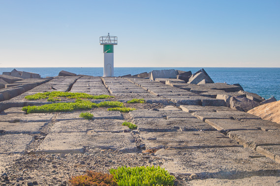 |
08:35 - The navigation light at the end of the rock wall. |
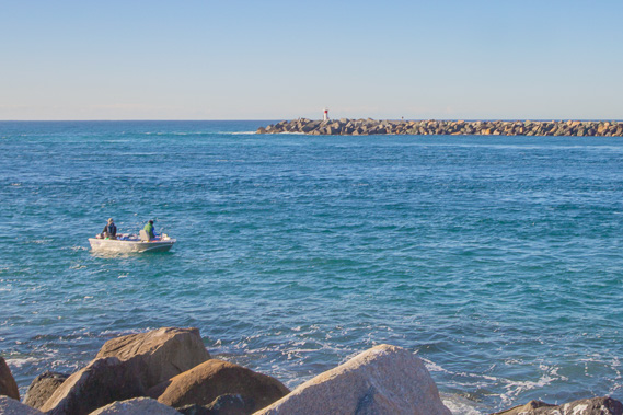 |
08:36 - Boat entering The Cut between the rock walls on either side keeping the channel deep. |
 |
08:42 - Heading across the channel looking over to Breakwater Island and parts of the northern Gold Coast I walked along on my final day down western Moreton Bay 18 days ago. |
 |
09:11 - Back on mainland Australia at the top of The Spit after hiking on islands for the past seventeen days. From here I look up to the western side of South Stradbroke Island and along southern Moreton Bay. |
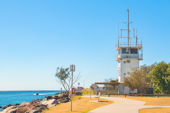 |
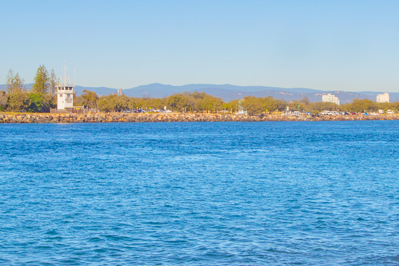
09:16 - The Seaway Tower at the top of The Spit monitoring the traffic going through The Cut. |
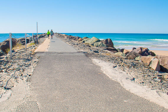 |
09:25 - Walkway along the top of the rock wall, noticeably crowded compared to the islands. |
 |
09:30 - Looking back along the Stradbroke Islands zoomed in. The hills in the distance are the towering sandhills of North Stradbroke. |
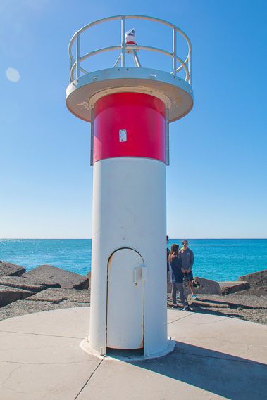 |
09:34 - Navigation light at the end of the seaway. |
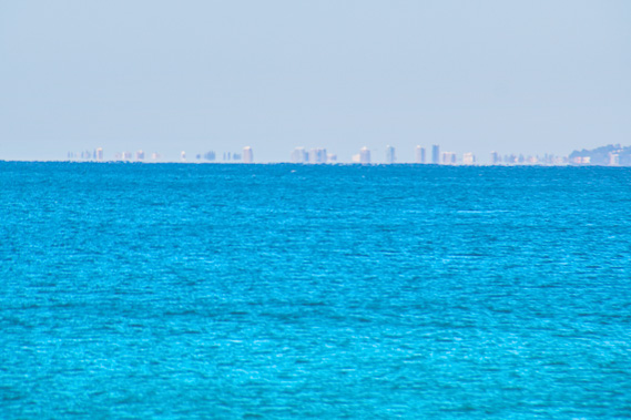 |
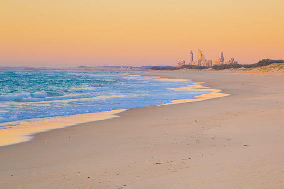
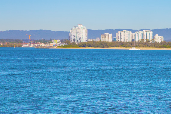
09:36 - View of Coolangatta in the distance. I will be passing the buildings in two days' time on the final afternoon of the trek. |
 |
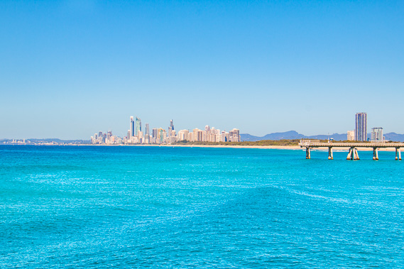
09:37 - Zoomed into Gold Coast city. I will be there in only a couple of hours. This is a bit hard to get my head around after so much wilderness hiking on the islands. |
 |
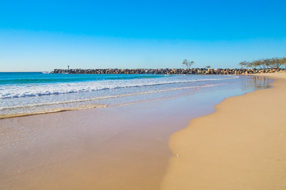
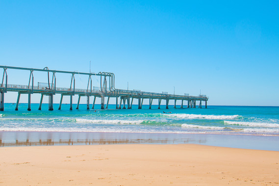
09:38 - Gold Coast and the South Port Pier as the low winter swell comes in. The Coral Sea is quite still most of the year. |
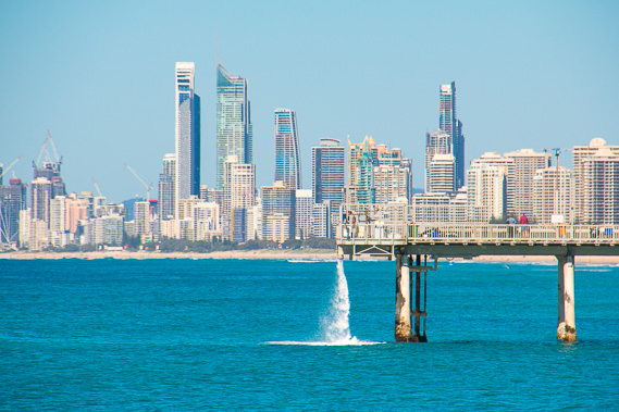 |
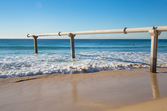
09:41 - Water and sand being pumped out of The Cut and deposited here from the end of the South Port Pier. |
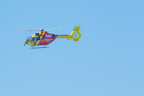 |
09:50 - One of the helicopters constantly heading up and down the Gold Coast creating a huge amount of noise pollution as it looks out for people in trouble and sharks. |
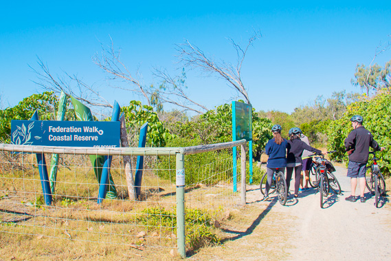 |
09:54 - The start of the Federation Walk heading down The Spit back to Southport. I take this track for a while before heading to the beach. |
 |
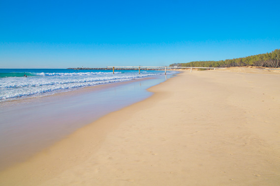
10:05 - Heading out on the pristine beach past the pier. |
 |
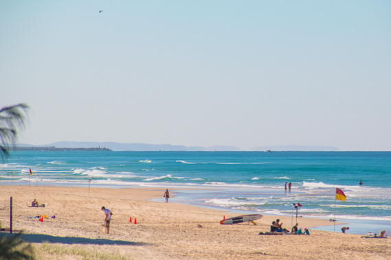
10:07 - Heading along the crowded beach towards the city centre. At least there aren't four wheel drives to contend with. This part of the beach allows dogs, so most people here are dog owners as most of the beaches along the Gold Coast are humans only. |
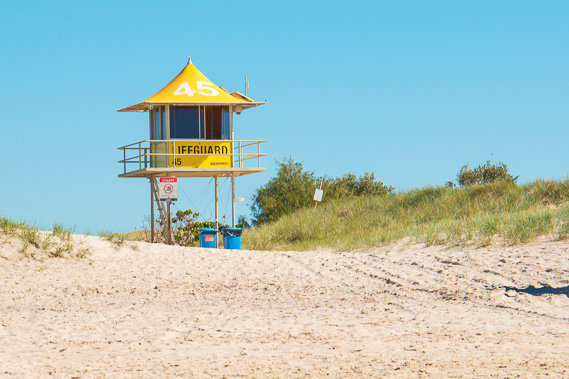 |
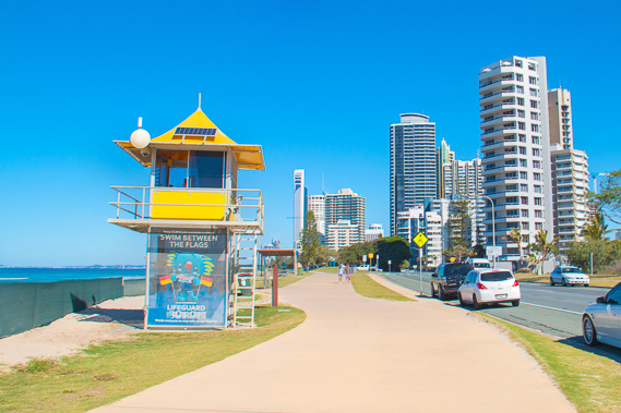
10:28 - A lifeguard tower - the first I have seen since Pelican Waters on the Sunshine Coast. This is tower number 45, counting down along the coast towards Coolangatta. Just 44 to go... |
 |
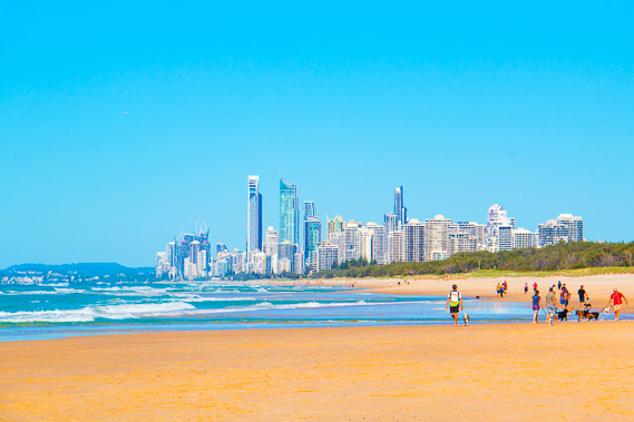
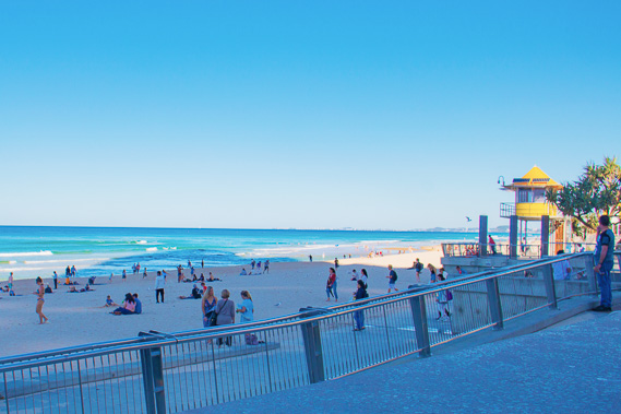
11:10 - The city draws near and the beach gets more crowded as I continue following the coast reaching the end of the dog beach. |
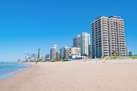 |
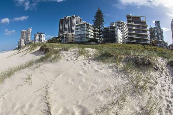
11:32 - Reaching the first of the apartment blocks extending along the coast. For many days, looking inland has just been sand dunes and scrubby bush. The landscape has abruptly changed. This part of the coast resembles what Surfer's Paradise would have been like in the 1970s with the high rises beginning to climb out of the narrow sand bar. |
 |
11:33 - The city on the sandbar is very close now. |
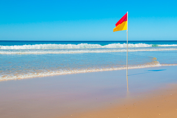 |
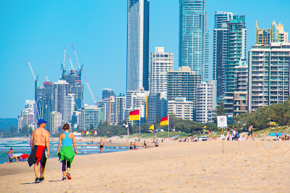
12:09 - A surf lifesaving flag. |
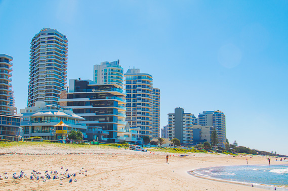 |
12:13 - Looking back along the beach at the newer apartment towers having been built in recent years. A large group of seagulls sun themselves on the beach. |
 |
12:25 - From here I leave the beach and following the start of the path towards the city. This path continues along the entire coast from here all the way to Point Danger. I no longer need to watch the tides, and don't have to walk along any of the beach anymore if I didn't want to. |
 |
12:49 - Zoomed in towards The Wall and hills of North Stradbroke which are now disappearing over the horizon. |
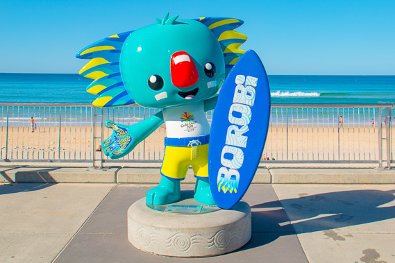 |
12:56 - A mascot left from the Gold Coast Commonwealth Games now permanently beside the beach. |
 |
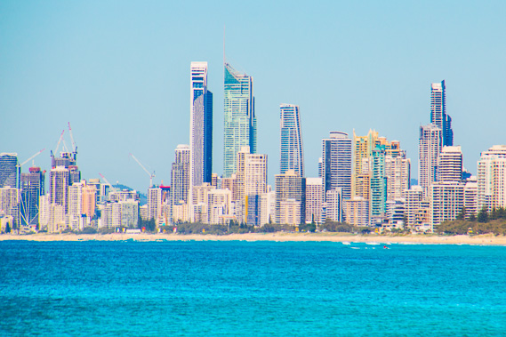
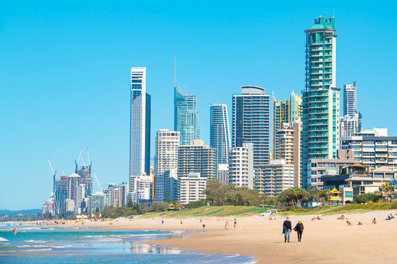
13:28 - I reach the main city of Surfer's Paradise. The first thing I notice are the long shadows cast over the beach as the mid afternoon sun drops below the towers. |
 |
13:29 - Looking back from the shadow are very impressively tall residential towers rising from the narrow sandbar. |
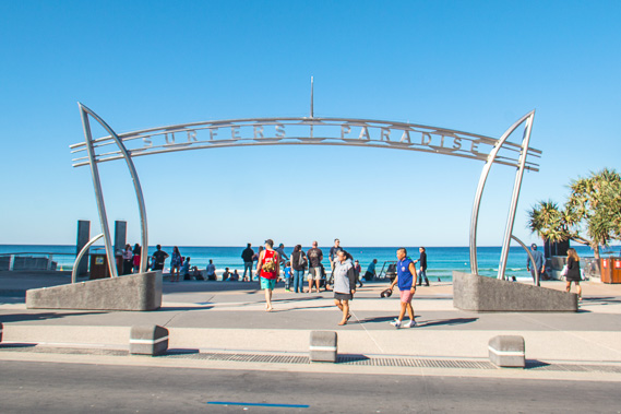 |
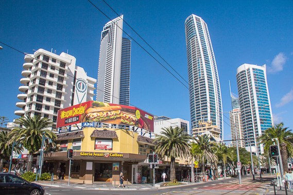
13:40 - The famous sign at the end of Cavill Street in Surfer's Paradise. I have arrived in the insanity of crowded paradise. |
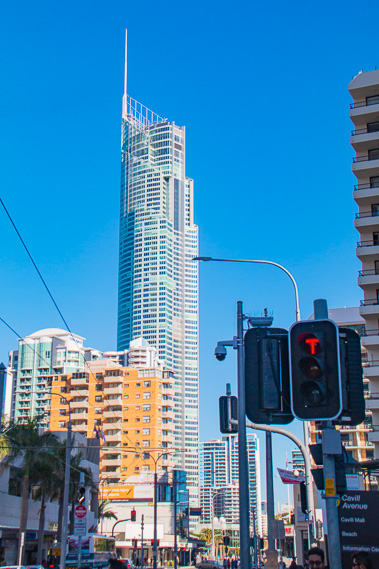 |
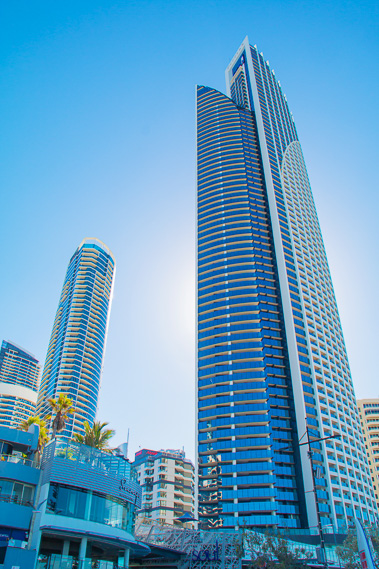
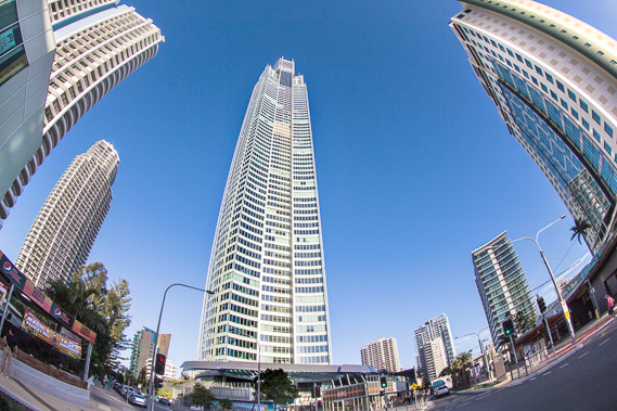
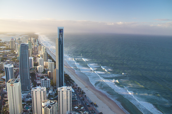
14:03 - The Q1 - Australia's tallest building, and once the world's tallest residential tower. There is a lookout near the top of the building from which I'm aiming to capture the sunset. |
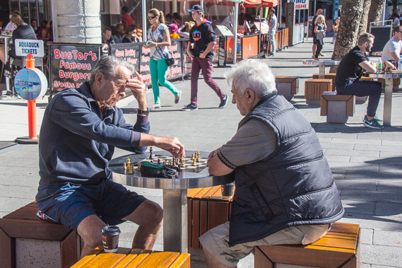 |
14:41 - Locals quietly playing chess in the middle of the otherwise frenetic Cavill Street Mall. |
 |
14:59 - Gold Coast buildings towering into the sky ready to catch the small clouds brought in by a sea breeze which has started blowing. |
 |
15:21 - I return to the beach in the late afternoon on the beach to watch the wind blow the soft sand into patterns. Although this beach is very busy and crowded, deadly brown snakes live in the grass between here and the buildings. |
 |
15:48 - The late afternoon air quickly cools, so I head towards the bottom of the Q1. |
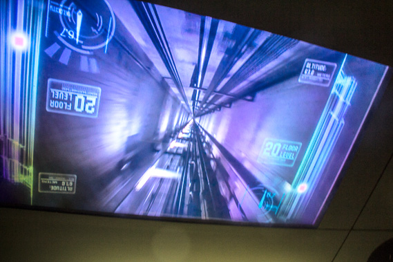 |
16:11 - Taking the elevator rising above the city to 238 metres above sea level, 47 metres short of the height of Mount Tempest on Moreton Island. This is the first elevator taken this trek. |
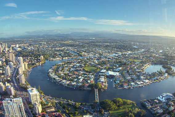 |
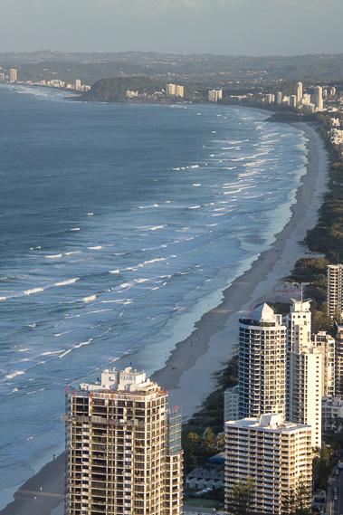
16:26 - View inland from the top of the Q1, with the Nerang River meandering behind the surprisingly narrow sandspit the city sits on. |
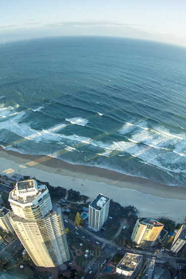 |
16:28 - Looking straight down at the sea. Below me is the Peninsula tower, the tallest building in the Gold Coast when I first moved here over 20 years ago. |
 |
16:32 - Looking south west zoomed into the Tweed Volcano. This enormous extinct volcano has solid rock extending towards the coast, continuing fifty metres below this sandbar. The foundations of the tall buildings sitting on this sand spit are dug into the solid volcanic rock. If it were not for the rock, it would be almost impossible to build these towers on the soft sand. |
 |
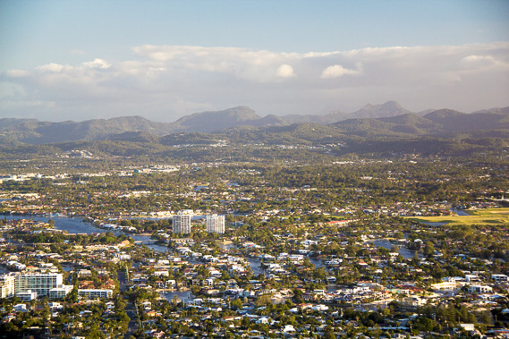
16:34 - Looking north back towards the Stradbrokes. Shadows of the buildings extend over the sea. Moreton Bay is seen on the other side of the very narrow sandspit in the distance before South Stradbroke Island widens. This sandspit is hardly the place to be in a large tsunami. |
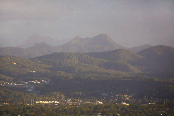 |
16:38 - Looking towards the twin peaks of Mount Cougal, and behind the peak of Mount Warning, the centre of the Tweed Volcano. Like the volcanoes of Point Lookout and Cape Moreton and Double Island Point, and the Glasshouse Mountains, this is all part of a volcanic system running down the length of Australia's East Coast following a hot spot that is now off the coast of Tasmania, as Australia drifts north. |
 |
16:39 - View to Burleigh Head, where I'm going tomorrow. This will be a shorter than normal walk as will the following day be. I want to make the most of the Gold Coast being the end of the trek. |
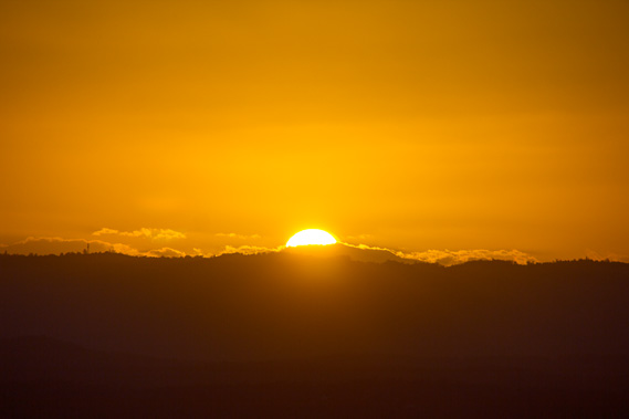 |
17:00 - The sun sets over Mount Tamborine. |
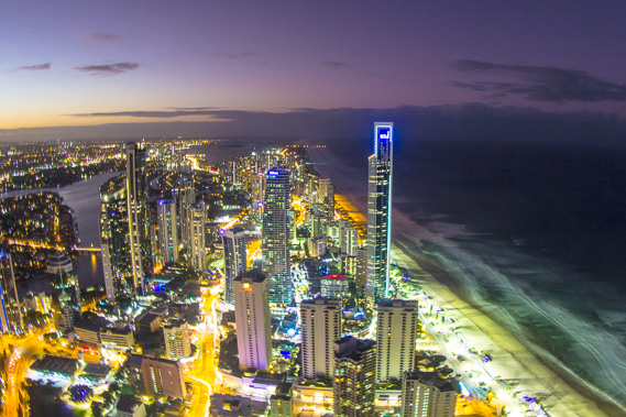 |
17:47 - The city lights come on. For the past three nights, these lights were the beacon where I was heading towards. Tonight its my noisy destination. Darkness falls, with the islands completely dark. |
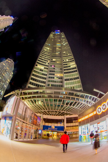 |
18:49 - Back down to earth at the bottom of the Q1. The winter air is quite cold now, expecting to drop to around ten degrees. |
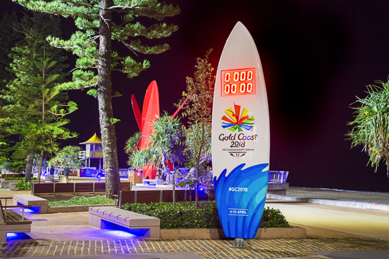 |
19:36 - The Gold Coast Commonweath Games countdown surfboard at the end of Cavill Street. |
|