This week in South East Queensland
1 - 7 July
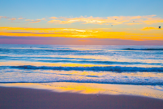
THE LATEST sunrise of the year finally occurs this week. Although we are past the shortest day, this is the hardest week to get up early in the morning as most mornings fall below ten degrees - the coldest part of night being just before the sun rises. It is around 6:40 AM when the sun does rise, making it a challenge to get started each day especially with most houses here not being very well insulated. After this week though, the sunrises will get earlier and less tortuous.
Today's hike starts at the bustling Surfer's Paradise, and continues southward along the coast amongst the crowds of morning walkers until reaching Burleigh Beach for lunch. From there I spent the afternoon exploring the forested Burleigh Head.
Today's Journey
Distance hiked today: 13.8km
Total distance hiked to date: 1093.5km
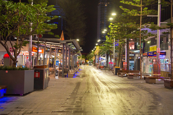 |
05:02 - The main street of Surfer's Paradise, Cavill Street. It is before first light with the street now washed and cleaned from the overnight partying ready for the new day. |
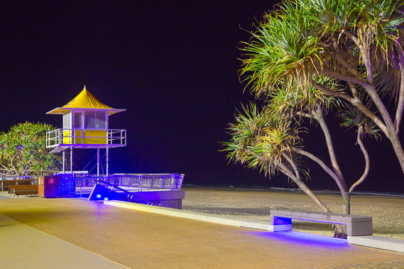 |
05:06 - The beach is still artificially lit with no sign of daylight. |
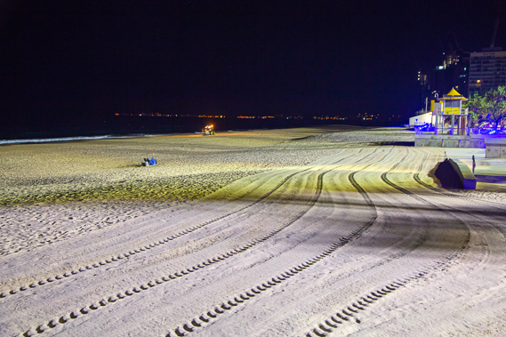 |
05:07 - A tractor sifts the sand along the entire beach clearing any rubbish ready for the new day. |
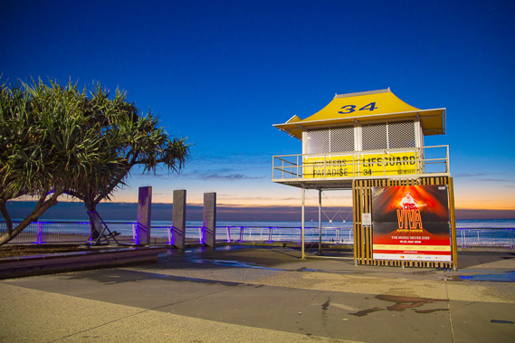 |
06:07 - First light of the day appears at life guard station 34 - another 33 to to today and tomorrow to Coolangatta. |
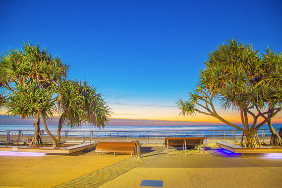 |
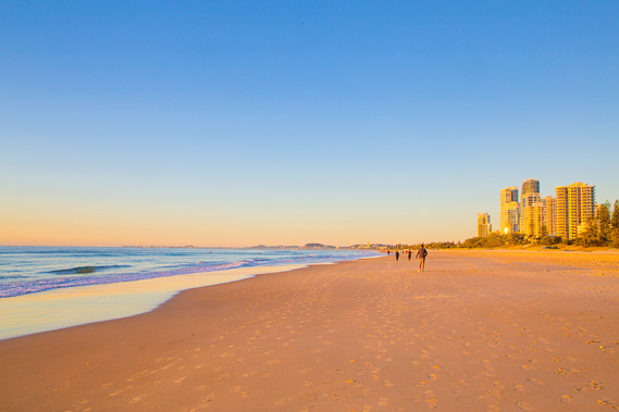
06:09 - The sky lightens between the pandanus trees. People are already out on the beach, so I start heading towards Burleigh. |
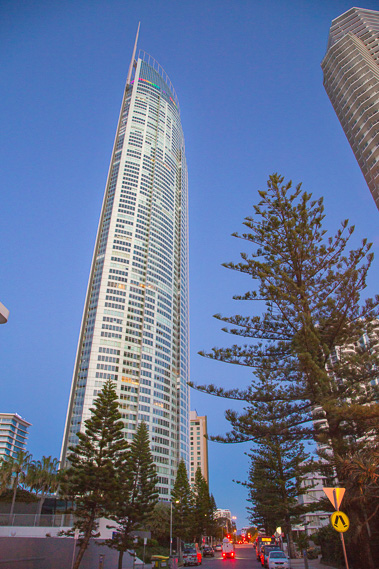 |
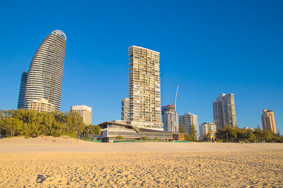
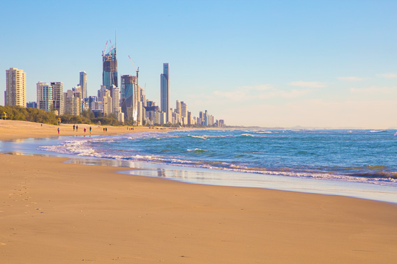
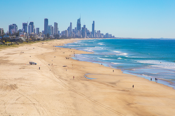
06:21 - Passing under the Q1. Opened in 2005, it was for a while the world's highest residential tower. |
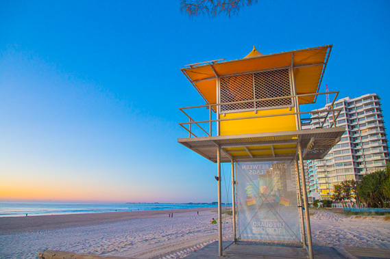 |
06:22 - I leave the footpath and head out onto the beach at lifesaving tower 33. |
 |
06:32 - The sky lightens over the sea as cloud lingers past the edge of the continental shelf. |
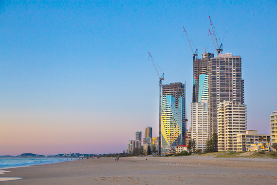 |
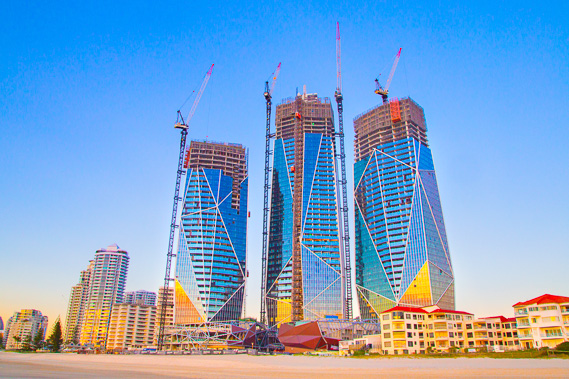
06:34 - New towers rising out of the sand bar. |
 |
06:35 - A lot of people come out of the residential apartment blocks onto the beach for their early morning walks. |
 |
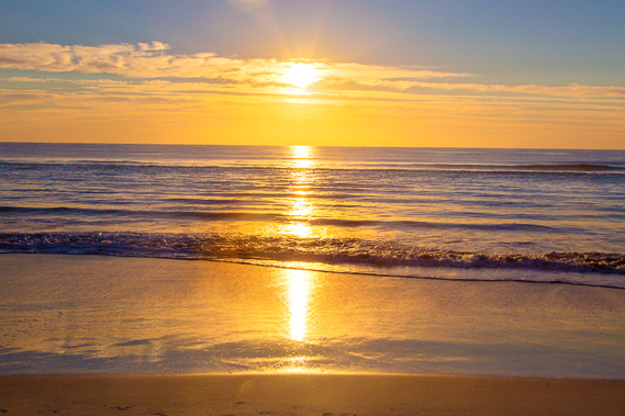
06:38 - The sun rises behind the distant clouds as seagulls fly past. |
 |
06:43 - The new towers brilliantly reflecting the sunrise to be. |
 |
06:44 - Kayakers paddling under the rising sun on the calm ocean. Although waves break on the beach, the water offshore is quite calm due to the lack of any big weather systems in the subtropical regions at this time of year. |
 |
06:52 - The rising sun streams across the beach and highlights the buildings. |
 |
07:03 - The sun filters through the clouds already heating the cool winter air. |
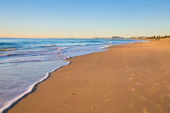 |
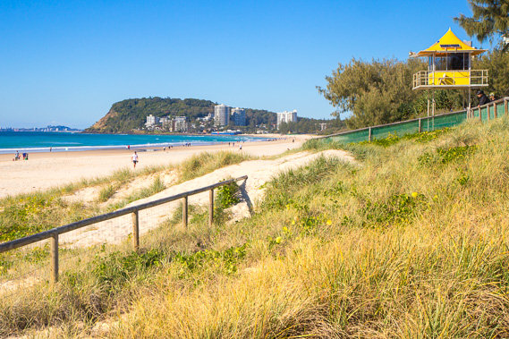
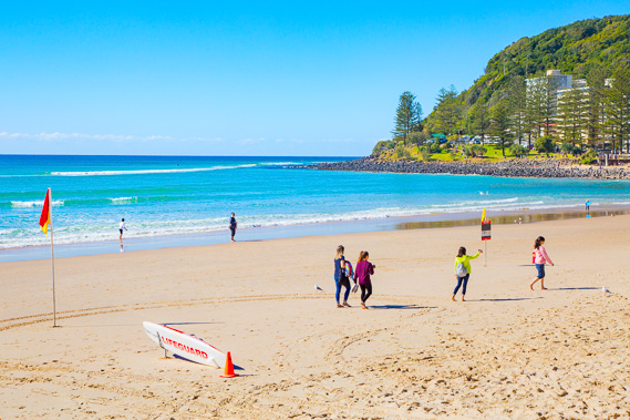
07:09 - The tide is beginning to rise as I look towards Burleigh Head where I'm destined today, and Coolangatta for tomorrow. I don't need the worry about the tide today, as the wide footpath continues along the low dunes above the beach. |
 |
07:25 - Zoomed into Coolangatta and Point Danger where I finish the trek tomorrow night. The point seems to hover over the water. |
 |
07:49 - More new high rises towering above the beach. There are lots of walkers now, but these are soon to be replaced with surfers and swimmers. |
 |
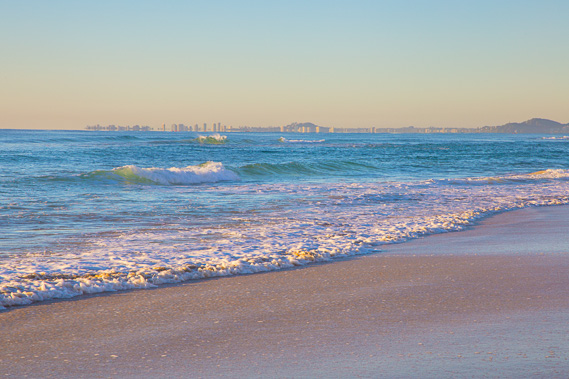
07:59 - Zoomed into Burleigh. Today is a relatively short and easy day as I have made very good progress along the remote ocean beaches in recent days. |
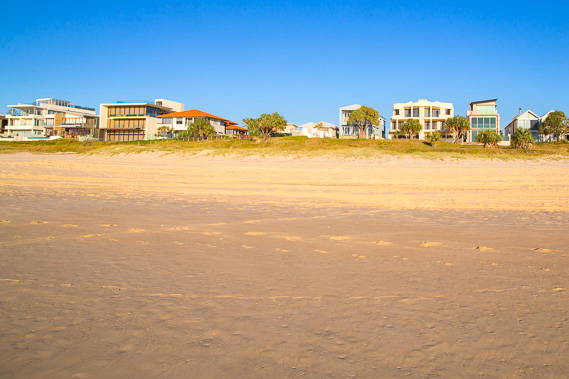 |
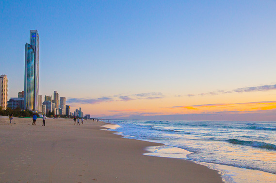
08:16 - Seaside houses making the beach look like Surfer's Paradise back in the 1940s and 1950s when it was an isolated surfing destination. Eventually people found out about it and the high rises went up. |
 |
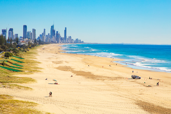
08:29 - The city is already a fair way behind behind me and lots of people are surfing in the cool winter morning. Even in the coldest part of winter, the sea temperature stays above twenty degrees. Most days the air temperature rises above twenty degrees even though it drops to about ten degrees at night. |
 |
09:02 - Zoomed into Burleigh before leaving the softening beach to follow the path running the entire length of the coast. The tide has come in enough to cover most of the hard sand now. |
 |
09:20 - Getting close to the first of several volcanic headlands forming part of the Tweed Volcano. |
 |
09:22 - Following the path above the beach at Miami. |
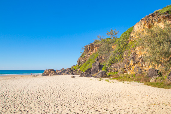 |
09:24 - At the edge of the rocky headland at Mick Shamburg Park. This is the first natural rock I have seen since leaving Point Lookout over four days ago. |
 |
09:27 - A steep stairway climbs the headland giving a good view back along the beach where I've walked over the morning. Looking in the distance the dark rock walls of the channel are visible as is part of the sandy beach of South Stradbroke Island. |
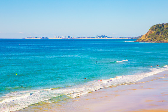 |
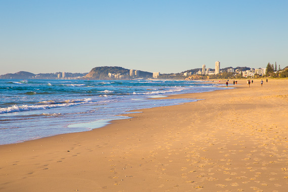
09:32 - Looking the other way and zooming in, Coolangatta is now clearly in view. |
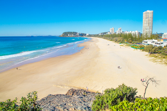 |
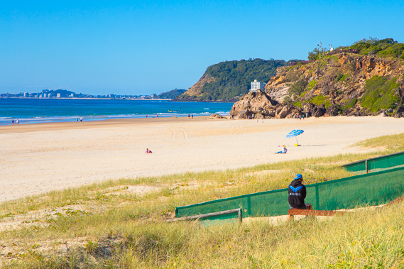
09:33 - View along the beach. Today I only need to reach Burleigh Head, but will be exploring the forest on the headland this afternoon. It is expected to cloud over this afternoon but there is no sign of it yet. |
 |
09:34 - Looking from the headland to the pointy summit of Mount Warning in the centre of the Tweed Volcano formation where these headlands have come from. This small headland is the northernmost point where the Tweed Volcano rock reaches the open sea. |
 |
09:35 - Last view of Surfer's Paradise from the top of the headland zoomed in. |
 |
09:49 - I head down from the headland continuing to follow the track. I get a brief view of Burleigh and its dramatic headland from the track in a break through the scrub. |
 |
10:26 - Getting close to Burleigh Head as the cloud begins to appear on the horizon, and starts coming over the Tweed Volcano behind me. |
 |
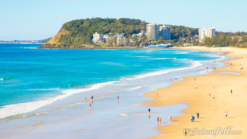
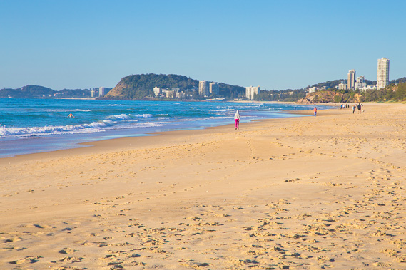
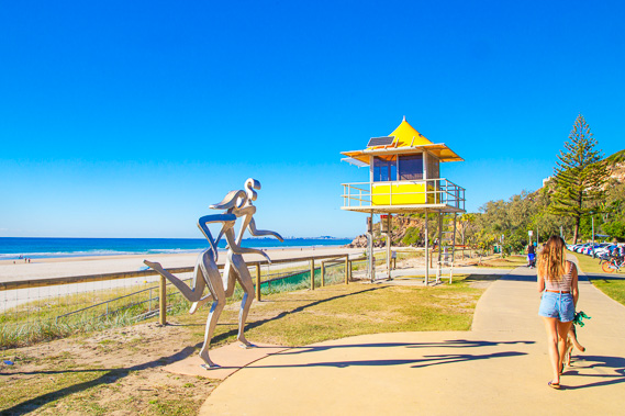
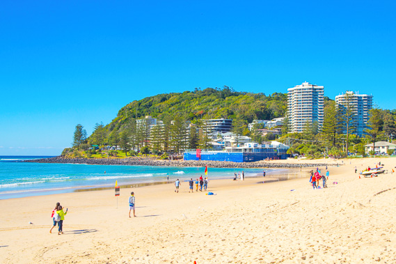
10:27 - Burleigh Beach. This is a relatively sheltered swimming beach with its spectacular headland making a great backdrop. All the other beaches since Point Lookout have not had headlands at either end to frame them nicely like this. |
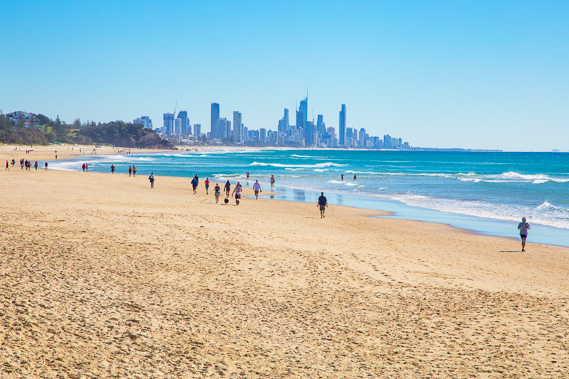 |
10:48 - View back to Surfer's Paradise from Burleigh Beach. It is already looking distant against the pristine blue sea just before the cloud comes over. |
 |
14:26 - After a long lunch break on the beach, I head into the forest at the start of the headland to explore the national park. |
 |
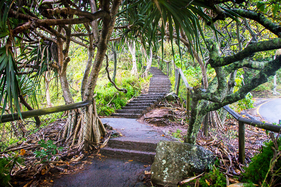
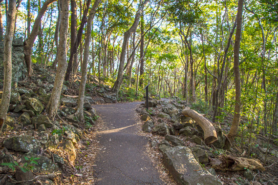
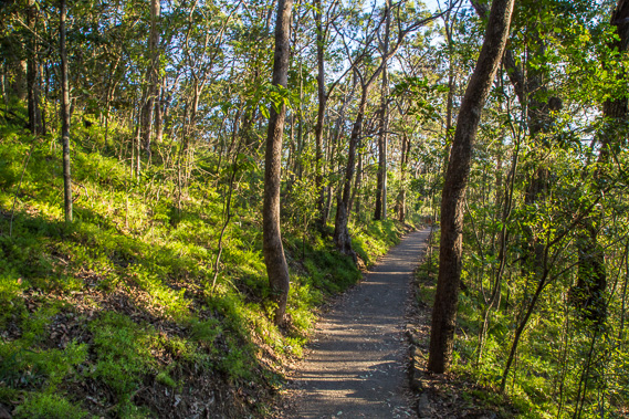
14:36 - The moderately rising track is well graded. The cloud has fortunately thickened enough to occasionally put a complete stop to the mottled sunlight coming through the low canopy. |
 |
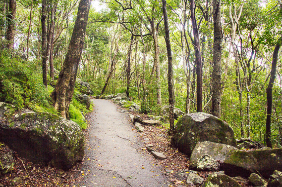
15:05 - The terrain becomes steep but the sealed path over the back of the headland is in very good condition. |
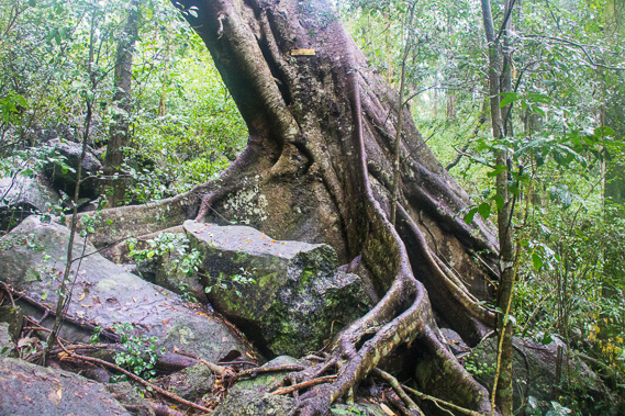 |
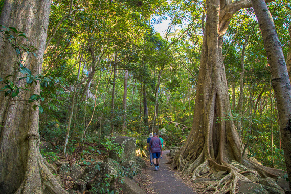
15:24 - A tree rooted in the crumbling volcanic rocks. Burleigh Head is the remains of what was once a particularly hard block of volcanic rock (possibly a dyke or sill) which has resisted erosion as the rest of the volcano has worn down over the millions of years following the last eruption. |
 |
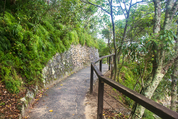
16:08 - The track continues to wind uphill now heading northward across the front of the bluff. I hear the sea gently roaring below. |
 |
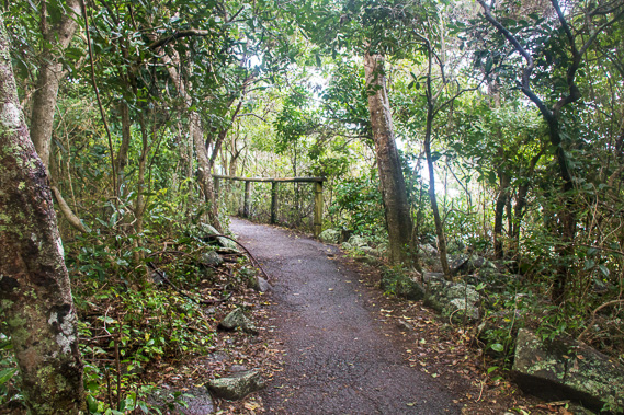
16:09 - More people on the track as the afternoon sun starts to get low and shines through the breaking clouds. |
 |
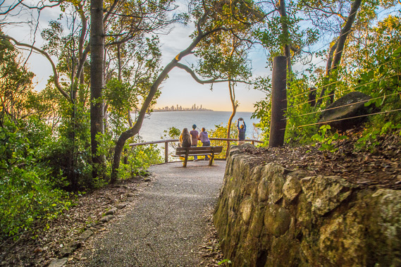
16:12 - Nearing the lookout at the top. |
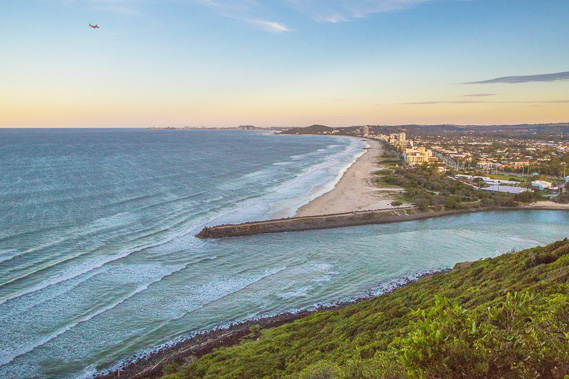 |
16:24 - View from the lookout as a plane comes in to land at Coolangatta Airport and the clouds sweep across to the west. The rest of the trek is clearly visible from here. This time tomorrow I will hopefully be at the end at Point Danger. |
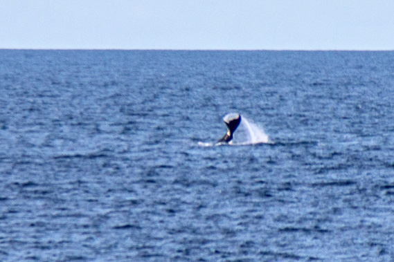 |
16:26 - A whale migrating north from Antarctica passes the coast. Tour boats go out from the Gold Coast and from Tangalooma taking whale watchers out with them to get a closer looks. |
 |
16:30 - Heading down the track back towards Burleigh. |
 |
16:40 - A lookout on the way down with no view - the trees have grown too much. |
 |
16:43 - Reaching the second lookout where I hope to watch the sunset, but the sun is too far to the left. I decide to leave the lookout and head back towards Burleigh Beach for a better view. |
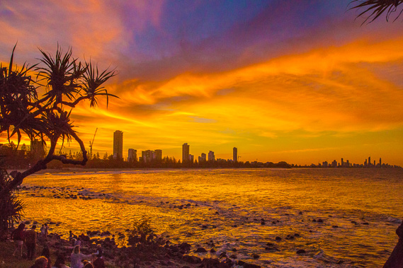 |
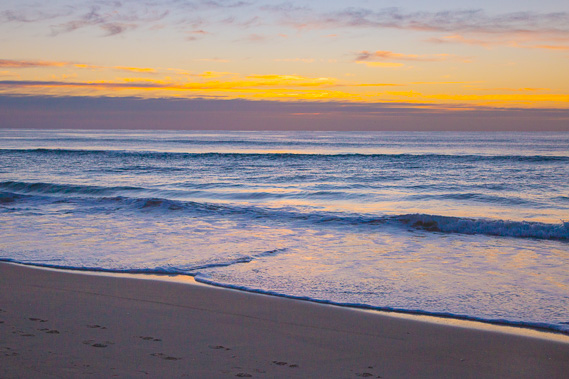
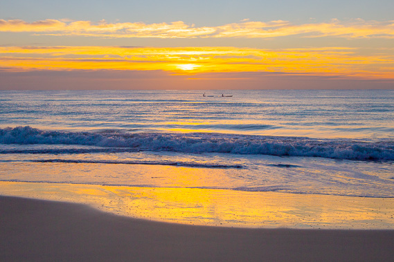
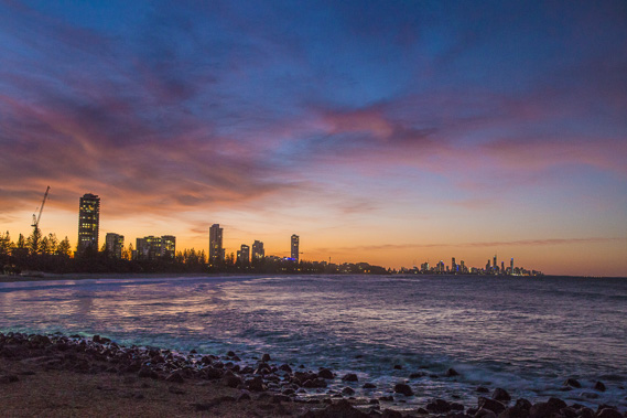
17:03 - I reach the bottom of the track just in time to view this amazing sunset. The sun has gone behind the high jet stream cloud but has turned it into fire over the sky. This is a spectacular evening view of the Gold Coast. |
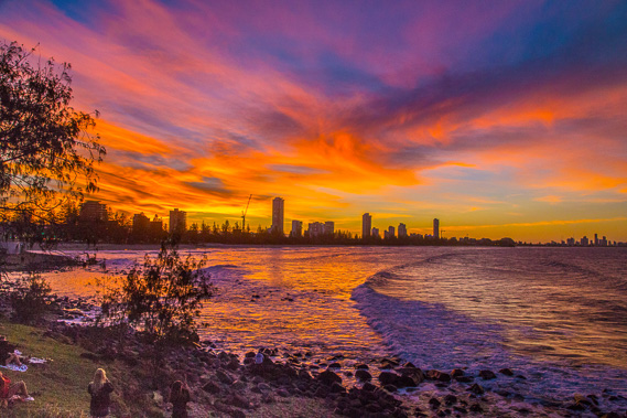 |
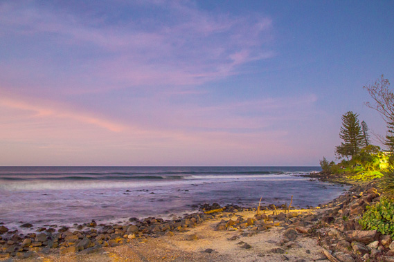
17:15 - The sky darkens as lot of others watch the amazing sunset on my penultimate night exploring the coast. |
 |
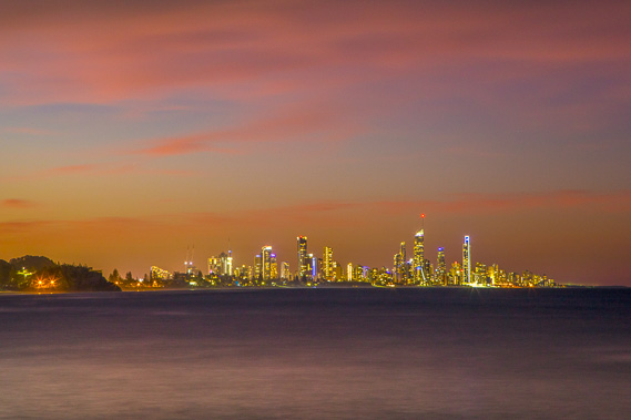
17:31 - The lights come on in the towering apartment blocks as the fire in the sky burns out. I need to head back to Burleigh for the night. |
 |
17:33 - The waves continue to break at the start of the headland as the light quickly diminishes. |
 |
17:48 - Surfer's Paradise glowing with its lighting, having seen it from above last night, and from the other side the previous two nights. |
 |
18:02 - Returning about half a kilometre to a lookout over the beach. Lights of the southern cross and the pointers are on the lookout. These stars have guided me south over much of this trek, and I have just one more day to go. |
|