|
||||||||||||||||||
|
||||||||||||||||||
Home > Diaries > 2000 > 5 |
||||||||||||||||||
|
||||||||||||||||||
|
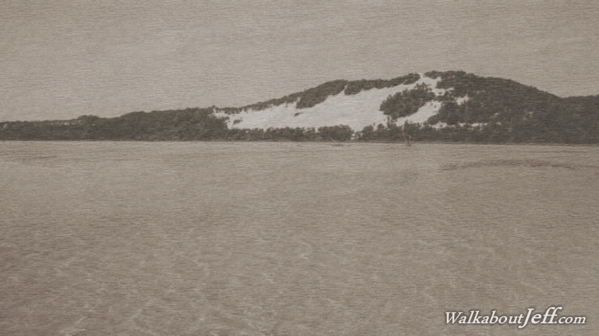
I DISCOVERED the Combie Trader was a more convenient and cheaper way to get across to Moreton Island, so decided to pack a backpack, get a bus to Scarborough Boat Harbour and catch the ferry from there. This is my first solo trip across the bay to Moreton Island, having seen how pristine it is in my previous trip about a year and a half ago. There was a bit of a wait inside the terminal as all the vehicles rolled on board the large flat platform of the ferry. Finally once all the vehicles were on board, those of us not taking vehicles across boarded along the bow ramp and headed upstairs to the observation deck above the vehicles. With three blasts the ferry took off and started backing into the harbour, with little space to turn around before the rows of yachts. Once backed out of the dock, it turned around and started heading out of the harbour, passing the long rock wall sheltering it from the low swells of Moreton Bay. Gannets sat on the large marker buoys directing our passage out into the bay, negotiating along a relatively deep channel in between the shallow mud banks on either side. The tide was mostly in hiding the banks beneath the murky water. The boat gradually turned towards the distant blue profile of the Moreton Island sandhills, amongst the tallest in the world. We set off passing Redcliffe Peninsula out into the water towards the northern end of Moreton Island. To the left ahead of us was the very low profile of Bribie Island. The water deepened but remained murky as we started gaining distance from the Redcliffe Peninsula, chugging along at a much slower speed than the Tangalooma Flyer last year. As we crossed the bay, we passed numerous submerged sand and mud banks breaking some of the bigger small waves. We remained in a relatively deep channel perhaps dredged. About half an hour after leaving Scarborough I could spot a very thin line of the golden beach on the horizon. The dark blue mass above the horizon was the thick eucalyptus forest covering much of the island apart from a few obvious sand patches around Tangalooma, and further south at Big and Little Sandhills. The whole island was stretched out before us but still distant, sheltering Moreton Bay from the ocean swells beyond. Another hour passed as we headed across the bay, passing the southern coast of Bribie Island. The thin yellow line along the horizon was a lot more obvious now, and it stretched to beyond the northernmost sandhills of the island, suggesting a flat expanse over the northern area where we were heading. The shallow waters suddenly gave way to a wide deep channel with large navigation piles following the path of the Brisbane River when it flowed through here during the last ice age when the sea level was a lot lower. This was the main shipping channel doubling back from off Tangalooma towards the eastern shore of Bribie Island. Once across the deep channel, the bay became shallow again, but the water was very clear and coloured a vibrant turquoise. We passed a shallow sand bank of golden sand appearing green under the water. Ahead I could see the landing at Bulwer, with the village hidden in amongst the trees of the low plain at the base of the sandhills. Even the forest of the sandhills was quite obvious. Looking south the headlands around Tangalooma appeared quite steep. After crossing another deep channel, we reached Bulwer, just short of the rusting remains of several shipwrecks. The bow of the ferry lowered as it ploughed into the shore. All the vehicles were let off onto the soft sandy beach before those of us who walked on walked off the ferry. There were a couple of entrances into the Bulwer Village. I will be returning here in about a week for several days, but decided to start heading along the northern coast straight away as I had quite a distance to hike. The sun was strong under the almost completely cloudless day as I set off along the beach rounding Comboyuro Point where I'll be camping in a week. Once around the point an increasing swell started breaking on the beach as I followed it close to the tall eucalytpus forest around a small sweeping bay. Once at the end of the bay, I reached the mouth of Dog Creek, a stream of water flowing into the ocean from the swamp in the forest. From here I started to walk along the desert like Taylor Bight, with enormous amounts of driftwood covering the soft sand. I stayed close to the beach to make quick progress towards the rocky headlands of Cape Moreton, now visible about eight kilometres away. The broad sand gradually narrowed to a series of deep pools created by the sea ever changing the coastline. I continued hiking for another hour before reaching the expanse of the Heath Island inlet. By now the tide was mostly out so it was a relatively dry crossing over the hard dark sand under several large sandblows. Once across the inlet, I continued following the beach passing the distinctive Yellow Patch and further until reaching the sand road crossing the rocky headlands of Cape Moreton. After the long beach walk, the constant uphill of the road was a little difficult, but I soon got into the rhythm. It was quite a long ascent getting close to the cape lighthouse before a steep drop into the ocean beach below. The downhill section of road was very rough and fortunately I didn't encounter any vehicles as I descended. Once on the main beach, I started following it southward. It stretched out about 35 kilometres to the top of North Stradbroke Island which was not at all visible in the slight haze coming off the ocean. After a couple of kilometres walking along the beach, I reached Spitfire Creek, where I rested for a while before continuing along the beach to about half way to Blue Lagoon where I found an entrance to a couple of campsites. Weary, I entered this entrance and found there was nobody else here, so I found a good campsite and pitched my tent, where I'll be based for several days. Here I rested until the early evening when I took a walk down to the middle of the Blue Lagoon campsite to fill my water bottles and return before darkness completely fell. |
||||||||||||||||||
|
||||||||||||||||||