Introduction to today's journey
Fraser Island, or K'gari as called by the local Butchulla People, stands magnificent as the word's largest sand island. The sand forming this island has been carried along the strong northward current from New South Wales over the past 750,000 years to be deposited here where the currents are not as strong. The sheltered northern end of the island marks the start of the Great Barrier Reef. The island is now national park protecting its unique rainforests, ancient dunes and pristine lakes making the island an adventurer's paradise seeking its untouched beauty.
Today's journey starts with a stop at Rainbow Beach where I explore Carlo Sandblow before joining a small tour group to head up to Inskip Point from where we catch a ferry across the channel onto Fraser Island. Once on the island we head north along the beach heading inland to Lake Mackenzie eventually reaching our camping ground at Dundubara.
Today's Journey
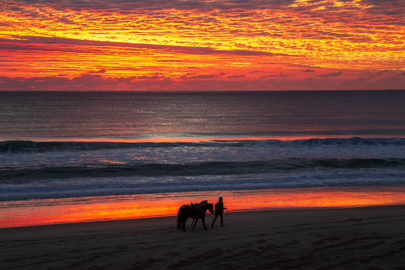 |
I start the day watching the spectaular sunrise over Rainbow Beach. A gentle swell breaks on the beach, famous for having Australia's longest surf break in ideal conditions. |
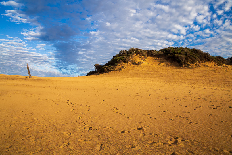 |
From Rainbow Beach village, I hike up the track to the start of the Cooloola Great Walk and reach the Carlo Sandblow a short distance up the track. |
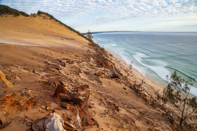 |
I head to the edge of the sand cliff looking over Rainbow Beach and look up the coast towards Inskip Point before hiking back to the village. |
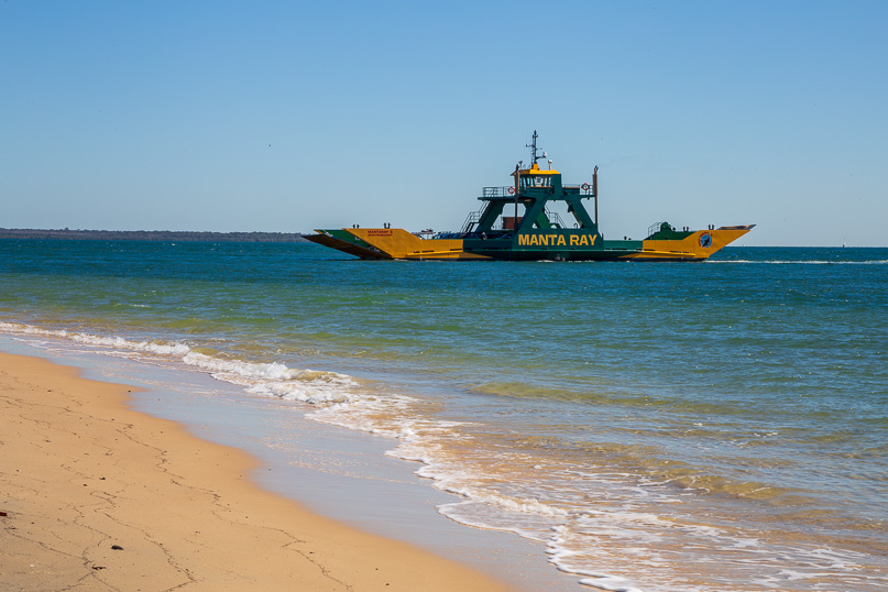 |
Meeting a small tour group at Rainbow Beach, we head north, reaching the top of Inskip Point. Here we catch the ferry across the channel to Fraser Island. |
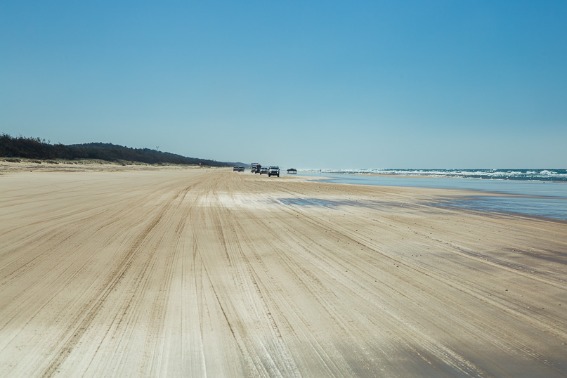 |
Travelling along the well worn western beach of Fraser Island, we progress northward along the coast. |
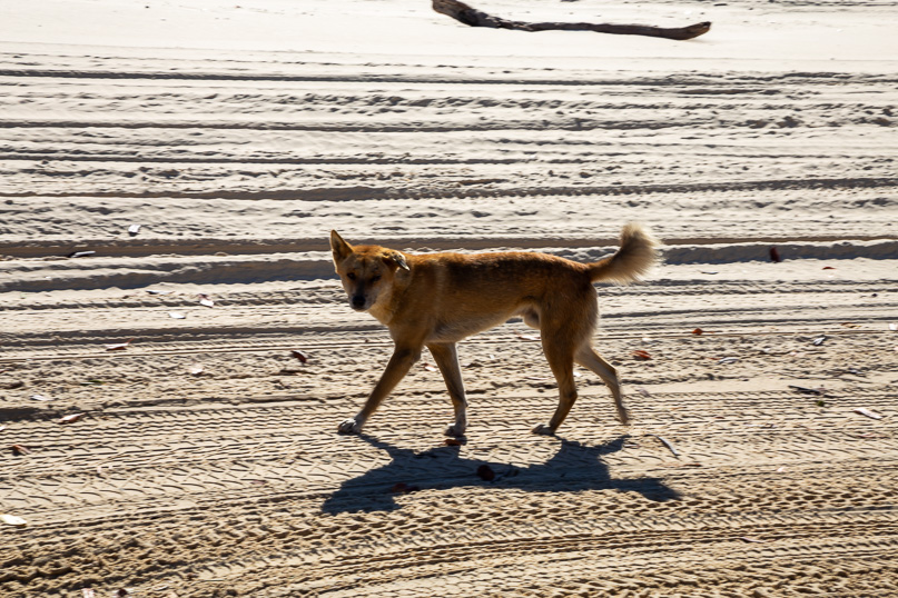 |
The occasional dingo fearlessly patrols the beach. |
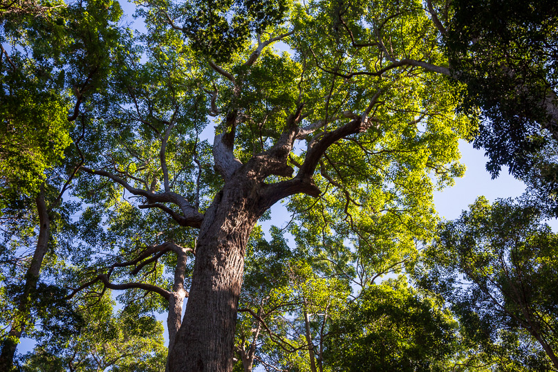 |
Heading inland from the beach, we follow a rough dirt track through the forest of ancient trees. This is a massive Syncarpia hillii which has a trunk 223 centimetres thick. |
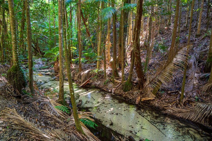 |
We eventually reach Central Station, where all the tram lines of the island once met. Here we stop for lunch. From there we walk down to the nearby crystal clear Wanggolba Creek through a large stand of rainforest, unique in these sand hills. |
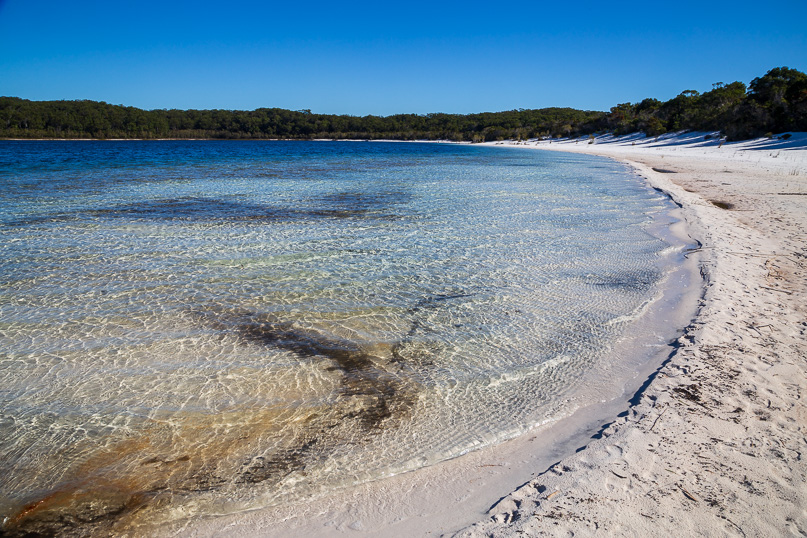 |
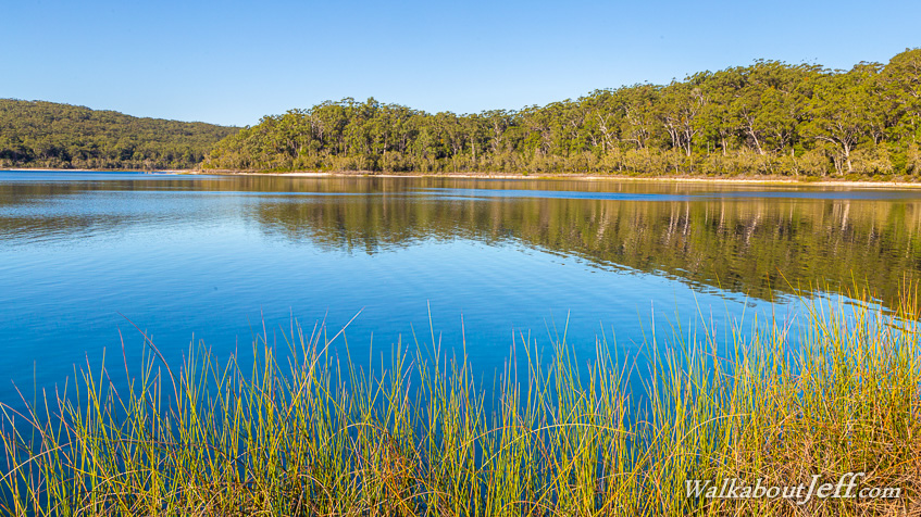
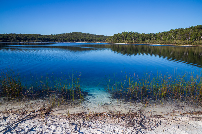
Heading a few more kilometres inland, we reach the pristine Lake Mackenzie, filled with rain water contained by the fine white sand. I hike around part of the lake. This is the clearest coastal lake I have ever seen. |
 |
I follow the water's edge along the pure white sand for about half way around the lake. |
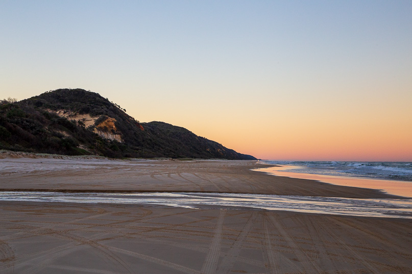 |
From the lake we head back along the rough sand track towards the beach. We reach the beach and continue heading northward crossing large streams braiding over the sand as the sun sets behind the island. |
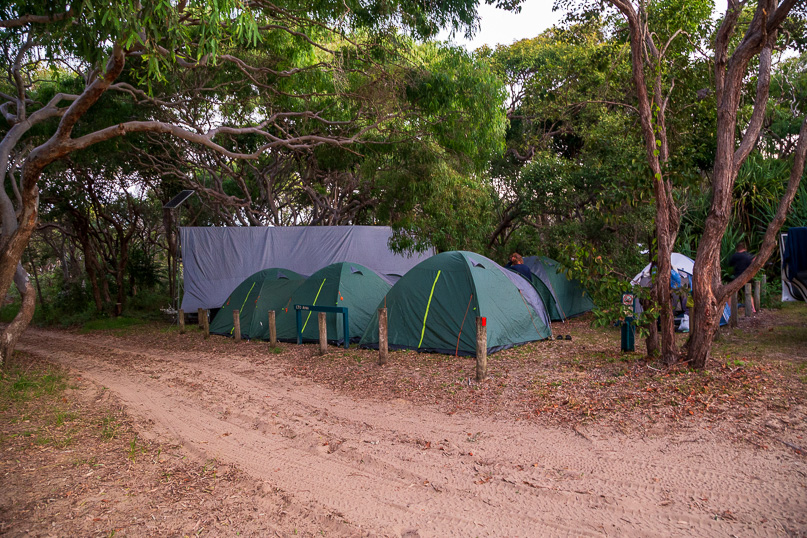 |
Our camping base at Dundubbera, about two thirds of the way along the island's 400 kilometre coast. This is the largest sand island in the world. |
|