Introduction to today's journey
The Shiretoko Peninsula stands as a pristine sanctuary of natural wonders at the northeastern tip of Hokkaido, Japan. Designated a UNESCO World Heritage Site for its exceptional biodiversity and untouched wilderness, Shiretoko captivates with its rugged coastline, dense forests, and towering cliffs. The peninsula's centerpiece is the Rausu Dake volcano, the highest peak in the Shiretoko range. The mountains are surrounded by a mosaic of habitats supporting diverse wildlife, including brown bears, deer, and rare bird species. Shiretoko's marine environment is equally rich, with nutrient-rich waters of the Sea of Okhotsk attracting seals, dolphins, and whales. Its dynamic ecosystem undergoes dramatic seasonal changes, from lush greenery in summer to the crystalline ice floes of winter, offering visitors a profound connection to nature in its purest form in this most remote corner of Hokkaido.
Today's journey takes me to the nearby Shiretoko Peninsula, exploring the volcanic landscape passing many bays along the coast to Shiretoko Five Lakes. From here we cross a mountain pass to view Russia's Kiril Islands before returning to Kiyosato.
Today's Journey
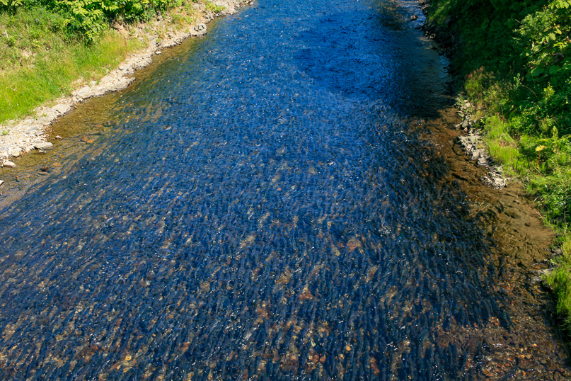 |
From Kiyosato we head along the only road heading into the remote Shiretoko, meaning "The End of the World" in the indigenous Ainu language. The River of Oshinkoshin absolutely full of fish. I have never seen so many fish in one place. This is just before the road heads into a tunnel going through a volcanic headland. |
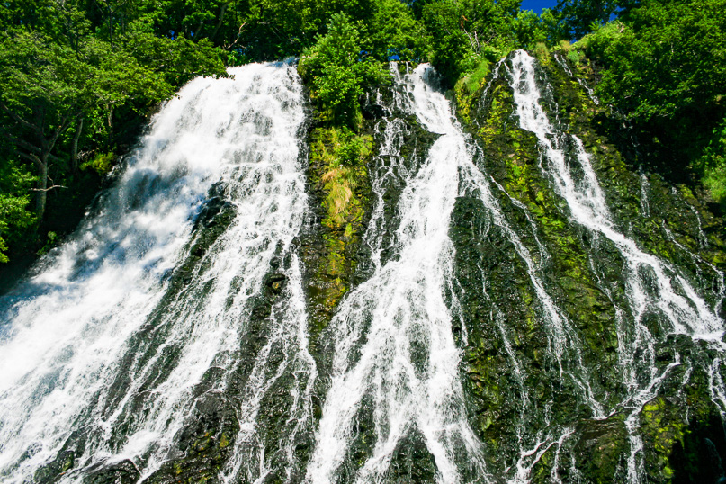 |
A short distance upstream is the Oshinkoshin Falls, flowing over an old lava flow oxygenating the water which is perhaps what is attracting the fish, or perhaps they are stuck here because they cannot go any further upstream to lay their eggs. |
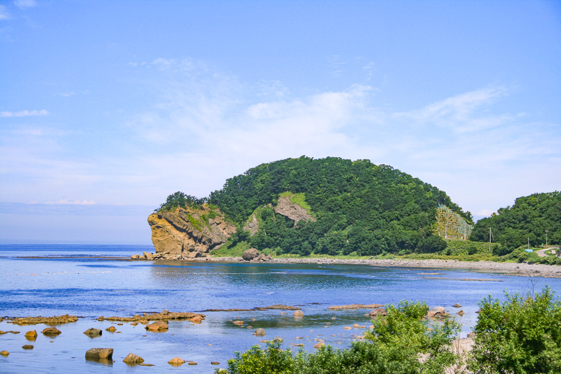 |
Passing Kameiwa Point just before Uturo fishing port. It looks very much like a turtle. |
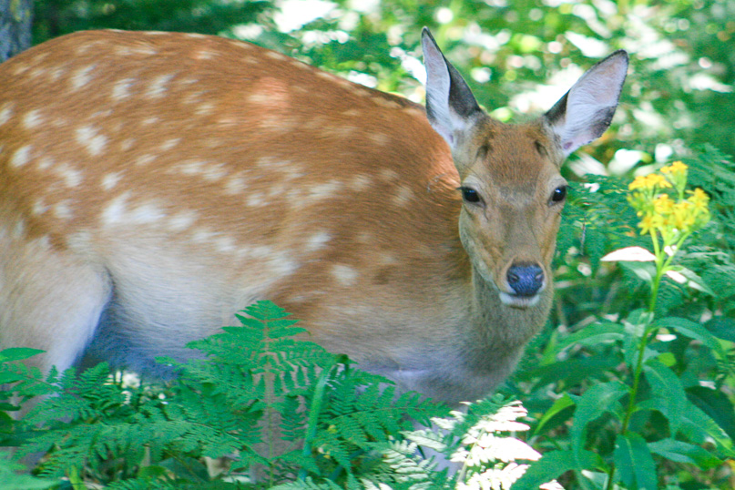 |
At one of our many stops, a deer appears very close by. |
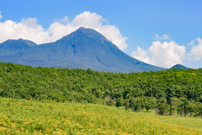 |
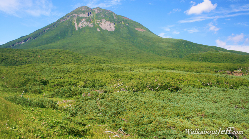
Looking across the summer flowers into the volcanic hills flanked by the Shiretoki Range, with Rausu Dake dominating the skyline. |
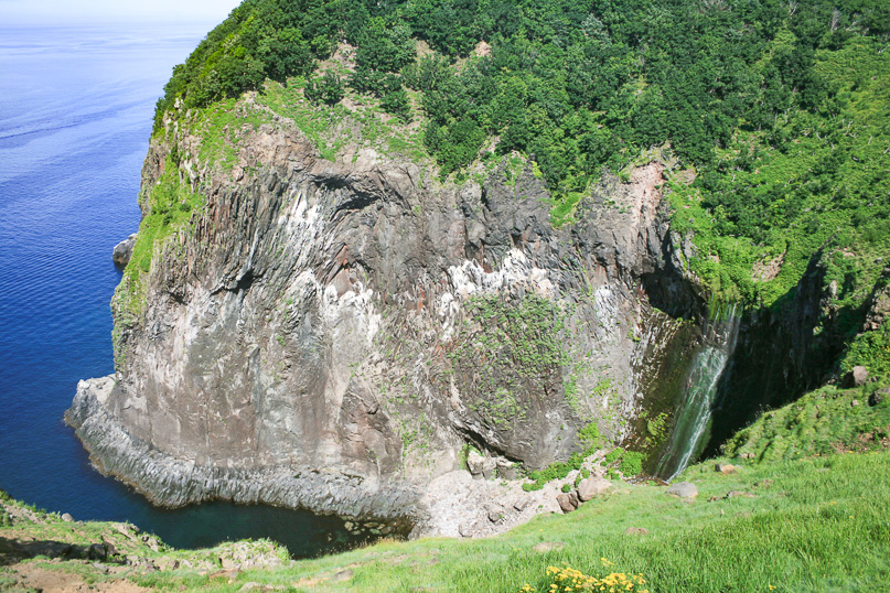 |
From Uturo the road heads inland over a small volcanic plateau. We park and follow a track to Furepe Falls, plunging into an old volcanic crater with one of its sides eroded away by the sea. |
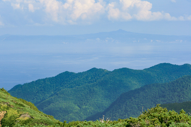 |
From the crater the road follows the Akai River upstream to the top of Shiretoki Saddle under Rausu Dake. From this pass I have a view across to the Kuril Islands, which is owned by Russia. I plan to travel through Russia later, but I've now had my first glimpse of it. |
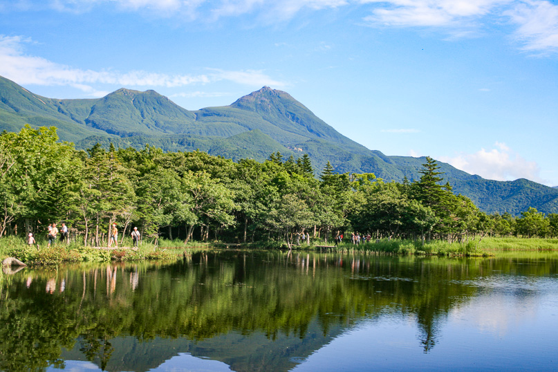 |
Returning down the mountains we almost reach the coast, but turn off to explore Shiretoko Five Lakes. From here the Shiretoko Range (with Rausu Dake in the centre) reflects in one of these lakes, formed by lava flows from the mountains. |
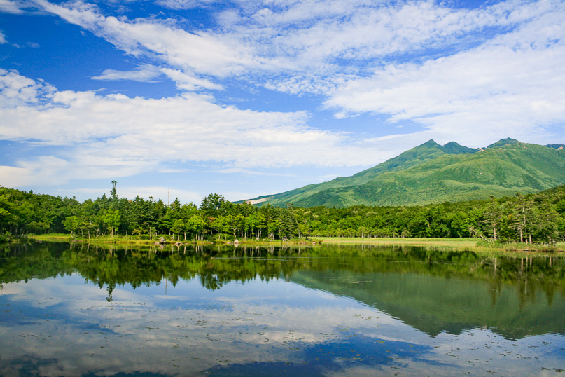 |
Looking eastward along the range to Japan's easternmost point. Amongst these mountains is Mount Io, a sulphur mountain. This view is from one of the smaller lakes. |
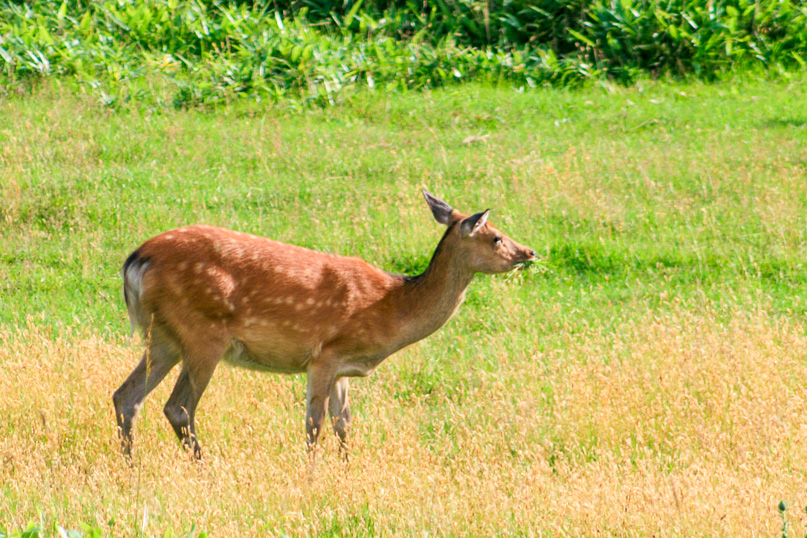 |
A deer grazes the fresh summer grass as we continue following the five lakes circuit discovering most of the lakes, but two are closed off because there is a bear in the area. |
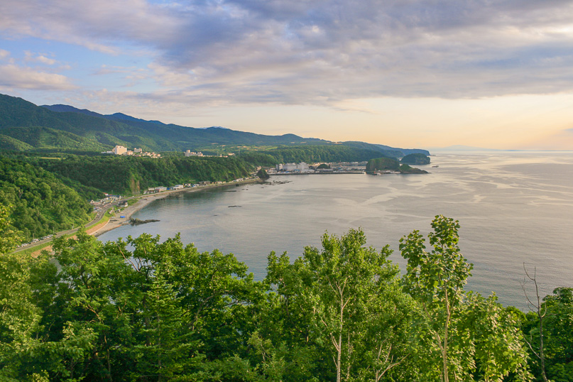 |
Returning to the road, we head over the hills back towards Kiyosato with a stop here just before Uturo. Shari Dake is visible on the horizon. |
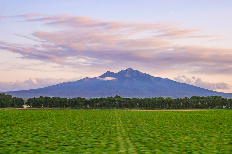 |
Returning to Kiyosato we pass under Shari Dake, appearing very tall and ominous under the brightly coloured dusk sky. |
|