--- Archive files ---
Home > Travels > Tweed > 8 |
Tranquil Cascades Eroding the Volcano
THE PLATEAU at O’Reilly’s seemed fairly even terrain, but the elevation of the Canungra Creek where I was heading towards was far below. The well graded track leading off the start of the main Border Range Track would drop 440 metres over its five kilometre length traversing the side of the gorge. The dry rainforest under the hot morning sun would make for a very long downhill hike.
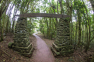
Track entrance |
Today I was exploring the rugged jungle once occupied by the Wangerriburra clan of the Yugamheh people. Although one would normally think of Australian Aboriginal people being desert dwellers eking out their existence on endless plains of barren red dust, the indigenous people who lived here quite comfortably lived as stewards of the rainforest. This was a sacred and spiritual place to them, where they successfully managed the rich natural resources easily accessible to the campsites where they lived. They used the ngaboy (lawyer vine) for climbing the big trees. Wrapping a loop around a tree they hauled themselves up cutting steps in the bark as they went.
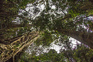
Looking up! |
They crafted things out of the basalt stones and rainforest vegetation before taking them downstream to trade for the coastal seafood and fruits with the saltwater people of the Gold Coast.
I’m sure many of the trails criss-crossing the park followed the paths that the Aboriginal people used here over the thousands of years.
The explorer Romeo Lahey constructed many of the tracks in the park during the great depression and up until the 1940s. With his engineering experience he observed the cattle could walk all day on steep terrain without tiring. He noted the tracks they trampled along would seldom exceed a 1 in 10 gradient, so he used that as a benchmark for his tracks. He used techniques in constructing stone walls and stone inverts which has proven to be so effective that these methods are still used today.
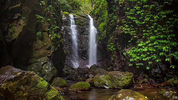
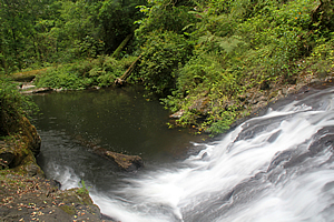
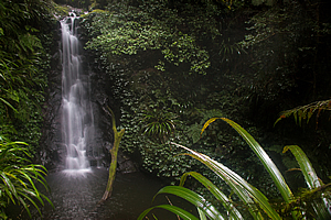
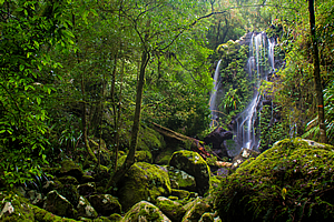
Darraboola Falls |
After nearly an hour of descending into the gorge, we reached Darraboola Falls (Aboriginal for two rocks), on a stream that tumbled down from the edge of the plateau. The deep cut gully was full of scrub from where a fairly recent storm surge had washed the forest away.
We rested here for a few minutes before continuing along the track which followed the creek downstream through the forest. It was not long before I could hear the roaring cascades of the nearby west branch of the Canungra Creek.
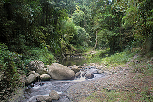
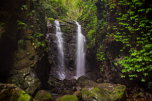
Yeeralahla |
The forest suddenly cleared as we reached the creek at Yeeralahla, a long deep pool carved out by the many floods that roar down here on a regular basis during the summer storms. Appropriately the name means “Blue Pool”. Fortunately the water was at normal levels despite all the rain that had fallen on the other side of the mountains. Any excess flood water had already flowed downstream cascading over giant boulders into small turquoise pools.
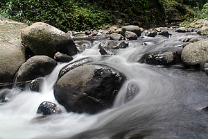
Rapid above Yeeralahla |
Although we had descended a huge distance, this part of the stream was still five hundred metres above sea level. The Creek still had a long way to drop before reaching the sea.
After a rest at the pool we started heading upstream. By now cloud was starting to envelope the plateau. Occasionally the harsh contrasts of the strong sun diffused behind the cloud that eternally hung over the crater rim now making photography possible.
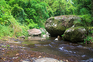
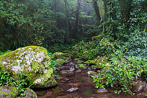
West Canungra Creek |
The forest on either side of the river was scrubby. Flood channels meandered alongside the channel of flowing water as it went from side to side. Upon reaching the side of the valley the terrain could become very steep landslides where the stream was cutting away into the mountain. For 23 million years the stream has cut the 440 metre deep gorge between the plateaus. Over the eons it has been cutting its way through the thick hard layers of basalt deposited by the volcano.
West Canungra Creek |
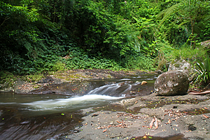
As we continued upstream, high bluffs necessitated the occasional crossing over large boulders almost purpose built as bridges. The first crossing was a row of flat boulders. The second crossing just above Kalgamahla Falls required us to wade across the shallow cool water. Below our crossing point the waterfall cascaded over rocks into a deep pool below.
We reached Yanbacoochie Falls a little upstream from another crossing over a row of huge flat boulders. Yanbacoochie is the Aboriginal word for “sit down and rest”. Unfortunately there was still a long way to go, so we decided not to linger here. The hot sun was very intense here, even though it felt humid enough for the clouds that normally perpetuate over the plateaus to return.
Yanbacoochie Falls |
There was one more creek crossing just above the waterfall leading us to the Box Forest Circuit. Here we decided to follow the higher track of the circuit to bypass some of the stream and make up for lost time.
At some point as we were trekking through the thick forest of tall trees, the sky above clouded over and rain began to fall. Fortunately it wasn’t a thunderstorm, but nonetheless the downpour was quite sudden as they tend to be around here. Thick cloud billowed into the valley restricting visibility across the valley in the rare gaps in the forest. The rain was bringing the forest back to life.
Sudden change in weather |
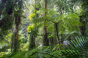
I was now in a subtropical rainforest area where the annual rainfall is around 1600 millimetres. The enclosed gorge remains very humid all year round (even during the spring dry season) allowing for very lush jungle vegetation clinging to the precipitous sides of the gorges. Thankfully the track was well graded. Navigation through this gorge would have otherwise been next to impossible.
The track reached a junction, the main one heading back to the plateau, whereas the Toolona Circuit headed back to the creek. The track moderately descended through very steep terrain held together by huge trees before reaching the Picnic Rock, at a point above where the Canungra Stream split into two. The Canungra Stream ran through Picnic Rock, flowing a lot smaller than I had seen it earlier. The flat rock with the stream running through a groove it had carved out over several millennia allowed for a relatively easy crossing.
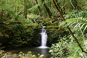
Box Log Falls |
Once across the stream we headed downstream through the dense jungle to Box Log Falls just above where the Toolona Stream met the West Canungra Creek. A flat about ten metres below the track marked where the two streams join unseen in the forest. Here the stream split into two falls plunging down a layer of hardened basalt into a rather dark rocky gully before heading downstream towards where we had hiked earlier. It seemed very different here enclosed in forest under dark forest with the rain falling.
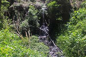
Small waterfall |
From Box Log Falls I headed back upstream diverting at Elenora Falls from where there wasn’t much of a view through the thick forest. Upon reaching the junction we continued along the Toolona Track across a short ridge to meet the Toolona Stream.
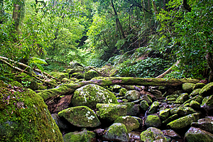
There was a succession of waterfalls along the first part of the stream, negotiating its way up alternating layers of basalt and rhyolite. The track crossed the stream over a layer of boulders that completely concealed the stream. Above that was a large pool into which a short waterfall flowed.
Waterfall plunging into pool |
Although there was no evidence here of human inhabitation, I knew the Aboriginal people would have ventured here for thousands of years. They have a way of living in harmony with the land without leaving any traces of civilisation. Over the years I have travelled to ancient civilisations where the ruins are still evident after hundreds of years of abandonment. Modern humans are the worst – it will take tens of thousands of years for all traces of civilisation to be ground back into the dust of the Earth after we disappear. The aboriginal people on the other hand lived without leaving any trace of their occupation apart from perhaps an early version of this track that was upgraded when white man began exploring here nearly a century ago.
Toolona Stream |
The land forms a very strong part of their culture. Those who inhabited these mountains tell of the Woongoongora Story. Mount Wanungra (Woonoongoora) along the border ranges is where the Toolona and Canungra streams flow from. Wanungra is considered the queen of the mountains, with her two daughters being the silver streams – Princesses Toolona and Canungra.
The streams intended to flow northwards towards the ocean passing around Mount Tamborine before heading eastwards into the Coomera River where they would overtake the daughters of Illimbah and Hobwee, who were betrothed to Tambourine.
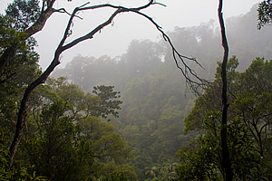
Misty forest |
Queen Woonoongoora was saddened that her daughters had defied her wishes. In her anger she send rain, wind and flood. The terrified princesses ran wildly in a vain attempt to cross the hills where the Kookooroo Princesses were already flooding the foothills under Mount Tambourine which he had generated in response to Queen Woonoongoora’s rage.
For many thousands of years since Queen Woonoongoora has turned her back on them to face across the great caldera towards Mount Nimbin. They say that from Mount Tambourine’s southern shoulder you can see the deep valleys of the Coomera (further to the east) and Canungra carved into gorges so deep there can be no turning back or joining together. In reality this has been due to 18 million years of erosion – plenty of time to cut gorges up to half a kilometre deep.
Mossy riverbed |
The Coomera collects most of Tambourine’s waters and swiftly reaches the ocean. Canungra on the other hand meanders its way slowly westward away from the sea.
They say you can still see the gnarled old Woonoongoora who perpetually gazes out at lonely Nimbin. The prevailing south east wind blows her hair back through the ancient beech trees, carrying a tale of sorrow to Toolona and Canungra, the fleeing princesses.
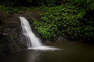
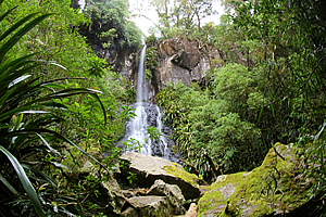
Chalahn Falls |
From the waterfall the track continued zig zagging its way above the cascades in the thick rainforest clinging to the steep sides of the gorge before reaching a tall waterfall plunging into a deep pool. A moss covered tree trunk lay next to the waterfall having been brought down by a recent flood.
Another zig zag track led up above the waterfall before the terrain evened over hard basalt. The stream meandered silently along the gully for some distance over about half an hour before the gorge narrowed again. Ahead I could hear the gentle hissing sound of another waterfall ahead. This was the beautiful Chalahn Falls – the Aboriginal word for rainbow. The cloud was still thick overhead preventing the sun from shining through to create any rainbows today, but this was still a spectacularly beautiful and mysterious waterfall plunging off the end of a rocky outcrop down a cliff with all types of moss and fern growing in every nook and cranny.
Toolona Stream |
From Chalahn Falls the track zig zagged up to just above the falls to another long flat area where the track crossed the stream again and followed the gently flowing stream to a small tranquil waterfall dropping into a pool. The trees above the falls leaned in over the stream as if to protect it.
By now the stream was getting quite small. It wasn’t too far to go to its source now. Another crossing at a gentle cascade revealed the gorge had widened out. I wasn’t level with the top of the plateau yet, but getting close.
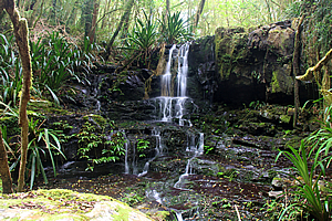
Toolona Falls |
Just when it seemed there weren’t any other waterfalls, I reach Toolona Falls, where the stream funnelled down over the edge of the soft rhyolite cliff before fanning out into a cascade, then disappearing almost completely under the rubble of enormous mossy boulders.
Once more the stream ran very gently above the waterfall. The vegetation was changing with the trees completely covered in epiphytic climbers and moss. The rainfall in this area is very high and when it isn’t raining, it is more often than not covered in thick misty cloud as it was now. The rain had stopped falling by now.
Toolona Stream |
I reached another small waterfall running over a two metre high black cliff of basalt. Above that was another creek crossing. This time the pool was so narrow I could simply step over it.
There was another crossing before I reached the highest waterfall in the stream. Here it trickled over the layered black basalt passing over a carpet of fine exposed roots belonging to some of the moss covered trees growing overhead.
Above the waterfall the stream split into several trickles draining from the wide gullies above. I was near the top of the plateau about to be transported a hundred million years back in time.
<< Previous | Next >> |
|
||
About this Page
|
||
|
|
|
Where is Walkabout Jeff? |
|
|

|
|
What is happening in Walkabout Jeff's hometown?
|
|
|

|
|
Who is Walkabout Jeff?Any normal person's idea of going out involves going to the local pub for a drink with a few mates. Walkabout Jeff isn't normal.
|
|
|

|
Follow Walkabout Jeff |
|