--- Archive files ---
Home > Treks > Inca Trail > Day 5 > 5.2 |
The Inca Tunnel
TEH COBBLESTONE trail going from the Conchamarca Campsite where we had stayed the night led for about two hundred metres across an elevated swamp. The swamp was contained in a narrow shelf between the steep hills towering to our right and the sharp drop plunging deep into the Aobamba valley below to the left. The track was built up over an impressive raised causeway over what would have otherwise been a very boggy trail through swamp. Clouds still covered the hills above us, but we could see the large granite outcrops near the top of the initial rises.
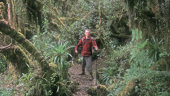
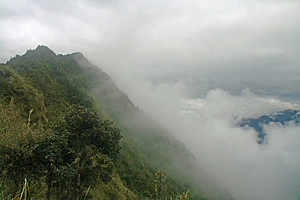
Trail leading from the campsite |
Our porters quickly overtook us as the track then ascended gently soon giving us a final view over the campsite, the Sayacmarca ruins beyond, and up the gully towards the second pass we had crossed yesterday, now just below the cloud line. Then we rounded the scrubby spur to proceed onto the next part of the trail.
The scrub quickly turned into moss covered small trees, similar to the New Zealand kanuka (tea tree). Through a break in the trees we could see a small waterfall tumbling down in amongst the scrub in the middle of the next gully. The landform of the long valley below us didn’t show character like the spectacular mountains behind us, suggesting to us that we were approaching the end of the Andes, where all the watershed flows into the Amazon basin maybe a couple of hundred kilometres away. All the trails of the Inca seemed to be over the mountains and across the dry west coast. They didn’t seem to have any interest in the Amazon, or if they did, there was probably no evidence left of their civilisation due to the jungle taking over whatever had been built.
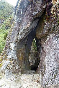
Entrance to the tunnel |
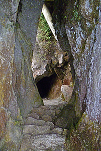
Inside the tunnel |
I started seeing cycad like plants growing in the scrub. Perhaps these were some kind of bromeliad.
The track suddenly ended at the entrance to a granite cave. The entrance was an elongated triangular tear shape easy to walk in. The roof being safely above my head and the width rather cosy though not requiring me to squeeze myself at all. The tunnel had a natural feel about it, but it had been hewn out by the Inca as part of the construction of the trail. The tunnel wall was less than a metre thick, so they could have easily carved the track around its edge.
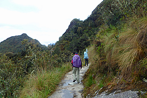
Approaching the pass |
One by one we entered the cave and followed a stairway carved into the rock for about sixteen metres until coming out at the bottom of the cave. By this stage my camera was quite badly fogged up thanks to the extremely high humidity here.
Upon passing the cave, the trail went further into the gully where the forest became thicker, with trees covered in thick carpets of moss. We continued about another two hundred metres before reaching the side of a tiny dirt clearing just to the right of the track where we each posed for some amazing cloud forest photos.
The terrain was very steep here being directly under the jagged peaks high above us. We passed very steep grey granite rock faces showing the amount of work that would have been done to have created the track five hundred years ago. Here large stones were set in large notches in the cliff face to create a stone surface wide enough to walk along. It was amazing that it had all held together for so long.
<< Previous | Next >> |
|
||
About this Page
|
||
|
|
|
Where is Walkabout Jeff? |
|
|

|
|
What is happening in Walkabout Jeff's hometown?
|
|
|

|
|
Who is Walkabout Jeff?Any normal person's idea of going out involves going to the local pub for a drink with a few mates. Walkabout Jeff isn't normal.
|
|
|

|
Follow Walkabout Jeff |
|