Facebook    YouTube   
 

| Home | Photography | Diary | Treks |

 
PreviousNext

The Inca Trail

The Inca Trail
Home > Trek > The Inca Trail


About this Page

Date:


Location:

Country:


Latitude:

Longitude:

Altitude:

13 - 18 October 2010
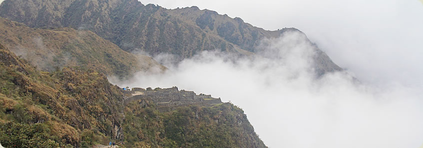
 

Inca Trail

Peru


13°18'S
72°15'W

2000 - 4215m ASL


Google Maps Link


Prologue - << Start here


Day 1 - From Jungle to Mountains

 - Gasping for Breath

 - The Briefing


Day 2 - Descendants of the Inca

 - Leaving Cuzco

 - Potatoes and Incan Descendants

 - Mountain Storm

 - Ollantaytambo


Day 3 - Walking Amongst the Giants

 - Where Porters buy their Equipment

 - The Gate and the Swingbridge

 - Cemetary

 - Ruins at the Bend

 - The First of many Standing Ovations

 - The Camp is just past the Bridge


Day 4 - Mountain Passes in the Clouds

 - Overnight Rain and Snow

 - Climb to the Top Camp

 - The Climb to Dead Woman Pass

 - At the Summit

 - Steep Descent to Lunch

 - The Storm

 - Ruins in the Clouds

 - Heavy Rain at the Campsite


Day 5 - Lost Cities of the Cloud Forest

 - I was up Early

 - The Inca Tunnel

 - Mountaintop Campsite

 - Ruins and Forests in the Sky

 - Campsite perched at the Edge of a Cliff

 - Forever Young

 - Farewell Dinner for the Porters


Day 6 - The City of Old Mountain

 - The Locked Gate

 - The Sungate

 - The Ultimate View and the Park Entrance

 - Tour around the City

 - We are down Here!

 - Residential area under the Mountain

 - Town at the Bottom of the Chasm

 - Return to Cusco


Epilogue


Blog from today:
The Inca Trail


PreviousNext


| Home | Photography | Diary | Treks | Archive |

 
© 2001-2020 walkaboutjeff.com - Copyright - Disclaimer - Who is Walkabout Jeff?