|
||||||||||||||||||||||||
|
||||||||||||||||||||||||
Home > Treks > Kosciuszko > Day 1 > 1.1 |
||||||||||||||||||||||||
|
||||||||||||||||||||||||
|
AUSTRALIA'S greatest engineering success is hidden deep within its highest mountains.
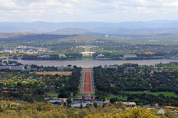
Last night we arrived in Australia’s capital city. Canberra is a relatively small city nestled deep in Australia’s Great Dividing Range sitting about half way between Sydney and Melbourne. When the powers that be decided to join the colony states together into a single Federal Government, there was much discussion over whether it should occur in Sydney or in Melbourne. They realised it had to be neither, so a large plot of land was purchased in a valley in the Great Dividing Range where the government could be based. They named the city Canberra, after the local aboriginal word “meeting place”. There the Federal Government was established to unify Australia. This has been in place for over a century now, but there is still a long way to go.
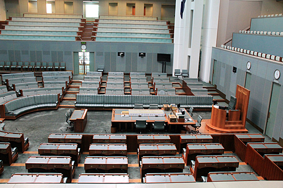
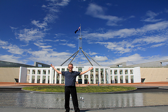
We started our trip exploring Parliament House, an enormously extravagant building set into a hill like a massively over-sided hobbit hole. No expense was spared here with the most decadent building materials that could be obtained were used for this 1.1 billion dollar extravagance to show off to the rest of the world. Following a tour around the building we climbed to the grassy hill on top of the building where a giant Australian flag was flying on top of a massive aluminium structure. The flag was flying at half-mast today as the Saudi Arabian king had died overnight.
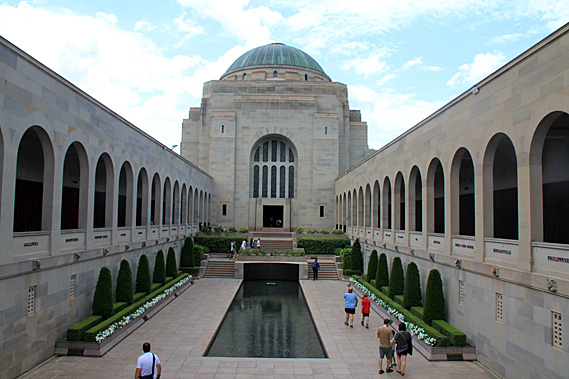
From the Parliament House we crossed over Lake Burley-Griffin to the Australian War Memorial, where the names of every Australian soldier killed in action had their names displayed along two very long bronze plaques on galleries leading to a central domed temple standing a Above a large pool where people were dropping coins in remembrance of those who fought other people’s wars. Below the memorial was a large museum containing all sorts of military artefacts and history, particularly covering World War 1 as this year was the ANZAC centenary. Behind the museum was Mount Ainslie. A memorial trail led the way to the summit. Along the way were a number of plaques covering different parts of the Kokoda Trail in Papua New Guinea. This was a significant part of Australia’s war history because it was there that the Australians defeated the Japanese who were on their way to invade Australia. This is one trail I’d like to attempt in future, but this weekend I had another one to do.
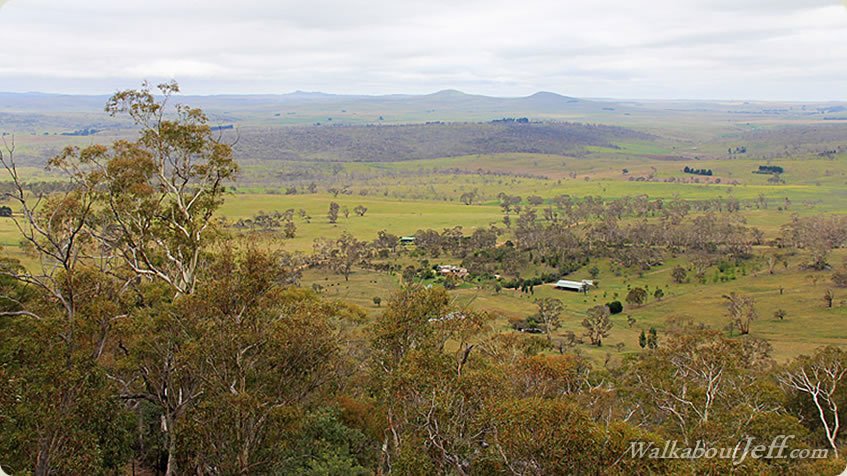
From the summit of Mount Ainslie I had clear views across Canberra with its sleepy city nestled in the valleys around the lake. Directly below was the dome of the war memorial with an avenue heading straight out across the lake to the massive Parliament House. Otherwise there was little in the way of high rise buildings. Black Mountain stood to the right with its spinning top style observation deck and communications tower standing alone at the top of the hill in the forest. Nestled in the valley between here and Black mountain was a cluster of five to ten storey government buildings where bureaucrats do the country’s rubber stamping and paperwork.
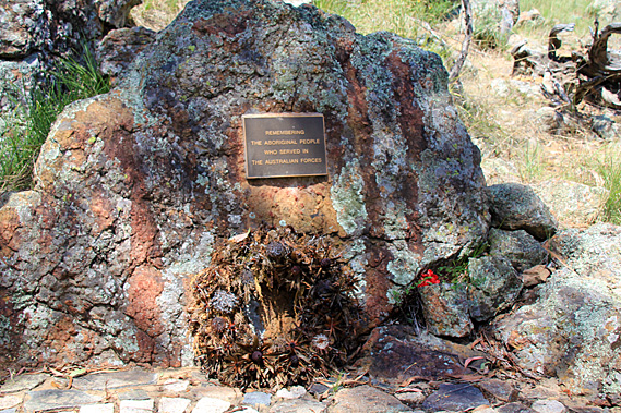
I returned down the trail to a small diversion at the end. I followed this diversion to a boulder with a small bronze plague simply commemorating the Aboriginal people who had lost their lives in the wars. It was very simple and separated away from the museum as if it perhaps didn’t even belong here. That seemed a bit weird to me as the Aboriginal people had lived here since a time before time. The Europeans settled here in 1788. The Aboriginal people arrived so long ago that no one knows for sure, perhaps around 50,000 years ago.
Some of the indigenous people had been sent overseas to give their lives to battles that had nothing to do with them. As I was soon to discover, they were a peaceful people with countless generations of history deeply ingrained in their relationship with the land. Here in the city it wasn’t apparent, apart from the clues of Canberra being named “the meeting place” (with a painting in Parliament House to reinforce it) and this most simple of memorials here at the base of Mount Ainslie.
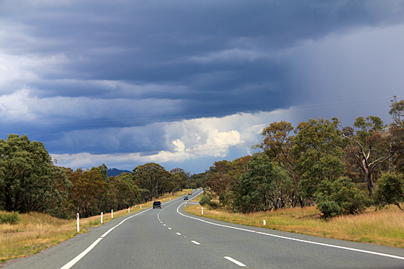
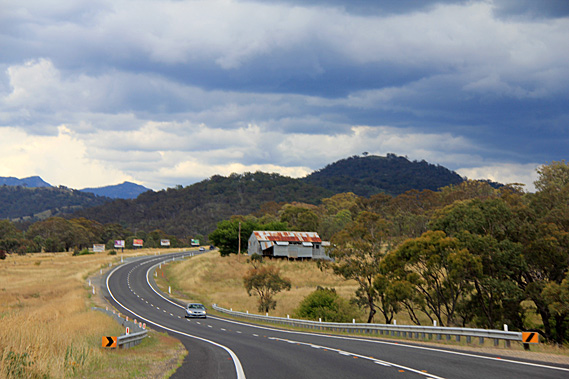
Cloud was already covering much of the sky when we departed Canberra heading southwards. We followed a valley running between mountains of the Great Dividing Range. The Great Dividing Range runs 3500 kilometres down almost the entire length of Australia’s East Coast from the sub-equatorial Cape York down to the sub-Antarctic shores of the Southern Ocean near Melbourne. We were a lot closer to the latter, in the highland temperate zones where exotic deciduous trees lined the avenues of suburban Canberra along with the native gum trees. It was not long though before the deciduous trees were behind us as we travelled through fertile farmland.
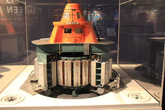
A summer thunderstorm was approaching. A blanket of rain was falling from the cloud. Gradually we got closer to it until the storm enveloped us. Heavy rain fell,, but only for a few minutes before we emerged out of the other side. Looking ahead, there was a much larger cloud bank with rain falling. The climb up the mountain tomorrow was looking doubtful. After an hour of travelling through remote farmland we reached the sleepy town of Cooma. At the entrance of the town was a large grey building, being the museum for the Snowy River Hydro Scheme. This was quite an eye opener for the recent history of this mountainous area.
Most of Australia’s electricity is generated by coal fuelled power stations. In a couple of short centuries we are burning up all the deposits of swamps that had been deposited over the past 500 million years. This is hardly a picture of sustainability. We are introducing solar and wind power with very limited success. Before this, the only feasible source of renewable energy was through harnessing the power of water. New Zealand does hydro-electricity very well. I recalled entering the Manapouri Power Station several years ago. I had travelled about a kilometre into a tunnel through a mountain to the massive power station some 173 metres below a large lake. This was just one of many hydro-electric power stations in New Zealand. Most of Australia does not have the luxury of high rainfall or mountainous gorges as New Zealand does. Being the driest and flattest continent in the world doesn’t lend itself to hydro power schemes capturing the power of large rivers, so it was surprising that the largest hydro power scheme imaginable began construction in 1949 at a time when Australia was still recovering from the economic quagmires of two world wars and the great depression.
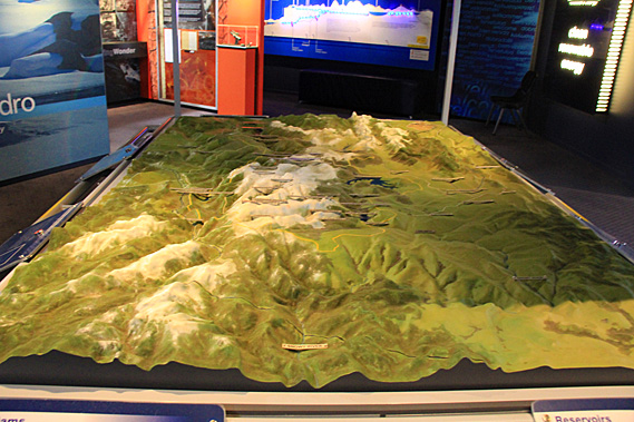
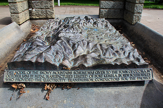
Tens of thousands of workers were hired from all around the world to settle in the area. Cooma quickly transformed from a quiet farming service town to one of the main centres. Several new towns were built from scratch and over a hundred temporary camps were established to house this huge workforce. Of the 100,000 people employed on the scheme, 60,000 came from 30 different countries from all around the world. The scheme is now recognised as the birthplace of multiculturalism in Australia. The scheme was led by New Zealander William Hudson. He was a man of high standards both for himself and for others, expecting complete dedication, loyalty and hard work. Through his strong leadership the project was successfully completed in 1974. The seasonal rivers that would normally dry up during the long dry spells began to flow permanently feeding a $3 billion dollar a year farming industry. 16 major dams, 1 pumping station, 145 kilometres of tunnels, and 80 kilometres of aqueduct had been constructed to produce 4,500 gigawatt hours of electricity per year. The lakes store about 7000 cubic kilometres of water between them allowing both irrigation and power generation to be consistent throughout the year.
Cloud seeding is used to further help the consistent supply of water. Minute concentrations of Silver Iodide is sprayed across a propane flame, rising into the clouds to cause moisture to freeze and create crystals large enough to fall as snow. Not only does this produce more water for the scheme, but it provides deeper snow on the mountaintops to benefit the rare pygmy possum which requires at least a metre of snow to protect it from predators during its winter hibernation. The cloud seeding also benefits the ski season tourism. In spring the snow melts providing more water feeding into the lakes for the power scheme. After the scheme finished in 1974, many of the workers stayed in the area. The country lifestyle was ideal for raising their families, so they maintained employment by buying shops and helping to start the fledgling tourism industry in this area. Many of the towns that were built for the scheme have continued to thrive to this day.
The Snowy Mountain Power Scheme is now one of the seven engineering wonders of the modern world. After exploring the museum, we passed through the sleepy town of Cooma continuing to head up towards the Snowy Mountains. The terrain suddenly became rougher with large outcrops of limestone remnant of a shallow ocean that covered this area during the Carboniferous period 350 million years ago before the Great Dividing Range was uplifted around 80 to a hundred million years ago. The mountains were very rounded and low due to 300 million years of erosion. We were close to a thousand metres above sea level and the scattered trees in the brown grassy paddocks became increasingly gnarly and windswept as we continued our approach to the Snowy Mountains. |
||||||||||||||||||||||||
|
||||||||||||||||||||||||