|
||||||||||||||||||||||||||
|
||||||||||||||||||||||||||
Home > Treks > Kosciuszko > Day 1 > 1.2 |
||||||||||||||||||||||||||
|
||||||||||||||||||||||||||
|
THE STORM was just beginning to clear when we arrived at our cabin beside Lake Jindabyne. It had completely stopped falling and the thunder could no longer be heard by the time we had settled into our cabin.
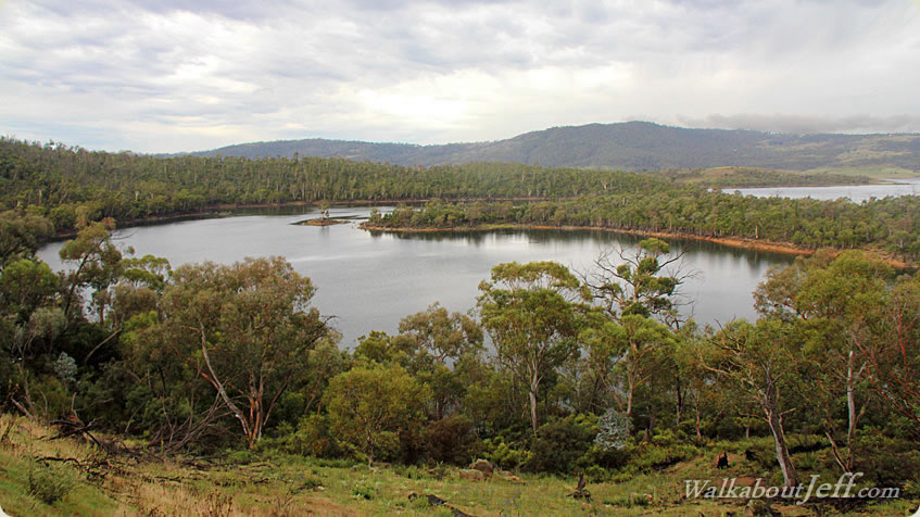
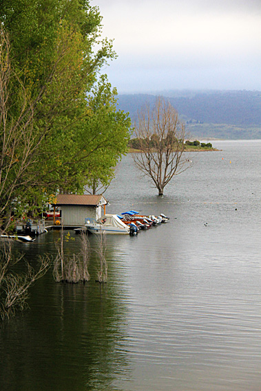
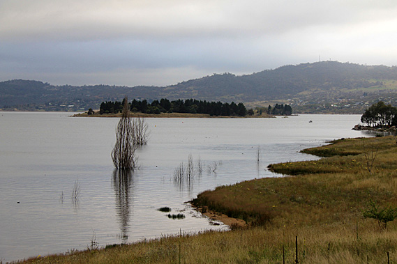
The air was a little chill, but that would be expected at this altitude of around 900 metres. The montane trees were different to those I was familiar with at lower altitudes. These were taller and gnarlier than I’m used to. The snow gums were exhibiting very beautiful colours. With the weather now clear we quickly explored the nearby lake. Some of the trees were growing in the water indicating the lake level was higher than usual. Perhaps this was a by-product of the spring melt. Maybe more snow had fallen in the mountains than usual. Several kilometres away the valley was blocked by the Jindabyne Dam which had been built as part of the power scheme in 1967. The town was originally a camp for the workers who built the town, but has since thrived as a tourist destination. Although this was clearly the off-peak, the town was still quite busy.
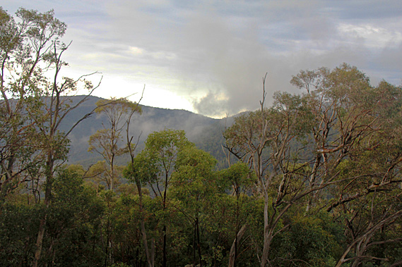
The town had to be relocated in the 1960s due to its original location getting flooded by the lake behind the dam. The town’s name is derived from the local Aboriginal word for “Valley”. The clouds were beginning to break. Hopefully this was a good sign that the mountaintops were going to be clear tomorrow. We decided to explore the area so we continued along the road towards Charlotte’s Pass. Almost immediately the farmland gave way to forest which covered the rolling hills. Cloud still draped the mountaintops keeping them elusive from view. The rugged snow gums were very colourful.
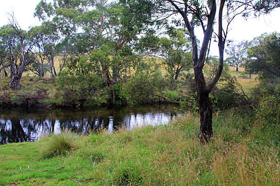
We turned off to the left into a small rest area at the Threadbo River just above where it meets the lake. We will be going up this valley tomorrow, but here there was a walkway which we started doing. The river silently sliced past the edge of the Threadbo River Picnic Area. The grassy patch was surrounded by the montane forest and low hills at the base of the Snowy Mountains. The Threadbo River follows a fault line from a place called The Big Boggy Plain quite some distance upstream. The fault line was created when the mountains were uplifted between 80 and 100 million years ago no doubt creating a spectacular mountain range which has now worn down.
The river valley served as an Aboriginal path to the high country for their summer ceremonies. People from different tribes near and far came here to the highest parts of the Snowy Mountains (which they know as Tidbillaga) for special ceremonies. This site marks one of their campsites they had used on the way to the mountains. The other local campsites are now submerged beneath Lake Jindabyne. The trails were also used for hunting and gathering food in the higher forests.
The herbs gathered from the high forests and alpine zone were considered to have particular spiritual and healing properties. Perhaps this was because they were growing in the realm of the spirit world, which the Aboriginal people considered to be on the mountaintops and in the skies above. The plants were brought back to their camps in the lower altitudes and planted in spiritual herb gardens they called Irramba. The Pallaibo Track began at the end of the river heading upstream. This would have no doubt been one of the original trails the Aboriginal people used to head up to the mountaintops. The track followed the river to Sawpit Creek 5.8 kilometres upstream. Darkness will be falling soon so there was nowhere near enough time to do the return trip.
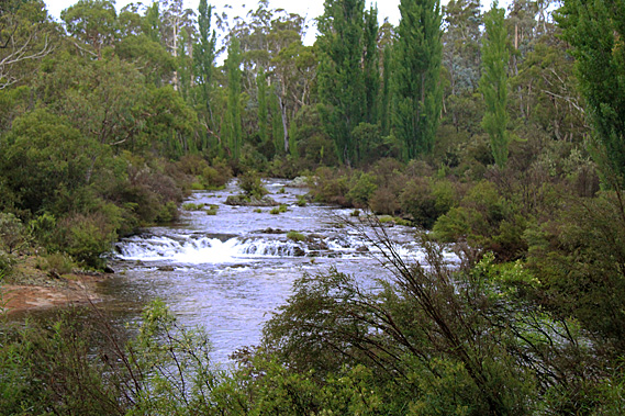
The river passing the picnic ground was deep and mirror flat, but a short distance upstream the water was shallow and cascading over rocks. The track was a bit rough negotiating its way through debris and terrain left by recent flooding. A burrow appeared by the side of the track perhaps dug by a rabbit or possibly by a platypus. The different animal species that live here inspire Aboriginal ceremonies, stories and laws. Few people know the stories in full. You have to earn the right for a senior tribal elder to tell such stories.
As people travelled across the land from tribe to tribe, they connected with the different groups, stories and ceremonies that were unique to each tribal group. The gum forest here was unlike any of the gum forests I’m familiar with around Brisbane. The species here were a lot tougher, built for the cool temperate summers and the snows of winter. At first glance all the trees appeared to be the same, but I quickly realised there were quite a few different species growing here, all different to those I was familiar with back home. Soon the valley began to close and limestone bluffs began to tower overhead. The track became rougher and the air suddenly dampened with the threat of more rain. I suggested we turn back.
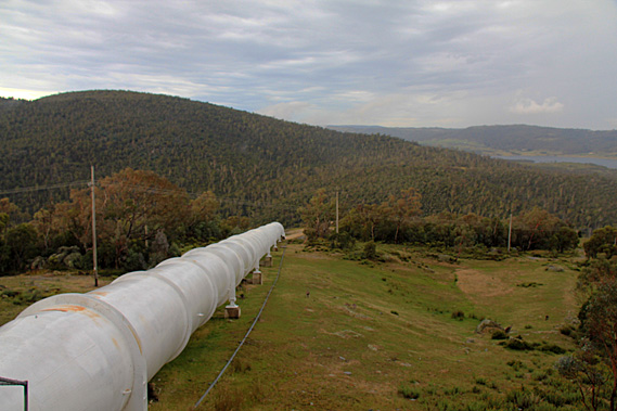
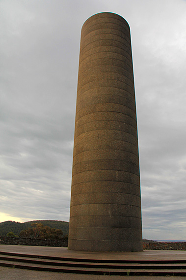
Upon reaching the car rain began falling just as I had expected. Did we just experience a temporary break in a large weather system that was closing in again to threaten our climb tomorrow? From Threadbo River we continued following the surprisingly well maintained road ascending higher into the mountain. It was not long before we could see the lake sprawled out below us. Rounding a corner there suddenly appeared a tall cylindrical chimney-like structure at the end of the spur beside the road. We continued a short distance further up the road before realising we were heading towards a toll booth near the ski fields. We turned back and stopped at the cylindrical tower.
The tower turned out to be a pumping station surge tank. From the surge tank a large white pipeline headed down the mountain to the Jindabyne Pumping station. During off-peak periods, the excess electricity generated by the scheme is sent to the pumping station to pump water to the nearby Geehi Reservoir. When water is needed from the reservoir, the pump is turned off and water is allowed to naturally flow down the mountain through the pipe. The surge tank helps regulate the flow of water between the reservoir and the pumping station especially when the direction of the water changes.
In front of the surge tower was a lookout over the Snowy River across the forested rolling hills gradually rising to the tops behind. By now it had stopped raining but there was still a lot of cloud around. Lake Jindabyne filled the valley below. Long headlands and small islands spread out intermittently across the lake towards the barrier of a low range of hills on the other side. Looking directly in front of me, giant granite boulders stood amongst the ancient montane gum forest. Behind us the rounded mountain continued rising towards the alpine zone. With increasing altitude the trees become smaller as the climate gets colder and wetter. Eventually at around 1850 metres it becomes too cold and wet for the trees to grow at all. Wisps of mist began rolling down over the nearby ridges and large drops of rain began falling again, so we returned to the car and continued heading down the hill.
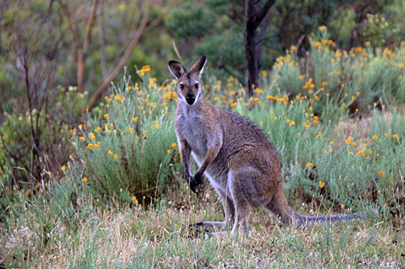
We turned off the main road along a side route towards the lake. Almost immediately we began to see large number of large kangaroos grazing on the grassy verge along the side of the road. These crepuscular animals were making the most of the cool of the evening. I had never seen so many large kangaroos in one place before. The grey kangaroos watched us closely as we cautiously passed them. We didn’t want to hit them. Such a large animal could cause a lot of damage.
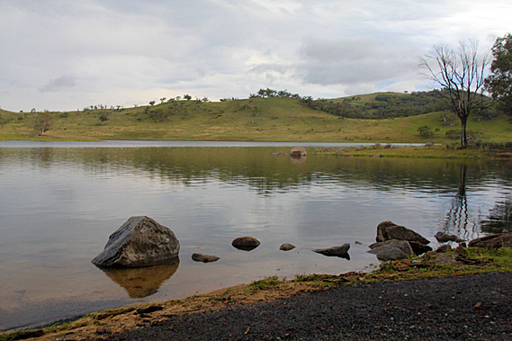
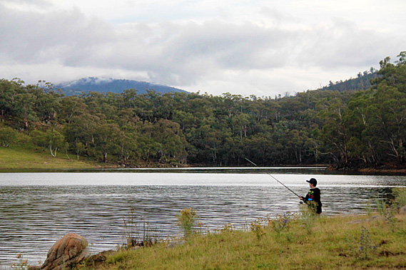
Eventually we reached the lake. The water was almost mirror-smooth. Only the slightest ruffling in the water blurred the reflection of the low hills draping the other side. A kangaroo was lurking in the forest above the lake’s edge. Upon seeing us it fixed its gaze for a few moments before hopping off through the grassy forest. We walked around the edge of the lake to a low point where several large boulders stuck out of the water lapping at the grassy edge. It seemed the water level was rising from the recent rain. Just around the point a young man was fishing in the peaceful solitude.
Upon leaving the lake we encountered a lot more kangaroos foraging the grassy undergrowth. Some just stood there watching us go by. Others hopped away bounding effortlessly balanced by their powerful tails. When Australia separated from the other continents the mammals evolved independently. One unique characteristic kangaroos have is the way they travel by hopping on their powerful hind legs. Most other mammals walk or run on four legs. The kangaroo’s hopping seems to be more efficient, allowing them to jump over uneven terrain. The sun was setting as we arrived back in Jindabyne. A brilliant yellow sunset asserted the end of the day. Will this mean rain or sunshine for tomorrow’s attempt at scaling Australia’s highest mountain? Only time will tell. |
||||||||||||||||||||||||||
|
||||||||||||||||||||||||||