|
||||||||||||||||
|
||||||||||||||||
Home > Treks > Kosciuszko > Day 2 > 2.4 |
||||||||||||||||
|
||||||||||||||||
|
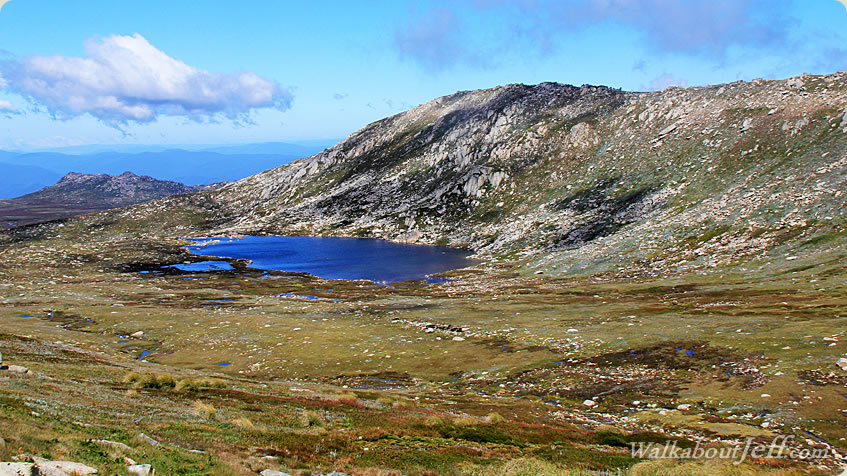
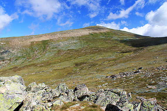
THE COOTAPATAMBA Lookout stood atop an exposed granite outcrop overlooking a small glacial hanging valley with a small lake at the bottom. The wind was blowing very strong here. Looking down from the lookout the valley plunged down towards the Threadbo Valley. The ridge I was climbing was perhaps the very top end of the Ramshead Range. The rolling hill of Mount Kosciuszko towered above the other side. A ridge from the mountain tapered off the other side of the glacial valley.
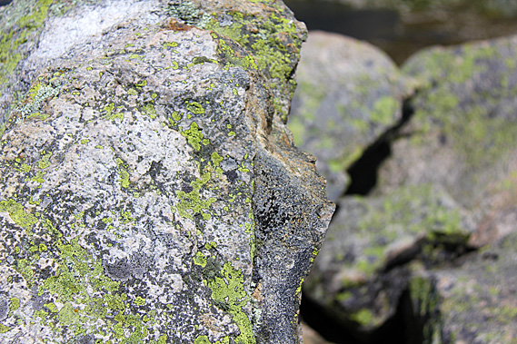
The lookout itself was a collection of huge granite boulders each covered in lichen that would have spent hundreds of years clinging for life growing in the very short summer growing seasons, and being buried by frozen snow for much of the year. Life was tough in these boulders where they grew. Despite that, the boulders provide excellent shelter for the heath and for the small animals that live here such as the mountain pygmy-possum and the bogong moth. Millions of bogong moths migrate here in early spring heading south from Southern Queensland to escape the heat of the lowlands. Their arrival provides a plentiful food supply for the birds and pygmy-possums. The bogong moth also provided a rich food source for the Aboriginal people when they come here during summer.
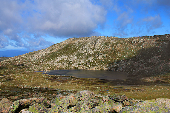
A small lake filled the bottom of the glacial valley. The glacier that had occupied this valley over the last ice age or two had carved out a depression which now held Lake Cootapatamba, Australia’s highest lake at around 1900 metres above sea level. The lookout was at about 2050 metres. This was the highest of the five glacial lakes in the park. These are the only glacial lakes on Mainland Australia. They contain the freshest water available on the mainland due to their low salt content and lack of nutrients.
Over winter the lake is covered in ice. Below the lake I could just see the Cootapatamba Hut, but it is for emergency shelter only as human waste is very destructive to the lake. The Aboriginal people called this lake Kau-oola-patamba – the place where the eagle drank. According to the local legend the ancestral eagle Maliyan who brought the bushfires to south-eastern Australia. He was responsible for the law of fire. The other two laws were wind and rain. Under the eagle the smaller raptors such as owls, kites and kestrels are associated with both wind and fire.
This lake was the drinking hole of the fire eagle. The rocky outcrops were the nesting sites for the eagle and the other firebirds. The loose rocks on the ground are the crumbs of the food the birds ate. The Aboriginal elders responsible for fire law met here at the lake every year to partake in their secret meetings and ceremonies. They would meet near Dead Horse Gap and head up the range to follow the path we have followed today before descending into Lake Cootapatamba. The two main groups of Eagle-hawk men were the Yerrung from south of the Murray River and the Merrung from the Monaro.
There were no eagles here these days, just the occasional crow. Today it was too windy even for crows. The strong wind ruffled the surface of the water. The lake ended in a small lip that no doubt formed the start of a stream running down the side of the mountain. Behind the lake were several marshes with small streams linking them thanks to the overnight rain. Much of the rock surrounding the lake and ascending the ridges was exposed, but there were large patches of alpine grass and heathland.
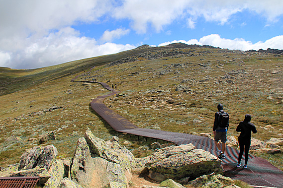
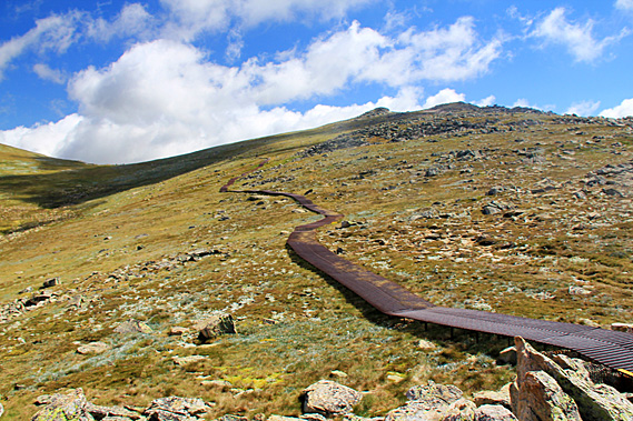
I could just see a tiny makeshift hut downstream from the lake. This is for emergency use only and no established trails lead to it because of the biological and cultural sensitivity of the area. After a brief rest at the lookout we continued following the metal walkway initially descending a few meters before starting an erratic ascent through the broken granite boulders. This led towards a low saddle around a kilometre away. Here the heath and grass grew only a couple of centimetres above the ground as if heavily grazed. The climate up here was tough for the foliage to grow in such a short growing season.
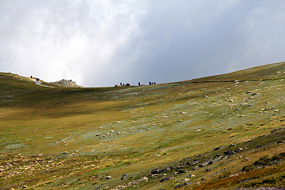
A large exposed area of rock lay across the front of Kosciuszko. This was the last area where the snow melts each spring. In some years the snow stays on well into summer. This year it had completely melted away. I could see several people resting at the top of the saddle ahead of me. This was Rawson Pass, the highest saddle in Australia. The trail steadily climbed leaving the lake behind in the old glacial valley. The terrain began to ease as it approached the saddle.
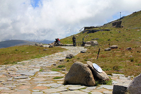
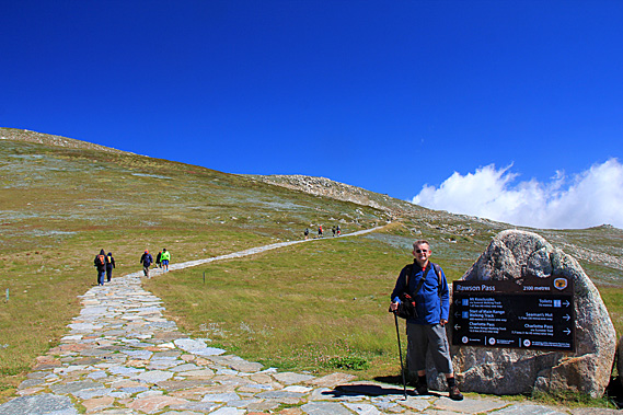
Eventually we reached the saddle. Here the metal walkway ended in a stone paved intersection. The track crossing the pass was wide enough to drive on. A sign on a large rock at the intersection indicated we were at Rawson Pass at 2100 metres above sea level. The track to the left gradually ascended towards the summit. The track going to the right passed some buildings set into the hill before steadily heading downhill to Charlotte’s Pass, where the current road begins. The road used to go along this trail to within a few metres of the summit. There were a number of large stones at the pass with plaques talking about the area. It was surprisingly busy here with the steady stream of hikers who had walked up with us from Threadbo meeting another stream of hikers who had come up from Charlotte’s Pass, meeting here as the final resting point before the summit. |
||||||||||||||||
|
||||||||||||||||