|
||||||||||||||||||
|
||||||||||||||||||
Home > Treks > Kosciuszko > Day 2 > 2.5 |
||||||||||||||||||
|
||||||||||||||||||
|
WHEN you are this close to the summit, the feeling of anticipation suddenly increases. Knowing that the rest of the climb is easily achievable gives you a spark of energy compelling you to go forward with renewed vigour towards the goal.
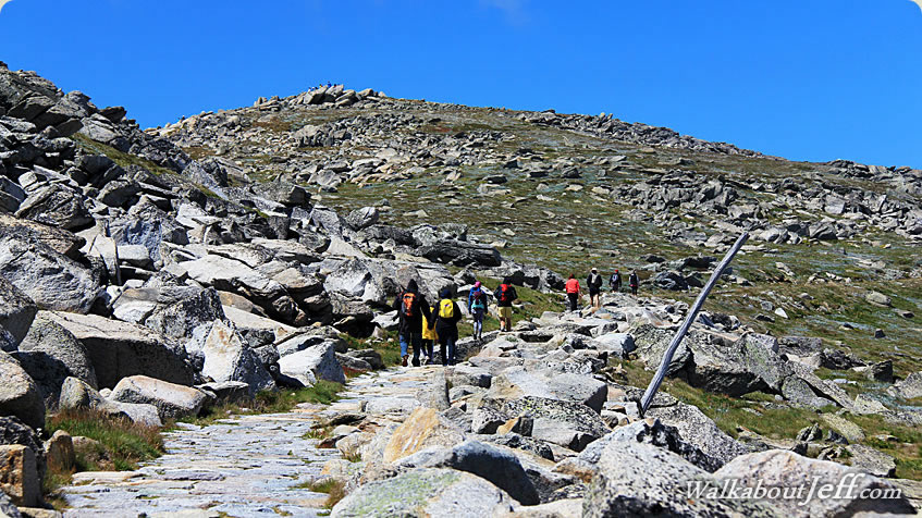
From Rawson Pass we began to follow the old road spiralling its way around the mountain towards the summit. The sky overhead was blue but most of the surrounding peaks were covered in thick cloud. Rawson Pass quickly dropped behind us and I could see the long scar of the old road heading down the side of the ridge to the glacial valley opening out towards Charlotte’s Pass and the Perisher Blue ski area. The cobblestone paving continued for about a hundred metres before reverting to a gravel road. A plastic honeycomb structure was set into the gravel to prevent it from eroding. This provided some good natural steps as the track moderately ascended around the side of the mountain.
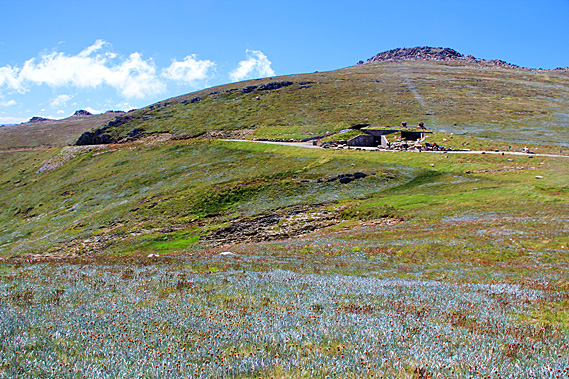
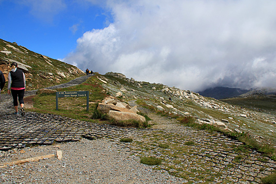
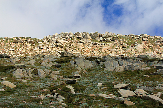
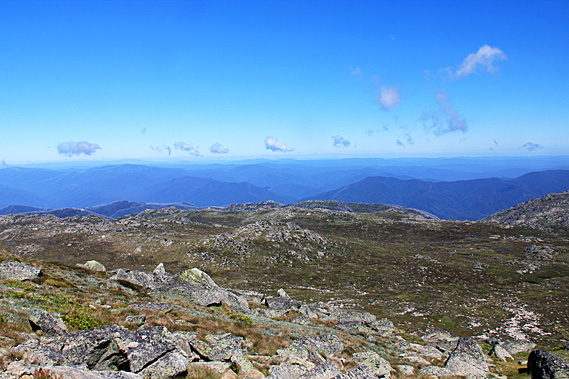
The terrain on either side of the track became steeper and rockier. Huge granite boulders lay scattered over the hill with alpine grasses growing in the sheltered nooks between them. About three hundred metres up from Rawson Pass we reached an intersection. The Main Range Track descended from the main trail. This was the main route around the alpine peaks heading back to Charlotte Pass. The Main Range Track and the old Charlotte Pass Road made a around circuit for fit hikers with a hut which they could stay in overnight a couple of kilometres down the Main Range Track. The main range track is supposed to provide spectacular views to the west before gradually descending to near Blue Lake, where the Aboriginal elders from tribes near and far used to meet at the annual hunt.
The unseen Blue Lake is the main camp of the legendary rainmaker, Dyillagamberra. The local Aboriginal people say the valley below us was also part of his territory. At the base of the valley I could now see the very small Club Lake. Many cultures consider a rainmaker to be a being that summons up rain. Whilst this is true, the Aboriginal people have a broader interpretation in that the rain maker also controls the rivers, the plants, the animals and the country itself, wherever water can be found. The Aboriginal elders who are assigned to associate with this spirit are also called rainmakers. The most senior rainmaker men meet at Blue Lake each year to hold secret meetings and ceremonies. They invoke Dyillagamberra to keep the rivers, springs, waterholes and swamps full wherever they travelled.
Dyillamgamberra has several sons. One of these is Garrugalla who lives in the clouds above the Main Range. He makes the winter snow (gu-nyinga), ice, frost and cold winds. He is helped by the nyinga ice spirits who live in the caves and rock crevices of the mountains. Garrugalla was definitely making his presence felt today. I could see a group of hikers in the distance approaching the intersection from the alpine trail. No doubt they will be diverting to climb the summit. They were all wearing backpacks and all looking very fit.
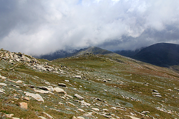
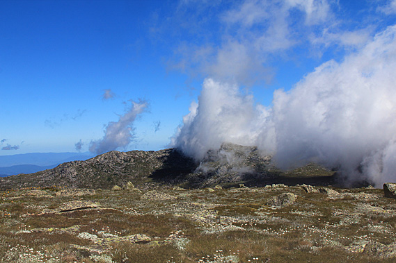
From the junction the main track continued rising moderately and heading around the mountain. The surrounding mountaintops were appearing lower now, and as one usually finds when reaching the top of a range the peaks all appeared at about the same height making the view a lot less spectacular than it had down in the valleys. By now we had reached the altitude of the bottoms of some of the larger clouds racing past. They seemed to be sticking to the mountaintops as they blew overhead. The track was turning with the dome of the mountain with Rawson Pass starting to disappear behind the hill. From here I could see the windward side of the mountaintop was clear. The fast wind was blowing high pressure air up the side of the mountain, then as it crossed the top, the pressure dropped causing the moisture in the damp air to condense as cloud.
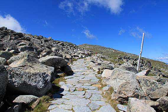
Three metre tall wooden poles stuck out of the ground at irregular intervals. These poles are used as markers in winter when the ground becomes covered in thick snow, deep enough to hide the road we were following. Looking to the right across a mountainous pass I could see Mount Townsend, Australia’s second highest mountain. Mount Townsend was a lot rockier and rugged than Kosciuszko. It certainly would make for a more challenging climb. It was not often scaled as it was quite some distance away from the Main Range Track.
The well gravelled track continued its moderate ascent. The track was in excellent condition. New gravel had been laid here only recently. On either side of the track grasses and alpine flowering ground plants covered the areas between the rocks. Looking ahead though the terrain was about to become very rocky. Looking down northwards down from the mountain, the view was clear across the well worn ranges of mountains. The formless mountains and hills were a distinctive blue colour thanks to the oils of the gum trees that grew on them. The track changed from gravel to cobblestones as it passed through the field of giant boulders just below the crest of a ridge we were following.
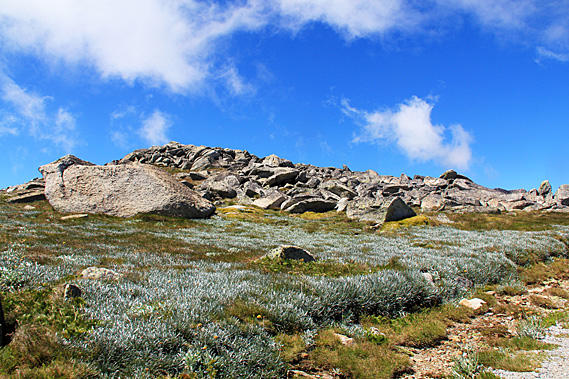
Once past the boulders though, the terrain smoothed. The chaos of boulders was suddenly replaced by a gentle field of green grass with only a few small rocks sticking through the surface. The track returned to gravel with black plastic hexagonal patterning holding it all together. The track continued winding around the mountain as it continued gaining altitude. With increasing altitude the dome quickly got smaller making the turn a lot quicker. Soon I could see Rawson Pass again, now appearing quite a long way below us. From the pass I could see the long scar of the road heading down towards Charlotte’s Pass to the left, and the metal walkway slithering down the hill to the right.
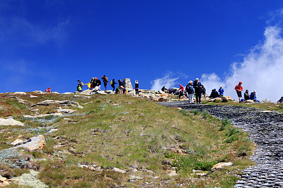
Looking up the track I could see a small crowd of people at the top of the dome, just thirty metres ahead of me. This was a very spiritual place for the indigenous people. Although they have been coming up to the Snowy Mountains for thousands of years, they very rarely climb the highest tops. The high mountains are close to the stars, where the spirits dance. They believe the spirits of the early travellers still live there. They were the old people who had gone long before them and remained here to guide the living. This was therefore taboo territory where one enters quietly and respectfully. Looking ahead the wide track led the way directly to a stone obelisk sitting on the summit. I was so close – nothing could stop me now. |
||||||||||||||||||
|
||||||||||||||||||