|
||||||||||||||||||||
|
||||||||||||||||||||
Home > Treks > Kosciuszko > Day 2 > 2.6 |
||||||||||||||||||||
|
||||||||||||||||||||
|
WHILST walking along a mountain trail, it is usually quiet with only a few people around you. I’ve always found it to be completely different at the summit of a mountain where a lot of people are gathered to make the most of being at the top before they head back down again.
The gravel track ended in a small round area of cobblestones perhaps just wide enough for a four wheel drive vehicle to turn around having reached the end of the road. The road had closed in 1974, but was still in drivable condition. At the end of the road some natural rock steps led the final few metres to the summit. A large stone beside the steps had a large plaque giving some history of the mountain. The text on the plaque was a direct copy of a sign that had been placed here in 1940 to mark the centenary of Strzelecki’s ascent of the mountain 175 years ago on 15 February 1840.
Although Strzelecki’s ascent was the first to be recorded, it is highly unlikely he was the first person to reach the summit. Stockmen had been leading their herds in the mountains from the 1830s in search of summer pastures, so it is likely some of them would have climbed to the summit. This is not to mention the Aboriginal people who have been coming here for well over ten thousand years. Although the mountaintops were sacred to them, some will have ventured to the summits. The sky above was clear, but a large cloud was heading directly towards us. I briefly waited for my travel companion to catch up. He had gotten a bit breathless on the last ascent with the track having risen at a constant gradient since Rawson Pass.
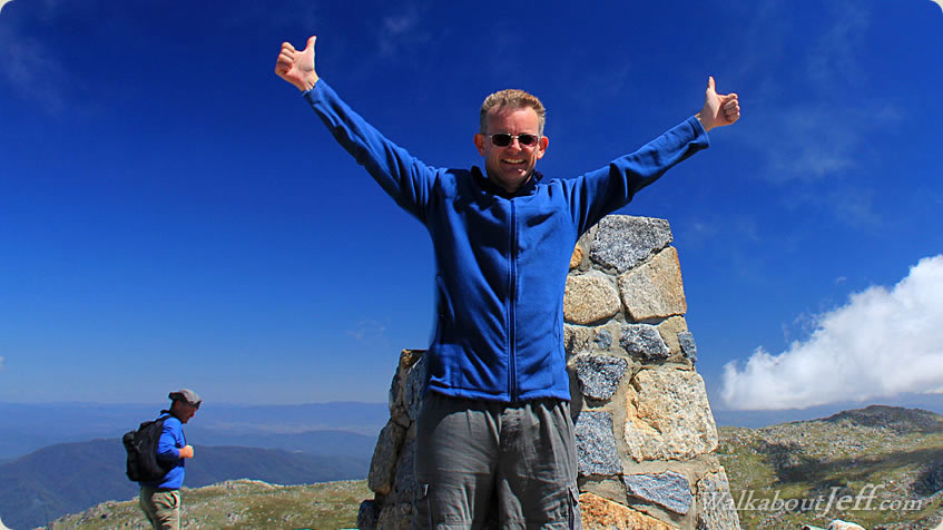
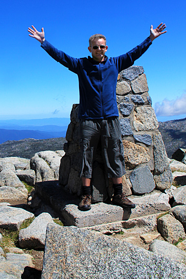
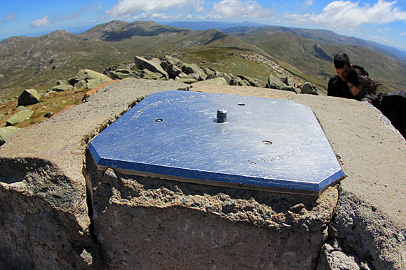
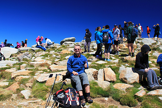
Together we climbed the steps and reached the summit, touching the top of the obelisk at the same time – no doubt in the same fashion that Tenzing Norgay and Edmund Hillary had done when they had summited Everest – the top of another continent. The obelisk sat atop a square block of concrete sitting amongst an assortment of large boulders making up the summit. The obelisk itself consisted of a number of granite boulders all cemented together with a stainless steel square plate on top with a screw thread in the centre to no doubt hold any surveying equipment used here. A small boulder at one of the top corners of the obelisk was missing. Apart from that it was in very good condition. A few others had their picture taken right against the sun. I arranged that we have our picture taken at the side where we weren’t going to have the sun behind us. We leaned against the obelisk as the wind was very strong here at around a hundred kilometres per hour. It seemed to be intensifying as the cloud suddenly made for a white background.
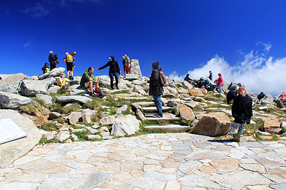
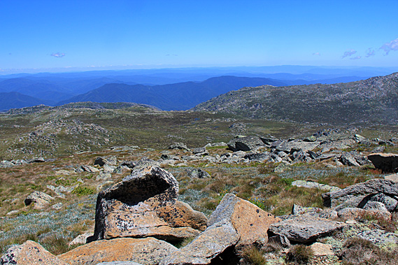
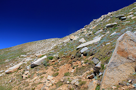
There was almost no vegetation up here. I figured that with thirty thousand people reaching the summit each summer, the grass didn’t stand a chance anywhere apart from in the inaccessible nooks between the boulders. The sun suddenly came back as I got my camera and we each did individual shots of each other. The lighting here was harsh – just as harsh as the biting wind. With celebration at the top of Australia all done, we headed downwind to some rocks where it was much better sheltered, even though still windy. From here we could just see Rawson Pass and follow the road heading down towards Charlotte’s Pass. The view was otherwise unspectacular. We were at the top of the highest mountain looking across to a number of rounded hills of similar height all tapering off into lower altitudes in all directions.
In the valleys I could see the streams all converging into the Snowy River to flow down to the hydro electric power schemes. Despite being the biggest engineering project in Australia’s history, it was completely invisible from here. There was no sign of civilisation apart from the trails that made their scars across the landscape. Otherwise it was exactly as appeared by the Polish explorers when they first climbed the mountain in 1840. Here we rested and ate lunch with all the other climbers who had too found rocks to shelter from the wind. There were about fifty, maybe sixty people up here either wandering around the obelisk, or sitting eating their food. More people would come, and those who had been at the top long enough began their descents back towards either Threadbo or Charlotte’s Pass.
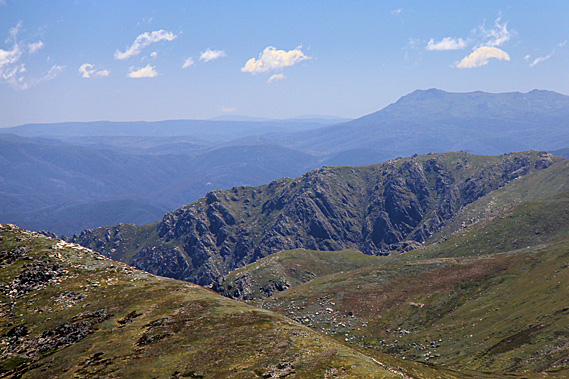
The wind was blowing very strong against us as we descended the main track around the back of the mountain. By now the sky had completely cleared apart from a few small clouds over distant hills. Harsh shadows dropped down the sides of the boulders we were walking past. The view across to Mount Townsend was a lot clearer now. Somehow the peak didn’t seem so intimidating as it had earlier when menacing cloud had draped its summit. There were quite a lot of people walking down with us, and quite a number walking up assisted by the strong wind. A lot of people were successfully achieving their conquest of the top of Australia today.
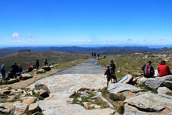
The wind became particularly strong at the point where we turned around towards Rawson Pass. The wind always blows strongest around ridges as the terrain funnels the air past the mountain. Here it would have been blowing over a hundred kilometres per hour. Once around the point though the wind quickly eased off. It was a quick descent to the junction of Main Range Track followed by an easy drop to the junction at Rawson Pass. There was plenty of time to spare. The chairlift down to Threadbo wasn’t going to close until 5:30 this afternoon, so we still had up to five hours on the mountain. We therefore decided to head down the Charlotte Pass Road for a while.
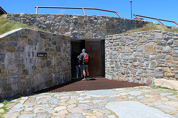
Just metres down the cobblestone road below the junction was a bike stand. Apparently you can cycle from Charlotte’s Pass to here, but leave your bike on the rack and walk the rest of the way to the summit. On a calm day this would be quite a nice ride, but with the wind pushing 80 kilometres per hour conditions would be treacherous for riding up against the head wind, and perhaps even more treacherous riding downhill with the wind. No wonder there were only a few bikes on the stand. Just past the bike stand a stone building was set into the hill. This would have to be Australia’s highest building, one of only two at above two thousand metres above sea level.
A large stone entrance led into a set of toilets. I needed to go so I went into the rather prison-like cubicles. It was rather cold even inside with its stone floor and stainless steel walls. I don’t think the temperature outside would have passed ten degrees today, reflecting the chill temperature in here. At least there wasn’t the wind chill to contend with. This toilet block was the highest building in Australia, and here I was taking Australia’s highest legal piss. Of course this wasn’t the highest piss I’ve ever had. Not including plane rides, the highest I’ve ever “been” was at 4820 metres above sea level in the little toilet block at Kibo on Mount Kilimanjaro. This was substantially less than half of that altitude and a good fifteen degrees warmer.
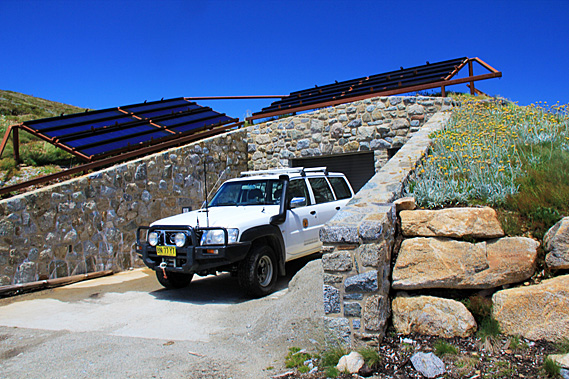
Once out of the toilet block we started walking down the road. There was another entrance to the building to the side. A large four wheel drive vehicle was parked there. Behind the vehicle was the ranger’s building. I’m not sure what it contained, but there were two large racks of solar panels on the grass above the building. It was quite a nicely landscaped stone building unobtrusively set into the hill, perhaps like what would be occupied by an alpine hobbit species. It was constructed from rocks concreted together in the same fashion as the obelisk at the summit. Just past the stone toilet block the cobblestones gave way to gravel as we continued to follow the road downhill in the hope of discovering more secrets of the mountain. |
||||||||||||||||||||
|
||||||||||||||||||||